Showing 1368 items matching " dandenong rd"
-
 Mrs Aeneas Gunn Memorial Library
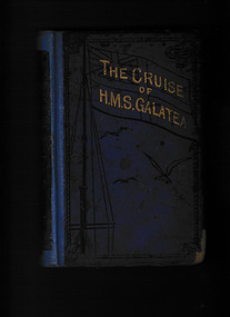
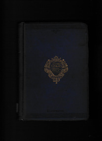
Book, Rev. John Milner et al, The cruise of HMS Galatea, Captain H.R.H. the Duke of Edinburgh, K.G. in 1867-1868, 1969
An account of a royal visit to Australia in the steam ship HMS GalateaIll, p.487.non-fictionAn account of a royal visit to Australia in the steam ship HMS Galatearoyal visits - australia, visits of state - australia, hrh duke of edinburgh -
 Mrs Aeneas Gunn Memorial Library
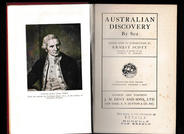
Book, Ernest Scott, Australian discovery by sea, 1929
Reproduces journals and first-hand accounts of explorers & navigators, including Torres, Quiros, Tasman, Pelsart, Dampier, Cook, Bligh, La Perouse, Bass,and Flinders.Ill, maps, p.412.non-fictionReproduces journals and first-hand accounts of explorers & navigators, including Torres, Quiros, Tasman, Pelsart, Dampier, Cook, Bligh, La Perouse, Bass,and Flinders.australia - history, australia - discovery and exploration -
 Mrs Aeneas Gunn Memorial Library
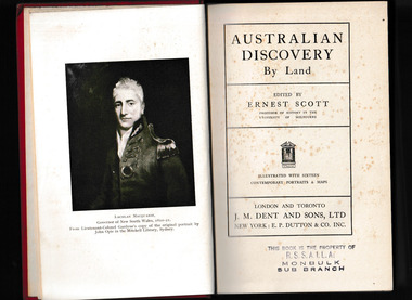
Book, Ernest Scott, Australian discovery by by land, 1929
Reproduces journals and first-hand accounts of explorers & navigators, including, Blaxland, Evans, Oxley, Cunningham, Hume & Hovell, Lockyer, Sturt, Mitchell, Eyre, Burke & Wills, Stuart. Many brief references to meetings with Aboriginal peoples.Ill, maps, p.422.non-fictionReproduces journals and first-hand accounts of explorers & navigators, including, Blaxland, Evans, Oxley, Cunningham, Hume & Hovell, Lockyer, Sturt, Mitchell, Eyre, Burke & Wills, Stuart. Many brief references to meetings with Aboriginal peoples.australia - history, australia - discovery and exploration -
 Mrs Aeneas Gunn Memorial Library
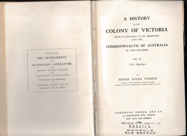
Book, Longmans, Green, and Co, A history of the Colony of Victoria : from its discovery to its absorption into the Commonwealth of Australia, 1904
A history of the Colony of Victoria : from its discovery to its absorption into the Commonwealth of Australia volume two 1854-1900Index, p.356.non-fictionA history of the Colony of Victoria : from its discovery to its absorption into the Commonwealth of Australia volume two 1854-1900victoria - history 1854-1900, victoria - settlement -
 Mrs Aeneas Gunn Memorial Library
Book, T. Nelson, Captain Cook's voyages around the world, 1900
Cook''s journal of his voyagesIll, maps, p.512.Cook''s journal of his voyagescaptain james cook, exploration -
 Mrs Aeneas Gunn Memorial Library
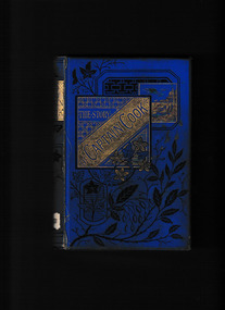
Book, Cassell, Petter, Galpin, The story of Captain Cook's three voyages round the world, 1870
A description of Cook's journeys for a juvenile audience.Ill, p.264.non-fictionA description of Cook's journeys for a juvenile audience.exploration, james cook - travels -
 Mrs Aeneas Gunn Memorial Library
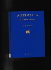
Book, T. Nelson and sons, Australia : a general account - history, resources, production, social conditions, 1929
Outline of geography, European exploration and settlement, economic development, social condition, flora and fauna; includes a brief general account of Aboriginal culture.Index, Ill, maps, p.272.non-fictionOutline of geography, European exploration and settlement, economic development, social condition, flora and fauna; includes a brief general account of Aboriginal culture.australia - social life and customs, australia - history -
 Mrs Aeneas Gunn Memorial Library
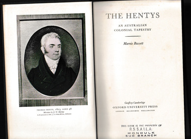
Book, Oxford University Press, The Hentys : an Australian colonial tapestry, 1955
A history of the Henty family, early settlers in Western Victoria.Index, bib, ill, maps, p.578.non-fictionA history of the Henty family, early settlers in Western Victoria.victoria - history - 1834-1851, henty family - history -
 Mrs Aeneas Gunn Memorial Library
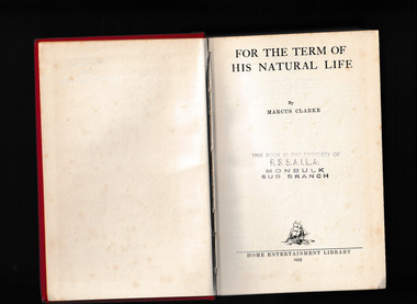
Book, Home Entertainment Library, For the term of his natural life, 1935
A novel of colonial prison life in Van Diemens Landp.494.fictionA novel of colonial prison life in Van Diemens Landaustralia - fiction, australia - convict system -
 Mrs Aeneas Gunn Memorial Library
Georgian House, Australian son : the story of Ned Kelly, 1956
The story of the life of Australian bushranger Ned KellyIll, p.283.non-fictionThe story of the life of Australian bushranger Ned Kellyned kelly, australia - bushrangers - history -
 Mrs Aeneas Gunn Memorial Library
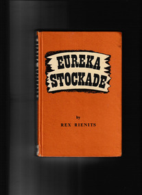
Book, Convoy Publications, Eureka stockade, 1949
The intriguing literary phenomenon of the revival of interest in the story of Eureka Stockade in Australia is discussed. The reason for the revival and a number of publications on the subject is that it began when Australia was not only involved in war, but when, for the first time, she faced a real and imminent danger of invasion.Ill, p.208.fictionThe intriguing literary phenomenon of the revival of interest in the story of Eureka Stockade in Australia is discussed. The reason for the revival and a number of publications on the subject is that it began when Australia was not only involved in war, but when, for the first time, she faced a real and imminent danger of invasion. australia - fiction, eureka stockade - motion picture -
 Mrs Aeneas Gunn Memorial Library
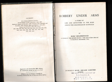
Book, Dymock's Book Arcade, Robbery under arms : a story of life and adventure in the bush and in the goldfields of Australia, 1957
Robbery Under Arms was acclaimed as an Australian classic almost immediately after it appeared in book form in the late 1880s. It was praised for its excitement, romance and authentic picture of 1850s colonial life. As the first writer to attempt a long narrative in the voice of an uneducated Australian bushman, Rolf Boldrewood had created a story with enduring cultural resonance. Its continuing appeal and popularity have seen the tale frequently adapted for stage, radio, film and television.Ill, p.427.fictionRobbery Under Arms was acclaimed as an Australian classic almost immediately after it appeared in book form in the late 1880s. It was praised for its excitement, romance and authentic picture of 1850s colonial life. As the first writer to attempt a long narrative in the voice of an uneducated Australian bushman, Rolf Boldrewood had created a story with enduring cultural resonance. Its continuing appeal and popularity have seen the tale frequently adapted for stage, radio, film and television. australia - fiction, australia - bushrangers - history -
![Book, Rolf Boldrewood [pseud.], Robbery under arms : a story of life and adventure in the bush and in the goldfields of Australia, 1947](/media/collectors/60ebece6200ed0291c364310/items/62d66c79340bc84dcd3d8b10/item-media/62d66d57340bc84dcd3d8c9a/item-fit-380x285.jpg) Mrs Aeneas Gunn Memorial Library
Mrs Aeneas Gunn Memorial LibraryBook, Rolf Boldrewood [pseud.], Robbery under arms : a story of life and adventure in the bush and in the goldfields of Australia, 1947
Robbery Under Arms was acclaimed as an Australian classic almost immediately after it appeared in book form in the late 1880s. It was praised for its excitement, romance and authentic picture of 1850s colonial life. As the first writer to attempt a long narrative in the voice of an uneducated Australian bushman, Rolf Boldrewood had created a story with enduring cultural resonance. Its continuing appeal and popularity have seen the tale frequently adapted for stage, radio, film and television.p.433.fictionRobbery Under Arms was acclaimed as an Australian classic almost immediately after it appeared in book form in the late 1880s. It was praised for its excitement, romance and authentic picture of 1850s colonial life. As the first writer to attempt a long narrative in the voice of an uneducated Australian bushman, Rolf Boldrewood had created a story with enduring cultural resonance. Its continuing appeal and popularity have seen the tale frequently adapted for stage, radio, film and television. australia - fiction, australia - bushrangers - history -
 Mrs Aeneas Gunn Memorial Library
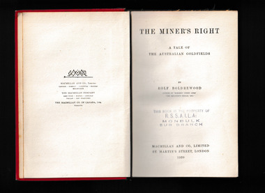
Book, Macmillan, The miner's right : a tale of the Australian goldfields, 1920
A novel of the Australian goldfieldsp.389.fictionA novel of the Australian goldfieldsaustralia - fiction, australia - goldrush -
 Mrs Aeneas Gunn Memorial Library
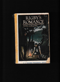
Book, C. J. DeGaris Publishing House, Rigby's romance : a "made in Australia" nove, 1921
A novel of country life - and some romance - in Australiap.276.fictionA novel of country life - and some romance - in Australiaaustralia - fiction, joseph furphy -
 Mrs Aeneas Gunn Memorial Library
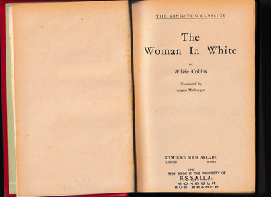
Book, Dymock's Book Arcade, The woman in white, 1947
Marian and her sister Laura live a quiet life under their uncle's guardianship until Laura's marriage to Sir Percival Glyde. Sir Percival is a man of many secrets. Hence, Marian and the girls' drawing master, Walter, have to turn detective in order to work out what is going on, and to protect Laura from a fatal plotIll, p.526.fictionMarian and her sister Laura live a quiet life under their uncle's guardianship until Laura's marriage to Sir Percival Glyde. Sir Percival is a man of many secrets. Hence, Marian and the girls' drawing master, Walter, have to turn detective in order to work out what is going on, and to protect Laura from a fatal plotengland - fiction, detective fiction -
 Mrs Aeneas Gunn Memorial Library
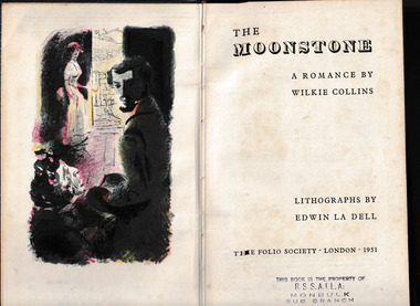
Book, The Folio Society, The moonstone, 1951
The novel that T.S. Eliot called ;the first, the longest, and the best of the modern English detective novels ; Guarded by three Brahmin priests, the Moonstone is a religious relic, the centerpiece in a sacred statue of the Hindu god of the moon. It is also a giant yellow diamond of enormous value, and its temptation is irresistible to the corrupt John Herncastle, a colonel in the British Army in India. After murdering the three guardian priests and bringing the diamond back to England with him, Herncastle bequeaths it to his niece, Rachel, knowing full well that danger will follow. True to its enigmatic nature, the Moonstone disappears from Rachel & rsquo;s room on the night of her eighteenth birthday, igniting a mystery so intricate and thrilling it has set the standard for every crime novel of the past one hundred fifty years. Widely recognized, alongside the stories of Edgar Allan Poe, as establishing many of the most enduring conventions of detective fiction, The Moonstone is Wilkie Collins masterwork and one of the greatest novels of the nineteenth century.Ill, p.417fictionThe novel that T.S. Eliot called ;the first, the longest, and the best of the modern English detective novels ; Guarded by three Brahmin priests, the Moonstone is a religious relic, the centerpiece in a sacred statue of the Hindu god of the moon. It is also a giant yellow diamond of enormous value, and its temptation is irresistible to the corrupt John Herncastle, a colonel in the British Army in India. After murdering the three guardian priests and bringing the diamond back to England with him, Herncastle bequeaths it to his niece, Rachel, knowing full well that danger will follow. True to its enigmatic nature, the Moonstone disappears from Rachel & rsquo;s room on the night of her eighteenth birthday, igniting a mystery so intricate and thrilling it has set the standard for every crime novel of the past one hundred fifty years. Widely recognized, alongside the stories of Edgar Allan Poe, as establishing many of the most enduring conventions of detective fiction, The Moonstone is Wilkie Collins masterwork and one of the greatest novels of the nineteenth century. england - fiction, romantic fiction -
 Mrs Aeneas Gunn Memorial Library
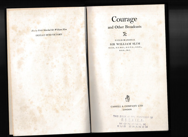
Book, Sir William Slim, Courage : and other broadcasts, 1957
Speeches and broadcasts by Sir William Slimp.186.non-fictionSpeeches and broadcasts by Sir William Slimworld war 1939-1945, speeches and broadcasts -
 Mrs Aeneas Gunn Memorial Library
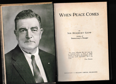
Book, Robertson & Mullens Ltd, When peace comes, 1943
A commentary on post-war reconstruction in Australiap.247.non-fictionA commentary on post-war reconstruction in Australiaeconomic policy - australia, reconstruction - australia -
 Mrs Aeneas Gunn Memorial Library
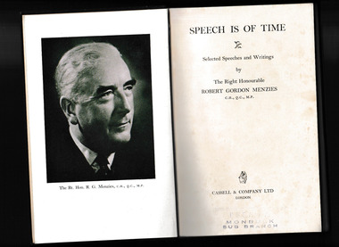
Book, Robert Gordon Menzies, Speech is of time : selected speeches and writings, 1958
A selection of speeches and writings by Robert Gordon MenziesIll, p.246.non-fictionA selection of speeches and writings by Robert Gordon Menziesworld politics, commonwealth of nations -
 Mrs Aeneas Gunn Memorial Library
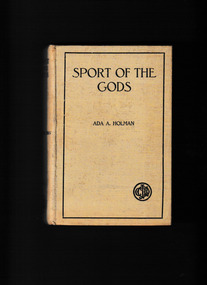
Book, C.J. De Garis Pub. House, Sport of the gods, 1921
A political noverl by feminist author Ada Holmanp.317.fictionA political noverl by feminist author Ada Holmanpolitics - australia, australia - fiction -
 Mrs Aeneas Gunn Memorial Library
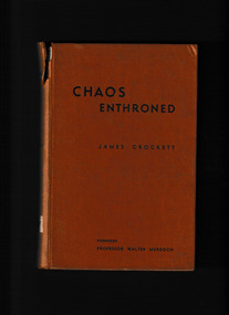
Book, Wyatt & Watts, Chaos enthroned, 1945
Fact or fiction or fantasy or a treatise on economics or a political manifesto? Or a queer mixture of them allp.337.fictionFact or fiction or fantasy or a treatise on economics or a political manifesto? Or a queer mixture of them allaustralia - fiction, novels - australia -
 Mrs Aeneas Gunn Memorial Library
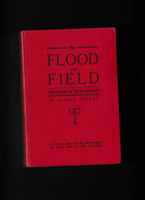
Book, G. Bell & Sons, By flood and field : adventures ashore and afloat in North Australia, 1912
Factual account of life in the Northern Territory in the late 19th century; - 1st section - Authors adventures as a shipwrecked mariner at Wark Aboriginal Settlement and Port Essington; 2nd section - Detailed narrative of the authors work & explorations as a customs official and as a patrol police officer, stationed at Port Darwin; Description of Malays and their trading ventures by proas; Relations between Malays and Aborigines employment of latter in collecting, trepangs, pearls, tortoise-shells - physical and cultural influences (e.g. intermixture, and language) feuds and murders; Notes on food gathering and hunting (use of wommera) - tracking - corroborrees settling of disputes by simulated fighting - group murder and guilt rites (Malays and Chinese), canoes decorated - Maria Is. sacred burial ground qualities of Aborigines; noted; Intertribal fighting - Woolna tribe against local Darwin Aborigines; Cannibalism at Limba Luchumbo - King River; Contact between Aborigines and settlers, ranging from extreme cruelty to great friendships; Aboriginal girls stolen for domestic work causing trouble; Further accounts of Chinese - opium & gold smuggling; Search for Dylompo - Groote Eylandt unsuccessful.Ill, p.327.non-fictionFactual account of life in the Northern Territory in the late 19th century; - 1st section - Authors adventures as a shipwrecked mariner at Wark Aboriginal Settlement and Port Essington; 2nd section - Detailed narrative of the authors work & explorations as a customs official and as a patrol police officer, stationed at Port Darwin; Description of Malays and their trading ventures by proas; Relations between Malays and Aborigines employment of latter in collecting, trepangs, pearls, tortoise-shells - physical and cultural influences (e.g. intermixture, and language) feuds and murders; Notes on food gathering and hunting (use of wommera) - tracking - corroborrees settling of disputes by simulated fighting - group murder and guilt rites (Malays and Chinese), canoes decorated - Maria Is. sacred burial ground qualities of Aborigines; noted; Intertribal fighting - Woolna tribe against local Darwin Aborigines; Cannibalism at Limba Luchumbo - King River; Contact between Aborigines and settlers, ranging from extreme cruelty to great friendships; Aboriginal girls stolen for domestic work causing trouble; Further accounts of Chinese - opium & gold smuggling; Search for Dylompo - Groote Eylandt unsuccessful. northern australia - description and travel, northern australia - economic relations -
 Mrs Aeneas Gunn Memorial Library
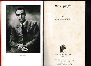
Book, Hamish Hamilton, Rum Jungle, 1953
Rum Jungle at the time was a recently discovered uranium mine. The book's principle theme is the sudden appearance of modern science in a region which has not really been civilised by white man. Anecdotal accounts of the authors travels in northern Australia, mainly NT; includes comments and stories about Aborigines; including Albert Namatjira.Ill, maps, p.154.non-fictionRum Jungle at the time was a recently discovered uranium mine. The book's principle theme is the sudden appearance of modern science in a region which has not really been civilised by white man. Anecdotal accounts of the authors travels in northern Australia, mainly NT; includes comments and stories about Aborigines; including Albert Namatjira.northern territory - description and travel, rum jungle - northern territory -
 Mrs Aeneas Gunn Memorial Library
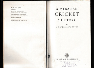
Book, AG Moyes, Australian cricket : a history, 1959
The author tells the game's whole story from the first recorded match until the season of 1957-8.Ill, p.615.non-fictionThe author tells the game's whole story from the first recorded match until the season of 1957-8.cricket - australia - history, sport - cricket -
 Mrs Aeneas Gunn Memorial Library
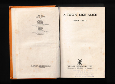
Book, William Heinemann, A town like Alice, 1950
A novel told partly in flashbacks about a girl's search for the Australian she met in Malaya during World War II. A young woman who miraculously survived a Japanese "death march" in World War II, and an Australian soldier, also a prisoner of war, who offered to help her--even at the cost of his life.p.332.fictionA novel told partly in flashbacks about a girl's search for the Australian she met in Malaya during World War II. A young woman who miraculously survived a Japanese "death march" in World War II, and an Australian soldier, also a prisoner of war, who offered to help her--even at the cost of his life.australia - fiction, women prisoners - fiction -
 Mrs Aeneas Gunn Memorial Library
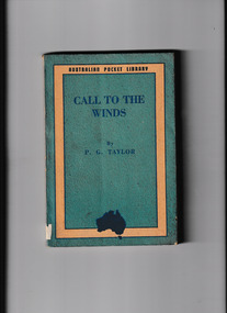
Book, Angus and Robertson, Call to the winds, 1944
Story of the last air-mail flight for New Zealand of the "Southern Cross" and a brief reference to events which followed it.p.184.Story of the last air-mail flight for New Zealand of the "Southern Cross" and a brief reference to events which followed it.air mail service - australia, southern cross (airplane) -
 Mrs Aeneas Gunn Memorial Library
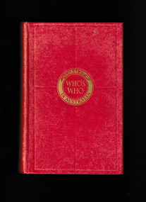
Book, The Herald and Weekly Times, Who's who in Australia 1944, 1944
Notable Australians in 1944p.906non-fictionNotable Australians in 1944australia - biography, biographies - dictionaries -
 Mrs Aeneas Gunn Memorial Library
Book, The Herald and Weekly Times, Who's who in Australia 1955, 1944
Notable Australians in 1955p.872non-fictionNotable Australians in 1955australia - biography, biographies - dictionaries -
 Mrs Aeneas Gunn Memorial Library
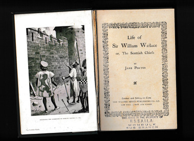
Book, Jane Porter, The Scottish Chiefs
William Wallace encounters secret passageways, disguises, and a quintet of horrible villains as he fights for Scotland at the turn of the fourteenth century.p.350fictionWilliam Wallace encounters secret passageways, disguises, and a quintet of horrible villains as he fights for Scotland at the turn of the fourteenth century. english fiction - 19th century, romantic fiction