Showing 5415 items
matching eltham road district
-
 Eltham District Historical Society Inc
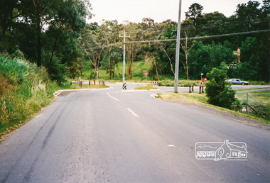
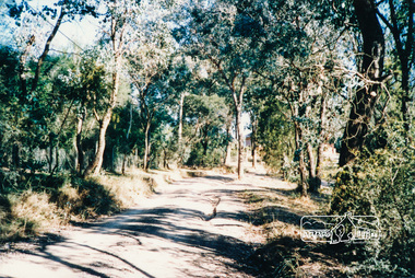
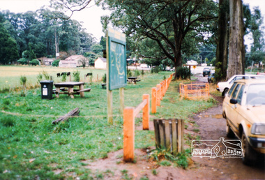
Photograph, Eucalyptus Road and Pitt Street/Nyora Road roundabout, Eltham
Looking north along Eucalyptus Road, showing roundabout at intersection of Pitt Street and Nyora Road, Eltham. Parks Victoria owns and manages the Pauline Toner Eltham Copper Butterfly Reserve on the left of the image. Colour photographeucalyptus road, pitt street, nyora road, roundabouts, eltham, pauline toner eltham copper butterfly reserve, pauline toner butterfly nature conservation reserve -
 Eltham District Historical Society Inc
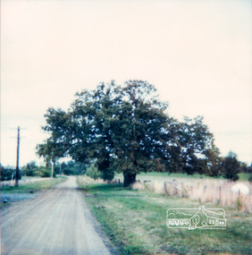
Photograph, Donaldson's Oak, Donaldsons Road, Kangaroo Ground, c.1967
Quercus Robur (English Oak) - Was planted by John Donaldson from seed collected from Windsor Great Park in 1878. Used for the Society's Banner project Joy Ness "View Hill" Kangaroo Ground June 11th 1986 In 1878 while on a trip to Scotland and England, John Donaldson visited Windsor Castle Park, where he collected some acorns which he brought back to Australia, to his property, "Kangaroo Hall" at Kangaroo Ground. He and his son John Anstruther Davidson Donaldson, who was then 10 years old, planted one near the present Donaldsons Lane, in 1878. This is now a very fine tree, 108 years old. This information comes from Miss Victoria Donaldson, daughter of John Anstruther Davidson Donaldson. Miss Donaldson suggests that "Wippell's Oak" at Kangaroo Ground may also have been grown from one of the same Windsor Park acorns.Colour Polaroid photographtrees, donaldsons oak, donaldson, donaldson road, kangaroo ground -
 Eltham District Historical Society Inc
Photograph, Kangaroo Ground - St Andrews Road
Five colour photographs of Kangaroo Ground/St Andrews Road, Kangaroo Ground/Panton Hill arearoads, st andrews road, kangaroo ground/st andrews road, panton hill, kangaroo ground -
 Eltham District Historical Society Inc
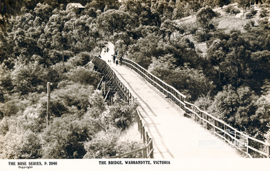
Photograph, The Bridge, Warrandyte, Victoria
Postcard showing old timber bridge over Yarra River at WarrandyteThe Rose Series P.2046bridges, yarra river, warrandyte, kangaroo ground road, postcards -
 Eltham District Historical Society Inc
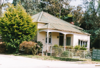
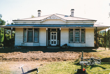
Photograph, 994 Main Road, Hurstbridge
Colour photograph of house at 994 Main Road Hurstbridgehouses, 994 main road, main road, heidelberg/kinglake road, hurstbridge -
 Eltham District Historical Society Inc
Photograph, Edendale Farm, Eltham
Four colour photographs of the house at Edendale Farm, Gastons Road Elthamedendale farm, eltham, gastons road, houses -
 Eltham District Historical Society Inc
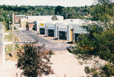
Photograph, Factories, Simms Road, Briar Hill, Feb 1990, 1990
Three colour photographs of factory complex, Simms Road, Briar Hill 1990briar hill, simms road, factories, industry -
 Eltham District Historical Society Inc
Photograph, Main Road, Lower Plenty
Colour photograph of Main Road, Lower Plenty/Montmorency east of Grand Boulevard looking towards Elthammain road, lower plenty, montmorency -
 Eltham District Historical Society Inc
Photograph, M. North, Main Road, Eltham near Fitzsimons Lane Roundabout, Dec 1985, 1/12/85
Two colour photographs of Main Road, ElthamSouth between Falkiner Street and Bolton Street at the roundabout of Fitzsimons Lane, Eltham, Dec 1985Noted on 463B 'See 1934 small black and white snap of flooded bridge and the same two shops. This snap taken from same location, Dec 1985. Old Eltham Park on right of photo The two shops at left (Ansel and Muir) Road ahead crosses new bridge over the Diamond Creek, Eltham Main Road now dual highway, through Lower Plenty to this bridge'main road, eltham, eltham south, fitzsimons lane, round about, falkiner street -
 Eltham District Historical Society Inc
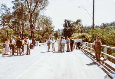
Photograph, Main Road Bridge Over Diamond Creek, Eltham, 26/10/84
Two colour photographs of Main Road Bridge over the Diamond Creek, Eltham: A. view from walkway below bridge B. Friday 26th October 1984, official opening of bridge after widening looking from Eltham towards Greensborough near Antoinette Streetbridges, main road, diamond creek, eltham, eltham south -
 Eltham District Historical Society Inc
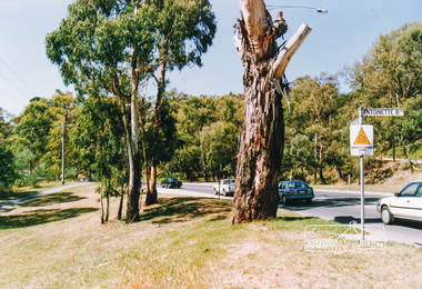
Photograph, Main Road, Eltham South near Antoinette Boulevard
Three colour photographs of Main Road, Eltham South near Antoinette Boulevardmain road, eltham, eltham south, antoinette boulevard -
 Eltham District Historical Society Inc
Photograph, Main Road, Eltham at Dalton Street
Colour photo of Main Road, Eltham looking south at Dalton Streetmain road, dalton street, eltham -
 Eltham District Historical Society Inc
Photograph, Main Road, Eltham near Dudley Street
Three colour photographs of Main Road, Eltham at Dudley Streetmain road, dudley street, eltham -
 Eltham District Historical Society Inc
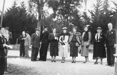
Photograph, Peter Bassett-Smith, Cermony for turning of the first sod, Eltham War Memorial Infant Welfare Centre Building, 18 Jul. 1950
Major Frank D. Stevens, RSL President and school boy Albert Feldbauer (youngest child of the children of the soldier fathers attending a school in the district) at the ceremony of turning the first sod for the Eltham War Memorial Infant Welfare Centre Building. Major Frank Stevens was later the Scout Commissioner of Heidelberg City Scout Groups from Fairfield railway gates to the intersection of Main Road at Hurstbridge.Eight original prints (21.5 x 18 cm - plus three duplicated) and one 10 x 15 cm colour print reproduction from a negative taken of original printalbert feldbauer, ceremonies, eltham, eltham war memorial building, fred griffiths, cr. fred squire, main road, major frank stevens, memorials, mrs dave lyon, mrs rains, war memorials, eltham infant welfare centre -
 Eltham District Historical Society Inc
Photograph, Our Lady's Catholic Church, Eltham
Colour photograph of Our Lady's viewed from the car parkmain road, eltham, churches, shops, catholic church, our ladys church -
 Eltham District Historical Society Inc
Photograph, Main Road, Eltham
Three photographs looking north along Main Road towards Arthur Street near Eltham Shopping Centre.main road, arthur street, eltham, shops -
 Eltham District Historical Society Inc
Photograph, Main Road at Pryor Street, Eltham
Five colour photographs showing Main Road at Pryor Street in Eltham Shopping Centre looking southmain road, pryor street, shops, eltham -
 Eltham District Historical Society Inc
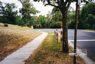
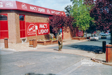
Photograph, Pedestrian access upgrade, Pryor Street, Eltham, c. Oct 1987
Looking down Pryor Street towards the intersection with Main Road, Mac's Liquor on left. Shows upgraded footpath area with new paving and planter boxesColour photographeltham, main road, shire of eltham, infrastructure development -
 Eltham District Historical Society Inc
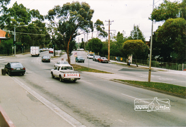
Photograph, Main Road, Eltham near Colemans Corner
Five colour photographs of looking south towards Eltham Shopping Centre at the intersection with Wattletree Road formerly known as Colemans Corner.eltham, main road, wattletree road, colemans corner, coleman -
 Eltham District Historical Society Inc
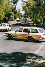
Photograph, Main Road, Eltham looking south near Diamond Street
Colour photograph of Main Road, Eltham looking south near Diamond Street on the right hand sidemain road, eltham, wattletree road, colemans corner, coleman -
 Eltham District Historical Society Inc
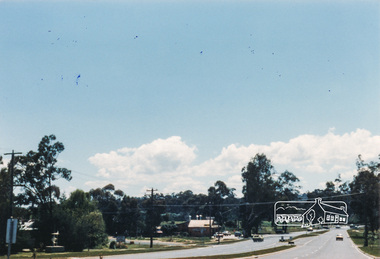
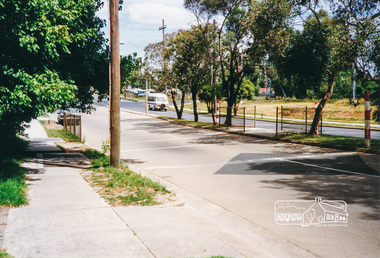
Photograph, Main Road, Research
Three colour photographs of Main Road between Research and Eltham East; two showing the bike path looking tworads Eltham and one viewed from Warrandyte Road near the roundabouteltham east, research, main road, research warrandyte road, warrandyte road, paths, bike paths -
 Eltham District Historical Society Inc
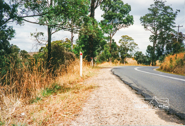
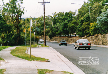
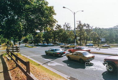
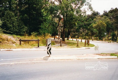
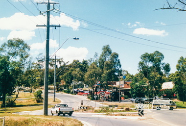
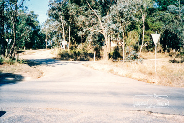
Photograph, Research-Warrandyte Road, Research
Three colour photographs of Research-Warrandyte Road, Research including roundabout at Main Roadresearch, research warrandyte road, warrandyte road, main road, roundabouts -
 Eltham District Historical Society Inc
Photograph, Research Shops, Feb 1990, 1/2/90
Six colour photographs of Research Shopping Centre and precinct including roundabout at Ingrams Roadmain road, research, shops, roundabouts -
 Eltham District Historical Society Inc
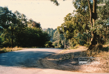
Photograph, Research Shops precinct
Two colour photographs in the vicinity of Research Shops: 1. At Main Road and Warrandyte Road roundabout looking south east towards the shops 2. At the north end of the shops at intersection of Raglan Road and Main Road looking north eastmain road, research, ingrams road, shops, roundabouts -
 Eltham District Historical Society Inc
Photograph, Main Road, Research
Three colour photographs showing Main Road, Research in the vicinity of Research Industrial Estate. 1. Looking north towards the Aqueduct 2. Looking north towards former road alignment 3. Looking north towards the Little Eltham Theatre 3.main road, research, research industrial estate -
 Eltham District Historical Society Inc
Photograph, Thompson Crescent near Norman Road, Research
Three colour photographs of Thompson Crescent, Researchthompson crescent, research -
 Eltham District Historical Society Inc
Photograph, Thompson Crescent area, Research
Three colour photographs of roads in the Thompson Crescent area, Research 1. Norman Road/Keith Court 2. Reynolds Road/Thompson Crescent North and Nicholson Street 3. Thompson Crescent, Researchthompson crescent, norman road, keith court, reynolds road, nicholson street, research -
 Eltham District Historical Society Inc
Photograph, Thompson Crescent area, Research
Three colour photographs of roads in the Thompson Crescent area, Research 1. Reynolds Road looking south from Thompson Crescent North 2. Reynolds Road/Thompson Crescent South 3. Reynolds Road/Thompson Crescent North, Researchthompson crescent, reynolds road, research -
 Eltham District Historical Society Inc
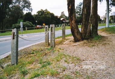
Photograph, Reynolds Road, Research
Two colour photographs of Reynolds Road, Research at southern intersection of Thompson Crescentreynolds road, thompson crescent, research -
 Eltham District Historical Society Inc
Photograph, Kinglake opposite shops
Two colour photographs of Kinglake-Whittlesea Road and area opposite Kinglake shopskinglake, kinglake whittlesea road, shops