Showing 112870 items matching "heidelberg-kinglake-road"
-
 Heidelberg Golf Club
Photograph, Heidelberg Golf Club, Heidelberg Golf Club: 75th anniversary dinner - Staff entertainment, 16/08/2003
Club members at the 75th anniversary dinner, Heidelberg Golf Club, held on 16 August 2003. Office staff member Josie entertains the crowd.From a collection of professional photographs taken at the Heidelberg Golf Club's 75th anniversary celebrations in 2003Colour photograph in photo album 75th anniversary celebrations, hgc members, office staff -
 Heidelberg Golf Club
Photograph, Heidelberg Golf Club, Heidelberg Golf Club: 75th anniversary dinner - Staff assembled before dinner service, 16/08/2003
Staff members in period costume assembled for a group photograph before the 75th anniversary dinner, Heidelberg Golf Club, held on 16 August 2003.From a collection of professional photographs taken at the Heidelberg Golf Club's 75th anniversary celebrations in 2003Colour photograph75th anniversary celebrations, office staff, bar staff, wait staff -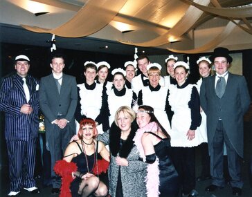
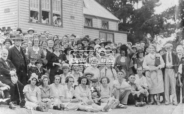 Eltham District Historical Society Inc
Photograph, Gathering at Upper Diamond Creek State School No. 2059, corner of Yates and Heidelberg Kinglake Roads, Upper Diamond Creek
Black and white copy of photo printed on glossy photographic paper 30.5 x 40.5 cm (12 x 16 inch); image size approx. 18.5 x 28 cmgroups, upper diamond creek state school -
 Heidelberg Golf Club
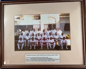
Photograph - Framed Team Photograph, Heidelberg Golf Club Bowling Club, Heidelberg Golf Club Bowling Club: Division 6 section winners season 1992-1993, 1993
Heidelberg Golf Club Bowling Club: Division 6 section winners season 1992-1993. Includes inset of team members absent on the day of photograph.Colour team photograph with caption in timber frame, under glass.heidelberg golf club, heidelberg golf club bowling club, pennant (bowls) -
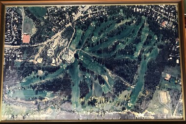 Heidelberg Golf Club
Photograph - Framed Photograph, Heidelberg Golf Club: The new course, 1980s
An aerial photograph of the Heidelberg Golf Course, around 1980s. Known as the 'new course' it was designed in 1968. This image shows the growth of treed areas around the course.One of several aerial photogrphs showing the layout of the Heidelberg Golf CourseLarge colour aerial photograph, timber frame with glass. heidelberg golf club, new course 1968 -
 Heidelberg Golf Club
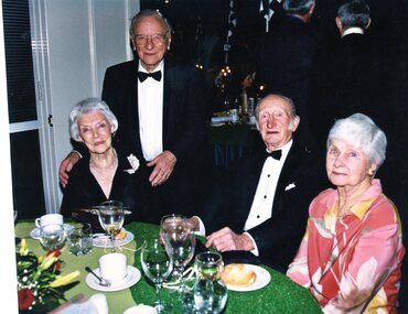
Photograph, Heidelberg Golf Club, Heidelberg Golf Club: 75th anniversary dinner - members at dinner, 16/08/2003
Members at the 75th anniversary dinner, Heidelberg Golf Club, held on 16 August 2003. Esna Crampton, Cliff Crampton, Sid Sanders, Liz Sanders.From a collection of professional photographs taken at the Heidelberg Golf Club's 75th anniversary celebrations in 2003Colour photograph in photo album 75th anniversary celebrations, hgc members -
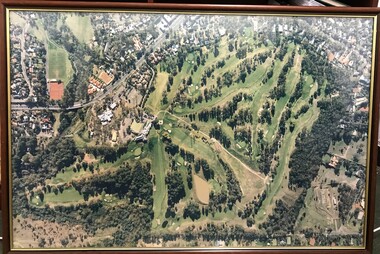 Heidelberg Golf Club
Photograph - Framed Photograph, Heidelberg Golf Club: The new course, 1970s
An aerial photograph of the Heidelberg Golf Course, around late 1970s. Known as the 'new course' it was designed in 1968. This image shows the encroaching residential areas around the course.One of several aerial photogrphs showing the layout of the Heidelberg Golf CourseLarge colour aerial photograph, timber frame with glass. heidelberg golf club, new course 1968 -
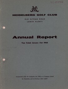 Heidelberg Golf Club
Booklet - Annual Report, Heidelberg Golf Club, Heidelberg Golf Club, Lower Plenty: Annual report, Year ended January 31st, 1966, 1966
Annual report of the Heidelberg Golf Club. Includes annual report, balance sheet and accounts to 31/01/1966. Annual General Meeting held April 1966.Annual reports found in this collection begin in 1933-34.28 page document. Typed text and black and white photographs. Bound in dark green card cover. 3 copies. annual reports, financial reports -
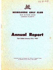 Heidelberg Golf Club
Booklet - Annual Report, Heidelberg Golf Club, Heidelberg Golf Club, Lower Plenty: Annual Report, Year ended January 31st, 1967, 1967
Annual report of the Heidelberg Golf Club. Includes annual report, balance sheet and accounts to 31/01/1967. Annual General Meeting held March 1967.Annual reports found in this collection begin in 1933-34.25 page document. Typed text and black and white photographs. Bound in light green card cover. annual reports, financial reports -
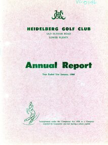 Heidelberg Golf Club
Booklet - Annual Report, Heidelberg Golf Club, Heidelberg Golf Club, Lower Plenty: Annual Report, Year ended January 31st, 1968, 1968
Annual report of the Heidelberg Golf Club. Includes annual report, balance sheet and accounts to 31/01/1968. Annual General Meeting held March 1968.Annual reports found in this collection begin in 1933-34.20 page document. Typed text and black and white photographs. Bound in dark red card cover. annual reports, financial reports -
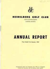 Heidelberg Golf Club
Booklet - Annual Report, Heidelberg Golf Club, Heidelberg Golf Club, Lower Plenty: Annual Report, Year ended January 31st, 1969, 1969
Annual report of the Heidelberg Golf Club. Includes annual report, balance sheet and accounts to 31/01/1969. Annual General Meeting held March 1969.Annual reports found in this collection begin in 1933-34.20 page document. Typed text and black and white photographs. Bound in cream card cover. 2 copies. annual reports, financial reports -
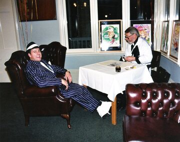 Heidelberg Golf Club
Photograph, Heidelberg Golf Club, Heidelberg Golf Club: 75th anniversary dinner - Stefan with the caricature artist, 16/08/2003
Caricature artist at work - 75th anniversary dinner, Heidelberg Golf Club, held on 16 August 2003. Club manager Stefan having his caricature drawn.From a collection of professional photographs taken at the Heidelberg Golf Club's 75th anniversary celebrations in 2003Colour photograph in photo album 75th anniversary celebrations, hgc members, caricature artist, stefan bazzani -
 Heidelberg Golf Club
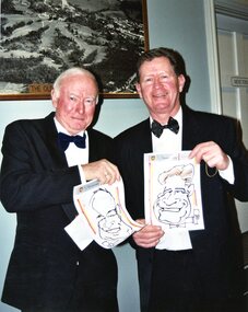
Photograph, Heidelberg Golf Club, Heidelberg Golf Club: 75th anniversary dinner - members with their caricatures, 16/08/2003
Caricature artist at work - 75th anniversary dinner, Heidelberg Golf Club, held on 16 August 2003. Club members David Shewin and Gary Wallis with their caricatures.From a collection of professional photographs taken at the Heidelberg Golf Club's 75th anniversary celebrations in 2003Colour photograph in photo album 75th anniversary celebrations, hgc members, caricature artist -
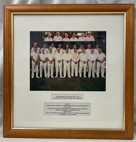
 Heidelberg Golf Club
Photograph - Framed Team Photograph, Heidelberg Golf Club Bowling Club, Heidelberg Golf Club Bowling Club: Promoted to division 2 after finishing 2nd in Pennant season 1994-1995, 1995
Heidelberg Golf Club Bowling Club: Promoted to division 2 after finishing 2nd in Pennant season 1994-1995. Taken on the bowling green with HGC clubhouse in background.Colour team photograph with caption in timber frame, under glass.heidelberg golf club, heidelberg golf club bowling club, pennant (bowls) -
 Heidelberg Golf Club
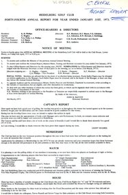
Document - Annual Report, Heidelberg Golf Club, Heidelberg Golf Club, Lower Plenty: Forty-fourth Annual Report, Year ended January 31st, 1973, 06/04/1973
Annual report of the Heidelberg Golf Club. Includes annual report, balance sheet and accounts to 31/01/1973. Annual General Meeting held 06/04/1973.Annual reports found in this collection begin in 1933-34. Numbering of annual reports commenced in 1973 with number 44.4 page document. Typed text. annual reports, financial reports -
 Heidelberg Golf Club
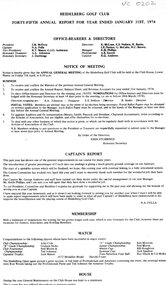
Document - Annual Report, Heidelberg Golf Club, Heidelberg Golf Club, Lower Plenty: Forty-fifth Annual Report, Year ended January 31st, 1974, 05/04/1974
Annual report of the Heidelberg Golf Club. Includes annual report, balance sheet and accounts to 31/01/1974. Annual General Meeting held 05/04/1974.Annual reports found in this collection begin in 1933-34. Numbering of annual reports commenced in 1973 with number 44.4 page document. Typed text. annual reports, financial reports -
 Heidelberg Golf Club
Document - Annual Report, Heidelberg Golf Club, Pre-1932: The Heidelberg Golf Club, Lower Plenty, 1928
Early annual reports of the Heidelberg Golf Club for pre-1932. This copy scanned and printed from Col. Garrard's scrapbook. No other copies of these annual reports have survived.Part of an almost complete set of annual reportsScanned and printed copy of early documents. Housed in plastic folder. annual reports, financial reports -
 Heidelberg Golf Club
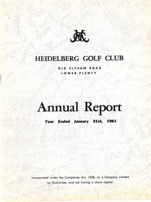
Booklet - Annual Report, Heidelberg Golf Club, Heidelberg Golf Club, Lower Plenty: Annual report, Year ended January 31st, 1961, 08/04/1961
Annual report of the Heidelberg Golf Club. Includes annual report, balance sheet and accounts to 31/01/1960. Annual General Meeting held 08/04/1961.Annual reports found in this collection begin in 1933-34.24 page document. Typed text and black and white photographs. Bound in grey card cover annual reports, financial reports -
 Heidelberg Golf Club
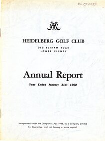
Booklet - Annual Report, Heidelberg Golf Club, Heidelberg Golf Club, Lower Plenty: Annual report, Year ended January 31st, 1962, 13/04/1962
Annual report of the Heidelberg Golf Club. Includes annual report, balance sheet and accounts to 31/01/1962. Annual General Meeting held 13/04/1962.Annual reports found in this collection begin in 1933-34.20 page document. Typed text and black and white photographs. Bound in light blue card cover annual reports, financial reports -
 Heidelberg Golf Club
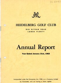
Booklet - Annual Report, Heidelberg Golf Club, Heidelberg Golf Club, Lower Plenty: Annual report, Year ended January 31st, 1963, 05/04/1963
Annual report of the Heidelberg Golf Club. Includes annual report, balance sheet and accounts to 31/01/1963. Annual General Meeting held 05/04/1963.Annual reports found in this collection begin in 1933-34.24 page document. Typed text and black and white photographs. Bound in cream card cover annual reports, financial reports -
 Heidelberg Golf Club
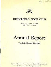
Booklet - Annual Report, Heidelberg Golf Club, Heidelberg Golf Club, Lower Plenty: Annual report, Year ended January 31st, 1964, 22/02/1964
Annual report of the Heidelberg Golf Club. Includes annual report, balance sheet and accounts to 31/01/1964. Annual General Meeting held 22/02/1964.Annual reports found in this collection begin in 1933-34.24 page document. Typed text and black and white photographs. Bound in grey card cover annual reports, financial reports -
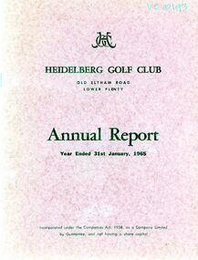 Heidelberg Golf Club
Booklet - Annual Report, Heidelberg Golf Club, Heidelberg Golf Club, Lower Plenty: Annual report, Year ended January 31st, 1965, 12/03/1965
Annual report of the Heidelberg Golf Club. Includes annual report, balance sheet and accounts to 31/01/1965. Annual General Meeting held 12/03/1965.Annual reports found in this collection begin in 1933-34.24 page document. Typed text and black and white photographs. Bound in red card cover annual reports, financial reports -
 Heidelberg Golf Club
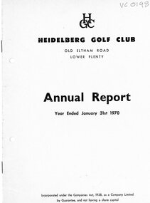
Booklet - Annual Report, Heidelberg Golf Club, Heidelberg Golf Club, Lower Plenty: Annual Report, Year ended January 31st, 1970, 10/04/1970
Annual report of the Heidelberg Golf Club. Includes annual report, balance sheet and accounts to 31/01/1970. Annual General Meeting held 10/04/1970.Annual reports found in this collection begin in 1933-34.18 page document. Typed text and black and white photographs. Bound in light blue card cover.. annual reports, financial reports -
 Heidelberg Golf Club
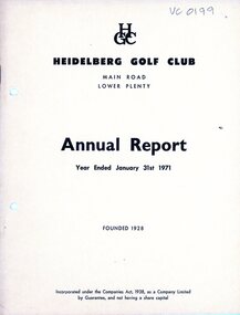
Booklet - Annual Report, Heidelberg Golf Club, Heidelberg Golf Club, Lower Plenty: Annual Report, Year ended January 31st, 1971, 16/04/1971
Annual report of the Heidelberg Golf Club. Includes annual report, balance sheet and accounts to 31/01/1971. Annual General Meeting held 16/04/1971.Annual reports found in this collection begin in 1933-34.18 page document. Typed text and black and white photographs. Bound in cream card cover. annual reports, financial reports -
 Heidelberg Golf Club
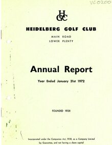
Booklet - Annual Report, Heidelberg Golf Club, Heidelberg Golf Club, Lower Plenty: Annual Report, Year ended January 31st, 1972, 07/04/1972
Annual report of the Heidelberg Golf Club. Includes annual report, balance sheet and accounts to 31/01/1972. Annual General Meeting held 07/04/1972.Annual reports found in this collection begin in 1933-34.20 page document. Typed text and black and white photographs. Bound in light green card cover. annual reports, financial reports -
 Heidelberg Golf Club
Photograph, Heidelberg Golf Club, Heidelberg Golf Club: 75th anniversary dinner - Office staff assembled before dinner service, 16/08/2003
Office staff including manager Stefan in period costume assembled for a group photograph before the 75th anniversary dinner, Heidelberg Golf Club, held on 16 August 2003.From a collection of professional photographs taken at the Heidelberg Golf Club's 75th anniversary celebrations in 2003Colour photograph in photo album75th anniversary celebrations, office staff, bar staff, wait staff, stefan bazzani -
 Heidelberg Golf Club
Photograph, Heidelberg Golf Club, Heidelberg Golf Club: 75th anniversary dinner - Office staff assembled before dinner service, 16/08/2003
Office staff including manager Stefan in period costume assembled for a group photograph before the 75th anniversary dinner, Heidelberg Golf Club, held on 16 August 2003.From a collection of professional photographs taken at the Heidelberg Golf Club's 75th anniversary celebrations in 2003 Colour photograph in photo album75th anniversary celebrations, office staff, bar staff, wait staff, stefan bazzani -
 Heidelberg Golf Club
Photograph, Heidelberg Golf Club, Heidelberg Golf Club: 75th anniversary dinner - HGC members, 16/08/2003
Club members at the 75th anniversary dinner, Heidelberg Golf Club, held on 16 August 2003. Master of ceremonies John Murray and Delys, Max McEvoy and Jennifer McEvoyFrom a collection of professional photographs taken at the Heidelberg Golf Club's 75th anniversary celebrations in 2003Colour photograph in photo album75th anniversary celebrations, hgc members -
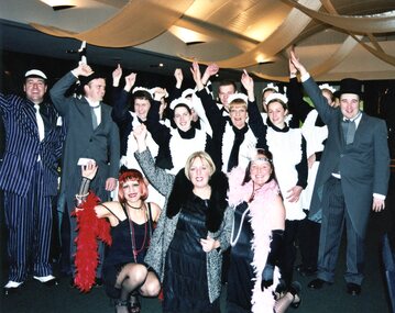
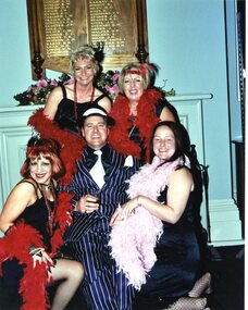
Heidelberg Golf Club
Photograph, Heidelberg Golf Club, Heidelberg Golf Club: 75th anniversary dinner - Staff assembled before dinner service, 16/08/2003
Staff members in period costume assembled for a group photograph, being entertained by Josie before the 75th anniversary dinner, Heidelberg Golf Club, held on 16 August 2003.From a collection of professional photographs taken at the Heidelberg Golf Club's 75th anniversary celebrations in 2003Colour photograph75th anniversary celebrations, office staff, bar staff, wait staff