Showing 16882 items matching "plenty-river"
-
 Lakes Entrance Historical Society
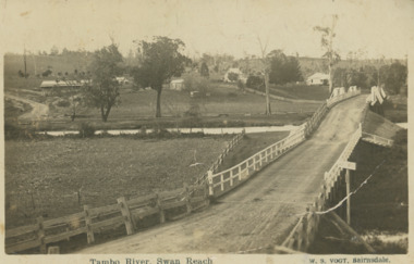
Postcard, Vogt Bairnsdale, Tambo River Swan Reach, 1920 c
Note on back to Ella from her brother Don dated 1920Black and white postcard showing the old Swan Reach bridge over the Tambo River looking east. Buildings L to R Riverslea guesthouse and school with high pitched roof. Swan Reach VictoriaTambo River Swan Reachwaterways, boats and boating, township, guesthouses, bridges -
 Rutherglen Historical Society
Book, Kath Bentley et al, River of Islands: Charts of the River Murray Yarrawonga Weir to Hume Dam, November 1983
Book contains information and sketch maps to aid in the navigation of the Murray River, with advice on hazards to look for as these will change over time.74 page A4 book with a drawing of a boat on the Murray River on the coverAutographed on the title page by the authors: "9-1-84 Leon Bentley | Kath Bentley"murray river, boating, river navigation, boating safety -
 Ballarat Heritage Services
Photograph - Photograph - Colour, Clare Gervasoni, Brembo River, Near San Giovanni Bianco, Lombardy, Italy, 2001, 2001
The Brembo River is a 74-kilometer river which runs entirely within the Province of Bergamo in the Lombardy Region of Italy.Colour photograph of the Brembo River.brembo river, san giovanni bianco, italy -
 Kew Historical Society Inc
Photograph, Outer Circle Railway Bridge over River Yarra, c.1900
This photograph forms part of the Eric Sibly collection of images and information relating to the Outer Circle Railway which he donated to the Kew Historical Society in 1974. Heritage Victoria Citation (Abridged) "The Chandler Highway Bridge, a 137 metre wrought iron lattice-truss girder bridge with four spans supported on red brick piers with moulded bluestone cappings. The bridge has a cantilevered walkway along the west side. ...The Chandler Highway Bridge crosses the Yarra River and connects Alphington and Kew. It was completed in November 1890 as part of the Outer Circle Railway Line.Black & white photograph of the railway viaduct over Yarra River looking south towards Kew.Reverse: "Pre 1930. Outer Circle Railway Bridge over River Yarra (now Chandler Highway) - note bridge over line on Kew side for Asylum Farm". KH - 56. Kew Historical Society.chandler highway, railway bridges - kew (vic), sir john monash, outer circle railway, river yarra - kew (vic) -
 Orbost & District Historical Society
book, Snowy River Mail as "Mail" Print, Princes Freeway Orbost Section, 2117.1 : 1976 2117.2 : 4.9.2013
The Snowy River Bridge, Princes Freeway, Orbost, Victoria was opened by the Hon. J A Rafferty, Minister for Transport, 25 November 1976. ‘The bridge was built at a cost of A$2.4 million and is the first of four bridges to be built as part of the 8.4 kilometre freeway bypass of Orbost. Construction of the bridges commenced in January 1975, with an expectation to open the bridge across the Snowy River as soon as possible. Less than two years later, on 25 November 1976, the bridge across the Snowy River was opened to traffic, allowing the old bridge to be demolished. The remainder of the Orbost Bypass, both the floodplain crossings and the eastern section around the township itself, was declared ‘Princes Freeway’. The newspaper article was written by David Jellie as part of the centenary celebrations of Vic Roads/Country Roads on 4.9.2013. David Jellie was the project engineer for the Snowy River Crossing Project.This book and article contain historical information and details about the construction of the bridges on the Orbost section of the Princes Freeway.2117.1 isaA thin paperbook book which contains a map, history and construction details of the Princes Freeway at Orbost. It has a program for the opening ceremony of the snowy River Bridge in 1976. 2117.2 is an article from the snowy River Mail on the history of the highway. It is dated 4.9.2013.In pencil - 20csnowy-river-bridge jellie-david princes-freeway-orbost -
 Lakes Entrance Historical Society
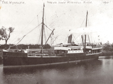
Photograph, TSS Wyrallah on Mitchell River, Bairnsdale Victoria, 1910
Black and white photograph of the TSS Wyrallah with crew and passengers standing on after deck while steaming slowly down the Mitchell River near Bairnsdale VictoriaTSS Wyrallah Passing down Mitchell River 1910boats and boating, rivers, gippsland lakes -
 Marysville & District Historical Society
Postcard (item) - Colour postcard, Souvenirs Australia Pty. Ltd, A Ford on the Acheron River, 1881, Post 1995
A postcard from a painting of a ford on the Acheron River that was painted in 1881 by H.J. Johnstone.A postcard from a painting of a ford on the Acheron River that was painted in 1881 by H.J. Johnstone. The original painting is oil on canvas and was donated to the Broken Hill City Art Gallery in 1948 by Mr. O. Von Rieben. This postcard was produced by Souvenirs Australia Pty. Ltd. in Glynde, South Australia as a souvenir of Marysville.H.J. JOHNSTONE/ A FORD ON THE ACHERON RIVER, 1881/ OIL ON CANVAS, 171cm x 245cm/ BROKEN HILL CITY ART GALLERY/ DONATED BY MR. O. VON RIEBEN, 1948 Made in/ Australia by/ Souvenirs Aust./ Pty. Ltd./ Adelaide/ BHG 2 ADDRESS Published by/ Souvenirs Australia Pty. Ltd./ Glynde/ Copyright A PITT CARDacheron river, oil painting, h.j. johnstone, broken hill city art gallery, mr. o. von rieben, postcard, souvenirs australia, souvenir -
 Eltham District Historical Society Inc
Negative - Photograph, J.A. McDonald, Eltham-Yarra Glen Road, Lower Plenty footbridge, Sep. 1955
The Eltham-Yarra Glen Road as designated originated at the Shire of Eltham boundary at the Plenty River. West of the river the road was known as the Heidelberg-Eltham Road. The section from the Plenty River is now known as Lower Plenty Road which becomes Main Road. The footbridge no longer exists but was originally sited to the south, adjacent to the old Lower Plenty Bridge, now part of the Plenty River Trail. Record of various Shire of Eltham infrastructure works undertaken during the period of 1952-1962 involving bridge and road reconstruction projects, sometimes with Eltham Shire Council Project Reference numbers quoted. It was during this period that a number of significant improvements were made to roads and new bridges constructed within the shire that remain in place as of present day (2022). In many situations, the photos provide a tangible visible record of infrastructure that existed throughout the early days of the Shire. The album was put together by or under the direction of the Shire Engineer, J.A. McDonald.1955-09, eltham-yarra glen road, lower plenty footbridge, lower plenty, lower plenty bridge, lower plenty road, main road, plenty river trail, bridge construction, infrastructure, shire of eltham -
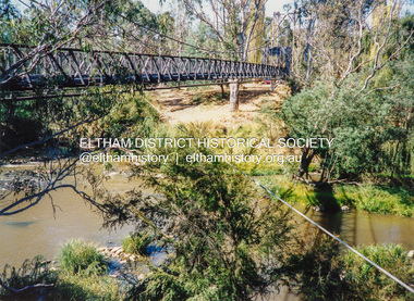 Eltham District Historical Society Inc
Photograph - Colour Print, Pedestrian suspension bridge over the Yarra River at Lower Plenty, c.1987
blessed sacrament fathers, bonds road, bridge, footbridge, lower plenty, odyssey house, seminary, yarra river -
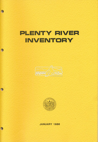 Eltham District Historical Society Inc
Book, Melbourne and Metropolitan Board of Works, Plenty River Inventory, 1986
The Melbourne and metropolitan Board of Works provided the lead agency role for implementing the Urban Waterways Program announced by the Victorian Government in February 1985. -
 Eltham District Historical Society Inc
Photograph, Plenty River at end of Palara Court, Montmorency, c.September 1966, 1966c
Black and white photographic printOriginally located in a Filmpro King Size Prints processing envelope $3.01 Shire of Eltham 9/9/66 and noted as Calrossie Ave area and crossed out Eltham-Yarra Glen Road, Bridge Street to Elsa Court existing conditions mid 1967montmorency, palara court, plenty river -
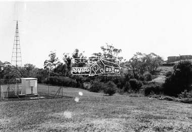
 Eltham District Historical Society Inc
Slide - Photograph, Batman Apple tree (Malus pumila), Plenty RIver Walking Trail, Corowa Crescent, Greensborough, c.2004
Part of a presentation on "Significant Trees, Wildflowers and Local Gardens" by Russell Yeoman to the 10 November 2004 Eltham District Historical Society meeting35mm colour positive transparency Mount - white 7 dots (Technodia Italy)batman apple tree, corowa crescent, greensborough, malus pumila, plenty river walking trail, significant tree -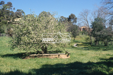
 Eltham District Historical Society Inc
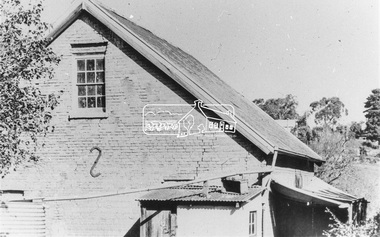
Photograph, Willis Vale on the north bank of the Plenty River, Church Street, Greensborough, c.1950
Photo probably sourced from Heidelberg Historical Society, Similar photo reproduced on p63 of The Diamond Valley Story by Dianne H. Edwards, Shire of Diamond Valley 1979. Black and white copy of photo printed on glossy photographic paper 30.5 x 40.5 cm (12 x 16 inch); image size approx. 18.5 x 28 cmchurch street, diamond valley story, greensborough, james willis mayger, partington family, willis vale -
 Greensborough Historical Society
Folder of Documents, Anne Paul, Plenty River Heritage sites / Anne Paul, 1937_
This collection of correspondence, articles and photographs was collected by GHS member Anne Paul in support of Heritage overlays for the Pioneer Children's Graves, Batman Apple Tree and Maroondah Aqueduct.Blue plastic folder containing a large number of documents and images.anne paul, pioneer childrens cemetery, batman apple tree, maroondah aqueduct -
 Greensborough Historical Society
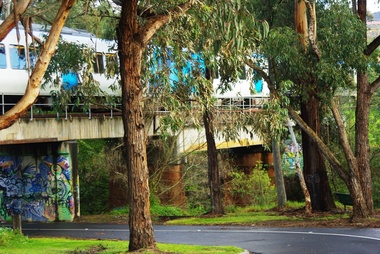
Photograph - Digital image, Marilyn Smith, Railway Road Rail Bridge over Plenty River Briar Hill, 17/09/2014
Rail bridge over Railway Road Greensborough, near Para Road.Digital copy of colour photographrailway road greensborough, para road greensborough -
 Greensborough Historical Society
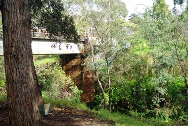
Photograph - Digital image, Marilyn Smith, Railway Road Rail Bridge over Plenty River Briar Hill, 17/09/2014
Rail bridge over Railway Road Greensborough.Digital copy of colour photograph -
 Greensborough Historical Society
Photograph - Digital image, Marilyn Smith, Railway Road Rail Bridge over Plenty River Briar Hill, 17/09/2014
Rail bridge over Railway Road Greensborough.Digital copy of colour photographrailway road greensborough -
 Greensborough Historical Society
Photograph - Digital image, Marilyn Smith, Railway Road Rail Bridge over Plenty River Briar Hill, 17/09/2014
Para Road near Railway Road Greensborough Digital copy of colour photographrailway road greensborough, para road greensborough -
 Greensborough Historical Society
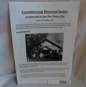
Folder, Greensborough and Plenty River Pioneer Trail, 30/10/2011
Trail notes from the Greensborough Historical Society Heritage Weekend Walk, Sunday 30th October 2011. Contains illustrations and information on historical sites within easy walk of Greensborough central.20-page plastic binder, spiral bound, clear cover. Contains trail notes. 6 pages, illus.Collected by Greensborough Historical Society. Folder commenced 2012.greensborough historical society, plenty river pioneer trail, noel withers, greensborough -
 Greensborough Historical Society
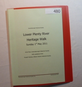
Folder, Lower Plenty River Heritage Walk 2011, 01/05/2011
Contains information about the sites visited on the Heritage Walk 2011 through Yallambie and Viewbank. Notes compiled by Anne Paul with assistance from Russell Yeoman.20-page plastic binder, redcover. Contains 12 page guide.plenty river, heritage trail, anne paul, greensborough historical society, yallambie, viewbank, russell yeoman -
 Eltham District Historical Society Inc
Photograph, View looking northwest along Plenty River Drive, Greensborough from outside No. 64, c.1986, 1986c
Shows the eastern bridge of the Greensborough Bypass under construction. Colour photograph originally located in a magnetic style album titled 'Greensborough Bypass 1990s 5' suffering significant degradation. No information contained in album or on reverse of photos except where noted. Relocated to archival photosafe storage.greensborough bypass, road construction, plenty river drive, greensborough -
 Eltham District Historical Society Inc
Photograph, Plenty River Drive near Booyan Crescent; Greensborough Bypass construction, c.1986, 1986c
Colour photograph originally located in a magnetic style album titled 'Greensborough Bypass 1990s 5' suffering significant degradation. No information contained in album or on reverse of photos except where noted. Relocated to archival photosafe storage.greensborough bypass, road construction, plenty river drive, greensborough -
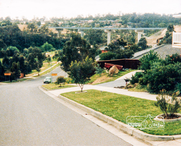
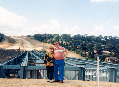
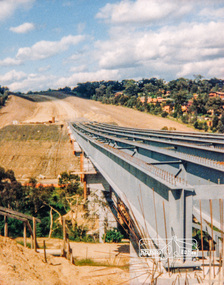
 Eltham District Historical Society Inc
Photograph, Looking east across the new 5-span bridge construction across the Plenty River from the western side; Greensborough Bypass construction, c.1986, 1986c
Shows the eastern bridge of the Greensborough Bypass under construction. Colour photograph originally located in a magnetic style album titled 'Greensborough Bypass 1990s 5' suffering significant degradation. No information contained in album or on reverse of photos except where noted. Relocated to archival photosafe storage.greensborough bypass, road construction, plenty river drive, greensborough, bridge construction -
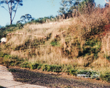
 Eltham District Historical Society Inc
Photograph, Bridge construction over the Plenty River; Greensborough Bypass construction, c.1986, 1986c
Colour photograph originally located in a magnetic style album titled 'Greensborough Bypass 1990s 5' suffering significant degradation. No information contained in album or on reverse of photos except where noted. Relocated to archival photosafe storage.greensborough bypass, road construction, greensborough, bridge construction -
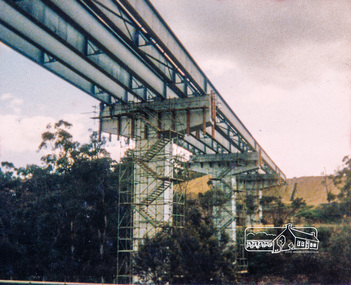
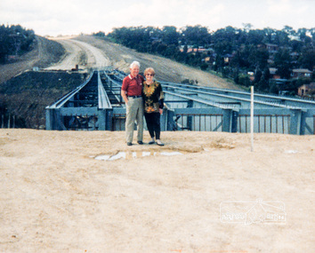
 Eltham District Historical Society Inc
Photograph, Looking east across the new bridge construction across the Plenty River from the western side up to the new roundabout at Civic Drive; Greensborough Bypass construction, c.1986, 1986c
Colour photograph originally located in a magnetic style album titled 'Greensborough Bypass 1990s 5' suffering significant degradation. No information contained in album or on reverse of photos except where noted. Relocated to archival photosafe storage.greensborough bypass, road construction, greensborough, bridge construction -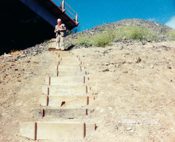
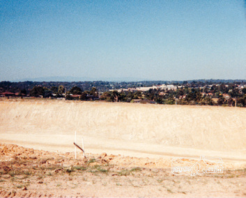 Eltham District Historical Society Inc
Photograph, Looking slightly east of south towards Greensborough Plaza from near the Plenty River; Greensborough Bypass construction, c.1986, 1986c
Colour photograph originally located in a magnetic style album titled 'Greensborough Bypass 1990s 5' suffering significant degradation. No information contained in album or on reverse of photos except where noted. Relocated to archival photosafe storage.greensborough bypass, road construction, greensborough, greensborough plaza