Showing 7203 items
matching port melbourne historical
-
 Eltham District Historical Society Inc
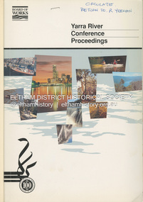
Book, Melbourne Metropolitan Board of Works, Yarra River Conference Proceedings, 1991
Conference staged by the Board of Works to present a range of papers examining the river's environment, recreational uses, natural resources, development, commerce and land use. Conference delegates included representatives from Eltham Shire Council and was held in April 1991. Session 1 Heritage and Environment: Flora and fauna / Paul Gullan. -- Geology and topography / Brian Finlayson. -- Aboriginal culture / Margaret Gardiner. Session 2 History. Session 3: Management plans and policies : overview of responsibilities / Dr Colin Leigh. --Role of the media / Peter Cole-Adams. -- Urban development / Paul Jerome. -- Port of Melbourne area / Leigh McKay. -- Recreation / Ken Marriott. Session 4: Perspectives - the current view. Session 5: Issues, challenges, potential solutions.non-fictionConference staged by the Board of Works to present a range of papers examining the river's environment, recreational uses, natural resources, development, commerce and land use. Conference delegates included representatives from Eltham Shire Council and was held in April 1991. Session 1 Heritage and Environment: Flora and fauna / Paul Gullan. -- Geology and topography / Brian Finlayson. -- Aboriginal culture / Margaret Gardiner. Session 2 History. Session 3: Management plans and policies : overview of responsibilities / Dr Colin Leigh. --Role of the media / Peter Cole-Adams. -- Urban development / Paul Jerome. -- Port of Melbourne area / Leigh McKay. -- Recreation / Ken Marriott. Session 4: Perspectives - the current view. Session 5: Issues, challenges, potential solutions.yarra river, melbourne -
 Eltham District Historical Society Inc
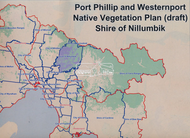
Book, Port Phillip and Westernport Native Vegetation Plan (draft), Shire of Nillumbik
Entire report available www.ppwema.vic.gov.au -
 Eltham District Historical Society Inc
Photograph - Aerial Photograph, Landata, Eltham; Crown Allotment 15, Section 5, Parish of Nillumbik (Stokes Orchard Estate), Feb. 1979
Centred on present day Diosma Rd, Stokes Pl, Nyora Rd and Eucalyptus Rd Historic Aerial Imagery Source: Landata.vic.gov.au Aerial Photo Details: Project No :1716 Project : WESTERN PORT FORESHORES Run : 15 Frame : 91 Date : 02/1979 Film Type : B/W Camera : RC8 Flying Height : 5500 Scale : 10000 Film Number : 3286 GDA2020 : 37°42'47"S, 145°09'57"E MGA2020 : 338339, 5824447 (55) Melways : 22 C4 (ed. 42) A History of the Development of Crown Allotment 15, Section 5, Parish of Nillumbik – Stokes Orchard Crown Allotment 15, Section 5, Parish of Nillumbik (CA15) is a square allotment of 158 acres or approximately a quarter of a square mile. It lies just beyond the eastern end of Pitt Street, south of Nyora Road to the northern end of Eucalyptus Road and extends east from Eucalyptus Road to Reynolds Road. The topography of CA15 is generally steep, sloping up to a hill near the centre of the land, the ridgeline passing through the properties along the southern side of Diosma Road. Eucalyptus Road is a straight north-south road with its northern end at the north west corner of CA15. Until the end of the 1970s this road was an un-named Government Road and was largely not open to traffic. With residential development in the 1970s the road was constructed, and the council allocated the name obviously in recognition of the predominant species of the local bushland. CA15 was purchased from the Crown by George D’Arley Boursiquot, a prominent Melbourne printer, on 28th October 1852. On November 23, 1922, former Member for Gippsland and Melbourne Real Estate Agent, Hubert Patrick Keogh purchased the allotment then sold it March 13, 1925, to local farmer, Robert David Taylor, a former Shire of Eltham Councillor (1911-1920) and Shire President (1919). Taylor had extensive land holdings stretching west towards Bible Street and Main Road. The Taylor home was situated at the top of the hill in Bible Street at present day 82 Bible Street. At the time of Taylor’s purchase in 1925, CA15 was subdivided into 48 lots that could be described as small rural properties or large residential lots. A typical lot size was one hectare or 2.5 acres. The subdivision created two roads, Nyora Road, and Diosma Road, each following an irregular alignment between Eucalyptus and Reynolds Roads. However, the lots were not sold off separately nor were the roads constructed. The land effectively remained as one parcel for many further years. Robert David Taylor died November 30, 1934, and probate was granted to his son of the same name, Robert David Taylor of Bible Street, Salesman and William McLelland Vance Taylor of 73 Emmeline Street, Northcote, Clerk, with the transfer of the land into their names on July 8, 1935. Frank Stokes worked as a qualified accountant at Kennons leather factory in Burnley, while living at 1 Thomas Street, Mitcham. He suffered from migraines and wanted to return to working the land (he had previously worked on farms and orchards since coming to Australia from England in 1926, both in WA and Vic.). He first travelled to the district by train in July 1942 to find land with the intention to establish an orchard. By chance he met Arthur Bird of Bird Orchard (bounded by Pitt Street, Eucalyptus Road, and Wattle Grove) and they got talking over their common interest. Arthur put Frank up for the night and pointed out the land, 158 acres- part of the Taylor Estate- £900, Crown Allotment 15, Section 5, Parish of Nillumbik (CA15) somewhat diagonally opposite Bird Orchard. Stokes applied through the Riverina Agency to purchase the land who in turn applied for permission from Canberra to sell as there was a new government regulation introduced during the Second World War banning land sales except for immediate production. Stokes obtained a loan on his Mitcham house of £600 @ 5% and paid £450 deposit with quarterly payments of £15 spread over 5 years. Stokes was assisted and advised by Arthur Bird who farmed the neighbouring orchard. In early 1943 Stokes took possession and would catch the train out to Eltham on Fridays after work and began building a hut on the corner of Nyora Road and the Government Road (Eucalyptus Road) for shelter and to lock up tools. He established an orchard on the central western part of the land through the centre of which ran a natural waterway (part of the present-day linear park) and was able to pay a neighbour (Hawkins) to help with clearing and fencing 25 acres, and with a horse and single furrowed plough, planted approximately 2,500 fruit trees - cherries, peaches, plums, almonds, pears, apricots and lemons as well as a few apples and oranges; a massive task. Aerial photographs from the 1940s through to the 1990s clearly show the orchard with most of the larger CA15 site remaining as natural bushland. A huge problem was hares and rabbits eating all the new buds off the tiny trees. As well as laying poison he painted the trees with a mixture of cow manure and lime, often working by moonlight. Procurement of wire and wire netting was difficult because of the war but after much effort he obtained a permit from the Agricultural Department for supplies in March 1944. In February 1945 Stokes applied for a permit to build a “packing shed” as no house building was allowed. It was to be 33 feet x 21 feet and cost £312. It was constructed mostly from second-hand materials, which were hard to obtain, especially iron for roofing. Stokes finished work at Kennons on October 31, 1945, and in March 1946 he sold the family home at Mitcham for £1,230 plus £170 for furniture. On May 15, 1946, title to the CA15 property was issued to Frank Howard Alfred Stokes, Orchardist and Gladys Ethel Stokes, Married Woman, both of Pitt Street, Eltham. The family of five then moved into the very unfinished “packing shed” at Eltham, which was a struggle to weatherproof. Eventually rooms were divided off and lined with hessian bags and whitewashed. Their income was firewood (cut and sold), selling rockery stones and cut Sweet Bursaria. (It was discovered during the 1940s that Sweet Bursaria contained the sunscreen compound Aesculin. The RAAF utilised this compound from Sweet Bursaria during WW2 for pilots and gunners.) The orchard’s first fruit sale was a half-case of Le Vanq peaches in December 1947 for the price of 8 shillings. In 1956 plans for house were drawn and Glen Iris bricks purchased (1956 Olympic Rings variant). The building of the house commenced in 1957 - 12 feet of original packing shed was removed – and was completed in 1959. Water was connected from newly built pressure storage on the property at the end of 1959 and the electricity connection for the first time at 3pm on April 29, 1960. The house remains to present day (somewhat modified) at 1 Nyora Road, home to Nyora Studio Gallery. On occasions, spare remnants of the 1956 bricks have been known to be unearthed in gardens on the estate as they were utilised by Frank Stokes to fill in rabbit holes. On May 26, 1950, a parcel of land was compulsorily acquired by the Melbourne and Metropolitan Board of Works on the hilltop to establish an easement for a high-level service reservoir to augment Eltham’s water supply. The project also included pipe tracks for the necessary water mains. The reservoir has now been superseded by higher level water tanks east of Reynolds Road and its former site is now a public reserve. On November 27, 1964, the State Electricity Commission served notice to compulsorily acquire a further parcel through the eastern part of the land for a major electricity transmission line that augmented supply from the La Trobe Valley to Melbourne. The easement was registered February 11, 1966. The easement was widened July 18, 1969 for a second transmission line to be constructed. In 1971 Melbourne Metropolitan Planning Scheme amendments adopted Nyora Road as the boundary between a residential zone to the north and a rural zone to the south. This determined the future development of the land. In the mid-1970s the Shire of Eltham divided the orchard into numerous rate-able parcel lots, the 48 lots having been established in 1925 and the subsequent rates assessment proved unsustainable for Stokes. He commenced selling lots outside the boundary of the orchard, north of Diosma and South of Nyora. However shortly later the land between Nyora and Diosma Roads and west of the electricity easement was sold and subdivided into residential lots, a housing development by Macquarie Builders and marketed as the Stokes Orchard Estate. New streets were created, and most were named after trees, although one, Stokes Place, commemorates the former owners. The development was undertaken in two stages; Stage 1 (1975) encompassing Scarlet Ash Court, Ironbark Close and Peppermint Grove bounded by Nyora and Eucalyptus roads and Stage 2 (1978) encompassing Stokes Place, Orchard Way, The Crest and The Lookout bound by Nyora and Diosma roads. The developer, Macquarie Builders went bankrupt shortly after the release of Stage 2 leaving many purchasers to fend for themselves and arrange for their own independent builders. There were also difficulties with sewerage for the land immediately south of Diosma Road and so the conventional residential lots were abandoned in favour of larger lots. The development of Orchard Way, The Crest and The Lookout did not proceed as planned and the proposed lots were incorporated into five-acre parcels instead. These included a low-density group housing development by the Graves family and the award winning Choong House (1983) with Gordon Ford developed garden immediately next door situated on the ridge of the hill nestled amongst the original bush, Eucalypt trees and Sweet Bursaria. In 1994, Nillumbik Shire Council applied Significant Environment and Significant Landscape overlays upon the properties on the south side of Diosma Road to ensure protection of this natural bush garden environment. With the arrival of the sewer along Diosma Road in the 1990s, most of these five-acre parcels have since been subdivided multiple times. The Choong house presently sits on a 2.7-acre property, which in 2022 Nillumbik Council nominated for Cultural Significance Heritage protection and is considered potentially significant at State level. The Stokes family were also associated with the Eltham Christian Church. In the 1970s this church had met in temporary premises in Eltham. Lots of the original 1925 subdivision remained south of Nyora Road and a number of these lots were utilized for the Eltham Christian School, which was established by the Eltham Christian Church in 1981. The school operated on this site until 2000. The premises are now used by The Vine Baptist Church. By the mid-1980s the whole of CA15 had been developed for residential and school purposes, except for the sections north of Diosma Road and between the transmission lines and Reynolds Road. Sewerage issues had been resolved for the section north of Diosma Road and in 1987 it was in the process of being subdivided into residential lots. The development coincided with the discovery of colonies of the rare and endangered Eltham Copper Butterfly on the site. This resulted in a community and political campaign to save the butterfly habitat. With the co-operation of the land developer the subdivision was altered to create two bushland reserves in the critical butterfly habitat areas. In the late 1980s the State Government was investigating options for establishing a metropolitan ring road link between Diamond Creek and Ringwood. The chosen route was adjacent to Reynolds Road and so this created a freeze on development of CA15 between Reynolds Road and the electricity easement. The ring road proposal was eventually abandoned, and this part of the land was subdivided into low density residential lots. Diosma Road has been discontinued at the electricity easement and the eastern part incorporated into View Mount Court with access from Reynolds Road. The whole of CA15 has now been developed for residential or associated purposes, ranging from conventional density to quite low density south of Nyora Road. Some remnants of the orchard remain, a few cherry trees on the Graves property and a lone apple tree in Stokes Place. The butterfly reserves comprise significant areas of remnant bushland. Linear reserves through the estate link with central Eltham via the Woodridge linear reserve and with Research along the electricity easement. CA15 as it exists today has a complicated history of rural use, Government acquisition, urban development, and community action. References: • “Stokes Orchard, an incomplete history”; Russell Yeoman with Doug Orford • Correspondence, Beryl Bradbury (nee Stokes) • Aerial Photographs, 1931-1991, Landata (landata.vic.gov.au) • Certificate of Title, Vol. 4930 Fol. 985900 • Plan Number LP 10859 aerial photo, diosma road, eltham copper butterfly, eucalyptus road, ironbark close, nyora road, peppermint grove, peter & elizabeth pidgeon collection, power transmission lines, reynolds road, scarlet ash court, stokes orchard estate, stokes place, woodridge estate, frank stokes -
 Eltham District Historical Society Inc
Photograph - Aerial Photograph, Landata, Eltham; Crown Allotment 15, Section 5, Parish of Nillumbik (Stokes Orchard Estate), Jan. 1984
Centred on present day Diosma Rd, Stokes Pl, Nyora Rd and Eucalyptus Rd Historic Aerial Imagery Source: Landata.vic.gov.au Aerial Photo Details: Project No :1716 Project : WESTERN PORT FORESHORES Run : 15 Frame : 70 Date : 01/1984 Film Type : B/W Camera : RC8 Flying Height : 5300 Scale : 10000 Film Number : 3833 GDA2020 : 37°42'38"S, 145°10'09"E MGA2020 : 338612, 5824719 (55) Melways : 22 D4 (ed. 42) A History of the Development of Crown Allotment 15, Section 5, Parish of Nillumbik – Stokes Orchard Crown Allotment 15, Section 5, Parish of Nillumbik (CA15) is a square allotment of 158 acres or approximately a quarter of a square mile. It lies just beyond the eastern end of Pitt Street, south of Nyora Road to the northern end of Eucalyptus Road and extends east from Eucalyptus Road to Reynolds Road. The topography of CA15 is generally steep, sloping up to a hill near the centre of the land, the ridgeline passing through the properties along the southern side of Diosma Road. Eucalyptus Road is a straight north-south road with its northern end at the north west corner of CA15. Until the end of the 1970s this road was an un-named Government Road and was largely not open to traffic. With residential development in the 1970s the road was constructed, and the council allocated the name obviously in recognition of the predominant species of the local bushland. CA15 was purchased from the Crown by George D’Arley Boursiquot, a prominent Melbourne printer, on 28th October 1852. On November 23, 1922, former Member for Gippsland and Melbourne Real Estate Agent, Hubert Patrick Keogh purchased the allotment then sold it March 13, 1925, to local farmer, Robert David Taylor, a former Shire of Eltham Councillor (1911-1920) and Shire President (1919). Taylor had extensive land holdings stretching west towards Bible Street and Main Road. The Taylor home was situated at the top of the hill in Bible Street at present day 82 Bible Street. At the time of Taylor’s purchase in 1925, CA15 was subdivided into 48 lots that could be described as small rural properties or large residential lots. A typical lot size was one hectare or 2.5 acres. The subdivision created two roads, Nyora Road, and Diosma Road, each following an irregular alignment between Eucalyptus and Reynolds Roads. However, the lots were not sold off separately nor were the roads constructed. The land effectively remained as one parcel for many further years. Robert David Taylor died November 30, 1934, and probate was granted to his son of the same name, Robert David Taylor of Bible Street, Salesman and William McLelland Vance Taylor of 73 Emmeline Street, Northcote, Clerk, with the transfer of the land into their names on July 8, 1935. Frank Stokes worked as a qualified accountant at Kennons leather factory in Burnley, while living at 1 Thomas Street, Mitcham. He suffered from migraines and wanted to return to working the land (he had previously worked on farms and orchards since coming to Australia from England in 1926, both in WA and Vic.). He first travelled to the district by train in July 1942 to find land with the intention to establish an orchard. By chance he met Arthur Bird of Bird Orchard (bounded by Pitt Street, Eucalyptus Road, and Wattle Grove) and they got talking over their common interest. Arthur put Frank up for the night and pointed out the land, 158 acres- part of the Taylor Estate- £900, Crown Allotment 15, Section 5, Parish of Nillumbik (CA15) somewhat diagonally opposite Bird Orchard. Stokes applied through the Riverina Agency to purchase the land who in turn applied for permission from Canberra to sell as there was a new government regulation introduced during the Second World War banning land sales except for immediate production. Stokes obtained a loan on his Mitcham house of £600 @ 5% and paid £450 deposit with quarterly payments of £15 spread over 5 years. Stokes was assisted and advised by Arthur Bird who farmed the neighbouring orchard. In early 1943 Stokes took possession and would catch the train out to Eltham on Fridays after work and began building a hut on the corner of Nyora Road and the Government Road (Eucalyptus Road) for shelter and to lock up tools. He established an orchard on the central western part of the land through the centre of which ran a natural waterway (part of the present-day linear park) and was able to pay a neighbour (Hawkins) to help with clearing and fencing 25 acres, and with a horse and single furrowed plough, planted approximately 2,500 fruit trees - cherries, peaches, plums, almonds, pears, apricots and lemons as well as a few apples and oranges; a massive task. Aerial photographs from the 1940s through to the 1990s clearly show the orchard with most of the larger CA15 site remaining as natural bushland. A huge problem was hares and rabbits eating all the new buds off the tiny trees. As well as laying poison he painted the trees with a mixture of cow manure and lime, often working by moonlight. Procurement of wire and wire netting was difficult because of the war but after much effort he obtained a permit from the Agricultural Department for supplies in March 1944. In February 1945 Stokes applied for a permit to build a “packing shed” as no house building was allowed. It was to be 33 feet x 21 feet and cost £312. It was constructed mostly from second-hand materials, which were hard to obtain, especially iron for roofing. Stokes finished work at Kennons on October 31, 1945, and in March 1946 he sold the family home at Mitcham for £1,230 plus £170 for furniture. On May 15, 1946, title to the CA15 property was issued to Frank Howard Alfred Stokes, Orchardist and Gladys Ethel Stokes, Married Woman, both of Pitt Street, Eltham. The family of five then moved into the very unfinished “packing shed” at Eltham, which was a struggle to weatherproof. Eventually rooms were divided off and lined with hessian bags and whitewashed. Their income was firewood (cut and sold), selling rockery stones and cut Sweet Bursaria. (It was discovered during the 1940s that Sweet Bursaria contained the sunscreen compound Aesculin. The RAAF utilised this compound from Sweet Bursaria during WW2 for pilots and gunners.) The orchard’s first fruit sale was a half-case of Le Vanq peaches in December 1947 for the price of 8 shillings. In 1956 plans for house were drawn and Glen Iris bricks purchased (1956 Olympic Rings variant). The building of the house commenced in 1957 - 12 feet of original packing shed was removed – and was completed in 1959. Water was connected from newly built pressure storage on the property at the end of 1959 and the electricity connection for the first time at 3pm on April 29, 1960. The house remains to present day (somewhat modified) at 1 Nyora Road, home to Nyora Studio Gallery. On occasions, spare remnants of the 1956 bricks have been known to be unearthed in gardens on the estate as they were utilised by Frank Stokes to fill in rabbit holes. On May 26, 1950, a parcel of land was compulsorily acquired by the Melbourne and Metropolitan Board of Works on the hilltop to establish an easement for a high-level service reservoir to augment Eltham’s water supply. The project also included pipe tracks for the necessary water mains. The reservoir has now been superseded by higher level water tanks east of Reynolds Road and its former site is now a public reserve. On November 27, 1964, the State Electricity Commission served notice to compulsorily acquire a further parcel through the eastern part of the land for a major electricity transmission line that augmented supply from the La Trobe Valley to Melbourne. The easement was registered February 11, 1966. The easement was widened July 18, 1969 for a second transmission line to be constructed. In 1971 Melbourne Metropolitan Planning Scheme amendments adopted Nyora Road as the boundary between a residential zone to the north and a rural zone to the south. This determined the future development of the land. In the mid-1970s the Shire of Eltham divided the orchard into numerous rate-able parcel lots, the 48 lots having been established in 1925 and the subsequent rates assessment proved unsustainable for Stokes. He commenced selling lots outside the boundary of the orchard, north of Diosma and South of Nyora. However shortly later the land between Nyora and Diosma Roads and west of the electricity easement was sold and subdivided into residential lots, a housing development by Macquarie Builders and marketed as the Stokes Orchard Estate. New streets were created, and most were named after trees, although one, Stokes Place, commemorates the former owners. The development was undertaken in two stages; Stage 1 (1975) encompassing Scarlet Ash Court, Ironbark Close and Peppermint Grove bounded by Nyora and Eucalyptus roads and Stage 2 (1978) encompassing Stokes Place, Orchard Way, The Crest and The Lookout bound by Nyora and Diosma roads. The developer, Macquarie Builders went bankrupt shortly after the release of Stage 2 leaving many purchasers to fend for themselves and arrange for their own independent builders. There were also difficulties with sewerage for the land immediately south of Diosma Road and so the conventional residential lots were abandoned in favour of larger lots. The development of Orchard Way, The Crest and The Lookout did not proceed as planned and the proposed lots were incorporated into five-acre parcels instead. These included a low-density group housing development by the Graves family and the award winning Choong House (1983) with Gordon Ford developed garden immediately next door situated on the ridge of the hill nestled amongst the original bush, Eucalypt trees and Sweet Bursaria. In 1994, Nillumbik Shire Council applied Significant Environment and Significant Landscape overlays upon the properties on the south side of Diosma Road to ensure protection of this natural bush garden environment. With the arrival of the sewer along Diosma Road in the 1990s, most of these five-acre parcels have since been subdivided multiple times. The Choong house presently sits on a 2.7-acre property, which in 2022 Nillumbik Council nominated for Cultural Significance Heritage protection and is considered potentially significant at State level. The Stokes family were also associated with the Eltham Christian Church. In the 1970s this church had met in temporary premises in Eltham. Lots of the original 1925 subdivision remained south of Nyora Road and a number of these lots were utilized for the Eltham Christian School, which was established by the Eltham Christian Church in 1981. The school operated on this site until 2000. The premises are now used by The Vine Baptist Church. By the mid-1980s the whole of CA15 had been developed for residential and school purposes, except for the sections north of Diosma Road and between the transmission lines and Reynolds Road. Sewerage issues had been resolved for the section north of Diosma Road and in 1987 it was in the process of being subdivided into residential lots. The development coincided with the discovery of colonies of the rare and endangered Eltham Copper Butterfly on the site. This resulted in a community and political campaign to save the butterfly habitat. With the co-operation of the land developer the subdivision was altered to create two bushland reserves in the critical butterfly habitat areas. In the late 1980s the State Government was investigating options for establishing a metropolitan ring road link between Diamond Creek and Ringwood. The chosen route was adjacent to Reynolds Road and so this created a freeze on development of CA15 between Reynolds Road and the electricity easement. The ring road proposal was eventually abandoned, and this part of the land was subdivided into low density residential lots. Diosma Road has been discontinued at the electricity easement and the eastern part incorporated into View Mount Court with access from Reynolds Road. The whole of CA15 has now been developed for residential or associated purposes, ranging from conventional density to quite low density south of Nyora Road. Some remnants of the orchard remain, a few cherry trees on the Graves property and a lone apple tree in Stokes Place. The butterfly reserves comprise significant areas of remnant bushland. Linear reserves through the estate link with central Eltham via the Woodridge linear reserve and with Research along the electricity easement. CA15 as it exists today has a complicated history of rural use, Government acquisition, urban development, and community action. References: • “Stokes Orchard, an incomplete history”; Russell Yeoman with Doug Orford • Correspondence, Beryl Bradbury (nee Stokes) • Aerial Photographs, 1931-1991, Landata (landata.vic.gov.au) • Certificate of Title, Vol. 4930 Fol. 985900 • Plan Number LP 10859 aerial photo, diosma road, eltham copper butterfly, eucalyptus road, ironbark close, nyora road, peppermint grove, peter & elizabeth pidgeon collection, power transmission lines, reynolds road, scarlet ash court, stokes orchard estate, stokes place, woodridge estate, frank stokes -
 Eltham District Historical Society Inc
Photograph - Aerial Photograph, Landata, Eltham; Crown Allotment 15, Section 5, Parish of Nillumbik (Stokes Orchard Estate), Mar. 1987
Centred on present day Diosma Rd, Stokes Pl, Nyora Rd and Eucalyptus Rd Historic Aerial Imagery Source: Landata.vic.gov.au Aerial Photo Details: Project No :1716 Project : WESTERN PORT FORESHORES Run : 15 Frame : 108 Date : 03/1987 Film Type : B/W Camera : RC10 Flying Height : 5600 Scale : 10000 Film Number : 4102 GDA2020 : 37°43'00"S, 145°10'13"E MGA2020 : 338725, 5824036 (55) Melways : 22 D5 (ed. 42)719 (55) Melways : 22 D4 (ed. 42) A History of the Development of Crown Allotment 15, Section 5, Parish of Nillumbik – Stokes Orchard Crown Allotment 15, Section 5, Parish of Nillumbik (CA15) is a square allotment of 158 acres or approximately a quarter of a square mile. It lies just beyond the eastern end of Pitt Street, south of Nyora Road to the northern end of Eucalyptus Road and extends east from Eucalyptus Road to Reynolds Road. The topography of CA15 is generally steep, sloping up to a hill near the centre of the land, the ridgeline passing through the properties along the southern side of Diosma Road. Eucalyptus Road is a straight north-south road with its northern end at the north west corner of CA15. Until the end of the 1970s this road was an un-named Government Road and was largely not open to traffic. With residential development in the 1970s the road was constructed, and the council allocated the name obviously in recognition of the predominant species of the local bushland. CA15 was purchased from the Crown by George D’Arley Boursiquot, a prominent Melbourne printer, on 28th October 1852. On November 23, 1922, former Member for Gippsland and Melbourne Real Estate Agent, Hubert Patrick Keogh purchased the allotment then sold it March 13, 1925, to local farmer, Robert David Taylor, a former Shire of Eltham Councillor (1911-1920) and Shire President (1919). Taylor had extensive land holdings stretching west towards Bible Street and Main Road. The Taylor home was situated at the top of the hill in Bible Street at present day 82 Bible Street. At the time of Taylor’s purchase in 1925, CA15 was subdivided into 48 lots that could be described as small rural properties or large residential lots. A typical lot size was one hectare or 2.5 acres. The subdivision created two roads, Nyora Road, and Diosma Road, each following an irregular alignment between Eucalyptus and Reynolds Roads. However, the lots were not sold off separately nor were the roads constructed. The land effectively remained as one parcel for many further years. Robert David Taylor died November 30, 1934, and probate was granted to his son of the same name, Robert David Taylor of Bible Street, Salesman and William McLelland Vance Taylor of 73 Emmeline Street, Northcote, Clerk, with the transfer of the land into their names on July 8, 1935. Frank Stokes worked as a qualified accountant at Kennons leather factory in Burnley, while living at 1 Thomas Street, Mitcham. He suffered from migraines and wanted to return to working the land (he had previously worked on farms and orchards since coming to Australia from England in 1926, both in WA and Vic.). He first travelled to the district by train in July 1942 to find land with the intention to establish an orchard. By chance he met Arthur Bird of Bird Orchard (bounded by Pitt Street, Eucalyptus Road, and Wattle Grove) and they got talking over their common interest. Arthur put Frank up for the night and pointed out the land, 158 acres- part of the Taylor Estate- £900, Crown Allotment 15, Section 5, Parish of Nillumbik (CA15) somewhat diagonally opposite Bird Orchard. Stokes applied through the Riverina Agency to purchase the land who in turn applied for permission from Canberra to sell as there was a new government regulation introduced during the Second World War banning land sales except for immediate production. Stokes obtained a loan on his Mitcham house of £600 @ 5% and paid £450 deposit with quarterly payments of £15 spread over 5 years. Stokes was assisted and advised by Arthur Bird who farmed the neighbouring orchard. In early 1943 Stokes took possession and would catch the train out to Eltham on Fridays after work and began building a hut on the corner of Nyora Road and the Government Road (Eucalyptus Road) for shelter and to lock up tools. He established an orchard on the central western part of the land through the centre of which ran a natural waterway (part of the present-day linear park) and was able to pay a neighbour (Hawkins) to help with clearing and fencing 25 acres, and with a horse and single furrowed plough, planted approximately 2,500 fruit trees - cherries, peaches, plums, almonds, pears, apricots and lemons as well as a few apples and oranges; a massive task. Aerial photographs from the 1940s through to the 1990s clearly show the orchard with most of the larger CA15 site remaining as natural bushland. A huge problem was hares and rabbits eating all the new buds off the tiny trees. As well as laying poison he painted the trees with a mixture of cow manure and lime, often working by moonlight. Procurement of wire and wire netting was difficult because of the war but after much effort he obtained a permit from the Agricultural Department for supplies in March 1944. In February 1945 Stokes applied for a permit to build a “packing shed” as no house building was allowed. It was to be 33 feet x 21 feet and cost £312. It was constructed mostly from second-hand materials, which were hard to obtain, especially iron for roofing. Stokes finished work at Kennons on October 31, 1945, and in March 1946 he sold the family home at Mitcham for £1,230 plus £170 for furniture. On May 15, 1946, title to the CA15 property was issued to Frank Howard Alfred Stokes, Orchardist and Gladys Ethel Stokes, Married Woman, both of Pitt Street, Eltham. The family of five then moved into the very unfinished “packing shed” at Eltham, which was a struggle to weatherproof. Eventually rooms were divided off and lined with hessian bags and whitewashed. Their income was firewood (cut and sold), selling rockery stones and cut Sweet Bursaria. (It was discovered during the 1940s that Sweet Bursaria contained the sunscreen compound Aesculin. The RAAF utilised this compound from Sweet Bursaria during WW2 for pilots and gunners.) The orchard’s first fruit sale was a half-case of Le Vanq peaches in December 1947 for the price of 8 shillings. In 1956 plans for house were drawn and Glen Iris bricks purchased (1956 Olympic Rings variant). The building of the house commenced in 1957 - 12 feet of original packing shed was removed – and was completed in 1959. Water was connected from newly built pressure storage on the property at the end of 1959 and the electricity connection for the first time at 3pm on April 29, 1960. The house remains to present day (somewhat modified) at 1 Nyora Road, home to Nyora Studio Gallery. On occasions, spare remnants of the 1956 bricks have been known to be unearthed in gardens on the estate as they were utilised by Frank Stokes to fill in rabbit holes. On May 26, 1950, a parcel of land was compulsorily acquired by the Melbourne and Metropolitan Board of Works on the hilltop to establish an easement for a high-level service reservoir to augment Eltham’s water supply. The project also included pipe tracks for the necessary water mains. The reservoir has now been superseded by higher level water tanks east of Reynolds Road and its former site is now a public reserve. On November 27, 1964, the State Electricity Commission served notice to compulsorily acquire a further parcel through the eastern part of the land for a major electricity transmission line that augmented supply from the La Trobe Valley to Melbourne. The easement was registered February 11, 1966. The easement was widened July 18, 1969 for a second transmission line to be constructed. In 1971 Melbourne Metropolitan Planning Scheme amendments adopted Nyora Road as the boundary between a residential zone to the north and a rural zone to the south. This determined the future development of the land. In the mid-1970s the Shire of Eltham divided the orchard into numerous rate-able parcel lots, the 48 lots having been established in 1925 and the subsequent rates assessment proved unsustainable for Stokes. He commenced selling lots outside the boundary of the orchard, north of Diosma and South of Nyora. However shortly later the land between Nyora and Diosma Roads and west of the electricity easement was sold and subdivided into residential lots, a housing development by Macquarie Builders and marketed as the Stokes Orchard Estate. New streets were created, and most were named after trees, although one, Stokes Place, commemorates the former owners. The development was undertaken in two stages; Stage 1 (1975) encompassing Scarlet Ash Court, Ironbark Close and Peppermint Grove bounded by Nyora and Eucalyptus roads and Stage 2 (1978) encompassing Stokes Place, Orchard Way, The Crest and The Lookout bound by Nyora and Diosma roads. The developer, Macquarie Builders went bankrupt shortly after the release of Stage 2 leaving many purchasers to fend for themselves and arrange for their own independent builders. There were also difficulties with sewerage for the land immediately south of Diosma Road and so the conventional residential lots were abandoned in favour of larger lots. The development of Orchard Way, The Crest and The Lookout did not proceed as planned and the proposed lots were incorporated into five-acre parcels instead. These included a low-density group housing development by the Graves family and the award winning Choong House (1983) with Gordon Ford developed garden immediately next door situated on the ridge of the hill nestled amongst the original bush, Eucalypt trees and Sweet Bursaria. In 1994, Nillumbik Shire Council applied Significant Environment and Significant Landscape overlays upon the properties on the south side of Diosma Road to ensure protection of this natural bush garden environment. With the arrival of the sewer along Diosma Road in the 1990s, most of these five-acre parcels have since been subdivided multiple times. The Choong house presently sits on a 2.7-acre property, which in 2022 Nillumbik Council nominated for Cultural Significance Heritage protection and is considered potentially significant at State level. The Stokes family were also associated with the Eltham Christian Church. In the 1970s this church had met in temporary premises in Eltham. Lots of the original 1925 subdivision remained south of Nyora Road and a number of these lots were utilized for the Eltham Christian School, which was established by the Eltham Christian Church in 1981. The school operated on this site until 2000. The premises are now used by The Vine Baptist Church. By the mid-1980s the whole of CA15 had been developed for residential and school purposes, except for the sections north of Diosma Road and between the transmission lines and Reynolds Road. Sewerage issues had been resolved for the section north of Diosma Road and in 1987 it was in the process of being subdivided into residential lots. The development coincided with the discovery of colonies of the rare and endangered Eltham Copper Butterfly on the site. This resulted in a community and political campaign to save the butterfly habitat. With the co-operation of the land developer the subdivision was altered to create two bushland reserves in the critical butterfly habitat areas. In the late 1980s the State Government was investigating options for establishing a metropolitan ring road link between Diamond Creek and Ringwood. The chosen route was adjacent to Reynolds Road and so this created a freeze on development of CA15 between Reynolds Road and the electricity easement. The ring road proposal was eventually abandoned, and this part of the land was subdivided into low density residential lots. Diosma Road has been discontinued at the electricity easement and the eastern part incorporated into View Mount Court with access from Reynolds Road. The whole of CA15 has now been developed for residential or associated purposes, ranging from conventional density to quite low density south of Nyora Road. Some remnants of the orchard remain, a few cherry trees on the Graves property and a lone apple tree in Stokes Place. The butterfly reserves comprise significant areas of remnant bushland. Linear reserves through the estate link with central Eltham via the Woodridge linear reserve and with Research along the electricity easement. CA15 as it exists today has a complicated history of rural use, Government acquisition, urban development, and community action. References: • “Stokes Orchard, an incomplete history”; Russell Yeoman with Doug Orford • Correspondence, Beryl Bradbury (nee Stokes) • Aerial Photographs, 1931-1991, Landata (landata.vic.gov.au) • Certificate of Title, Vol. 4930 Fol. 985900 • Plan Number LP 10859 aerial photo, diosma road, eltham copper butterfly, eucalyptus road, ironbark close, nyora road, peppermint grove, peter & elizabeth pidgeon collection, power transmission lines, reynolds road, scarlet ash court, stokes orchard estate, stokes place, woodridge estate, frank stokes -
 Glen Eira Historical Society
Article - St Aloysius Church, Caulfield
Includes three miscellaneous newspaper article clippings. The first, features in the Caulfield leader, dated 03/08/2010, details the opening of new school buildings at St Aloysius Primary School in Caulfield. The second is a colour advertisement regarding the open day, and enrolment at, St Aloysius Primary School, dated 14/02/2012 and placed in the Caulfield/Port Phillip Leader. The last is a black and white article in the Sunday Herald Sun, dated 25/03/2012, profiling a couple, Lindsay and Rosemary Shannon, who were married at St Aloysius Catholic Church on 07/10/1961. All articles include photographs of various sizes, in both colour and black and white.st aloysius primary school, caulfield/port phillip leader, caulfield, balaclava road, catholic schools, caulfield south, caulfield leader, primary schools, ormond, st aloysius church, davies andrew, cromwell street, catholic church, danby michael m. p., shardey helen m. p., tang steven, sammon jason, shannon lindsay, shannon rosemary, parliamentary representatives, weddings, mayors, local officials and employees, principals, advertisements, building construction, construction (events and activities), classrooms, libraries -
Glen Eira Historical Society
Article - ST KEVIN'S CATHOLIC CHURCH, GLEN ORME AVENUE
Caulfield/ Port Phillip Leader – April 19, 2010 – announcing performance of tenor Maurice Connell at St Kevin’s Catholic Church – Ormond at 3pm on Good Fridaycaulfield, musical events & activities, st kevin’s catholic church, operas, connell maurice, ormond, murrumbeena, glen orme ave -
Glen Eira Historical Society
Saint Pauls Anglican Church; 530 Dandenong Road, Caulfield North
Two Port Philip Leader articles on the Rev Howard Langmead. His talents as a comedien and acknowledgement of the church’s Billboard sign, which is causing a lot of interest, locally and interstate. Date unknown. Includes two colour photographs.caulfield, billboards, saint pauls anglican church, comedians., langmead howard rev., saint clements anglican church, dandenong road, brighton road, caulfield north, elsternwick -
Glen Eira Historical Society
Article - Glen Eira College
Various articles relating to Glen Eira College’s activities. Two black and white photos dated August 1984 of Caulfield High School’s musical Superman The Musical. A newspaper article dated 05/07/2011 from the Caulfield Port Phillip Leader about school mosaic tile project for Patterson Station underpass which also includes twelve other local schools. Newspaper article dated 08/11/2011 from the Caulfield Port Phillip Leader about the Glen Eira College visual and performing arts exhibition. A Newspaper article dated 09/05/2012 from Melbourne Weekly Bayside, Your Community Voice about Glen Eira College going global with their language immersion project.superman the musical, musical events and activities, caulfield high school, glen eira college, anderson jill, teachers, lamb lesley, booran road, caulfield, art, irving pamela, artists, ethnic communities, international mosaic conference, mckinnon secondary college, wesley college elsternwick, our lady of the sacred heart, bentleigh west kindergarten, patterson train station, shows and exhibitions -
Glen Eira Historical Society
Article - Balaclava Road Primary School No. 3820
An article dated 29/03/2011 from the Caulfield/ Port Phillip Leader, announcing the opening of Caulfield Junior College’s new learning and library space.caulfield junior college, douglas tim, teachers, danby michael, balaclava road, southwick david, caulfield north, parliamentary representatives, tucker road primary, colleges, glen eira college, primary education -
Glen Eira Historical Society
Article - Bentleigh Secondary College
Four items about this college: Two general advertisements from Leader Newspaper. South Edition, dated 2010 and 2011. Newspaper articles dated 13/11/2011 advertising forthcoming staff and student reunion, giving schools former names and website shows address as Vivien Street Bentleigh East. Article from Melbourne Weekly dated 05/06/2012 on teacher Bill Thomas, receiving award won from the United Nations, Victoria, Environmental Day Awards. Advertisement from Caulfield/ Port Phillip Leader of 13/03/2012 about the Gifted and Talented Program Year 7, 2013.secondary schools, bentleigh high school., teachers, schools, bentleigh east, moorabbin city technical high school., thomas bill, advertising, moorabbin city secondary college., teachers, vivian street, margaretta street, awards, programs, bentleigh secondary college., mitchell m., festivals and celebrations -
Glen Eira Historical Society
Ephemera - Kilvington Baptist Girls Grammar School
Four items about Kilvington Baptist Girls Grammar School. Brochure introducing Kilvington Baptist Girls Grammar School, undated. Card with compliments of the Administrator, dated 18/12/1985. Advertisement in Southern edition of Leader News DUX 2010 for Kilvington Girls Grammar. Advertisement for Caroline Barrett Scholarships 2012 dated 07/06/2012 from Caulfield/Port Phillip Leader.kilvington baptist girls grammar school, leila road, katandra road, ormond road, stone g.w., teachers, kilvington girls grammar, caroline barrett scholarships -
Glen Eira Historical Society
Article - Ripponlea Primary School No. 4087
Six newspaper articles (in five items) about this school. Five with colour photographs. The newspaper articles are from Caulfield/Port Phillip Leader, dated 15/03/2011, 20/09/2011 and 01/05/2012 and one from Glen Eira News, dated April 2012, and Melbourne Weekly Bayside, 02/05/2012. 1/The first article mentions the schools’ highest fundraiser prize for Jump Rope for Heart Day. 2/The second item consists of two colour photos that advertise the school’s 90th anniversary celebrations, and asks former students to loan memorabilia for the year. 3/Glen Eira News article of April 2012 shows Mayor Jamie Hyams presenting awards to three students. 4/An article about the school fete for its 90th anniversary. 5/An article dated 26/03/2013 from the Glen Eira/Port Phillip Leader. Gives details of the two retiring members of the school’s teaching staff, including one colour photograph.ripponlea primary school, st. kilda east, newtown suzanne, carrington grove, fundraising events, festivals and celebrations, hyams jamie, councillors, mayors, fetes, primary schools, reynolds michelle, jarman jenny -
Glen Eira Historical Society
Document - St. Aloysius Primary School Caulfield
Three advertisements for St. Aloysius Primary School Enrolment - 06/03/2012, 10/05/2011, 08/03/2011, Caulfield/Port Phillip Leader. Includes summary of special programs.st. aloysius primary school, advertisements, programs, schools, catholic schools, davies andrew, cromwell street, caulfield -
Glen Eira Historical Society
Article - St. Joseph’s Catholic Primary School
This file contains two items. Open Day Advertisement for 18 March 2011. Source Caulfield/Port Phillip Leader dated 8 March 2011. A Colour photograph of Art Class activities source Caulfield/Port Phillip Leader, September 2011.schools, catholic school, primary school, st. joseph’s catholic primary, art exhibition, principal, simon collis, students, henry, lola, jay -
Glen Eira Historical Society
Document - St. Kevin’s Primary School
This file contains three items. A colour advertisement for St. Kevin’s Primary School, Ormond in the Caulfield/Port Phillip Leader on 22/05/2012. Includes a colour photograph of the school with new additions and lists the programs and strengths of the school. A colour advertisement for St. Kevin’s in the Caulfield/Port Phillip Leader on 14/04/2011. Also includes information on classes etc. A copy of the 1987 Moorabbin Community Directory Listing for St. Kevin’s Primary School.st. kevin’s primary school, ormond, st. kevin’s primary school ormond, school curriculum, school, catholic schools, independent schools, primary schools, principals, cooney m., lundrum s., parents club -
Glen Eira Historical Society
Article - Murrumbeena State School No. 3449
One article from Herald – Sun 05/07/1967 written by Mrs Hazel Swan with reference to class v 1919. Three articles from the Caulfield/ Port Phillip Leader, one dated 28/06/2011, two dated 07/02/2012 and three dated 17/04/2012 regarding pupils and event, sporting or otherwise respectively.murrumbeena state school, murrumbeena road, twins, herald sun, presbyterian church hall, melina aynes, hazel swan, sean wroe, victorian school sports awards, mr mac donald, debby wall, jayah matthews, miss philbrich, australian sprinter, school sports., kalerina grosdanis, weetbix tryathalon, school sport australian soccer championships, murrumbeena primary school community. -
Glen Eira Historical Society
Article - Anderson, Adam
Photocopy of a letter of reference for Adam Anderson, Head Gardener at Ripponlea by Julia Sargood Photocopy of 8 page pamphlet ‘Portrait of a Gardener: Adam Anderson” by Richard Heathcote includes photographs and diagrams dated circa 1996 Photocopy of article from “Weekend” dated 21/09/1996 About Adam Anderson at Ripponlea includes photographs of him and his descendant Malcolm Anderson Photocopy of article from “Port Phillip/Caulfield Leader” date 23/09/1996 concerning Adam Anderson his descendant Malcolm Anderson and the exhibition at Ripponlea about Adam Anderson which ran from 30/8/1996 to 30/11/1996anderson adam, sargood frederick sir, sargood julia, mansions, ripponlea, gardeners -
Glen Eira Historical Society
Document - Davis, Jack
1/Handwritten notes on Jack Davis. 2/Photocopy of book covers titled “A Waltz on the Wild Side”, “Nothing too Serious” and “Chrysler Sedan and Threepenny Ice Creams and the back cover information sheet of Jack Davis biography and a photocopy of the inside cover, copyright clause and publication details with disclaimer. 3/An article from the Caulfield Port Phillip Leader dated 01/02/2011 on Jack Davis' latest book “A Waltz on The Wild Side”.davis jack, davis val, a waltz on the wild side, nothing too serious, a chrysler sedan and threepenny ice creams, davis aj, world war 1939-1945, books -
Glen Eira Historical Society
Document - McKinnon Secondary College
File contains 3 items: 1) the school listing from the City of Moorabbin Community Directory Listing 1987, including information about the principal, mothers club and president of the school council 2) an advertisement for a school information night from the Caulfield/ Port Phillip Leader 19/05/2011 3) an advertisement for the school from the Leader News South Edition Dux 2010.mckinnon high school, mckinnon road, parents clubs, mckinnon secondary college, education, clubs and associations, lawrence alan, schools, donovan noel, colleges, mckinnon, school committees -
Glen Eira Historical Society
Article - McKinnon Secondary College
File contains 4 items: 1) an article from the Caulfield/Port Phillip Leader 01/02/2011 about a trip to India made by year 10 students from the school 2) an article from the Melbourne Weekly Bayside 15/06/2012 about Aimee Liu, a student from the school who received a Premier’s Award in 2011 3) an article from the Caulfield/ Port Phillip Leader 21/06/2011 about the sporting achievements of Nicholas Edwards, a student from the school 4) an article from the Caulfield/ Port Phillip Leader 09/08/2011 about Alex Samulenok, Alistair Ward and Jessica Osburn, three students from the school who performed in the 2011 Victorian State Schools Spectacular.mckinnon secondary college, victorian state schools spectacular, liu aimee, anderson lindsay, edwards nicholas, mckinnon, samulenok alex, caulfield bears, education, ward alistaire, moorabbin saints, schools, osburn jessica, birrell garry, music, choir sport, australian rules football, competitions, premier’s award -
Glen Eira Historical Society
Article - Parnham, Brett
Caulfield/Port Phillip Leader dated April 26, 2011. Article on Brett Parnham detailing his regular blood donations over the last ten years.glen eira, murrumbeena, caulfield, ormond, esakoff margaret, hawthorn road, welfare organisations, elsternwick, parham brett -
Glen Eira Historical Society
Article - Glen Huntly State School No.3703 Grange Road
Four items on events at Glenhuntly Primary School. Article from Caulfield/Port Phillip Leader dated 17/05/2011, noting that Glenhuntly Primary School has won a Melbourne Water Junior Landcare raingarden in schools grant worth $5000. Article from Caulfield/Port Phillip Leader dated 31/05/2011 re former students, now grandparents who revisited their old school and were given a tour of school before answering students’ questions about their time at the school. Two articles about the craft group at Glenhuntly Primary School and the reason why they chose to have their monthly working bee to benefit the school, from Melbourne Weekly Bayside dated 09/11/2011, and Caulfield/Port Phillip Leader dated 01/11/2011 mentioning the school fete and the articles they have been making for their stall. Article from Caulfield/Port Phillip Leader informing parents about their new initiative called Little Bookworms, held at the school for children aged three to five, run by the school librarian and prep teacher Amy Tinetti every Tuesday.primary schools, glenhuntly state school, glen huntly state school, glen huntly primary school, glenhuntly primary school, poutney harry, hocking hazel, allen lorna, macartney ina, fetes, glen huntly, grange road, sewing, hallams soo, shiell annette, festivals and celebrations, melbourne water junior landcare, horticultural activities, tinetti amy, simm anne-maree, murray poppa, ibrahim tracy, manuell helen, williams vicki, mcevory theresa, crafty mums, little bookworms -
 Eltham District Historical Society Inc
Book, Andrew Mackenzie, Walter Withers; The Forgotten Manuscripts / compiled and introduced by Andrew Mackenzie ; foreword by Kathleen Mangan, 1987
Alexander McCubbin published Fanny Withers ‘The Life & Art of Walter Withers’ in 1920. But, although Withers had written a 100 page manuscript, the book was edited into a 28 page format. This is that entire manuscript, its preparatory notes and three other manuscripts (1902, 1911, 1918).1. Signed by Andrew Mackenzie on Title page 2. Collector's edition No 58 signed by Andrew Mackenzie and Kathleen Mangan on Title pageartists, eltham, fanny withers (nee flinn), walter withers -
Eltham District Historical Society Inc
Document - Folder, Newman, Charles
British army officer Major Charles Newman was an early settler on the Yarra River at Templestowe after serving in India in the East India Company. Later be married and moved to Tasmania, farming at Black Brush near Pontville. In 1835 he came to the Port Phillip District and explored the Yarra River, returning with his family. David Crockett and Hazel Poulter researched, respectively, Charles Newman and the Templestowe area, identifying the Newman house, Pontville, on the Yarra banks. David Crockett also researched James and Anne Anderson. Contents Newspaper article: "David fills in the gaps", Diamond Valley News, 16 December 1986.29 October 1985, p62. Story of Charles Newman and of David Crockett and Hazel Poulter's researches. Letter, A (Tony) B Owen to Eltham Historical Society, 12 March 2018, enclosing information about Major Charles Newman. Email, Eltham District Historical Society to Tony Owen, acknowledging receipt of information about Major Charles Newman. Photocopy of pages from "Glimpses of Life in Victoria", pp38-43. Flier, "Heritage Events in Nillumbik, 2005". Photocopy of pages from unidentified volume, chapter headed "The Bush", and part chapter IV "Bushrangers". Warrandyte Historical Society publication "The Wurundjeri Clan of the Kulin". Whitehorse Manningham Heritage Network search results for "Andersons Station on the Yarra Yarra", "A brief history of Warrandyte", "The branch is broken", "Melbourne's historic home", "Land with infamous past", "Charles Newman's original grave at Monckton", and "Site of Major Newman's land". Photocopy of pages from "Templestowe - a folk history", Hazel Poulter, 1985,: "The squatter, Major Charles Newman".Newspaper clippings, A4 photocopies, etccharles newman, british east india company, templestowe vic, warrandyte vic, david crockett, hazel poulter, james anderson, anne anderdon, a b owen, wurundjeri clan of the kulin, andersons station on the yarra river -
 Eltham District Historical Society Inc
Book, Lenore Frost, Dating Family Photos 1850-1920, 1991
Includes information on types of photographs, dating by costume and conservation, photographs, bibliography and index. This book is a wealth of useful information with respect to dating photographs focusing on women's, men's and children's fashions by the decades. It also provides an explanation of the variuos types of photographic prints and postcards available by date with reference to various photographers and their operating time frames and locations. It is essentially a bible to assist in the dating of vintage photographs.fashion, photographer, photography -
Glen Eira Historical Society
Newspaper - Maisel, Phillip
This filecontains two press cuttings with photographs of Philip Maisel aged 89, describing Mr.Maisel’s community work for the Melbourne Oral History project that records audio and video recordings of Holocaust survivors and includes 1300 video recordings made by Mr. Maisel and for which he received a Victorian Seniors of the Year Award. The press cuttings are as follows a. Press cutting from the Caulfield / Port Philip Leader dated October 11th 2011 has a photo of Mr Maisel before a TV screen with his image b. The press cutting from the Melbourne Weekly Bayside, ‘Your Community Voice’, for October 12th 2011 with a photo of Mr Maisel showing his award plaque with the Victorian Member for Health and Ageing, the Hon. David Davies.jewish community, voluntary workers, phillip maisel, jewish holocaust and research center, senior citizens, history, awards, oral history, citizens of the year, video recording equipment, victorian citizens of the year -
Glen Eira Historical Society
Article - Bentleigh East Primary School
This file contains 3 items 1.Newspaper article from Port Phillip Leader 19/10/2010 celebrating 50th anniversary of school, a time capsule from 1985 was opened. 2.1987 City of Moorabbin Community Directory listing of schools in area. 3.A research note on the amalgamation of Bentleigh East State school and Moorabbin Heights State school.bentleigh east primary school no.2083, moorabbin heights primary school, 50th anniversary, time capsule, coatesville primary school no.4712, bentleigh west primary school no.4318, tucker road moorabbin primary school no.4687, valkstone primary school no.4778, eastmoor primary school no.4790 -
 Glen Eira Historical Society
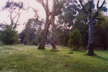
Article - Boyd Park
This file contains two items. Two original photographs of Boyd Park, date unknown. An article from the CAULFIELD/ PORT PHILLIP LEADER on a massive swamp gum tree that was felled by heavy winds in Boyd Park, Murrumbeena, dated 03/08/2012.glen eira, glen eira environment group, smith colin, caine paul, boyd park, murrumbeena, parks, conservation of natural land and energy economics, reserves, bushland, gardens, resources, trees, plants -
 Glen Eira Historical Society
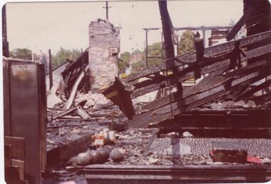
Article - Caulfield Park Bowling Club
This file contains five items. Two original photographs of the remains of Caulfield Park Bowling Club after the fire of 1977, date unknown. An article on the opening of the greens at Caulfield Park Sports Club from the CAULFIELD/ PORT PHILLIP LEADER dated 30/08/2011. An article on a competition that Caulfield Park Sports Club participated in to support the Alcohol Education Rehabilitation Foundation, dated 25/10/2011. An article on the Caulfield Park lawn bowls team being crowned the champions of the Sandbelt region bowls competition and their advancement to the regional playoffs. From the CAULFIELD/ PORT PHILLIP LEADER dated 10/04/2012. An article on the Caulfield Park bowling club ladies team’s win of the 2013 Victorian State Fours Title at Bendigo. GLEN EIRA/ PORT PHILLIP LEADER dated 07/05/2013.caulfield park bowling club, caulfield, caulfield park sports club, entertainment, competitions, aer mixed pairs challenge, alcohol education rehabilitation foundation, mccarthy ann, meltzer sel, sandbelt, pekelman marion, macaulay desiree, victorian state fours title, clubs, associations, organisations, societies, sports, recreations, leisure, cultural events, cultural activities, lawn bowls, sporting clubs, competitions, sports grounds, sports people