Showing 576 items matching "yarra yarra district"
-
 Marysville & District Historical Society
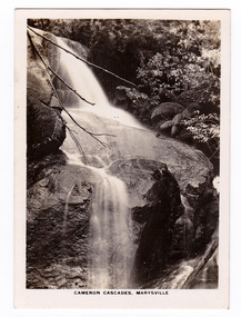
Photograph (item) - Black and white photograph, Rose Stereograph Company, Cameron Cascades, Marysville, 1913-1967
An early black and white photograph of the Cameron Cascades near Marysville, Victoria.An early black and white photograph of the Cameron Cascades near Marysville, Victoria. The Cameron Cascades are off the Lady Talbot Drive. Lady Talbot Drive a 24 kilometer scenic rainforest car journey which passes a number of walks and waterfalls in the Yarra Ranges National Park. Lady Talbot Drive is named after Lady Sarah Elizabeth, the wife of Sir Reginald Talbot, who was the Governor of Victoria from 25th April, 1904 to 6th July 1908. The photograph was also used to produce the Rose Series postcard P. 2313.marysville, victoria, photograph, cameron cascades, waterfalls, cameron cascades track, lady talbot forest drive, p. 2313, rose series postcard, souvenir, rose stereograph company, sir reginald talbot, lady sarah elizabeth talbot -
 Marysville & District Historical Society
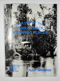
Book, The Last of the Yarra Track Stopping Places, 1980
A history of the stopping points on the Yarra TrackPaperback. Front cover has a black and white photograph of a wagon being pulled by two horses which have stopped to drink from a wide river. The back cover has a black and white photograph of an area of snow with a snow covered bush in the foreground.Sticker on front cover / Revised / Edition Stamp of Marysville & District / Historical Society Inc / P.O. Box 22 / Marysville 3779marysville, yarra glen, wood's point, history, yarra track -
 Marysville & District Historical Society
Photograph (item) - Colour tinted photograph, Valentine Publishing Co. Pty. Ltd, The Road to Cumberland Valley, Marysville. No. 1, 1923-1963
An early colour tinted photograph of the intersection of the Buxton Marysville Road and the Marysville-Wood's Point Road.An early photograph of the Buxton Marysville Road and the Marysville-Wood's Point Road intersection. The Marysville-Buxton Road joins the Maroondah Highway which leads to Alexandra. The Marysville-Woods Point Road was originally part of the Yarra Track, constructed in the early 1860s to provide access between Healesville and the Woods Point Goldfields. Despite the steep terrain and engineering difficulties, the Yarra Track soon became a busy route used by pack horses, horse-drawn drays, and wagons. Today this sealed mountain road is a popular scenic drive between Marysville and Warburton. On the right of the photograph can be seen 'The Crossways Hotel' which is circa 1920 and one of the oldest buildings still standing in Marysville. 'The Crossways Hotel' survived the 2009 Black Saturday bushfires, through the efforts of the owner using buckets of water from the nearby Steavenson River. In the background can be seen the Poontawan Guest House which later became the Marysville Chalet Guest House which was on the site of the original Steavenson's Hotel. That guest house no longer exists and the Christ Church stands on the land where the guest house once stood. This photograph was published by the Valentine Publishing Co Pty. Ltd as a souvenir of Marysville.marysville, victoria, marysville chalet guest house, crossways hotel, christ church marysville, poontawan guest house, steavenson's hotel, valentine publishing co, souvenir, yarra track, wood's point road, mining, buxton-marysville road, marysville-wood's point road, maroondah highway, alexandra -
 Marysville & District Historical Society
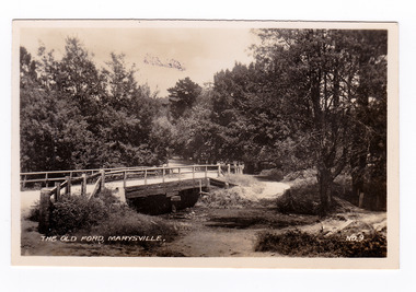
Photograph (item) - Black and white photograph, Valentine Publishing Co. Pty. Ltd, The Old Ford, Marysville No.9, 1923-1963
An early black and white photograph of the old ford in Marysville, Victoria.An early photograph of the bridge at the end of the main street in Marysville which is near the Buxton-Marysville Road and the Marysville-Wood's Point Road intersection. The Marysville-Buxton Road joins the Maroondah Highway which leads to Alexandra. The Marysville-Woods Point Road was originally part of the Yarra Track, constructed in the early 1860s to provide access between Healesville and the Woods Point Goldfields. Despite the steep terrain and engineering difficulties, the Yarra Track soon became a busy route used by pack horses, horse-drawn drays, and wagons. Today this sealed mountain road is a popular scenic drive between Marysville and Warburton. This photograph was published by the Valentine Publishing Co Pty. Ltd as a souvenir of Marysville.marysville, victoria, valentine publishing co, souvenir, buxton-marysville road, marysville-wood's point road, maroondah highway, alexandra, yarra track, mining -
 Marysville & District Historical Society
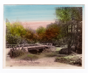
Photograph (item) - Colour tinted photograph, Valentine Publishing Co. Pty. Ltd, The Old Ford, Marysville No.9, 1923-1963
An early colour tinted photograph of the old ford in Marysville, Victoria. This photograph was published by the Valentine Publishing Co Pty. Ltd. as a souvenir of Marysville.An early photograph of the bridge at the end of the main street in Marysville which is near the Buxton-Marysville Road and the Marysville-Wood's Point Road intersection. The Marysville-Buxton Road joins the Maroondah Highway which leads to Alexandra. The Marysville-Woods Point Road was originally part of the Yarra Track, constructed in the early 1860s to provide access between Healesville and the Woods Point Goldfields. Despite the steep terrain and engineering difficulties, the Yarra Track soon became a busy route used by pack horses, horse-drawn drays, and wagons. Today this sealed mountain road is a popular scenic drive between Marysville and Warburton. This photograph was published by the Valentine Publishing Co Pty. Ltd as a souvenir of Marysville.marysville, victoria, valentine publishing co, souvenir, buxton-marysville road, marysville-wood's point road, maroondah highway, alexandra, yarra track, mining -
 Marysville & District Historical Society
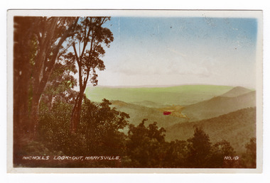
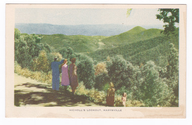
Photograph (item) - Colour tinted photograph, Valentine Publishing Co. Pty. Ltd, Nicoll's Lookout, Marysville No.10, 1923-1963
An early colour tinted photograph of Nicholl's Look-out near Marysville in Victoria. This photograph was published by the Valentine Publishing Co Pty. Ltd. as a souvenir of Marysville.An early colour tinted photograph of Nicholl's Look-out near Marysville in Victoria. This lookout is situated on the Marysville-Wood's Point Road. The Marysville-Woods Point Road was originally part of the Yarra Track, constructed in the early 1860s to provide access between Healesville and the Woods Point Goldfields. Despite the steep terrain and engineering difficulties, the Yarra Track soon became a busy route used by pack horses, horse-drawn drays, and wagons. Today this sealed mountain road is a popular scenic drive between Marysville and Warburton. This photograph was published by the Valentine Publishing Co Pty. Ltd. as a souvenir of Marysville.marysville, victoria, valentine publishing co, souvenir, nicholl's look-out, mining, yarra track -
 Marysville & District Historical Society
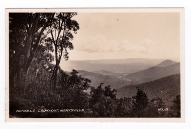
Photograph (item) - Black and white photograph, Valentine Publishing Co. Pty. Ltd, Nicoll's Lookout, Marysville No.10, 1923-1963
An early black and white photograph of Nicholl's Look-out near Marysville in Victoria.An early black and white photograph of Nicholl's Look-out near Marysville in Victoria. This lookout is situated on the Marysville-Wood's Point Road. The Marysville-Woods Point Road was originally part of the Yarra Track, constructed in the early 1860s to provide access between Healesville and the Woods Point Goldfields. Despite the steep terrain and engineering difficulties, the Yarra Track soon became a busy route used by pack horses, horse-drawn drays, and wagons. Today this sealed mountain road is a popular scenic drive between Marysville and Warburton. This photograph was published by the Valentine Publishing Co Pty. Ltd. as a souvenir of Marysville.marysville, victoria, valentine publishing co, souvenir, nicholl's look-out, mining, yarra track -
 Marysville & District Historical Society
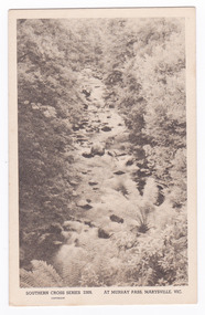
Postcard (item) - Black and white postcard, Rose Stereograph Company, At Murray Pass, Marysville, 1913-1967
A postcard in a series produced by the Rose Stereograph Company in Victoria, Australia as a souvenir of Marysville.An early black and white photograph of the Taggerty River from Murray Pass near Marysville, Victoria. Murray Pass is located on the Lady Talbot Drive. Lady Talbot Drive a 24 kilometer scenic rainforest car journey which passes a number of walks and waterfalls in the Yarra Ranges National Park. Lady Talbot Drive is named after Lady Sarah Elizabeth, the wife of Sir Reginald Talbot, who was the Governor of Victoria from 25th April, 1904 to 6th July 1908. This postcard was produced by the Rose Stereograph Company as a souvenir of Marysville.SOUTHERN CROSS SERIES 2309/ COPYRIGHT/ AT MURRAY PASS, MARYSVILLE, VIC. POST CARD. Correspondence Addressmarysville, victoria, photograph, taggerty river, murray pass, lady talbot forest drive, southern cross series, 2309, postcard, souvenir, lady talbot drive, sir reginald talbot, sarah elizabeth talbot -
 Marysville & District Historical Society
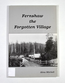
Book - Paperback book, Alma Mitchell, Fernshaw the Forgotten Village, 2001
The story of the village of Fernshaw between the dates of 1864 and 1890.Paperback. Front cover has the title and author's name. Also, a black and white photograph taken by John W. Lindt entitled 'First Glimpse of Fernshaw'.non-fictionThe story of the village of Fernshaw between the dates of 1864 and 1890.fernshaw, victoria, history, watts river, yarra track -
 Marysville & District Historical Society
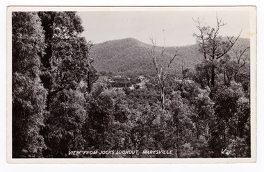
Postcard (item) - Black and white postcard, Valentine Publishing Co. Pty. Ltd, View From Jock's Lookout, Marysville. V. 21, 1923-1963
An early black and white photograph of the view from Jock's Lookout of Marysville in Victoria. An early black and white photograph of the view from Jock's Lookout of Marysville in Victoria. Jock's Lookout is situated on the Marysville-Wood's Point Road. The Marysville-Woods Point Road was originally part of the Yarra Track, constructed in the early 1860s to provide access between Healesville and the Woods Point Goldfields. Despite the steep terrain and engineering difficulties, the Yarra Track soon became a busy route used by pack horses, horse-drawn drays, and wagons. Today this sealed mountain road is a popular scenic drive between Marysville and Warburton. This postcard was published by the Valentine Publishing Co. Pty. Ltd. as a souvenir of Marysville.VALENTINE'S/ POST CARD/ A GENUINE PHOTOGRAPHjock's lookout, marysville, victoria, postcard, valentine publishing co, souvenir, marysville-wood's point road, yarra track, mining, warburton -
 Marysville & District Historical Society
Postcard (item) - Black and white postcard, Valentine Publishing Co. Pty. Ltd, View From Jock's Lookout, Marysville. V. 21, 1923-1963
An early black and white photograph of the view from Jock's Lookout of Marysville in Victoria.An early black and white photograph of the view from Jock's Lookout of Marysville in Victoria. Jock's Lookout is situated on the Marysville-Wood's Point Road. The Marysville-Woods Point Road was originally part of the Yarra Track, constructed in the early 1860s to provide access between Healesville and the Woods Point Goldfields. Despite the steep terrain and engineering difficulties, the Yarra Track soon became a busy route used by pack horses, horse-drawn drays, and wagons. Today this sealed mountain road is a popular scenic drive between Marysville and Warburton. This postcard was published by the Valentine Publishing Co. Pty. Ltd. as a souvenir of Marysville.VALENTINE'S/ POST CARD/ A GENUINE PHOTOGRAPHjock's lookout, marysville, victoria, postcard, valentine publishing co, souvenir, marysville-wood's point road, yarra track, mining, warburton -
 Marysville & District Historical Society
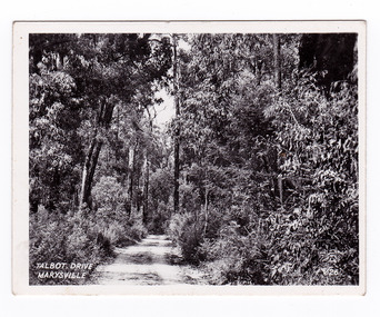
Photograph (item) - Black and white photograph, Valentine Publishing Co. Pty. Ltd, Talbot Drive, Marysville. V. 26, 1923-1963
An early black and white photograph of Talbot Drive in Marysville, Victoria.An early black and white photograph of Talbot Drive in Marysville, Victoria. Lady Talbot Drive a 24 kilometer scenic rainforest car journey which passes a number of walks and waterfalls in the Yarra Ranges National Park. Lady Talbot Drive is named after Lady Sarah Elizabeth, the wife of Sir Reginald Talbot, who was the Governor of Victoria from 25th April, 1904 to 6th July 1908. This photograph was published by the Valentine Publishing Co. Pty. Ltd. as a souvenir of Marysville.talbot drive, lady talbot drive, marysville, victoria, photograph, valentine publishing co, souvenir, sir reginald talbot, sarah elizabeth talbot -
 Marysville & District Historical Society
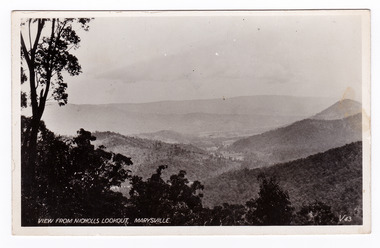
Postcard (item) - Black and white postcard, Valentine Publishing Co. Pty. Ltd, View From Nicholl's Lookout, Marysville. V. 43, 1923-1963
An early black and white photograph of the view of Marysville in Victoria taken from Nicholl's Lookout.An early black and white photograph of the view of Marysville in Victoria taken from Nicholl's Lookout. This lookout is situated on the Marysville-Wood's Point Road. The Marysville-Woods Point Road was originally part of the Yarra Track, constructed in the early 1860s to provide access between Healesville and the Woods Point Goldfields. Despite the steep terrain and engineering difficulties, the Yarra Track soon became a busy route used by pack horses, horse-drawn drays, and wagons. Today this sealed mountain road is a popular scenic drive between Marysville and Warburton. This postcard was published by the Valentine Publishing Co Pty. Ltd. as a souvenir of Marysville.VALENTINE'S/ POST CARD/ A GENUINE PHOTOGRAPHmarysville, nicholl's lookout, victoria, postcard, valentine publishing co, souvenir -
 Marysville & District Historical Society
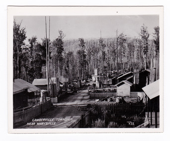
Photograph (item) - Black and white photograph, Valentine Publishing Co. Pty. Ltd, Camberville Township, Near Marysville. V. 35, 1923-1963
An early black and white photograph of the township of Cambarville near Marysville in Victoria.An early black and white photograph of the township of Cambarville near Marysville in Victoria. Cambarville is notable for its giant mountain ash (Eucalyptus regnans) trees within the Cumberland Memorial Scenic Reserve, and relics from former sawmills and gold mining. The Big Culvert is located nearby on the Marysville-Woods Point Road, which was historically part of the Yarra Track. Cambarville was established as a timber mill town in the 1940s. Timber mill owners A Cameron and FJ Barton named Cambarville. They established the mill to salvage timber from trees destroyed in the 1939 bushfires. Cambarville was impacted by the 2009 Black Saturday bushfires and any remaining structures were destroyed. This photograph was produced by Valentine Publishing Co as a souvenir of Marysville.marysville, victoria, photograph, valentine publishing co, souvenir, cambarville, cumberland valley, cumberland scenic reserve, big culvert, marysville-wood's point road, yarra track, a cameron, fj barton, 1939 bushfires, 2009 black saturday bushfires -
 Marysville & District Historical Society
Photograph (item) - Black and white photograph, Valentine Publishing Co. Pty. Ltd, Camberville Township, Near Marysville. V. 35, 1923-1963
An early black and white photograph of the township of Cambarville near Marysville in Victoria.An early black and white photograph of the township of Camberville near Marysville in Victoria. Cambarville is notable for its giant mountain ash (Eucalyptus regnans) trees within the Cumberland Memorial Scenic Reserve, and relics from former sawmills and gold mining. The Big Culvert is located nearby on the Marysville-Woods Point Road, which was historically part of the Yarra Track. Cambarville was established as a timber mill town in the 1940s. Timber mill owners A Cameron and FJ Barton named Cambarville. They established the mill to salvage timber from trees destroyed in the 1939 bushfires. Cambarville was impacted by the 2009 Black Saturday bushfires and any remaining structures were destroyed. This photograph was produced by Valentine Publishing Co as a souvenir of Marysville.marysville, victoria, photograph, valentine publishing co, souvenir, cambarville, cumberland valley, cumberland scenic reserve, big culvert, marysville-wood's point road, yarra track, a cameron, fj barton, 1939 bushfires, 2009 black saturday bushfires -
 Marysville & District Historical Society
Photograph (item) - Black and white photograph, Murray Views, Murray Views No. 47. Nicholl's Lookout, Marysville, Vic, Post 1929
An early black and white photograph of the view of Marysville taken from Nicholl's Lookout.An early black and white photograph of the view of Marysville taken from Nicholl's Lookout. Nicholl's Lookout is situated on the Marysville-Wood's Point Road. The Marysville-Woods Point Road was originally part of the Yarra Track, constructed in the early 1860s to provide access between Healesville and the Woods Point Goldfields. Despite the steep terrain and engineering difficulties, the Yarra Track soon became a busy route used by pack horses, horse-drawn drays, and wagons. Today this sealed mountain road is a popular scenic drive between Marysville and Warburton. This photograph was produced by Murray Views in Gympie, Queensland as a souvenir of Marysville. nicholl's lookout, marysville, victoria, photograph, murray views, souvenir, marysville-wood's point road, yarra track, mining, warburton -
 Marysville & District Historical Society
Postcard (item) - Colour tinted postcard, Nucolorvue Productions, Nicholl's Lookout, Marysville, 1950's
An early colour photograph of the view of Marysville in Victoria taken from Nicholl's Lookout.An early colour photograph of the view of Marysville in Victoria taken from Nicholl's Lookout. Nicholl's Lookout is situated on the Marysville-Wood's Point Road. The Marysville-Woods Point Road was originally part of the Yarra Track, constructed in the early 1860s to provide access between Healesville and the Woods Point Goldfields. Despite the steep terrain and engineering difficulties, the Yarra Track soon became a busy route used by pack horses, horse-drawn drays, and wagons. Today this sealed mountain road is a popular scenic drive between Marysville and Warburton. This postcard was produced by Nucolorvue Productions in Elwood, Victoria as a souvenir of Marysville.POST CARD NUCOLORVUE PRODUCTIONS, ELWOOD, VICTORIAnicholl's lookout, marysville, victoria, nucolorvue productions, postcard, souvenir, marysville-wood's point road, yarra track, mining, warburton -
 Marysville & District Historical Society
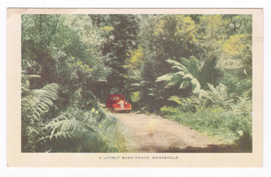
Postcard (item) - Colour postcard, Nucolorvue Productions, A Lovely Bush Track, Marysville, 1950's
An early colour photograph of a car travelling along Lady Talbot Drive in Marysville in Victoria.An early colour photograph of a car traveling along Lady Talbot Drive in Marysville in Victoria. Lady Talbot Drive a 24 kilometer scenic rainforest car journey which passes a number of walks and waterfalls in the Yarra Ranges National Park. Lady Talbot Drive is named after Lady Sarah Elizabeth, the wife of Sir Reginald Talbot, who was the Governor of Victoria from 25th April, 1904 to 6th July 1908. This road was originally constructed as a corduroy road (or log road) is a type of road or timber trackway made by placing logs, perpendicular to the direction of the road over a low or swampy area. The result is an improvement over impassable mud or dirt roads, yet rough in the best of conditions and a hazard to horses due to shifting loose logs. This postcard was produced by Nucolorvue Productions in Elwood, Victoria as a souvenir of Marysville.POST CARD NUCOLORVUE PRODUCTIONS, ELWOOD, VICTORIAmarysville, victoria, nucolorvue productions, postcard, souvenir, lady talbot drive, lady talbot forest drive, sir reginald talbot, lady sarah elizabeth talbot, corduroy road -
 Marysville & District Historical Society
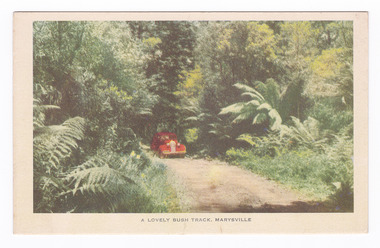
Postcard (item) - Colour postcard, Nucolorvue Productions, A Lovely Bush Track, Marysville, 1950's
An early colour photograph of a car traveling along Lady Talbot Drive in Marysville in Victoria.An early colour photograph of a car traveling along Lady Talbot Drive in Marysville in Victoria. Lady Talbot Drive a 24 kilometer scenic rainforest car journey which passes a number of walks and waterfalls in the Yarra Ranges National Park. Lady Talbot Drive is named after Lady Sarah Elizabeth, the wife of Sir Reginald Talbot, who was the Governor of Victoria from 25th April, 1904 to 6th July 1908. This road was originally constructed as a corduroy road (or log road) is a type of road or timber trackway made by placing logs, perpendicular to the direction of the road over a low or swampy area. The result is an improvement over impassable mud or dirt roads, yet rough in the best of conditions and a hazard to horses due to shifting loose logs. This postcard was produced by Nucolorvue Productions in Elwood, Victoria as a souvenir of Marysville.POST CARD NUCOLORVUE PRODUCTIONS, ELWOOD, VICTORIAmarysville, victoria, nucolorvue productions, postcard, souvenir, lady talbot drive, lady talbot forest drive, sir reginald talbot, lady sarah elizabeth talbot, corduroy road -
 Marysville & District Historical Society
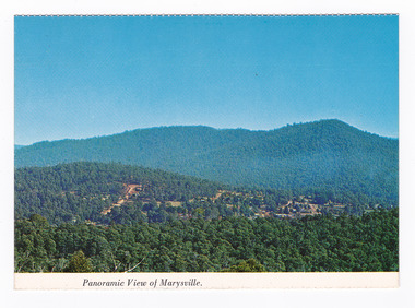
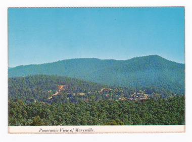
Postcard (item) - Colour postcard, Nucolorvue Productions Pty. Ltd, Panoramic View of Marysville, Pre 2009
A colour photograph of the view of Marysville from Barton's Lookout which is near the Cumberland Valley in Victoria.A colour photograph of the view of Marysville from Barton's Lookout which is near the Cumberland Valley in Victoria. The Cumberland Valley is notable for its giant mountain ash (Eucalyptus regnans) trees within the Cumberland Memorial Scenic Reserve, and relics from former sawmills and gold mining. The Big Culvert is located nearby on the Marysville-Woods Point Road, which was historically part of the Yarra Track. Cambarville, which is in the Cumberland Valley, was established as a timber mill town in the 1940s. Timber mill owners A Cameron and FJ Barton named Cambarville. They established the mill to salvage timber from trees destroyed in the 1939 bushfires. Cambarville was impacted by the 2009 Black Saturday bushfires and any remaining structures were destroyed. Barton's Lookout was named after a member of the Barton Family who were amongst Marysville's earliest pioneering families. This postcard was produced by Nucolorvue Productions as a souvenir of Marysville.NU-COLOR-VUE/ OF/ AUSTRALIA MARYSVILLE, VICTORIA Panoramic View of Marysville from/ CUMBERLAND. PLACE/ STAMP/ HERE POST CARD NUC.171 - NUCOLORVUE PRODUCTIONS PTY. LTD./ COPYRIGHT Printed in Australiamarysville, barton's lookout, victoria, nucolorvue productions, postcard, souvenir, cumberland valley, cumberland memorial scenic reserve, big culvert, marysville-wood's point road, yarra track, mining, timber mills, a cameron, fj barton, cambarville, 1939 bushfires, 2009 black saturday bushfires -
 Marysville & District Historical Society
Postcard (item) - Colour postcard, Nucolorvue Productions Pty. Ltd, Panoramic View of Marysville, Pre 2009
A colour photograph of the view of Marysville from Barton's Lookout which is near the Cumberland Valley in Victoria.A colour photograph of the view of Marysville from Barton's Lookout which is near the Cumberland Valley in Victoria. The Cumberland Valley is notable for its giant mountain ash (Eucalyptus regnans) trees within the Cumberland Memorial Scenic Reserve, and relics from former sawmills and gold mining. The Big Culvert is located nearby on the Marysville-Woods Point Road, which was historically part of the Yarra Track. Cambarville, which is in the Cumberland Valley, was established as a timber mill town in the 1940s. Timber mill owners A Cameron and FJ Barton named Cambarville. They established the mill to salvage timber from trees destroyed in the 1939 bushfires. Cambarville was impacted by the 2009 Black Saturday bushfires and any remaining structures were destroyed. Barton's Lookout was named after a member of the Barton Family who were amongst Marysville's earliest pioneering families. This postcard was produced by Nucolorvue Productions as a souvenir of Marysville.NU-COLOR-VUE/ OF/ AUSTRALIA MARYSVILLE, VICTORIA Panoramic View of Marysville from/ CUMBERLAND. PLACE/ STAMP/ HERE POST CARD NUC.171 - NUCOLORVUE PRODUCTIONS PTY. LTD./ COPYRIGHT Printed in Australia Hi There! how are you? fine I hope....Hows school/ treating you?/ Isn't it beautiful now Autumns back again./ You'll have to come up soon and see us, where/ really you/ Ok! it beautiful, the air so fresh and/ clean it makes you want to cry. There are/ so many magnificent and brill marysville, barton's lookout, victoria, nucolorvue productions, postcard, souvenir, cumberland valley, cumberland memorial scenic reserve, big culvert, marysville-wood's point road, yarra track, mining, timber mills, a cameron, fj barton, cambarville, 1939 bushfires, 2009 black saturday bushfires -
 Marysville & District Historical Society
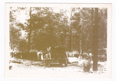
Postcard (item) - Black and white postcard, Marysville & District Historical Society Inc, Bullock Teams at the Dump, Woods Point Road, 1993
A black and white photograph of bullock teams at the Log Dump at on the Wood's Point Road.A black and white photograph of bullock teams at the Dump at on the Wood's Point Road. The Marysville-Woods Point Road was originally part of the Yarra Track, constructed in the early 1860s to provide access between Healesville and the Woods Point Goldfields. Despite the steep terrain and engineering difficulties, the Yarra Track soon became a busy route used by pack horses, horse-drawn drays, and wagons. Today this sealed mountain road is a popular scenic drive between Marysville and Warburton. This postcard was produced by the Marysville Historical Society as a souvenir of Marysville.YESTERYEAR POSTCARDS AFFIX/ STAMP/ HERE BULLOCK TEAMS AT THE DUMP,/ WOODS POINT ROAD. C Marysville Historical Society, 1993marysville, bullock teams, woods point road, victoria, marysville historical society, postcard, souvenir, yesteryear postcards, marysville-wood's point road, yarra track, healesville, mining, timber mills, warburton -
 Marysville & District Historical Society
Postcard (item) - Colour postcard, Scancolor (Australia) Pty Ltd, Marysville-Victoria-Australia-Walking track through the "Beeches", Pre 2009
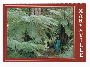
A colour photograph of a couple walking on the track through the "Beeches".A colour photograph of a couple walking on the track through the "Beeches". Starting from the spectacular Taggerty Cascades, the Beeches Rainforest Walk meanders through the ancient cool temperate rainforest of the Yarra Ranges. Dominated by Myrtle Beech trees and stands of Mountain Ash, the rainforest is home to many species of birds including lyrebirds. This postcard was produced by Scancolor Australia as a souvenir of Marysville.MARYSVILLE/ Victoria - Australia Walking track through the "Beeches". scancolor Australia (03) 555 1944/ CS 4067marysville, victoria, the beeches, walking track, scancolor australia, postcard, souvenir -
 Marysville & District Historical Society
Postcard (item) - Colour postcard, Scancolor (Australia) Pty Ltd, Marysville-Victoria-Australia-Walking track through the "Beeches", Pre 2009
A colour photograph of a couple walking on the track through the "Beeches".A colour photograph of a couple walking on the track through the "Beeches". Starting from the spectacular Taggerty Cascades, the Beeches Rainforest Walk meanders through the ancient cool temperate rainforest of the Yarra Ranges. Dominated by Myrtle Beech trees and stands of Mountain Ash, the rainforest is home to many species of birds including lyrebirds. This postcard was produced by Scancolor Australia as a souvenir of Marysville.MARYSVILLE/ Victoria - Australia Walking track through the "Beeches". scancolor Australia (03) 555 1944/ CS 4067marysville, victoria, the beeches, walking track, scancolor australia, postcard, souvenir -
 Marysville & District Historical Society
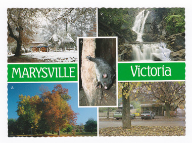
Postcard (item) - Colour postcard, Nucolorvue Productions Pty. Ltd, Marysville-Victoria, Pre 2009
A postcard with 5 colour photographs of local attractions in and around Marysville in Victoria.A postcard with 5 colour photographs of local attractions in and around Marysville in Victoria. This postcard was produced by Nucolorvue Productions as a souvenir of Marysville.MARYSVILLE/ Victoria 1. Burrengeen Park in Winter./ 2. Steavenson Falls./ 3. Autumn tonings of Marysville./ 4. Olde Yarra Track Shoppe./ 5. Mountain Grey (Brushtail) Possum. NU-COLOR-VUE/ OF/ AUSTRALIA AFFIX/ STAMP/ HERE/ 18 MA002/ NCV 5408 ADDRESS/ POSTCODE Made in Australia COPYRIGHT/ Nucolorvue Productions Pty. Ltd. Telephone: (03) 560-1788marysville, victoria, burrengeen park, steavenson falls, autumn, yarra track, mountain grey possum, brushtail possum, nucolorvue productions, postcard, souvenir -
 Marysville & District Historical Society
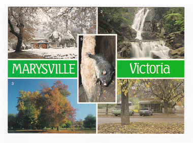
Postcard (item) - Colour postcard, Nucolorvue Productions Pty. Ltd, Marysville-Victoria, Pre 2009
A postcard with 5 colour photographs of local attractions in and around Marysville in Victoria.A postcard with 5 colour photographs of local attractions in and around Marysville in Victoria. This postcard was produced by Nucolorvue Productions as a souvenir of Marysville.MARYSVILLE/ Victoria 1. Burrengeen Park in Winter./ 2. Steavenson Falls./ 3. Autumn tonings of Marysville./ 4. Olde Yarra Track Shoppe./ 5. Mountain Grey (Brushtail) Possum. NU-COLOR-VUE/ OF/ AUSTRALIA AFFIX/ STAMP/ HERE/ 18 MA002/ NCV 5408 ADDRESS/ POSTCODE Made in Australia Date Stamp MARYSVILLE VIC AUST DEAR MELISSA,/ HERE IT IS MELISA/ YOUR OWN CARD AS/ REQUESTED. I AM/ RELAXING IN FRONT OF/ A HUGE LOG FIRE AT/ THE MOMENT BEFORE/ ATTACKING A 4 COURSE/ MEAL FOR TEA. I/ HAVE SETTLED IN TO/ THIS WAY OF LIFE/ ALREADY AND AM THROUGH/ LY ENJOYING IT. LOTS/ OF PAINTING MATERIAL/ AROUND HERE TOO. HEATED/ POOL (SALT) IS BEAUT./ SEE YOU LATER/ Jess xx M/S MELISA THOMSON/ C/- COCA-COLA BOTTLERS/ 128 BRIENS RD/ NORTHMEAD 2152/ SYDNEY/ N.S.W. COPYRIGHT/ Nucolorvue Productions Pty. Ltd. Telephone: (03) 560-1788marysville, victoria, burrengeen park, steavenson falls, autumn, yarra track, mountain grey possum, brushtail possum, nucolorvue productions, postcard, souvenir -
 Marysville & District Historical Society
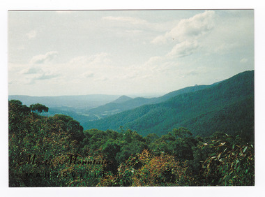
Postcard (item) - Colour postcard, Nucolorvue Productions Pty. Ltd, Mystic Mountains-Marysville, Pre 2009
A colour photograph of the view of the mountains surrounding Marysville in Victoria from Nicholl's Lookout.A colour photograph of the view of the mountains surrounding Marysville in Victoria from Nicholl's Lookout. The mountains surrounding Marysville are known as the Mystic Mountains and Nicoll's Lookout is on the Marysville-Wood's Point Road. The Marysville-Woods Point Road was originally part of the Yarra Track, constructed in the early 1860s to provide access between Healesville and the Woods Point Goldfields. Despite the steep terrain and engineering difficulties, the Yarra Track soon became a busy route used by pack horses, horse-drawn drays, and wagons. Today this sealed mountain road is a popular scenic drive between Marysville and Warburton. This postcard was produced by Nucolorvue Productions in Elwood, Victoria as a souvenir of Marysville.This postcard was produced by Nucolorvue Productions Pty. Ltd. as a souvenir of Marysville.NICHOLS LOOKOUT/ Marysville Victoria NU-COLOR-VUE/ AUSTRALIA'S NATIONAL POSTCARD COMPANY AFFIX/ STAMP/ HERE/ 17MA019/ NCV 9603 POSTCODE COPYRIGHT/ Nucolorvue Productions Pty. Ltd.,/ Telephone: (03) 560-1788/ Made in Australiamarysville, mystic mountains, nicholl's lookout, victoria, nucolorvue productions, postcard, souvenir, marysville-wood's point road, yarra track, healesville, mining, warburton -
 Marysville & District Historical Society
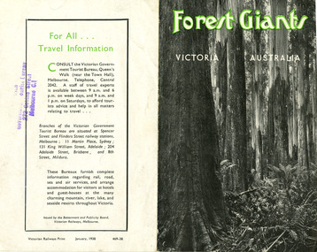
Ephemera (Item) - Information brochure, Victorian Government Tourist Bureau, Forest Giants Victoria Australia, 01-1938
An information brochure on where to see tall trees, Forest Giants, in Victoria, including Marysville, that was published in January, 1938.An information brochure on where to see tall trees, Forest Giants, in Victoria, including Marysville, that was published in January, 1938.Victorian Railways Print January, 1938 469-38 Stamp of Victorian/ Government Tourist Bureau/ 272 Collins Street/ Melbourne C.1victoria, australia, victorian government tourist bureau, betterment and publicity board, victorian railways, white mountain ash, red mountain ash, messmate, blue gum, mountain ash, cumberland valley, marysville, mount monda, healesville, acheron way, alpine highway, omeo, baw baws, strzelecki ranges, otway ranges, warburton, yarra junction, noojee, bulga and tarra valley park, yarram, turton's pass, otway forest, beech forest, apollo bay, information brochure, brochure -
 Marysville & District Historical Society
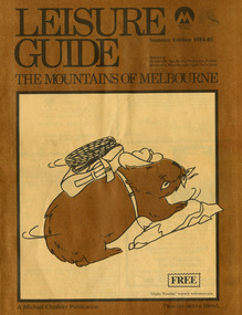
Magazine (Item) - Leisure guide, Michael Cheshire, LEISURE GUIDE THE MOUNTAINS OF MELBOURNE, 1984
A leisure guide to the mountains of Melbourne beginning in the eastern suburbs, going through the Yarra Valley and into the Great Dividing Range. This was produced by Michael Cheshire as a free publication to promote Melbourne tourism. The magazine featured Healesville, Marysville, Warburton, Eildon, Alexandra, the Upper Yarra area, and includes information on wineries in the district. It was released in the summer of 1984-1985.A leisure guide to the mountains of Melbourne beginning in the eastern suburbs, going through the Yarra Valley and into the Great Dividing Range.Summer Edition 1984-85 Featuring:/ Healesville, Marysville, Warburton, Eildon,/ Alexandra, Wineries and Upper Yarra Area.healesville, warburton, eildon, alexandra, upper yarra, marysville, victoria, australia, leisure guide, michael cheshire, blackwood holiday flats, black spur motel and caravan park, tudor lodge road house, nanda binya lodge, marysville caravan park, marysville recreation and fun park, scenic motel, the tower motel, the cumberland, cathedral restaurant, cathedral restaurant gallery, taggerty golf course, taggerty holiday units, marylyn guest house