Showing 23748 items
matching sardine-creek
-
 Eltham District Historical Society Inc
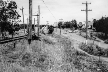
Photograph, Looking north along Main Road from Cecil Street intersection, Eltham, February 1968, Feb 1968
Shows position of under road water course, which also went under railway line to the Diamond Creek and Cecil Street sign.In February 1968 an unknown person took a series of photos from the Eltham Hotel at Pitt Street heading north along Main Road through the shopping centre to just north of Elsa Court covering the length of the section of Main Road which was duplicated shortly thereafter. Shows the condition and environment of the streesscape of Main Road, Eltham immediately prior to the duplication between Pitt Street and Elsa Court through the shopping centre. Also shows a number of shops and businesses that operated at that time.Black and white photographduplication, eltham, main road, cecil street, railway line, watercourse, floods -
 Hume City Civic Collection
Photograph
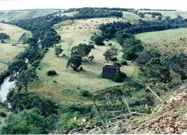
Lochton Flour Mill was established in the 1850s and is only one of a few surviving mills in Victoria. It is situated on a horseshoe bend on the Deep Creek at Bulla.A coloured photograph of a horse shoe bend in a river and the open flood plain. The river is tree-lined. The ruins of a stone building are on the river bend. A damaged fence and prickly pears are in the foreground.lochton mill, deep creek, hunter, william morrison, george evans collection -
 Clunes Museum
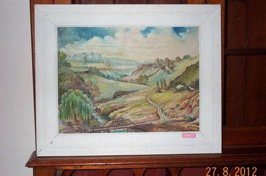
Painting, RICHARD FORD, CIRCA 1923
OIL PAINTING FEATURING BRIDGE ACROSS CRESWICK CREEK IN THE STATION FLAT AREA. NORTH WEST OF CLUNES. BRIDGE IS NOW REPLACED BY "FORD".OIL PAINTING BY CLUNES ARTIST RICHARD FORD.local history, illustration, oil, ford richard -
 Mt Dandenong & District Historical Society Inc.
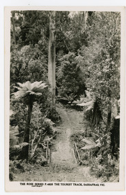
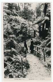
Photograph, Tourist Track, Sassafras. Vic, c1920
The tourist track running alongside the creek from Sassafras Mechanics’ Hall to Emerald. In the early 1900s the track started at Rostrevor Guest House.Black & White postcard P1501 from the Rose Series. Shows a log bridge along a tree fern lined section of the Tourist Track.On reverse - POST CARD A Real Photograph. Produced in Australia.rose series, sassafras, track, postcard, mechanics' hall -
 Mt Dandenong & District Historical Society Inc.
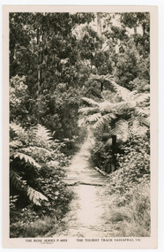
Photograph, The Tourist Track, Sassafras. Vic, c1920
The tourist track running alongside the creek from Sassafras Mechanics’ Hall to Emerald. In the early 1900s the track started at Rostrevor Guest House.Black and white photograph. Rose Series P. 4825 postcard showing a footbridge along a Tourist rack surrounded by bush and tree ferns.rose series, rostrevor, mechanics' hall, sassafras, track -
 Mt Dandenong & District Historical Society Inc.
Photograph, Sassafras Gully, Victoria, c1920
The tourist track running alongside the creek from Sassafras Mechanics’ Hall to Emerald. In the early 1900s the track started at Rostrevor Guest House.Black and white copy of Rose Series Post card P. 74 showing two young women standing on a footbridge at Sassafras Gully. A set of steep steps can be seen above them.rose series, track, footbridge, bridge, sassafras -
 Mt Dandenong & District Historical Society Inc.
Photograph, The Tourist Track, Sassafras.Vic, c1920
The tourist track running alongside the creek from Sassafras Mechanics’ Hall to Emerald. In the early 1900s the track started at Rostrevor Guest House.Black and white Rose Series postcard P. 4832 showing a section of the Tourist Track in Sassafras surrounded by tree ferns and bush.On Reverse POST CARD A Real Photograph. Produced in Australia.sassafras, rose series, postcard, track -
 Eltham District Historical Society Inc
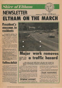
Journal - Newsletter, Shire of Eltham, Shire of Eltham newsletter, 1979
Articles, some with photos. Subjects include President's message, Eltham-templestowe intersection, indoor recreational centre, Bridge over Watsons Creek, town square, list of councillors, forward planning, recreational faciliaites including Eltham town park, Hurstbridge hall, roads, community welfare services, eltham Community and reception centre opening, amenities for youth, concrete bridge at Arthurs creek and Mitton's Bridge at St Andrew's Newsprint, 4 pages harry gilham collection, intersection, round-about, recreation, recreational centre, watsons creek, town square, councilors, newsletter, planning, parks, hurstbridge hall, community welfare service, roads, eltham community and reception centre, youth, skateboard track, mitton's bridge, arthur's creek, fitzsimons lane, main road, road construction, rondabout -
 Greensborough Historical Society
Map, Melbourne and Metropolitan Board of Works. Survey Division, MMBW, Yarra 2500 / 13.21. Central Greensborough, 1979_05
Melbourne and Metropolitan Board of Works. Yarra 2500 [base map]. 13-21, Parishes of Keelbundora 2856 and Nillumbik 3310, Municipality of Diamond Valley 257. Shows street names, easement sizes, lot numbers, lodged plan numbers, names of prominent features, contour values, creek or river names. Central Greensborough. Prominent streets: Main Street, Para Road, St Helena Road and Diamond Creek Road.MMBW Map in 1:2500 [scale] series. Cream parchment with green tape reinforcing on edges and punched holes on left edge.mmbw, melbourne and metropolitan board of works, shire of diamond valley, greensborough - maps -
 Ballarat Heritage Services
Photograph - Colour, Clare Gervasoni, Fawcett Hall and Public Library, 2015, 11/01//2015
Fawcett Hall is 14 kilometres North West of Alexandra, North East Victoria, in Spring Creek Road and is set amongst a small picturesque rural farming and business community with hills as a backdrop and Stony Creek running alongside the public reserves property boundary. Part of our hall building dates back to its establishment in 1882. Originally the hall served as a Mechanics Institute and Public Library and later as a primary school.Colour photograph of a weatherboard Hall.fawcett hall and public library, fawcett, fawcett mechanics' institute -
 Melton City Libraries
Photograph, Wendy, Bon and Peter Barrie, c.1948
Sections of the property from the Ferris Rd to the Toolern Creek were compulsorily acquired for the construction of the Melton By Pass road to become the Western Freeway. The freeway plan divided the original 1911“Darlingsford” farm. The section of the Ferris Rd 70-acre paddock belonging to Bon became the Freeway and roundabout. The construction to the west passed over the paddocks and the internal track along the fences connecting the Barrie brothers to the original Homestead at the Toolern Creek. Wendy, Bon and Peter Barrie entering Ferris Road from houselocal identities -
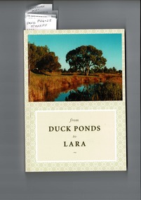 Lara RSL Sub Branch
from Duck Ponds to Lara, Booklet from Duck Ponds to Lara, 2004
Lara - Duck Ponds history and input by local population. Insight into the History of a small community.Local knowledge of Lara's History, some items are not well known, Excellant referamce.Soft back booklet a collection of of memories "From Duck Ponds to Lara." Published by the Lara Heritage Festival Inc 2004. Edited by Mary Budd, Caroline Delaney, and John Grainger. Contributions of short stories to the project have come from local residents. Booklet also came with a fold-up heritage map of Lara printed on both sides. The booklet is tagged for the names of contributors who are members of Lara R. S. L. Front of the Booklet is half covered by a photograph of Lara Creek and environes. Booklet also came with a fold-up heritage map of Lara printed on both sides.duck ponds, lara -
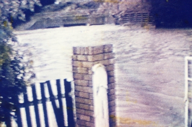 Ringwood and District Historical Society
Photograph, Ringwood Bowling Club- Flooding of greens, 1989
Colour photographPhotograph was taken off the video shots taken by Jack Shandley. The flooding occurred on 10th April, 1989, when four inches of rain fell in 1½ hours. Photograph shows the height of the water in relation to the top of the Mullum Creek viaduct. -
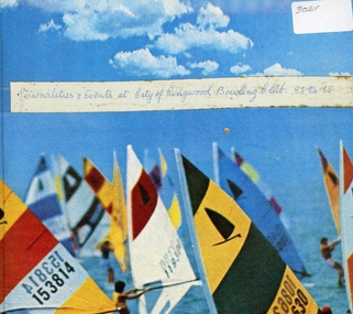 Ringwood and District Historical Society
Album, Ringwood Bowls Club- Miscellaneous photographs of Club personalities and events, 1983, 1984, 1985
Coloured photographs(61)Photographs include: Luncheon at Rembrandt, May 1984. Visit to Coal Creek. Cup Eve, 1984. Annual Dinner, March 29th 1985. Ladies World Bowls, 1985. Smorgesboard Social Bowls 17th November 1985. Miscellaneous photographs. -
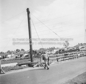 Eltham District Historical Society Inc
Album - Photograph, J.A. McDonald, General; Albion Street and Eltham-Yarra Glen Road, Oct. 1955
General – Country Roads Board Albion Street bridge over Moonee Ponds Creek, Brunswick West Derrick for launching beams October 1955Record of various Shire of Eltham infrastructure works undertaken during the period of 1952-1962 involving bridge and road reconstruction projects, sometimes with Eltham Shire Council Project Reference numbers quoted. It was during this period that a number of significant improvements were made to roads and new bridges constructed within the shire that remain in place as of present day (2022). In many situations, the photos provide a tangible visible record of infrastructure that existed throughout the early days of the Shire. The album was put together by or under the direction of the Shire Engineer, J.A. McDonald.infrastructure, road construction, shire of eltham, 1955-10, albion street, bridge construction, country roads board, benchmark studies, brunswick west, moonee ponds creek -
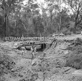 Eltham District Historical Society Inc
Negative - Photograph, J.A. McDonald, Heidelberg-Kinglake Road, 3 Nov. 1959
Job 56M431 Contractors Wolf and Wood Yow Yow Creek Bridge Old bridge cut Temporary bridge in use 3 November 1959Record of various Shire of Eltham infrastructure works undertaken during the period of 1952-1962 involving bridge and road reconstruction projects, sometimes with Eltham Shire Council Project Reference numbers quoted. It was during this period that a number of significant improvements were made to roads and new bridges constructed within the shire that remain in place as of present day (2022). In many situations, the photos provide a tangible visible record of infrastructure that existed throughout the early days of the Shire. The album was put together by or under the direction of the Shire Engineer, J.A. McDonald.infrastructure, shire of eltham, bridge construction, heidelberg-kinglake road, road construction, yow yow creek, 1959-11-03 -
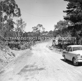 Eltham District Historical Society Inc
Negative - Photograph, J.A. McDonald, Heidelberg-Kinglake Road, Mar. 1960
Job 56M431 ?? ?? bridge and curve improvement to south of Yow Yow Creek March 1960 Contractor W.E. Wolf – Bridge, F.C. Wood - RoadRecord of various Shire of Eltham infrastructure works undertaken during the period of 1952-1962 involving bridge and road reconstruction projects, sometimes with Eltham Shire Council Project Reference numbers quoted. It was during this period that a number of significant improvements were made to roads and new bridges constructed within the shire that remain in place as of present day (2022). In many situations, the photos provide a tangible visible record of infrastructure that existed throughout the early days of the Shire. The album was put together by or under the direction of the Shire Engineer, J.A. McDonald.infrastructure, 1960-03, bridge construction, cherry tree road, heidelberg-kinglake road, road construction, shire of eltham -
 Eltham District Historical Society Inc
Slide - Photograph, Candlebark, Eltham Lower Park, c.Nov. 2001
Part of a slide show presentation "A Trip Down the Diamond Creek" by Russell Yeoman to the Eltham District Historical Society meeting of 14 Nov. 200135mm colour positive transparency Mount - Black and Whitecandlebark, eltham lower park, significant tree -
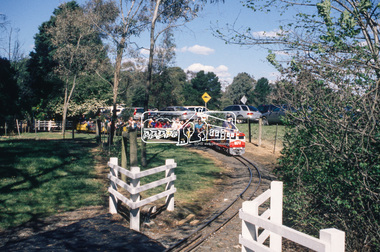
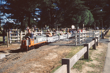 Eltham District Historical Society Inc
Slide - Photograph, Diamond Valley Railway, Eltham Lower Park, c.Nov. 2001
Part of a slide show presentation "A Trip Down the Diamond Creek" by Russell Yeoman to the Eltham District Historical Society meeting of 14 Nov. 200135mm colour positive transparency Mount - Black and Whiteeltham lower park, diamond valley railway -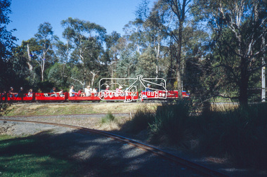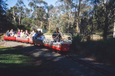
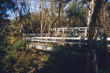 Eltham District Historical Society Inc
Slide - Photograph, Brougham Street Bridge, Eltham, c.Nov. 2001
Part of a slide show presentation "A Trip Down the Diamond Creek" by Russell Yeoman to the Eltham District Historical Society meeting of 14 Nov. 200135mm colour positive transparency Mount - Black and Whitebrougham street bridge, eltham -
 Eltham District Historical Society Inc
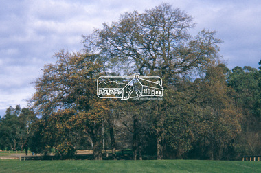
Slide - Photograph, Oak trees, Pitt Street Rugby field, Eltham, c.Nov. 2001
Part of a slide show presentation "A Trip Down the Diamond Creek" by Russell Yeoman to the Eltham District Historical Society meeting of 14 Nov. 200135mm colour positive transparency Mount - Black and Whiteeltham, oak trees, pitt street rugby field, significant tree -
 Eltham District Historical Society Inc
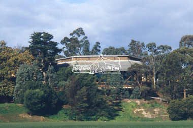
Slide - Photograph, Eltham Community Centre, c.Nov. 2001
Part of a slide show presentation "A Trip Down the Diamond Creek" by Russell Yeoman to the Eltham District Historical Society meeting of 14 Nov. 200135mm colour positive transparency Mount - Black and Whiteeltham, eltham community centre -
 Eltham District Historical Society Inc
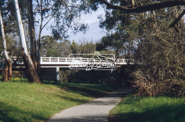
Slide - Photograph, Bridge Street Bridge, Eltham, c.Nov. 2001
Part of a slide show presentation "A Trip Down the Diamond Creek" by Russell Yeoman to the Eltham District Historical Society meeting of 14 Nov. 200135mm colour positive transparency Mount - Black and Whiteeltham, bridge street bridge -
 Eltham District Historical Society Inc
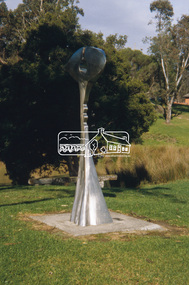
Slide - Photograph, Surveyor of Suburban Environs, Ernst Fries (1991), Alistair Knox Park, Eltham, c.Nov. 2001
Part of a slide show presentation "A Trip Down the Diamond Creek" by Russell Yeoman to the Eltham District Historical Society meeting of 14 Nov. 200135mm colour positive transparency Mount - Black and Whiteeltham, alistair knox park, art in public places, ernst fries, public art, surveyor of suburban environs (1991) -
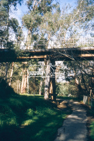
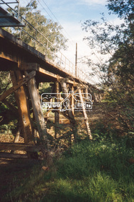
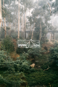 Eltham District Historical Society Inc
Slide - Photograph, Eltham Railway Trestle Bridge, c.Nov. 2001
Part of a slide show presentation "A Trip Down the Diamond Creek" by Russell Yeoman to the Eltham District Historical Society meeting of 14 Nov. 200135mm colour positive transparency Mount - Black and Whiteeltham, eltham railway trestle bridge, eltham trestle bridge, trestle bridge -
 Eltham District Historical Society Inc
Slide - Photograph, Eltham Railway Trestle Bridge, c.Nov. 2001
Part of a slide show presentation "A Trip Down the Diamond Creek" by Russell Yeoman to the Eltham District Historical Society meeting of 14 Nov. 200135mm colour positive transparency Mount - Black and Whiteeltham, eltham railway trestle bridge, eltham trestle bridge, trestle bridge