Showing 55805 items
matching documents-maps
-
 Bendigo Historical Society Inc.
Document - MCCOLL, RANKIN AND STANISTREET COLLECTION: GOLDEN CARSHALTON NO LIABILITY, 1934-1960
Documents; Bundle of documents tied with string, Cert of Inspection for Boiler, Electricity Agreement, Scrip Certificates, Commonwealth Bank Pass Book for (pounds)10 deposit for PMG charges, Lease Agreement, Name change from Big Hill North N.L., Lease agreement Tennant Creek, Insurance documents, Rules. Legal Opinion Document. Golden Carshalton N.L.MCCOLL RANKIN & STANISTREETorganization, business, golden carshalton nl, mccoll rankin & stanistreet -
 Royal District Nursing Service (now known as Bolton Clarke)
Document, black and white, c.1957
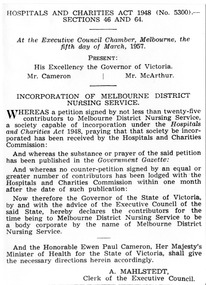
In 1957 the 'Incorporation of the Melbourne District Nursing Service' was authorized on the 5th of March 1957. The Melbourne District Nursing Society was founded in February 1885 and in 1926 opened the After-Care Home. The name of the Society then became the Melbourne District Nursing Society and After-Care Home until 1935 when the word 'Home' was replaced with the word 'Hospital'. In 1957 the two bodies separated and the the 'Incorporation of the Melbourne District Nursing Service' was authorized on the 5th of March 1957. This name continued to be used until 1966 when Royal patronage was granted and it became the Royal District Nursing Service (RDNS).Black and white document - 'Incorporation of Melbourne District Nursing Service' . The document is bold black printing on a white background. The document commences 'Hospital and Charities Act 1948 (No. 5300); follows are the names of those present being the Governor of Victoria and two other men. The body of the document contains twenty-three lines and finishes with ‘A. Mahlstedt Clerk of the Executive Council’.melbourne district nursing society, melbourne district nursing service, royal district nursing service, rdns, after- care hospital, mdns incorporation -
 Bendigo Historical Society Inc.
Document - DORR FAMILY DOCUMENTS - PROBATE DOCUMENT & WILL
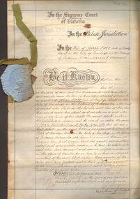
Probate and Will of John Dorr, Bridge St., Bendigo. Corn Merchant, dated 3 July 1899. Document has a loose light blue paper imprinted seal with green 13mm ribbon threaded into the left edge of the document. Also a photocopy of document.person, family, dorr family, dorr family documents - probate document & will, john dorr, the supreme court of victoria, cohen kirby & woodward, elizabeth dorr, chas cohen, john odgers -
 Bacchus Marsh & District Historical Society
Map, Subdivision of the Manor House Property Bacchus Marsh c.1908
This land sales plan shows allotments of land offered for sale in the inner township area of Bacchus Marsh in 1908. The land put up for sale was from the estate of the late Mr and Mrs J.E. Crook. That being James Elijah Crook and his wife Harriet, (nee Athorn). The Crooks had been resident in Bacchus Marsh since the 1840s and were prominent members of the community. They were prominent in the business, social and civic affairs of the town and district. In the 1850s the Crooks acquired the Manor House and nearby land once owned by the Bacchus family. James Crook died in 1889. When Harriet Crook died in February 1908 their estate was offered for sale. This included the large stone home known as the Manor House and various parcels of land including around 50 allotments of land near the Manor House, bounded by Young, Lerderderg, Crook and Main Streets. Most of these allotments of land were sold in October 1908. The Manor House itself was passed in at the sale and continued to be owned by the Crook family for several decades after 1908.A single page map on a single page of a bound volume of maps. The map shows portions of land for sale from the subdivision of the Manor House property in Bacchus Marsh in 1908. The names of most of the buyers of the portions of land have been hand-written into the various allotments they purchased. The maps are pasted into a bound volume containing 76 maps or plans in total. High resolution digital image stored on BMDHS computer network. bacchus marsh victoria maps, land sales bacchus marsh, manor house bacchus marsh, crook family bacchus marsh -
 Orbost & District Historical Society
writing desk, before 1888
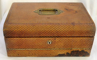
This was presented to Mr A.D. Munro by the residents of Orbost on his retirement as postmaster in 1888. In 1883 the mail terminus was at Newmerella. In July 1883 it was extended to the north side of the river and Archie Munroe became Acting Post Master. He was Post Master until 1885 when the telegraph line came to Orbost.Archie Munro was a well-known Orbost identity who first operated a boot shop in Cameron's barn. He was also active in the promotion of the first brass band in Orbost. He was the son of Hector Munro.A large brown leather portable writing desk. It has a brass handle on the top. Inside are copies of some Munro family documents in a document folder.On a brass plate-Presented to Mr A.B. Munro by the RESIDENTS OF ORBOST on his retirement as Post Master. A.D. 1888munro-archie writing-desk post-office -
 Bendigo Historical Society Inc.
Document - MCCOLL, RANKIN AND STANISTREET COLLECTION: EAST CLARENCE GOLD MINING CO - LIQUIDATION, 1948/50
Document; manilla folder contains documents relative to liquidation of East Clarence shareholder reports, correspondence. East Clarence gold Mining Company No Liability.MCCOLL RANKIN & STANISTREETorganization, business, gold mining correspondence, mccoll rankin & stanistreet -
 Bendigo Historical Society Inc.
Document - GERTRUDE PERRY COLLECTION: DOCUMENTS RELATING TO PERRY PROPERTY, 1955 - 1959
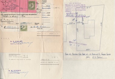
Documents. Quantity of documents and receipts relating to purchase and alterations of property situated at 16 Burrowes St Golden Square by Gertrude Perry 1955 to 1959.place, building, residential, gertrude perry collection, documents relating to perry property -
 Bendigo Historical Society Inc.
Document - BANK RECEIPT (GOLD), 1868
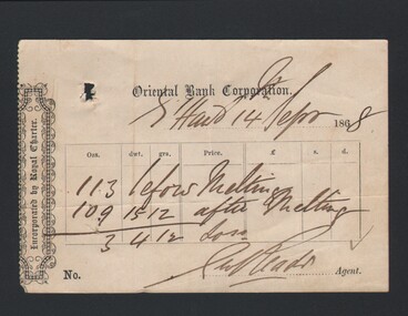
Document. Bank Receipt (Gold). Paper Document receipt from the Oriental Bank Corporation. Dated 14 Sep 1868. Appears to be signed by ? Reads.cottage, miners, bank receipt (gold), oriental bank corporation, ? reads -
 Bendigo Historical Society Inc.
Document - BANK RECEIPT (GOLD), 1868
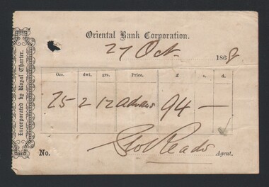
Document. Bank Receipt (Gold). Paper document receipt from the Oriental Bank Corporation, dated 27 Oct 1868. Appears to be signed by ? Reads.cottage, miners, bank receipt (gold), oriental bank corporation, ? reads -
 Moorabbin Air Museum
Manual (item) - (SP) Bristol Beaufort Illustrated Parts LIst
-
 8th/13th Victorian Mounted Rifles Regimental Collection
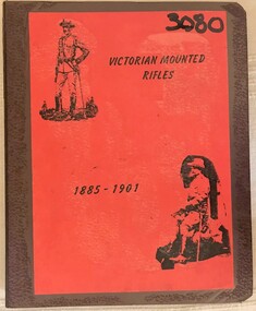
Book - Ring binder Boer War references
Red covered 4-ring binder containing documents relating to Boer War soldiers from Victoria. Index sheet in attached pdf document.boer war, maygar, hillier, ramsay, haycroft -
 Bendigo Historical Society Inc.
Document - THEATRES COLLECTION: THEATRES IN BENDIGO
Nine pages photocopy of a typewritten document on the history of theatres particularly in the Bendigo area. The document contain many corrections and cancellations. Date and author unknown.entertainment, theatre, theatres in bendigo -
 Eltham District Historical Society Inc
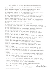
Document - Folder, Bridgeland Estate, Eltham South, 1998
Various documents, including a history, letter and reminscences relating to properties of the Bridgeland Estate including Antoinette Boulevard and Leonard Crescent, Eltham South. 5 photocopies of parts of maps relating to subdivisions from 1842 to the 1925 Bridgland Park Estate Folders 78 and 80 from Harry Gilham Collection 12 pagesantoinette boulevard, leonard crescent, eltham south, bridgeland park estate, harry gilham collection -
 Marysville & District Historical Society
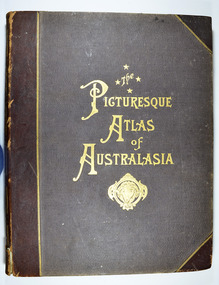
Book - Hardcover book, Picturesque Atlas Publishing Company Limited, The Picturesque Atlas of Australasia-Volume 2, 1886
The Picturesque Atlas of Australasia-Volume 2Hardcover. Cover is brown with the title in gold lettering. Underneath the title is a symbol of a solid wreath surrounding the head of a ram. Three fold-out maps are included; Railway Postal and Telegraph Map of South Australia, 1888; Railway Postal & Telegraph Map of Queensland, 1888; Railway, Postal, Telegraph and Rainfall Map of Tasmania 1889. non-fictionThe Picturesque Atlas of Australasia-Volume 2atlas, australasia, history -
Bendigo Historical Society Inc.
Map - CAMPBELL COLLECTION: BENDIGO AND DISTRICT MAPS, 23-4-29
Map. Whirrakee, Parish of Whirrakee, Total area 4419 acres, scale 20 chains to 1 inch. Unused water race in centre of map. Eucalypt Oil Distillery, bottom of map. Prepared in W.P.B. from Assessor's Plan and Parish Plan. G.W.Latimer 23-4-29. (number 385 in map cupboard 1)G.W.Latimermap, bendigo, agricultural lands -
 Victorian Aboriginal Corporation for Languages
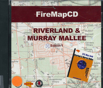
CD-ROM, Country Fire Services South Australia, FireMapCD Riverland &? Murray Mallee, 2001
The area covered by this map is the same as the CFS Riverland & Murray Mallee Map Book. The area covered adjoins the Mount Lofty Ranges map book on the eastern boundary at Murray Bridge, north to Morgan and east to Renmark and the State Border. It extends southwards to join the northern boundary of the Lower South East map book at Padthaway.CD-ROMfire protection, victorian maps -
University of Melbourne, Burnley Campus Archives
Plan - Photocopy, Sunshine Planning Scheme, 1993
Photocopies. 18.02.1993. (1) 5 copies Map User Guide - Sunshine Planning Scheme. List of Zones, Reservations and additional Planning Controls. (2) Sunshine Planning Scheme - Local Section. Zones and Reserved Land Map No 2. (3) Map No 3. (4) Map No 4. Used in planning Native Garden Woodlandsunshine, reservations, native garden, planning scheme, victoria department of planning and development -
 Bendigo Military Museum
Photograph - Lithographic Squadron Personnel and Equipment, Army Survey Regiment, Fortuna, Bendigo, c1990
These 28 photographs of Lithographic Squadron personnel and equipment was taken at Fortuna, Bendigo circa 1990. The photos were taken on the east side of Fortuna Villa, the Print Room’s map trimming and dispatch work area and the inside and outside Air Survey Support Section (BARCRO).These 28 photographs of Lithographic Squadron Personnel and Equipment was taken at Fortuna, Bendigo circa 1990. The 35mm colour photograph negatives were scanned at 96 dpi and are part of the Army Survey Regiment’s Collection. .1) - Photo, colour, c1990. RAEME and maintenance support, unidentified civilian. .2) - Photo, colour, c1990. Eastern side of Fortuna Villa, unidentified, CPL Le-Anne (Smallshaw) Shirley. .3) - Photo, colour, c1990. Eastern side of Fortuna Villa, SGT Gary Kerr. .4) - Photo, colour, c1990. Eastern side of Fortuna Villa, CPL Roy Hicks. .5) - Photo, colour, c1990. Eastern side of Fortuna Villa, unidentified. .6) - Photo, colour, c1990. Unidentified passing Q-Store & Transport Compound. .7) - Photo, colour, c1990. Data Management & Map Library. .8) - Photo, colour, c1990. Unidentified officer passing Q-Store heading up to Map Library. .9) - Photo, colour, c1990. Eastern side of Fortuna Villa, SPR Michelle Withers. .10) - Photo, colour, c1990. Unidentified RAEME soldier passing Q-Store heading up to Map Library. .11) & .12) - Photo, colour, c1990. Delivery of bulk map printing paper. WO2 Jeff Willey on forklift, unidentified. .13) & .14) - Photo, colour, c1990. Print Room, Wohlenberg MCS-2 guillotine. .15) to .18) - Photo, colour, c1990. Air Survey Support Section (BARCRO), Carl Zeiss Rectifying Enlarger. .19) - Photo, colour, c1990. Air Survey Support Section (BARCRO), film contact frame. .20) - Photo, colour, c1990. Air Survey Support Section (BARCRO), Pakotone film development processors. .21) & .22) - Photo, colour, c1990. Air Survey Support Section (BARCRO) entry/exit. .23) & .24) - Photo, colour, c1990. Air Survey Support Section (BARCRO) miscellaneous equipment. .25) & .26) - Photo, colour, c1990. Air Survey Support Section (BARCRO), CPL Warren ‘Waldo’ Shirley. .27) & .28) - Photo, colour, c1990. Outside Air Survey Support Section (BARCRO), L to R: WO1 Peter Coombes, CPL Warren ‘Waldo’ Shirley..1P to .28P – There are no annotations.royal australian survey corps, rasvy, army survey regiment, army svy regt, fortuna, asr, litho sqn -
 Eltham District Historical Society Inc
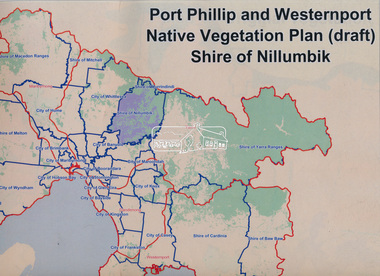
Book, Port Phillip and Westernport Native Vegetation Plan (draft), Shire of Nillumbik
Entire report available www.ppwema.vic.gov.au -
 Greensborough Historical Society
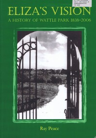
Book, Ray Pearce, Eliza's vision: a history of Wattle Park 1838-2006, 2006
An outline of the history of Wattle Park (Vic).207 p., illus., colour map.non-fictionAn outline of the history of Wattle Park (Vic).urban parks - melbourne, wattle park (vic.), parks - melbourne - history -
Greensborough Historical Society
Newsletter, Greenhills and North Greensborough Progress Association, Community News: official journal of the Greenhills and Nth. Greensborough Progress Association and the Apollo Parkways Progress Association. July 1978. Edition No. 6/78, 07/1978
Orchids can still be found!, Yandell Bushland Reserve: a management study, School news, This and that, Did you know?, From the Council Chamber, A quarry in Plenty???, The restoration of access from Pinehills to Greensborough,Newsletter, 16 p., illus., map.greenhills and north greensborough progress association, greenhills, apollo parkways progress association, apollo parkways -
 Greensborough Historical Society
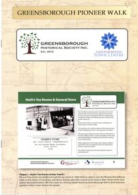
Booklet, Greensborough Historical Society Inc, Greensborough Pioneer Walk, 2021
A guide to the historic photographs which have been mounted on 12 plaques in Greensborough Town Centre. 8 p., photographs, captions and mapgreensborough, pioneer walks, greensborough historical society -
 Greensborough Historical Society
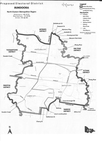
Map - Map (Copy), Electoral Boundaries Commission, Proposed electoral district: Bundoora, 01/07/2021
Proposed revised electoral boundaries for the electoral district of Bundoora (North-Eastern Metropolitan Region) as at 01/07/20211p. black and white copy of mapelectoral boundaries, bundoora - maps, victoria - parliament -
 Mission to Seafarers Victoria
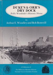
Book, Arthur E. Woodley et al, Duke’s & Orr’s Dry Dock, Polly Woodside’s Historic Home, 1985
70 pages : illustrations, facsimiles, mapsnon-fictionduke and orr dry dock, polly woodside, national trust, yarra river, south wharf, interest group -
 Phillip Island and District Historical Society Inc.
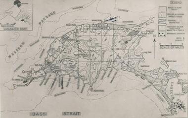
Photograph
One of a collection of over 400 photographs in an album commenced in 1960 and presented to the Phillip Island & Westernport Historical Society by the Shire of Phillip IslandPhotograph of a geological map of Phillip Islandlocal history, photography, phillip island map, black & white photograph, maps & mapping, phillip island, geology, john jenner, bryant west -
 Greensborough Historical Society
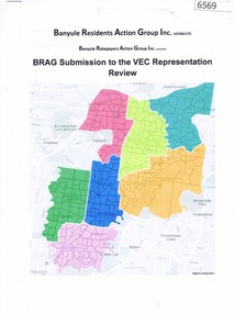
Document, BRAG submission to the VEC Representation Review, by Banyule Residents Action Group Inc, 2019_
This is a submission to the Victorian Electoral Commission, which periodically reviews electoral representation in municipal areas. The last review of Banyule City Council was in 2007.7 p. typescript with colour mapbanyule city council, brag banyule residents action group -
 Greensborough Historical Society
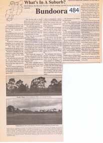
Newspaper Clipping, Bundoora: What's in a Suburb?, 16/09/2000
A short history of Bundoora from its earliest subdivision in 1838 to the end of the 20th century. Includes information on hospitals in the area - Larundel, Mont Park, 1 page, text, photos and map.bundoora, mont park -
Greensborough Historical Society
Article, The 1909 "Battle of Greensborough" / by John Gibson, 1909_
In 1909 military exercises were held in the Greensborough area. In this researched article the site is identified and activities related.This is the text of a presentation by John Gibson at the April 2013 meeting of GHS.2 pages, text, map and photograph.sugarloaf hill, bundoora, john gibson, greswell hill, latrobe house -
 Greensborough Historical Society
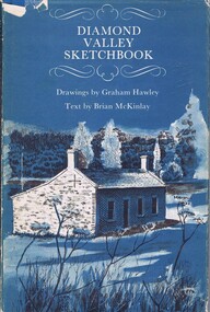
Book, Diamond Valley Sketchbook, 1973_
Contains drawings by Graham Hawley and text by Brian McKinley. Shows landmarks around the Diamond Valley.63p., illus., map as endpapers, dustcover."Happy birthday Kathryn May 1976"diamond valley, eltham, greensborough -
 Greensborough Historical Society
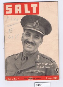
Magazine, Australia. Army. Australian Army Education Service, Salt. Vol.6 No.7, 7 June 1943, 07/06/1943
The Army Education Journal contains information for army personnel. This edition has articles on War Service Homes, rope work and several conflict areas.48 p., line drawings, maps.Vol. 6, No. 7australia. army, world war ii