Showing 55839 items
matching documents-maps
-
 Greensborough Historical Society
Article, The 1909 "Battle of Greensborough" / by John Gibson, 1909_
In 1909 military exercises were held in the Greensborough area. In this researched article the site is identified and activities related.This is the text of a presentation by John Gibson at the April 2013 meeting of GHS.2 pages, text, map and photograph.sugarloaf hill, bundoora, john gibson, greswell hill, latrobe house -
 Greensborough Historical Society
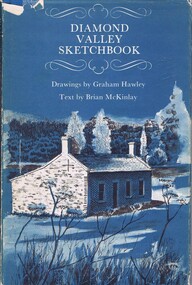
Book, Diamond Valley Sketchbook, 1973_
Contains drawings by Graham Hawley and text by Brian McKinley. Shows landmarks around the Diamond Valley.63p., illus., map as endpapers, dustcover."Happy birthday Kathryn May 1976"diamond valley, eltham, greensborough -
 Greensborough Historical Society
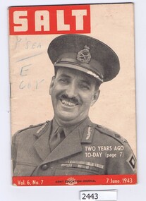
Magazine, Australia. Army. Australian Army Education Service, Salt. Vol.6 No.7, 7 June 1943, 07/06/1943
The Army Education Journal contains information for army personnel. This edition has articles on War Service Homes, rope work and several conflict areas.48 p., line drawings, maps.Vol. 6, No. 7australia. army, world war ii -
 Greensborough Historical Society
Handbook, Banyule City Council Services and Information 2012/2013, 2012-2013
The 2012/2013 handbook of council services and information for the City of Banyule.An annual publication distributed to all homes in the Banyule local government area.56 pages, colour illustrationa and maps.banyule city council, city of banyule -
 Greensborough Historical Society
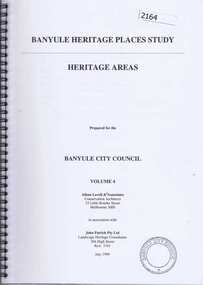
Book, Banyule Heritage Places Study. Vol. 4: Heritage Areas, 1999_07
This volume (4) of the Banyule Heritage Places Study: Heritage Areas deals mainly with areas in the Heidelberg, Eaglemont and Ivanhoe areas. Were Street Montmorency is mentioned.63 pages, col. illus., maps.heritage places, were street, heidelberg, ivanhoe, eaglemont -
 Greensborough Historical Society
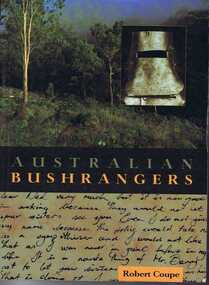
Book, New Holland Publishing (Australia), Australian bushrangers / by Robert Coupe, 1998_
This book tells the stories of Australian bushrangers from early colonial days to the Kelly Gang in 1880.195 p., illus., maps. Paperback.bushrangers, robert coupe -
 Greensborough Historical Society
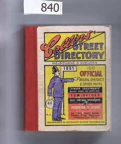
Book, Collins' Street Directory: Melbourne & suburbs 1951, 1951_
This 1951 street directory covers many Melbourne suburbs but not Greensborough. In the 1950s Greensborough was still a rural settlement. This directory is interesting for anyone wanting to check mid-20th century developments.A comprehensive coverage of suburban, inner city streets.Street directory. 411 pages, maps.melbourne, street directories -
 Greensborough Historical Society
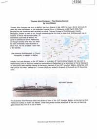
Document, John Gibson et al, Thomas John Finnigan - the missing gunner, 1914-1918
Article on the World War 1 service of Thomas Finnigan and the likelihood that he abandoned his wife and future child in Ireland when he took ship to Australia in 1915.6 p., colour images and mapthomas john finnigan, world war 1 project -
Glenelg Shire Council Cultural Collection
Map - Map- Tarragal, n.d
Map - Tarragal - No further information supplied -
 City of Moorabbin Historical Society (Operating the Box Cottage Museum)
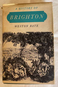
Book, Brown Prior Anderson Pty.Ltd, A History of Brighton, 1962
This book is about the history of Brighton and Henry Dendy's survey the early settlement of Brighton and its surrounds and the involvement of Dendy J.B.Were George Higinbotham Thomas Bent and J.H. Taylor in the growth of the community.xi, 425 p. : ill., maps :non-fictionThis book is about the history of Brighton and Henry Dendy's survey the early settlement of Brighton and its surrounds and the involvement of Dendy J.B.Were George Higinbotham Thomas Bent and J.H. Taylor in the growth of the community. brighton, dendy, bent, were, higinbotham, taylor, survey, settlement. -
 Halls Gap & Grampians Historical Society
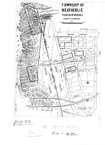
Map - Coloured
... MAPS ...Map showing layout for township of HeatherlieTownship of Heatherlie; Parish of Boroka; County of Borung; scale measurement; R.O. Robson Authorised surveyormaps, heatherlie township -
 Halls Gap & Grampians Historical Society
Map - Coloured
Background on Bridle Path up Stony Creek Gorge Pre 1840 C. B. Hall, squatter on Mokepilly Run 1841-1842, first European to discover the Fyans Creek valley, the entrance of which became known as Hall's Gap. He later recorded that he followed a number of tracks which he assumed had been made by the Aboriginies and described one as "leading up a wild romantic glen and over on to the source of the Glenelg River". This could well have been the route taken up Stony Creek gorge by the first timber-cutters in this part of the Grampians to the saddle between the Wonderland and Mt. Difficult ranges known as Valley Gap 1850s/60s Timber cutters and shingle splitters were reported to be moving into the eastern side of the Grampians and by the mid 1860s there were a number of families connected to the supplying of timber to Pleasant Creek living in the "Hall's Gap ranges". John Wakeham, the first store owner in Pleasant Creek in 1854, established a timer-mill in upper Stony Creek Gorge in the late 1850s. Wakeham is credited for the clearing and levelling of the first bridle-path up the gorge. 1870s By the mid 1870s the track had been extended over Valley Gap to the Victoria Forest (the upper region of the Victoria Valley). McKeon's bullock team was known to have hauled red gum from the Valley to Stawell in the late 1870s and the 1880s. 1880s In 1887 an article in the Pleasant Creek news describes the Stony Creek Gorge track as "being a ledge alongside the mountain range, formed in the early days with the aid of earth and timber, along which the bullock teams used to travel to Horsham and plains of the Wimmera beyond." 1890s Gold was discovered in the catchment area of Stony Creek and by the end of the 1890s a new track was built from "near the junction of Fyan's and Stony Creeks, up the gorge to the diggings settlement. The mining Department had paid L300 for its construction and, when completed, the track was "three miles and 30 chains in length, the side cuttings at the narrowest part being 10 feet between" and "the watercourses which cross the track at various points" having been "filled up with rocks rolled down the sides of the hills, and consequently there can be no damage caused by bushfires which destroyed the former wooden bridges erected on the old track to Wakeham's saw-mill, the remains of which are still to be seen at the side of the diggings" The article goes on to further describe the track as one which "can with ease travel with a two horse conveyance either up or down" and that the workmen engaged in the construction of the track would be attending "a ball that night at McKeon's farm near the mouth of the gap to celebrate the successful completion of the undertaking". 1900s At what time the bridle path was extended beyond Valley Gap to the Wartook basin on the Mt. Difficult Range has not yet been determined. However, it is known that, by the turn of the century, people were travelling between Halls Gap and the caretakers' residence at Wartook Reservoir along what was now known as the "Bluff Road. Wartook's embankment had been constructed in 1887 and at that time there was already a track from Rosebrook Station homestead (near the present day Wartook Pottery) to the reservoir. Philip Rose owned both Rosebrook and Wartook Stations from the mid 1840s to the late 1850s and had regularly leased the Wartook basin to Cobb & Co. to rest horses there. 1920s Following the war of 1914-1918, tourism really took off in the Grampians, and Halls Gap rapidly grew. People would travel as far as they could on the many tracks then hike to the many lookouts being discovered by local tour guides. This led to the need for access across the range so that horse riders and the increasing number of vehicles could travel between Horsham and Halls Gap. To this end, the Bluff Road was improved and extended on 1929 and at its opening in March, 1930, by Lady Somers it was renamed the Mt. Victory Road.Map of Mt Victory Road and othersaccess routes, mt victory rd, bridle path, roads -
 Eltham District Historical Society Inc
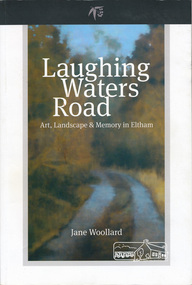
Book, Shire of Nillumbik, Laughing Waters Road: art, landscape & memory by Jane Woollard, 2016
"Laughing Waters has been a source of inspiration for many artists and designers, and was a natural extension of the dynamic art and lifestyle movement that began in the 1930s at Montsalvat. It was also an important site in the development of the Melbourne art scene in the 1960s and '70s, especially the earth building movement known as the Eltham Style. Since 2001 more than eighty artists have been in residence at Laughing Waters in Birrarung House and Riverbend. Their experiences and art making are woven together with Wurundjeri, European and family histories to create an evocative account of a special place in a bushy outer suburb of Melbourne." -- back cover. Eltham District Historical Society is acknowledged in the Acknowledgments section of this book.264 pages : illustrations, maps, portraits ISBN 9780994486707laughing waters, eltham, yarra river, artists, killeavey, mud bricks -
 Eltham District Historical Society Inc
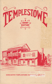
Book, Doncaster Templestowe Historical Society, Templestowe: A Short History by Irvine Green, 1982
Templestowe is a suburb in the City of Manningham on the border of the Yarra River across from which is Eltham, in the Shire of Nillumbik24 p. : ill., 3 maps ISBN 0950092037templestowe -
 Eltham District Historical Society Inc
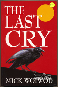
Book, Mick Woiwod, The Last Cry by Mick Woiwod, 1997
Novel relating a Wurundjuri man's experiences and changes in lifestyle in the 1840s in Victoria with the arrival of settlers. Includes glossary of words including words of the aborigina people.384 p. : map ; 24 cm.ISBN 0646325485wurundjuri people, victoria 1840s -
 Eltham District Historical Society Inc
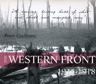
Book, ABC Books for the Australian Broadcasting Corporation, The Western Front 1916-1918 by Peter Cochrane, 2004
"Using both official and unofficial photos, this is a powerful visual record of the ANZAC experience of the Western Front, WW1 - the scene of some of the bloodiest horrors and the greatest loss of life. Australian photographer." --Publisher's description.138 pages : illustrations, portraits, map ISBN 0733312802world war 1914-1918, australian imperial force, anzacs, military campaigns, western front -
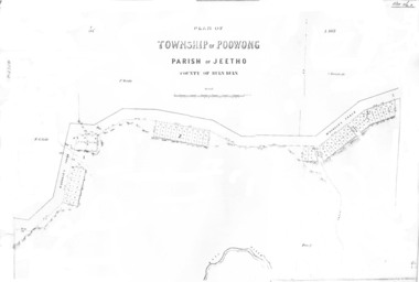 Poowong Historical Group
Poowong Township Map 1
Photocopy of original map - fair quality41584 pencilled on top left corner -
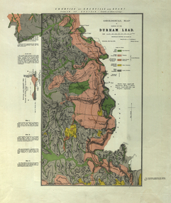 Federation University Historical Collection
Plan, Durham Lead, 1870
Geological Map of portions of Durham Lead. durham lead, reginald a.f. murray, plan, garibaldi, garibaldi company, geology, chryseis company, hardies hill, city of manchester company, williamson's creek, south grenville company, enfield company, pioneer company, duke of northumberland company, monmowth gully, extinct volcano crater, mount mercer basalt -
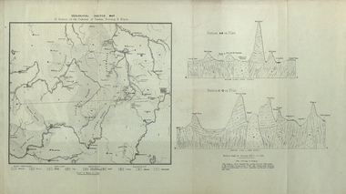 Federation University Historical Collection
Map, Geological Sketch Map of of Dundas, Berung, and Ripon Counties
Map of the Counties of Dundas, Berung, and Riponcounty of dundas, county of berung, county of ripon, map, geology, ararat, stawell, hamilton, grampians -
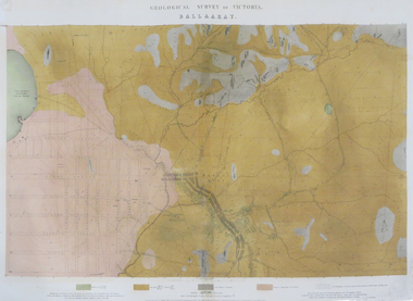 Federation University Historical Collection
Map - Map - Geological, Ballarat, 1858, 10/1858
Four colour geological map of Ballarat.map, ballarat, geology, black hill, golden point, povery point -
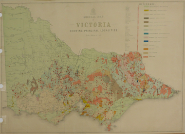 Federation University Historical Collection
Map, Department of Mines - Victoria, Geological Map of Victoria, 1936, 1936
Printed colour geological map of Victoria.victoria, geology, map, geological map -
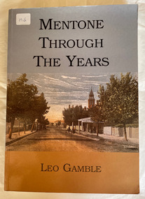 City of Moorabbin Historical Society (Operating the Box Cottage Museum)
Book, Gamble, Leo, Mentone through the years, 2003
Mentone through the years - Kulin Nation - 2000.. Traces the development of Mentone its buildings, people and important events. Bunurong people, Land Boom of 1880s, WW1, Jazz Age298 pages : ill, maps, index, Mentone through the years - Kulin Nation - 2000.. Traces the development of Mentone its buildings, people and important events. Bunurong people, Land Boom of 1880s, WW1, Jazz Agementone, kulin nation, land boom -
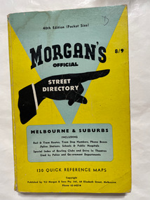 City of Moorabbin Historical Society (Operating the Box Cottage Museum)
Book, Val Morgan & Sons, Morgan's Street Directory - Melbourne & Suburbs, 1960's
Official street directory. Melbourne & suburbs. Morgan's official street directory of Melbourne & suburbsPocket size - 130 Reference mapsOfficial street directory. Melbourne & suburbs. Morgan's official street directory of Melbourne & suburbsmelbourne, suburbs, street directory -
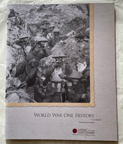 City of Moorabbin Historical Society (Operating the Box Cottage Museum)
Book, Victorian Government, World war one history : Victoria's story, ANZAC centenary, 2014-2018 sharing Victoria's stories & making connections, 2014
42 pages : illustrations, map, portraits non-fictionworld war one, victoria, anzac, soldiers -
 Running Rabbits Military Museum operated by the Upwey Belgrave RSL Sub Branch
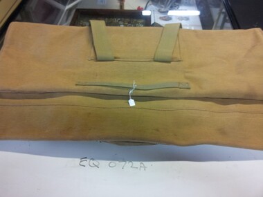
Bag
Carry Case for EQ072 (Map table)equipment, army -
 Running Rabbits Military Museum operated by the Upwey Belgrave RSL Sub Branch
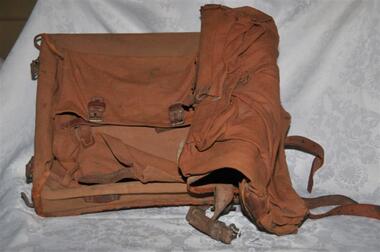
Pack
Map case, Australian, Pat.15.equipment, ww1, army -
 Bendigo Historical Society Inc.
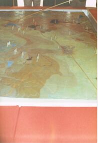
Photograph - CASTLEMAINE GAS COMPANY COLLECTION: PHOTO MAP
Detailed map with several plastic markers on it.Kodakbusiness, retail, gas and fuel -
Bendigo Historical Society Inc.
Map - BENDIGO GOLDFIELD MAP 1913
CD, Bendigo Goldfield Map 1913. -
Port Melbourne Historical & Preservation Society
Map - "The Township of Sandridge", Public Lands Office, 1859
Photocopy 1859 map of township of Sandridgelocal government - municipal district of sandridge, frank callaghan -
Port Melbourne Historical & Preservation Society
Map - Lagoon and beach, Sandridge, Borough of Sandridge, 1870
Map of Lagoon and beach with soundings, 1870.Signed by Chas. Clay, Borough Surveyor, Sandridge.charles clay, sandridge lagoon