Showing 10832 items
matching maps
-
 Seaworks Maritime Museum
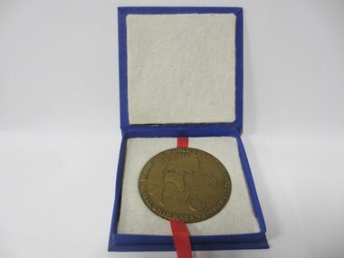
Medallion
Bronze mellion featuring image of ship on one side and map of the world on the other "Merchant Marine Academy/ Goynia/ Poland/ Dar Mzodzieey" Verso "Round the World Voyage/ Tall ship Races Hobart- Sydney" PMA 0291 WMA 76 -
 Mission to Seafarers Victoria
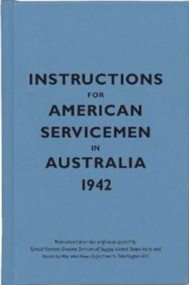
Book - Pocket book, Special Service Devision, Service of Supply, United States Army, Instructions for American Servicemen in Australia 1942, 2007
In 1942, the United States issued Instructions for American Servicemen in Australia as a quick guide to Australia's people, politics, history and culture for Americans stationed there during the Second World War. It was one of several similar sets of instructions put together by the US government to help its soldiers, sailors and airmen adjust to life abroad.Pocket size book of blue colour ix, [54] p. : ill., mapsnon-fictionIn 1942, the United States issued Instructions for American Servicemen in Australia as a quick guide to Australia's people, politics, history and culture for Americans stationed there during the Second World War. It was one of several similar sets of instructions put together by the US government to help its soldiers, sailors and airmen adjust to life abroad. 1942, american soldiers, australia -
 Phillip Island and District Historical Society Inc.
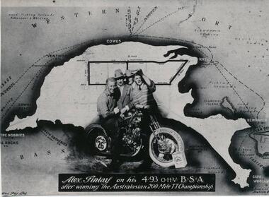
Photograph
One of a collection of over 400 photographs in an album commenced in 1960 and presented to the Phillip Island & Westernport Historical Society by the Shire of Phillip IslandPhotograph of Alex Findlay on his motor cycle superimposed on a map of Phillip IslandAlex Findlay on his 4.93 OHV B.S.A. after winning the Australasian 200 mile TT Championshiplocal history, photography, souvenir, phillip island's first motor cycle race, black & white photograph, phillip island race track, motor cycle racing, alex findlay, john jenner, bryant west -
 Greensborough Historical Society
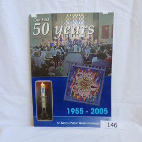
Book, Para Printing Pty Ltd, Our first 50 years: 1955-2005. St Mary's Parish Greensborough, 1955-2005
A history of St Mary's Parish Greensborough compiled to celebrate the 50th anniversary of the founding of the Parish 1955-2005.History of this Parish and those who have contributed to its development.74 pages, colour illustrations, maps. Soft cover with photograph of interior of church.Inside cover in pencil 'Bonnie Dickson', a contributor to the publication.st marys catholic church, greensborough, churches -
 Greensborough Historical Society
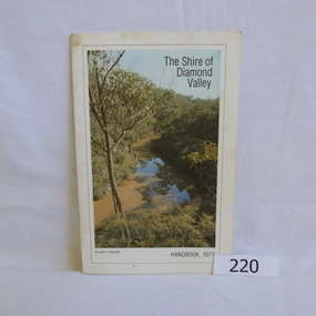
Book, Shire of Diamond Valley, The Shire of Diamond Valley Handbook 1977, 1977_
The Shire of Diamond Valley was a Local Government Area located about 20 kilometres northeast of Melbourne. The shire covered an area of 74.38 square kilometres and existed from 1964 until 1994.Annual guide to services in Shire of Diamond Valley18pages, illus (some colour), maps. Front cover photograph "Plenty Gorge".shire of diamond valley, greensborough, handbooks -
 Greensborough Historical Society
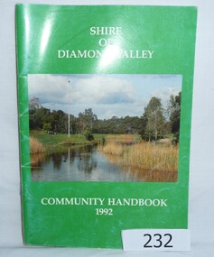
Book, Shire of Diamond Valley Community Handbook 1992, 1992_
Guide to services provided by Shire of Diamond Valley. The Shire of Diamond Valley was a Local Government Area located about 20 kilometres northeast of Melbourne. The shire covered an area of 74.38 square kilometres and existed from 1964 until 1994.Annual guide to services in Shire of Diamond Valley52 pages, col illus., maps. Cover illustration of Kalparrin Gardens Greensboroughshire of diamond valley, greensborough, handbooks -
 Greensborough Historical Society
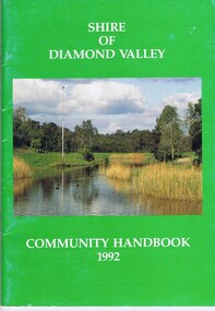
Book, Shire of Diamond Valley, Shire of Diamond Valley Community Handbook 1992, 1992_
Guide to services provided by Shire of Diamond Valley. The Shire of Diamond Valley was a Local Government Area located about 20 kilometres northeast of Melbourne. The shire covered an area of 74.38 square kilometres and existed from 1964 until 1994.Annual guide to services in Shire of Diamond Valley52 pages, col illus., maps. Cover illustration of Kalparrin Gardens Greensboroughshire of diamond valley -
 Greensborough Historical Society
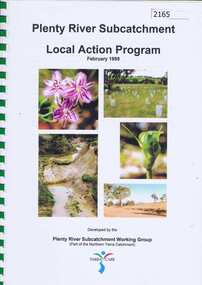
Book, Plenty River Subcatchment: Local Action Plan / Plenty River Subcatchment Working Group, 1999_02
Plenty River Subcatchment Implementation Program was developed to provide information on local catchment management issues and actions to address these issues.44 page book in spiral binding. Col. illus and maps. 2 copies.plenty river, yarra river -
 Glenelg Shire Council Cultural Collection
Map - Map - Historic Buildings, Portland, 1970s
Camperdown and District Heritage Society collectionBlack and white pamphlet. Inside map of Portland showing location of historical buildings.map, historic buildings, portland -
 Greensborough Historical Society
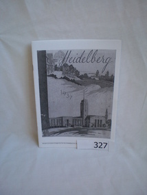
Booklet, Heidelberg 1937 - excerpts, 1937_04
Copy of parts of 1937 booklet to commemorate the official opening of the City of Heidelberg Civic Centre - Town Hall and Municipal Offices.A snapshot of the Heidelberg area in 1937, includes photos of local homes and civic amenities12 pages, photocopied and folded to A5 size. Black and white photos, maps.This flyer is an extract of images from the City of Heidelberg Civic Centre Official Opening Booklet "Heidelberg 1937" [footnote on each page]heidelberg municipal offices, heidelberg town hall, the centre ivanhoe -
 Greensborough Historical Society
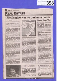
Newspaper clipping, Fields give way to business boom, 1993_
Tells some of the story of the settlement of Greensborough and Lend Leases' gradual take over of Greensborough shopping area. In Canberra Times Wednesday 17 November 1993, page 27: Melbourne: Lend Lease Corp Ltd is to undertake a $600 million redevelopment of two suburban Melbourne shopping centres, at Dandenong and Greensborough; to be built in conjunction with Australia's largest retailer; Coles Myer Ltd. The project will create about 2000 jobs; 1000 during construction and 1000 in long-term retail.Has some history of Greensborough and records the average land prices in 1993. A black and white Sunday Age newspaper story. Includes map and photograph of resident.greensborough, lend lease, 1993, land prices -
4th/19th Prince of Wales's Light Horse Regiment Unit History Room
Booklet (4 copies), Hints on Map Reading Instruction 1943, Aug 1943
Soft covered booklet issued to help junior instructors in the teaching of map readingmap reading -
 Eltham District Historical Society Inc
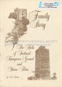
Book, Family story, concerning a Scottish border family which migrated to the Port Phillip District of Australia in 1839 and the countryside which became their home / by Vera Jackson, 1986
Family story, concerning a Scottish border family which migrated to the Port Phillip District of Australia in 1839 and the countryside which became their homePaperback; 48 p. : ill., geneal. tables, maps, ports. ; 31 cm.ISBN 1862522804bell family, kangaroo ground, yarra flats -
 Eltham District Historical Society Inc
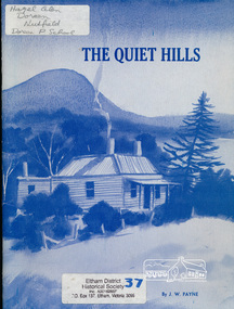
Book, The quiet hills / J.W. Payne, 1989c
Paperback; 40 p. : ill., portraits, maps, index, pbk ; 29 cm.doreen -
 Eltham District Historical Society Inc
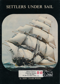
Book, Charlwood, D. E. (Donald Ernest), 1915-2012, Settlers under sail / by Don Charlwood ; with pictorial research, layout, and design by Donald Walker and Robert L. Suggett, 1980
Paperback; 28 p. : ill. (1 col.), map, ports. ; 30 cm.ISBN 0724116842 or 0724182314lorch ard (ship), ship voyage, ship wrecks -
 Eltham District Historical Society Inc
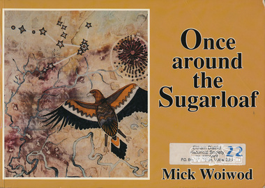
Book, Mick Woiwod, Once around the Sugarloaf : the transformation of a Victorian landscape and the story of its people / Mick Woiwod, 1992
Paperback; 301 p. : ill., ports., maps ; 21 x 30 cm.ISBN 0646106198 [signed by author on title page]sugarloaf mountain -
 Eltham District Historical Society Inc
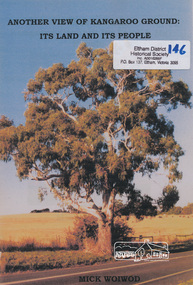
Book, Mick Woiwod, Another view of Kangaroo Ground : its land & its people / Mick Woiwod, 2009
Paperback; 54 p. : ill. (some col.), maps, port ; 30 cm.Inscribed and signed by Author wurundjeri, social customs, place names, yarra river, environment, kangaroo ground, culture, aborigines -
 Eltham District Historical Society Inc
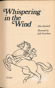
Book, Alan Marshall (1902-1984), Whispering in the wind : by Alan Marshall ; illustrated by Jack Newnham, 1969
Hardback missing dust jacket; 165 p. : ill.,map on end-papers.SBN 17002901alan marshall -
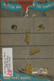 Eltham District Historical Society Inc
Book, Mary Kent Hughes, Matilda waltzes with the Tommies / by Mary Kent Hughes (T/Major Thornton, R.A.M.C.), 1943
Hardback with dust jacket; 176 p. : ill., maps, ports. ; 22 cm.mary kent hughes, world war ii -
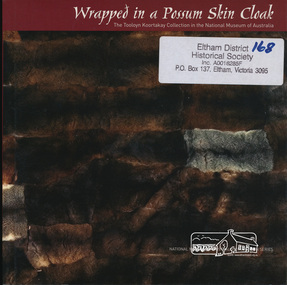 Eltham District Historical Society Inc
Book, National Museum of Australia, Wrapped in a Possum Skin Cloak by Amanda Jane Reynolds, 2005
Debra Couzens, Vicki Couzens, Lee Darroch and Treahna Hamm revived their communities' craft of cloak-making. Comprises tools, artworks, ornaments and two magnificently worked possum skin cloaks.vii, 64 p. : chiefly col. ill., map, ports. ; 18 cm.ISBN 1876944366aboriginal culture, possum skin cloaks -
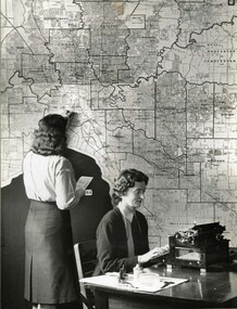 Victoria Police Museum
Photograph (Auxiliary police)
Taken from an album of various police departments at Russell Street. Auxiliary Police woman looking at a traffic map of Victoria at D24 in Russell Street.police women, d24, russell street, women's police auxiliary force, police woman, policewomen, policewoman -
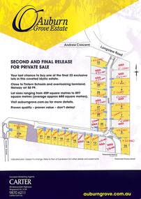 Ringwood and District Historical Society
Pamphlet, Auburn Grove Estate, Croydon South, Victoria - circa 2012
Multicoloured brochure with plan of subdivision on one side and map of general area on the otherSecond and Final Release for Private Sale - 22 lots - Auburn Grove, Croydon South. Handwritten sales prices are noted against blocks sold. Marketing Agents: Carter, 90 Maroondah Highway Ringwood Vic 334, (Telephone) 98706211, (Email) carter.com.au -
 Marysville & District Historical Society
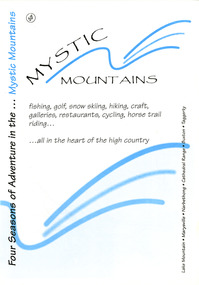
Ephemera (Item) - Visitor information pack, Four Seasons of Adventure in the Mystic Mountains, Unknown
A visitor information pack on Marysville and the surrounding district.A visitor information pack on Marysville and the surrounding district.marysville, victoria, australia, visitor information pack, lake mountain, narbethong, cathedral range, buxton, taggerty, mystic mountains, beauty spot walk, tree fern gully walk, michaeldene track, keppel track, woods lookout track, lady talbot forest drive, wishing well, taggerty river picnic area, taggerty river, phantom falls, keppel falls, the beeches walking track, mount sugarloaf, department of conservation & environment victoria -
 Federation University Historical Collection
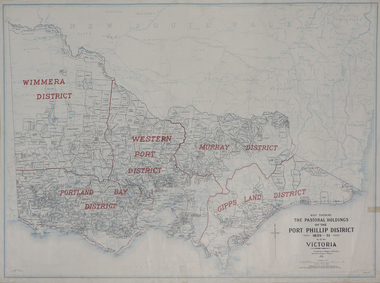
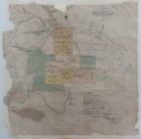
Plan, Map Showing the Pastoral Holdings of the Port Phillip District 1835-1851 Now Victoria, 1932, 1932
Another name for Pastoral Holdings is squatting runs. Information on Alfred Stephen Kenyon of the Historical Society of Victoria can be found at http://adb.anu.edu.au/biography/kenyon-alfred-stephen-6936/text12035 Map of Victoria showing the boundaries of the Port Phillip District (Victoria) pastoral boundaries. pastoral holdings, squatters, squatting, victoria, land, crown lands, a.s. kenyon, alfred stephen kenyon -
 Federation University Historical Collection
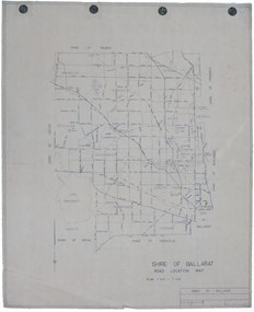
Map, Shire of Ballarat Road Location Map, 1968, 05/06/2014
White paper road location map. Scale 1 mile to 1 inchballarat, shire of ballarat, roads, dowling forest, lake burumbeet, lake learmonth, ascot, windermere, tourello -
 Federation University Historical Collection
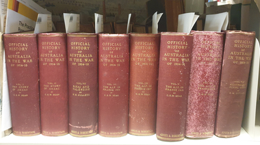
Banner - Book, Charles E.W. Bean, Official History of Australia in the War, Vol 1, The Story of ANZAC: The first phase, 1937
Red hard covered book of 662 pages, 111 maps and 56 illustrations.Inside front in pencil "H.J. Sims"world war, world war one, charles bean, aif, egypt, anzac, sims, h.j. sims -
 Federation University Historical Collection
Book, H.S. Gullett, Official History of Australia in the War, Vol 7, Sinai and Palestine, 1937
Red hard covered book of 844 pages, with 77 maps and 83 illustrations.world war, stretcher, sinai, palestine, gallipoli, turks, light horse, gaza, chetwode, allenby, beersheeba, archibald murray, camels, ambulances -
 Federation University Historical Collection
Map, Lintons Pre-emptive Section, 1872, 1872
Printed map with coloured shading by F. W Niven Lydiard Street, Ballaratmap, mining districts, lintons claim, lintons diggings, f w niven, nivens steam lithographic machine, f.w. niven -
Federation University Historical Collection
Book, George Brown, Prospectors' Guide (Victoria), 1936, 1936
Brown soft covered book with pullout map showing auriferous areas of Victoria. prospecting, gold, geology, quartz reefs, indicators, ballarat indicators, miners' rights, mining leases, forest regulations, equipment, gold cradle, puddling machine, sluice box, whim, whip, california pump, cradle, mining, tools, mining laws -
Federation University Historical Collection
Booklet, Little Desert National Park and Wail State Forest Proposed Management Plan, 1991, 11/1991
Grey soft covered report of 80 pages. Includes a pull out map.little desert national park, wait state forest, management plan, horsham, department of conservation and environment, rod gowans, don spence, wimmera river, threatened plants, fauna, flora, birds, mammals, wergaia, scarred trees, mounds, pest plants, pest animals, tourism and recreation, timber, grazing, conservation