Showing 4551 items matching "historical maps"
-
 Federation University Art Collection
Laser Print, 'Kali's Star with Orange Crosses' by Carole Wilson
Carole WILSON (1960- ) Born Canberra, Australia Carole Wilson is an artist living and working in Ballarat, Victoria where she is Associate Professor in Visual Arts and Deputy Dean in the School of Arts. Carole studied at both the Canberra School of Art and Philip Institute of Technology, now RMIT, in Melbourne and completed a PhD at the University of Ballarat in 2001. Her original training was in printmaking and she was a founding member of Jillposters, feminist poster group, in 1983 and worked at Another Planet Posters, Melbourne. For over a decade Carole Wilson has utilised discarded and salvaged materials such as floral carpets, maps and atlases to create works which engage with aspects of botany, garden history, travel and historical ornament. In recent years she has undertaken residencies in Italy, the US, Malaysia and The Netherlands which have all had a significant impact on her work. 'Woven Mantra: A Visual Expression of Meditation' is the title of Carole Wilson's thesis undertaken for a PhD - Visual Arts at the University of Ballarat in 2001. The research project examines the links between spiritual practice and visual art. More specifically, the research examines the relationships between repetition of a manta, and repetition of an image. This item is part of the Federation University Art Collection. The Art Collection features over 2000 works and was listed as a 'Ballarat Treasure' in 2007. Carole Wilson lectures at Federation University Australia: 2010- Senior Lecturer in Visual Arts, Honours and Research Degrees Co-ordinator 2009-2011 Lecturer in Studio Practice and Postgraduate Co-ordinator 1999-2008 Lecturer in Visual Arts (Sessional) art, artwork, carole wilson, printmaking, alumni -
 Port Fairy Historical Society Museum and Archives
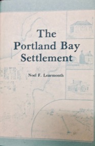
Book, The Historical Committee Of Portland, The Portland Bay Settlement, 1934
Aboriginal resistance to settlement, Native Police Force, G.A. Robinsons proposal to re-settle Flinders Island people and extracts fom his 1841 expedition report. Contents I. The early navigators and explorers II. Sealers and whalers and tales of the sea III. The Hentys and Victoria's first permanent settlement IV. Early incidents and personalities V. Under government control Vi. Social life and activities VII. The story of the press VIII. Business, professions and industry IX. Hotels and roads X. Sport XI. Environs of Portland XII. Miscellaneous historical items.8vo; pp. x, 285; frontispiece, numerous b/w illustrations, plans and maps two of which are folding, index, appendices including "List of Purchasers at original land sale", "First Election List", "Subscription lists for both First Church of England and First Presbyterian Church", original blue cloth, title in gilt on spinenon-fictionAboriginal resistance to settlement, Native Police Force, G.A. Robinsons proposal to re-settle Flinders Island people and extracts fom his 1841 expedition report. Contents I. The early navigators and explorers II. Sealers and whalers and tales of the sea III. The Hentys and Victoria's first permanent settlement IV. Early incidents and personalities V. Under government control Vi. Social life and activities VII. The story of the press VIII. Business, professions and industry IX. Hotels and roads X. Sport XI. Environs of Portland XII. Miscellaneous historical items.robinson, george augustus, 1791-1866., government policy - initial period and protectionism - 1788-1850., government policy - state and territory - victoria., law enforcement - police - native police., race relations - violent - massacres, murders, poisonings etc. - to 1900., sport., pioneers -- victoria -- portland., portland (w vic sj54-11), portland (vic.) -- history., book -
 Port Fairy Historical Society Museum and Archives
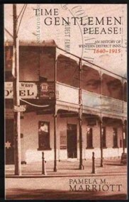
Book, Pam Marriott, Time gentlemen please! : an history of Western District inns, 1840-1915, 2001
Time Gentlemen Please! : A History of Western District Inns 1840-1915 An historical record of the public houses, which flourished in Belfast and Western District during the timeframe, complete with licensees.xix, 327 p. : ill., map, ports. ; 24 cm. Includes indexnon-fictionTime Gentlemen Please! : A History of Western District Inns 1840-1915 An historical record of the public houses, which flourished in Belfast and Western District during the timeframe, complete with licensees.bars (drinking establishments) -- victoria -- western district, victoria -- social life and customs -- 1901-1945, victoria -- social life and customs -- 1834-1900, book -
 Port Fairy Historical Society Museum and Archives
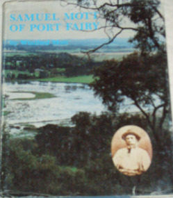
Book, Roebuck, Samuel Mott of Port Fairy, 1984
Samuel Mott of Port Fairy, his background and descendantsviii, 266 p. : ill., facsims., geneal. tables, maps, ports. ; 27 cm. Map and geneal. tables on lining papers. Bibliography: p. viii.non-fictionSamuel Mott of Port Fairy, his background and descendantsmott, ca1790-1873. samuel, mott family, victoria -- genealogy, port fairy history, book -
 Port Fairy Historical Society Museum and Archives
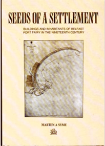
Book, Roebuck, Seeds of settlement :Buildings and Inhabitants of Belfast Port Fairy in the Nineteenth Century, 1991
Seeds of a settlement : a perspective of Port Fairy in the second half of the nineteenth century through the surviving buildings and their inhabitants / Marten A. Symexii, 158, [1] p. folded leaf of plate : ill., maps, ports. ; 25 cm. non-fictionSeeds of a settlement : a perspective of Port Fairy in the second half of the nineteenth century through the surviving buildings and their inhabitants / Marten A. Symeport fairy (vic.) -- history, book, history, biography, port fairy, residents, buildings -
 Port Fairy Historical Society Museum and Archives
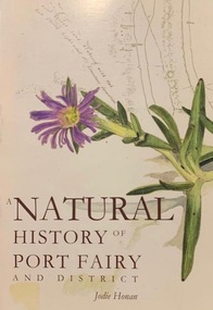
Book, Port Fairy Historical Society, A Natural History of Port Fairy and District, 2009
Natural history of Port Fairy Includes bibliographical references and index136 p. : ill., maps, ports. ; 22 cm.non-fictionNatural history of Port Fairy Includes bibliographical references and indexnatural history -- victoria -- port fairy., natural history, honan jodie, book -
 Vision Australia
Photograph - Image, Ron Goodwin reading a map of Wynyard train station, 1969?
Ron Goodwin reads a tactile map of Wynyard Railway Station in Sydney's CBD. The map was made at the Sydney Tesol College with wood working machinery and painting/decorating sections. In front of Ron sits a ultrasonic torch.B/W photograph of man looking at relief map of Wynyard Station14/69051 Ann. Report Orientation - historicalroyal blind society of nsw, ron goodwin, maps -
 Vision Australia
Photograph - Image, Using a 3D map of Sydney
... Learning layout of City of Sydney by raised map Orientation... - historical RBS XI B/W photograph of blind man using relief map Using ...A blind man feels model buildings on a relief map of the Sydney CBD whilst two others look on. B/W photograph of blind man using relief mapLearning layout of City of Sydney by raised map Orientation - historical RBS XIroyal blind society of nsw, maps -
 Vision Australia
Photograph - Image, Ron Bruce reading Sydney Train map, 1971?
Ron Bruce reading a Braille map of Sydney's railway network.B/W photograph of man reading braille map1/71016 M&O -historicalroyal blind society of nsw, ron bruce, maps -
University of Melbourne, Burnley Campus Archives
Map, Photo Mapping Services Pty. Ltd, Burnley College Burnley Gardens, 1995
HistoricalMap compiled by Photo Mapping Services Pty. Ltd., using aerial photography, dated 9th July, 1995. (1) Coloured proof. Scale 1:500. Aerial views, with and without trees marked, of Burnley Gardens: (2) Map with trees (3) Map without trees, sections numbered but no legend.burnley college, gardens, trees -
 Lilydale RSL Sub Branch
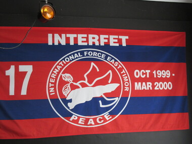
Flag, Panhandling Australia Pty Ltd, Interfet
Red and blue horizontal stripes. The words Interfet - ttop centre. No 17 LHS October 1999 - March 2000 RHS. Historical information - Double circle, in centre is a map of East Timor with floral emblem, surrounded by the words 'International Force East Timor, Peace at base of circle. -
 Port Fairy Historical Society Museum and Archives
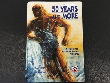
Book, Alan Best and Contributors, 50 Years and More / A History of Surf Life Saving Victoria
History of Surf Life Saving Victoria over 50 years154p. :I;;. (Some col.), maps. Ports., fascism,:non-fictionHistory of Surf Life Saving Victoria over 50 yearssurf life saving victoria, surf lifesaving (aquatic sports), history, book -
 Falls Creek Historical Society
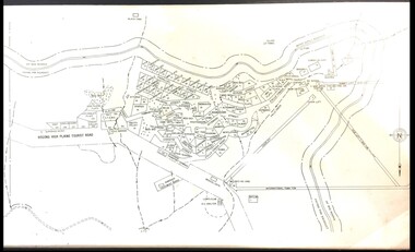
Map - Falls Creek mid 1970s
A site map produced for the Falls Creek Tourist Area Management CommitteeThis map is significant because it documents an important stage in the development of Falls Creek, Victoria.A framed and mounted site map of Falls Creek mid 1970sfalls creek tourist area management committee, falls creek tourist area, falls creek 1970s -
 Falls Creek Historical Society
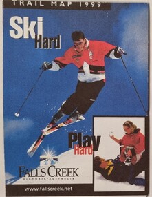
Booklet - Falls Creek Cross Country Trail Guide 1999
This publication was developed by the Falls Creek Resort Management Committee to promote activities and facilities at Falls Creek for the Winter Season 1999. It was a publication specifically focused on cross country skiers. This item is significant because it illustrates how Falls Creek has been marketed and promoted over time.A coloured fold out trail guide including a map of all trailsfalls creek trails, falls creek marketing, falls creek promotion, cross country skiing -
 Falls Creek Historical Society
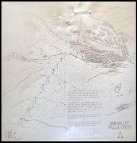
Map - Sun Valley, Falls Creek, 1966
This hand drawn map shows the Gully Chair, Summit Tow and the Village Tow. It also highlights the Nursery Poma. Several buildings can be seen along with the Visitor Centre in the Gully carpark, Skyline can can be seen adjacent to the Gully Chair. The Sun Valley T-Bar was designed by Ron McCallum and began operation in 1967. It had a length of 826 metres and an elevation of approximately 200 metres. In 1989 the Sun Valley T-Bar was replaced by the Scott Quad. Ron McCallum was a founder of Alpine Developments. It appears that his first lift was the Skyline portable tow at Falls Creek in 1954. As an engineer, he went on to build about 20 chairlifts and T-bars in the 1960s and early 1970s including at least five at Falls Creek. This map is significant because it shows plans for the development of a major tow at Falls Creek in the 1960s.A framed black and white concept map for the proposed new lift in Sun Valley, Falls Creek.sun valley tow, ron mccallum, falls creek tows -
 Falls Creek Historical Society
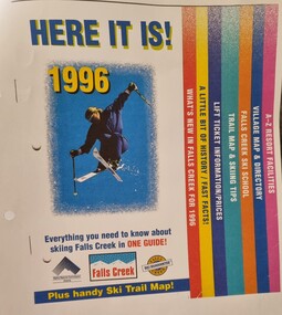
Booklet - Falls Creek Guide 1996 - HERE IT IS!
Falls Creek Resort Management produce a range of marketing materials for each season. This publication titled "HERE IT IS!" aims to include everything you need to know about skiing at Falls Creek in one guide. It also included a Ski Trail map. Sections included are:- What's new in Falls Creek for 1995 A little bit of History/fast facts Trail map and skiing tips Falls Creek Ski School Village map and directory A - Z Resort facilitiesThis item is significant because it illustrates how Falls Creek has been marketed and promoted over time.A coloured publication including images, maps and text covering all aspects of Falls Creek for the 1996 season. The cover features an image of a skier in the air. Seven sections are colour coded on the right hand edge of At bottom of page logos are included Left to right;- Alpine Resorts Commission Victoria; Falls Creek: Falls Creek Ski Guaranteefalls creek facilities, falls creek activities, falls creek marketing -
 Mrs Aeneas Gunn Memorial Library
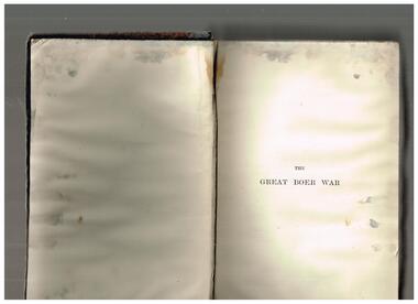
Book, Arthur Conan Doyle, The great Boer war, 1902
While most people remember Sir Arthur Conan Doyle for his 'Sherlock Holmes' stories, he actually wanted more to be a journalistic and historical writer. This is one of his works in that vein, documenting the events of the Boer War, which had yet to end at the time of writing.Index, maps, p.743.non-fictionWhile most people remember Sir Arthur Conan Doyle for his 'Sherlock Holmes' stories, he actually wanted more to be a journalistic and historical writer. This is one of his works in that vein, documenting the events of the Boer War, which had yet to end at the time of writing.boer war 1899-1902, arthur conan doyle -
 Mrs Aeneas Gunn Memorial Library
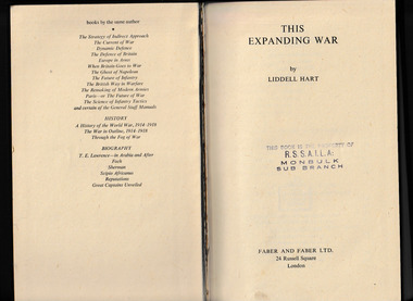
Book, Faber and Faber, This expanding war, 1943
A brief history of the initial years of World War TwoIndex, maps, p.278.non-fictionA brief history of the initial years of World War Twoworld war 1939-1945 - history, war - historical treatment -
 Mrs Aeneas Gunn Memorial Library
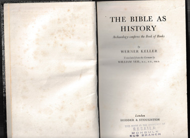
Book, Hodder & Stoughton, The Bible as history : archaeology confirms the Book of Books, 1956
... a historical perspective Index, ill, maps, p.436. The Bible as history ...A study of the bible from a historical perspectiveIndex, ill, maps, p.436.non-fictionA study of the bible from a historical perspectivebible - history, bible - interpretation -
Canterbury History Group
Document - School Project: Elgar's Special Survey, Tudehope, Jennifer, 1963
Well researched essay on the background of Elgar's Special Survey. Includes mapcanterbury, elgar> henry t., land surveys, boroondara, campbell> j & r, dacre> r, towns> r., sea> h., dyce> a., mccarthy> w.g., shenley> james, henty's paddock, norris> j.r., maling> j, canterbury road, survey road, boroondara roads board, camberwell historical society, mont albert road, brooks> r., land subdivisions -
 Kilmore Historical Society
CHAMBERS INFORMATION FOR THE PEOPLE VOL 2, 1848
Faded brown loose cloth cover with embossed detailing on cover and spine 'Chambers information for the people, Vol 2, History - Geography' 809 pages ; Maps; Illus; Handwritten inscription on first page - '37, 41, 040 CHA R 29' Stamp on various pages 'Kilmore Mechanics Institute' encyclopedia, kilmore mechanics institute library. -
 Kilmore Historical Society
CHAMBERS INFORMATION FOR THE PEOPLE VOL 1, 1848
Faded brown loose cloth cover with embossed detailing on cover and spine 'Chambers information for the People, Vol 1 Sciences - Arts & C.' 809 pages ; Maps; Illus; 27cm Handwritten inscription on first page - '36, 41, 040 CHA R 28' Stamp on various pages 'Kilmore Mechanics Institute' science, arts, kilmore mechanics institute library. -
 Kilmore Historical Society
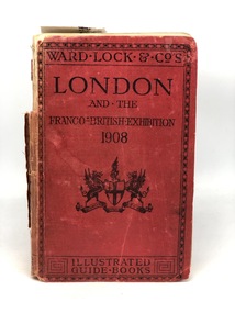
LONDON AND THE FRANCO-BRITISH-EXHIBITION 1908, 1908
Red cloth cover, loose front cover and pages With printed detailing on cover and spine 'London; Ward-Lock & Co's; London and the Franco-British-Exhibition 1908; Illustrated Guide Books' xliv; A-T; 97 pages ; 17cm; Illus; Maps kilmore mechanics institute library. -
 Kilmore Historical Society
KEYE AND MALLESON'S HISTORY OF THE INDIA MUTINY OF 1856-8, Kaye and Malleson's history of the India mutiny of 1856-8 Vol.IV, 1889
Red cloth cover with gold writing on the spine and cover damaged binding and some ripped pages xxxvi, 412 pages ; ǂc 19 cm ; maps205 marked in pen on first page 'Mechanics Institute Kilmore' Stamp Dedicated by author to the memory of his brother in law Quintin Battyehistory, 1857-1858, india mutiny, kilmore mechanics institute library. -
 Kilmore Historical Society
KEYE AND MALLESON'S HISTORY OF THE INDIA MUTINY OF 1856-8, Kaye and Malleson's history of the India mutiny of 1856-8 Vol.II, 1889
Red cloth cover with gold writing on the spine and cover damaged binding and some ripped pages xxiv, 506 pages ; ǂc 19 cm ; maps 203 marked in pen on first page 'Mechanics Institute Kilmore' Stamp Dedicated by author to the memory of his brother in law Quintin Battyehistory, 1857-1858, india mutiny, kilmore mechanics institute library. -
 Kilmore Historical Society
KEYE AND MALLESON'S HISTORY OF THE INDIA MUTINY OF 1856-8, Kaye and Malleson's history of the India mutiny of 1856-8 Vol.V, 1889
Red cloth cover with gold writing on the spine and cover damaged binding and some ripped pages xxiv, 362 pages ; ǂc 19 cm ; maps206 marked in pen on first page 'Mechanics Institute Kilmore' Stamp Dedicated by author to the memory of his brother in law Quintin Battyehistory, 1857-1858, india mutiny, kilmore mechanics institute library. -
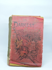 Kilmore Historical Society
In Darkest Africa, In Darkest Africa or the Quest Rescue and Retreat of EMIN Governor of Equatoria, 1890
Late Victorian travels, skirmishes and adventures in Africa. Colonial edition not for sale in Great Britain.Brown cardboard covered book with printed red paper overlay. Poor condition. Spine missing, splitting of volume. Paper detached from front cover. Front cover partially detached, back cover detached. 38 Full Plate illustrations. Other woodcut illustrations. 4 maps. 635pp. Indexed.P.2 Mechanics Institute Kilmore stamp, '79'.kilmore mechanics institute library. -
 Kilmore Historical Society
Himalayan Journals, Himalayan Journals or Notes of a Naturalist, Vol. 1 of 2, 1854
Notes of a naturist in Bengal, the Sikkim, and Nepal Himalayas, the Khasia Mountains, etc. Dedicated to Charles Darwin by his affectionate friend, the author.Red/brown cloth-covered hardback book. Embossed design around borders of front and back covers, front cover shows central image in gold colour. Maps and engraved illustrations. Cover worn & stained. Fair condition.Sticker inside front cover, 'Upham & Beet/(late Redwell)/46,New Bond Street'. On 2nd flyleaf '83'. Title page has small cut out section top right corner.kilmore mechanics institute library. -
Canterbury History Group
Book, Richard Broome, Remembering Melbourne 1850-1960, 2016
A book of over 700 black and white illustrations and photographs of early Melbourne scenes, mainly buildings, which have been demolished or significantly changed. The first half of the book concentrates on the CBD but includes public gardens and the Yarra River. The second half of the book looks at a number of the inner suburbs including Footscray.Large red covered book with black and white dust cover featuring panoramic view of Princes Bridge looking North. 366 pages : photographs, 1 map, portraits. Includes bibliographical references and indexnon-fictionA book of over 700 black and white illustrations and photographs of early Melbourne scenes, mainly buildings, which have been demolished or significantly changed. The first half of the book concentrates on the CBD but includes public gardens and the Yarra River. The second half of the book looks at a number of the inner suburbs including Footscray.historical buildings - melbourne, melbourne - history, canterbury - history -
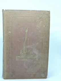
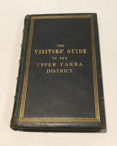 Mont De Lancey
Book, The visitors' guide to the Upper Yarra District
Presented to the Wandin Historical Society by Mrs. Noel Rowe (nee Massina), 1992. Restored by Apollo Moon.Navy hard covered book with gold embossing of title and decorative border. Includes maps and blank pages. Has marbled end papers.upper yarra, yarra river