Showing 143117 items
matching colour-photograph
-
 Greensborough Historical Society
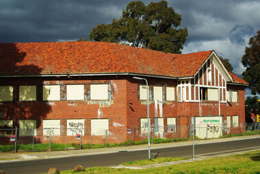
Photograph - Digital Image, Marilyn Smith, Larundel. Blocks A and B, front, 05/09/2017
This photograph shows the front of Blocks A and B at the old Larundel Hospital site. Some buildings on this site are heritage listed on the Victorian Heritage Database.Digital copy of colour photographlarundel hospital -
 Greensborough Historical Society
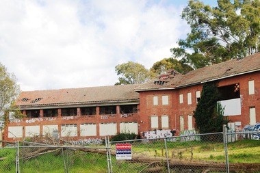
Photograph - Digital Image, Marilyn Smith, Larundel. Block B, rear, 05/09/2017
This photograph shows the rear of Block B at the old Larundel Hospital site. Some buildings on this site are heritage listed on the Victorian Heritage Database.Digital copy of colour photographlarundel hospital -
 Greensborough Historical Society
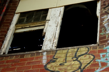
Photograph - Digital Image, Marilyn Smith, Architectural detail at Larundel, 05/09/2017
This photograph shows architectural detail on buildings at the old Larundel Hospital site. Some buildings on this site are heritage listed on the Victorian Heritage Database. Digital copy of colour photographlarundel hospital -
 Greensborough Historical Society
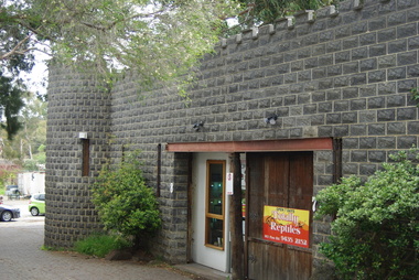
Photograph - Digital Image, Totally Reptiles, 183 Para Road, 06/11/2017
This photograph shows the exterior of the building at 183 Para Road when it was used for Totally Reptiles, who shared the building with Greensborough Grain Store.In 2017, the Greensborough Grain Store closed its Para Road premises and now trades online.Digital copy of colour photographgreensborough grain store, para road greensborough, totally reptiles -
 Greensborough Historical Society
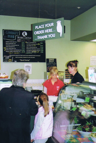
Photograph - Digital image, Frank Solomon, The Snug Cafe St Helena 3, 1990c
St Helena Marketplace was the site of "The Snug". These photographs were taken by Frank Solomon and depict a cafe called The Snug, which is no longer operating.Digital copy of colour photographthe snug, st helena marketplace -
 Greensborough Historical Society
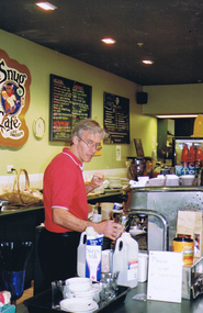
Photograph - Digital image, Frank Solomon, The Snug Cafe St Helena 4, 1990c
St Helena Marketplace was the site of "The Snug". These photographs were taken by Frank Solomon and depict a cafe called The Snug, which is no longer operating.Digital copy of colour photographthe snug, st helena marketplace, st helena -
 Glen Eira Historical Society
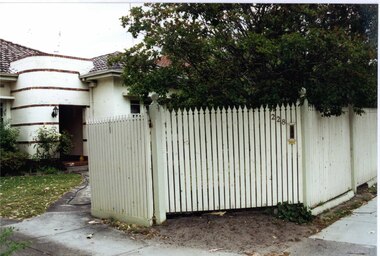
Photograph, Murrumbeena Road, 228, Murrumbeena, 2001
Originally labelled "Beauville Estate, Established 1936, Still Thriving 65 years on, 10th March 2001", the Beauville Estate Album contains colour photographs of houses in the Estate. They were taken around the time of the Beauville Estate’s 65th Heritage Celebration held on 10/03/2001 and donated to the Caulfield Historical Society shortly afterwards. Photographer unknown.City of Glen Eira’s Heritage Management Plan Vol 2 p79 (this is p84 of the pdf version) – HO12 Beauville Estate and environs, Murrumbeena: The Beauville Historic Area is important at the State level as the first large housing estate undertaken by the AV Jennings Construction Co, later Jennings Group Limited, Victoria’s largest home builder. It is important also as a very early estate development incorporating a range of features other than houses and including made roads, shops and recreation facilities. In this respect it was the forerunner of the comprehensively planned housing estate of the post war era. The estate is distinguished by its aesthetic values, as is the earlier and comparable Hillcrest Estate, which are formed by a combination of restrained diversity in house styles, with the exception of no. 30 in the emerging International style, and by a landscaped garden environment. See Significance Statement in Glen Eira’s Heritage Management Plan by Andrew Ward (1996) Vol 2 p.79. Available from https://www.gleneira.vic.gov.au/media/4779/heritage_management_plan_volume_2.pdf (Note see p.84 of pdf)Colour photograph of a white, rendered, brick house. Other features include an enclosed porch with a curved wall decorated with narrow bands of bricks, a tiled roof and a tall white picket fence and gate with "228" and a letterbox in the middle section.murrumbeena, houses, architectural styles, 1930's, inter war style, a.v. jennings, av jennings, jennings, brick houses, beauville estate, porches, jennings albert victor, murrumbeena road, sir albert victor jennings, a v jennings construction co, beauville estate heritage area, glen eira city council, architectural features, jennings group limited, land subdivision, gardens, beauville historic area, rendered houses, brick features, picket fences -
 Clunes Museum
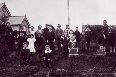
Photograph, ROGER PURCELL, BALARAT
ORIGINAL PHOTOGRAPH OWNED BY MRS. LENA COOK OF CASTLEMAINE ROAD, CRESWICK..1 .2 BLACK & WHITE COPIES (NO ORIGINAL IN COLLECTION), PHOTOGRAPH OF SCHOOLCHILDREN AND THEIR TEACHER - TOURELLO SCHOOL.ON BACK OF ORIGINAL PHOTOGRAPH - W.H. POINTER - PHOTOGRAPHER - CLUNES.local history, photography, photographs, schools, tourello -
 Greensborough Historical Society
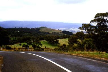
Slide - Photograph, John Ramsdale, Whittlesea to Wallan Road: Slide 89, 1990s
Photograph shows road and rural scene. this is the Whittlesea to Wallan Road north of Whittlesea.Part of the John Ramsdale collection of slides and audio visual material.Colour photograph scanned from slide.No maker's marks. No caption on slide.whittlesea, wallan, whittlesea to wallan road -
 Greensborough Historical Society
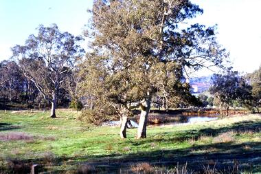
Slide - Photograph, John Ramsdale, Lower Plenty with Odyssey House in background: Slide 103, 1990s
Photograph shows gum trees in paddock. This is in Lower Plenty with Odyssey House in background.Part of the John Ramsdale collection of slides and audio visual material.Colour photograph scanned from slide.No maker's marks. No caption on slide.lower plenty, odyssey house -
 Greensborough Historical Society
Slide - Photograph, John Ramsdale, Lower Plenty and Rosanna Golf Course: Slide 111, 1990s
Photograph shows a rural scene in Lower Plenty and Rosanna Golf Course to rightPart of the John Ramsdale collection of slides and audio visual material.Colour photograph scanned from slide.No maker's marks. No caption on slide.lower plenty, rosanna golf course -
 Greensborough Historical Society
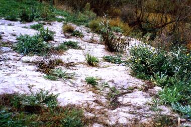
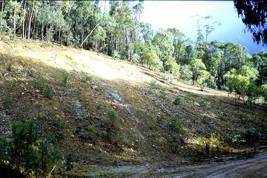
Slide - Photograph, John Ramsdale, Weeds in sandy soil: Slide 114, 1990s
Photograph shows weeds growing in sandy soil, an indication of poor soil management.Part of the John Ramsdale collection of slides and audio visual material.Colour photograph scanned from slide.No maker's marks. No caption on slide.land management, weeds -
 Greensborough Historical Society
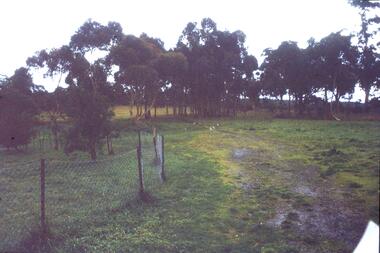
Slide - Photograph, John Ramsdale, Rural scene: Slide 17, 1990s
Photograph shows a rural scene with post and wire fence and trees. Location unknown.Part of the John Ramsdale collection of slides and audio visual material.Colour photograph scanned from slide.No caption. Printed maker's mark on slide "Kodak Kodachrome Slide"rural landscape -
 Greensborough Historical Society
Slide - Photograph, John Ramsdale, Plenty River behind football ground: Slide 51, 1990s
Photograph shows a river and bushland. This is the Plenty River behind the football ground in Greensborough.Part of the John Ramsdale collection of slides and audio visual material.Colour photograph scanned from slide.No maker's marks. Caption on slide "Plenty"plenty river greensborough, plenty river -
 Greensborough Historical Society
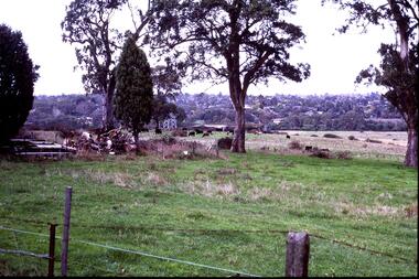
Slide - Photograph, John Ramsdale, Near scar tree Yallambie: Slide 48, 1990s
Photograph shows rural view with cattle and trees. This is the scar or canoe tree in Yallambie. Part of the John Ramsdale collection of slides and audio visual material.Colour photograph scanned from slide.No caption. Printed maker's mark on slide "Kodak Kodachrome Slide"scar tree, canoe tree, yallambie -
 Greensborough Historical Society
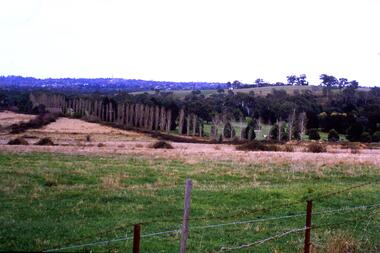
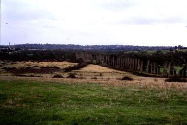
Slide - Photograph, John Ramsdale, Looking towards Bulleen brickworks; Slide 126, 1990s
Photograph shows a rural view with paddocks and trees, looking towards Bulleen brickworks.Part of the John Ramsdale collection of slides and audio visual material.Colour photograph scanned from slide.No caption. Printed maker's mark on slide "Kodak Kodachrome Slide"bulleen -
 Greensborough Historical Society
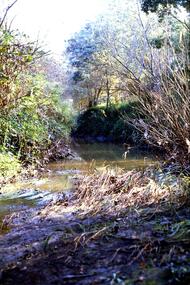
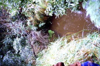
Slide - Photograph, John Ramsdale, Source of the Plenty River: Slide 32, 1990s
Photograph of the source of the Plenty River at Bruces Creek Whittlesea showing water and vegetation.Part of the John Ramsdale collection of slides and audio visual material.Colour photograph scanned from slide.No maker's marks. No caption on slide.plenty river, vegetation, whittlesea -
 Greensborough Historical Society
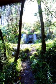
Slide - Photograph, John Ramsdale, Drain into Plenty River: Slide 71, 1990s
Photograph shows a culvert or drain with graffiti - long view This drains into the Plenty River.Part of the John Ramsdale collection of slides and audio visual material.Colour photograph scanned from slide.No maker's marks. No caption on slide.plenty river -
 Greensborough Historical Society
Slide - Photograph, John Ramsdale, Headwaters of the Plenty River: Slide 81, 1990s
Photograph shows hill with trees and run off to the river. This is the headwaters of the Plenty River.Part of the John Ramsdale collection of slides and audio visual material.Colour photograph scanned from slide.No maker's marks. No caption on slide.plenty river -
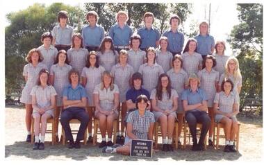
 Greensborough Historical Society
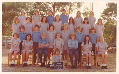
School Photograph - Digital Image, Watsonia High School, Watsonia High School WaHIGH 1976 Form 1A, 1976_
A class photograph of Watsonia High School 1976 Form 1A. Students are not named.Digital copy of colour school photographwatsonia high school -
 Greensborough Historical Society
School Photograph - Digital Image, Watsonia High School, Watsonia High School WaHIGH 1976 Form 4D, 1976_
A class photograph of Watsonia High School 1976 Form 4D. Students are not named.Digital copy of colour school photographwatsonia high school -
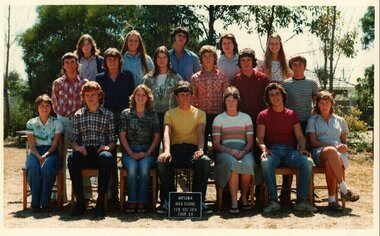 Greensborough Historical Society
School Photograph - Digital Image, Watsonia High School, Watsonia High School WaHIGH 1976 Form 6A, 1976_
A group photograph of Watsonia High School 1976 Form 6A. Students are not named.Digital copy of colour school photographwatsonia high school -
![Photograph - Digital image, Greensborough Cemetery [view 5], 08/03/2012](/media/collectors/4f729f5697f83e03086015b8/items/54c4afd22162f1070475eca3/item-media/54c4b0222162f1070475f0d9/item-fit-380x285.jpg) Greensborough Historical Society
Greensborough Historical SocietyPhotograph - Digital image, Greensborough Cemetery [view 5], 08/03/2012
View of Greensborough Cemetery on 8/3/2012. Photograph taken by Jasmin Burge.Greensborough Cemetery was created when land was given for the cemetery by Mr William Poulter, a local settler, about 1864. The cemetery holds the graves of many of the early settlers in the district. The cemetery holds approximately 250 grave sites with 350 people buried there. Digital copy of colour photograph of cemetery.greensborough cemetery -
![Photograph - Digital image, Greensborough Cemetery [view 6], 26/07/2011](/media/collectors/4f729f5697f83e03086015b8/items/54c4b0aa2162f1070475f8a9/item-media/54c4b0df2162f1070475fb80/item-fit-380x285.jpg) Greensborough Historical Society
Greensborough Historical SocietyPhotograph - Digital image, Greensborough Cemetery [view 6], 26/07/2011
View of Greensborough Cemetery 26/07/2011. Photograph taken by Jasmin Burge.Greensborough Cemetery was created when land was given for the cemetery by Mr William Poulter, a local settler, about 1864. The cemetery holds the graves of many of the early settlers in the district. The cemetery holds approximately 250 grave sites with 350 people buried there. This photo captures the grave of Giles Poulter.Digital copy of colour photograph of cemetery.greensborough cemetery -
![Photograph - Digital image, Greensborough Cemetery [view 7], 04/10/2011](/media/collectors/4f729f5697f83e03086015b8/items/54c4b1412162f107047606db/item-media/54c4b1702162f10704760d3a/item-fit-380x285.jpg) Greensborough Historical Society
Greensborough Historical SocietyPhotograph - Digital image, Greensborough Cemetery [view 7], 04/10/2011
View of Greensborough Cemetery 04/10/2011. Photograph taken by Jasmin Burge.Greensborough Cemetery was created when land was given for the cemetery by Mr William Poulter, a local settler, about 1864. The cemetery holds the graves of many of the early settlers in the district. The cemetery holds approximately 250 grave sites with 350 people buried there. Digital copy of colour photograph of cemetery.greensborough cemetery -
![Photograph - Digital image, Greensborough Cemetery [view 2], 08/03/2012](/media/collectors/4f729f5697f83e03086015b8/items/54c4b1cd2162f10704761367/item-media/54c4b1fd2162f1070476170e/item-fit-380x285.jpg) Greensborough Historical Society
Greensborough Historical SocietyPhotograph - Digital image, Greensborough Cemetery [view 2], 08/03/2012
View of Greensborough Cemetery 08/03/2012. Photograph taken by Jasmin Burge.Greensborough Cemetery was created when land was given for the cemetery by Mr William Poulter, a local settler, about 1864. The cemetery holds the graves of many of the early settlers in the district. The cemetery holds approximately 250 grave sites with 350 people buried there. Digital copy of colour photograph of cemetery.greensborough cemetery -
![Photograph - Digital image, Greensborough Cemetery [view 3], 26/07/2011](/media/collectors/4f729f5697f83e03086015b8/items/54c4b25a2162f10704761bfa/item-media/54c4b2882162f10704761e1b/item-fit-380x285.jpg) Greensborough Historical Society
Greensborough Historical SocietyPhotograph - Digital image, Greensborough Cemetery [view 3], 26/07/2011
View of Greensborough Cemetery 26/07/2011. Photograph taken by Jasmin Burge.Greensborough Cemetery was created when land was given for the cemetery by Mr William Poulter, a local settler, about 1864. The cemetery holds the graves of many of the early settlers in the district. The cemetery holds approximately 250 grave sites with 350 people buried there. Digital copy of colour photograph of cemetery.greensborough cemetery -
![Photograph - Digital image, Greensborough Cemetery [view 4], 26/07/2011](/media/collectors/4f729f5697f83e03086015b8/items/54c4b2e12162f10704762248/item-media/54c4b30e2162f107047625ec/item-fit-380x285.jpg) Greensborough Historical Society
Greensborough Historical SocietyPhotograph - Digital image, Greensborough Cemetery [view 4], 26/07/2011
View of Greensborough Cemetery 26/07/2011. Photograph taken by Jasmin Burge.Greensborough Cemetery was created when land was given for the cemetery by Mr William Poulter, a local settler, about 1864. The cemetery holds the graves of many of the early settlers in the district. The cemetery holds approximately 250 grave sites with 350 people buried there. Digital copy of colour photograph of cemetery.greensborough cemetery -
![Photograph - Digital image, Greensborough Cemetery [view 8], 26/07/2011](/media/collectors/4f729f5697f83e03086015b8/items/54c4b51b2162f1070476504c/item-media/54c4b54c2162f107047653e7/item-fit-380x285.jpg) Greensborough Historical Society
Greensborough Historical SocietyPhotograph - Digital image, Greensborough Cemetery [view 8], 26/07/2011
View of Greensborough Cemetery 26/07/2011. Photograph taken by Jasmin Burge.Greensborough Cemetery was created when land was given for the cemetery by Mr William Poulter, a local settler, about 1864. The cemetery holds the graves of many of the early settlers in the district. The cemetery holds approximately 250 grave sites with 350 people buried there. Digital copy of colour photograph of cemetery.greensborough cemetery -
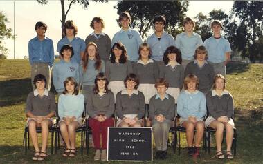 Greensborough Historical Society
School Photograph - Digital Image, Watsonia High School WaHIGH 1982 Year 11A, 1982_
The photograph shows a Watsonia High School class from 1982, Year 11AWatsonia High School was a local educational facility that was closed in 1989. Greensborough Secondary College opened in 1990 which merged Watsonia High and Watsonia Technical Schools together. Digital copy of a colour school photograph.watsonia high school