Showing 1346 items
matching back creek
-
 Ringwood and District Historical Society
Photograph, Adelaide Street Ringwood. c1918
Black and white photograph"Written on back of photograph" Adelaide Street, near Mullum Creek. -
 Ringwood and District Historical Society
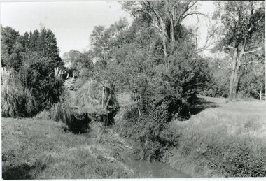
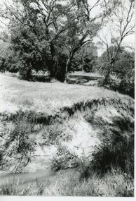
Photograph, Mullum Mullum Creek- 29-10-89
Black and white photograph"Written on back of photograph" Mullum Mullum Creek Looking East (upstream) North Bank near Harrison St -
 Ringwood and District Historical Society
Photograph, Mullum Mullum Creek- 29-10-89
Black and white photograph"Written on back of photograph" Mullum Mullum Creek North bank looking West Near Harrison St -
 Ringwood and District Historical Society
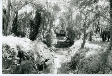
Photograph, Mullum Mullum Creek- 29-10-89
Black and white photograph"Written on back of photograph" Mullum Mullum Creek North bank view towards the West. Taken West of Harrison St.. Weed infested scrub on banks. -
 Ringwood and District Historical Society
Photograph, Mullum Mullum Creek- 29-10-89
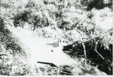
Black and white photograph"Written on back of photograph" Mullum Mullum Creek North bank West of Harrison St Rubbish and weeds - view generally to the East -
 Ringwood and District Historical Society
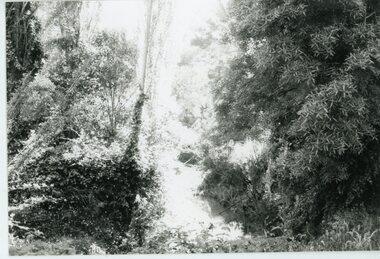
Photograph, Mullum Mullum Creek- 29-10-89
Black and white photograph"Written on back of photograph" Mullum Mullum Creek From North bank (Munro St side)View generally downstream West of Harrison St Note rubbish and weeds. -
 Ringwood and District Historical Society
Photograph, Mullum Mullum Creek- 29-10-89
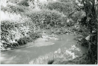
Black and white photograph"Written on back of photograph" Mullum Mullum Creek View downstream from North bank. A most pleasant part near New St (South bank) -
 Ringwood and District Historical Society
Photograph, Mullum Mullum Creek- 29-10-89
Black and white photograph"Written on back of photograph" Mullum Mullum Creek North bank. A swampy patch at the rear of a Munro St property. Not drained or cared for. -
 Ringwood and District Historical Society
Photograph, Mullum Mullum Creek- 29-10-89
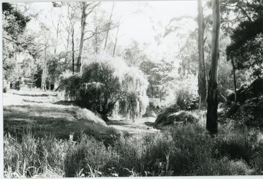
Black and white photograph"Written on back of photograph" Mullum Mullum Creek Near Acacia St -
 Orbost & District Historical Society
framed photograph
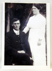
William Garnet Macalister's parents, Thomas Mewburn and Ruth Hannah Macalister, owned and operated "Orbost House". William Garnet Macalister was born at Bairnsdale in 1884 and at Sale, aged 72, in 1958. He operated a line of coaches conveying passengers and parcels from Orbost to Cabbage Tree Creek, Club Terrace, Cann River and surrounding districts. The service departed from Orbost on Wednesdays and from the Cann River Hotel on Fridays. He was also Orbost's first milkman. He married Ethel Roda SAYERS in 1909. ( Information from John Phillips) The Macalister family is associated with early Orbost.A copy of a b/w 1920 wedding photograph. It is in a wooden frame. The photo is of a groom, William Garnet Macalister, seated with his bride, Ethel, Roda Macalister, standing on his right an arm at his back.Handwritten on back - WILLIAM GARNET MACALISTER - SON OF THOMAS MEWBURN MACALISTER RUTH HANNAH MACALISTER OF ORBOST HOUSE B 1910 died 2003 (93 years old) ETHEL RODA MACALISTER (nee SAYERS)macalister-william macalister-ethel orbost-house -
 Ringwood and District Historical Society
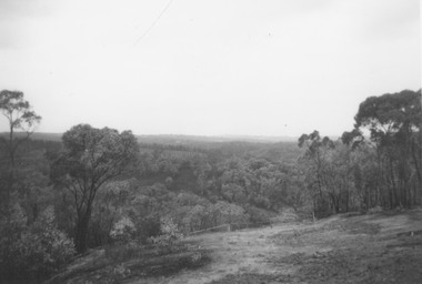
Photograph, Looking down range from 600 yard mound at Ringwood Rifle Range, Jumping Creek Reserve - 1965
Written on back of photograph, "Looking down range from 600 yard mound - 1965". -
 Ringwood and District Historical Society
Photograph, Ringwood Rifle Range, Jumping Creek Reserve hut at 600 yards mound, 1962
Written on back of photograph, "Range hut at 600 yards mound - 1962". -
 Ringwood and District Historical Society
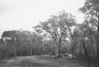
Photograph, Ringwood Rifle Range, Jumping Creek Reserve after the January 1962 bushfires, with the 300 yard hut still standing
Written on back of photograph, "Ringwood Rifle Range, Jumping Creek Reserve after fires, January 1962. 300 yard hut still standing." -
 Ringwood and District Historical Society
Photograph, The remains of the target shed at Ringwood Rifle Range, Jumping Creek Reserve after the January 1962 bushfires
Written on back of photograph, "Target shed after fires - 1962". -
 Ringwood and District Historical Society
Photograph, View up range from the target pit at Ringwood Rifle Range, Jumping Creek Reserve after the January 1962 bushfires
Written on back of photograph, "Looking from target pit up range after fires, 1962." -
 Ringwood and District Historical Society
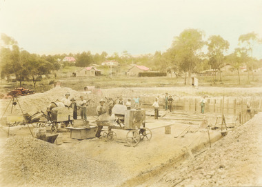
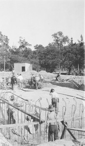
Photograph, Construction of Ringwood baths, Miles Avenue. Construction began in January 1934 and the pool was officially opened in November that year
Coloured photograph. Photograph taken by "Mervyne" Ringwood Studios."Written on back of photograph" Ringwood baths under construction. Photo taken from corner of Ringwood St & Miles Ave. Houses just above baths are in Reynolds Ave & top left in Warrandyte Road. Top centre- corner Warrandyte Road & Woodside Ave. White railing centre right is on the bridge across Mullum Creek. Adelaide St ran from Maroondah Highway to Reynolds Ave. Bridge later washed away- 1931. -
 Ringwood and District Historical Society
Photograph, Ringwood baths under construction, 1934. White railing at centre right is on the bridge across Mullum Creek
Sepia photograph"Written on back of photograph" Building baths Ringwood St. Looking Nth West. -
 Ringwood and District Historical Society
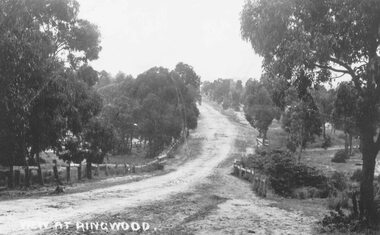
Photograph, Maroondah Highway East, Ringwood- 1870. Sandy Creek, now Ringwood Lake
3 photographs (2 large black and white, 2 small- 1 black and white, 1 sepia) Written on all photographs, "View at Ringwood" Typed below large photograph: "Main St looking east. Right hand side of gully now Ringwood Lake. Written on back of sepia print: "1870, Sandy Creek now Ringwood Lake" -
 Ringwood and District Historical Society
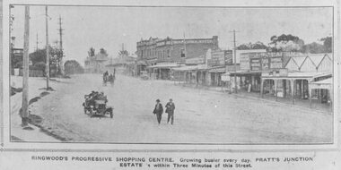
Photograph, Maroondah Highway Central, Ringwood. Ringwood Shopping Centre, Whitehorse Rd- 1924
Black and white photograph (3 copies) Typed below one photograph: "Ringwood Shopping Centre, Whitehorse Rd. - 1924". Typed below other copies: "Ringwood's progressive shopping centre. Growing busier every day. Pratt's Junction Estate is within Three Minutes of this Street". Typed on back of one copy: "Copied from a circular by F.V. Parker 24/11/23 advertising Pratts Junction Estate. 86 lots. Oliver St. Georges Rd. & Junction St., between Mullum Creek & Whitehorse Rd. £3 deposit and 1£ per month." -
 Ringwood and District Historical Society
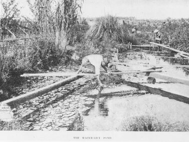
Photograph, The Water-Lily Pond at Hill's Flower Farm, Ringwood, in 1905, 1905
Black and white photograph (2 copies)Typed under photograph: The Water Lily Pond. Mr Hill's flower farm, Mt Dandenong Rd. Later Howship's. In area around Howship Street. Written on back of one image: 'Australasian' 29/3/05. John Hill's flower farm, Mt Dandenong Rd. Later Howship's flower farm subdivided, name retained in street name. Pool was part of Sandy Gully Creek 1905.water lillies, flower farming -
 Ringwood and District Historical Society
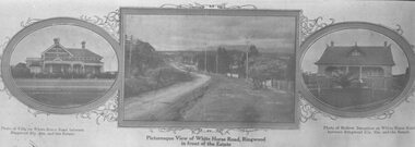
Photograph, Strip of images used for Ringwood Heights Estate land sale promotion - 1924
Strip of 3 views apparently part of a land sale advertisement - View of Whitehorse Rd between photos of two Whitehorse Rd houses.Typed on back of photographs, "Ringwood Heights Estate. Land on left of road and down to Mullum Creek. Sold by T. Grant. 97 lots, 1st March 1924. J.B. McAlpin, agent. No deposit, 1 pound per month." -
 Ringwood and District Historical Society
Photograph, C of E jambed on bridge over Mullum Creek, W'dyte Rd. Ringwood 1924
Written on back of photograph, "C of E jambed on bridge over Mullum Creek, W'dyte Rd. 1924." Typed below another copy: "Moving Church of England, Ringwood. Stuck on bridge over Mullum Creek in Warrandyte Rd. 1924". Written on backing sheet, "Church of England being moved from C/r Pratt Street and Maroondah H'way to rear post office via Warrandyte Rd., Reynolds Av. and Ringwood Street." -
 Ringwood and District Historical Society
Photograph, View towards library in Warrandyte Road being built, across creek. c.1969. Two photographs
Written on back of photograph, "View towards library being built, across creek." -
 Ringwood and District Historical Society
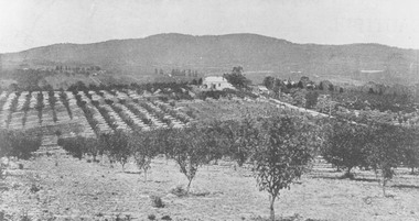
Photograph, View from Canterbury Road/Balfour Avenue area overlooking Martell's orchard, Heathmont, 1929
Black and white photograph of orchard. House in middle range, mountains in background. Photograph appears to be reproduced from subdivisional brochure. Note inserted in sleeve reads, "It has been pointed out that the mountains are to the east and the view is looking south. This therefore is not a 'straight' photograph. House still exists in Eden Avenue at October, 1996".(3 copies).Typed below photograph, "Panoramic view taken on the estate". "View overlooking Martell's orchard, Heathmont, 1929". Taken from corner Canterbury Rd. and Balfour Ave. looking south. Dandenong Creek just beyond house. Washusen Rd. on right". Written on back of one of the copies, "Heathmont Station Estate 1922". "Station Street, Lisgoold St. Canterbury Rd. Vivienne Cres. Balfour Ave." -
 Ringwood and District Historical Society
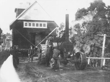
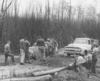
Photograph, Ringwood Rifle Club. Rebuilding viaduct Jumping Creek Reserve after bushfires,1962
Typed on back of photograph, "Ringwood Rifle Club. Rebuilding viaduct Jumping Creek Reserve after bushfires 1962. Brian Pump, not knowing the sleepers had been burned away went to drive across and his truck went straight down. Club captain A. Williams wearing felt hat and smoking cigarette." -
 Ringwood and District Historical Society
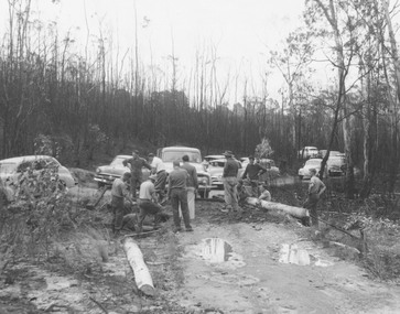
Photograph, Ringwood Rifle Club. Re-building viaduct destroyed in bushfire of January 1962 - Jumping Creek Reserve
Black and white photographTyped on back of photograph- "Ringwood Rifle Club. Re-building viaduct destroyed in bushfires of January 1962. Jumping Creek Reserve". -
 Ringwood and District Historical Society
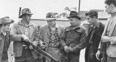
Photograph, Ringwood Rifle Club. 'Mail' photo, 13/5/1954
Black and white photograph (2 copies)Written on back of one copy- "Ringwood Rifle Club. 'Mail' photo, 13/5/1954. L. to R. Vic Beveridge, Constable Bill Hall team captain, Frank Corr, Frank Phillips, Jim Walker and J. Wood". Written on back of second copy- "Ringwood Rifle Club met at corner Main St. and Warrandyte Rd. to proceed to range Jumping Creek Road, South Warrandyte. Const. W. Hall, Capt. 2nd from left." -
 Marysville & District Historical Society
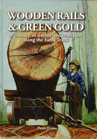
Book - Hardcover book, Peter Evans, Wooden Rails & Green Gold-A century of timber and transport along the Yarra Track, 2022
A history of the timber mills along the Yarra Track from Narbethong to Matlock.Hardcover. Shows Mick Taylor making last-minute adjustments to the rigging of a large log about to commence its journey down the incline to the Marysville Timber and Seasoning Company No.1 mill. Back cover has a photograph of a rail tractor towing a timber trolley along a timber tramway.non-fictionA history of the timber mills along the Yarra Track from Narbethong to Matlock.timber, timber mills, yarra track, narbethong, matlock, marysville, wood's point, wilks creek, great divide, cathedral range, cumberland, foresters, sawmillers, peter evans -
 Marysville & District Historical Society
Book - Hardcover book, Peter Evans, Wooden Rails & Green Gold-A century of timber and transport along the Yarra Track, 2022
A history of the timber mills along the Yarra Track from Narbethong to Matlock.Hardcover. Shows Mick Taylor making last-minute adjustments to the rigging of a large log about to commence its journey down the incline to the Marysville Timber and Seasoning Company No.1 mill. Back cover has a photograph of a rail tractor towing a timber trolley along a timber tramway.non-fictionA history of the timber mills along the Yarra Track from Narbethong to Matlock.timber, timber mills, yarra track, narbethong, matlock, marysville, wood's point, wilks creek, great divide, cathedral range, cumberland, foresters, sawmillers, peter evans -
 Eltham District Historical Society Inc
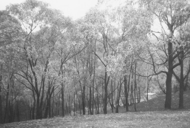
Photograph, Strath Creek, Autumn Excursion, Hume and Hovell's 1824 expedition, 26 May 1996, 26/05/1996
[article by Bettina Woodburn in EDHS Newsletter No. 109, July 1996:] ON THE TRAIL OF HUME AND HOVELL - REPORT ON THE AUTUMN EXCURSION - On a green and fresh morning (Sunday 26th May 1996) the Cobb and Co coach (driven by the most obliging Peter Tampion) set off in a north easterly direction from Eltham to connect with Hume and Hovell's route on their 1824 explorations of central Victoria. The Society would follow a series of monuments erected for the 1924 centenary of the expedition from King Parrot Creek (Tuesday 7th December 1824), through Strath Creek, over Sunday Creek (Sunday 12th December 1824) at Broadford, Tullamarine, St Albans, Deer Park, through Werribee, skirting east of the You Yangs to Lara and Avalon Beach. Because their distance-measuring wheel had broken and a one degree mistake was made in calculations, the two leaders of the original group of six convict-companions arrived at Corio Bay, instead of the expected Western Port, discovered earlier by Flinders. From below Mt. Disappointment (Hume and Hovell's difficulties in "scrambling over brush and rock", "leeches in forest, as well as no water", "cutting grass 4-5 ft. high", dreadful scrub", "devil flies") we took an easier route, saw the Strath Creek memorial in ground fog and a wonderful "field of dreams", the Hume-Hovell privately owned cricket ground with its white picket boundary fence. Now, after a steep climb, in sunshine under gums we stretched and viewed magnificent rolling hills and fog-filled valleys - not "smoke from Aborigines' bush fires". After morning tea at Broadford we followed the Sunday Creek valley beside the Hume Freeway, passed the Wallan Wallan Rest Area (more appropriately Hume and Hovell Rest Area) to tum right at Beveridge. In Gellibrand Hill Park, near the headwaters of the Moonee Ponds Creek, we experienced the landscape the first European settlers saw - huge river red gums and rolling pastures. The gardens and sheltered courtyard of the 1840s, timber, brought from .....[?] prefabricated Woodlands Homestead, provided a pleasant lunch stop. We enjoyed a private tour, panoramic views over Melbourne and surroundings and the excitement of arriving and departing aircraft. Our next river crossing was at Werribee, "in a vast treeless plain", then we drove on by-ways no coach had previously travelled, to find "an immense sheet of water" salty Corio Bay, off-course to the west. In late afternoon of a super, calm, late autumn day we headed homewards. Back at Eltham we were rather surprised to find that we had travelled a total of 347 km. Thanks again to Russell Yeoman for his research and organization. What a wonderful day! Colour photographactivities, monument, hume and hovell, murchison valley, strath creek