Showing 40607 items
matching colour
-
 Eltham District Historical Society Inc
Scrapbook Album, The Colour and Texture of Eltham, 1997, 1997
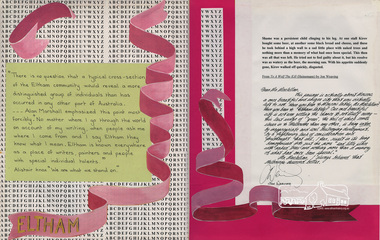
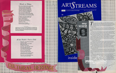
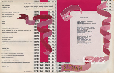
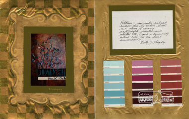
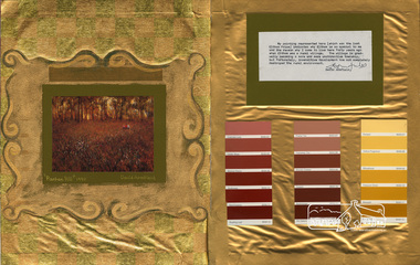
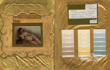
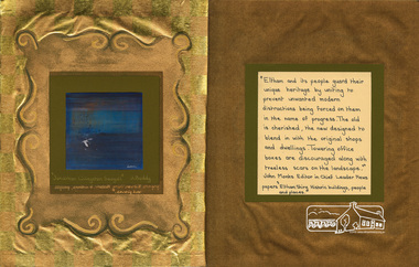
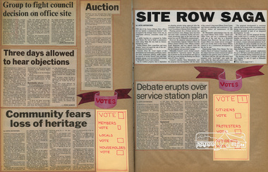
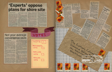
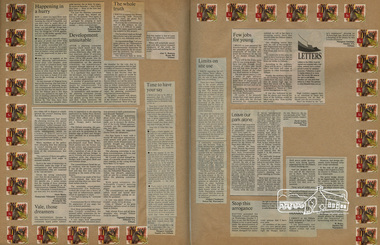
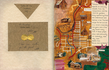
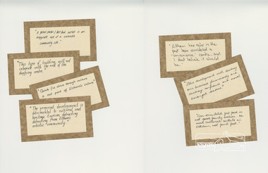
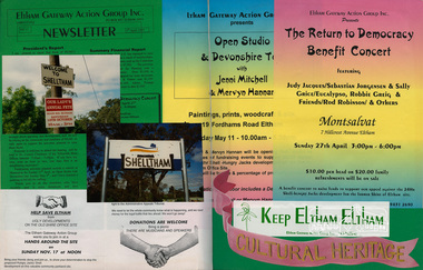
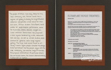
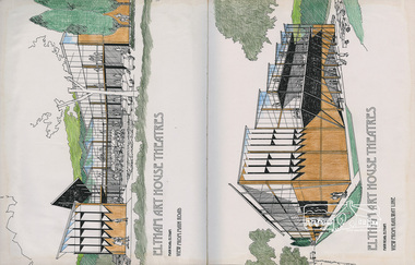
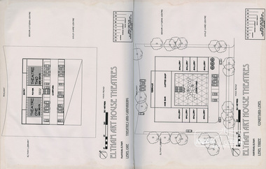
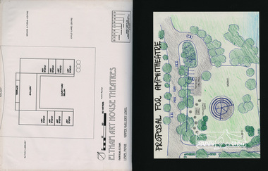
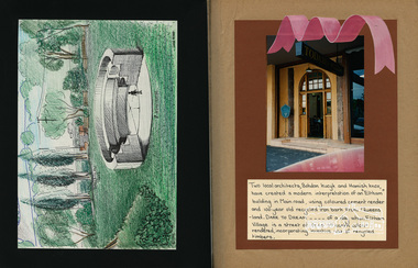
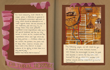
Put together by a member of the Eltham Community Action Group in participation with various artists, writers, local business people and other local citizens and sent to Minister Maclellan, Planning Minister in the Kennet Government in protest of proposed plans to sell the former Eltham Shire Office site at 895 Main Road Eltham in order to develop a Shell Service Station and Hungry Jacks fast food outlet. The purpose was to express what is unique about the character of Eltham, why people live and work there and why such a development would be out of character and inappropriate for the Eltham Gateway along with alternative development proposals. This protest was the catalyst for the formation of the Eltham Community Action Group.Scrapbook album approx 40 x 30 x 4 cm, black hardcovers and 36 double page openings, numerous blank pages.alan marshall, alistair knox park, alistair knox, alternative proposals, ampitheatre, artists, betty langley, bohdan kucyk, bootmakers cottage, bridge street, cultural heritage map, david armfield, diamond creek, diamnond valley news, eltham art house theatres, eltham community action group, eltham library, eltham traders, eltham, flavour of eltham, george stebbing, gordon ford, hamish knox, helen lucas, hungry jacks, janet r boddy, jarrold cottage, jarrold family, john pizzey, jon weaving, lena skipper, letters, local business register, 895 main road, main road, eltham shire office, matcham skipper, ming mackay, minister maclellan, montsalvat, mudbrick, newspaper clippings, peter dougherty, peter glass, pioneers and painters, railway line, shell service station, shelltham, protests, shillinglaw cottage, shire of eltham, nillumbik shire, st margaret's anglican church, todaro, trestle bridge, wingrove cottage, charles symons wingrove -
 Eltham District Historical Society Inc
Scrapbook Album, The Colour and Texture of Eltham, 1997, 1997
Put together by a member of the Eltham Community Action Group in participation with various artists, writers, local business people and other local citizens and sent to Minister Maclellan, Planning Minister in the Kennett Government in protest of proposed plans to sell the former Eltham Shire Office site at 895 Main Road Eltham in order to develop a Shell Service Station and Hungry Jacks fast food outlet. The purpose was to express what is unique about the character of Eltham, why people live and work there and why such a development would be out of character and inappropriate for the Eltham Gateway along with alternative development proposals. This protest was the catalyst for the formation of the Eltham Community Action Group.Scrapbook album approx 40 x 30 x 4 cm, black hardcovers and 36 double page openings, numerous blank pages.alan marshall, alistair knox park, alistair knox, alternative proposals, ampitheatre, artists, betty langley, bohdan kucyk, bootmakers cottage, bridge street, cultural heritage map, david armfield, diamond creek, diamnond valley news, eltham art house theatres, eltham community action group, eltham library, eltham traders, eltham, flavour of eltham, george stebbing, gordon ford, hamish knox, helen lucas, hungry jacks, janet r boddy, jarrold cottage, jarrold family, john pizzey, jon weaving, lena skipper, letters, local business register, 895 main road, main road, eltham shire office, matcham skipper, ming mackay, minister maclellan, montsalvat, mudbrick, newspaper clippings, peter dougherty, peter glass, pioneers and painters, railway line, shell service station, shelltham, protests, shillinglaw cottage, shire of eltham, nillumbik shire, st margaret's anglican church, todaro, trestle bridge, wingrove cottage, charles symons wingrove -
 Eltham District Historical Society Inc
Scrapbook Album, The Colour and Texture of Eltham, 1997, 1997
Put together by a member of the Eltham Community Action Group in participation with various artists, writers, local business people and other local citizens and sent to Minister Maclellan, Planning Minister in the Kennet Government in protest of proposed plans to sell the former Eltham Shire Office site at 895 Main Road Eltham in order to develop a Shell Service Station and Hungry Jacks fast food outlet. The purpose was to express what is unique about the character of Eltham, why people live and work there and why such a development would be out of character and inappropriate for the Eltham Gateway along with alternative development proposals. This protest was the catalyst for the formation of the Eltham Community Action Group.Scrapbook album approx 40 x 30 x 4 cm, black hardcovers and 36 double page openings, numerous blank pages.alan marshall, alistair knox park, alistair knox, alternative proposals, ampitheatre, artists, betty langley, bohdan kucyk, bootmakers cottage, bridge street, cultural heritage map, david armfield, diamond creek, diamnond valley news, eltham art house theatres, eltham community action group, eltham library, eltham traders, eltham, flavour of eltham, george stebbing, gordon ford, hamish knox, helen lucas, hungry jacks, janet r boddy, jarrold cottage, jarrold family, john pizzey, jon weaving, lena skipper, letters, local business register, 895 main road, main road, eltham shire office, matcham skipper, ming mackay, minister maclellan, montsalvat, mudbrick, newspaper clippings, peter dougherty, peter glass, pioneers and painters, railway line, shell service station, shelltham, protests, shillinglaw cottage, shire of eltham, nillumbik shire, st margaret's anglican church, todaro, trestle bridge, wingrove cottage, charles symons wingrove -
 Eltham District Historical Society Inc
Scrapbook Album, The Colour and Texture of Eltham, 1997, 1997
Put together by a member of the Eltham Community Action Group in participation with various artists, writers, local business people and other local citizens and sent to Minister Maclellan, Planning Minister in the Kennet Government in protest of proposed plans to sell the former Eltham Shire Office site at 895 Main Road Eltham in order to develop a Shell Service Station and Hungry Jacks fast food outlet. The purpose was to express what is unique about the character of Eltham, why people live and work there and why such a development would be out of character and inappropriate for the Eltham Gateway along with alternative development proposals. This protest was the catalyst for the formation of the Eltham Community Action Group.Scrapbook album approx 40 x 30 x 4 cm, black hardcovers and 36 double page openings, numerous blank pages.alan marshall, alistair knox park, alistair knox, alternative proposals, ampitheatre, artists, betty langley, bohdan kucyk, bootmakers cottage, bridge street, cultural heritage map, david armfield, diamond creek, diamnond valley news, eltham art house theatres, eltham community action group, eltham library, eltham traders, eltham, flavour of eltham, george stebbing, gordon ford, hamish knox, helen lucas, hungry jacks, janet r boddy, jarrold cottage, jarrold family, john pizzey, jon weaving, lena skipper, letters, local business register, 895 main road, main road, eltham shire office, matcham skipper, ming mackay, minister maclellan, montsalvat, mudbrick, newspaper clippings, peter dougherty, peter glass, pioneers and painters, railway line, shell service station, shelltham, protests, shillinglaw cottage, shire of eltham, nillumbik shire, st margaret's anglican church, todaro, trestle bridge, wingrove cottage, charles symons wingrove -
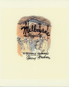 Ringwood and District Historical Society
Book, Melbourne the Olympic City, subtitled 10 Facsimile Drawings With Colour - Harry Hudson
Yellow soft covered book containing Melbourne street scene sketches, photographs, and recollections contributed in 2021 by former pupils of Ringwood High School as a tribute to their well remembered art teacher, Harry Hudson (1910-1974). The images are reproduced from a folio of drawings that Harry made as a souvenir of Melbourne at the time of the 1956 Olympic Games. Contents and contributors: Flinders Street Station - Jeanette Fry Bourke Street - Graham Edney Collins Street - Michael Anderson, Thomas Guest, Eleanore Peeler Princess Theatre - John Wood, Thomas Guest Melbourne Town Hall - Thomas Guest Princes Bridge - Jeanette Fry StPaul's Cathedral - Ian McCleave Public Library - Gavin Fry Swanston Street - Peter Fry StPatrick's Cathedral - Gavin Fry. -
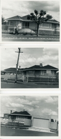 Ringwood and District Historical Society
Photograph, Archie and Ruby Harker 's residence 16B Churchill St, Mont Albert Built in 1961 - Collection of black and white and colour photographs including interior
Archie and Ruby Harker were connected to the Wieland Family through Ruby's sister Thelma who married Stan Wieland. Archie did well in the printung company he worked for and was a Manager.6 Black and white photos of the Harker house and garden and 38 coloured photos of rooms and particularly the chandeliers and ceilings. (Scanned as groups of 3 or 4 photos due to the number) -
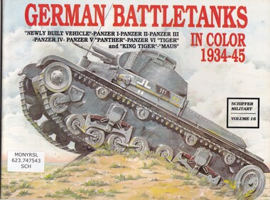 Monbulk RSL Sub Branch
Book, Schiffer Publishing, German battle tanks in colour 1934-1945, 1989
Detailed description of the German battle tanks, "newly built vehicle"-Panzer I-Panzer II-Panzer III-Panzer IV-Panzer V "Panther"-Panzer VI "Tiger" and "King Tiger"-"Maus"ill (col, b/w), p.52.non-fictionDetailed description of the German battle tanks, "newly built vehicle"-Panzer I-Panzer II-Panzer III-Panzer IV-Panzer V "Panther"-Panzer VI "Tiger" and "King Tiger"-"Maus" tanks - germany, military technology - germany -
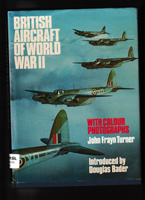 Monbulk RSL Sub Branch
Book, Sidgwick and Jackson, British aircraft of World War II with colour photographs, 1975
Detailed description of every British aircraft in World War IIIndex, ill, p.144.non-fictionDetailed description of every British aircraft in World War IIgreat britain - aircraft - world war ii, airplanes - military -
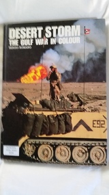 Monbulk RSL Sub Branch
Book, Greenhill, Desert storm : the Gulf War in colour, 1991
pictorial representation of the first Gulf warIll, map, p.96.non-fictionpictorial representation of the first Gulf waroperation desert shield, gulf war 1991 -
 Moorabbin Air Museum
Photograph (item) - Australian P51 Mustang ( Commonwealth Aircraft Factory), CAC Mustang colour photo
RAAF, CAC -
Moorabbin Air Museum
Manual (item) - Douglas DC-4 Maintenance manual Vol 1 - General Handling and Service - revised ed Sept 1947 with colour pictures
-
Moorabbin Air Museum
Booklet (item) - GAF Collection - Safety signs and colours Part 1.Specification for colour and design