Showing 423 items matching " map of system"
-
 Bendigo Historical Society Inc.
Map - General view of area of proposed construction of Lake Eppalock. Map 'A'
... on the Campaspe River system. Map General view of area of proposed ...John Perry Collection. Laminated map of proposed construction of Lake Eppalock. Map 'A'. Black and white map in laminate. Circa 1951. The dam was built by the State Rivers and Water Supply Commission of Victoria. The dam wall height is 45 metres (148 ft) and the main embankment is 1,041 metres (3,415 ft) long. At 100% capacity the dam wall was designed to hold back 304,651 megalitres (6.7014×10¹⁰ imp gal; 8.0480×10¹⁰ US gal) of water. The surface area of Lake Eppalock is 3,011 hectares (7,440 acres) and the catchment area is 2,124 square kilometres (820 sq mi). The controlled spillway is capable of discharging 8,040 cubic metres per second (284,000 cu ft/s). Lake Eppalock supplies both stock and domestic water to the Campaspe irrigation district. It also serves as a water supply to Bendigo and Heathcote and, in more recent times, Ballarat. The lake is a major attraction for those engaging in watersports, with a number of tourist parks and accommodation facilities available. Permissible activities on the lake include high-speed boating, water skiing, sailing, canoeing, fishing and swimming. The lake's water levels were low for approximately eight years between 2002 and 2010 during a prolonged drought, which restricted the amount of recreational activity until rainfall in the latter half of 2010 returned the lake to 100 percent capacity. Built between 1961 and 1964, Lake Eppalock remains the only water storage on the Campaspe River system.map, dam, water, weir, eppalock -
 Monbulk RSL Sub Branch
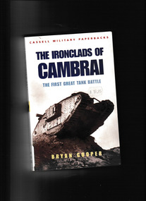
Book, Bryan Cooper, The ironclads of Cambrai: The first great tank battle, 2002
When tanks, the newly invented British weapon, were used for the first time in a mass attack on November 20 1917, they not only achieved one of the most remarkable successes of the First World War but set the pattern for the future of mechanized warfare. For the first time in three years of bloody trench warfare, epitomized by the slaughter at Passchendaele which was then reaching its climax, tanks brought about a breakthrough of the massive German defense system of the Hindenburg Line, followed up by British infantry and cavalry divisions. They were supported for the first time by low flying.Index, ill, maps, p.303.non-fictionWhen tanks, the newly invented British weapon, were used for the first time in a mass attack on November 20 1917, they not only achieved one of the most remarkable successes of the First World War but set the pattern for the future of mechanized warfare. For the first time in three years of bloody trench warfare, epitomized by the slaughter at Passchendaele which was then reaching its climax, tanks brought about a breakthrough of the massive German defense system of the Hindenburg Line, followed up by British infantry and cavalry divisions. They were supported for the first time by low flying. tanks - history, france - campaigns - passchaendaele -
 Melbourne Tram Museum
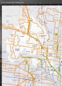
Map - Set of 3, Metlink, "Your Guide to Melbourne's Public Transport System - City of Manningham", c2005
... to Melbourne's Public Transport System - City of Manningham" Map Set of 3 ...Folded map titled "Your Guide to Melbourne's Public Transport System - City of Manningham", published by Metlink c2005. Has a map of transport routes in the City of Manningham, details of Metcards, bus routes, maps of the tram and train network and Metcard agents. 2 - as for .1, but for the City of Moonee Valley 3 - ditto for City of BoroondaraDemonstrates a map produced by Metlink for each municipality.Map - 18 fold - 6x3 - pocket size, printed in full colour.trams, tramways, maps, city of manningham, city of moonee valley, city of boroondara, metlink