Showing 452 items
matching parks - greensborough
-
 Greensborough Historical Society
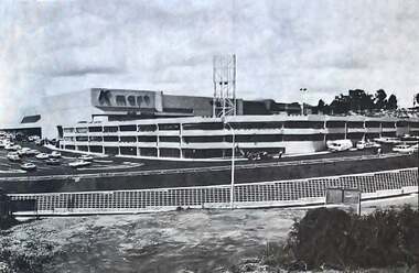
Photograph - Photograph - Digital Image, The Valley Voice, Greensborough Centre 1979, 24/01/1979
A view of the newly completed (1979) Greensborough Centre (now called Greensborough Plaza). Shows the exterior KMart sign and multi storey car park. Also an aerial view of the complex. Several photographs of the central area.Digital copy of newspaper articlegreensborough plaza, kmart greensborough -
 Greensborough Historical Society
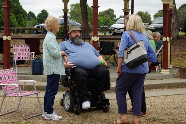
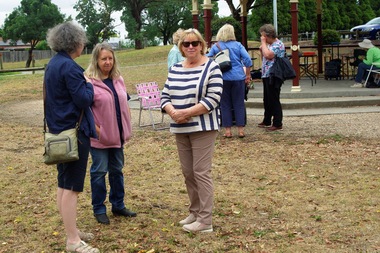
Photograph - Photograph - Digital Image, Marilyn Smith, GHS BBQ at War Memorial Park 29/01/2022, 29/01/2022
... greensborough war memorial park.... Greensborough Historical Society greensborough war memorial park ...Digital images of the Greensborough Historical Society BBQ held at War Memorial Park on 29/01/2022 to celebrate the new year at GHS. Members in this photo include Lesley and Norm and 2 people with backs to camera.Part of a collection of miscellaneous historical images with a connection to the local area.Digital colour photographsgreensborough historical society, greensborough war memorial park, barbeques -
 Greensborough Historical Society
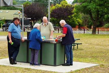
Photograph - Photograph - Digital Image, Marilyn Smith, GHS BBQ at War Memorial Park 29/01/2022, 29/01/2022
... greensborough war memorial park... greensborough war memorial park barbeques Digital colour photographs GHS ...Digital images of the Greensborough Historical Society BBQ held at War Memorial Park on 29/01/2022 to celebrate the new year at GHS. Members in this photo include Gary, Sue, Peter and Lewis.Part of a collection of miscellaneous historical images with a connection to the local area.Digital colour photographsgreensborough historical society, greensborough war memorial park, barbeques -
 Greensborough Historical Society
Photograph - Photograph - Digital Image, Marilyn Smith, GHS BBQ at War Memorial Park 29/01/2022, 29/01/2022
... greensborough war memorial park... Historical Society greensborough war memorial park barbeques Digital ...Digital images of the Greensborough Historical Society BBQ held at War Memorial Park on 29/01/2022 to celebrate the new year at GHS. Members in this photo include Margaret, John, (back to camera) and Kath.Part of a collection of miscellaneous historical images with a connection to the local area.Digital colour photographsgreensborough historical society, greensborough war memorial park, barbeques -
 Greensborough Historical Society
Photograph - Photograph - Digital Image, Marilyn Smith, GHS BBQ at War Memorial Park 29/01/2022, 29/01/2022
... greensborough war memorial park... greensborough war memorial park barbeques Digital colour photographs GHS ...Digital images of the Greensborough Historical Society BBQ held at War Memorial Park on 29/01/2022 to celebrate the new year at GHS. Members in this photo include Dianne, Dawn and Marilyn.Part of a collection of miscellaneous historical images with a connection to the local area.Digital colour photographsgreensborough historical society, greensborough war memorial park, barbeques -
 Greensborough Historical Society
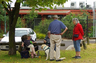
Photograph - Photograph - Digital Image, Marilyn Smith, GHS BBQ at War Memorial Park 29/01/2022, 29/01/2022
... greensborough war memorial park... Historical Society greensborough war memorial park barbeques Digital ...Digital images of the Greensborough Historical Society BBQ held at War Memorial Park on 29/01/2022 to celebrate the new year at GHS. Members in this photo include Dianne, Dawn, Gary, Sue and Lewis.Part of a collection of miscellaneous historical images with a connection to the local area.Digital colour photographsgreensborough historical society, greensborough war memorial park, barbeques -
 Greensborough Historical Society
Photograph - Photograph - Digital Image, Marilyn Smith, GHS BBQ at War Memorial Park 29/01/2022, 29/01/2022
... greensborough war memorial park... greensborough war memorial park barbeques Digital colour photographs GHS ...Digital images of the Greensborough Historical Society BBQ held at War Memorial Park on 29/01/2022 to celebrate the new year at GHS. Members in this photo include Gary, Sue and Lewis.Part of a collection of miscellaneous historical images with a connection to the local area.Digital colour photographsgreensborough historical society, greensborough war memorial park, barbeques -
 Greensborough Historical Society
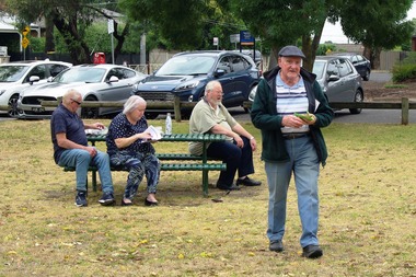
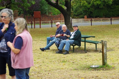
Photograph - Photograph - Digital Image, Marilyn Smith, GHS BBQ at War Memorial Park 29/01/2022, 29/01/2022
... greensborough war memorial park... greensborough war memorial park Digital colour photographs GHS BBQ ...Digital images of the Greensborough Historical Society BBQ held at War Memorial Park on 29/01/2022 to celebrate the new year at GHS. Members in this photo include Neil, Rosie, Peter and Adrian.Part of a collection of miscellaneous historical images with a connection to the local area.Digital colour photographsgreensborough historical society, greensborough war memorial park -
 Greensborough Historical Society
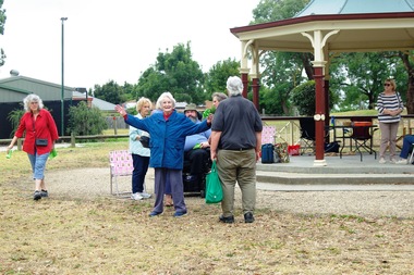
Photograph - Photograph - Digital Image, Marilyn Smith, GHS BBQ at War Memorial Park 29/01/2022, 29/01/2022
... greensborough war memorial park... greensborough war memorial park barbeques Digital colour photographs GHS ...Digital images of the Greensborough Historical Society BBQ held at War Memorial Park on 29/01/2022 to celebrate the new year at GHS. Members in this photo include Kath, Lesley, Rosie, and Norm.Part of a collection of miscellaneous historical images with a connection to the local area.Digital colour photographsgreensborough historical society, greensborough war memorial park, barbeques -
 Greensborough Historical Society
Photograph - Photograph - Digital Image, Marilyn Smith, Greensborough Fallen Soldiers' Memorial 2019, 29/09/2019
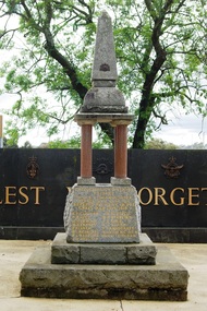
... greensborough war memorial park... at Greensborough War Memorial Park. The Plaque was laid in 2015... at Greensborough War Memorial Park. The Plaque was laid in 2015 ...Digital images of the Greensborough Fallen Soldiers' Memorial taken in 2019. The Memorial is shown from all four sides in its current position in relation to later memorials at Greensborough War Memorial Park. The Plaque was laid in 2015 and is inscribed "Greensborough War Memorial Park Time Capsule. Installed 11 November 2015 by Cr Craig Langdon, Mayor, and Cr Mark Di Pasquale, Bakewell Ward. Commemorating the Centenary of ANZAC. To be opened every 25 years." Names of 2015 Banyule Councillors are inscribed around edge of plaque.Part of a collection of miscellaneous historical images with a connection to the local area.Digital colour photographs fallen soldiers memorial greensborough, greensborough war memorial park, craig langdon, mark di pasquale, war memorials greensborough, plaques -
 Greensborough Historical Society
Newsletter, Greenhills and North Greensborough Progress Association, Community News: official journal of the Greenhills and Nth. Greensborough Progress Association. 5th May, 1975. Edition No. 4/75, 05/05/1975
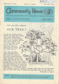
This edition includes a report on the Progress Association's April 1975 meeting, Have you ever admired our trees? Stop press: purchase agreement for a 413 acre park in Diamond Valley [from Mr. and Mrs. Young's combined properties], Diamond Valley Repertory, From the Council Chamber, Letter to the Editor, In memoriam: Gertrude Kerry, Jack Moncrieff, This and that, Kinder news, Meet the natives, Half a horse. Is it better than no horse? A digital copy of this Newsletter is available from Greensborough Historical Society.Newsletter, 23 p., illus.greenhills and north greensborough progress association, greenhills -
 Greensborough Historical Society
Newsletter, Greenhills and North Greensborough Progress Association, Community News: official journal of the Greenhills and Nth. Greensborough Progress Association. 5th September, 1975, 05/09/1975
This edition includes a report on the Progress Association's meeting, A park close to the heart of Greensborough, From the Council Chamber, The Plenty Gorge : can our region's major landscape resource survive? A digital copy of this Newsletter is available from Greensborough Historical Society.Newsletter, 4 p., illus.greenhills and north greensborough progress association, greenhills -
 Greensborough Historical Society
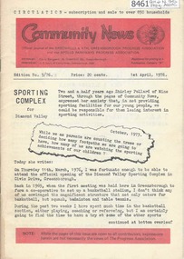
Newsletter, Greenhills and North Greensborough Progress Association, Community News: official journal of the Greenhills and Nth.Greensborough Progress Association and the Apollo Parkways Progress Association. 1st April, 1976. Edition No. 3/76, 01/04/1976
This edition includes a report on the The Apollo Parkways Progress Association's March 1976 meeting, Sporting complex for Diamond Valley, History in the district, 300 miles of park... the forestry concept, This and that, Functions of your local Health Department, School and Kinder news, Guide news, Battle of the bluestone, From the Council Chamber, Meet the natives, Diamond Valley Repertory, Apex Club in Greensborough. A digital copy of this Newsletter is available from Greensborough Historical Society. Newsletter, 28 p., illus.greenhills and north greensborough progress association, greenhills, apollo parkways progress association, apollo parkways -
 Greensborough Historical Society
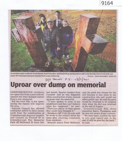
Newspaper - Newspaper Clipping, Uproar over dump on memorial, 13/07/2011
... greensborough war memorial park... a development in Greensborough being dumped at War Memorial Park in 2011 ...Greensborough residents are upset at soil from a development in Greensborough being dumped at War Memorial Park in 2011. Includes a Letter to the Editor from a disgruntled Banyule resident in reply to this article.News clipping, black text, colour image.greensborough war memorial park, chainsaw sculptures -
 Eltham District Historical Society Inc
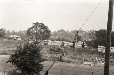
Photograph, Sherbourne Road, Para Road and Simms Road at Briar Hill, 3 November 1967, 3 Nov 1967
Viewed from eastern side of Para Road opposite Graham Body Works.. Simms Road is running to the right in front of the old house. The house belongs to Mrs Cameron whose daughter married a DAVEY after which Davey Street is named. Excavation work is being undertaken for the realignment of the Para Road and Sherbourne Road intersection where the current roundabout is located, approximately where the two cars are parked. Mrs Cameron's house and the other are where Montmorency Secondary College is situated. The school opened in 1969.Roll of 35mm black and white negative film, 6 strips Ilford HP3briar hill, cameron, davey, davey road, graham body works, greensborough, montmorency secondary college, sherbourne road, simms road, vw service -
 Eltham District Historical Society Inc
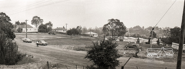
Photograph, Sherbourne Road, Para Road and Simms Road at Briar Hill, 3 November 1967, 3 Nov 1967
Viewed from eastern side of Para Road opposite Graham Body Works.. Simms Road is running to the right in front of the old house. The house belongs to Mrs Cameron whose daughter married a DAVEY after which Davey Street is named. Excavation work is being undertaken for the realignment of the Para Road and Sherbourne Road intersection where the current roundabout is located, approximately where the two cars are parked. Mrs Cameron's house and the other are where Montmorency Secondary College is situated. The school opened in 1969.Photostitch from multiple images on roll of film. Roll of 35mm black and white negative film, 6 strips Ilford HP3briar hill, cameron, davey, davey road, graham body works, greensborough, montmorency secondary college, sherbourne road, simms road, vw service -
 Eltham District Historical Society Inc
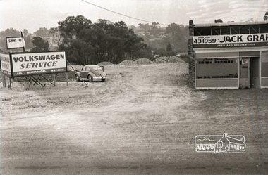
Photograph, Sherbourne Road, Para Road and Simms Road at Briar Hill, 3 November 1967, 3 Nov 1967
Viewed from eastern side of Para Road opposite Graham Body Works.. Simms Road is running to the right in front of the old house. The house belongs to Mrs Cameron whose daughter married a DAVEY after which Davey Street is named. Excavation work is being undertaken for the realignment of the Para Road and Sherbourne Road intersection where the current roundabout is located, approximately where the two cars are parked. Mrs Cameron's house and the other are where Montmorency Secondary College is situated. The school opened in 1969.Roll of 35mm black and white negative film, 6 strips Ilford HP3briar hill, cameron, davey, davey road, graham body works, greensborough, montmorency secondary college, sherbourne road, simms road, vw beetle, vw service -
 Eltham District Historical Society Inc
Photograph, Railway overpass on Sherbourne Road at junction of Para Road and Simms Road, Briar Hill, 3 November, 1967
Viewed from railway line opposite Graham Body Works. Simms Road is running to the right in front of the old house. The house belongs to Mrs Cameron whose daughter married a DAVEY after which Davey Street is named. Excavation work is being undertaken for the realignment of the Para Road and Sherbourne Road intersection where the current roundabout is located, approximately where the two cars are parked. Mrs Cameron's house and the other are where Montmorency Secondary College is situated. The school opened in 1969.Roll of 35mm black and white negative film, 6 strips Ilford HP3briar hill, cameron, davey, davey road, graham body works, greensborough, montmorency secondary college, sherbourne road, simms road -
 Eltham District Historical Society Inc
Photograph - Digital Photograph, Alan King, Blue Lake, Plenty Gorge Park, 2008
A quarry was transformed into the Blue Lake. Published: Nillumbik Now and Then / Marguerite Marshall 2008; photographs Alan King with Marguerite Marshall.; p179 The dramatic steep-sided Plenty Gorge lies along the divide of two geological areas, and separates the Nillumbik Shire and the City of Whittlesea. On the Nillumbik side are undulating hills and sedimentary rock, and in Whittlesea, lies a basalt plain formed by volcanic action up to two million years ago. This provides the Plenty Gorge Park with diverse vegetation and habitats, making it one of Greater Melbourne’s most important refuges for threatened and significant species. The park, established in 1986, consists of around 1350 hectares, and extends 11 kilometres along the Plenty River, from Greensborough to Mernda. It provides a wildlife corridor for around 500 native plant and 280 animal species. The area’s plentiful food and water attracted the Wurundjeri Aboriginal people and then European settlers. By 1837 squatters had claimed large runs of land for their sheep and cattle. The Plenty Valley was among the first in the Port Phillip District to be settled - mainly in the less heavily timbered west - and was proclaimed a settled district in 1841.But by the late 1880s, the settlers’ extensive land clearing for animal grazing, then agriculture, depleted the Wurundjeri’s traditional food sources, which helped to drive them away. Many Wurundjeri artefacts remain (now government protected), and so far 57 sites have been identified in the park, including scarred trees, burial areas and stone artefacts. Pioneer life could be very hard because of isolation, flooding, bushfires and bushrangers. Following the Black Thursday bushfires of 1851, basalt was quarried to build more fire-resistant homes. Gold discoveries in the early 1850s swelled the population, particularly around Smugglers Gully; but food production made more of an impact. In the late 1850s wheat production supplanted grazing. In the 1860s the government made small holdings available to poorer settlers. These had the greatest effect on the district, particularly in Doreen and Yarrambat, where orchards were established from the 1880s to 1914. Links with a prominent early family are the remains of Stuchbery Farm, by the river’s edge bounded by Smugglers Gully to the north and La Trobe Road, Yarrambat, to the east. The Stuchberys moved to the valley in 1890, and the family still lives in the area. In 1890, Alfred and Ada first lived in a tent where four children were born, then Alfred built the house and outbuildings around 1896. They planted an orchard, then a market garden, and developed a dairy. The family belonged to the local Methodist and tennis communities. Their grandson Walter, opened the Flying Scotsman Model Railway Museum in Yarrambat, which his widow, Vi, continues to run. Wal was also the Yarrambat CFA Captain for 22 years until 1987. Walter sold 24 hectares in 1976 for development - now Vista Court - and in 1990, the remaining 22.6 hectares for the park. Remaining are an early stone dairy and remnants of a stone barn, a pig sty and a well. Until it was destroyed by fire in 2003, a slab hut stood on the Happy Hollow Farm site, at the southern end of the park. The hut is thought to have been built in the Depression around 1893. This was a rare and late example of a slab hut with a domestic orchard close to Melbourne. Emmet Watmough and his family first occupied the hut, followed by a succession of families, until the Bell family bought it around 1948. There they led a subsistence lifestyle for 50 years, despite encroaching Melbourne suburbia. The Yellow Gum Recreation Area includes the Blue Lake, coloured turquoise at certain times of the year. Following the 1957 bushfires, this area was quarried by Reid Quarries Pty Ltd for Melbourne’s first skyscrapers, then by Boral Australia. However in the early 1970s water began seeping into the quarry forming the Blue Lake and the quarry was closed. The State Government bought the site in 1997 and opened it as a park in 1999.This collection of almost 130 photos about places and people within the Shire of Nillumbik, an urban and rural municipality in Melbourne's north, contributes to an understanding of the history of the Shire. Published in 2008 immediately prior to the Black Saturday bushfires of February 7, 2009, it documents sites that were impacted, and in some cases destroyed by the fires. It includes photographs taken especially for the publication, creating a unique time capsule representing the Shire in the early 21st century. It remains the most recent comprehenesive publication devoted to the Shire's history connecting local residents to the past. nillumbik now and then (marshall-king) collection, blue lake, plenty gorge park -
 Eltham District Historical Society Inc
Photograph - Digital Photograph, Marguerite Marshall, Stuchbery Farm dairy, 14 March 2008
Stuchbery Farm was situated on the Plenty River bounded by Smugglers Gully to the north and La trobe Road, Yarrambat, to the east. Alan and Ada Stutchbery moved to the valley in 1890, first living in a tent where four children were born. Alfred built a home and outbuildings around 1896. They planted an orchard, then a market garden and developed a dairy. Published: Nillumbik Now and Then / Marguerite Marshall 2008; photographs Alan King with Marguerite Marshall.; p179 The dramatic steep-sided Plenty Gorge lies along the divide of two geological areas, and separates the Nillumbik Shire and the City of Whittlesea. On the Nillumbik side are undulating hills and sedimentary rock, and in Whittlesea, lies a basalt plain formed by volcanic action up to two million years ago. This provides the Plenty Gorge Park with diverse vegetation and habitats, making it one of Greater Melbourne’s most important refuges for threatened and significant species. The park, established in 1986, consists of around 1350 hectares, and extends 11 kilometres along the Plenty River, from Greensborough to Mernda. It provides a wildlife corridor for around 500 native plant and 280 animal species. The area’s plentiful food and water attracted the Wurundjeri Aboriginal people and then European settlers. By 1837 squatters had claimed large runs of land for their sheep and cattle. The Plenty Valley was among the first in the Port Phillip District to be settled - mainly in the less heavily timbered west - and was proclaimed a settled district in 1841. But by the late 1880s, the settlers’ extensive land clearing for animal grazing, then agriculture, depleted the Wurundjeri’s traditional food sources, which helped to drive them away. Many Wurundjeri artefacts remain (now government protected), and so far 57 sites have been identified in the park, including scarred trees, burial areas and stone artefacts. Pioneer life could be very hard because of isolation, flooding, bushfires and bushrangers. Following the Black Thursday bushfires of 1851, basalt was quarried to build more fire-resistant homes. Gold discoveries in the early 1850s swelled the population, particularly around Smugglers Gully; but food production made more of an impact. In the late 1850s wheat production supplanted grazing. In the 1860s the government made small holdings available to poorer settlers. These had the greatest effect on the district, particularly in Doreen and Yarrambat, where orchards were established from the 1880s to 1914. Links with a prominent early family are the remains of Stuchbery Farm, by the river’s edge bounded by Smugglers Gully to the north and La Trobe Road, Yarrambat, to the east. The Stuchberys moved to the valley in 1890, and the family still lives in the area. In 1890, Alfred and Ada first lived in a tent where four children were born, then Alfred built the house and outbuildings around 1896. They planted an orchard, then a market garden, and developed a dairy. The family belonged to the local Methodist and tennis communities. Their grandson Walter, opened the Flying Scotsman Model Railway Museum in Yarrambat, which his widow, Vi, continues to run. Wal was also the Yarrambat CFA Captain for 22 years until 1987. Walter sold 24 hectares in 1976 for development - now Vista Court - and in 1990, the remaining 22.6 hectares for the park. Remaining are an early stone dairy and remnants of a stone barn, a pig sty and a well. Until it was destroyed by fire in 2003, a slab hut stood on the Happy Hollow Farm site, at the southern end of the park. The hut is thought to have been built in the Depression around 1893. This was a rare and late example of a slab hut with a domestic orchard close to Melbourne. Emmet Watmough and his family first occupied the hut, followed by a succession of families, until the Bell family bought it around 1948. There they led a subsistence lifestyle for 50 years, despite encroaching Melbourne suburbia. The Yellow Gum Recreation Area includes the Blue Lake, coloured turquoise at certain times of the year. Following the 1957 bushfires, this area was quarried by Reid Quarries Pty Ltd for Melbourne’s first skyscrapers, then by Boral Australia. However in the early 1970s water began seeping into the quarry forming the Blue Lake and the quarry was closed. The State Government bought the site in 1997 and opened it as a park in 1999.This collection of almost 130 photos about places and people within the Shire of Nillumbik, an urban and rural municipality in Melbourne's north, contributes to an understanding of the history of the Shire. Published in 2008 immediately prior to the Black Saturday bushfires of February 7, 2009, it documents sites that were impacted, and in some cases destroyed by the fires. It includes photographs taken especially for the publication, creating a unique time capsule representing the Shire in the early 21st century. It remains the most recent comprehenesive publication devoted to the Shire's history connecting local residents to the past. nillumbik now and then (marshall-king) collection, ada stuchbery, alan stuchbery, dairy, stuchbery farm, farm buildings, yarrambat, plenty gorge park -
 Greensborough Historical Society
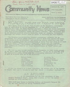
Newsletter, Greenhills and North Greensborough Progress Association, Community News: official journal of the Greenhills and North Greensborough Progress Association. 20th July 1970. Edition No. 6/70, 20/07/1970
This edition includes a report on the Progress Association's July1970 meeting, Councillors' report, Roads, nature or "nature strips", Protecting and improving the Plenty River, Toxic insecticides - the total dangers, New park complex to be Bundoora Fields, School and Kinder news, Scout and Guide news, Letter to editor. A digital copy of this Newsletter is available from Greensborough Historical Society.Newsletter, 16 p., illus. greenhills and north greensborough progress association, greenhills -
 Greensborough Historical Society
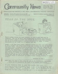
Newsletter, Greenhills and North Greensborough Progress Association, Community News: official journal of the Greenhills and North Greensborough Progress Association. 27th July, 1972. Edition No. 5/72, 27/07/1972
This edition includes a report on the Progress Association's July 1972 meeting, Year of the Book, Spring planting time, School and kinder news, Letter to the editor, Megalopolis or the bush, Parks, gardens and reserves, Eltham Film Society. Supplement to July 1972 "Community News" Open forum. A digital copy of this Newsletter is available from Greensborough Historical Society.Newsletter, 16 p., illus. greenhills and north greensborough progress association, greenhills -
 Melbourne Tram Museum
Ephemera - Timetable - bus - The Met - set of 24, The Met, 1992 & 1993
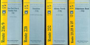
SSet of 24 The Met bus timetables, with diagrammatic map, major stops and contact details. All dated during1993 unless noted otherwise. 1 - Route 216/9 - Deer Park West & Sunshine Park - City 2 - Route 220 - Sunshine - City - 1992 3 - Route 232 - Altona North - City - 1992 4 - Route 233 - Fishermens Bend - City - 1992 5 - Route 254 - Northland Shopping Centre - City - 1992 6 - Route 256 - La Trobe Uni - City - 1992 7 - Routes 258 & 259 - Northland Shopping Centre, and La Trobe Uni - City via Eastern Freeway - 1992 8 - Route 260 etc - Deep Creek Templestow - Donvale - City 9 - Route 264 - Mitcham, Donvale City 10 - Route 265 - Deep Creek - City 11 - Route 602 - Brighton - city 12 - Route 269, 291 and 296 - Greensborough, Heidelberg & Newmans Road to Box Hill 13 - Route 272 - Warrandyte - City 14 - Route 276 & 278 - Warrandyte - City 15 - Route 284 & 270 - East Kew - City or Box Hill 16 - Route 285 - The Pines - Box Hill 17 - Route 286 & 288 - The Pines and Templestowe - Box Hill 18 - Route 290 - North Nunawading - Box Hill 19 - Route 292 etc - Box Hill, Deep Creek, Ringwood, Warrandyte 20 - Route 301, 281 315 - Ringwood, Park Orchards and Donvale - City 21 - Route 305 - Box Hill - Ringwood 22 - Route 366 & 367 - Ringwood - Croydon 23 - Route 600 - St Kilda - Brighton Beach - 1992 24 - Route 601 - Gardenvale - City - 1992Yields information about some of The Met bus services 1993Set of 24 The Met timetables, DL size, printed in two colours.timetables, the met, route 216, route 220, route 232, route 233, route 254, route 258, route 259, route 260, route 264, route 265, route 256, route 602, route 269, route 272, route 276, route 284, route 270, route 285, route 286, route 288, route 290, route 292, route 301, route 305, route 366, route 367, route 600, route 601 -
 Melbourne Tram Museum
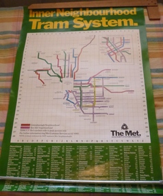
Poster, The Met, "Inner Neighbourhood tram system", mid 1980's
Poster, full colour printed on gloss paper titled "Inner Neighbourhood tram system", giving a diagrammatic Map of the tram system, suburbs, tram route destination names and route numbers and peak service route numbers. Has a separate section for the City area. Shows the routes that ran into the Greensborough and Box Hill Neighbourhoods. At the base of the map has The Met logo and name, a customer service number which has been glued over the printed number. At the base of the poster is a location guide for places of interest, sporting facilities, parks and gardens, railway stations etc.trams, tramways, the met, map, tickets, neighbourhood tickets, tramways -
 Greensborough Historical Society
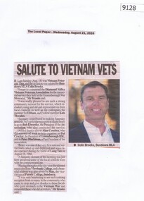
Article - Newspaper Clipping, The Local Paper, Salute to Vietnam Vets, 21/08/2024
... greensborough war memorial park... brooks diamond valley vietnam veterans association greensborough ...Article about Vietnam Veterans DayBlack and white text and colour imagevietnam veterans, colin brooks, diamond valley vietnam veterans association, greensborough war memorial park -
 Greensborough Historical Society
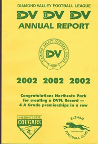
Book - Annual Report, Diamond Valley Football League, Diamond Valley Football League. Annual Report. Season 2002, 2002
A complete record of the DVFL season 2002, includes financial report, description of events, membership, teams, scores from the seasons games and winners of best and fairest awards for all divisions and age groups. including black and white photos. In 2002 the Division 1 Premiers were Northcote Park Football Club.This annual report covers many teams from within the Diamond Valley area. Includes junior and senior teams.Foolscap size book. 236 pages, printed on double sides of pages. Yellow cover with black text and includes typed tables and black and white photosaustralian rules football, greensborough football club, diamond valley football league, dvfl, northern football league, nfl, northern football netball league, nfnl, northcote park football club -
 Greensborough Historical Society
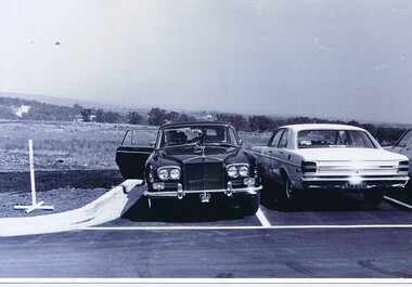
Photograph - Photograph - Digital Image, Opening of Shire of Diamond Valley offices 1972: Official cars, 26/02/1972
The official opening of the Shire of Diamond Valley offices in Greensborough on 26/02/1972. This photograph shows the official car of the Governor of Victoria, (Sir Rohan Delacombe) parked in the carpark at the venue. Includes a copy of the folder cover.Photographs taken by a member of SDV staff.Photograph 1 of a folder of 21 colour photographsOn cover of folder "Opening of S.D.V. Office"shire of diamond valley, shire of diamond valley offices 1972, sir rohan delacombe -
 Eltham District Historical Society Inc
Film - Video (VHS), Nillumbik Shire Council, The Nillumbik Story, 1996
PART 1 – NILLUMBIK (00:00-07:17) Opening features various scenes around Nillumbik Shire. For 40,000 years Nillumbik was the home of the Wurundjeri people. Robert Hoddle gave the district its name. Jock Ryan, then president of Nillumbik Historical Society discusses the names Nillumbik and Diamond Creek. In the late 1830s white occupation began with gold found in Warrandyte in 1851 and 12 years later at Diamond Creek -the Diamond Reef which led to the Caledonian gold rush. Jock Ryan discusses the Diamond Creek mine, which was thriving until it burnt out in 1915. Large numbers of workmen moved into area in late 1870s to construct the Maroondah Aqueduct. With growing population of Melbourne, the nearby Yan Yean system had severely disrupted the flow of the Plenty River, forcing the closure of three flour mills there. The aqueduct came to the rescue carrying water 66km from Healesville to Preston. When the Diamond Creek gold mine burnt down the local economy suffered but fruit growing industry had already been established and Diamond Creek became a thriving fruit growing centre. Interview with Jack Powell, a long-time fruiterer at St Andrews market, his family had lived in the area for a hundred years, 3 to 4 generations, “a lot of hard work”. By the time the railway arrived fruit growing was no longer competitive. The railway brought the city closer and day trippers. The Green Wedge separates the shire from the more densely developed neighbours such as Whittlesea, Doncaster, Templestowe, Bulleen and Greensborough. Population at the time (1996) was 19,000 but links to the past remain strong. Mudbrick houses along the Heritage Trail The saving of Shillinglaw Cottage from demolition in 1963 and relocation brick by brick. PART 2 – ENVIRONMENT (07:18-14:44) Peter Brock (with Bev Brock in background) at St Andrews market discusses his childhood growing up in the district and the environment and the values it instilled upon him and his own family. The Brocks have been in the district since the 1860s. Nillumbik Shire responsible for managing three catchment areas; Diamond Creek, Arthurs Creek and Watsons Creek. Follows the course of the Diamond Creek commencing in Kinglake through the district to its confluence with the Yarra River at Eltham at Eltham Lower Park. Highlights Eltham Lower Park community revegetation program and the newly constructed (1996) viewing platform built of new and recycled timbers at the confluence of the Diamond Creek and Yarra River. Also featured are outdoor recreation on the river and at Eltham Lower Park including the Diamond Valley miniature railway. Sugarloaf reservoir and recreational activities and fishing. Aerial view of Memorial Park and Shire of Eltham War Memorial tower at Garden Hill, Kangaroo Ground. Significant tourism opportunities for the shire with 3 million potential day-trippers in metropolitan Melbourne. Council and community working together to find a way to promote the shires natural and artistic assets. At Arthurs Creek, the Brock family and neighbours working together to take care of their waterway. Peter Brock’s uncle, Sandy Brock talks about environmental management and the Arthurs Creek Landcare group and actions to eradicate blackberry problem. Having previously planted Cypress rows they are replacing them with indigenous species to improve the water supply, keeping cattle out of the creek bed to improve the quality downstream flowing into the Yarra. Eltham East Primary School Band playing “All things bright and beautiful” merges into scenes of the bushland sanctuary set aside by the school in 1980 with unidentified teacher discusses the sanctuary and their education program and school children’s comments. Plight of a family of Wedgetail eagles nesting in the path of a developer’s bulldozer at North Warrandyte and actions to save their nesting areas. PART 3 – ARTS (14:45-22:00) Arts and Jazz festival at Montsalvat featuring interviews with Sigmund Jorgensen discussing Montsalvat and its principles. Also Matcham Skipper. Clifton Pugh’s funeral at Montsalvat and his legacy at Dunmoochin near Cottlesbridge with artists in residence, at the time, Chicago artist Charles Reddington who discusses the benefits of the experience. An unidentified female artist also talks about the program and why people are drawn to the area. Unidentified man on street talking about the amount of talent in the area, artists, poets, musicians, authors. Artist Ming Mackay (1918-2009) interviewed talking about the people she mixes with on “the Hill”. Works of local artists are displayed Eltham Library Community Gallery and Wiregrass gallery with a new coffee shop at the Wiregrass making it an even more popular destination. Music at St Andrews Hotel (may be a little bit country) and the Saturday market where likely to hear anything. Sellers and patrons at the market asked about what attracts them to the market and where they came from. Scenes of poets/authors giving readings. CREDITS Music by John Greenfield from the CD Sweet Rain “The Snow Tree”, Uncle Music UNC 2001 Cameras - David Mirabella and Peter Farragher Editor – Olwyn Jones Written and Produced by Jason Cameron A Jason Cameron Proction for Nillumbik ShireProvides a record of the relatively newly created Shire of Nillumbik at the time and the features and attactions of the shire in its people arts, culture and environmentVHS Cassette (five copies) DVD (one copy) Converted to MP4 file format 0:22:00, 1.60GBvideo recording, arthurs creek, arthurs creek landcare group, artists, artists in residence, arts, arts festival, authors, blackberry, brock family, bulldozer, bulleen, bushland sanctuary, caledonian gold rush, charles reddington, clifton pugh, cottlesbridge, cypress rows, developer, diamond creek, diamond creek mine, diamond reef, diamond valley miniature railway, doncaster, dunmoochin, education program, eeps, eltham, eltham east primary school, eltham east primary school band, eltham library community gallery, eltham lower park, environment, fishing, flour mill, fruit growing, fruiterer, garden hill, gold mining, green wedge, greensborough, heritage trail, hurstbridge railway line, jazz festival, jock ryan, kangaroo ground, kangaroo ground tower, kinglake, maroondah aqueduct, matcham skipper, memorial park, ming mackay (1918-2009), montsalvat, mudbrick houses, music, musicians, nesting area, nillumbik historical society, nillumbik shire, north warrandyte, old timer, orchards, peter brock, plenty river, poets, population, recreation, recreational activities, revegetation, robert hoddle, sandy brock, shillinglaw cottage, shire of eltham war memorial, sigmund jorgensen, st andrews hotel, st andrews market, sugarloaf reservoir, templestowe, the hill, tourism, viewing platform, warrandyte, water catchment area, watsons creek, wedgetail eagle, whittlesea, wiregrass gallery, wurundjeri, yarra river, jack powell -
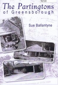 Greensborough Historical Society
Book, Sue Ballantyne et al, The Partingtons Of Greensborough, 2024
... family Greensborough local history whatmough park partingtons ...History of the Partington Family of Greensborough; from their arrival in Australia in 184 , including the purchase of land in Greensborough and the subsequent compulsory acquisition of some of this land for parks and reserves by various local government authorities. An edited version of family histories by descendant Faye Fort (nee Partington) is included in part 2 of the book.Sourced from family documents and primary sources.Soft Covered book with black and white text and images in black and white, colour, sepiapartington family, greensborough, local history, whatmough park, partingtons flat, yandell reserve, faye fort (nee partington) -
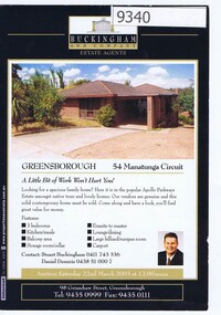 Greensborough Historical Society
Card - Advertising Leaflet, Buckingham and Company Estate Agents, 54 Manatunga Circuit Greensborough, 2003
54 Manatunga Circuit Greensborough. 3 bedroom home, sold in 2003 as part of the Partington estate. This was the retirement home of Alan and Wyn Partington after moving from Whatmough Park. This house was built by their son Gary. Real estate advertising card, 1 sheet, printed in colour both sides. manatunga circuit greensborough, alan partington, wyn partington, gary partington