Showing 10832 items
matching maps
-
 Phillip Island and District Historical Society Inc.
Book, Aboriginal string bags : nets and cordage, 1999
xv, 157 p. : ill., maps ; 24 cm. Occasional papers, Anthropology and History ; Inscribed 'To Phillip Island & District Historical Society with best wishes from Alan West, January 2000'.fibers, string craft, australia, rope, aboriginal australians, industries -
 Greensborough Historical Society
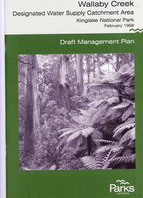
Booklet, Parks Victoria, Wallaby Creek: designated water supply catchment area. Kinglake National Park: Draft management plan 1998, 1998_02
Wallaby Creek is part of Kinglake National Park, and is a restricted access catchment area to protect quality of water supplied to Melbourne's water supply system. 26 p. black print on white paper, green cover, three folded mapskingllake national park, water supply, wallaby creek, parks victoria -
 Greensborough Historical Society
Book, Angus & Robertson Ltd, Official History of Australia in the War of 1914-18; by C. E. W. Bean. 8th edition, 1938_
The official history of Australia in WW1 written by C. E. W. Bean12 volumes. Hard cover, dark red binding. Maps and black and white illustrationsPresented to James Gordon Saunders Longfellow St Norman Park Q July 1950c e w bean, world war i, australia army, gallipoli -
 Greensborough Historical Society
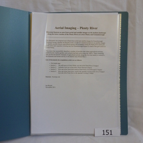
Folder, Aerial Imaging - Plenty River: by Ian Bryant, 2011_11
Investigates early land use along the Plenty River from north of the main aqueduct crossing in Greensborough to south of the golf course in Lower PlentyHistorical features seen from aerial and satellite images of the modern landscape may indicate earlier agricultural land usage.9 x A4 pages of text and colour annotated maps downloaded from nearmap.com.plenty river, ian bryant, lower plenty, greensborough, yallambie park, aerial photography -
 Greensborough Historical Society
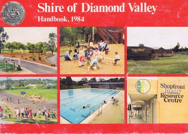
Book, Shire of Diamond Valley Handbook 1984, 1984_
Guide to services provided by Shire of Diamond Valley. The Shire of Diamond Valley was a Local Government Area located about 20 kilometres northeast of Melbourne. The shire covered an area of 74.38 square kilometres and existed from 1964 until 1994.Annual guide to services in Shire of Diamond Valley32 pages, col illus., maps. Cover illustration of recreation facilities in Diamond Valley.shire of diamond valley, greensborough, handbooks -
 Greensborough Historical Society
Folder, Ian Bennetts, Is there a pattern to the distribution of burglaries and thefts reported to the Greensborough police station, and what factors may influence this? by Ian Bennetts, 1990_
Year 12 Geography individual research project, Montmorency Secondary College, 1990. Investigates whether there a pattern to the distribution of burglaries and thefts reported to the Greensborough police station, and what factors may influence this? by Ian Bennetts72 p. spiral bound loose leaf folder. Typescript, coloured maps and diagramsVictorian Police logo on title page.thefts, greensborough, police - greensborough -
 Greensborough Historical Society
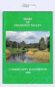
Book, Shire of Diamond Valley, The Shire of Diamond Valley Handbook 1992, 1992_
The Shire of Diamond Valley was a Local Government Area located about 20 kilometres northeast of Melbourne. The shire covered an area of 74.38 square kilometres and existed from 1964 until 1994.Annual guide to services in Shire of Diamond Valley54 pages, illus (some colour), maps. Front cover photograph:Kalparrin Gardens Greensboroughshire of diamond valley, greensborough, handbooks -
Glenelg Shire Council Cultural Collection
Map - Map - Bridgewater Lakes Tour, 1970s
Typed up directions around the Bridgewater area. Inside: Map of Portland - Bridgewater area.map, tourism, travel, recreation, cape bridgewater -
Glenelg Shire Council Cultural Collection
Postcard - Postcard - Mac's Hotel Portland, Victoria, n.d
Coloured postcard. Depiction of Mac's Hotel Portland, advertisement, map of location on reverse of postcard.Front: 'MAC'S MOTEL-HOTEL' - black print in white border, bottom edge of postcard -
 Greensborough Historical Society
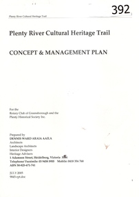
Report, Plenty River Cultural Heritage Trail : Concept & management plan, 2005_07
Prepared for the Rotary Club of Greensborough and Plenty Historical Society by Dennis Ward, this report outlines the heritage importance of the Plenty River Trail around Greensborough.This is an ongoing project by Dennis Ward. This report is an early version of the 2011 Squatters, speculators and settlers: Plenty River Cultural heritage trail. (Item 258) 66 page report, Illus, (some col.) , maps. In red 2-ring binder.Some handwritten notes in last pages.plenty river cultural heritage trail, dennis ward, rotary club of greensborough, plenty historical society, plenty river -
4th/19th Prince of Wales's Light Horse Regiment Unit History Room
Booklet, Capt W Stanley Lewis MSc, FRGS, Military Map Reading for the New Army, Feb 1941
Soft covered booklet covering various details of military maps and how to read them. Price Two shillings and six pencemanual, map reading -
 Kiewa Valley Historical Society
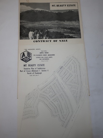
Folder - Mt Beauty Estate
After the State Electricity of Victoria completed the construction of the Kiewa Hydro Electric Scheme in 1961 the township of Mt Beauty was sold. The Shire of Bright (currently Alpine Shire) purchased the town and individual houses were put up for sale to the public.The sale of Mt Beauty changed the town - its occupants, its industry, its governance etc. Papers held in a manila folder. They include the Contract of Sale and Maps of Mt Beauty 1961mt beauty township, shire of bright -
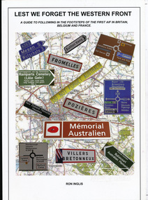 Eltham District Historical Society Inc
Book, Ronald William Inglis, Lest we forget the Western Front : a guide to following in the footsteps of the first AIF in Britain, Belgium and France, 2010
A guide to sites and memorials relevant to the first Australian Imperial Force in Britain, Belgium and France in the First World War170 p. : ill. (some col.), maps (some col.), ports. ; 30 cm.ISBN 9780646519920australian imperial force, war memorials, world war 1 battle fields -
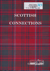 Eltham District Historical Society Inc
Book, Scottish Connections : the story of Agnes Grant and her Grant and McKenzie ancestors in Scotland to her life in Victoria, Australia, together with a genealogy of her cousins and descendants to 2000 / Grant Angus, 2001
Paperback; xx, 295 p. : ill., geneal. tables, maps, ports. ; 29 cm.ISBN 0646413481mackenzie family, grant family, agnes grant -
 Victoria Police Museum
Map (Thomas McIntyre), 1878 - 1880
Created by Constable Thomas McIntyre, sole survivor of the police party murdered by the Kelly Gang at Stringybark Creek near Mansfield Victoria in 1878. Thomas McIntyre was the main witness in Ned Kelly's trial.Large hand drawn map of the Stringybark Creek ambush site on blue government paper.ned kelly, kelly gang, victoria police, thomas mcintyre, stringybark creek, thomas lonigan, michael kennedy, thomas scanlan -
Ringwood and District Historical Society
Map, Photocopy of Part of a map of Warrandyte -Yarra Valley area year unknown possibly c1930, c1930
Photocopy of Part of a map of Warrandyte -Yarra Valley area year unknown possibly c1930 -
Ringwood and District Historical Society
Map, Prepared by Commonwealth Section Imperial General Staff, Topographical map of Ringwood and surrounding areas dated 1-Aug-1935
Topographical map of Ringwood and surrounding areas dated 1-Aug-1935. Two copies.Ringwood Zone -
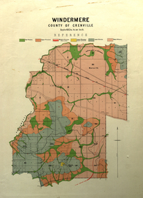 Federation University Historical Collection
Map, Windermere, County of Grenville
Coloured geological map of Windermere, County of Grenville. Scale is 40 chains to 1 inchwindermere, grenville, krause, plan, map -
Federation University Historical Collection
Book, Wendy Jacobs et al, Maldon Conservation Study, 1977, 1977
Brown soft covered book of 94 pages. It includes pull out maps and plans. conservation, maldon, planning, john templeton, porcupine flat, tarrengower, mining, architecture, town and country planning board, wendy jacobs, miles lewis, gary vines -
 City of Moorabbin Historical Society (Operating the Box Cottage Museum)
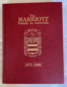
Book - Family History, Marriott, Ralph, The Marriott family in Australia, 1871-1986, 1986
The History and family tree of John Marriott and his wife Emma Kitchen and their descendants in Australia, 1871-1986371 p. : ill., facsims., geneal. tables, maps, plans, ports.: includes indexnon-fictionThe History and family tree of John Marriott and his wife Emma Kitchen and their descendants in Australia, 1871-1986marriott, family history, market gardening, moorabbin, bentleigh, pioneer -
 City of Moorabbin Historical Society (Operating the Box Cottage Museum)
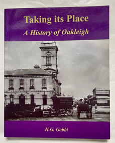
Book, Gobbi, H. G. (Helen Grace), Taking its place : a history of Oakleigh marking its sesquicentenary, 1853-2003, 2004
243 p. : ill., maps, plans; Includes index. Bibliography: p. 232-235.oakleigh, history -
 City of Moorabbin Historical Society (Operating the Box Cottage Museum)
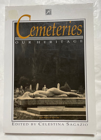
Book, Sagazio, Celestina, Cemeteries : our heritage
184 p. : ill., 1 map Includes bibliography (p. 173-178) and index.non-fictioncemeteries, historic sites, victoria -
 City of Moorabbin Historical Society (Operating the Box Cottage Museum)
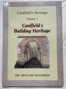
Book, Solomon, Geulah, Caulfield's Building Heritage : Caulfield's Heritage : Volume 1, 1989
ill., maps, ports. ; Vols. 1-4 together in case. Includes bibliographies and indexes.non-fictioncaulfield, buildings, heritage buildings -
 City of Moorabbin Historical Society (Operating the Box Cottage Museum)
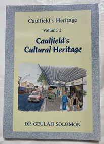
Book, Solomon, Geulah, Caulfield's Cultural Heritage : Caulfield's Heritage :Volume 2, 1989
ill., maps, ports. ; Vols. 1-4 together in case. Includes bibliographies and indexes.non-fictioncaulfield, buildings, heritage buildings -
 City of Moorabbin Historical Society (Operating the Box Cottage Museum)
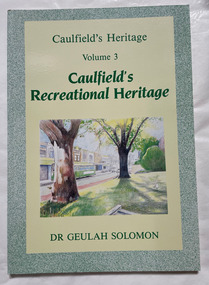
Book, Solomon, Geulah, Caulfield's Recreational Heritage : Caulfield's Heritage :Volume 3, 1989
ill., maps, ports. ; Vols. 1-4 together in case. Includes bibliographies and indexes.non-fictioncaulfield, buildings, heritage buildings -
 City of Moorabbin Historical Society (Operating the Box Cottage Museum)
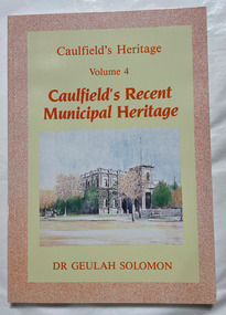
Book, Solomon, Geulah, Caulfield's Recent Municipal Heritage : Caulfield's Heritage :Volume 4, 1989
ill., maps, ports. ; Vols. 1-4 together in case. Includes bibliographies and indexes.non-fictioncaulfield, buildings, heritage buildings -
 Bendigo Historical Society Inc.
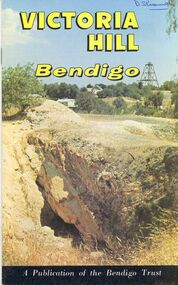
Book - STRAUCH COLLECTION: VICTORIA HILL BENDIGO
Victoria Hill Bendigo a publication of the Bendigo Trust with maps, black and white & colour photographs.bendigo, gold mining, victoria hill, bendigo-history-mining -
Bendigo Historical Society Inc.
Map - STRUGNELL COLLECTION: BENDIGO GOLD FIELD GEOLOGICAL SURVEY, 1936
Bendigo Goldfieds Geological Survey. Prepared in the Bendigo Office Bottom Section of original map.Dept of Mines Victoriabendigo, gold mining, geological map -
Bendigo Historical Society Inc.
Map - STRUGNELL COLLECTION: BENDIGO GOLD FIELD GEOLOGICAL SURVEY, 1936
Bendigo Goldfieds Geological Survey. Prepared in the Bendigo Office Top Section of original map.Dept of Mines Victoriabendigo, gold mining, geological map -
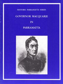 Bendigo Historical Society Inc.
Book - STRAUCH COLLECTION: GOVERNOR MACQUARIE IN PARRAMATTA
Booklet, Historic Parramatta Series Governor Macquarie in Parramatta, with black and white photographs and a map.australia, history, parramatta, australia - history - nsw - parramatta