Showing 173742 items matching "1200-mair-street"
-
 Eltham District Historical Society Inc
Photograph, George Coop, Carrucan's Dairy on Dalton Street, Eltham, c.1969, 1969
Viewed from intersection of Mount Pleasant Road and Metery Road looking northwest. The dairy is in the foreground situated on Dalton Street. An unmade Bible Street can be seen running down the hill at the left to intersect with Dalton Street. Dalton Street runs from left to right between the dairy and the Carrucan family home opposite located on the southeast corner of Bible and Dalton streets. Doug Orford recalls the dairy was at a slight angle to Dalton Street. Tim Erickson, (a nephew to Betty Erickson, nee Carrucan) reacalled (9 May 2025): the bottom front paddock ran from MeteryRoad to Mount Pleasant Road The brick dairy from 1thje 1950s had 10-15 milking cow , Jersey and Guernsey6 and the used to send the cream to Eltham Dairy The garage when Tim was a child used to house a couple of sulkies The laundry was a local home built job The small house built late 1940s for Betty Carrucan for her family The small orchard grew Quince, Apple and Plum The main block was the upper paddock Cypress trees remain present as of 2025 Originally 2 buildings but a third was added in the early 1900s for a kitchen and diningDigital TIFF file Scan of 35mm Ilford HP4 black and white transparencybible street, carrucan dairy, carrucan home, dalton street, eltham, mount pleasant road -
 Warrnambool and District Historical Society Inc.
Document, Register Subdivision WCC, Late 20th century
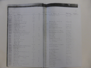
These sheets contain photocopied information on Warrnambool streets and blocks – Allotment numbers and Section numbers, names of developers, date of street construction approval, names of lawyers, Titles Office information etc. They have been originally compiled by Warrnambool City Council staff and concern Warrnambool streets projects from the 1950s, 60s and 70s. This is photocopied material and therefore is of little historical importance. But the information contained therein will be useful for researchers. Document One: These are 57 photocopied pages containing lists of Warrnambool streets and blocks and information on their development. The original information has been handwritten. The pages have been stapled together but the staples have been removed. Document Two: These are twelve photocopied lists of Warrnambool streets with sub-division and development information. The lists have printed plan numbers on the left side and the rest of the information is hand-printed. Two pages have been glued together on one sheet to make six pages. The pages have been stapled together but the staples have been removed. warrnambool streets, warrnambool city council, history of warrnambool -
 Eltham District Historical Society Inc
Document - Building Plan, J.M. Harcourt, 22 Peter Street, Eltham, c.1946
Pise or Adobe Brick Cottage for Mr D. Sawer in Peter St., Eltham Design and drawings by J.M. Harcourt, Clay Nuneham, Eltham. The cottage at present day 22 Peter Street was built circa 1946. Also Drawing of planned carport and future extension for 22 Peter Street, Eltham22 peter street, building plans, clay nuneham, d. sawer, eltham, j.m. harcourt design, adobe house, j.m. harcourt designc.1946, pise house -
 Eltham District Historical Society Inc
Slide, Andrews Street, Eltham, c. Jan 1983
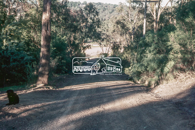
Roll of film taken by Eltham Shire Council officers of the Beard street group, a private street scheme, before construction commenced. They provide perspective of the changes in housing styles and road development that began sweeping in from the mid 1970s with increasing urbanisation of what was once more outlying suburbs and regions.35 mm colour positive transparency (1 of 7) Mount - Blank Card,eltham, housing estate, infrastructure, private street scheme, roads, andrews street -
 Eltham District Historical Society Inc
Slide, Thomas Street, Eltham, c. Jan 1983
Roll of film taken by Eltham Shire Council officers of the Beard street group, a private street scheme, before construction commenced. They provide perspective of the changes in housing styles and road development that began sweeping in from the mid 1970s with increasing urbanisation of what was once more outlying suburbs and regions.35 mm colour positive transparency (1 of 7) Mount - Blank Card,eltham, housing estate, infrastructure, private street scheme, roads, thomas street -
 Eltham District Historical Society Inc
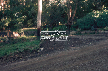
Slide, Andrews Street, Eltham, c. Jan 1983
Roll of film taken by Eltham Shire Council officers of the Beard street group, a private street scheme, before construction commenced. They provide perspective of the changes in housing styles and road development that began sweeping in from the mid 1970s with increasing urbanisation of what was once more outlying suburbs and regions.35 mm colour positive transparency (1 of 7) Mount - Blank Card,eltham, housing estate, infrastructure, private street scheme, roads, andrews street -
 Eltham District Historical Society Inc
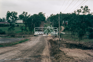
Slide, Frank Street, Eltham, c. Jan 1983
Roll of film taken by Eltham Shire Council officers of the Beard street group, a private street scheme, before construction commenced. They provide perspective of the changes in housing styles and road development that began sweeping in from the mid 1970s with increasing urbanisation of what was once more outlying suburbs and regions.35 mm colour positive transparency (1 of 7) Mount - Blank Card,eltham, housing estate, infrastructure, private street scheme, roads, frank street -
 Eltham District Historical Society Inc
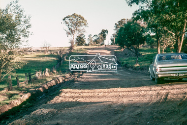
Slide, Beard Street, Eltham, c. Jan 1983
Roll of film taken by Eltham Shire Council officers of the Beard street group, a private street scheme, before construction commenced. They provide perspective of the changes in housing styles and road development that began sweeping in from the mid 1970s with increasing urbanisation of what was once more outlying suburbs and regions.35 mm colour positive transparency (1 of 7) Mount - Blank Card,eltham, housing estate, infrastructure, private street scheme, roads, frank street, beard street -
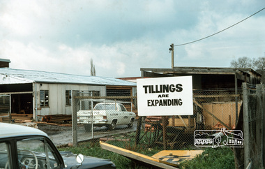 Eltham District Historical Society Inc
Photograph, Tillings timber yard, Bridge Street, Eltham, 1968, 1968
Tillings started as a small family owned business in Eltham, in Bridge Street Eltham and is now a major timber supplying business with branches all over Australia specialising in cedar. It operated in Bridge Street in the light industrial area and also stored timber on other blocks within the light industrial area. Digital copy of colour photographfred mitchell collection, 1968, eltham, bridge street, n.j. tillings, tillings timber yard -
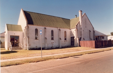 Stawell Historical Society Inc
Photograph, Free Methodist Chapel Church in Wakeham Street 1870 -- Coloured
Coloured photograph of Church built in Wakeham Street Stawell in 1870 and used as a Free Methodist Chapel. After the various branches of the Methodist Church united about 1900 the building was used by the Free Masons until their building in Skene Street was erected in 1926. It's now the home of the Stawell Municipal Band.Colour photograph depicting a Church (brick) building with a timber fence around the back section of the church. -
 Stawell Historical Society Inc
Postcard, Main Street Stawell 1906
Upper Main Street Stawell Looking West Across Layzell Street Intersection. J Chadwick Draper sign in centre of photo. Turf Hotel on left, Danes Grocer on right. Foresters Hotel on left. Horse drawn buggy near centre of photo. c1900's. Same as 0539-2streetscape, businesses -
 Ringwood and District Historical Society
Photographs, Construction Stage of historical Miner's Cottage Museum completed 1983, and panoramic view of partial construction of commercial buildings on former Ringwood Market site, Seymour Street, Ringwood c.1970s. On cardboard
3964/1 15 photographs on cardboard 76cmX51cm depicting construction stages of historical Miner's Cottage Museum completed 1983; 3964/2 4 photographs on cardboard 85.5cmX22.5cm forming panoramic view of partial construction of commercial buildings on former Ringwood Market site, Seymour Street, Ringwood c.1970s -
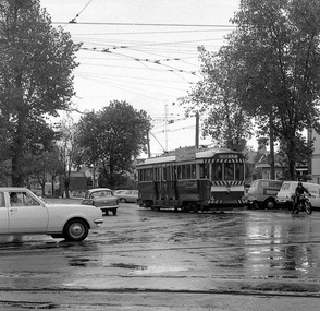 Ballarat Tramway Museum
Photograph - Digital image, Peter Bruce, "No. 34 at Drummond Street South", 1970s
Yields information about the Hospital Corner intersection.Digital image of No. 34 turning from Drummond St South into Sturt St. Tram has the destination of Lydiard St North. At Hospital Corner. Photo taken by Peter Bruce 1970's and 1971, prior to the closure of the Ballarat tramway system. Peter's Title of image: "No. 34 at Drummond Street South"trams, tramways, drummond st sth, hospital corner, sturt st, tram 34 -
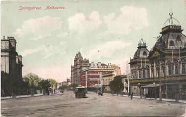 Melbourne Tram Museum
Postcard, "Spring street Melbourne", mid 1900's?
Divided back postcard featuring a coloured image of Spring Street Melbourne, with the Princess Theatre, The Imperial Hotel, The Grand Hotel, Windsor Hotel and Parliament House. A single cable tram is in Spring St about to turn into Gisborne St. Rear has space for stamp, address, message. Notes that it was printed in Germany.trams, tramways, cable trams, spring st, gisborne st, hotels, parliament -
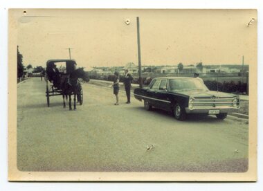 Orbost & District Historical Society
Photograph - Opening of Orbost Museum
This is a photograph of Mr & Mrs Peter Nixon about to board Kaye Lynn's covered jinker which is pulled by a horse to travel to open the Orbost Historical Society's Museum in Nicholson Street, Orbost. The original location of the Museum 1967 was in the building which is now (2022) used by the Cricket Club & Senior Citizens. The Library was also located there. Since 1994 and following the Orbost Shire's amalgamation into East Gippsland, the Library and Museum were located into the Shire's Business Centre in Ruskin Street, Orbost.photograph of an event in Orbost A b/w photograph of large car on the right hand side, two people in the centre, and a horse and sulky on the left. They are in a street.On back: Mr and Mrs Nixon are about to board Kaye Lynn's covered jinker to travel to open Orbost Historical Museum in Nicholson Street, Orbost. peter nixon mp, orbost museum, kaye lynn -
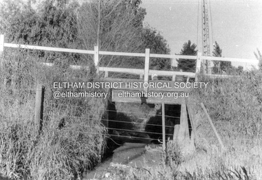
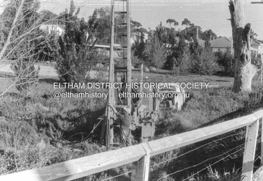 Eltham District Historical Society Inc
Album - Photograph, J.A. McDonald, Cecil Street Bridge, Eltham-Yarra Glen Road, Eltham, Oct. 1962
Eltham-Yarra Glen Road Cecil Street Bridge Looking upstream Oct. 1962Record of various Shire of Eltham infrastructure works undertaken during the period of 1952-1962 involving bridge and road reconstruction projects, sometimes with Eltham Shire Council Project Reference numbers quoted. It was during this period that a number of significant improvements were made to roads and new bridges constructed within the shire that remain in place as of present day (2022). In many situations, the photos provide a tangible visible record of infrastructure that existed throughout the early days of the Shire. The album was put together by or under the direction of the Shire Engineer, J.A. McDonald.H941 stamped on reverse (film processing #)infrastructure, shire of eltham, bridge construction, road construction, 1962-10, bible street reserve, cecil street bridge, eltham, eltham-yarra glen road, main road -
 Eltham District Historical Society Inc
Album - Photograph, J.A. McDonald, Cecil Street Bridge, Eltham-Yarra Glen Road, Eltham, Oct. 1962
Eltham-Yarra Glen Road Cecil Street Bridge Looking upstream Oct. 1962Record of various Shire of Eltham infrastructure works undertaken during the period of 1952-1962 involving bridge and road reconstruction projects, sometimes with Eltham Shire Council Project Reference numbers quoted. It was during this period that a number of significant improvements were made to roads and new bridges constructed within the shire that remain in place as of present day (2022). In many situations, the photos provide a tangible visible record of infrastructure that existed throughout the early days of the Shire. The album was put together by or under the direction of the Shire Engineer, J.A. McDonald.H941 stamped on reverse (film processing #)infrastructure, shire of eltham, bridge construction, road construction, 1962-10, cecil street bridge, eltham, eltham-yarra glen road, main road -
 Eltham District Historical Society Inc
Slide, Possibly looking east along Rosehill Road, Lower Plenty towards Bolton Street intersection, 18 July 1972, 1972
Reconstruction works by Eltham Shire Council, Bolton Street, Eltham, 18 July 197235 mm colour positive transparency Mount - Agfacolor Service (Blue)bolton steet, eltham, eltham shire council, infrastructure, lower plenty, road construction, rosehill road -
 Eltham District Historical Society Inc
Slide, Looking south along Bolton Street towards intersection with Rosehill Road, Lower Plenty, 18 July 1972, 1972
Reconstruction works by Eltham Shire Council, Bolton Street, Eltham, 18 July 197235 mm colour positive transparency Mount - Agfacolor Service (Blue)bolton steet, eltham, eltham shire council, infrastructure, lower plenty, road construction, rosehill road -
 Eltham District Historical Society Inc
Slide, Drainage under driveway near No. 10 Bolton Street, Lower Plenty, 18 July 1972, 1972
Reconstruction works by Eltham Shire Council, Bolton Street, Eltham, 18 July 197235 mm colour positive transparency Mount - Agfacolor Service (Blue)bolton steet, eltham, eltham shire council, infrastructure, lower plenty, road construction, rosehill road -
 Eltham District Historical Society Inc
Slide, Looking south along Bolton Street to intersection with Main Road, 18 July 1972, 1972
Reconstruction works by Eltham Shire Council, Bolton Street, Eltham, 18 July 197235 mm colour positive transparency Mount - Agfacolor Service (Blue)bolton steet, bolton street shops, eltham, eltham shire council, infrastructure, main road, road construction -
 Eltham District Historical Society Inc
Slide, Possibly looking south along Bolton Street towards intersection with Grand Boulevard, Eltham, 18 July 1972, 1972
Reconstruction works by Eltham Shire Council, Bolton Street, Eltham, 18 July 197235 mm colour positive transparency Mount - Agfacolor Service (Blue)bolton steet, eltham, eltham shire council, ht holden, infrastructure, kgf-182, road construction -
 Greensborough Historical Society
Flyer - Advertising Leaflet, Buckingham and Company Estate Agents, 132 Nell Street Greensborough, 2023
132 Nell Street Greensborough. 3 bedroom home, sold July 2023 for $865,000. Real Estate advertising leaflet, 1 sheet, printed in colour both sidesnell street greensborough -
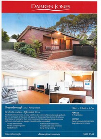 Greensborough Historical Society
Advertising Leaflet, Darren Jones Real Estate, 3/31 Henry Street Greensborough, 2014
For sale notice for 3/131 Henry Street Greensborough, sold in April 2015 for $360,000Cardboard leaflet, printed in colour both sides, includes floor planhenry street greensborough -
 Greensborough Historical Society
Folder of documents, Nepean Street - fact or fiction?, by Peter Simmenauer, 2018_09
Record of ownership of 216 Nepean Street Greensborough 1916-1997, Grace Park areaPhotocopies of four Certificates of Title and other land documents, with summary of land ownership 1916-1997nepean street greensborough, grace park -
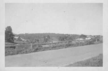 Greensborough Historical Society
Photograph - Digital image, Nance Reardon, Grimshaw Street looking from the Simons' house 1950s, 1950s
Photograph of Grimshaw Street looking from the Simons' house. The WaterMarc complex is now on this site.Digital copy of black and white photograph.simons family, grimshaw street greensborough, watermarc -
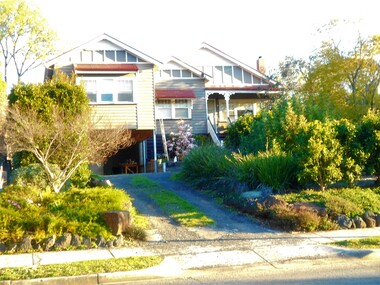
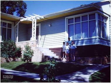 Greensborough Historical Society
Photograph - Digital Image, Paul de Sauty, 43 Hailes Street Greensborough, 1960s, 1960s
Photograph of the house at 43 Hailes Street Greensborough, the de Sauty family home, 1960s.Digital copy of colour photograph.hailes street greensborough, paul de sauty -
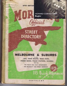 Greensborough Historical Society
Directory, Morgan's Official Street Directory of Melbourne & Suburbs, 37th edition, 1951, 1951_
One of the standard Melbourne street directories prior to the publication of Melways. Edition 37, 1951. Contains mid-20th century street maps of Melbourne including Greensborough area.Hardback book, printed in black and red, colour coverCard attached: Howard Cornish OAM, Buglerstreet directories, melbourne -
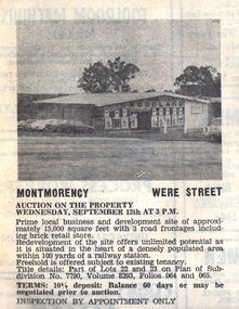 Greensborough Historical Society
Advertisement - Digital image, Diamond Valley News, Were Street Foodland Auction, 1973, 12/09/1973
Advertisement for the auction on 12/09/1973 of 55 Were Street Montmorency Foodland Store. Digital copy of newspaper advertisement.were street montmorency, foodland