Showing 180137 items
matching streets
-
 Federation University Historical Collection
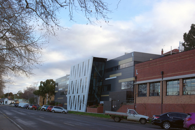
Photograph - Colour Photograph, Clare Gervasoni, Ballarat School of Mines from Albert Street, Ballarat, 29/07/2020
The Ballarat School of Mines Botanical Garden was established in 1870, and was used by students of Materia Medica and Botany.Colour photograph of Ballarat School of Mines buildings in Albert Street, Ballaratballarat school of mines, flecknoe building, albert street, m.b. john building, ballarat tech school -
 Federation University Historical Collection
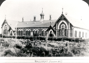
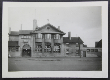
Photograph, Pleasant Street State School
Black and white photographic copy of a brick school at Pleasant Street, Ballarat.pleasant street state school, education, school -
 Federation University Historical Collection
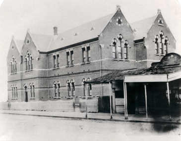
Photograph, Humffray Street State School
Black and white photographic copy of a brick school at Humffray Street, Ballarat.education, school, humffray street state school -
 Federation University Historical Collection
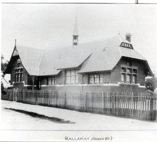
Photograph - Black and White, Queen Street State School, Ballarat
Black and white photograph of a brick primary school in Queen Street, Ballarat.education, school, queen street primary school -
 Mission to Seafarers Victoria
Photograph - Photograph, Black and white, c. 1945
The building is clearly what is now known as the Mission to Seafarers, however there seems to be a sign on the building describing it as the Mission to Seamen. Depicts actual road outside the Mission, Flinders st which seems to still be undeveloped with wooden? drainage covers still in place suggesting a period for the photograph circa late 1930s to the immediate post WW2 era.The image is part of the century long record of the central location of the Mission at 717 Flinders St. Black and white photograph depicting the Flinders Street building circa 1945. victoria-missions-to-seamen, melbourne-missions-to-seamen, cottage, windvane, flinders street -
 Phillip Island and District Historical Society Inc.
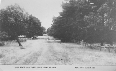
Photograph, Unmade road in Cowes
Part of a collection of 'Rose & Valentine' series of Post Cards. Copied by John Jansson 1984View of a beach road, Cowes. Unmade, grassy, tree lined street.Along Beach Road, Cowes, Phillip Island, Victoria. Real Photo Series M1256local history, photography, photographs, postcards, cowes, phillip island, black & white postcard copy, phillip island early roads -
 Phillip Island and District Historical Society Inc.
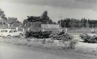
Photograph, c. 1960
One of a collection of over 400 photographs in an album commenced in 1960 and presented to the Phillip Island & Westernport Historical Society by the Shire of Phillip IslandPhotograph of the Cowes Tennis Courts Chapel Street Cowes. c. 1960local history, photography, cowes tennis courts, black & white photograph, cowes tennis club, tennis, sport, john jenner, bryant west -
 Glenelg Shire Council Cultural Collection
Photograph - Photograph - National School, Julia Street, 1970s
Photographic print of a rephotographed photograph. Image of National School, Julia Street.Front: 'Portland State School' - green ink Back: 'State School' - blue biroportland, street scene, national school, julia street -
 Eltham District Historical Society Inc
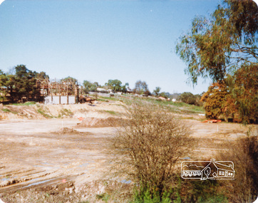
Photograph, Ruth H. Pendavingh, Building of the new Coles store at the corner of Main Road and Arthur Street, Eltham, 1999
Four colour photographs showing construction of the Coles store in Arthur streeteltham, coles store, arthur street, construction, buildings -
 Eltham District Historical Society Inc
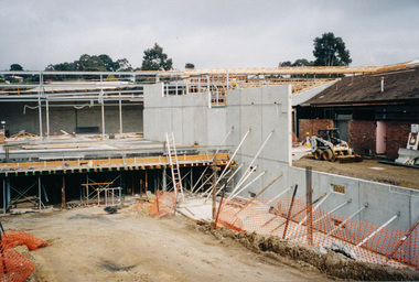
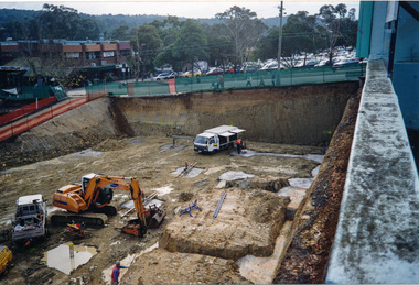
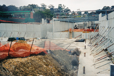
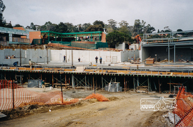
Photograph, Peter Bassett-Smith, Construction of Eltham Community Centre, June 1977, 1977
The valley of Diamond Creek, Eltham looking south from Bridge Streeteltham, eltham community centre, buildings, construction -
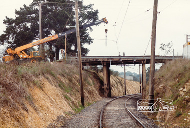
 Eltham District Historical Society Inc
Photograph, Old railway bridge at Silver Street, Eltham
Colour photograph of demolition of old railway bridge at Silver Street, Elthamrailways, bridges, silver street, eltham -
 Eltham District Historical Society Inc
Photograph, Ruth H. Pendavingh, Building of the new Coles store at the corner of Main Road and Arthur Street, Eltham, 1999
Four colour photographs showing construction of the Coles store in Arthur streeteltham, coles store, arthur street, construction, buildings -
 Eltham District Historical Society Inc
Photograph, Silver Street Railway Bridge
Colour photograph of old Silver Street railway bridge being demolishedrailways, bridges, silver street, eltham -
Eltham District Historical Society Inc
Photograph, Floods Falkiner Street, Eltham, 1956
Four photographs of floods in Falkiner Street area, Eltham, October 1956diamond creek, floods, falkiner street, main road, eltham -
 Eltham District Historical Society Inc
Photograph, Grove Street, Eltham
Colour photograph of Grove Street, Eltham near Eltham East Schoolgrove street, eltham -
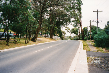
 Eltham District Historical Society Inc
Photograph, Main Road, Eltham at Dalton Street
Colour photo of Main Road, Eltham looking south at Dalton Streetmain road, dalton street, eltham -
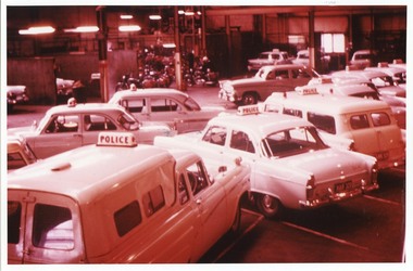 Victoria Police Museum
Photograph (police car)
Russell Street garage including Fairlanes, Customlines and Zephyrs. Circa 1960police vehicles; wireless patrol; motor transport branch; ford fairlane car; ford customline car; holden zephyr car; russell street -
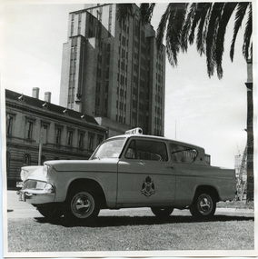 Victoria Police Museum
Photograph (police car)
Ford Anglia, side view, with Russell Street in the background. Circa 1960police vehicles; wireless patrol; motor transport branch; motor transport section; ford anglia car; russell street -
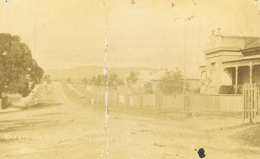 Ringwood and District Historical Society
Photograph, Bedford Rd / Bayswater Rd. looking east from Warrandyte Rd. railway underpass, c1910
Dirt Road with houses and planter boxes for street trees on one side.Multiple copies of photos SS0078 and SS0079 - Backing sheet on one reads "Bedford Rd. looking east from Warrandyte Rd. railway underpass, c1910". Others have Bayswater Rd, Bedford Rd etc names. Some copies state "Ringwood House on Right". There is a also a postcard version. SS0079rev is an image of the postcard reverse, dated feb 24 1910 -
 Ringwood and District Historical Society
Photograph, Church of England, Patterson Street, Ringwood East - 1960, 1960
Photos of East Ringwood Church of England Church in Patterson Street in 1960Written on back of photographs, "Christ Church, Church of England, East Ringwood - 1960", "C of E, Rwd. E." and "C of E, Rwd. E." -
 Ringwood and District Historical Society
Photographs, Byron Street looking south. Norwood High School
Byron Street looking south. Norwood High School circa 1990 -
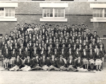 Federation University Historical Collection
Photograph, Ballarat Teachers' College
The Ballarat Teachers' College is a predecessor Institution of Federation University Australia. Students of the Ballarat Teachers' College in the grounds of Dana Street Primary Schooll.ballarat teachers' college, dana street primary school -
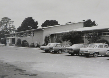 Federation University Historical Collection
Photograph - Photograph - Black and White, Ballarat Teachers' College, Gillies Street
Four cars are parked outside Ballarat Teachers' College in Gillies Street.ballarat teachers' college, gillies street -
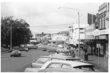 Federation University Historical Collection
Photograph - Black & White, Sturt Street Ballarat Looking Towards Bridge Mall, c1980
Photograph of Sturt Street Ballarat showing Ballarat and Bridge Mall in the distanceballarat, bridge mall, sturt street, cars -
 Federation University Historical Collection
Photograph - Photograph - Colour, Ballarat Railway Station, Lydiard Street North, Ballarat, c2010
Colour photograph of the exterior of the Ballarat Railway Station in Lydiard Street North. ballarat railway station, railway, ballarat, ballarat train station, lydiard street north, ballarat -
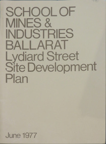 Federation University Historical Collection
Book, School of Mines & Industries Ballarat Lydiard Streete Site Development Plan, 1977, 06/1977
Ballarat School of Mines and industry is a predecessor of Federation University Australia.Brown soft covered book of the Lydiard Street Site Development Plan.ballarat school of mines, development plan, site development, lydiard street, site influences, campus plan, ballarat school of mines campus -
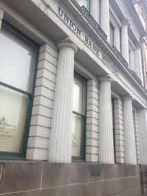 Federation University Historical Collection
Photograph - Colour, Former Union Bank of Australia, Ballarat, 2015, 18/12/2015
Photograph of a former bank building in Lydiard Street South, Ballarat, and a plaque.Plaque "1857-1957 This tablet commemorates the opening on 1st July 1857 of the Ballarat branch of the Union Bank of Australia Limited. These premises housed the branch until 30th September 1951 when the Union Bank of Australia Limited was merged with the Bank of Australiasia to form Australia and New Zealand Bank Limited."anz, bank, union bank, ballarat, union bank of australasia, bank of australasia, union bank of australia -
Federation University Historical Collection
Booklet, R.L. Taylor, Analysis Tables For Chemical Students, 1897
Blue soft covered bookSigned inside front "Thomas Daavis Eureka Street Ballarat East"r.l. taylor, chemistry, thomas davis