Showing 11594 items matching " maps"
-
 Bendigo Military Museum
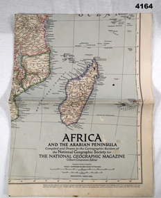
Map - MAP, COLOURED, The National geographic Magazine, Africa & the Arabian Peninsula, March 1950
... Maps ...Part of the collection of Frederick Gardner Davey DFC No 410533 RAAF. Refer Cat No 3536P for his service details.Coloured political map featuring borders,towns,and Allies, small physical inset in bottom LH corner.maps, africa, arabian -
 Whitehorse Historical Society Inc.
Map, Boroondara, Nunawading, 1853
... Maps ...Map of section of Parishes of Boroondara and NunawadingMap of section of Parishes of Boroondara and Nunawading with allotments numbered and named. Note on verso: Boroondara and Nunawading c1853.Map of section of Parishes of Boroondara and Nunawading maps, parish of nunawading, parish of boroondara -
 Greensborough Historical Society
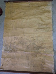
Map, Map of Greensborough - Jessop's Real Estate, 1930c
This map of Greensborough hung in the office of Cec Jessop's Real Estate office corner Main and Grimshaw Street. Includes a word document listing street name changes from the original map to today, according to Norm Colvin.This map was saved from the building when the business closed.Canvas roll-up map with timber rails top and bottom.greensborough - maps, cecil jessop, greensborough street names -
Canterbury History Group
Map - Maling Road Urban Renewal Map 1972, 1972
... Maps ...Photocopy of map of proposed urban renewal in Maling Road Canterbury 1971canterbury, maling road, town planning, maps -
 Greensborough Historical Society
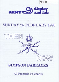
Booklet, Simpson Barracks, Then and now: Army display and fair 1990, 25/02/1990
Display and fair programme describing events with map of locations, held at Simpson Army Barracks 25/02/1990.8 page booklet with programme and map.Paperaustralian army, watsonia army barracks, simpson army barracks -
![Map, Plan showing proposed deviation of the road through McKenzie's Flat to Bacchus Marsh. [Undated]](/media/collectors/5e461d8021ea67224c82f2a1/items/677d22f37f2053f3e5d500dc/item-media/677d25247f2053f3e5d50950/item-fit-380x285.jpg) Bacchus Marsh & District Historical Society
Bacchus Marsh & District Historical SocietyMap, Plan showing proposed deviation of the road through McKenzie's Flat to Bacchus Marsh. [Undated]
The date of this map or plan is uncertain. McKenzie's Flat is a bushland picnic area on the Lerderderg River in the Lerderderg State Park close to Bacchus Marsh. The proposed road deviation shown on this map is very close to a sharp bend in the Lerderderg River which shows an island in the centre of that bend. The name of a landholder, J.B. Perry is shown on the map close to the area of the road deviation.The land shown is identified as within the Parish of Merrimu.Single page map showing a proposed deviation of the road from McKenzie's Flat to Bacchus Marsh. Scale: 5 chains to 1 inch. Part of a set of maps which are pasted into a bound volume containing 76 maps or plans in total. High resolution digital image stored on BMDHS computer network. mckenzies flat bacchus marsh, bacchus marsh roads and streets -
Tatura Irrigation & Wartime Camps Museum
Buttons
Issued to Sister Kathleen Heaphy of Australian Army Nursing service. Sister Heaphy was attached, for part of her service, to 28 Camp Hospital Internment camp 1.4 round identical brass buttons with a metal shank crown and map of Australia and wording around the circumference. 2 of the buttons have split pins through the shank.Australian Military Forces and a crown and map of Australia. Stokes and Sons Melbourneaustralian army nursing service, sister kathleen heaphy, 28 camp hospital internment camp 1, brass buttons -
 Tatura Irrigation & Wartime Camps Museum
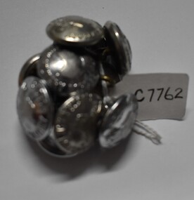
Buttons, 1049's
Issued to Sister Kathleen Heaphy of Australian Army Nursing service. Sister Heaphy was attached, for part of her service, to 28 Camp Hospital Internment camp 1.10 identical round silver metal buttons with a metal shank crown and map of Australia and wording around the circumference. 2 have split pins through the shank.Australian Military Forces and a crown and map of Australia. Stokes and Sons Melbourneaustralian army nursing service, 28 camp hospital internment camp 1, silver metal buttons -
 Greensborough Historical Society
Map, Greensborough c 1980s, 1980s
Map of Greensborough and surrounds showing bus routes servicing Eltham College.Map of Greensborough and surrounds, black print with colour markings."Bundoora Retirement Village" marked in red pen at E20greensborough - maps, eltham college, bus routes, public transport -
 Dandenong/Cranbourne RSL Sub Branch
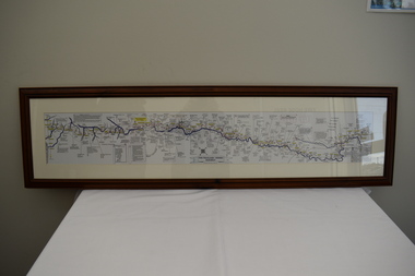
Map - Burma - Siam Railway
Is of Historical significance. This map was put together by T.R.Beaton on the 15th February 2002. He used old railway and road maps to show the route and it took him over 15 months to put together. T.R. Beaton was Manager/Curator of Australian Government Memorial Museum built above " Hellfire Pass " or Konyu Cutting.Framed picture map of the Burma _ Siam Railway. -
 Greensborough Historical Society
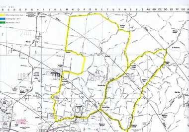
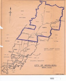
Map, City of Heidelberg, City of Heidelberg, 1962, 02/02/1962
Map of City of Heidelberg showing boundaries of its six wards; North Ward is highlighted, covering Watsonia, Greensborough, part Bundoora, St Helena, Plenty, Yarrambat and Diamond Creek.Blue print mapCity of Heidelberg Scale: 1" to 1 ml. G.M.H. 2.2.62city of heidelberg, heidelberg - maps -
Whitehorse Historical Society Inc.
Pamphlet, Schwerkolt Cottage Mitcham
A pamphlet issued by City of NunawadingA pamphlet issued by City of Nunawading on Schwerkolt Cottage with photographs and location map.A pamphlet issued by City of Nunawading schwerkolt cottage, city of nunawading -
 Whitehorse Historical Society Inc.
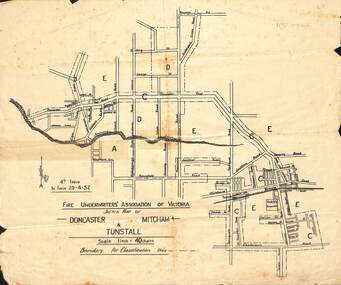
Map - Fire Underwriter's Association Sketch Map, Fire Underwriter's Association of Victoria, Doncaster, Mitcham and Tunstall, 29/4/1932
Shetch map of Doncaster, Mitcham and Tunstall. Scale 1inch = 40 chainsA sketch map of Doncaster, Mitcham and Tunstall by the Fire Underwriters' Association of Victoria.non-fictionShetch map of Doncaster, Mitcham and Tunstall. Scale 1inch = 40 chainsmap, doncaster, mitcham, tunstall -
 City of Kingston
Pamphlet - Colour, Arthur Tuckett & Son, Auctioneers and Subdivisional Specialists, Auction of Station Estate, Moorabbin, 1923
Sales plan for land in the suburb of Moorabbin, bounded by Railway Crescent, South Road, Jasper Road and Pattersons Road.The developing urban area of Moorabbin within the City of Kingston. This land sale pamphlet illustrates the subdivision of land within the municipality and the changing demographic of the district as new houses are constructed.Colour pamphlet advertising an auction of the Station Estate Moorabbin. Incorporates details of the shopping facilities, proximity to the railway line, variety of schools and churches in the area, and a sales plan for home sites and shop fronts. Incorporates a map of the estate bordered by Pattersons Road, Japer Road, South Road and Railway Crescent. Handwritten in grey pencil top right front page: Station Estate / late [indecipherable] Handwritten in red pencil on subdivision map: x [on majority of properties marked on the map] Handwritten in grey pencil on subdivision map: additional subdivisions drawn in and large lines drawn across the mapmoorabbin, land sales, estate -
Whitehorse Historical Society Inc.
Map, Melbourne and Metropolitan Board of Works, Feb 1982
... Maps ...Map area: North - Laburnum and Blackburn Stations East - Blackburn Lake South - bordering Canterbury Road West - Middleborough Roadnon-fictionMap area: North - Laburnum and Blackburn Stations East - Blackburn Lake South - bordering Canterbury Road West - Middleborough Roadmaps, melbourne and metropolitan board of works, parish of nunawading -
Hume City Civic Collection
Map, Sunbury Township 1857
This is a reprint of a 1857 map of the township of Sunbury in the County of Bourke produced by the Public Records Office by courtesy of the Surveyor General in 1978.This is a reprint of a 1857 map of the township of Sunbury.sunbury, shire of bulla, sunbury township, 1850s -
Port Melbourne Historical & Preservation Society
Photograph - Woolsheds between Beacon and Barak Roads, Port Melbourne, Don Hossack, 1947
Donated by Don Hossack who took the photograph when he was 16 years old and working at the woolsheds. He recalls that bags of oats and barley were stored here.Photo (10 x 12" glossy black and white print) of the wool sheds between Beacon and Barak Roads. Shows north easternmost sheds and rail line. The wool sheds were built by the Americans during World War II and taken down again in the 1950s . Map (hand drawn) on rear shows location of photograph.map (hand drawn) of location of photographtransport - railways, built environment - industrial, war - world war ii -
Whitehorse Historical Society Inc.
Document, Eastern Freeway Extension, 2000 - 2002
... Maps ...Eastern Freeway ExtensionEastern Freeway Extension- Cost estimates for community consultation option Public consultation process : report on analysis submissions Deep Creek Road - Landscape concept Media Release from Premier of Victoria VicRoads - Works update newsletters Whitehorse City Council minutes VicRoads Correspondence Schwerkolt Cottage Precinct - Concept Plan VicRoads maps.Eastern Freeway Extensioneastern freeway extension, vicroads, victoria. department of infrastructure, city of whitehorse, schwerkolt cottage, landscape planning, maps -
 Bacchus Marsh & District Historical Society
Map, Bullengarook Parish, County of Bourke
An undated parish plan map for the parish of Bullegarook. This parish area is close to the Bacchus Marsh district and borders some of the areas contained within the former Bacchus Marsh Shire and present day Moorabool Shire.A single page paper map showing the parish plan map for Bullengarook. This parish area contains the locality of Bullengarook and parts of the Wombat State Forest and is close to the town of Gisborne. A cadastral map showing land ownership. The map is not dated but a very similar map held by the State Library of Victoria is estimated to date from about 1927. The map is pasted into a bound volume containing 76 maps or plans in total. High resolution digital image stored on BMDHS computer network. bullengarook parish maps -
 Greensborough Historical Society
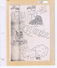
Photograph Album, Plenty/Briar Hill Camp 1989, 04/09/1989
Photographs and maps from Plenty/Briar Hill Camp 1989. Possibly a school project, includes itinerary. Photographs are not named. Location: "Tandara" Halls Gap.Colour photographs and maps in albumHand drawn front cover with name of artist.plenty, briar hill -
 St Kilda Historical Society
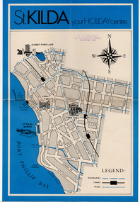
Document - Map, St Kilda your holiday centre, c1970
Map of St Kilda for tourists. Undated but estimated to have been produced in 1970.Single sheet map printed on paper in blue and blackst kilda tourism -
Whitehorse Historical Society Inc.
Map, Map of Mitcham, Tunstall and Blackburn, c1937
... Maps ...Map of Mitcham, Tunststall and Blackburn showing the location of T.M. McDonnell, real estate agent, Whitehorse Road, MitchamMap of Mitcham, Tunststall and Blackburn showing the location of T.M. McDonnell, real estate agent, Whitehorse Road, MitchamMap of Mitcham, Tunststall and Blackburn showing the location of T.M. McDonnell, real estate agent, Whitehorse Road, Mitchammaps, mcdonnell, t.m. -
4th/19th Prince of Wales's Light Horse Regiment Unit History Room
Map Set, Timor Leste, 1999
Operational maps for Australian Defence Force participation in InterfetSet of maps for Timor-Leste Op Interfet 1. Ermera District Navigation Map 1:25,000 2. Dare Area Special 1:25,000 3. Timor-Leste Parliamentary Elections 4. Dili Planning Map Overlay Timor-Leste 1:6,000 5. Timor-Leste Planning Mao -
 Greensborough Historical Society
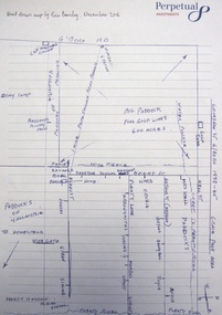
Map - Digital Image, Eric Barclay's Grace Park map, November 2016, 2016_11
Eric Barclay's Grace Park map, November 2016. Eric recalls the area around Grace Park from the late 1940s.Digital copy of black and white maperic barclay, barclay family, grace park -
 Warrnambool and District Historical Society Inc.
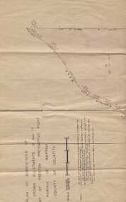
Subdivision plan, Part of Preston Estate Parish of Wappan
This map possibly relates to land of John Bostock at Preston, Delatite. Part of a collection of papers relating to the Bostock family one of the earliest pioneering families in Warrnambool.Cream coloured map printed in black with sections coloured in pink. Plan of subdivision of part of crown allotments 15 and 17 and part of Preston pre- emptive right, Parish of Wappan, County of Delatite.warrnambool,bostock,augustus bostock map, delatite map,district of wappan map, -
 Croydon RSL Sub Branch
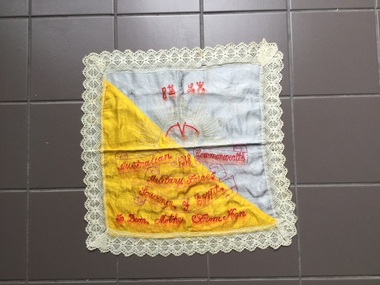
Map, 8th Light horse, 1918
Hand made map of Egypt from a soldier to his motherMap of Egypt. Square, blue,yellow,white,red. CottonHand made -
 Montmorency–Eltham RSL Sub Branch
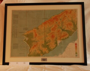
Map - Framed 1915 map of Sulva Bay, Gallipoli, 1915 Map of Silva Bay, Gallipoli, 1915
This map was used in the Dardenelles Campaign 1915-1916.Framed map showing the Sulva Bay area of the Gallipoli battlefield in 1915.world war one, middle east, gallipoli, 1915, map, dardenelles, sulva bay, survey department, battlefields, egypt cairo -
 Whitehorse Historical Society Inc.
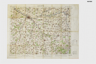
Map - Amiens France Map from collection of C H Honybun, Amiens, 1916
WW1 Topograhical Map of Amiens Region, France (Allied) 1915Printed map, France 1:100,000 Ordnance Survey, Oct 1915non-fictionWW1 Topograhical Map of Amiens Region, France (Allied) 1915world war 1914 - 1918, ameins -
 City of Kingston
Pamphlet - Black and white, Stott & Burke, Highland Estate Bentleigh, c.1915
Sales plan for land in the suburb of Bentleigh, along Collins and Ross Streets, bounded by Jasper Road.The developing urban area of Bentleigh within the City of Kingston. This land sale pamphlet illustrates the subdivision of land within the municipality and the changing demographic of the district as new houses are constructed.Black and white pamphlet advertising for private sale the Highland Estate, Bentleigh. Incorporates a map of the estate between Collins St and Ross St, bordered by Japser Road. Handwritten in grey pencil on map: additional subdivisions numbered 15-19 drawn along Ross St Handwritten in grey pencil on map: indecipherable annotations to subdivisions 1, 3 and 14land sales, bentleigh, estate