Showing 575 items
matching landscape view
-
![Township of Lorne, and Loutitt Bay / [by] Nicholas Caire, circa 1876](/media/collectors/550653872162f11fb04854aa/items/5783458ad0cdd1176c6f0c78/item-media/578345eed0cdd1176c6f852b/item-fit-380x285.jpg) Kew Historical Society Inc
Kew Historical Society IncPhotograph, Anglo-Australasian Photographic Company, Township of Lorne, and Loutitt Bay, c. 1876
... the introduction of dry plate photography, he began a series of landscape ...Nicholas Caire was born on Guernsey in the Channel Islands in 1837. He arrived in Adelaide with his parents in about 1860. In 1867, following photographic journeys in Gippsland, he opened a studio in Adelaide. From 1870 to 1876 he lived and worked in Talbot in Central Victoria. In 1876 he purchased T. F. Chuck's studios in the Royal Arcade Melbourne. In 1885, following the introduction of dry plate photography, he began a series of landscape series, which were commercially successful. As a photographer, he travelled extensively through Victoria, photographing places few of his contemporaries had previously seen. He died in 1918. Reference: Jack Cato, 'Caire, Nicholas John (1837–1918)', Australian Dictionary of Biography.An original, rare photograph from the series 'Views of Victoria: General Series' by the photographer, Nicholas Caire (1837-1918). The 60 photographs that comprise the series were issued c. 1876 and reinforced a neo-Romantic view of the Australian landscape to which a growing nationalist movement would respond. Nicholas Caire was active as a photographer in Australia from 1858 until his death in 1918. His vision of the Australian bush and pioneer life had a counterpart in the works of Henry Lawson and other nationalist poets, authors and painters.‘Township of Lorne, and Loutitt Bay’ : Views of Victoria (General Series) No.60 : Albumen silver photograph | Photo on card with Title and Description on reverse | Mounted 24 x 30 cm; Photo 12 x 17 cm.On Reverse: ‘Loutitt Bay is fast becoming one of the most fashionable Watering-places in Victoria, partly from its easy access by Rail, combined with the magnificent scenery to be found in the Cape Otway Ranges, and the very moderate charges of the houses of accommodation. The large house near the foreground is that of Mr. Mountjoy, which is a Restaurant. Duncan’s Hotel can be seen in the distance, on the brow of the hill.’nicholas caire (1837-1918), lorne (vic), duncan's hotel, loutitt bay, landscape photography - victoria -
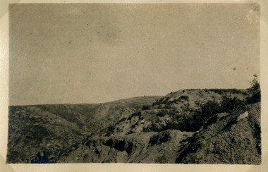
![Cumberland Creek, near Point Sturt / [by] Nicholas Caire, circa 1876](/media/collectors/550653872162f11fb04854aa/items/57834713d0cdd1176c71111b/item-media/57834799d0cdd1176c71e113/item-fit-380x285.jpg) Kew Historical Society Inc
Kew Historical Society IncPhotograph, Anglo-Australasian Photographic Company, Cumberland Creek, near Point Sturt, c. 1876
... the introduction of dry plate photography, he began a series of landscape ...Nicholas Caire was born on Guernsey in the Channel Islands in 1837. He arrived in Adelaide with his parents in about 1860. In 1867, following photographic journeys in Gippsland, he opened a studio in Adelaide. From 1870 to 1876 he lived and worked in Talbot in Central Victoria. In 1876 he purchased T. F. Chuck's studios in the Royal Arcade Melbourne. In 1885, following the introduction of dry plate photography, he began a series of landscape series, which were commercially successful. As a photographer, he travelled extensively through Victoria, photographing places few of his contemporaries had previously seen. He died in 1918. Reference: Jack Cato, 'Caire, Nicholas John (1837–1918)', Australian Dictionary of Biography.An original, rare photograph from the series 'Views of Victoria: General Series' by the photographer, Nicholas Caire (1837-1918). The 60 photographs that comprise the series were issued c. 1876 and reinforced a neo-Romantic view of the Australian landscape to which a growing nationalist movement would respond. Nicholas Caire was active as a photographer in Australia from 1858 until his death in 1918. His vision of the Australian bush and pioneer life had a counterpart in the works of Henry Lawson and other nationalist poets, authors and painters.‘Cumberland Creek, near Point Sturt’ : Views of Victoria (General Series) No.59 : Albumen silver photograph | Photo on card with Title and Description on reverse | Mounted 24 x 30 cm; Photo 12 x 17 cm.On Reverse: ‘The Cumberland Creek is so named from the close resemblance it bears to the place bearing that name in the mother country. The present illustration represents the precipices and hills which surround the Cumberland Creek. The soil around the hills is mostly sandstone rubble, hence the only vegetation identical with the spot is the inevitable sword grass and salt scrub, which frequently exist where no other vegetation can be found.’nicholas caire (1837-1918), landscape photography -
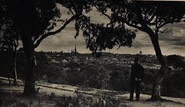 Kew Historical Society Inc
Photograph - Urban landscape, Henry Beater Christian, 1930s
Henry Christian (c.1809-91), the grandfather of the photographer, was one of the first settlers in Kew. He arrived in Victoria with his wife Agnes and son Orlando in 1855 on the Gypsy Queen. He established a rope-making business in Bulleen Road by 1858 but was declared insolvent two years later. In his final years, he was celebrated as one of the oldest living settlers of the district. His son, Orlando Henry Beater Christian (c.1853-1930) became a member of the Hawthorn Band and a foundation member of the Willsmere Swimming Club. Orlando and his wife Elizabeth had four children of which Henry Beater Christian (1886-1962) was the eldest.An item from an outstanding and diverse photographic collection, assembled by members of the Christian family of Pakington Street, Kew, comprising professional and amateur photography, depicting individuals, natural and settled environments and the interactions between these worlds. Many of the photographs vividly capture the worlds of three generations of men - Henry Christian, his son Orlando Henry Beater Christian, and his grandson of Henry Christian. The most important photographer was the youngest, Henry Christian, who was a keen explorer, not just of his immediate environment but also of the Victorian wilderness. His major opus is contained in two albums in which he records, sometimes in majestic detail and on other occasions the intimate features of the natural world. His photographic travels during the 1920s, often in solitary ramblings but on other occasions with companions, recall the heroic landscape photography of an earlier era, pioneered by Nicholas Caire. In addition to their aesthetic value, the albums are historically significant records within the State of Victoria, of what is now a distant point in time, and of places that have become radically altered through human intervention.Black and white photo of the rear view of a man in a hat standing under a tree on a hill looking across the Yarra River (unseen) towards Melbourne. The exhibition building and the spires of St Patrick’s Cathedral can be seen on the skyline. The man may be Orlando Henry Beater Christian. If all the spires are intact it must postdate 1939 when work begun in the early 1930s on the spires began. He may be standing on the edge of the Yarra Boulevard.melbourne skyline - 1930s, yarra boulevard -- kew (vic.), christian-washfold collection -
 Kew Historical Society Inc
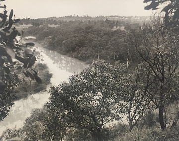
Photograph, J E & B L Rogers, View of Yarra from Cliffs, Studley Park, 1958
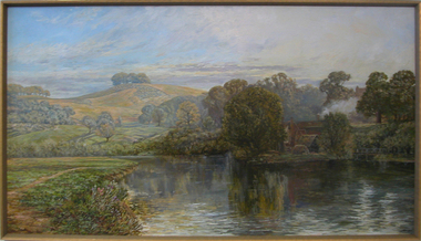
... river -- kew (vic) landscape photography "View of Yarra from ...This work forms part of the collection assembled by the historian Dorothy Rogers, that was donated to the Kew Historical Society by her son John Rogers in 2015. The manuscripts, photographs, maps, and documents were sourced by her from both family and local collections or produced as references for her print publications. Many were directly used by Rogers in writing ‘Lovely Old Homes of Kew’ (1961) and 'A History of Kew' (1973), or the numerous articles on local history that she produced for suburban newspapers. Most of the photographs in the collection include detailed annotations in her hand.The Rogers Collection provides a comprehensive insight into the working habits of a historian in the 1960s and 1970s. Together it forms the largest privately-donated collection within the archives of the Kew Historical Society.Back and white photograph of the Yarra River at Kew. In the distance the towers of the Kew Asylum are visible."View of Yarra from Cliffs, Studley Park" / "Studley Park" / "Jim's" / "58"yarra river -- kew (vic), landscape photography -
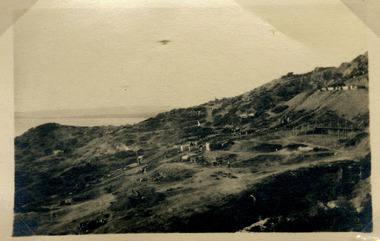 Magnet Galleries Melbourne Inc
view of country side
... Melbourne melbourne ww1 world war 1 landscape country views photo ...photoww1, world war 1, landscape, country views -
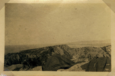 Magnet Galleries Melbourne Inc
view of country side
... Melbourne melbourne ww1 world war 1 landscape country views view ...ww1, world war 1, landscape, country views -
 Magnet Galleries Melbourne Inc
view of country side
... Melbourne melbourne ww1 world war 1 country views landscape photo ...photoww1, world war 1, country views, landscape -
 Brimbank City Council Art Collection
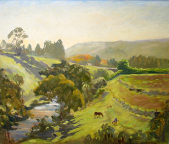
Painting, Maribyrnong River from Horseshoe Bend Road, Keilor, 1977
Local SceneImpressionistic view of valley with a creek running through it. Three horses in the foreground - AR0064Information about the artist on the back. "James Farrell is a member of the Victorian Artists Society" and "is represented at the Australian War Memorial, Canberra".keilor, maribyrnong, river, painting, impressionist, landscape -
 Sunbury Family History and Heritage Society Inc.
Photograph
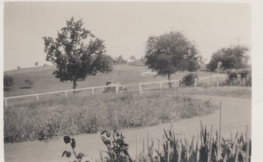
This is a view of one of the settled parts of Sunbury when it was a small country service town and before its rapid suburban expansion.A black and white photo with a cream border of a landscape in a country town. A driveway is in the foreground wi A small settlement on a distant rise is visible. a post and rail fence in the middle distance and two tries growing beyond the fence line. -
 Sunbury Family History and Heritage Society Inc.
Photograph
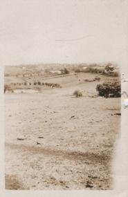
... A sepia photograph with a cream frame of a portrait view... of a portrait view of a rural landscape. Photograph Photograph ...A portrait view overlooking Sunbury township taken from a hill above the Goonawarra vineyard at the eastern end of the settlement. A sepia photograph with a cream frame of a portrait view of a rural landscape.sunbury township., goonawarra winery -
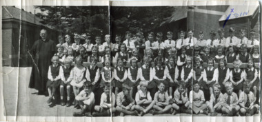 Surrey Hills Historical Society Collection
Digital photo, Our Holy Redeemer school photo, late 1950s, 1950s
School history - ref https://ourholyredeemer.cam.org.au/history In 1904 Fr. George Robinson erected a weatherboard school-hall where the present hall now stands. It was blessed and opened by Archbishop Carr on 20th November of that year. In January 1905, the Sisters of St Joseph took charge of the school. Archbishop Mannix opened and blessed the new brick school on 10th November 1918. From 1941-1972, Fr Tim Fitzpatrick was parish priest and head of the school. He is the priest on the LHS of this large school photo. Personal history: Although they lived in Prospect Street, Box Hill, John and Mary Turnbull attended Our Holy Redeemer School, as did Susan Hirst who lived across the road from the Turnbull family with her parents Ray and Shirley Hirst at 29 Prospect Street.Part of a large landscape black and white photo of a priest with a large group of children grouped as follows: Back row: 20 boys Second back row: 21 girls Second row: 16 girls Front row: 10 boys. Behind the group is a large cypress tree and to either side the church and (?) school building. The boy 4th from the right in the back row is marked with an 'x' in blue biro. This is part of a large landscape photo. The 2 pieces should be viewed as one. On front 'x' in blue biro is believed by the donor to have been made by Hughn Turnbull, his father. On rear in blue biro: "X JOHN" and " T MARY" plus in black in John Turnbull's hand "(MY SISTER)"; "SUSAN HIRST / SH (crossed out) / 3rd from RIGHT END" The donor has indicated that his father made the markings on the front of the photo. schools, our holy redeemer school, fr tim fitzpatrick, john turnbull, mary turnbull, susan hirst -
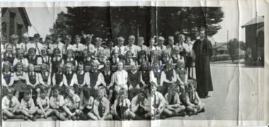 Surrey Hills Historical Society Collection
Digital photo, Our Holy Redeemer school photo, late 1950s (Part 2), 1950s
School history - ref https://ourholyredeemer.cam.org.au/history In 1904 Fr. George Robinson erected a weatherboard school-hall where the present hall now stands. It was blessed and opened by Archbishop Carr on 20th November of that year. In January 1905, the Sisters of St Joseph took charge of the school. Archbishop Mannix opened and blessed the new brick school on 10th November 1918. From 1941-1972, Fr Tim Fitzpatrick was parish priest and head of the school. Personal history: Although they lived in Prospect Street, Box Hill, John and Mary Turnbull attended Our Holy Redeemer School, as did Susan Hirst who lived across the road from the Turnbull family with her parents Ray and Shirley Hirst at 29 Prospect Street.Part of a large landscape black and white photo of a priest with a large group of children grouped as follows: Back row: 19 boys Second back row: 14 girls Second row: 15 girls Front row: 12 boys. Behind the group is a large cypress tree and to either side the church and (?) school building. The girl in the 2nd row, first on the left is marked with an 'T' in blue biro; the girl 3rd from the right in the same row is circled in blue biro. There is a Californian bungalow in the background. This is half of a large landscape photo and the 2 pieces should be viewed together. On front 'T' and a circle in blue biro are believed by the donor to have been made by Hugh Turnbull, his father. On rear in black: "OUR HOLY REDEEMER - SURREY HILLS / PROBABLY 1950's" schools, our holy redeemer school, fr tim fitzpatrick, john turnbull, mary turnbull, susan hirst -
 The Dunmoochin Foundation
Oil Painting, Melbourne 1962, 1962
Thick impasto painting depicting a bird's eye view of the city of Melbourne and the Yarra river.Signed and dated 'Eric Stewart 1962'. eric stewart, painting, landscape, melbourne, yarra river -
 Federation University Art Collection
Watercolour, 'Park St, Mt Pleasant' by J. Fowler, 1979
This item is part of the Federation University Art Collection. The Art Collection features over 1000 works and was listed as a 'Ballarat Treasure' in 2007.Framed watercolour of a treed view of Ballarat.art, artwork, j. fowler, mount pleasant, ballarat, landscape, watercolour -
 Federation University Art Collection
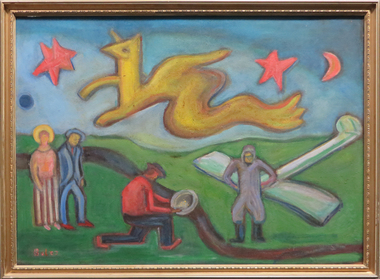
Painting, Bernard Boles, 'Valley of the Hippogriffen' by Bernard Boles, c1938
"The landscape of the Valley is in between Ballarat and Geelong, the pranged aeroplane came from Geelong, the prospector and the strolling couple are surreal props to the scene, and the poetic hippogriffen serves as a bunyip which could be a local connotation of apprehension od bush loneliness. Bernard BOLES (1912-2001) Born Benalla, Victoria Bernard Boles studied at Melbourne Technical College and in London. He was known as critic, writer, sculptor and painter. His works were influences by Cubism and Surrealism. Boles exhibited widely in London and on his return to Australia in 1964. "Boles drew on the biomorphic marine imagery typical of Surrealism all around the world, as seen for example in the work of Wadsworth and Yves Tanguy. In 1949 Boles, having been rejected from the Victorian Artists’ Society, would tie two pictures to the fence outside the show and spend the ensuing two weeks sharing his views on art with passersby." ('Surrealism and Australia: towards a world history of Surrealism' by Rex Butler and A.D.S. Donaldson) This item is part of the Federation University Art Collection. The Art Collection features over 1000 works and was listed as a 'Ballarat Treasure' in 2007.Australian SurrealismFramed Australian Surrealist work. Artist's Comment: "The landscape of the Valley is in between Ballarat and Geelong, the pranged aeroplane came from Geelong, the prospector and the strolling couple are surreal props to the scene, and the poetic hippogriffen serves as a bunyip which coul dbe a local connotation of apprehension od bush loneliness. Gift of Lyndsay Boles.art, artwork, bernard boles, australian surrealism, bunyip -
 Federation University Art Collection
Painting - Artwork, Jeff Woodger, 'View Near Clunes' by Jeff Woodger, 2008
Jeff WOODGER Born Bendigo, Victoria Jeff studied art at La Trobe University in 1986, and a Graduate Diploma in teaching in 1989. He worked as a teacher from 1990 to 1998. In 1994 Jeff was awarded a Master of Arts from La Trobe University. He then studied at the prestigious Slade School, London and the National Gallery of Art in Washington D.C. Jeff Woodger completed a Doctor of Philosophy (Fine Art) at University of Ballarat (now Federation University) in 2006. This work was part of the exhibition assessment for this study. Jeff Woodger has lived and worked in Japan regularly since 1994. His passion is to paint post romantic landscapes in the classical style which are deeply inspired by many of the seventeenth century greats such as Claude Lorraine and Salvator Rosa. This item is part of the Federation University Art Collection. The Art Collection features over 2000 works and was listed as a 'Ballarat Treasure' in 2007.art, artwork, clunes, landscape, artist, jeff woodger, alumni -
 University of Melbourne, Burnley Campus Archives
Photograph - Black and white print, Administration Building, 1949
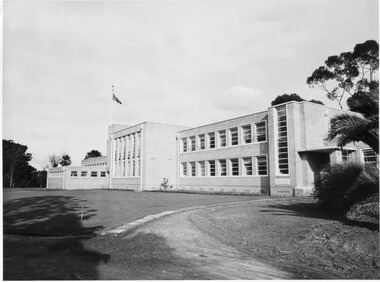
Note by T.H. Kneen 20.02.1991, Early stages of landscaping for the new building. Note young Magnolia grandiflora planted to soften stark wall. The building comprised right to left Principal's office, office for school teaching staff, offices for Fruit Preserving Branch, Agrostology Branch and future Plant Breeding Branch (branches of the Department of Agriculture), four class rooms, Assembly Hall, Library and student change rooms. The old Pavilion was demolished earlier.3 copies black and white photographs. Very similar views of the newly constructed Administration Building. Planting around the building. Flag flying.principal's office, fruit preserving branch, agrostology branch, plant breeding branch, assembly hall, library, pavilion, planting, landscaping, magnolia grandiflora, staff room, class rooms, student change rooms -
 University of Melbourne, Burnley Campus Archives
Plan, Roh Cross, Lilydale Quarry Recreational Study for Landscape Studies, 1986
Plans on tracing paper and paper by Rob Cross Landscape Design. (1) Site Analysis No 1 dated 08.06.96. Scale 1:2400. (2.) Proposed Activity Zones No 2 dated 03.06.96. Scale 1:2400. (3) West Section of Valley No 3 dated 11.06.96. Scale 1:1000. (4) Concept Plan No 4 dated 11.06.96. Scale 1:2400. (5) Axonometric View No 5 dated 30.06.96. Scale 1:2400.lilydale, quarry, rob cross landscape design, landscape studies -
University of Melbourne, Burnley Campus Archives
Plan, [Plans for Extensions to Student Amenities Building], 1996-2001
(1) External paving & footing plan - Proposed outdoor eating plan at Student Amenities Block, Victorian College of Agriculture & Horticulture. For - Burnley Student Association (Ross Greer Consultants P/L). Includes design modifications 2001. (2) Proposed outdoor eating area Student Amenities Block, VCAH. Schemes 1-8. (Includes plans for pergola, terrace, etc.) (3) Quotes from landcraft for landscape works around canteen (including ramps.) (4) John Stephens Catering Equipment Pty. Ltd. - Burnley Student Union. Plan View 1:20. Many copies of most documents including amendments.amenities, students, vcah, burnley -
 Federation University Art Collection
Painting - Artwork - Painting, Margaret Burns, Arapiles View
Framed landscape in oil. If you can provide information on this artist and artwork please use the link below. landscape, arapiles, horsham, margaret burns, horsham student collection -
Federation University Art Collection
Drawing, Victor Cobb, At Miss Bale's Castlemaine by Victor Cobb, 26/4/1931
Victor Ernest COBB OM (14 August 1876-2 December, 1945) Born Footscray, Victoria Victor Cobb studied drawing under Bernard Hall at the National Gallery School in 1896. He was self taught in the art of etching, creating his own press and tools. He became known for his popular views of Melbourne and as a teacher of etching. Melbourne Grammar School marked its sesquicentenary in 2008. As part of the celebrations, a Talents Committed Exhibition was staged. This exhibition recognised 150 Old Melburnians who have made a difference to the City of Melbourne, the State of Victoria and the wider community in Australia and overseas. The above profile was included in the Talents Committed Exhibition in 2008. Double sided sketch by Victor Cobb. One side is 'At Miss Bale's, Castlemaine, the other is some line work towards a landscape26/4/31 At miss Bale's Castlemaine V.E.C.victor cobb, castlemaine, a.m.e. bale, landscape -
Federation University Art Collection
Drawing, Victor Cobb, At Castlemaine by Victor Cobb, 26/4/1931
Victor Ernest COBB OM (14 August 1876-2 December, 1945) Born Footscray, Victoria Victor Cobb studied drawing under Bernard Hall at the National Gallery School in 1896. He was self taught in the art of etching, creating his own press and tools. He became known for his popular views of Melbourne and as a teacher of etching. Melbourne Grammar School marked its sesquicentenary in 2008. As part of the celebrations, a Talents Committed Exhibition was staged. This exhibition recognised 150 Old Melburnians who have made a difference to the City of Melbourne, the State of Victoria and the wider community in Australia and overseas. The above profile was included in the Talents Committed Exhibition in 2008. Double sided sketch by Victor Cobb. One side is 'At Castlemaine, the other is some line work towards a landscape V.E.C. At Castlemaine 26/4/31victor cobb, castlemaine, a.m.e. bale, landscape -
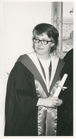 Royal District Nursing Service (now known as Bolton Clarke)
Photograph - Photograph, black and white, Barry Sutton, 13 07 1971
The photograph was taken in the Board Room of Royal District Nursing Service (RDNS) 452 St. Kilda Road, Melbourne. It was taken after Sister Pat (Paddy) Rowley received her Fellowship of the Australian College of Nursing. The Australian College of Nursing describes the Fellowship as follows: "Fellowship of the Australian College of Nursing (ACN), is a prestigious member status awarded to nurses in recognition of significant professional achievement. Fellowship recognizes the experience and contribution of nurse leaders to ACN and the profession".The regalia worn by Sr. Rowley as a Fellow, is a black gown with the wide trim to the front edges of scarlet satin and the regalia hood of inner white and outer scarlet satin. Sr. Rowley is the Principal Nurse Educator at RDNS.Sister Rowley commenced at Melbourne District Nursing Society (MDNS) in 1956 working as a District Nurse in a large district covering South Melbourne, Albert Park, Middle Park, and suburbs bordering from St. Kilda to Port Melbourne. In 1961 she was asked to be a Control Sister answering the telephones in Headquarters. She left MDNS for a short period, and after being asked to return was accepted, in August 1962 to take the MDNS 2nd Post Basic Course written by Miss Mary Evans; during this time Sr. Rowley wrote a paper on Liaison which led to continuity of care of patients between hospitals and RDNS. Following the course she commenced in Education and rewrote the Post Basic Course. In 1964 Sr. Rowley commenced, on a part time basis, working as a Liaison Officer at the Alfred Hospital. She attended the Teachers College, doing the 12 month course in 6 months, but this course did not have a health component, so she applied, and received, a Florence Nightingale Scholarship to the College of Nursing, gaining her Diploma of Nursing Education in 1968. Following this she became the, now named, Royal District Nursing Service (RDNS), Education Officer. In 1969 Sr. Rowley, with Miss Mary Evans, DON, attended the quadrennial Congress of the International Council of Nurses in Montreal, Canada and then Sr. Rowley visited USA looking at Public Health Nursing Education programs. As well as her RDNS work, Sr. Rowley became Nursing Consultant to the St. John's Ambulance Association in 1970, assisting in planning their Home Nursing Course book. In July 1971 Sister Pat (Paddy) Rowley, was awarded Fellowship of the Australian College of Nursing (ACN). The Australian College of Nursing describes the Fellowship as follows: "Fellowship of the Australian College of Nursing (ACN), is a prestigious member status awarded to nurses in recognition of significant professional achievement. Fellowship recognizes the experience and contribution of nurse leaders to ACN and the profession”. Sr. Rowley was then appointed as Principal Nurse Educator and wrote many of the programs for the Education department. Working as an Educator she travelled to regional hospitals, e.g. in Geelong and Ballarat to give lectures on District Nursing. When the Education Department relocated to 488 St. Kilda Road, she arranged the floor plan of the rooms. Sister Rowley retired from RDNS in 1988 having worked for 26 years in Education and a total of 32 years with the Melbourne, later named Royal, District Nursing Service. . Black and white photograph of a three quarter length view of Royal District Nursing Service (RDNS), Sister Pat (Paddy) Rowley. Sister Rowley, who has her head turned slightly toward the left of the photograph, is wearing dark rimmed glasses and has short dark straight hair. Over her light coloured top, she is wearing a black long open gown with wide trim, and regalia hood of white inner and dark outer satin. Her hands are clasped to the front holding a rolled white certificate held closed with a ribbon and bow. In the background the left edge of a framed landscape painting is seen on the wall. Part of Photographer stamp. Quote No. KJ 57royal district nursing service, rdns, fellowship of the acn, melbourne district nursing service, sister pat (paddy) rowley -
![Royal Australian Nursing Federation campaign badge, [1986?]](/media/collectors/5bb42dc221eaf31100db1d3b/items/5c4949a821ea731428437a84/item-media/5c4949c621ea73142843a678/item-fit-380x285.jpg) Australian Nursing & Midwifery Federation
Australian Nursing & Midwifery FederationRoyal Australian Nursing Federation campaign badge, [1986?]
Distributed to nurses during campaigning for improved wages and working conditions in the 1980s, possibly during the historic 1986 Victorian 50-day nurses strike. In October 1986, Victorian nurses began their longest strike after the failure of repeated talks with the health minister David White who was committed to reducing the classification and pay of almost half of Victoria’s nurses. Skeleton staff were left in the wards while picket lines, tents and caravans were set up outside hospitals in both metropolitan and regional Victoria. After 50 days of industrial action, Victorian nurses voted to return to work on 20 December 1986. The Royal Australian Nursing Federation (RANF) became the Australian Nursing Federation in 1989, suggesting that this button is from the late 1980s. Similar to the badges worn in this photo [https://stories.anmfvic.asn.au/86strike/media/2560-1440-landscape-sec2-contentb-hr_logwf7a.jpg] from 1986 (see individual on the far right).This badge is of historic significance as it represents nurses' struggle for industrial and professional status. This struggle was made particularly visible through the 1986 Victorian nurses' strike, which had great impact on the way Australian society viewed nurses and working women (Bessant, 1992).Circular white and red plastic badge. Silver metal, plastic-coated, with safety pin fastener adhered to back. Badge printed with 'Nurses DO dare to Struggle' and 'R.A.N.F. [Royal Australian Nursing Federation] Vic. [Victorian] Branch'.nursing, nurses, industrial action, strike action, unionism, trade unions, badges, buttons, pins, campaigning, 1986 victorian nurses strike, labour history, royal australian nursing federation, victoria, australia -
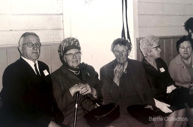 Melton City Libraries
Photograph, Mrs Knox and Beryl Gillespie at the First Hundred Years Celebration of Melton State School 430, 1970
Beryl Knox speaking about early life in Melton. Page 1 1949 – 64 years ago. We began our married life at Melton Sth. The house on the corner of the Exford Rd and Staughton St-- dusty gravel roads, box thorns and noxious weeds everywhere and a sprinkling of houses and vacant land. It was a friendly community consisting of old family names. McDonalds, Blacks, Dodemaide, Cahill, Coopers, Minns, Tinklers, Nesbitts, Cochranes, Wickhams, Exells. Mavis Butler. The home owned by Mr. Robinson and Miss Robinson had been shifted in two parts transported from Diggers Rest and it is still standing 2013. Bruce’s father purchased the house and two adjoining blocks, the Conways built on one and the Rawlinson family on the other block. Eileen still resides there, she was only a baby in a pram and the family had not long arrived from England. The railway line was close to the house and the contents would rattle when heavy steams trains went through, and on a clear frosty night the 1am paper train would echo roar through very loudly when labouring towards the Exford Bridge. Then the two carriage motor train was introduced, this was great for the workers and schoolies who travelled to Melbourne. The train pulled up at the crossing or riding to pick up or drop off. Melva Gillespie (nee Hirt) Bill Cahill delivered the milk by the billy and then in bottles. Len Kennedy (Paul Kennedy’s father, Norma Murrays son) delivered Jongebloeds bread, he always had a sweep going for the Melbourne Cup and raffles for the footy club. Mr. Woodgate owned an old bus and pick up point was the Post Office when there was a Saturday film on a Melton. There were no doctors or dentists in the district. If we need a Doctor we had to travel to Bacchus Marsh or discuss problems over the phone. In later years a Bacchus Marsh Doctor rented the Bluestone building in McKenzie St a couple of days a week. If we needed the Dentist we had to travel to West Footscray or Footscray. We did our banking at “State Savings” then the Miss Minns had the agency and then Bardsleys Store. We travelled to Bacchus Marsh to the National and Commercial banks. Station Rd to Western Highway, now (High Street) was a narrow stretch of bitumen and gravel farmland either side and a couple of farm houses and large gum trees on the properties. Page 2 North of the Railway line Mrs Bessie Jones, mother of Chas and Betty Jones managed the Post Office, next door to her Chas and Betty had the Shell Centre, and later moved the business to Melton. Hughie Nesbitt and mother owned the grocery and hardware store, and I bought my first set of saucepans there. On the opposite side of Station road Mr Coombe owned the fruit shop, and also provided soft drinks and lollies for children. The Chaff Mill was on the corner of Station Rd and Brooklyn Rd. Mr Lumsden was manager and later years Bernie Trethowan and Jack Butler were partners. It finally burnt down and is a Service Station now. Along Brooklyn Rd there were a few houses and Victoria Hall, not a very big hall, but catered for lots of functions, Balls, Fancy Dress, Bazaars, Square Dancing and meetings. The Bacchus Marsh Baptists held Sunday School in the hall. A group of shops were built south of the railway line Molly and Len Skinner managed the Post Office and handled a few essential groceries. Tom McDonald and Ron Lunsberg were the butchers. Mary and Syd Cooper lived next door to us and often in turn would run out of something when we had a baking spree we would borrow or exchange, sugar flour etc over the fence. Mavis and Jack Butler lived there before the Coopers. Bernie and Iris Trethowan lived two doors up. Neighbours were invited into their home to view the first black and white television in Melton Sth. Bill Exell was one of the first Melton Sth farmers to sell his land to developers, the land was idle for years before housing developed. I joined the Melton Valley Golf Club in 1960. The Gun Club as our Club House, an old tin shed consisting a water tank, trestle table and forms and dirt floor. It was a 9 hole course with sand scraps and landscape putting before greens. The Common or parkland was part of the Golf Course. It was open for every ones recreation. Roy Norton an old identity trained his trotters on the Common and wouldn’t clear the track for the golfers. The golfers had to avoid him to continue to play. We had to keep clear when the young youths came in their paddock cars and motorbikes. Over the years the Toolern Creek flooded its banks, water and debri covered the course on one year our first Club house was flooded out. It took several working bees to clean it up. We lived at Melton Sth for 15 years and moved to Melton on the farm “Croxton Park.” The Nixon family farm “Mowbray” adjoined the farm. Bruce worked the land cropping the farm when Mrs Nixon died. Page 3 (page 4 on the handwritten script) Bruce had the first offer to buy, in those days it wasn’t easy to get good bank loans. Part of the land is the Golf Course now and Mr O’Shea purchased the bulk. Moving to Melton was totally different – I became involved with Committees, Scouts, Guides, Mothers Clubs, CWA, Church Op shop (8 years). Melton Amateurs players produced and tutored by Mabel Rogers exerts from Pyjama Game, South Pacific, Carousel - later years a group of ladies did gentle water exercise at Essendon and Station Road swimming pool. I was 20 or so years in Probus. The local followed the football, there was always a Gymkhana on the long weekend in June. The tennis always created a lot of interest during the finals. It didn’t matter which team played the supporters were treated to a cup of tea and leftovers from their afternoon tea. In 1978 were the first residents to move into the Jennings Estate Kurunjang and lived there 31 years and retired 4 years ago into Unit. The amazing changes I have experienced. Merrimu supplied our water, after depending on tanks. The landscape changed completely when developers came in, no more dusty plains \ typed web Sept 2013 McFarlane, Mrs Knox and Beryl Gillespie at the First Hundred Years Celebration of Melton State School 430. The event was held at Mechanics Hall, Melton.local identities, local significant events, education -
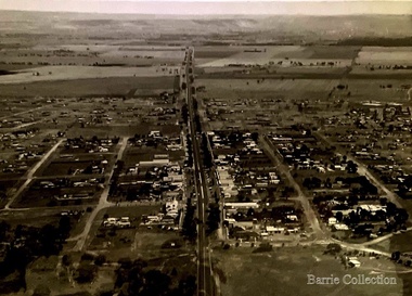 Melton City Libraries
Photograph, Main Street, Melton, 1973
Bird's eye view of Main Street, Melton, looking west.landscapes of significance -
 Phillip Island Conservation Society Inc.
Work on paper - Photocopy of newspaper cutting, "PHILLIP ISLAND/A place to fall in love"
This article was written by an English visitor named Elsa Christian who was touring Australia and New Zealand with her husband Frank in their own small van. The article was published in the Australian Women’s Weekly, magazine, March 1966. Elsa writes she wanted to visit four Australian locations before she died: Ayers Rock (actually Uluru), the Snowy River project, dolphins at Coolangatta and the Penguin Parade at Phillip Island. These destinations were all very popular in the 1960s for both Australian residents and overseas visitors. Because the roads were becoming better too many locations, self guided tours in small vans for cars towing bond would caravans were becoming more popular means of seeing AustraliaThe article is significant in many ways. 1. Indicates the places English visitors commonly wish to see in Australia. 2. Describes the growing trend to self- drive van/camping holidays. 3. Gives the route taken from Melbourne to Phillip Island during the 1960s. 4. Describes the appearance of the roadsides and locations visited. 5. It is written in a descriptive and lyrical style designed to appeal to Women’s Weekly magazine readers, who were probably wondering how they could visit Phillip Island with their husbands or families themselves, and what there was to see there. 6. Gives the visitors’ view of how the Penguin Parade operated at the time. 7. Includes a description of potter and artist Eric Juckert’s renowned garden at Grossard Point, Ventnor. 8. Indicates how introduced plants such as Hawthorn pushes and Kate weed were common in the area. 9. Describes Phillip Island as “a place to fall in love” because of its natural beauty, fauna and coastal seascapes. 10. As a visitor Elsa describes the housing estates as a blot on the landscape, but also sees the value as a way of their owners escaping from the hustle and bustle of Melbourne. 11. Gives the visitors’ interpretation of the behaviour of wildlife the RC in the wild, as well as Elsa’s knowledge about some of the species she encounters.Photocopy of full page article with 5 columns of text, a map and 2 photographs. Black ink on white paper. Photographs blackened in photocopying processphillip island, cape woolamai, penguin parade, seal rocks, nobbies, township of rhyll phillip island, princes highway, dandenong, pakenham, kooweerup, carinya creek, officer, san remo, gippsland highway, holiday homes, fort dumaresq, kitty miller's beach, wreck of the speke, hereford cattle, fleetwood manor, koalas, ventnor, eric juckert, little penguin behaviour -
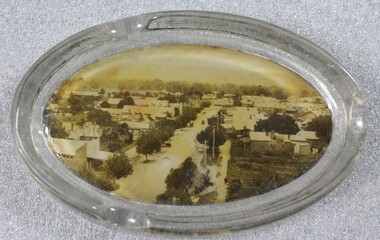 Wodonga & District Historical Society Inc
Memorabilia - Souvenir Glass Ashtray Wodonga, Victoria
A wide range of small china or glass pieces carrying scenic views of holiday destinations or key locations were a popular kind of souvenir during much of the 20th century. Several different items have been produced to commemorate Wodonga and its landmarks over time. These items document key changes in Wodonga and its heritage. This ashtray showcases a photo of High Street, Wodonga, VictoriaThis item has local historic and social significance as it depicts which features of the city the community valued in the past. It has artistic significance as an example of the kinds of souvenirs used widely across Australia to represent communities and the landscape.An oval shaped glass ashtray, incorporating a sepia print image of High Street, Wodonga, Victoriawodonga victoria, souvenir, high street wodonga, ash trays -
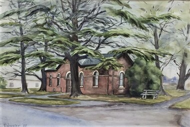 Pyrenees Shire Council
Watercolour, Vivienne Wheeler, Mechanics Institute Beaufort, 1987
significant as a work of art by local Pyrenees artist, locally significant to the Central Highlands Region of Victoria as a representation of local landscape and/or culture view of building on street watercolour on paper signed: V Wheeler 87 (lower left) verso: Artist V Wheeler MECHANICS INSTITUTE BEAUFORT 1987 -
Pyrenees Shire Council
photograph, Avoca in 1866 by J.N. Dallimore, 1866
J.N. Dalimore was an amateur photographer and settler who arrived at Port Phillip (Victoria) with his wife in September 1840 on board the Himalaya. Dalimore lived at Woodstock Station, near Avoca, he exhibited view photographs of the district at the 1866 Melbourne Intercolonial Exhibition that were sent on to the 1867 Paris Universal Exhibition. The Avoca Mail of 7 November 1866 reported: Mr Dallimore of Woodstock, determined that the town of Avoca and its environs shall be pictorially represented at the Victorian and Paris Exhibitions, has we learn, forwarded a series of photographs representing the High Street and the Pyrenees [Victoria] from different points of view. All the photographs are well executed and will possess considerable interest for the friends of Avocaites visiting the World’s Fair in 1867. Also included were views of Dallimore’s own station. They won him a medal 'for good Landscape Photography’. His panoramic photograph of Avoca is in the Shire Council significant as a historic photograph of Avoca, locally significant to the Central Highlands Region of Victoria as a representation of local landscape and/or culture Black and white photograph of Avoca showing Rutherford Street to the left and the original site of the Avoca Hotel"verso (affixed): AVOCA MAIL, 1st JUNE 1867. ""A remarkably well-executed photograph of the town of Avoca taken in 1866. and forming one of the exhibits at the Melbourne Exhibition, has been presented to the Avoca Shire Councilby F.W. Dalimore formally of Woodstock verso (affixed): No. 875 Intercolonial Exhibition 1866 Exhibitor: Avoca Shire Council Class: Section:"