Showing 9111 items
matching 2012/2013
-
 Orbost & District Historical Society
book, Vic Roads Centenary 1913 -2013, 2013
The publication, VicRoads Centenary: Keeping Victorians Connected for 100 Years, looks at the people and projects that define VicRoads’ history. Written by current and former VicRoads’ employees, the publication details the organisation’s portfolio of major projects, which includes the Great Ocean Road, Hume Highway and Eastern Freeway. Other sections report on Victoria’s world-first road safety initiatives, VicRoads’ use of technology and sustainability measures. (ref VicRoads) This item is one of several books donated by David Jellie at a presentation to Orbost Historical Society. He was a contributor to the book and was the engineer for the Snowy River Bridge (Princes Highway) at Orbost 1974-1976.This book is a useful reference tool on the history of road construction in Victoria including East Gippsland.A thick, bound paperback book, titled "VicRoads Centenary Keeping Victorians Connected for 100 Years". On the front cover is a black/white photograph of two men working on a road. One has a pick. The book contains the history of VicRoads, photographs, maps and advertisements. Some are b/w. Others are coloured.vicroads book roads snowy-river-bridge jellie-david -
 Federation University Historical Collection
Newspaper, The Courier, 06 May 2013, 06/05/2013
Ballarat newspaper with feature articles on the opening of the Museum of Australian Democracy at Eureka.the courier, ballarat courier, museum of australian democracy at eureka, m.a.d.e., ella hancock, ella howard, denic napthine, noah philp, lucy whitford, kirsten phillps, mary-anne gooden, justin gare, eureka flag, eureka flag conservation, shane howard, patrick howard, eureka stockade, nbn, national broadband network, clunes book town, norm hand, crocker -
 Warrnambool and District Historical Society Inc.
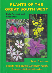
Book, Star Printing Terang Victoria. 978-0-9751360-1-0, Plants of the Great South West 2013 Second Edition, 2013
Second edition (revised a& expanded edition) First edition 2004. Guide to the indigenous plants of South West Victoria. South West Victoria: Nelson – Port Campbell. Zone A.B.C & D. Local maps BioregionsCard cover green) gloss white paper. End papers. Map 1&2. 6 pages credits, title, table of contents, forward, acknowledgements, disclaimer, websites. 348 pages. Colour maps & photographs. References & reading. Index plantsof western victoria, kevin sparrow, warrnambool -
 Eltham District Historical Society Inc
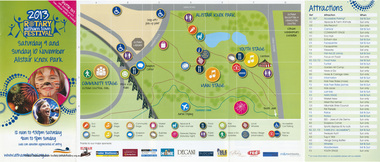
Document - Program, 2013 Rotary Eltham Town Festival Saturday 9 and Sunday 10 November, Alistair Knox Park, 2013
Four-fold DL size colour brochure printed both sides2013, eltham community festival, eltham festival, program, rotary eltham town festival -
 Women's Art Register
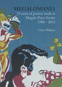
Book, Chris Wallace et al, Megalomania 35 years of posters made at Megan Print Studio 1980 - 2013, 2013
A visual record of posters made at Megalomania Print Studio, a print collective in Canberra 1980-2013Booknon-fictionA visual record of posters made at Megalomania Print Studio, a print collective in Canberra 1980-2013community, political art, artist unknown, gender, health, environment -
 Victorian Interpretive Projects Inc.
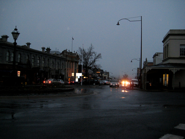
Photograph - Digital, Clare Gervasoni, Daylesford at Night, 2013, 07/07/2013
Daylesford is a Central Victorian town known for mineral water and hospitality..1) Rainy, night scene looking down Vincent Street, Daylesford towards Hepburn Springs. .2) Former Daylesford Post Officedaylesford, post office, vincent street -
 Victorian Interpretive Projects Inc.
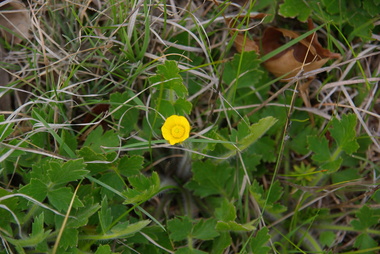
Photograph - Digital, Clare Gervasoni, Buttercup in Smythesdale Cemetery, 2013, 15/09/2013
While visiting Smythedale Cemetery the Buttercup was pointed out. It was commented that "it was rare to see a Buttercup these days".Colour digital image of a yellow buttercup growing in the Smythesdale Cemetery.buttercup, flora, smythesdale -
 Victorian Interpretive Projects Inc.
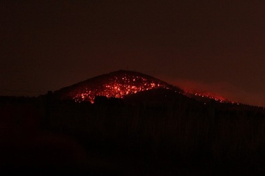
Photograph - Digital, Andrew Matheson, Night View of Fire on Mount Warrenheip, 2013, 15/05/2013
The photographer took these night photos from his home in Bungaree, on close proximity to Mount Warrenheip.A bushfire on Mount Warrenheip, near Ballarat, photographed at night.warrenheip, fire, bushfire, bungaree -
 Victorian Interpretive Projects Inc.
Photograph - Colour, Clare Kathleen Gervasoni, Anderson's Mill from Elizabeth St, Smeaton, 2013, 22/09/2013
A digital photograph of the Smeaton landscape taken from Elizatbeth Street. The view features Anderson's Millsmeaton, anderson's mill -
 Victorian Interpretive Projects Inc.
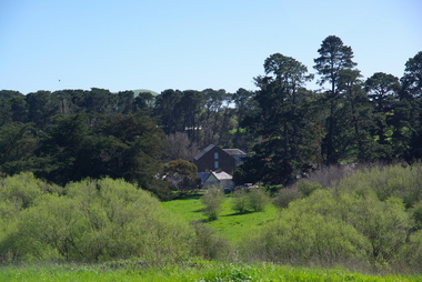
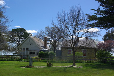
Photograph - Colour, Former Kooroocheang Primary School, 2013, 20/09/2013
The former school is now a private residence. Colour photograph of the former school and teacher's house at Kooroocheang. kooroocheang, education, school -
 Victorian Interpretive Projects Inc.
Photograph - Colour, Clare Kathleen Gervasoni, Mount Franklin from Smeaton, 2013, 20/09/2013
Colour photograph of the volcano known as Mount Franklin as seen from Smeaton, Victoria.mount franklin, smeaton -
 Victorian Interpretive Projects Inc.
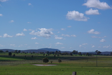
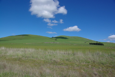
Photograph - Colour, Clare Kathleen Gervasoni, Smeaton Volcanic Landscapes, 2013, 22/09/2013
Smeaton Hill was the name of the property first settled by squatter Captain John Hepburn and Elizabeth Hepburn.Five landscape photographs of the seven volcanic hills around Smeaton.smeaton, kooroocheang, john hepburn, john hepburn, elizabeth hepburn, volcano, volcanic -
 Victorian Interpretive Projects Inc.
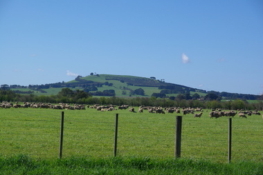
Photograph - Colour, Clare Kathleen Gervasoni, Smeaton from Queen Street, 2013, 22/09/2013
A volcanic hill as seen from Queen Street, Smeaton, Victoriasmeaton, volcano, volcanic -
 Victorian Interpretive Projects Inc.
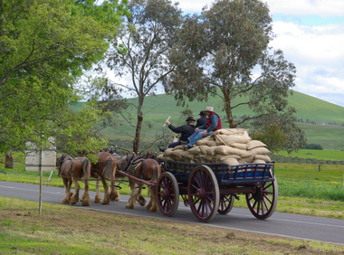
Photograph - Digital, Clare Kathleen Gervasoni, Horse Drawn Waggons during the 175th Anniversary of Smeaton, 2013, 06/10/2013
On the weekend of Saturday 5 and Sunday 6 June the community of Smeaton organised celebratons to commemorate 175 years since the arrival of Captain John Hepburn, Elizabeth Hepburn, and their two children.Fourteen colour photographs of two horse drawn waggons operating during the 175th anniversary of John Hepburn Settling at Smeaton. The Waggons were moving from the Smeaton town centre towards Anderson's Mill.smeaton, 175th anniversary, anniversary, john hepburm, elizabeth hepburn, waggon, horse drawn, hors, waggon wheel, wagon -
 Victorian Interpretive Projects Inc.
Photograph - Photograph - Colour, Clare Gervasoni, Ballarat from the top of the Ballarat State Offices, 2013, 22/11/2013
A number of photographs of Ballarat taken from the top of Ballarat's former State Offices, Camp Street.ballarat, ballarat state offices, ballarat trades hall, mt buninyong, mt warrenheip, bunninyong, warrenheip, ballarat post office, black hill, state offices -
 Victorian Interpretive Projects Inc.
Photograph - Colour, Clare Gervasoni, Mount Franklin From Maldon, 2013, 09/01/2013
Mount Franklin was named after John Franklin.A digital colour photograph showing the extinct volcano known as Mount Franklin in the distance. The photo was taken from the site of the former Beehive Mine in Maldon.mount franklin, maldon, volcano, beehive, beehive mine -
 Victorian Interpretive Projects Inc.
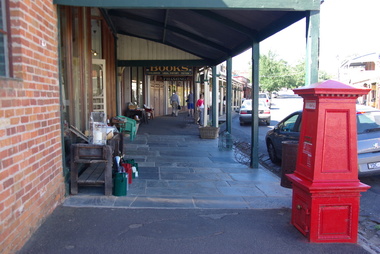
Photograph - Colour, Clare Gervasoni, Maldon, 2013, 09/01/2013
Three colour digital images showing the main street of Maldon. They images include flagstones and stone guttersmaldon, flagstone, gutter, spoon gutter, verandah -
 Victorian Interpretive Projects Inc.
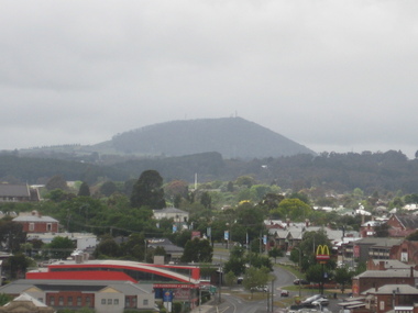
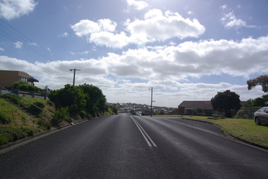
Photograph - Colour, Clare Gervasoni, Warrnambool, 2013, 29/12/2013
Five digital images showing a hillside in Warrnambool.warrnambool -
 Victorian Interpretive Projects Inc.
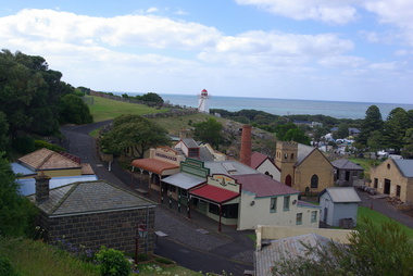
Photograph - Colour, Flagstaff Hill, Warrnambool, 2013, 29/12/2013
-
 Victorian Interpretive Projects Inc.
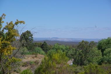
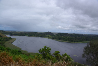
Photograph - Colour, Clare Gervasoni, Tower Hill, Victoria, 2013
The Tower Hill Reserve is located inside a dormant volcano, and features a lake and wetlands. It became Victoria's first national park in 1892, but by the 1930s the early settlers had cleared much of the land for grazing, cropping and quarrying. In the 1960s the bare hills and islands were revegetated based in species identified from Eugene von Guerard's painting of Tower Hill. Tower Hill was formed around 30,000 years ago in a violent volcanic eruption. The initial eruption created the outer rim of the volcano, and later smaller eruptions formed the internal hills that are evident today. The layers of volcanic ash layers include artefacts relating to indigenous communites.A series of colour digital photographs showing Tower Hill, near Port Fairy, Victoria. Tower Hill is an extinct volcano.tower hill, volcano, extinct -
 Victorian Interpretive Projects Inc.
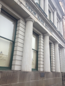
Photograph - Colour, Clare Gervasoni, Former Union Bank of Australasia Limited, Lydiard Street, Ballarat, 2013, 13/10/2013
A photograph detail of the facade of the Former Union Bank of Australasia Limited, and the associated plaquebank, union bank, union bank of australasia, ballarat, lydiard street -
 Victorian Interpretive Projects Inc.
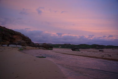
Photograph - Colour, Clare Gervasoni, Mouth of the Hopkins River, Warrnambool, 2013, 22/12/2013
The Hopkins River flows through WarrnamboolFive colour photographs of Warrnambool's Hopkins River. This area, also known as Blue Hole, features ciiffs, rock formations and rock pools. warrnambool, hopkins river, mouth, blue hole -
 Victorian Interpretive Projects Inc.
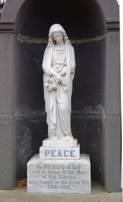
Photograph - Colour, Clare Gervasoni, Snake Valley War Memorial, 2013, 01/04/2013
world war 1, world war, snake valley, war memorial -
 Victorian Interpretive Projects Inc.
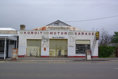
Photograph - Colour, Clare Gervasoni, Koroit Motor Garage, 2013, 23/12/2013
Exterior view of Koroit Motor Garage, including an old petrol bowser and coin operated petrol machine.koroit motor garage, koroit, petrol station, petrol bowser -
 Narre Warren and District Family History Group
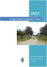
Book, Narre Warren & District Family History Group Inc, 2013 Lang Lang Cemetery Tour, 2013
Cemetery tour focusing on early history of Lang Lang Cemetery and 18 burials.36 pages : illustrations ; 30 cm.non-fictionCemetery tour focusing on early history of Lang Lang Cemetery and 18 burials.lang lang (vic.), lang lang cemetery, clara and john wuchatsch, henry and christina cozens, william and elizabeth alloway, william and ellen garnham, mary flintoft, henry hughes, john and rachel bartlett, jane and louisa pickersgill, robert and catherine henderson, fanny stephens, george and silas baker, james and dorcas baker, james and agnes nelson, walter frank mackie, susannah norquay, rev. daniel and sarah gunson, william and sarah priestly, john and elizabeth albon -
 Eltham District Historical Society Inc
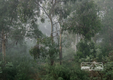
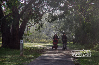
Photograph, Fred Mitchell, Misty morning on the Diamond Creek Trail, 19 June 2013, 19/06/2013
Digital copy of colour photographfred mitchell collection, 2013, diamond creek trail -
 Eltham District Historical Society Inc
Photograph, Fred Mitchell, Misty morning on the Diamond Creek Trail, 19 June 2013, 19/06/2013
Digital copy of colour photographfred mitchell collection, 2013, diamond creek trail -
 Eltham District Historical Society Inc
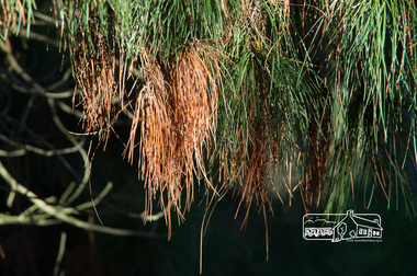
Photograph, Fred Mitchell, Mixed pine needles, Eltham Lower Park, 23 June 2013, 23/06/2013
Digital copy of colour photographfred mitchell collection, 2013, eltham lower park -
 Eltham District Historical Society Inc
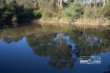
Photograph, Fred Mitchell, Tree reflections in the Yarra River at the confluence with the Diamond Creek, Eltham Lower Park, 23 June 2013, 23/06/2013
Digital copy of colour photographfred mitchell collection, 2013, eltham lower park, confluence, diamond creek, yarra river -
 Eltham District Historical Society Inc
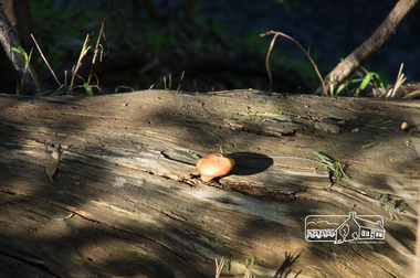
Photograph, Fred Mitchell, Toadstool, Eltham Lower Park, 23 June 2013, 23/06/2013
Digital copy of colour photographfred mitchell collection, 2013, eltham lower park