Showing 772 items
matching eltham (vic)
-
 Eltham District Historical Society Inc
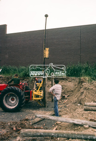
Slide - Photograph, Construction of Public Toilet, Research, c.Dec. 1980
Pile driving treated pine poles, Research Comfort Station, c.Dec. 198035mm colour positive transparency Mount - Kodak Kodachrome Cardinfrastructure, public toilets, research (vic.), research comfort station, construction -
 Eltham District Historical Society Inc
Slide - Photograph, Maroondah Aqueduct, Ingrams Road, Research, c.Aug. 1978
35mm colour positive transparency Mount - Grey and Whiteaqueduct, ingrams road, maroondah aqueduct, research (vic.) -
 Eltham District Historical Society Inc
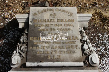
Photograph, Eltham Cemetery Trust, Grave of Michael and Bridget Cecilia Dillon, Eltham Cemetery, Victoria, 4 May 2016
Bridget was the daughter of John Wright MURRAY(1816-1867) and Mary SWEENEY(1833-1909). She married Hamilton DRAIN(1847-1886) in 1884 and they had a daughter, Mary Ellen DRAIN(1886-1888). Following husband Hamilton Drain’s death in 1886, and her infant daughter Mary’s death in 1888, Bridget married Michael Dillon in 1894. It appears that she and Michael had no children together. Electoral roll records indicate that Michael was a farmer and that he and Bridget lived in Research, Vic. Some damage has occurred to their monument and the Eltham Cemetery Trust would like to locate a next of kin or family member. Unfortunately, there was no purchase information recorded, only the following details; no next of kin. Deceased Location Date of Death Interment Date Michael Dillon Roman Catholic 205 10/12/1916 11/12/1916 Bridget Cecilia Dillon Roman Catholic 206 7/04/1927 19/04/1927 The photo of the headstone is dated 4 May 2016, which provides the best detail of the inscription.The headstone has deteriorated further in the last few years. In Loving Memory of Michael Dillon Died 10th Dec. 1916 Aged 65 years Also Bridget Cecilia Wife of the above Died 17th April 1927 Aged 78 years R.I.PBorn Digitaleltham cemetery, gravestones, michael dillon, bridget cecilia dillon (nee sweeeney) -
 Eltham District Historical Society Inc
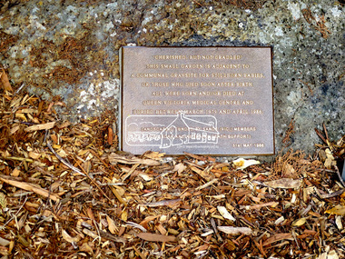
Photograph, Jim Connor, Memorial to still born babies, Eltham Cemetery, 1 Mar 2016
Plaque in the memorial to still born babies at Eltham cemetery, Mt Pleasant Road, Eltham which lies under the trees on the west side of cemetery. The plaque within a garden bed states: “Cherished, but not cradled. This small garden is adjacent to a communal gravesite for stillborn babies, or those who died soon after birth. They were all born and /or died at Queen Victoria Medical Centre and buried between March 1979 and April 1986.” The landscaping was funded by Stillborn and Neonatal death Support (SANDS) Vic. Members. It also initially had a low wooden seat in place. (No longer in place April 2022) The Queen Victoria Medical Centre itself was founded in 1896 and at the time was one of only three hospitals worldwide founded, managed and staffed by women. The Centre has since merged and amalgamated with the Monash Medical Centre. Records in EDHS files also indicate that the communal burial sites within Eltham Cemetery was also for bodies that were donated for science. Tomorrow's history documented todayeltham, jim connor collection, eltham cemetery, sands, stillbirth and neonatal death support, memorial to still born babies, memorial plaque, plaque, women in eltham cemetery tour -
 Eltham District Historical Society Inc
Slide - Photograph, Bells Hill Road, Research, c.May 1988
Looking north along Bells Hill Road at intersection with Kybrolyde Ct, Research, May 198835mm colour positive transparency (1 of 36) Mount - Kodak KodachromeProcess Date MAY 88Mbells hill road, infrastructure, kybrolyde ct, research (vic.), roads -
 Eltham District Historical Society Inc
Slide - Photograph, Bells Hill Road, Research, c.May 1988
Looking north along Bells Hill Road at intersection with Kybrolyde Ct, Research, May 198835mm colour positive transparency (` of 36) Mount - Kodak KodachromeProcess Date MAY 88Mbells hill road, infrastructure, kybrolyde ct, research (vic.), roads -
 Eltham District Historical Society Inc
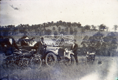
Slide, Motor Picnic, Kangaroo Ground, c.1920
Colour positive photograph taken c. Nov. 1974 of an original black and white print Indian Motor Bike, Dodge Car owned by Wraights of Kangaroo Ground (Nillumbik Historical Society)35 mm colour positive transparency Mount - Kodak Kodachrome CardProcessed Nov 1974kangaroo ground, motor picnic, motor vehicles, motorcycles, nillumbik historical society, picnic, vic registration 22115, wraight family -
 Eltham District Historical Society Inc
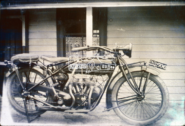
Slide, Indian Scout Motorbike owned by D. Wraight of Kangaroo Ground, c.1920
Colour positive photograph taken c. Nov. 1974 of an original black and white print Indian Motor Bike owned by D. Wraight of Kangaroo Ground (Nillumbik Historical Society)35 mm colour positive transparency Mount - Kodak Kodachrome CardProcessed Nov 1974d. wraight, indian scout, motorcycles, nillumbik historical society, vic registration 22506, kangaroo ground -
 Eltham District Historical Society Inc
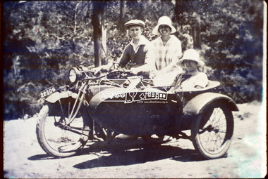
Slide, D. Wraight on his Indian Scout with sidecar, c.1920
Colour positive photograph taken c. Nov. 1974 of an original black and white print (Nillumbik Historical Society)35 mm colour positive transparency Mount - Kodak Kodachrome CardProcessed Nov 1974d. wraight, indian scout, kangaroo ground, motorcycles, nillumbik historical society, side-car, vic registration 22506 -
 Eltham District Historical Society Inc
Slide, Maroondah Aqueduct, Research, Victoria, 22 Mar. 1981
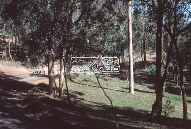
... land and the Shire of Eltham took control of this section ...An inspection tour of the Maroondah Aqueduct was undertaken by the Shire of Eltham Historical Society on Sunday, March 22nd, 1981, commening where the aqueduct crosses Main Rd., Research, just below Eltham College. The Maroondah Aqueduct was part of Melbourne’s water supply system. It carried water over the 66 km from the Maroondah Reservoir on the Watts River at Healesville to the Preston Reservoir. Of this length, 41 km were open channel, 10 km, tunnel through hills and 15 km in 14 inverted siphons across stream valleys. The route of the aqueduct is north of Tarrawarra and Yarra Glen, along the Yarra escarpment south of Christmas Hills and crossing Watsons Creek into the present Shire of Eltham near Henley Rd. The eastern part of the route lies entirely within the former boundaries of the shire. The aqueduct passes south of Kangaroo Ground to Research and crosses the Diamond Creek by siphon at Allendale Rd., Eltham North. It then extends to Reservoir via St. Helena, Greensborough North and Bundoora. Water first flowed through the aqueduct in February 1891 when it was fed by a diversion weir on the Watts River. Records of the building of the aqueduct indicate that it was a significant construction achievement. The present Maroondah Reservoir was completed in 1927 and the aqueduct was enlarged at that time to take increased flows. About 1971 the section of the aqueduct through and north of Research was replaced by a large pipe and that section of the channel is now unused. The channel has remained largely intact (unlike sections at Greensborough and Bundoora where long lengths of the disused aqueduct have been demolished or filled in). The M.M.B.W. relinquished control of the disused aqueduct reserve which is crown land and the Shire of Eltham took control of this section of the reserve as a linear park. The Maroondah Aqueduct is considered to be an important historic structure, not just to the local area but to the metropolitan area generally. It is considered important to preserve substantially intact long lengths of the disused aqueduct, together with its bridges and other associated structures. 35 mm colour positive transparency (1 of 5) Mount - Agfachrome Agfa CS System black 8 dotsactivities, heritage excursion, maroondah aqueduct, research (vic.), shire of eltham historical society -
 Eltham District Historical Society Inc
Slide, Maroondah Aqueduct, Research, Victoria, 22 Mar. 1981
... land and the Shire of Eltham took control of this section ...An inspection tour of the Maroondah Aqueduct was undertaken by the Shire of Eltham Historical Society on Sunday, March 22nd, 1981, commening where the aqueduct crosses Main Rd., Research, just below Eltham College. The Maroondah Aqueduct was part of Melbourne’s water supply system. It carried water over the 66 km from the Maroondah Reservoir on the Watts River at Healesville to the Preston Reservoir. Of this length, 41 km were open channel, 10 km, tunnel through hills and 15 km in 14 inverted siphons across stream valleys. The route of the aqueduct is north of Tarrawarra and Yarra Glen, along the Yarra escarpment south of Christmas Hills and crossing Watsons Creek into the present Shire of Eltham near Henley Rd. The eastern part of the route lies entirely within the former boundaries of the shire. The aqueduct passes south of Kangaroo Ground to Research and crosses the Diamond Creek by siphon at Allendale Rd., Eltham North. It then extends to Reservoir via St. Helena, Greensborough North and Bundoora. Water first flowed through the aqueduct in February 1891 when it was fed by a diversion weir on the Watts River. Records of the building of the aqueduct indicate that it was a significant construction achievement. The present Maroondah Reservoir was completed in 1927 and the aqueduct was enlarged at that time to take increased flows. About 1971 the section of the aqueduct through and north of Research was replaced by a large pipe and that section of the channel is now unused. The channel has remained largely intact (unlike sections at Greensborough and Bundoora where long lengths of the disused aqueduct have been demolished or filled in). The M.M.B.W. relinquished control of the disused aqueduct reserve which is crown land and the Shire of Eltham took control of this section of the reserve as a linear park. The Maroondah Aqueduct is considered to be an important historic structure, not just to the local area but to the metropolitan area generally. It is considered important to preserve substantially intact long lengths of the disused aqueduct, together with its bridges and other associated structures. 35 mm colour positive transparency (1 of 5) Mount - Agfachrome Agfa CS System black 8 dotsactivities, heritage excursion, maroondah aqueduct, research (vic.), shire of eltham historical society -
 Eltham District Historical Society Inc
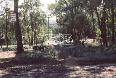
Slide, Maroondah Aqueduct, Research, Victoria, 22 Mar. 1981
... aqueduct research (vic.) shire of eltham historical society 35 mm ...This view shows the area that would develop into the Research Industrial Estate. In centre distance though largely hidden by trees is the site of the Research Hall, which was later demolished and a new Eltham Little Theatre constructed in 1988 as a bicentennial project. The hills in the distance near the power lines now a housing estate.35 mm colour positive transparency (1 of 5) Mount - Agfachrome Agfa CS System black 8 dotsactivities, heritage excursion, maroondah aqueduct, research (vic.), shire of eltham historical society -
 Eltham District Historical Society Inc
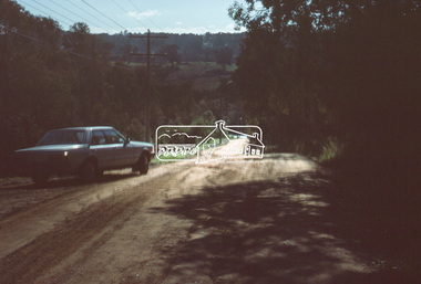
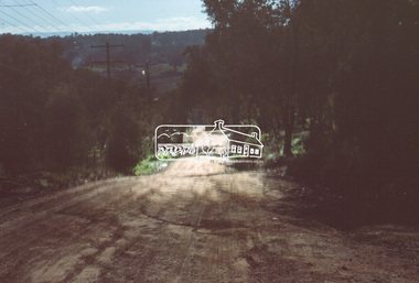
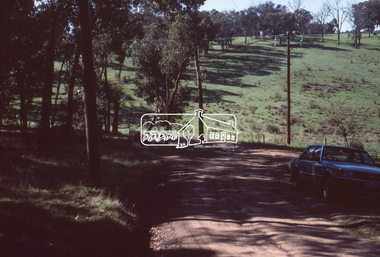
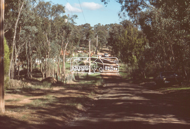
Slide, Thompson Crescent, Research, May 1983
One of a series of images of roads and infrastructure taken by Eltham Shire Council Planning and Engineering officers, May 1983 specifically looking at road conditions and drainage in Research (Vic.) around Thompson Crescent.35 mm colour positive transparency (1 of 11) Mount - Kodak Kodachrome Cardroads, infrastructure, research (vic.), thompson crescent -
 Eltham District Historical Society Inc
Slide, Thompson Crescent, Research, May 1983
One of a series of images of roads and infrastructure taken by Eltham Shire Council Planning and Engineering officers, May 1983 specifically looking at road conditions and drainage in Research (Vic.) around Thompson Crescent.35 mm colour positive transparency (1 of 11) Mount - Kodak Kodachrome Cardroads, infrastructure, research (vic.), thompson crescent, beddoe street, howell court -
 Eltham District Historical Society Inc
Slide, Thompson Crescent, Research, May 1983
One of a series of images of roads and infrastructure taken by Eltham Shire Council Planning and Engineering officers, May 1983 specifically looking at road conditions and drainage in Research (Vic.) around Thompson Crescent.35 mm colour positive transparency (1 of 11) Mount - Kodak Kodachrome Cardroads, infrastructure, research (vic.), thompson crescent, howell court -
 Eltham District Historical Society Inc
Slide, Morelle Street, Research, May 1983
One of a series of images of roads and infrastructure taken by Eltham Shire Council Planning and Engineering officers, May 1983 specifically looking at road conditions and drainage in Research (Vic.) around Thompson Crescent.35 mm colour positive transparency (1 of 11) Mount - Kodak Kodachrome Cardroads, infrastructure, research (vic.), finnigan street, morelle street -
 Eltham District Historical Society Inc
Slide, Finnigan Street, Research, May 1983
One of a series of images of roads and infrastructure taken by Eltham Shire Council Planning and Engineering officers, May 1983 specifically looking at road conditions and drainage in Research (Vic.) around Thompson Crescent.35 mm colour positive transparency (1 of 11) Mount - Kodak Kodachrome Cardroads, infrastructure, research (vic.), finnigan street, morelle street -
 Eltham District Historical Society Inc
Slide, Eva Street, Research, May 1983
One of a series of images of roads and infrastructure taken by Eltham Shire Council Planning and Engineering officers, May 1983 specifically looking at road conditions and drainage in Research (Vic.) around Thompson Crescent.35 mm colour positive transparency (1 of 11) Mount - Kodak Kodachrome Cardroads, infrastructure, research (vic.), eva street -
 Eltham District Historical Society Inc
Slide, Brenda Street, Research, May 1983
One of a series of images of roads and infrastructure taken by Eltham Shire Council Planning and Engineering officers, May 1983 specifically looking at road conditions and drainage in Research (Vic.) around Thompson Crescent.35 mm colour positive transparency (1 of 11) Mount - Kodak Kodachrome Cardroads, infrastructure, research (vic.), brenda street, research-warrandyte road -
 Eltham District Historical Society Inc
Slide, Norman Road, Research, May 1983
One of a series of images of roads and infrastructure taken by Eltham Shire Council Planning and Engineering officers, May 1983 specifically looking at road conditions and drainage in Research (Vic.) around Thompson Crescent.35 mm colour positive transparency (1 of 11) Mount - Kodak Kodachrome Cardroads, infrastructure, research (vic.), norman road -
 Eltham District Historical Society Inc
Slide, Thompson Crescent, Research, May 1983
One of a series of images of roads and infrastructure taken by Eltham Shire Council Planning and Engineering officers, May 1983 specifically looking at road conditions and drainage in Research (Vic.) around Thompson Crescent.35 mm colour positive transparency (1 of 11) Mount - Kodak Kodachrome Cardroads, infrastructure, research (vic.), norman road, thompson crescent -
 Eltham District Historical Society Inc
Slide, Thompson Crescent, Research, May 1983
One of a series of images of roads and infrastructure taken by Eltham Shire Council Planning and Engineering officers, May 1983 specifically looking at road conditions and drainage in Research (Vic.) around Thompson Crescent.35 mm colour positive transparency (1 of 21) Mount - Kodak Kodachrome Cardroads, infrastructure, research (vic.), thompson crescent -
 Eltham District Historical Society Inc
Photograph, Eltham Performing Arts Centre, 1603 Main Road, Research, c.May 1988
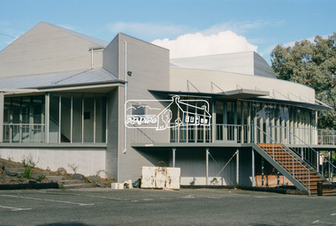
The Eltham Performing Arts Centre is a mult-use community facility with a seating capacity of up to 200 in the theatre mode. The project budget of $675,000 was jointly funded by the Shire of Eltham, Eltham Little Theatre Inc. and the Bicentennial Authority. Building works commenced in May 1987 and the Centre officially opened on 26th January, 1988 (Australia Day). It was constructed on the site of the old Research Hall in Main Road, Research, which was the previous home of the "Eltham Little Theatre."35mm colour positive transparency (1 of 25) Mount - Kodak EktachromeProcess Date MAY 88Meltham little theatre, eltham performing arts centre, main road, research (vic.) -
 Eltham District Historical Society Inc
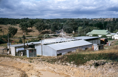
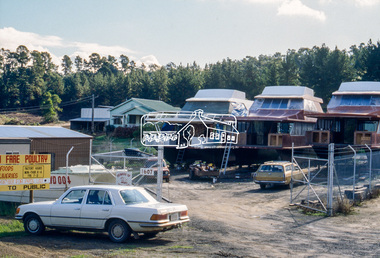
Slide - Photograph, Research Industrial Estate, 1607 Main Road, Research, c.May 1988
35mm colour positive transparency (1 of 23) Mount - Kodak EktachromeProcess Date MAY 88Mboat building, research industrial estate, main road, research (vic.) -
 Eltham District Historical Society Inc
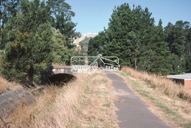
Slide - Photograph, Maroondah Aqueduct, Research, c.Mar. 1989
35mm colour positive transparency (1 of 28) Mount - Kodak KodachromeProcess Date MAR 89Mmaroondah aqueduct, research (vic.) -
 Eltham District Historical Society Inc
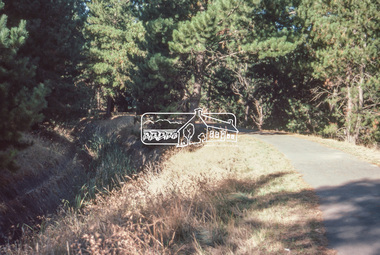
Slide - Photograph, Maroondah Aqueduct, Research, c.Mar. 1989
35mm colour positive transparency (1 of 28) Mount - Kodak KodachromeProcess Date MAR 89Mmaroondah aqueduct, research (vic.)