Showing 2594 items
matching maps of victoria
-
 Phillip Island and District Historical Society Inc.
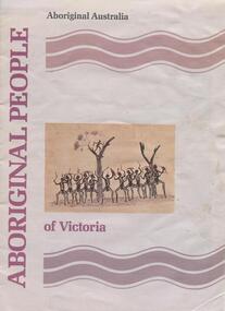
book, Aboriginal people of Victoria, 1990
15 p. : ill. (some col.), map, ports. ; 30 cm. Cover title. Cat. no. 8907893. Bibliography: p. 15. ISBN 0644101547Stamped: Phillip Island & District Historical Societyrichard broome, aboriginal people of victoria, aboriginal australia. culture and society, aboriginal australians -- australia -- victoria., aboriginal and torres strait islander commission -
 Phillip Island and District Historical Society Inc.
Book, Aboriginal string bags : nets and cordage, 1999
xv, 157 p. : ill., maps ; 24 cm. Occasional papers, Anthropology and History ; To The Phillip Island and District Historical Society, With best wishes, Alan West, July 2001fibers, string craft, australia, rope, aboriginal australians, industries -
Phillip Island and District Historical Society Inc.
Book, Aboriginal string bags : nets and cordage, 1999
xv, 157 p. : ill., maps ; 24 cm. Occasional papers, Anthropology and History ; Inscribed 'To Phillip Island & District Historical Society with best wishes from Alan West, January 2000'.fibers, string craft, australia, rope, aboriginal australians, industries -
Phillip Island and District Historical Society Inc.
Book, Broadbent's Official Road Guides Company, Broadbent's official guide : Gippsland and south-east corner of N.S.W. incorporating large scale maps, 1950
J.P. Anderson, 97 Salmon St., Hastings'victoria, guidebooks -
Phillip Island and District Historical Society Inc.
Book, William Collins, library atlas : consisting of one hundred and ten maps of modern, historical, and classical geography, &c., with descriptive letterpress of Modern geography by James Bryce, Historical geography by William F. Collier, Classical geography by Leonard Schmitz; with copious indices, 1876?
Inscribed: Hazel Fair, 37 Laura St., E. Bruns. N. 10. Stamped: J.R. Mann, Bookseller, Victoria Market ; Phillip Island & District Historical Society -
Phillip Island and District Historical Society Inc.
Book, LOVE, Don, Shipwrecks on the South Gippsland Coast, 2005
... -island-and-the-bass-coast shipwrecks victoria south gippsland ...Maps on endpapers. Includes bibliographical references and indexes.shipwrecks, victoria, south gippsland, history -
Phillip Island and District Historical Society Inc.
Book, F.E. Hiscocks &? Co, F.E. Hiscocks &? Co.'s new Victorian counties atlas, 1874 [cartographic material] : together with map of Victoria, indicating roads, distances, relative position of counties, &?c, 1874
... [cartographic material] : together with map of Victoria, indicating...-island-and-the-bass-coast Victoria maps Labelled 'Cowes Free ...Labelled 'Cowes Free Public Library', 'Phillip Island Historical Society, Cleeland Bequest'.victoria, maps -
Phillip Island and District Historical Society Inc.
Book, Whitehead, Whitehead's new map of Victoria with alphabetical key 1867-8, 1868
... Whitehead's new map of Victoria with alphabetical key 1867...-island-and-the-bass-coast Whitehead's new map of Victoria ... -
 Greensborough Historical Society
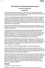
Article, Norm Colvin, Events leading up to the Plenty Ladies' Petition 1842, 2020_
This article, written and researched by Norm Colvin, GHS Secretary, identifies the people involved in the events leading to the petition to the Governor of Victoria, C. J. La Trobe, from 'Ladies resident on Plenty River' requesting protection from bushrangers, 5 May 1842. It identifies the bushrangers, the owners of the stations robbed, the group of men who rode out to assist and the identity of the "ladies" who signed the petition.This article identifies the people involved in the incidents, a list of locals in the 1840s.12 pages typescript, map.plenty river, bushrangers, petitions -
 Greensborough Historical Society
Book - Atlas, Victoria. Department of Sustainability and Environment, Melbourne atlas, 2006_
The purpose of the Melbourne Atlas is to give a spatial view of physical , environmental, social, economic and cultural aspects of Melbourne which can be used in planning. It contains maps and graphs depicting many aspects of life in Melbourne. A snapshot of life in Melbourne in 2006.Various paging, text, illus., colour maps. Wire binding.melbourne, maps, town planning, social conditions -
 Greensborough Historical Society
Pamphlet, Bus Association Victoria, Melbourne @ your fingertips: Melbourne's city and Northern suburbs, 2010s
An explanation of Melbourne's bus network in the city and Northern suburbs.Colour leaflet, double-sided, 6 p., map.public transport, buses -
 Greensborough Historical Society
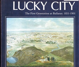
Book, Weston Bate, Lucky city: the first generation at Ballarat: 1851-1901, 1978
The history of Ballarat in its early goldmining days is entwined with the impact on the environment of the area.96 p., illus., maps.non-fictionThe history of Ballarat in its early goldmining days is entwined with the impact on the environment of the area.ballarat, gold rush, gold discoveries victoria -
 Greensborough Historical Society
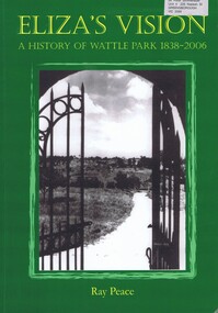
Book, Ray Pearce, Eliza's vision: a history of Wattle Park 1838-2006, 2006
An outline of the history of Wattle Park (Vic).207 p., illus., colour map.non-fictionAn outline of the history of Wattle Park (Vic).urban parks - melbourne, wattle park (vic.), parks - melbourne - history -
 Greensborough Historical Society
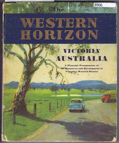
Book, Australian Publicity Council, The Western horizon of Victoria Australia, 1960c
... of Victoria. 111 p., illus. (some col.), maps. The Western horizon ...A glossy publicity publication for the state of Victoria.111 p., illus. (some col.), maps.non-fictionA glossy publicity publication for the state of Victoria.victoria - history, western district (vic.), melbourne - history -
 Greensborough Historical Society
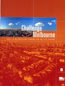
Book, Victoria. Department of Infrastructure, Challenge Melbourne: issues in metropolitan planning for the 21st century, 2000
A report on Melbourne's future growth and a strategic plan to manage this growth, 2000.36 p., text, col. illus., maps and col. plansmelbourne (victoria), town planning, infrastructure victoria -
 Greensborough Historical Society
Document, Parliament of Victoria, Ministers & Members search - the Hon. Colin Brooks (Bundoora), 23/04/2021
Biographical details of the Hon. Colin Brooks, MLA for Bundoora, taken from Parliament of Victoria - Ministers and Members website; and, map of the electoral district of Bundoora.2 p. text and colour photograph, with colour map of Bundoora Electoral Districtbrooks family, victoria parliament, colin brooks, bundoora -
 Greensborough Historical Society
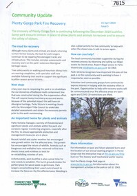
Booklet, Parks Victoria et al, Plenty Gorge Park fire recovery, 15/04/2020
Community update on rehabilitation of the section of Plenty Gorge Park affected by a bushfire in December 20196 p. text and colour photographs and mapplenty gorge park, bushfires, blue lake, yellow gum park, plenty -
 Greensborough Historical Society
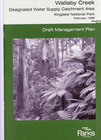
Booklet, Parks Victoria, Wallaby Creek: designated water supply catchment area. Kinglake National Park: Draft management plan 1998, 1998_02
Wallaby Creek is part of Kinglake National Park, and is a restricted access catchment area to protect quality of water supplied to Melbourne's water supply system. 26 p. black print on white paper, green cover, three folded mapskingllake national park, water supply, wallaby creek, parks victoria -
 Greensborough Historical Society
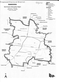
Map - Map (Copy), Electoral Boundaries Commission, Proposed electoral district: Bundoora, 01/07/2021
... - maps victoria - parliament 1p. black and white copy of map ...Proposed revised electoral boundaries for the electoral district of Bundoora (North-Eastern Metropolitan Region) as at 01/07/20211p. black and white copy of mapelectoral boundaries, bundoora - maps, victoria - parliament -
 Mission to Seafarers Victoria
Map - Street Map, Port de Papeete Tahiti
Several items were given by a seafarer, Mr Nicholas Garlick (1926-2009) into the care of Father Brady who retired from St Pauls Cathedral, Melbourne in 2018. Father Brady later donated the collection of; objects, documents and an extensive collection of cruise ship menus (1937-end of 20thC) to the Mission via the intermediary William Hastie, volunteer at the Mission for Seafarers.Tourist map of the streets of Port de Papeete, Tahiti printed in greenish-grey ink on thin ochre coloured cardboard. Produced for Hertz rent a car (see media). port de papeete, tahiti, hertz, nick garlick, nicholas garlick, father brady, william hastie, ship engineer, sailors, seamen, seafarers -
 Lorne Historical Society
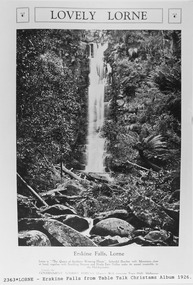
Pamphlet - Tourist Brochure, Lovely Lorne
The Victorian Railways promoted tourist destinations around Victoria. A folded paper tourist brochure about Lorne The front cover is a coloured painting of Lorne from above the Erskine River towards the main beach. , on the back is a black and white sketch tourist map of the roads, tracks and beauty spots. Inside the first fold are 6 black and white photographs, Cumberland River, Mt St George, Phantom Falls, Cumberland Cliffs, Teddy’s Lookout, leafy walk towards the pier. Inside contains written descriptions of the highlights of Lorne and six black and white photographs, four general views of Lorne, Lover’s Walk, Erskine Falls . souvenirs, victorian railways, publicity -
Lorne Historical Society
Pamphlet - Tourist pamphlet Lorne, Lorne Victoria Australia
Victorian Railways printed a series of brochures publicizing holiday destinations.A folded paper souvenir pamphlet. The cover is a colored picture of Lorne from Scotsman’s Hill with two bathing suited young women in the foreground, and a blurb extolling the virtues of Lorne. On the back is a red, yellow and blue map of Lorne and district. Inside are eight black and white photographs of Lorne attractions,; the Main Street, tennis courts, Erskine River, walking tracks and the George River with the phrase ,” The resort that embraces everything for the perfect holiday.”souvenirs, pamphlets, victorian railways, -
 Koroit & District Historical Society
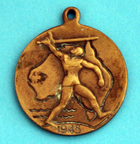
WWII school peace memorial 1945, Front with map of Australia, 1945
wwii, school, peace, medal, world war two -
 Koroit & District Historical Society
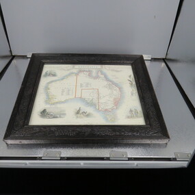
Framed Map of Australia
-
 Mission to Seafarers Victoria
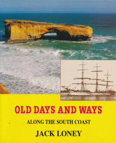
Book, Jack Loney, Old Days and Ways Along the South Coast, 1992
78 p., [30] p. of plates : ill. (some col.), maps, ports. (some col.)non-fictionaustralia, shipping, shipwrecks, jack loney (1925-1995) -
 Mission to Seafarers Victoria
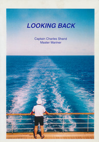
Book - Autobiography, Charles Shand, Looking Back, 2000
197 p. : ill. , 4 maps A small newspaper clipping about the death of Charles Shand was glued by the book donor and friend (Keith Oliver). The order of service from the Box Hill RSL was also found in the book.non-fictionww2, merchant navy, master mariner, captain charles shand (1915-2007), malta, patrick edward murphy, ned murphy -
 Mission to Seafarers Victoria
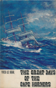
Book, Yves le Scal, The Great Days of the Cape Horners, 1966
vi, 222 p., [24] p. of plates : ill., maps .non-fictionkeith oliver, yves le scal, cape horn, cape horners -
 Mission to Seafarers Victoria
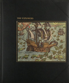
Book, Time-Life Books, The Explorers, 1978
Illustrations of the time of explorationBlack cover with picture of ship and embossed gilded writingsnon-fictionIllustrations of the time of explorationseafarers, time life books, explorers, maps, india, christopher columbus, marco polo, caravel, navigation, the americas, spain, portugal -
![Map, Public Lands Office, Township of Sandridge [cartographic material] / lithographed at the Public Lands Office, March 30th 1859, 30 March 1859](/media/collectors/4f729f5897f83e0308601603/items/63c6354eae7bf372478c58b7/item-media/63c635d4ae7bf372478c7627/item-fit-380x285.jpg) Mission to Seafarers Victoria
Mission to Seafarers VictoriaMap, Public Lands Office, Township of Sandridge [cartographic material] / lithographed at the Public Lands Office, March 30th 1859, 30 March 1859
The map shows where the land of the Customs House was and where the Bethel church was built in 1860. It also shows the name Gregory, a family of land owners who became the managers of the new building on the same site in 1889.sandridge, bethel church, customs house, gregory -
 Greensborough Historical Society
Map, Keelbundora. Counties of Bourke and Evelyn, 1950_11
... of Bourke and Evelyn Map Victoria. Department of Lands and Survey ...Covers area bounded by Merri Creek, Yarra River, Plenty River and Crown Portions 24 to 28, with section including Maroondah Aqueduct and Darebin Creek.Photocopy of digitised mapkeelbundora (parish)