Showing 10834 items
matching maps
-
 Bendigo Historical Society Inc.
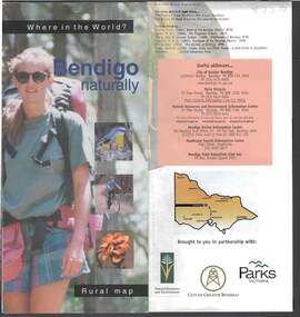
Document - BENDIGO NATURALLY TOURIST BROCHURE
District rural map describing topical walks and activities. Parks Vic, Bendigo Greater City publication.bendigo, tourism, natural environment -
 Port Melbourne Historical & Preservation Society
Pamphlet - Facilities, brief history and map, Port of Melbourne, Port of Melbourne, 1980
Eight pamphlets covering the facilities, brief history and map of the Port of Melbourne to 1980. Printed for use as handouts.melbourne harbor trust - port of melbourne authority, transport - shipping -
Port Melbourne Historical & Preservation Society
Map, City of Port Melbourne, 1963 - 1992
Used by Port Melbounre CouncilMap, City of Port Melbourne (.01) July 1992 (.02) June 1983 (.03) December 1963engineering department - city of port melbourne -
Port Melbourne Historical & Preservation Society
Map, Port Melbourne City Council, Port Melbourne - Our City, Our Life, Our Choice - No Amalgamation, Jun 1986
Port Melbourne - Our City, Our Life, Our Choice - No Amalgamation Map of area with names and addresses local government - city of port melbourne, amalgamation, frederick charles jackson, town clerks, liana thompson, mayors -
National Vietnam Veterans Museum (NVVM)
Memorabilia, Memorabilia of Raylene (Sykes) Nagy
Contains 7 letters and a map that were sent to her during the Vietnam War by Donald George Woo.vietnam war, 1961 - 1975 -- veterans -- australia, 3rd cavalry regiment -
Port Melbourne Historical & Preservation Society
Map - Lagoon between Ingles and Spring Streets, Sandridge, 26 Mar 1872
Prepared by Mr ORME for the Lagoon Committee and presented with a report on 26.3.1872.Map of Lagoon between Ingles Street and Spring Street. 26 March 1872. In brown wooden frameBorough Surveyor's Stamp in bottom right hand corner.sandridge lagoon, mr orme -
 Coal Creek Community Park & Museum
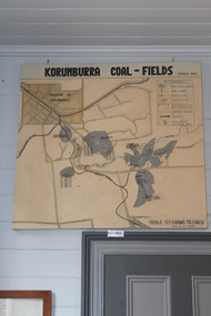
Map of Korumburra's Coal, Korumburra Coal Fields, 1910
8513.1 - Map of coal fields, township, roads, creeks, railways and boreholes in the Korumburra area. Painted on Canvas -
 Bendigo Historical Society Inc.
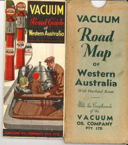
Document - BILL ASHMAN COLLECTION: VACUUM ROAD MAP WESTERN AUSTRALIA
Vacuum Road Map of Western Australia with overland route with the compliments of the Vacuum Oil Company Pty Ltd.map -
 Bendigo Historical Society Inc.
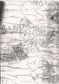
Document - CONSTABLE RYAN COLLECTION: MAP OF NORTH BENDIGO CHINESE CAMP
Photocopy of a map showing various mining leases around North Bendigo. The photocopy is not of a very good quality.map, bendigo, north bendigo -
Bendigo Historical Society Inc.
Photograph - RAILWAY PHOTOGRAPHS
DVD. Railway Photographs Disc 1 1887 Railways Map Disc 2 Bendigo Art Gallery. -
 Bendigo Historical Society Inc.
Document - OLD TOM LEASE MAP
Hand Drawn map of Old Tom Lease - Parish of Huntly, County of Bendigo, Mining district of Sandhurst.place, land, mining -
Bendigo Historical Society Inc.
Map - PART OF THE BOROUGH OF EAGLEHAWK, 9/12/1902
Map: Part od the Borough of Eaglehawk, Parish of Sandhurst, County of Bendigo. Parish plan Canvas backedmap, bendigo, city streets, borough of eaglehawk, parish of sandhurst, county of bendigo -
Bendigo Historical Society Inc.
Map - KOOYOORA, July 23rd 1857
Map: The Township of Kooyoora and suburban allotments in the Parish of Kingower. This plan has been applied to a newer backingmap, township, kooyoora, allotments, parish of kingower -
 Bendigo Historical Society Inc.
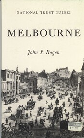
Book - NATIONAL TRUST GUIDES MELBOURNE, 1970
National Trust Guides Melbourne, 92 pages of descriptions, history and photographs of Melbourne heritage buildings with map.John P Roganhistory, melbourne, melbourne history, heritage buildings, national trust. -
Bendigo Historical Society Inc.
Map - SANDHURST SHEET 2, No date visible
Map:Sandhurst, County of Bendigo Sheet 2. Parish plan, Eaglehawk. ( number 200 in Map Cupboard 1)map, bendigo, city streets, sandhurst -
 Stanley Athenaeum & Public Room
Administrative record - Old bank books, Bank Books - Athenaeum Committee No.610-01346
State Bank books with light blue/dark blue covers with picture of map of Victoria on front cover.State Bank of Victoria - 26 Jan 1972 - 12 Jun 1974. Transactions for 'Athenaeum Committee Stanley' -
 Stanley Athenaeum & Public Room
Administrative record - Old bank books, Bank Books - Athenaeum Committee No.610-01346
State Bank books with light blue/dark blue covers with picture of map of Victoria on front cover.State Bank of Victoria - 12 Jun 1974 - 16 Jul 1976. Transactions for 'Athenaeum Committee Stanley' -
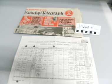 National Vietnam Veterans Museum (NVVM)
Newspaper
Sunday Telegraph sydney dated 3rd Oct 1987 and a map of assembly area for the Welcome Home Paradenewspaper, welcome home parade -
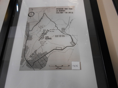 National Vietnam Veterans Museum (NVVM)
Photograph, Operation Toan Thano 1
Photograph in black frame with inner white matting and outer blackm matting of FSB Balmoral Regional Map.photograph, toan thang, fsb balmoral, battle of coral-balmoral -
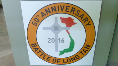 National Vietnam Veterans Museum (NVVM)
Print, 50th Anniversary of the Battle of Long Tan
Print on wooden backing. Commemorative. Orange circle, grey cross, Vietnam map green and red 201650th Anniversary Battle of Long Tancommemorative print, battle of long tan -
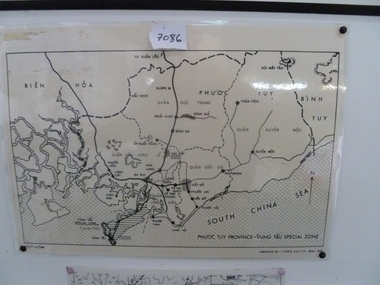 National Vietnam Veterans Museum (NVVM)
Map, Map of Phuoc Tuy Province - Vung Tau Special Zone, 1/05/1968 12:00:00 AM
Laminated map of Phuoc Tuy Province - Vung Tau special zone. Oulne of hamlets and military bases.AFV/F7-12/1188map, vung tau, 1 atf, 1 alsg -
 National Vietnam Veterans Museum (NVVM)
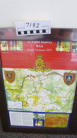
Poster - Poster, Information Board, A Field Battery RAA, South Vietnam 1971
Silver framed display board of map, photos and notes of Operation Overlord - contact 7th June, 1971A Field Battery RAA, South Vietnam 1971a field artillery, operation overlord -
 National Vietnam Veterans Museum (NVVM)
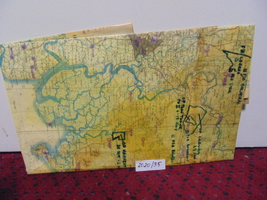
Map
A large laminated coloured map of Joint Operations Graphic (ground), Vietnam. there are specific information highlighted in pen.3rar, mcphail collection, map -
Tatura Irrigation & Wartime Camps Museum
Invitation, Tatura the heart of the Goulburn Valley, 1944
Invitation to Hon. J. H. Lienhop MLC to open the Industry of Haworth, Thomas and James Woollen textile Centre in Tatura Manufacturing Co. 18 November 1944. Included list of names and photo copies of all.Cream card title on front, map of Victoria. Tatura shown on back and hand written signatures surrounding it. j. h. lienhop, haworth, thomas and james woollen textile centre -
 Williamstown High School
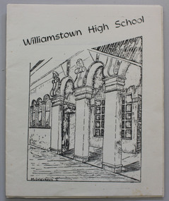
1976 orientation booklet
Pamphlet printed on white paper, 20 p. Includes enrollment information,school rules and map of school.Some editorial comments included. See the PDF file, attached.williamstown high school, 1976, orientation handbook, school rules -
 Victorian Aboriginal Corporation for Languages
Book, Department of Natural Resources and Environment, Victoria's biodiversity : our living wealth, 1997
Lush colour photographs of the particular environments, including flora, fauna, birds etc and maps locating area.Colour illustrations, colour photographsconservation, sustainability, biodiversity, victorian alps, mallee -
Lakes Entrance Regional Historical Society (operating as Lakes Entrance History Centre & Museum)
Book, Bird, Eric and Lennon, Jane, The Entrance to the Gippsland Lakes, 1973
A scientific and historical study of the artificial entrance to the entrance to the Gippsland Lakes, victoria. Includes references, illustrations, mapsexploration, transport, commerce, civil engineering -
Lakes Entrance Regional Historical Society (operating as Lakes Entrance History Centre & Museum)
Book, Gardner P D, Names of East Gippsland, 1992
A compilation of some of the place names of East Gippsland, and an explanation of the reasons for the naming, contains photographs and sketch maps.township, historic sites, social history -
Lakes Entrance Regional Historical Society (operating as Lakes Entrance History Centre & Museum)
Book, Gardner P D, Names of the Latrobe Valley and West Gippsland, 1992
Some of the place names of the Latrobe Valley and West Gippsland, victoria with explanations for their naming. Illustrated with map and photographs.township, historic sites, social history -
Lakes Entrance Regional Historical Society (operating as Lakes Entrance History Centre & Museum)
Book, Commonwealth Forests Taskforce, Gippsland REgional Forest Agreement Consultation Paper, 1999
Comprehensive report prepared by officials to support the forest agreement process containing many maps in Gippsland Victoriaforest, heritage