Showing 55885 items
matching documents-maps
-
 Greensborough Historical Society
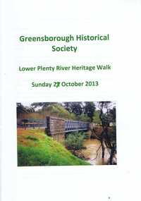
Booklet, Lower Plenty River Heritage Walk Sunday 27 October 2013, 27/10/2013
This booklet was used during the Heritage Walk along the Lower Plenty River in October 2013. It outlines natural and built landscapes of interest along this trail. 24 pages, illus. (some col.), maps.lower plenty, plenty river, lower plenty river heritage walk -
 Greensborough Historical Society
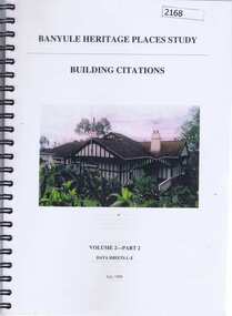
Book, Banyule Heritage Places Study, Volumes 1 and 2, 1999_07
Two volumes of the Banyule Heritage Places Study. Vol. 1: An Urban History [1837-1940s], covers Heidelberg, Ivanhoe, Greensborough and Janefield (Bundoora). Vol 2: Building Citations - Part 2, Data Sheets L-Z deals mainly with houses in the Heidelberg, Eaglemont and Ivanhoe areas. Approx 300 pages, col. illus and maps.historic houses, ivanhoe, eaglemont, heidelberg, banyule city council, greensborough -
 Greensborough Historical Society
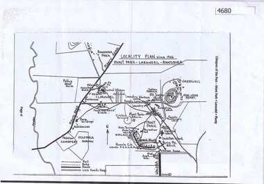
Map, Mont Park buildings still existing, 1946_
Locality Plan indicates buildings still existing within the Mont Park - Larundel mental health complex; Table lists 16 buildings by year built, initial purpose, subsequent uses and current address2 pages,one map, one table larundel, mont park -
 Greensborough Historical Society
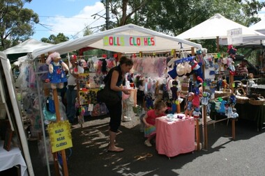
Article, Dawn Bennetts (nee Petts), Eltham Community Market, 1978o
A history of the Eltham Community Market by stallholder Dawn Bennetts. The Market began in 1978 and Dawn joined in 1985.7 typed pages, col. illus. and maps.eltham community market, dawn bennetts -
 Glenelg Shire Council Cultural Collection
Souvenir - Spoon - Commemorative Victoria 150th, n.d
Spoon commemorative Victoria 150th with map of Victoria. -
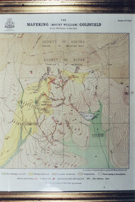 Halls Gap & Grampians Historical Society
Photograph - Coloured, C 1900
... MAPS ...Colour photo of framed map of Mafeking Goldfield.mining, mafeking, maps -
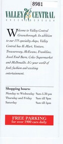 Greensborough Historical Society
Pamphlet - Advertising pamphlet, Valley Central Greensborough, 1980s
Early advertising and list of tenants for Valley Central, now known as Greensborough Plaza. Gloss colour pamphlet and black and white mapgreensborough shopping centre, greensborough plaza, valley central -
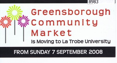 Greensborough Historical Society
Card - Advertising Card, Diamond Valley Community, Greensborough Community Market 2008, 2008
Advertising Card about the Greensborough Community Market moving to La Trobe University in 2008. This market is managed by Diamond Valley Community Support.Coloured Advertising Card - 2 sided with mapmarkets, greensborough community market, diamond valley community support -
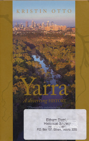 Eltham District Historical Society Inc
Book, Text Publishing, Yarra: a diverting history by Kristin Otto, 2009
Exploration of the history and meaning of Melbourne's Yarra river and those who have lived and worked on it. Softcover, 245 p. : ill. maps, ports. ISBN 9781921520006yarra river -
 Eltham District Historical Society Inc
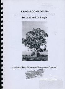
Book, Andrew Ross Museum, Kangaroo Ground: its Land and its People by Mick Woiwod published by Andrew Ross Museum, 2002
Kangaroo Ground's geology, original people, European settlers, plants used by Wurundjeri people26 leaves : ill., maps ; 30 cm.wurundjeri (australian people) -
 Eltham District Historical Society Inc
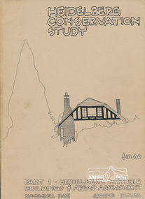
Book, Graem Butler, Heidelberg Conservation Study, Part 1 Heidelberg Historic Buildings and Areas Assessment by Graeme Butler, November 1985
Historic Buildings and Areas Assessment by Graeme Butler. Part 1 of award winning study carried out in 1982 in collaboration with a community advisory committee to Heidelberg City Council. Pioneering identification of a broad range of heritage assets varying from buildings, gravestones, farm structures, landscape areas, mileposts, divided street construction, in a time when buildings only were assessed in municipal studies.2 v. : ill., maps ; 29 cm.significant buildings heidelberg victoria, history development of heidelberg victoria, man-made landscape heidelberg victoria, significant precincts heidelberg victoria, conservation study, graeme butler -
 Eltham District Historical Society Inc
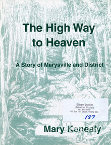
Book, Marysville & District Historical Society, The High Way to Heaven: a story of Marysville and District by Mary Kenealy, 2006
Details how this little village came into being through the pioneer families and the gold rush in the mid 1800s. Also includes extensive list of 20th century families. Details the sport and recreation delights of the area, the tourism, the timber industry and the religious denominations. Includes illustrations. 132 p. : ill., facsims., maps, portsISBN 0646462903marysville -
 Eltham District Historical Society Inc
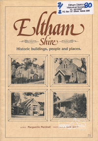
Book, Marguerite Marshall, Eltham Shire: Historic buildings, people and places, by Marguerite Marshall, 1987
Historic buildings people and places in Eltham Victoria45 p. : ill., map ; 30 cm.In one copy of 1983 edition [written on note stuck onto preface page] Hi Sue, book as promised. Hope you can get some use out of it. Nice meeting you, regards, Jane Glynnhistoric buildings eltham victoria, historic people eltham victoria -
 Eltham District Historical Society Inc
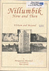
Book, Marguerite Marshall, Nillumbik Now and Then: Eltham and Beyond, by Marguerite Marshall, photographs by Ron Grant, 2002
As a journalist with the former Diamond Valley News, Marguerite Marshall wrote a series of articles on local places of historic interest, later published as the small book "Eltham Shire - Historic Buildings and Places" (1983). Many years this expanded version was published under a new title "Nillumbik Now and Then: Eltham and Beyond". ISBN 0-9580553-0-0 Three copies plus one additional copy of same edition but slight typeset variations to cover and photos throughout book 46 p. : ill., maps ; 30 cm.[written inside front cover of one copy] Best Wishes to the Eltham District Historical Society - Marguerite Marshalleltham shire, shire of nillumbik, shire of eltham, historical buildings, landmarks -
 Eltham District Historical Society Inc
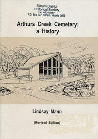
Book, Arthurs Creek Cemetery Trust, Arthurs Creek Cemetery: a History by Lindsay Mann, 2004
Revised Edition.viii, 31 p. : ill., map, ports.ISBN 0646439189arthurs creek, cemetery -
 Eltham District Historical Society Inc
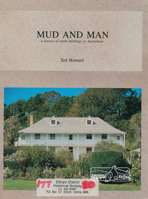
Book, Earthbuild, Mud and Man: a history of earth buildings in Australia by Ted Howard, 1992
Includes references to local sites Bear's Castle, Yan Yean (City of Whitlesea), mud brick houses in Eltham, including at Montsalvat and Eltham Community Centre, Smith's Gully, Plenty Baptist Church and Warrandyte. Includes chapter on Alistair Knox. The author's own home appears in the book on page 100. It was situated at Batman Road, Eltham next to the manse and church opposite Stanley Avenue. It was demolished for unit development June 2004 after the author's death in 2003. A significant and oft cited history of the mud brick earth construction style of architecture which includes a number of examples within the Shire of Nillumbik, known to be a site of the environmental earth building movement following WW2.198 p. : ill. (some col.), maps ISBN 0646069624earth construction, mud bricks, pise, domestic architecture -
 Warrnambool RSL Sub Branch
BOB: Map - 1:13,000, YPRES, Yperen, p.40, 'Baedeker's Belgium and Holland',1905,14th Edition (English), Leipzig: Karl Baedeker, Publisher, 1905
Bob Snape always included in his kit a few second hand Baedeker's guide books, as well as the 'Belgium and Holland' volume. Bob was a keen observer and commentator and used these guide books as any interested tourist. Bob's letters home often made reference to the history, culture and architecture of the countries he visited in the course of the war. Bob's English born father had lived and worked in France from 1878 to 1880 before his emigration to Australia.Two tone map in orange, grey and black. snape collection -
 Warrnambool RSL Sub Branch
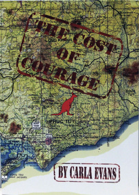
Book, THE COST OF COURAGE
Paperback. Title superimposed on coloured map of VietnamAuthor Carla Evans Published 2012 -
 Warrnambool RSL Sub Branch
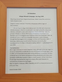
Work on paper - 2/2 Battalion Aitape Wewak Campaign, 2/2 Battalion Aitape Wewak Campaign Jan-Aug 1945
Framed print-out of the adjacent map's storyDetails the story of the 2/2 Battalion in the Aitape Wewak campaign, and the story of its connection with the present owners -
 Federation University Historical Collection
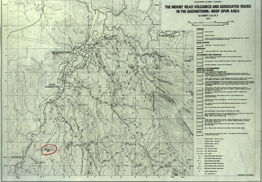
Map, The Mount Read Volcanics and Associated Rocks in the Queenstown - Whip Spur Area, 1978, 1978
Contour map of the Queenstown area in Tasmania, Australia.department of mines tasmania, volcanics, mount read, queesntown, whip spur, mining, king river, gormanston, mt owen, lynchford -
 Federation University Historical Collection
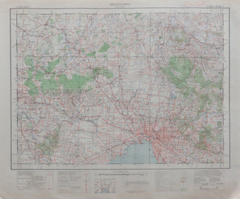
Map, Melbourne, 1943, 1943
2 copies of printed colour map on papermelbourne -
 Federation University Historical Collection
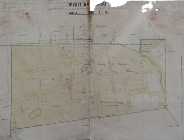
Map, No 6817 Ballaarat, Parish of Ballaarat, Mining District of Ballaarat, c1908
Printed map with pencil inscriptions on recto and versomap, mining districts, mining district of ballaarat -
Glenelg Shire Council Cultural Collection
Map - Map -Port of Portland Photocopy, n.d
Port of Portland Authority Archivesport of portland archives -
 City of Moorabbin Historical Society (Operating the Box Cottage Museum)
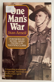
Book, Arneil, Stan, One Man's War, 1980
Diary of a young Australian prisoner of war in Changi in 1942-194588 p. : ill., facsims., map, portsnon-fictionDiary of a young Australian prisoner of war in Changi in 1942-1945world war ii, prisoner of war, changi -
 City of Moorabbin Historical Society (Operating the Box Cottage Museum)
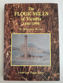
Book, Jones, W. Lewis et al, The flour mills of Victoria 1840-1990 : an historical record, 1990
History of Victoria's flour mills (over 250)xxvi, 420 p. : ill., maps, ports.non-fictionHistory of Victoria's flour mills (over 250)flour mills, victoria -
 City of Moorabbin Historical Society (Operating the Box Cottage Museum)
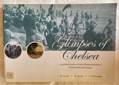
Book, Jacobs, Margaret et al, Glimpses of Chelsea : a pictorial history of early Chelsea and district, 2007
126 p. : ill., 1 map, ports. non-fictionchelsea history, chelsea -
 City of Moorabbin Historical Society (Operating the Box Cottage Museum)
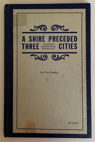
Book, Thomas Arthur Sheehy, A Shire Preceded Three Cities Moorabbin, Sandringham, Mordialloc, 1965
The story of Moorabbin as seen by its people.46p. : illus., ports., folded map; indexnon-fictionThe story of Moorabbin as seen by its people.moorabbin, pioneers, early settlers -
 City of Moorabbin Historical Society (Operating the Box Cottage Museum)
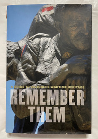
Book, Hutchinson, Garrie, Remember them : a guide to Victoria's wartime heritage, 2007
""Remember them" has been funded by the Government of Victoria, and produced by the Veteran's Unit, Department of Planning and Community Development."--Title page verso.308 p. : ill. (some col.), maps ; non-fiction""Remember them" has been funded by the Government of Victoria, and produced by the Veteran's Unit, Department of Planning and Community Development."--Title page verso.war memorials, soldier monuments, soldiers, world war one, world war two, korean war, vietnam war, south african war, monuments -
 Running Rabbits Military Museum operated by the Upwey Belgrave RSL Sub Branch
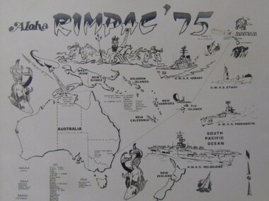
Photo
RIMPAC '75, Map of Pacific Ops. Areaphoto, ww2, ran -
 Running Rabbits Military Museum operated by the Upwey Belgrave RSL Sub Branch
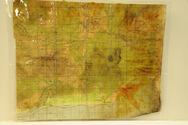
Map
... Maps ...Viet Cong Map of Nui Dat Areamaps, vietnam, general