Showing 10834 items
matching maps
-
 Eltham District Historical Society Inc
Book, Diamond Creek Basin Study. Part 1, A Compendium of Factors Relevant to Stormwater Flows, 1980
Basin Studies are studies to evaluate water supply and demand and help ensure reliable water supplies by identifying strategies to address imbalances in water supply and demand.Spiral Bound. 157 leaves in various foliations (some folded) : illustrated. (some colour.), maps (some colour.)aerial photographs, allendale road, arthurs creek mine, arthurs creek road bridge, arthurs creek, bald spur look-out, bank protection, bolton steet, bridge street bridge, bridge street, bridges, challenger street, chute street, construction, coolaroo drive, culvert, deep creek, diamond creek basin, diamond creek region, diamond creek, diamond street bridge, drainage works, eltham lower park, eltham town park, eltham trestle bridge, eltham west drains, eltham, erosion, flood management, floods, footbridge, glen katherine estate, gold mining, gum glade, hurstbridge, kangaroo ground, kinglake escarpment, kinglake national park, latiners hat factory, main road bridge, main road, masons falls, melbourne metropolitan board of works, monash bridge, mount sugarloaf, nillumbik park, orchards, railway culvert, railway line, ramptons road, real estate advertisement, research creek, st helena east drain, st helena road, st helena, storm sewers, stormwater, sugarloaf-preston transfer main crossing, susan street, union mine, village pond, water flow, watkins street, wattletree road, weidlich road, wingrove park, yarra river, zig zag road, water supply, basin study -
 Bendigo Military Museum
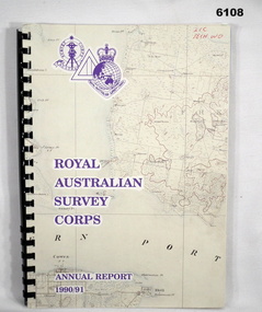
Administrative record - Royal Australian Survey Corps - Annual Report 1990/91, Royal Australian Survey Corps, Late 1991
Annual Report detailing the status of Australian mapping, charting and geodesy for the period 1 Jul 90 - 30 Jun 91A4 soft covered book, glossy paper pages and plastic pockets containing maps. Plastic ring bindingTop right hand corner "2IC Tech WO"royal australian survey corps, rasvy, fortuna, army survey regiment, army svy regt, asr -
 Lara RSL Sub Branch
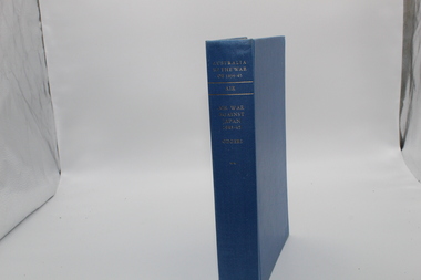
Book, Australia in the War of 1939-1945 - Air War Against Japan 1943-1945 AIR Author George Odgers, First Published in 1957
The history of the Royal Australian Air Force in WWII beginning with the first offensive against Japan and ends with the return of the RAAF to Australia after the surrender of the Japanese Forces.Australia in the War of 1939-1945 - Air War Against Japan 1943-1945 AIR Maps, Illustrations, Photographs, Australian War Memorialraaf, 1943-1945, japan, pacific war, phillipines, burma, minelaying, mindoro, catalinas, anti-submarine, tarakan, labuan, rabaul, new guinea -
 Bendigo Military Museum
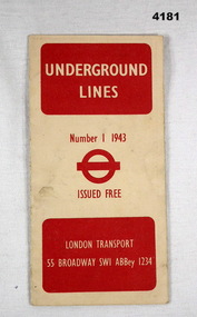
Map - UNDERGROUND LINES, London Transport, 1943
Item part of the Fredrick Gardner Davey DFC No 410533 RAAF collection. Refer Cat No 3536P for his service details.Cream card with red print on the cover, has two fold out sections to give a map of the London Underground.map, london, underground -
 Bendigo Military Museum
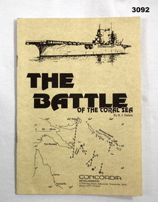
Booklet - BOOKLET, CORAL SEA, B J Dalton, The Battle of the Coral Sea, c.1992
Cream illustrated cardboard covered booklet of 12 pages. Drawing of ship & map of battle area on front cover.books-naval-history, illustrations, coral sea -
 Bendigo Military Museum
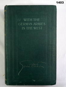
Book, Sven Hedin, With the German Armies in the West
Green buckram hard cover, light green print. 402 pages, illustrated black & white maps / drawings. books, biography, military history -
 Bendigo Military Museum
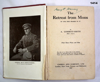
Book, A Corbett - Smith, The Retreat From Mons By One Who Shared In It, 1917
Faded maroon buckram hard cover. Title & author embossed but not inked. 256 pages, illustrated with photos & maps.Mary P Clancbooks, military history -
 Bendigo Military Museum
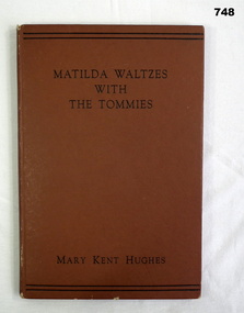
Book, Mary Kent Hughes, Matilda Waltzes with the Tommies, 1944
176 page illustrated hardcover book with maps on inside of front and rear covers. Brown cover with black wordingbooks, military history -
 Phillip Island and District Historical Society Inc.
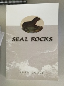
book, Ruth Gooch, Seal Rocks and Victoria's primitive beginnings, 2008
ix, 166 p. : ill., maps, ports. ; 25 cm. Includes index. Bibliography: p. 151-159. Stamped Phillip Island & District Historical Societyseal rocks, local aboriginal history, sealing, western port -
 Greensborough Historical Society
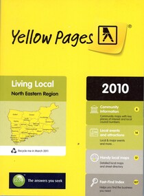
Book - Directory, Telstra Corporation Limited, Yellow Pages: Living local North Eastern Region 2010, 2010
Yellow Pages is a listing of businesses and organisations and their telephone numbers and addresses within the north eastern region of Melbourne432 p black print on white and yellow paper, paperback, includes UBD Street maps and street indextelephone directories, north east melbourne -
 Montmorency/Eltham RSL Sub Branch
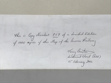
Map - Burma Railway Map (annotated)
Fold-out sheet of paper showing and describing the details of locations along the railway; part of a numbered series of maps -
 Phillip Island and District Historical Society Inc.
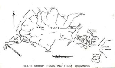
Photograph
One of a collection of over 400 photographs in an album commenced in 1960 and presented to the Phillip Island & Westernport Historical Society by the Shire of Phillip IslandPhotograph of a map of Phillip Island in the making and showing fourteen separate Islands before natural processes joined them.local history, photography, phillip island, black & white photograph, phillip island geology, map, dr g baker, john jenner, bryant west -
 Greensborough Historical Society
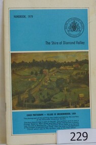
Book, The Shire of Diamond Valley Handbook 1979, 1979_
The Shire of Diamond Valley was a Local Government Area located about 20 kilometres northeast of Melbourne. The shire covered an area of 74.38 square kilometres and existed from 1964 until 1994.Annual guide to services in Shire of Diamond Valley32 pages, illus (some col.), maps. Cover illustration is a copy of the Ellis painting "Village of Greensborough 1889".shire of diamond valley, greensborough, handbooks -
 Greensborough Historical Society
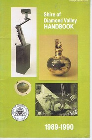
Book, Shire of Diamond Valley Handbook 1989-1990, 1989_
Guide to services provided by Shire of Diamond Valley. The Shire of Diamond Valley was a Local Government Area located about 20 kilometres northeast of Melbourne. The shire covered an area of 74.38 square kilometres and existed from 1964 until 1994.Annual guide to services in Shire of Diamond Valley32 pages, col illus., maps. Cover illustration of items from the Diamond Valley Shire Art Collection.shire of diamond valley, greensborough, handbooks -
 Greensborough Historical Society
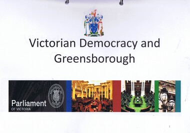
Folder, Victorian democracy and Greensborough, compiled by Anne Paul, 2019_06
Outline of events leading to independent separate representative government for Victoria in 1850, and information on electoral districts and parliamentary members in the Greensborough and surrounding areas to date. Talk presented by Anne Paul to a GHS General meeting on 29 June 2019.90 p. in loose leaf ring binder. Text, maps and colour illustrations. Printed copy of PowerPoint presentationgreensborough, victoria parliament, anne paul -
 Glenelg Shire Council Cultural Collection
Map - Fold-out fire control map - Region 4 Victoria, n.d
Fold-out fire control map for Region 4 - Victoria Northern sheet, includes numerical and alphabetical index. -
 Kiewa Valley Historical Society
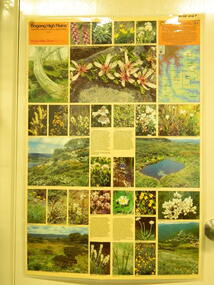
Map / Chart, Vegetation Map & Guide to Alpine Flora: Rocky Valley, 1982
This poster is of Rocky Valley is on the Victorian High Plains where the State Electricity Commission of Victoria worked on the Kiewa Hydro Electric Scheme and also where cattlemen brought their cattle up during summer at various times. Its significance is due to it shows the flora of the area after the Kiewa Hydro Electric Scheme Rocky Valley damn has been build and therefore is a valuable for comparison to see what plants are there now after this information on this poster was complied. Historic: Comparison of the flora at Rocky Valley with other areas on the Victorian High Plains and with Rocky Valley before and after the Kiewa Hydro Scheme and / or grazing there. Is therefore research significance and interpretive capacity due to this compatibility value.Laminated double sided vegetation map and guide to the Alpine flora of the Rocky Valley area, with photographs of plants and vegetation.rocky valley. alpine. flora. vegetation. plants. s.e.c.v.. cattlemen. victorian high plains. -
 Kiewa Valley Historical Society
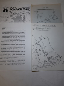
Papers - Mt Beauty Pondage Walk
The Mt Beauty area is picturesque during each of the seasons and therefore an attraction for tourists. During the 1980s and 1990s the Pondage Walk was popular as visitors were able to borrow a tape recording and stop along the way listening to the history of the area.After the completion of the Kiewa Hydro Electric Scheme Mt Beauty became a tourist destination. The walks are popular and vary in length, difficulty and duration. Papers describing walks in the Mt Beauty area including the Mt Beauty Pondage Walk. Includes maps of the walks.mt beauty pondage walk, tourism -
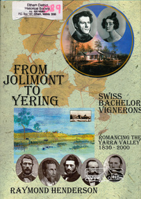 Eltham District Historical Society Inc
Book, Raymond Henderson, From Jolimont to Yering and along our Yarra valleys with Neuchatel's bachelor vignerons / Raymond Henderson, 2006c
Hardback with dust jacket; 426 p. : ill. (some col.), geneal. tables, maps, ports. ; 31 cm.ISBN 0958135851yarra river valley, wine making, vineyards -
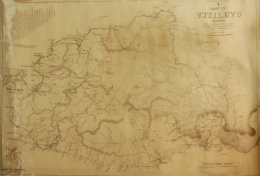
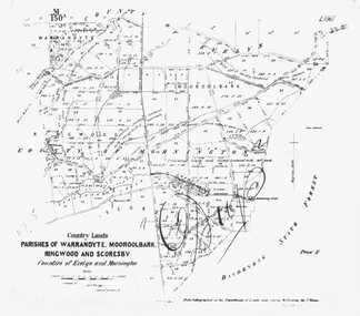 Ringwood and District Historical Society
Photograph, Map-Parishes of Warrandyte, Mooroolbark, Ringwood and Scoresby. 1870
Photograph of map "Country Lands - Parishes of Warrandyte, Mooroolbark, Ringwood and Scoresby - Counties of Evelyn and Mornington" dated 1870. -
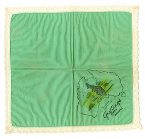 Marysville & District Historical Society
Souvenir (Item) - Souvenir handkerchief, Unknown
A souvenir handkerchief from The Log Cabin in Marysville in Victoria.A souvenir handkerchief from The Log Cabin in Marysville in Victoria. The Log Cabin was built by Thomas Henry Branchflower who had arrived from England late in 1921. It was built for Gwendoline Pitman after the death of her father Clarence Pitman and the disappearance of her sister Olive in July 1926. Gwendoline operated an artist and souvenir shop in the newly built Log Cabin in partnership with Peter Mackey who was a Melbourne optician and artist.SOUVENIR/ OF AUSTRALIA Greetings/ from/ Marysville.the log cabin, marysville, victoria, thomas henry branchflower, gerald branchflower, mary chain, gwendoline pitman, clarence pitman, kooringa guesthouse, olive pitman, wilbur anderson, peter mackey, souvenir handkerchief, souvenir -
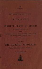 Federation University Historical Collection
Book, William Baragwanath, Memoirs of the Geological Survey of Victoria No 14: The Ballarat Goldfield, 1923, 1923
257 page foolscap pink covered book relating to the Ballarat goldfields plus 32 plates of maps and sections. william baragwanath, mining, geological survey of victoria, ballarat, goldfields, raglan street, ballarat -
Federation University Historical Collection
Book, Maldon Historic Reserve Management Plan, 1989, 1989
This book was prepared by the Royal Botanic Gardens, Mebourne Soft covered report of 83 pages, including 10 folded leaves of plates , and 11 maps (some coloured). maldon, geology, flora, vermin, parkin's reef, derby hill, beehive reef, long gully, union hill, mount tarrengower, eaglehawk gully, porcupine flat, neggetty range, peg leg gully, sandy creek, smiths creek, landscape -
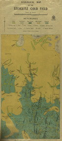 Federation University Historical Collection
Map, Geological Map of The Stieglitz Gold Field, 1940
At the bottom of the 2nd page, there is text that reads "Geologically and topographically surveyed in 1909 by W.H. Ferguson, Assistant Field Geologist. Published 1940."Rectangular geological map edged in masking tape showing Steiglitz, Victoria. Scale 48 chains to 4 inches.steiglitz, geology, geological map, north albion, moreep, mining, mine, caribald reef, durdidwarrah, gilbraltar hill, mount pleasant gully, township of steiglitz, w.h. ferguson, garibaldi reef, yankee gully, kinglock mine engine shaft, herbert werner frederick de nully, albion gully, virago reef, mulrooney's reef -
 Federation University Historical Collection
Map, Plan showing Locality of Reported Gold Find District of Tavula, 1935
Map with coloured shading on paper backed onto linen showing Crown Indian Settlement, Tovatova, Koro, Devotamap, devota, koro, crown indian settlemt, tovatova, tavua -
Federation University Historical Collection
Book, Business, Service & Street Directory: Ballarat, Hepburn and Golden Plains Shires, 2011, 2011
Soft covered directory with advertisments, maps, business listings and community services. The cover featurs the Ballarat Botanical Gardens.directory, street directory, business directory, ballarat, hepburn, golden plains -
Federation University Historical Collection
Book, Business, Service & Street Directory: Ballarat, Hepburn and Golden Plains Shires, 2008-9, 2008
Soft covered directory with advertisments, maps, business listings and community services. The cover featurs the Ballarat Avenue of Honour.directory, street directory, business directory, ballarat, hepburn, golden plains -
 Federation University Historical Collection
Booklet, Report of Natural Resources and Operations 1 Seminar April, 1983, 1983
This report details the program of a Natural Resources and Operations Seminar for the Victorian T.A.F.E. Off-Campus Network, hosted by the Victorian School of Forestry in Creswick. Thirty-one participants were in attendance. The program was conducted from the 6th to the 8th of April, 1983 and excursions were made to the You Yangs Forest Park, the Serendip Wildlife Research Station and Werribee Gorge National Park.A ring bound booklet of 19 pages and clear laminate covers. Includes a map of the Victorian School of Forestry, Creswick.natural resources, seminar, school of mines ballarat, ballarat school of mines, victorian t.a.f.e off-campus network, school of forestry, creswick, victorian school of forestry -
Glenelg Shire Council Cultural Collection
Photograph - Photograph -Port of Portland office, n.d
Port of Portland Authority ArchivesBack: White Sticker ---Trade Fair 61-67 - black biroport of portland archives, offices, map, victoria -
 City of Moorabbin Historical Society (Operating the Box Cottage Museum)
Book, Howe, Renate et al, The challenge of the city : the centenary history of Wesley Central Mission 1893-1993, 1993
240 p., [40] p. of plates : ill., maps, ports. Includes bibliographies p. 218-234, and index.non-fictionreligion, wesley central mission, uniting church, city missions