Showing 9733 items matching "2016-03-05"
-
 Ballarat Heritage Services
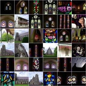
Digital photographs, L.J. Gervasoni, Infant Jesus Catholic Church Koroit stained glass windows, 2011-2016
http://vhd.heritagecouncil.vic.gov.au/places/69285 Digital imageschurch, catholic, koroit, infant jesus, presbytery, bluestone, interior, religion, stained glass, window, art -
 Ballarat Heritage Services
Digital photographs, L.J. Gervasoni, Infant Jesus Catholic Church Koroit stained glass windows - detail, 2011-2016
http://vhd.heritagecouncil.vic.gov.au/places/69285 Digital imageschurch, catholic, koroit, infant jesus, presbytery, bluestone, interior, religion, stained glass, window, art, feet, chalice, fish, grain -
 Ballarat Heritage Services
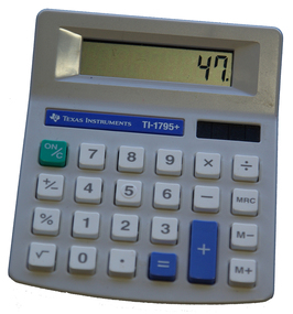
Photograph - Colour, Calculator, 21/06/2016
Colour photograph of a battery operated calculator.calculator, mathematics -
 Ballarat Heritage Services
Photograph - Colour, Mathematics Teaching Tools, 21/06/2016
Colour photograph Mathematics Teaching Tools such as dice, cards, bead counters and popsicle sticks.calculator, mathematics, dice, cards, bead counters and popsicle sticks. -
 Ballarat Heritage Services
Digital photographs, L.J. Gervasoni, Boarding the 109 tram at Kew, 2016
kew junction, tram, 109 tram, streetscape, shopping centre, public transport -
 Ballarat Heritage Services
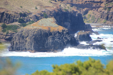
Digital photographs, L.J. Gervasoni, Bushrangers Bay, 2016
coast, coastal, coastal geomorphology, geology, ocean, waves, bushrangers bay -
 Ballarat Heritage Services
Digital photographs, L.J. Gervasoni, Elephant Rock Bushrangers Bay, 2016
coast, coastal, coastal geomorphology, geology, ocean, waves, bushrangers bay, elephant rock -
 Ballarat Heritage Services
Digital photographs, 2016, L.J. Gervasoni, Potatoes for Sale at Newlyn, 2016
Colour photograph of a potato stall at Newlynnewlyn, potatoes, sale, sign -
 Ballarat Heritage Services
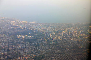
Aerial digital photograph, L.J. Gervasoni, Mouth of the Yarra River and Westgate on approach to Melbourne's Tullamarine Airport, 2016
hoto taken from flight in to Melbourne International airport.Digital aerial image of Melbourne, Victoria.aerial, landscape, cityscape, mouth, yarra river, west gate bridge, aerial photograph -
 Ballarat Heritage Services
Digital Photograph, L.J. Gervasoni, Melbourne CBD and Albert Park Lake on approach Melbourne Airport, 2016
Digital Image showing an aerial view of the Melbourne Central Business District and Albert Park.aerial, melbourne, yarra river, cbd, albert park, lake, port phillip bay -
 Ballarat Heritage Services
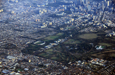
Digital Photograph, L.J. Gervasoni, Royal Park CBD and zoo from the air, 2016
Digital Image showing an aerial view of the Melbourne Central Business District and Royal Park.aerial, melbourne, yarra river, cbd, royal park, zoo -
 Ballarat Heritage Services
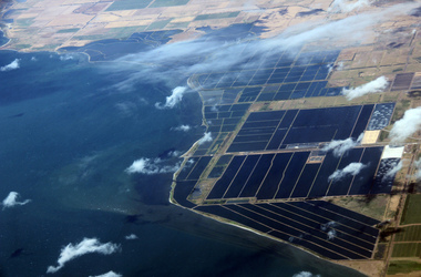
Digital Photograph, L.J. Gervasoni, werribee farm from the air, 2016
Digital Image showing an aerial view of the Melbourne Central Business District and Royal Park.aerial, melbourne, werribee farm, sewerage -
 Ballarat Heritage Services
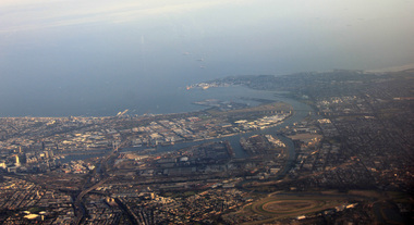
Photograph, L.J. Gervasoni, Mouth of the Yarra River from the air, 2016
Digital Image showing an aerial view of the mouth of the Yarra River from the airaerial, melbourne, mouth, yarra, river, port phillip bay, flemington, docklands, bolte bridge, west gate bridge -
 Ballarat Heritage Services
Photograph - Colour, Camelia, Ballarat, 2016
Colour photograph of a carmelia after a fall of snow in Ballarat.camelia, ballarat, winter, flower, garden -
 Ballarat Heritage Services
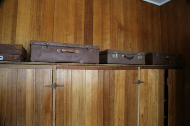
digital photographs, Lisa Gervasoni, Lady Northcote, 2014 - 2016
lady northcote, childrens, farm, british, settlement scheme, suitcases -
 Ballarat Heritage Services
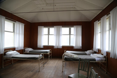
digital photographs, Lisa Gervasoni, Lady Northcote, 2014 - 2016
lady northcote, childrens, farm, british, settlement scheme, dorms, beds -
 Ballarat Heritage Services
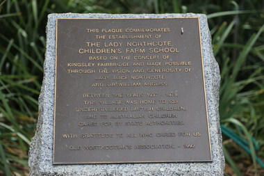
Digital photographs, Lisa Gervasoni, Plaque at the Lady Northcote Children's Farm School, 2014 - 2016
Colour photograph of a plaque relating to the Lady Northcote Children's Farm school.lady northcote, childrens, farm, british, settlement scheme, plaque -
 Ballarat Heritage Services
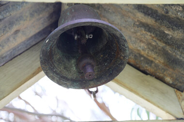
Photograph - Colour, Lisa Gervasoni, Bell at Lady Northcote, c2015, 2014 - 2016
Colour photograph of a bell at Lady Northcote.lady northcote, childrens, farm, british, settlement scheme, school, bell -
 Ballarat Heritage Services
digital photographs, Lisa Gervasoni, Lady Northcote, 2014 - 2016
lady northcote, childrens, farm, british, settlement scheme, school, gates -
 Ballarat Heritage Services
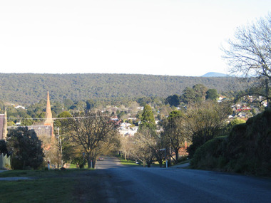
digital photographs, Lisa Gervasoni, Daylesford's Bellbird View, c2006-2016
Colour photograph of Daylesford. This view was used for the opening scenes of the ABC television seried 'Bellbird'.heritage, daylesford, townscape, view -
 Ballarat Heritage Services
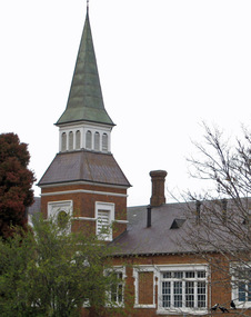
digital photographs, Lisa Gervasoni, Daylesford Primary School, c2006-2016
Colour photograph of a brick building with tower, known as Dayleford Primary School.heritage, daylesford, townscape, primary school, daylesforf primary school -
 Ballarat Heritage Services
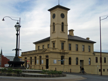
digital photographs, Lisa Gervasoni, Daylesford Post Office, c2006-2016
Colour photograph of the Daylesford Post Office. heritage, daylesford, townscape, daylesford post office -
 Ballarat Heritage Services
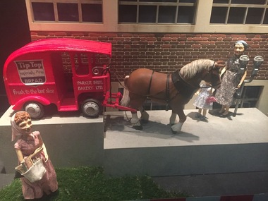
Photograph - Photograph - Colour, Clare Gervasoni, Myer (Ballarat) Christmas Window Display, 12/2016
This window was previously used in Myer Melbourne Christmas Window displayDigital Photograph Myer (Ballarat) Christmas Window Display showing model of horse drawn tip top vanchristmas windows, tip top, myer, ballarat, sturt street -
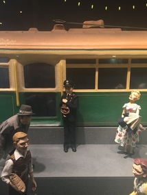 Ballarat Heritage Services
Photograph - Colour, Myer (Ballarat) Christmas Window Display, 12/2016
Colour photograph of a miniature tram in a Myer Christmas window display.christmas windows, tram, conductor -
 Ballarat Heritage Services
Photograph - Colour, Earth Banks, Old Sarum, England, 01 November 2016
William the Conqueror inherited Old Sarum from the last Saxon king of England. It was an ideal site for a royal castle. It was here in 1070 that William paid off his army after a long and bitter campaign in northern England. It was here in 1086 that he called together all the major landholders in England so they could swear allegiance to him. It was a crucial moment. The Domesday Book was being written, a threatened Viking invasion had only just been averted and William's eldest son was in armed rebellion. Old Sarum was an important place where this Norman king of England held power. In 1794 the Ordnance Survey set out to check the accuracy of the first mapping of Southern England, which had begun ten years earlier. From a point just below Old Sarum Lieutenant William Mudge laid out a base-line 36,574 feet (11,253 metres) long. From each end of the line the positions of distant places were plotted using a huge theodolite made in 1791 by Jesse Ramsden. The accuracy of the process, which was repeated all over England, depended on Jesse Ramsden's craftsmanship and on William Mudge's surveying skill in setting out this first base-line from Old Sarum. The nearer end of Mudge's line is marked by an inscribed stone beside the modern A345 at Old Sarum. ordnance survey, william mudge, jesse ramsden, william the conqueror, old sarum, saxon, 1086, england -
 Ballarat Heritage Services
Photograph - Colour, Stonework, Old Sarum, England, English Heritage Site, 01 November 2016
William the Conqueror inherited Old Sarum from the last Saxon king of England. It was an ideal site for a royal castle. It was here in 1070 that William paid off his army after a long and bitter campaign in northern England. It was here in 1086 that he called together all the major landholders in England so they could swear allegiance to him. It was a crucial moment. The Domesday Book was being written, a threatened Viking invasion had only just been averted and William's eldest son was in armed rebellion. Old Sarum was an important place where this Norman king of England held power. In 1794 the Ordnance Survey set out to check the accuracy of the first mapping of Southern England, which had begun ten years earlier. From a point just below Old Sarum Lieutenant William Mudge laid out a base-line 36,574 feet (11,253 metres) long. From each end of the line the positions of distant places were plotted using a huge theodolite made in 1791 by Jesse Ramsden. The accuracy of the process, which was repeated all over England, depended on Jesse Ramsden's craftsmanship and on William Mudge's surveying skill in setting out this first base-line from Old Sarum. The nearer end of Mudge's line is marked by an inscribed stone beside the modern A345 at Old Sarum. ordnance survey, william mudge, jesse ramsden, william the conqueror, old sarum, saxon, 1086, england