Showing 1947 items matching " flooding"
-
 Eltham District Historical Society Inc
Album - Photograph, J.A. McDonald, Yarra Glen-Glenburn Road, Apr. 1956
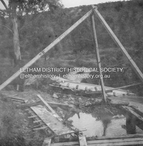
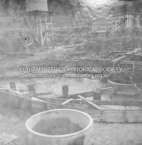
Showing first flood debris April 1956Record of various Shire of Eltham infrastructure works undertaken during the period of 1952-1962 involving bridge and road reconstruction projects, sometimes with Eltham Shire Council Project Reference numbers quoted. It was during this period that a number of significant improvements were made to roads and new bridges constructed within the shire that remain in place as of present day (2022). In many situations, the photos provide a tangible visible record of infrastructure that existed throughout the early days of the Shire. The album was put together by or under the direction of the Shire Engineer, J.A. McDonald.infrastructure, shire of eltham, bridge construction, jehosophat creek, road construction, yarra glen-glenburn road, 1956-04 -
 Eltham District Historical Society Inc
Album - Photograph, J.A. McDonald, Yarra Glen-Glenburn Road, Apr. 1956
Showing first flood debris April 1956Record of various Shire of Eltham infrastructure works undertaken during the period of 1952-1962 involving bridge and road reconstruction projects, sometimes with Eltham Shire Council Project Reference numbers quoted. It was during this period that a number of significant improvements were made to roads and new bridges constructed within the shire that remain in place as of present day (2022). In many situations, the photos provide a tangible visible record of infrastructure that existed throughout the early days of the Shire. The album was put together by or under the direction of the Shire Engineer, J.A. McDonald.infrastructure, shire of eltham, bridge construction, jehosophat creek, road construction, yarra glen-glenburn road, 1956-04 -
 Greensborough Historical Society
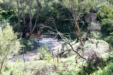
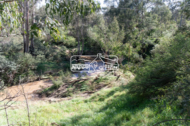
Photograph - Digital Image, River's up on Greensborough Bridge, 1910c
Plenty River in flood at old Greensborough bridge.Digital copy of black and white photograph.plenty river, floods -
 Eltham District Historical Society Inc
Photograph, George W. Bell, Flood Eltham, 1960s
Diamond Creek in flood at Eltham c.1960sBlack and white printfloods, eltham, diamond creek, george w bell collection -
 Victorian Interpretive Projects Inc.
Photograph - Colour, Clare Gervasoni, Rain Inundation on the corner of Armstrong Street (south) and Eyre Streets, Ballarat, 2011, 22/10/2011
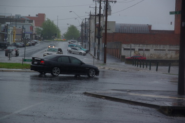
The flooded area is on the part of Ballarat known as the escarpmentrain, ballarat, flood -
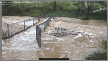
 Eltham District Historical Society Inc
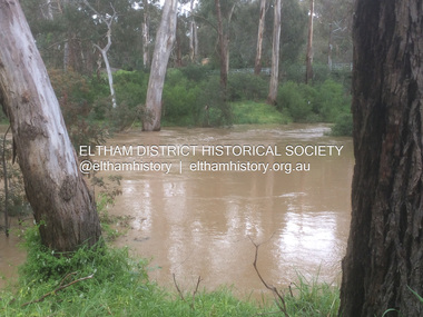
Photograph - Digital Photograph, Carlota Quinlan, Diamond Creek in flood, Diamond Creek Trail, Eltham South, 16 Oct 2021
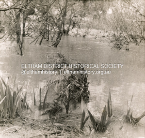
... flooding ...diamond creek (creek), diamond creek trail, eltham south, flooding, floods, floodwater -
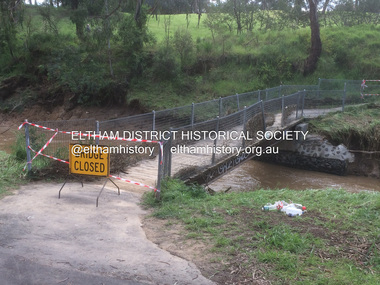
 Eltham District Historical Society Inc
Photograph - Digital Photograph, Carlota Quinlan, Diamond Creek in flood, Diamond Creek Trail, Eltham South, 16 Oct 2021
... flooding ...diamond creek (creek), diamond creek trail, eltham south, flooding, floods, floodwater -
 Eltham District Historical Society Inc
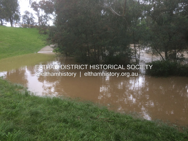
Photograph - Digital Photograph, Carlota Quinlan, Diamond Creek in flood, Diamond Creek Trail, Eltham South, 16 Oct 2021
... flooding ...diamond creek (creek), diamond creek trail, eltham south, flooding, floods, floodwater -
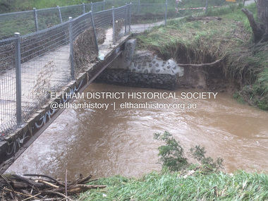
 Eltham District Historical Society Inc
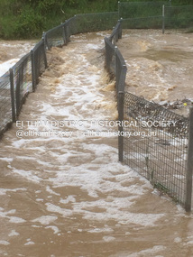
Photograph - Digital Photograph, Carlota Quinlan, Diamond Creek in flood, Diamond Creek Trail, Eltham South, 17 Oct 2021
... flooding ...diamond creek (creek), diamond creek trail, eltham south, flooding, floods, floodwater -
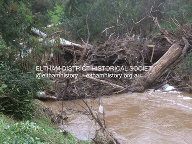
 Eltham District Historical Society Inc
Photograph - Digital Photograph, Carlota Quinlan, Diamond Creek in flood, Diamond Creek Trail, Eltham South, 17 Oct 2021
... flooding ...diamond creek (creek), diamond creek trail, eltham south, flooding, floods, floodwater -
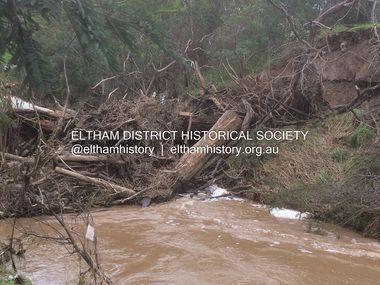
 Eltham District Historical Society Inc
Photograph - Digital Photograph, Carlota Quinlan, Diamond Creek in flood, Diamond Creek Trail, Eltham South, 17 Oct 2021
... flooding ...diamond creek (creek), diamond creek trail, eltham south, flooding, floods, floodwater -
 Eltham District Historical Society Inc
Photograph - Digital Photograph, Carlota Quinlan, Diamond Creek in flood, Diamond Creek Trail, Eltham South, 17 Oct 2021
... flooding ...diamond creek (creek), diamond creek trail, eltham south, flooding, floods, floodwater -
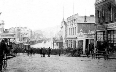 Ballaarat Mechanics' Institute (BMI Ballarat)
Victoria St Hill flooding in Bridge St, Max Harris
... flooding ...This photograph is from the Max Harris Collection held by the Ballaraat Mechanics' Institute. Please contact BMI for all print and usage inquiries.ballarat, flood, flooding, bridge st, bakery hill, carriages -
 Tatura Irrigation & Wartime Camps Museum
Book, Lake Eildon - A Record low, 2000
... flooding ...To record and compare water levels and to showcase the success of "Eildon Lake Charters" in Murrindindi Tourism Competition "Best New Business 2000". Book includes many old historic preflooding photos.Clear plastic dust cover. White front cover with photograph of Eildon and Sugarloaf Dam in foreground. Insert of charter boat.buesiness, flooding, boat club, books, history, local -
 Eltham District Historical Society Inc
Film - Video (Digital), Carlota Quinlan, Diamond Creek in flood, Diamond Creek Trail, Eltham South, 16 Oct 2021
... flooding ...diamond creek (creek), diamond creek trail, eltham south, flooding, floods, floodwater -
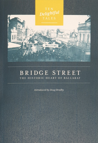 Federation University Historical Collection
Booklet, Doug Bradby, Bridge Street: The Historic Heart of Ballarat, 2020
Twenty eight page dark green covered book on Ballarat's Bridge Street, including information on the Gravel Pits, Main Road shops, floods, Chinese cerneval, Queen carneval, Yarrowee Bridge, Eureka Stockade, fire, Yarrowee Creek.non-fictionballarat, gravel pits, main road shops, floods, chinese cerneval, queen carneval, yarrowee bridge, eureka stockade, fire, yarrowee creek, bridge street -
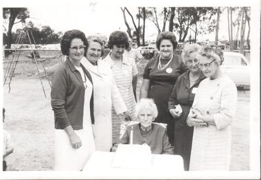
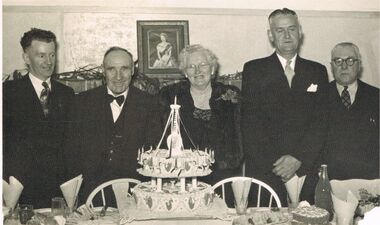 Bendigo Historical Society Inc.
Photograph - BERT GRAHAM COLLECTION: GROUP PHOTO, 1956
Black & white photograph, Bert Graham Collection, 5 people in photo are from left to right are; Bert Graham, Mr. & Mrs. Tully, Tom Flood, Tom Norris, the occasion was the 25th Birthday 1956, of the Bendigo East progress Association.bendigo, clubs, bendigo east progress association -
 Bendigo Historical Society Inc.
Photograph - SHELBOURNE EAST SS 1012 COLLECTION: BACK TO SHELBOURNE EAST
Black and white photograph of seven women. On the back: Mabel Levershia, Alma Wiegard, Pat Flood, Bill Levershia, Olive Wiegard, Jess Levershia. At back to school E. Sh. With older back to lady (Roberts) Mrs. Jean Brotherton.education, bendigo, shelbourne east -
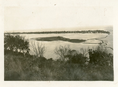 Lakes Entrance Historical Society
Photograph - Bullock Island, 1930c
Black and white photograph of Bullock Island, showing the footbridge to the island, the rock groynes at the western end of the island, built to direct flood and tide waters to entrance. Photo taken from Kalimna Hill, scub in foreground. Lakes Entrance Victoriawaterways, islands, township -
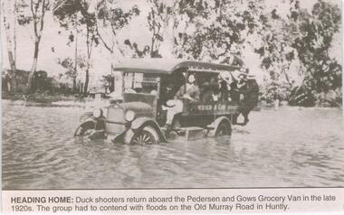 Bendigo Historical Society Inc.
Newspaper - JENNY FOLEY COLLECTION: HEADING HOME
BHS CollectionBendigo Advertiser ''The way we were'' from 2003. Heading home: duck shooters return aboard the Pedersen and Gows Grocery Van in the late 1920s. The group had to contend with floods on the Old Murray Road in Huntly. The clip is in a folder.newspaper, bendigo advertiser, the way we were -
 Eltham District Historical Society Inc
Album - Photograph, J.A. McDonald, Dixons Creek Road, 23 Sep. 1955
Dixons Creek in flood Temporary bridge washed outRecord of various Shire of Eltham infrastructure works undertaken during the period of 1952-1962 involving bridge and road reconstruction projects, sometimes with Eltham Shire Council Project Reference numbers quoted. It was during this period that a number of significant improvements were made to roads and new bridges constructed within the shire that remain in place as of present day (2022). In many situations, the photos provide a tangible visible record of infrastructure that existed throughout the early days of the Shire. The album was put together by or under the direction of the Shire Engineer, J.A. McDonald.1955-09-23, bridge construction, dixons creek bridge, dixon's creek road, flood damage, floods, infrastructure, road construction, shire of eltham -
 Greensborough Historical Society
Photograph - Photograph (Copy), Anne Paul, Plenty River in flood 2003, Lower Plenty, 2003_12
Two views of Plenty River in flood, Lower Plenty.2 colour photographs printed on paper, handwritten captionslower plenty, plenty river, floods -
 Clunes Museum
Photograph
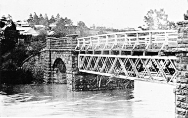
SUSPENSION BRIDGE WAS SWEPT AWAY IN A FLOOD ABOUT 1909.BLACK AND WHITE PHOTOGRAPH SHOWING THE SUSPENSION BRIDGE IN FOREGROUND, GOVERNMENT BRIDGE IN CENTRE.MAYBE THIS IS THE SWING BRIDGE WHICH WAS SWEPT AWAY ABOUT 1909. IT WAS ABOVE EBERHARD'S CORDIAL FACTORY.local history, photography, bridges, suspension bridge -
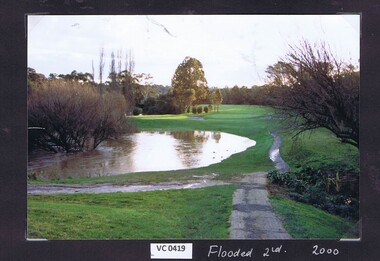 Heidelberg Golf Club
Photograph, Flooded 2nd fairway 2000: Heidelberg Golf Club, 2000
Flooded 2nd fairway 2000 at Heidelberg Golf Club.Colour photograph.hgc course, 2nd fairway -
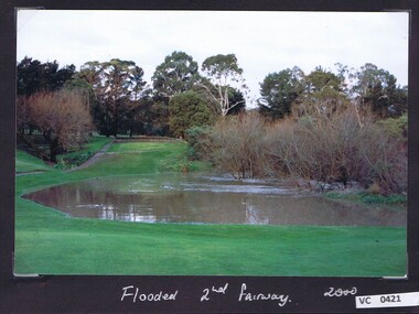 Heidelberg Golf Club
Photograph, Flooded 2nd fairway 2000: Heidelberg Golf Club, 2000
Flooded 2nd fairway 2000 at Heidelberg Golf Club.Colour photograph and caption.hgc course, 2nd fairway -
Canterbury History Group
Photograph, 1983
Canterbury Bowling Club green flooded December 1983Opening Day 03/09/1982Coloured Photograph 15cm x 10cmbowling green, canterbury bowling club, railway lines -
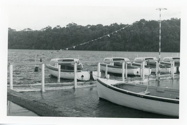 Lakes Entrance Historical Society
Photograph - Business, Lakes Post Newspaper, 1998c
Black and white photograph of the North Arm, showing hire boat jetty covered with flood waters caused by a high tide, four hire boats and rowing boat at jetty. House visible on top of Kalimna Heights in background. Lakes Entrance Victoriaboats and boating, tourism, businesses -
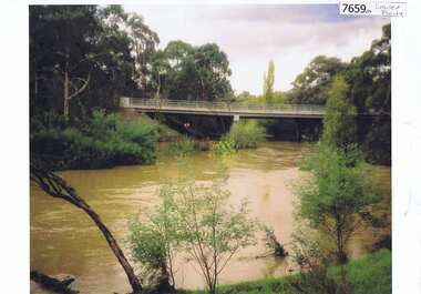
 Eltham District Historical Society Inc
Photograph, Peter Pidgeon, Diamond Creek near Main Road Bridge, Eltham South, 8 Sep. 2021
Evidence of flooding from recent winter and early spring rainBorn Digitaleltham south, diamond creek trail, diamond creek (creek), floods -
 Eltham District Historical Society Inc
Photograph, Peter Pidgeon, Diamond Creek near Main Road Bridge, Eltham South, 8 Sep. 2021
Evidence of flooding from recent winter and early spring rainBorn Digitaleltham south, diamond creek trail, diamond creek (creek), floods -
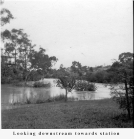 Greensborough Historical Society
Photograph - Digital Image, Tony Fitton, Plenty River flood 1960s, 1960s
The Plenty River in flood, 1960s. Photos taken by Tony Fitton. Digital copy of black and white photographs.Captions on imageplenty river, floods