Showing 6243 items
matching 1989/90
-
 Ringwood and District Historical Society
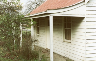
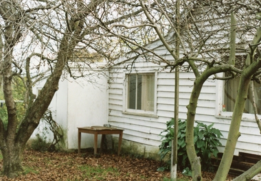
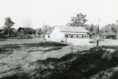
Photograph, Hill’s old house on Canterbury Road, Ringwood, demolished for the golf course July 1989, Circa 1989
Digital photograph -
 Ringwood and District Historical Society
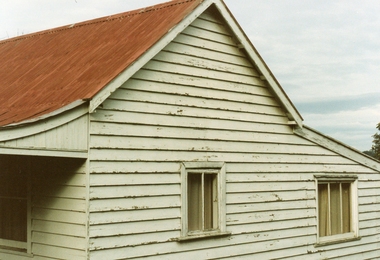
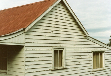
Photograph, Hill’s old house on Canterbury Road, Ringwood, demolished for the golf course July 1989, Circa 1989
Digital photograph -
 Ringwood and District Historical Society
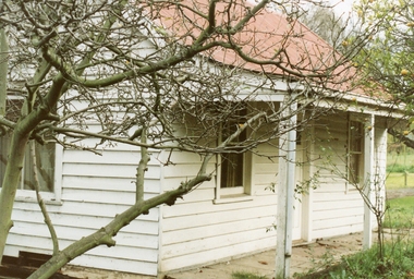
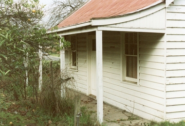
Photograph, Hill’s old house on Canterbury Road, Ringwood, demolished for the golf course July 1989, Circa 1989
Digital photograph -
 Ringwood and District Historical Society
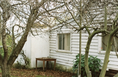
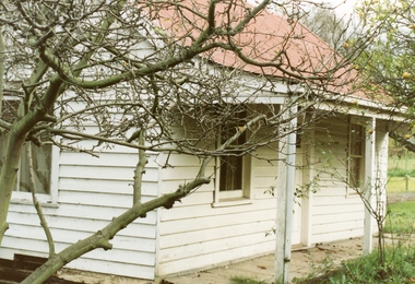
Photograph, Hill’s old house on Canterbury Road, Ringwood, demolished for the golf course July 1989, Circa 1989
Digital photograph -
 Ringwood and District Historical Society
Photograph, Hill’s old house on Canterbury Road, Ringwood, demolished for the golf course July 1989, Circa 1989
Digital photograph -
 Ringwood and District Historical Society
Photograph, Hill’s old house on Canterbury Road, Ringwood, demolished for the golf course July 1989, Circa 1989
Digital photograph -
 Ringwood and District Historical Society
Photograph, Hill’s old house on Canterbury Road, Ringwood, demolished for the golf course July 1989, Circa 1989
Digital photograph -
 Ringwood and District Historical Society
Photograph, Hill’s old house on Canterbury Road, Ringwood, demolished for the golf course July 1989, Circa 1989
Digital photograph -
 Ringwood and District Historical Society
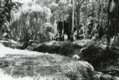
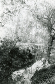
Photograph, Mullum Mullum Creek, at the end of George Street on 10th September 1989, 1989
Digital photograph -
 Ringwood and District Historical Society
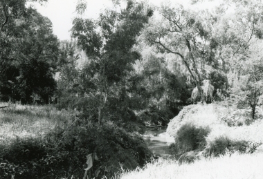
Photograph, Mullum Mullum Creek, between Junction St and Suda Avenue on 10th September 1989, 1989
Digital photograph -
 Ringwood and District Historical Society
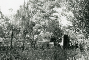
Photograph, Wantirna road, Ringwood, last house on East side before Dandenong Creek on 20th May 1989, 1989
Digital photograph -
 Ringwood and District Historical Society
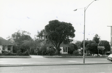
Photograph, Maroondah Highway. The house at the corner of George Road. Taken from the South side near the junction of Mt Dandenong Road on 10th September 1989, 1989
Digital photograph -
 Ringwood and District Historical Society
Photograph, Maroondah Highway. The house at the corner of George Road. Taken from the South side near the junction of Mt Dandenong Road on 10th September 1989, 1989
Digital photograph -
 Ringwood and District Historical Society
Photograph, Mullum Mullum Creek off Miles Avenue, view towards Warrandyte Road about where Melbourne St was on 10th September 1989, 1989
Digital photograph -
 Ringwood and District Historical Society
Photograph, Mullum Mullum Creek between the library and St Pauls on 10th September 1989, 1989
Digital photograph -
 Ringwood and District Historical Society
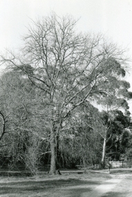
Photograph, The Mullum Mullum Creek track, the oak tree at back of library on 10th September 1989, 1989
Digital photograph -
 Ringwood and District Historical Society
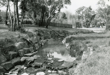
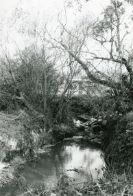
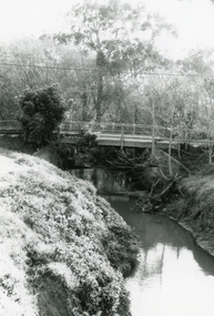
Photograph, Mullum Mullum Creek at the Ringwood Street bridge, west side on 10th September 1989, 1989
Digital photograph -
 Ringwood and District Historical Society
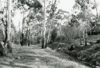
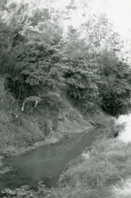
Photograph, Mullum Mullum Creek on south side about half-way between Ringwood Street and Acadia Street on 10th September 1989, 1989
Digital photograph -
 Ringwood and District Historical Society
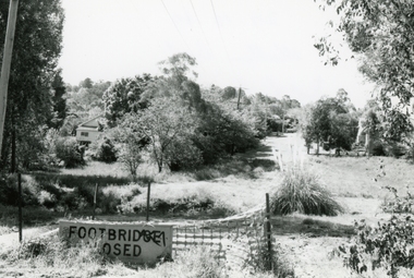
Photograph, Mullum Mullum Creek near New and Nelson Streets corner, looking upstream on 29th October 1989, 1989
Digital photograph -
 Ringwood and District Historical Society
Photograph, Mullum Mullum Creek end of Acacia Street, where footbridge want to Harrison Street on 29th October 1989, 1989
Digital photograph -
 Ringwood and District Historical Society
Photograph, Mullum Mullum Creek near New and Nelson Streets corner, downstream, on 29th October 1989, 1989
Digital photograph -
 Ringwood and District Historical Society
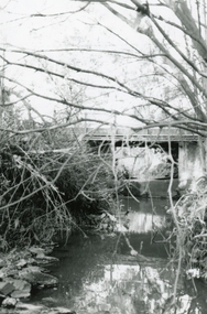
Photograph, Mullum Mullum Creek on Ringwood Street bridge, east side, on 10th September 1989, 1989
Digital photograph -
 Ringwood and District Historical Society
Photograph, Mullum Mullum Creek towards Ringwood Street, near old Melbourne Street off Miles Avenue, on 10th September 1989, 1989
Digital photograph -
 Ringwood and District Historical Society
Photograph, Mullum Mullum Creek, fenced garden of a Munro St property that has encroached into the creek boundary 29th October 1989, 1989
Digital photograph -
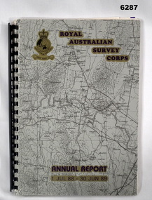 Bendigo Military Museum
Administrative record - Royal Australian Survey Corps Report on Activities - 1 July 1988 - 30 Jun 1989, Army Survey Regiment, 30 Jun 1989
This is a Report summarizing the activities of the Royal Australian Survey Corps during the F/Y 1988/89A4 Booklet, plastic ring binding with part of 1:250,000 map of SI5-15 Canberra printed on the front cover. Includes text, photos, maps and diagramsroyal australian survey corps, rasvy, fortuna, army survey regiment, army svy regt, asr -
 Eltham District Historical Society Inc
Book, D. Pendavingh, Yarra River Trail Plan 1989: Banksia Street to Warrandyte, 1989
Also contains a loose A3 mylar plan inserted - Depart of Planning and Urban Growth, Heidelberg; Main Yarra Trail; Warringal Parklands and Banyule Flats, Detail Plan and Locality Plan -
 Eltham District Historical Society Inc
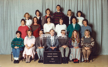
Photograph, Staff, Eltham North Primary School, 1989, 1989
Kim Tarpey (front row, second from right), Alf Franklin (front row, third from right)) Peter Furlong (Principal, front row, fourth from right), Rex Wenn (Deputy Principal, front row, fith from right. Marg Aperloo (second row, first from left). Rex Wenn became the President of the national Boys Choir. He had two boys in the choir during his time at Eltham North Primary.Digital file only - scanned from personal photos on loan to EDHSalf franklin, eltham north primary school, kim tarpey, marg aperloo, peter furlong, rex wenn, staff members -
 Eltham District Historical Society Inc
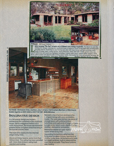
Newsclipping, Lalirra, 100 Scenic Crescent, Eltham, June 1989, 1989
Contained in Volume 2 of a set of two spiral magnetic photo albums, each containing 10 leaves, 20 pages; Vol. 1 labelled "Houses - Eltham South" and Vol. 2 labelled "Eltham Houses". Newspaper clippings promoting house auctioneltham, real estate advertisement, houses, lalirra, morrisons estate agent, scenic crescent -
 Eltham District Historical Society Inc
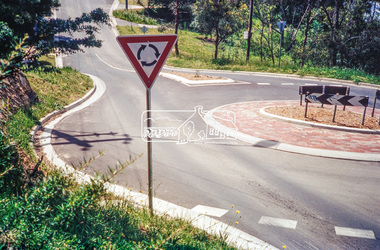
Photograph, Looking north along Ryans Road at intersection with Kerrie Crescent, Eltham, c.October 1989, 1989
Ryans Road was reconstructed and sealed to the north of Kerrie Crescent in 1983. Roundabout and southern reconstruction added later. This photo is probably shortly after construction of roundabout (before 1991 when Doug Orford photographed all the Shire boundaries as roundabout was well planted at that stage) Cross Ref: 04070 and 01878-25Roll of 35mm colour negative film, 1 stripsFuji 100eltham north, kerrie crescent, round about, ryans road, streets -
 Eltham District Historical Society Inc
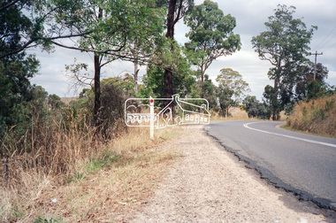
Photograph, Looking south towards the Kangaroo Ground Horse and Pony Club, Kangaroo Ground-St Andrews Road, Kangaroo Ground, c.1989, 1989
Roll of 35mm colour negative film, 5 strips Kodak GA100 5095infrastructure, kangaroo ground, kangaroo ground horse and pony club, kangaroo ground-st andrews road, streets