Showing 1101 items
matching information map
-
 Whitehorse Historical Society Inc.
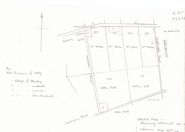
Document, Subdivisions 1859, nd
Sketch map of subdivisions of 1859.Sketch map of subdivisions of 1859. Allotment 126 and portions of 125, 126 and 130, including 'Village of Studley', 'Village of New Brunswick' and two unnamed. Information from Mr McComb, retired surveyor; sketch and notes. Areas near railway line east of Mitcham Station and North East corner of Canterbury and Mitcham Roads. Refer map A - SP 110.Sketch map of subdivisions of 1859.land subdivision, heatherdale road, mitcham, purches street, mitcham road, vermont, canterbury road, whitehorse road, brunswick road, creek road, centre road, studley village, new brunswick village -
 Whitehorse Historical Society Inc.
Document - Report, Frederick Henry Stockfield, 1/06/1997
Photocopy of a school assignment. It describes a number of local War Memorials and gives information about Frederick Henry Stockfield who is listed on the Mitcham War Memorials. His family lived in Blackburn Road Blackburn and he had worked picking fruit. He was an artillery man who trained in England and fought in the Third Battle of Ypres. He died of wounds on 21/9/1917 and is buried in the Military Huts Cemetery in Dickenbuscg, Belgium. Photographs of his grave and the cemetery are included. There is information about the life of a Gunner and some about his family. Photographs. Maps. Approx 38 pagesstockfield, frederick harry;, world war 1914-1918. battle of ypres, war memorials -
 Whitehorse Historical Society Inc.
Map, Dandenong Ranges Area, 1956
... survey information. Maps Ringwood Mitcham Warrandyte Sheet 1 ...Sheet 1. Parts of Parishes: Nunawading, Warrandyte and Ringwood. Scale: 10 chains : 1 inch. Contour intervals marked and locations of buildings.Sheet 1. Parts of Parishes: Nunawading, Warrandyte and Ringwood. Scale: 10 chains : 1 inch. Contour intervals marked and locations of buildings. Compiled from aerial photographs and cadastral survey information.Sheet 1. Parts of Parishes: Nunawading, Warrandyte and Ringwood. Scale: 10 chains : 1 inch. Contour intervals marked and locations of buildings. maps, ringwood, mitcham, warrandyte -
Whitehorse Historical Society Inc.
Map, M.M.B.W, c1962
Melbourne Metropolitan Area Base Map series sheet 235, covering part, Mitcham, Nunawading and Ringwood areas.Melbourne Metropolitan Area Base Map series sheet 235, covering part, Mitcham, Nunawading and Ringwood areas. Prepared by Department of Lands and Survey and Melbourne and Metropolitan Board of Works from State aerial Survey, June 1957 and Cadastral Survey information, August 1960. Scale 1:4,800.Melbourne Metropolitan Area Base Map series sheet 235, covering part, Mitcham, Nunawading and Ringwood areas. maps, mitcham, nunawading, ringwood, melbourne and metropolitan board of works, victoria. department of lands and survey -
Whitehorse Historical Society Inc.
Report, Charles William Gilbert Blake, 1/06/1997
Photocopy of school assignment. Includes information about a number of local war memorials and an investigation of Charles William Gilbert Blake whose name is on the Mitcham War Memorials. Blake enlisted in East Burwood. He trained in Egypt and was then sent to England where he died in hospital of an abscess in the brain. He is buried at the Tidworth Military Cemetery. Photographs. Maps. Approx 28 pagesblake, charles william gilbert, war memorials, world war, 1914 - 1918, tidworth military cemetery -
Whitehorse Historical Society Inc.
Pamphlet, Blackburn Lake Sanctuary, c2000
Description of the Blackburn Lake Sanctuary with a brief history, information about events held in the sanctuary and the role of the Blackburn Lake sanctuary Advisory Committee. Detailed map.Description of the Blackburn Lake Sanctuary with a brief history, information about events held in the sanctuary and the role of the Blackburn Lake sanctuary Advisory Committee. Detailed map.Description of the Blackburn Lake Sanctuary with a brief history, information about events held in the sanctuary and the role of the Blackburn Lake sanctuary Advisory Committee. Detailed map.blackburn lake, blackburn lake sanctuary advisory committee -
Whitehorse Historical Society Inc.
Document - Report, Henry William Dowton, 1/06/1997
Luther College Year 10 History report on Henry William Dowton, a name on the Mitcham War Memorial. Includes material from Australian Archives and from the family. 'Dick' Dowton was from Gippsland and was killed at Pozieres during the Battle of the Somme on 25th July 1916. The report details visits to various War Memorials and the search for information. Also included is information from the Trafalgar Historical Society including correspondence to and from Dowton and between his parents and the army as they sought information about his death. Illustrations, maps, 64 pages.dowton, henry william;, world war, 1914-1918. battle of the somme, war memorials -
Whitehorse Historical Society Inc.
Document - Report, Frank Isaac White, 01/06/1997
Photocopy of a Luther Collage assignment on visits to war memorials and an investigation of Frank Isaac White, a name on the Mitcham War Memorial. White served in Egypt and France,. Maps show the route of his journeys including a period in hospital in England. Information is given about soldiers living conditions and his role as a artillery man. He was killed in Belgium on 20th September 1917 and buried in the Menin Road South Cematery at Ypres. Photographs of the cemetary are included and of his grave.white, frank isaac, menin road south military cemetry, ww1, war memorials -
Whitehorse Historical Society Inc.
Document, Letter from Glyn France with enclosures, 1993
Letter to Nunawading Historical Society from Glyn France with information on Schwerkolt Family with enclosures: 2 maps showing Frankfurt and Neudorgel; Domestic Personal service book and translation by Dr Ursula Halls; Marriage Certificate (August & Pauline Richter) 1850. Proceedings before coroner 9 Sep 1867; Letter from Alf Antonio to the Age re local schools.schwerkolt, paulina, marriage certificates, domestic personal service book, schwerkolt, johann august, richter, paulina, nunawading north primary school, antonio, alfred, halls, ursula, mitcham primary school, no. 2904, sweeney, john -
Whitehorse Historical Society Inc.
Map, Nunawading Planning Scheme, 7/06/1994 12:00:00 AM
Local Section maps 1 - 4 with index. Geographical information system land Information Branch. Scale 1:10,000 Shows zoning under planning scheme.Local Section maps 1 - 4 with index. Geographical information system land Information Branch. Scale 1:10,000 Shows zoning under planning scheme.Local Section maps 1 - 4 with index. Geographical information system land Information Branch. Scale 1:10,000 Shows zoning under planning scheme.blackburn, blackburn north, blackburn south, forest hill, heatherdale, maps, nunawading, vermont, vermont south, town planning, burwood east, laburnum -
Whitehorse Historical Society Inc.
Pamphlet, Information Bulletin, 1/12/1993
Freeway Extension between Doncaster Road and Springvale Road to go ahead.Freeway Extension between Doncaster Road and Springvale Road to go ahead. Map showing location and history of project given.Freeway Extension between Doncaster Road and Springvale Road to go ahead. freeways, doncaster road, doncaster, springvale road, nunawading, vicroads, city of nunawading, city of camberwell, city of box hill, city of ringwood -
Whitehorse Historical Society Inc.
Letter - Correspondence, Vermont, 15/11/1987 12:00:00 AM
etter from Grace Gibbs to Keith Rooney containing information on the history of Vermont and hand-drawn sketch map of local orchards and farms - also information on Vermont Seventh Day Adventists, now Ringwood Seventh Day Adventist Church.Letter from Grace Gibbs to Keith Rooney containing information on the history of Vermont and hand-drawn sketch map of local orchards and farms - also information on Vermont Seventh Day Adventists, now Ringwood Seventh Day Adventist Church.etter from Grace Gibbs to Keith Rooney containing information on the history of Vermont and hand-drawn sketch map of local orchards and farms - also information on Vermont Seventh Day Adventists, now Ringwood Seventh Day Adventist Church.vermont, gibbs, clare, rooney, keith, vermont seventh day adventist church, ringwood seventh day adventist church -
Whitehorse Historical Society Inc.
Document, Andreas Fritsch, 1992
History and maps of the brick quarry opened by Andreas Fritsch in Nunawading in 1856.History and maps of the brick quarry opened by Andreas Fritsch in Nunawading in 1856. His quarry was between Burwood Road and Mahoneys Reserve, enclosed with a letter from Geoff Ford, historian and pottery collector to Mrs B. Gray. Information on history taken from Niall Brennan's 'History of Nunawading'.History and maps of the brick quarry opened by Andreas Fritsch in Nunawading in 1856. clay, fritsch, andreas, ford, geoff, gray, beryl, pottery -
Whitehorse Historical Society Inc.
Map, Dandenong Ranges area. Sheet 7, c1957
Detailed map covering area from Mitcham and Vermont to Ringwood and Heathmont.Detailed map covering area from Mitcham and Vermont to Ringwood and Heathmont. Shows streets, block boundaries, buildings, railway and creeks. Note says prepared from State Aerial Survey, April 1954 and Cadastrial Survey information July 1956.Detailed map covering area from Mitcham and Vermont to Ringwood and Heathmont. maps, mitcham, vermont, ringwood, heathmont -
Whitehorse Historical Society Inc.
Map, Melbourne Metropolitan Area Base Map series. Sheet 214, c1960
Map showing northern section of the City of Nunawading together with parts of Shire of Doncaster and Templestowe.Map showing northern section of the City of Nunawading together with parts of Shire of Doncaster and Templestowe. Shows roads, creeks, block numbers and contours at 5 feet vertical increments. Note on map: 'prepared ... from State Aerial Survey, January 1957 and Cadastral Survey information February 1959'.Map showing northern section of the City of Nunawading together with parts of Shire of Doncaster and Templestowe. maps, city of nunawading, shire of doncaster and templestowe -
Whitehorse Historical Society Inc.
Pamphlet, Heritage trails in Whitehorse - Blackburn, 2001
... Heritage Trail through Blackburn - brochure with map... with map and historical information and photographs of places ...Heritage Trail through Blackburn - brochure with map and historical information and photographs of places of historical interest throughout Blackburn.Heritage Trail through Blackburn - brochure with map and historical information and photographs of places of historical interest throughout Blackburn. A heritage fund project supported by the Commonwealth.Heritage Trail through Blackburn - brochure with map and historical information and photographs of places of historical interest throughout Blackburn.walking trails, city of whitehorse, blackburn -
 Whitehorse Historical Society Inc.
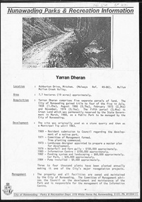
Document, Yarran Dheran, ?1985
Information brochure on development and features of Yarran Dheran Reserve, including map. Prepared by City of Nunawading Parks and Recreation Department, ?1985.yarran dheran, parks and reserves -
Whitehorse Historical Society Inc.
Map, Melbourne Metropolitan Area Base Map, 1957?
Sheet 254 of part of the Municipality of Nunawading and part of the Parish of Nunawading, showing roads, block numbers, creeks and contours mostly south of Canterbury Road.Sheet 254 of part of the Municipality of Nunawading and part of the Parish of Nunawading, showing roads, block numbers, creeks and contours mostly south of Canterbury Road. Prep. from State Aerial and Cadastral survey information, August 1957. Scale: 400 ft = 1 inchSheet 254 of part of the Municipality of Nunawading and part of the Parish of Nunawading, showing roads, block numbers, creeks and contours mostly south of Canterbury Road. city of nunawading, cadastral -
 Whitehorse Historical Society Inc.
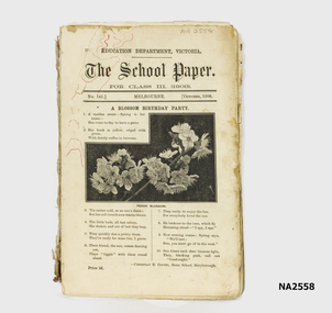
Book, The School Paper for Class 111 - Education Dept Vic, 1908 - 1909
According to an accompanying from donor, these school papers were used bt H.Tuck at Vermont State School -1918.This 'book' appears to be a series of journals or magazines bound together with a home made twisted cloth spine and hand stitched. Photo of peach blossom on front cover of issue for October, no. 141. Gothic Script Title. (see also History and Other Information)Several red ink scribbles similar to map markings on top left hand corner.books, school/educational -
 Whitehorse Historical Society Inc.
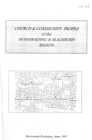
Pamphlet - Report, Church and community profile of the Nunawading and Blackburn region, 1/06/1997 12:00:00 AM
A report produced by Maroondah Presbytery of the Uniting ChurchA report produced by Maroondah Presbytery of the Uniting Church examining the state of the church in the Nunawading and Blackburn regions. Churches included are Mount Pleasant, Mountview, Nunawading, Parkmore, St Ninian's, The Avenue, and Vermont Uniting churches and the Nunawading District Young Adult Ministry. Statistical membership figures are given and compared with demographics of the district. Ministerial and other leadership resources are listed. Property details are listed as are community resources provided. Information on Strathdon Community is given. An appendix relates the amalgamation of the Mitcham Methodist and Presbyterian Churches to form Mountview Uniting Church. Another appendix relates a parable: 'Lying Offshore' by William Jones. A map shows the location of all local Uniting Churches. 20 pages.A report produced by Maroondah Presbytery of the Uniting Church mount pleasant uniting church, mountview uniting church, mitcham, nunawading uniting church, parkmore uniting church, forest hill, st ninians uniting church, blackburn south, vermont uniting church, uniting church. young adult ministry, nunawading district, strathdon community -
Whitehorse Historical Society Inc.
Document - Correspondence, Letter and Map Schwerkolt houses, 9/11/1993
Letter to W. Gray, Nunawading Historical Society from Glyn France enclosing map of Schwerkolt property and rough plan of old stone house drawn by Arthur Schwerkolt [map filed at A-SP 120]. Gives information about dates of building 'old' and 'new' houses.schwerkolt, arthur, schwerkolt, myra, france glyn, schwerkolt cottage -
 Whitehorse Historical Society Inc.
Photograph - School Project, Memories of an Australian Soldier, 1/06/1997 12:00:00 AM
Photocopy of Luther College Year 10 history project describing several war memorials and researching the story of Sergeant Charles Samuel Hall whose name appears on the Mitcham War Memorial. He served at Gallipoli and on the Western Front but contracted tuberculosis and died at the Australian Military Hospital, Harefield Park in Middlesex. The report includes information about tuberculosis and relates the disease to the conditions in Gallipoli and in France. A report on the Battle of Pozieres is included. 70p. Maps. Photographs.hall, charles samuel, world war 1914-1918. battle of poziers, war memorials -
 Whitehorse Historical Society Inc.
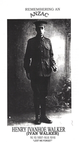
Article - School Project, Remembering an ANZAC, 1/06/1997 12:00:00 AM
Photocopy of Luther College Year 10 History assignment which describes several war memorials and researches the story of Henry Ivanhoe (Ivan) Walker whose name is on the Mitcham and Box Hill War Memorials.Photocopy of Luther College Year 10 History assignment which describes several war memorials and researches the story of Henry Ivanhoe (Ivan) Walker whose name is on the Mitcham and Box Hill War Memorials. He was killed by shellfire on the Western Front and his body never recovered. Copies of letters to and from his parents as they tried to find out information about his death are included. There is some information about his family and an interview with his sister Mrs Hazel Hall who provided some of his letters to his family. 65p Maps. Photographs.Photocopy of Luther College Year 10 History assignment which describes several war memorials and researches the story of Henry Ivanhoe (Ivan) Walker whose name is on the Mitcham and Box Hill War Memorials.walker, henry ivanhoe (ivan), walker family, war memorials, world war, 1914 - 1918 -
 Whitehorse Historical Society Inc.
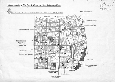
Map, Nunawading parks and recreation information, 1990 ?
... of Nunawading, 199-? Nunawading parks and recreation information Map Map ...Map of parks and reserves in the City of Nunawading, 199-?city of nunawading. parks and recreation department, parks and reserves -
Hume City Civic Collection
Booklet - Melbourne Airport
A paperback booklet with a cardboard cover with folding flap on the inside of the front and backnon-fictionmelbourne airport, aviation, airports, tullamarine -
Southern Sherbrooke Historical Society Inc.
Information folder - Lysterfield Avenue Of Honour
Folder containing items pertaining to Lysterfield Avenue Of Honour. Contents: -typescript, Details of servicemen for whom trees were planted in the Lysterfield Avenue of Honour, 1919 -letter, Heather Ronald to Edmund Williams, re. Lysterfield Avenue of Honour, dated 31st May 1994 -Shire of Sherbrooke Council meeting agenda item, 1st February 1994, inc. 2-page summary, letter E. Williams to Shire dated 13th October 1993, hand-drawn map of area, letter E. Williams to Shire dated 10th September 1993, letter E. Williams to Shire dated 24th June 1993, copy of page from Rowville-Lysterfield Community News. -Program of Events for dedication of Avenue of Honour, 25th February 1995, Knox Historical Society. -Invitation to dedication of Avenue of Honour from Knox HS to Susan Heywood-Downard and members of Southern Sherbrooke Historical Society -
Southern Sherbrooke Historical Society Inc.
Information folder - Belgrave Heights Convention Ground
Information folder containing items pertaining to the history of the Belgrave Heights Convention Grounds. Contents: -map, "Belgrave District Road Map" showing locations in Belgrave Heights & South -map "Belgrave Heights Road Map" showing Convention Grounds, buildings and other local sites -Various items photocopied on single sheet, inc. token for Gospel Supplies, Belgrave Heights; item re. Rudi Atwood, minister; list of hymns; photo of Main St, Belgrave. -
Southern Sherbrooke Historical Society Inc.
Information folder - Lysterfield
Information folder containing items pertaining to the history of Lysterfield. Contents: -Articles copied from Knox HS newsletter, inc. Lysterfield, Lysterfield Road, -typescript, "Early settlement of the district later known as Lysterfield", 5 pages -typesccript, "William Lyster and the Lysterfield Valley", 2 pages -map, part of parish map of Scoresby, showing holdings in Lysterfield -illustrations, "A Victorian Model Farm: Nareewarran Grange" -illustration, The Homestead (Nareewarran Grange), 2 copies -copy, 'The Golden Age Of Australian Opera', Chapter 7, an account of William Lyster at Lysterfieldwilliam lyster, lysterfield, nareewarran grange -
Southern Sherbrooke Historical Society Inc.
Information folder - Lockwood House
Folder containing items pertaining to the history of Lockwood House, Belgrave Heights. Contents: -notes, hand-written, on holidays in Belgrave Heights, 6 sheets on Ansett memo pad. -typescript, "Holidays In The Dandenongs" -printed sheets, "Doongala Forest Reserve", Dept of Conservation, Forests & Lands, includes map of Doongalla walking tracks, hand-written on back "Doongala/751 1717/Open week days except/Thursday./Open weekends by appointment" -5 Certificates of Title for parcels of land included in Lockwood Estate.lockwood house, elvery family, guesthouses -
Southern Sherbrooke Historical Society Inc.
Information folder - "The Bungalow"
Material donated by current owner, Inga Melgaard, 20th November 2006.Folder containing information pertaining to "The Bungalow", Belgrave Heights. Material supplied by current owner, Inga Melgaard, on 20th November, 2006. Contents:/"Specifications of a bungalow for W.J. Murrell's (sic) Esq" drawn up by Leslie J.W.Reed, Architect, "Kaleno", 45 Thanet St, Malvern, dated September 1915./House sale advertisement, showing photograph, floor plan, description and location map./Subdivision maps, 6 sheets./Certificate of Title, Vol. 3892, Fol.778347, dated 28th May 1915, William Joseph Murrells./Certificate of Title, Vol. 6939. Fol. 1387757, dated 31st October, 1946, Agnes Murrells and Nora Murrells./CD containing Certificates of Title, photos taken in 1994 and photos taken by current owner, and a list of previous owners, 1915-1979./Copy of above list.