Showing 11731 items
matching ringwood
-
 Ringwood and District Historical Society
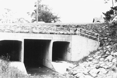
Photograph, Warrandyte Rd. culvert upstream (East) side. Ringwood 1987
Written on back of photograph, "13.4.87. Warrandyte Rd. culvert upstream (East) side." -
 Ringwood and District Historical Society
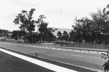
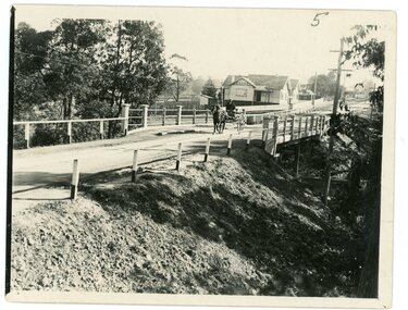
Photograph, Warrandyte Rd. bridge, Ringwood. Sept. 1987
Written on back of photograph, "13.9.87. Warrandyte Rd. bridge". -
 Ringwood and District Historical Society
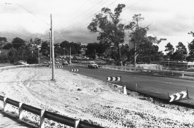
Photograph, Warrandyte Rd. bridge, Ringwood. April 1987
Written on back of photograph, "8.4.87. Warrandyte Rd. bridge". -
 Ringwood and District Historical Society
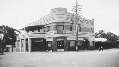
Photograph, Coach and Horses Hotel, Ringwood circa 1940
Black and white photograph of Coach and Horses Hotel in Maroondah Highway, west of New Street, now adjacent to Eastlink Freeway, on northern side. There are two duplicate photos. Certainly the photo was taken post-1940 as the previous Coach & Horses Hotel, on the south side, burnt down in 1940. The telephone pole indicates that era, with limited lines. The style of the building was Art Deco that generally existed in the 1920s-1930s but did continued in Australia in the 1940s. The building has the appearance of being newly-built. Was H4, in the old cataloguing system. -
 Ringwood and District Historical Society
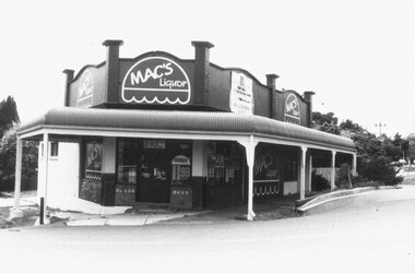
Photograph, "Gilligan's Island" - Bloods old store refurbished as MAC's Liquor. Ringwood 1987
2 photographs from different angles, MAC's Liquor (Blood's old store after facelift)Written on back of one photograph, "13.9.87. Gilligan's Island". -
 Ringwood and District Historical Society
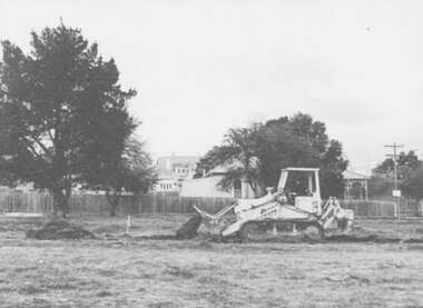
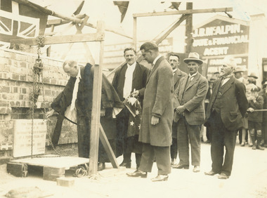
Photograph, First sod being turned on site of Masonic Centre, corner Pratt St. and Warrandyte Rd. Ringwood (undated)
Written on back of picture, "First sod being turned on site of Masonic Centre, corner Pratt St. and Warrandyte Rd." -
 Ringwood and District Historical Society
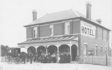
Photograph, Club Hotel, Mount Dandenong Road, (East) Ringwood in 1897
Black and white photograph.(several copies) of brick hotel with veranda. Horse and card outside and group of people standing in front of veranda.Typed below one photograph, "Club Hotel Mt. Dandenong Rd. 1897". Another adds "Incorporated in present structure". A third copy is labelled "Mrs Sweeney", possible owner. -
 Ringwood and District Historical Society
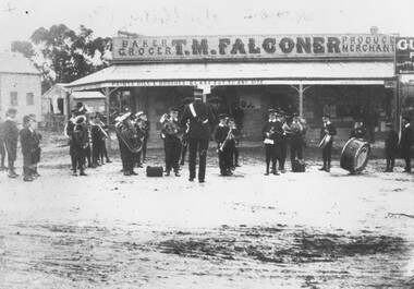
Photograph, St. Vincent de Paul's Band - 1909, Ringwood
Band standing in front of T.M. Faslconer store.Label below photograph of 1 copy reads, 'St. Vincent de Paul's Band - 1909'. Another copy reads, 'St. Vincent de Paul's Boys Band 1909 Arbor Day' and 'Given by Mrs. Tom Falconer'. Last copy has inscription on backing sheet reading, 'St. Vincent de Paul boys band at c/r Adelaide and Main Sts. 1909'. -
 Ringwood and District Historical Society
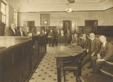
Photograph, 'First council meeting in new Ringwood chambers, 1928
Written on back of photograph, 'First council meeting in new chambers, 1928. 1924 Foundation Council. Mayor Cr. A.T. Miles, Town Clerk, A.F.B. Long, Engineer, F.R. Lucas, R???? MR. Gill and Mr. Ostrom, Rate collector, W.T. Jenkins, Architect, A.C. Leith, Councillors, J.K. McCaskill, R. Wilkins, A. Blood, W. McKinlay, J.B. McAlpin. Medical officer, Dr. Langley (absent). -
 Ringwood and District Historical Society
Photograph, Mayor A.T. Miles laying foundation stone of the Ringwood town hall - Corner of Main Street and Melbourne Street 19.2.1927
Typed below photograph, 'Mayor A.T. Miles laying foundation stone of the town hall - Corner of Main Street and Melbourne Street 19.2.1927'. Written on backing, 'Mayor A.T. Miles laying stone of town hall, C/r Main St. & Melbourne St. 19.2.1927. A.T.M., Long, Town Clerk, A.C. Leith, Architect, J. Roberts, Builder, and J. Hyden from Lilydale.' -
 Ringwood and District Historical Society
Photograph, Opening Ringwood Lionsville Centre by H. Bolte 1962/3
Undated, but Max Deuter was Mayor 1962/63 according to Place of Many Eagles Appendix IITyped below photograph, 'Opening Lionsville Centre by H. Bolte'. [no date]. Catalogue card reads, 'Opening of Lionswood. Old card said Lionswood [not Lionsville]. Mayor - Cr. Max Deuter, Cr. McLeod RH side. Premier Bolte - 3rd from RH side.' -
 Ringwood and District Historical Society
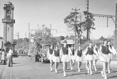
Photograph, Scout Carnival - March 1959. Hampton Marching Girls leading procession past Ringwood Clock Tower
Written on back of photograph, 'Scout Carnival - March 1959. Hampton Marching Girls leading procession.' -
 Ringwood and District Historical Society
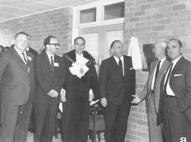
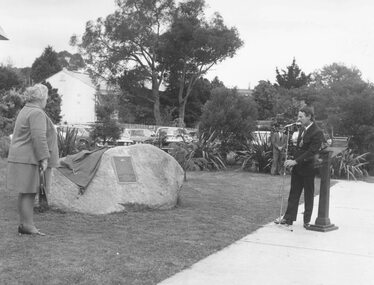
Photograph, Mrs. E.V. Pullin, MBE and Mayor Morris at unveiling of plaque at Ringwood library 26.20.74
Written on back of photograph, 'Mrs. E.V. Pullin, MBE and mayor Morris at unveiling of plaque at library 26.20.74.' -
 Ringwood and District Historical Society
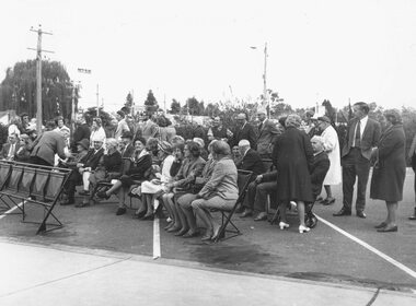
Photograph, Spectators at plaque unveiling art Ringwood Library 26.10.74
Written on backing sheet, 'Spectators at library, 26.10.74'. -
 Ringwood and District Historical Society
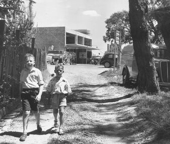
Photograph, Midway Arcade, Ringwood, being built. Lane went to Adelaide Street - 1956
2 young boys in lane (unidentified)Written on backing sheet, "Midway Arcade being built. Lane went to Adelaide Street - 1956". -
 Ringwood and District Historical Society
Photograph, Corner Adelaide St. and Civic Place, Ringwood 1966. Later parking area for Eastland
Typed below photograph, "Corner Adelaide St. and Civic Place. Now parking area for Eastland - 1966". -
 Ringwood and District Historical Society
Photograph, Wantirna Rd House and external toilet near Viaduct (Station hand's house) Ringwood 1986
Written on back of photograph F0098b: " Wantirna Rd. Outside toilet. Station-hand's house. Near viaduct, 1986.". On Back of F0098a: "This is house with external toilet. Bldg. Near viaduct 1986, Wantirna Rd." -
 Ringwood and District Historical Society
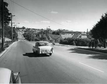
Photograph, Warrandyte Rd. looking towards Maroondah Highway, Ringwood - 1967
Typed below photograph, "Warrandyte Rd. looking towards Maroondah Highway - 1967". Written on backing sheet, "Warrandyte Rd. 1967. alongside Woodside Ave. looking towards Maroondah Highway. (Taken from same spot as 1902 photo with 2 children on road)". -
 Ringwood and District Historical Society
Photograph, Warrandyte Road, Ringwood, Victoria. (undated)
Black and white photograph of horse and cart on Warrandyte Road at Mullum Mullum Creek bridge. House is on corner of Reynolds Avenue. -
 Ringwood and District Historical Society
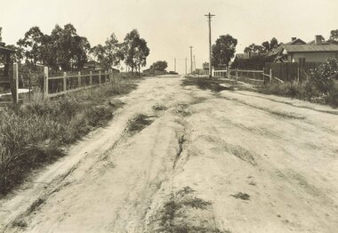
Photograph, Barkly St, Ringwood. Shop of Dark's, corner Haig St (undated)
Rough dirt Road.Written on backing sheet, "Barkly St. Shop of Dark's, corner Haig St." -
 Ringwood and District Historical Society
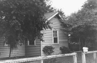
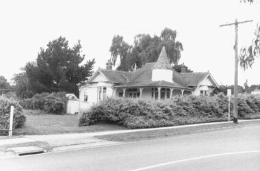
Photograph, Sole remaining house in Adelaide Street, Ringwood 1987
Written on back of photograph, "9 Jan. 1987 - Sole remaining house in Adelaide Street. Not included in the plans for redevelopment of Eastland." -
 Ringwood and District Historical Society
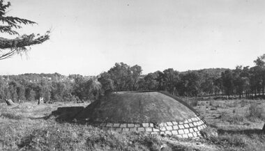
Photograph, Old well on site of MacRobertson factory, Canterbury Rd Ringwood. 1964
Written on backing sheet, "Old well on site of MacRobertson factory, Canterbury Rd. 1964". -
 Ringwood and District Historical Society
Photograph, Cadbury factory, Canterbury Road, Ringwood 1973, 'Church Paddock'
Written on backing sheet, "Cadbury factory, Canterbury Road, 30/9/73, 'Church Paddock'". -
 Ringwood and District Historical Society
Photograph, Old clayhole in Dublin Rd. Military Depot grounds, East Ringwood (undated)
Written below photograph, "Old clayhole in Dublin Rd. Military Depot grounds". -
 Ringwood and District Historical Society
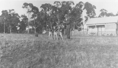
Photograph, First house built in Junction Street, Ringwood, near Mullum Mullum creek (undated)
Man with two dogs in front.Written on backing sheet, "First house built in Junction Street, near creek". -
 Ringwood and District Historical Society
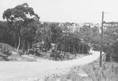
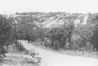
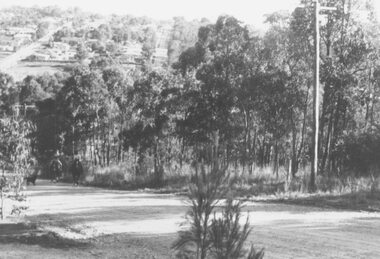
Photograph, View of Glenvale Road, Ringwood, looking towards Loughnan Road at bridge 1964
See Also #25Written on back of photograph, "1964 - View of Glenvale Road looking towards Loughnan Road at bridge. Original supplied by Garrett Gundry." -
 Ringwood and District Historical Society
Photograph, View of Glenvale Road, Ringwood. Warnes Road in left background 1964
See Also #25Written on back of photograph, "1964 - View of Glenvale Road. Supplied by Garrett Gundry. Warnes Road in left background. Deep Creek Road in centre background." -
 Ringwood and District Historical Society
Photograph, View of Glenvale Road, Ringwood 1964
See Also #25Written on back of photograph, "1964 - View of Glenvale Road. Supplied by Garrett Gundry. Warnes Road in left background. Deep Creek Road in centre background." -
 Ringwood and District Historical Society
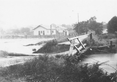
Photograph, Mullum Creek in flood, Ringwood. Adelaide St. Bridge to Reynolds Ave washed away, 1931
Catalogue card reads, "Mullum Creek in flood. Adelaide St. Bridge to Reynolds Ave washed away, 1931". Typed below photograph, "Adelaide St. bridge, to Reynolds Ave washed out in 1931 (Bridge not replaced). 1934?" -
 Ringwood and District Historical Society
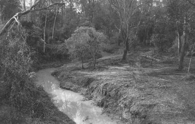
Photograph, Mullum Creek looking east from bridge in Warrandyte Road Ringwood. St. Paul's extreme left, 1972
Typed below photograph, "Mullum Creek looking east. St. Paul's extreme left, 1972".