Showing 10846 items
matching maps
-
 Bendigo Historical Society Inc.
Map - AXEDALE, COUNTIES OF BENDIGO & RODNEY, 1961
Map, Axedale, Counties of Bendigo & Rodney.Axe Creek, Campaspe River, Longlea Railway Station, Axedale Railway Station, Wallan & Bendigo Railway.Township of Axedale. By authority A.C.Brooks, Govt. Printer, Melbourne.Drawn and reproduced at the Dept. of Lands and Survey, Melbournd. Price 1/-. 1961. (number 61 in map cupboard 1)A.C.Brooks, Government Printer, Melbourne.map, bendigo, axedale -
Bendigo Historical Society Inc.
Map - BAGSHOT : COUNTY OF BENDIGO, November 1948
Map. Bagshot. County of Bendigo, Huntly, Whirrakee, Egerton, Goornong, Ellesmere, Wellsford. Reedy Creek, Sandy Creek. Drawn and reproduced at the Department of Lands and Survey, Melbourne, Victoria. November 1948, Price 2/-. By authority J.J. Gourley, Government Printer, Melbourne. (number 46 in map cupboard 1)J.J. Gourley, Government Printer, Melbourne.map, bendigo, bagshot -
Bendigo Historical Society Inc.
Map - GOORNONG : COUNTY OF BENDIGO, September 1943
Map. Goornong, County of Bendigo, Egerton, Bagshot, Ellesmere, Muskerry, Campaspe, Nolan, Campaspe River, Town of Goornong. By authority : H.E. Daw, Government Printer, Melbourne. Drawn and reproduced at the Department of Lands and Survey, Melbourne, Victoria. September 1943, Price 2/-. (number 44 in map cupboard 1)H.E. Daw, Government Printer, Melbourne.map, bendigo, goornong -
Bendigo Historical Society Inc.
Map - WOODSTOCK : COUNTY OF BENDIGO, 26-9-17
Map. Woodstock, County of Bendigo, Derby, Leichardt, Marong, Shelbourne, Laanecoorie, Tarnagulla. L.5512. Photo-Lithographed at the Depatment of Lands and Survey, Melbourne, by W.J. Butson, 26-9-17. Price 1/-. By authority A.J. Mullett, Government Printer, Melbourne. (number 19 in map cupboard 1)A.J. Mullett, Government Printer.map, bendigo, woodstock -
Bendigo Historical Society Inc.
Map - CROSBIE : COUNTY OF BENDIGO, 28-9-76
Map. Crosbie, County of Bendigo, County of Rodney, Mt. Pleasant Creek, Weston, Toolleen, Redcastle, Dargile, Knowsley East. W.E. Porter, draughtsman, August 1878. Photo-Lithographed at the Department of Lands and Survey, Melbourne, J. Noune,28-9-76. (number 113 in map cupboard 1)W.E. Porter, Draughtsmanmap, bendigo, crosbie -
 Ballarat Tramway Museum
Memorabilia - Event Materials, The Courier Ballarat, "Ballarat Begonia Festival - Souvenir Program ", 30/01/2001 12:00:00 AM
Thirty two page colour or black and white printed program for the 1998 Begonia Festival. Includes festival events, maps, details of related events and advertisements. On page 7 is a quarter page advertisement from the Ballarat Tramway Museum. Map on centre page and program shows details of our operations.trams, tramways, btm, begonia festival, festival program -
 Bendigo Historical Society Inc.
Slide - DIGGERS & MINING. DIGGERS AND MINERS, c1850s
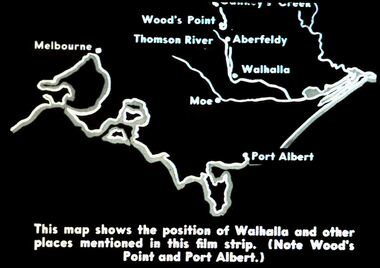
Diggers & Mining. Diggers and miners. Walhalla - Gold Town. This map shows the position of Walhalla and other places mentioned in this film strip. (Note Wood's Point and Port Albert.) Other places on map; Melbourne, Moe, Thomson River, Aberfeldy. Markings: 5 995 WAL. Used as a teaching aid.hanimounteducation, tertiary, goldfields -
 Falls Creek Historical Society
Plan - Leases of part of Falls Creek Tourist Area, 1984
Bob (Herman) Hymans (a former member of the Royal Netherlands Navy was born in Bloemendaal, Holland on 30th September 1922. During World War II he fought against the Japanese in the Dutch East Indies (now Indonesia) and was imprisoned in Changi and on the Burma Railway. After gaining qualifications as a Ski Instructor, Bob arrived in Falls Creek in May 1950. Working as an Instructor and Supervisor at Bogong Lodge, Bob decided his future was in accommodation. He was successful in negotiating an indenture for land from the State Electricity Commission (SEC). It took Bob two years to build his Grande Coeur Chalet but, tragically, it was burned down in August 1961. Bob also built the first Chairlift in Australia. This was a single chairlift and the structure was built from wooden electricity poles. He was constantly full of new ideas and proposals for the village. Bob Hymans died on 7th May 2007. This Collection of documents and letters tells the story of Bob’s endeavours to develop Falls Creek into the ski village it is today. This map is significant because it documents boundaries of early leases in Falls Creek Tourist Area.This map is part of Bob Hymans documents. It is a large Surveyor's Plan of a section of the Falls Creek Tourist Area. It is endorsed by J Parker, Chief Surveyor of the State Electricity Commission of Victoria on 27-3-84. It shows streets, lot numbers and measurements. It was a compilation created from existing lease maps. Heading - PART OF FALLS CREEK TOURIST AREA PART OF CROWN ALLOTMENT 1 PARISH OF CARRUNO PART OF CROWN ALLOTMENT 1 PARISH OF DARBALANG COUNTY OF BOGONGmap of falls creek, falls creek leases, falls creek 1980s -
 Falls Creek Historical Society
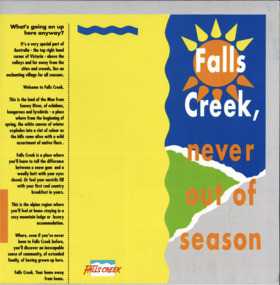
Booklet - Brochure - Falls Creek, Never Out of Season
A part of a yearly marketing and information material promoting Falls Creek region for the summer holidays. The slogans incorporated include " Falls Creek, Never Out of Season" and "Falls Creek, your home away from home"This item is important as it documents seasonal activities at Falls Creek Alpine ResortSquare yellow, blue, orange and green brochure titled Falls Creek, Never out of Season. Opens to a larger square program with internal pages of yellow and blue with central mud-map of Melbourne-Sydney with lines to Falls Creek. Accomodation information surrounding map and photographs with text on back pages.falls creek marketing, falls creek activities, falls creek -
 Whitehorse Historical Society Inc.
Book - Exercise Book, c1900
School exercise book - stiff, faded blue and red marbled board covers - centre stitched. All pages filled with homework and extensive map work and calligraphy of a high standard. Inscription inside front cover and inside back cover. First page is a map of Scotland dated May 29.Homework Book 1912 Dorothy [sic]C.Dixon Vermont.|Inside Back cover: The end of this book finished 10.11.12 at Vermont State School.books, school/educational -
 Bendigo Military Museum
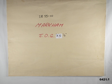
Map - SB55-10 Markham Joint Operations Graphics Air and Ground print separations, Royal Australian Survey Corps, Bendigo, Dec 1981
This set of map prints was assembled as a training aid. The collection is a complete set of individual color prints of each colour used on the final printed maps for each map Joint Operations Graphic (JOG) JOG Ground and JOG Air versions. This map series was produced in two versions to help coordinate military Ground Operations and Air Operations. The ground users required that heights and measurements were in Metres, whilst air users required height information in Feet for altimeters. The Air Version also contained more Aeronautical information including safe flying height information called Maximum Elevation Figures (MEF). Later printing of JOG incorporated printing in just four colours Cyan, Magenta, Yellow and Black (CMYK). Item 6421.1 is an example of a JOG Ground and item 6421.2 is an example of its matching JOG Air version.1:250,000 SB55-10 Markham JOG A and G colour separations bound together in a manilla card covered folder bound with a timber edge. royal australian survey corps, rasvy, fortuna, army survey regiment, army svy regt, asr -
 Orbost & District Historical Society
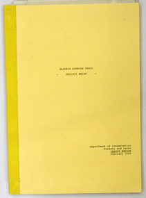
document, BALDWIN SPENCER TRAIL Project Brief 1988, February 1988
This document was produced by the Department of Conservation, Forests & Land Management, Orbost, to commemorate the visit by Baldwin-Spencer in 1989 as part of the Bicentennial Walking Tracks Project. The Baldwin Spencer Trail closely follows the route of scientist and explorer William Baldwin Spencer. Sir Walter Baldwin Spencer KCMG (23 June 1860 – 14 July 1929) was an English-Australian biologist and anthropologist. this booklet is a useful reference tool.A document of 10 pp with a cream cover, titled, Baldwin Spencer Trail Project Brief Feb 1988. It contains mapsbaldwin-spencer -
 Bendigo Military Museum
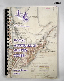
Administrative record - 75th Anniversary of the Royal Australian Survey Corps - Annual Report 1989/90, Royal Australian Survey Corps, 1990
Royal Australian Survey Corps Annual Report 1989/90 of all mapping and charting carried out during that periodAn A4 booklet, glossy pages, map index of all mapping scales, 17 pages and Annexes, plastic ring bindingroyal australian survey corps, rasvy, fortuna, army survey regiment, army svy regt, asr -
Warrnambool and District Historical Society Inc.
Sale Poster, Mercer Print, "Arran" 1967, 1967
This Auction notice is for the sale of an Ellerslie property called "Arran" , owned by Mr Philip M. Ormsby. The date of the auction is Thursday 16th February 1967. Vendors solicitors are Archer Naughtin and Forrest of Mortlake and the sale agents are Dennys, Lascelles Limited. Portions of "Arran" had been in the family since 1865. The property has 3/4 mile frontage to the Hopkins river.This sale notice is of general interest as a well established property in a good farming region. Long sheet with sale details of the property Arran The majority of the text is black with some highlighted in red.There is a map of the property on the reverse.warrnambool, arran, ellerslie -
 Eltham District Historical Society Inc
Book, D. Pendavingh, Yarra River Trail Plan 1989: Banksia Street to Warrandyte, 1989
Also contains a loose A3 mylar plan inserted - Depart of Planning and Urban Growth, Heidelberg; Main Yarra Trail; Warringal Parklands and Banyule Flats, Detail Plan and Locality Plan -
 Eltham District Historical Society Inc
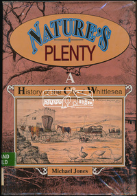
Book, Michael Jones, Nature's plenty : a history of the City of Whittlesea, 1992
This book explores Whittlesea's history from early 1830's to 1991. Environment of the Aboriginal people about the the time of European settlement. Possible use of a 'swamp management system' now buried under Yan Yean reservoir. Smallpox epidemics among Aboriginal people prior to settlement - probably from the activity of nearby European sealers. Estimations of Aboriginal populations. Scattered references throughout. Subjects Health - Infectious diseases - Smallpox. Settlement and contacts - Colonisation - 1788-1850. Settlement and contacts - Colonisation - 1851- Environment - Land management. Demography. Woiwurrung / Wurundjeri / Woiwurung people (S36) (Vic SJ55-05) Yan Yean (Vic SJ55-05) Eden Park (Vic SJ55-05) Whittlesea (Vic SJ55-05) Diamond Creek (Vic SJ55-05) Kingslake (Vic SJ55-05) Whittlesea (Vic.) -- History.xvi, 319 p., [16] p. of plates : ill. (some col.), maps (some col.), ports. ; 28 cm. the plenty, farming, settlement, gold rush, plenty river, donnybrook, germantown, separation, thomastown, whittlesea, epping, woodstock, city of whittlesea, railway, yan yean, roll of honour -
 Marysville & District Historical Society
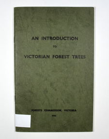
Book - Paperback book, An Introduction to Victorian Forest Trees, 1961
A history of forestry in Victoria Paperback. Cover is green with only the title on the front cover. On the inside back cover is a map of Victoria with the state forests indicated.Stamp of Marysville & District / Historical Society Inc / P.O. Box 22 / Marysville 3779victoria, forestry, forest, trees -
 Bendigo Military Museum
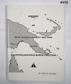
Booklet - History of the New Guinea Survey Section 1967 by LT Jack Viccars, Lt Jack Stewart Viccars, Circa 1967
Military surveying in New Guinea began in in WWII with the formation of the New Guinea Force Field Survey Section which later became 8th Australian Field Survey Section and later 2 Field Survey Section of 6th Army Topographical Survey Section. This history was written by LT Jack Viccars and member of the Unit.A4 Booklet, Black and white, 43 Pages, 4 Annexes, Map Indexes, Gloss Paper Cover, Bound by staplesForward by Brigadier D. Macdonald (Retd) AM, Royal Australian Survey Corps 1936-1967, Preface by LT Jack J.S. Viccarsroyal australian survey corps, rasvy, fortuna, army survey regiment, asr -
 Bendigo Military Museum
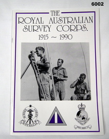
Booklet - Booklet Royal Australian Survey Corps History, " The Royal Australian Survey Corps " 1915-1990, c, 1995
This article was presented as a paper to the 1990 Australian War Memorial History Conference to mark the 75th anniversary of the formation of the "Australian Survey Corps" on 1 July 1915. The Corps has since been renamed. Booklet, A4, 13 Pages, Cardboard Cover, Colour, Maps, Photographs, Black and White. Held together by metal staplesroyal australian survey corps, rasvy, fortuna, army survey regiment, army svy regt, asr -
 Federation University Historical Collection
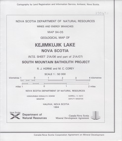
Map - Geological, Nova Scotia Department of Natural Resources, Kejimkujik Lake, Nova Scotia: Geological Map 94-05, 1994
Produced b Nova Scotia Department of Natural Resources, Mines and Energy Branches. The Minister of the Department was the Honourable Donald R Downe and the Deputy Minister was Darrell D HiltzLarge coloured map depicting different areas and deposits. Includes a legend, symbols used, mineral abbreviations and alteration abbreviations.Symbolsnova scotia, kejimkujik lake, geological survey, cartography, mine and energy branches, donald r downe, minister, darrell d hiltz, deputy mnister, south mountain batholith project, legend, symbols -
Federation University Historical Collection
Map - Map - Geological, Kejimkujik Lake, Nova Scotia: Geological Map 94-05, 1994
Produced by Nova Scotia Department of Natural Resources, Mines and Energy Branches. The Minister of the Department was the Honourable Donald R Downe and the Deputy Minister was Darrell D HiltzLarge coloured map depicting different areas and deposits. Includes a legend, symbols used, mineral abbreviations and alteration abbreviations.Symbolskejimkujik lake, nova scotia -
 Federation University Historical Collection
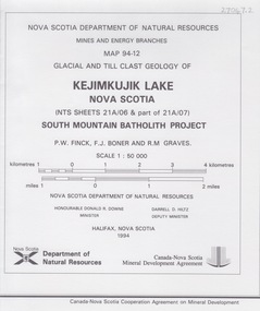
Map - Geological, Kejimkujik Lake, Nova Scotia: Glacial and Till Clast Geology: Map 94-12, 1994
Produced b Nova Scotia Department of Natural Resources, Mines and Energy Branches. The Minister of the Department was the Honourable Donald R Downe and the Deputy Minister was Darrell D HiltzLarge coloured map depicting different areas and deposits. Includes a legend, symbols used, mineral abbreviations and alteration abbreviations.Symbols -
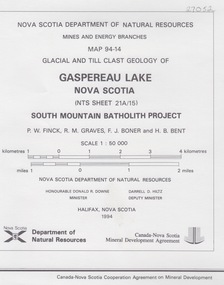 Federation University Historical Collection
Map - Geological, Gaspereau Lake, Nova Scotia: Glacial and Till Clast Geology: Map 94-14, 1994
Produced by Nova Scotia Department of Natural Resources, Mines and Energy Branches. The Minister of the Department was the Honourable Donald R Downe and the Deputy Minister was Darrell D HiltzLarge coloured map depicting different areas and deposits. Includes a legend, symbols used, mineral abbreviations and alteration abbreviations.Symbolsnova scotia, department of natural resources, mines and energy branch, donald r downe, minister, darrel d hiltz, deputy minister, glacial and till clast, geo;logy, south mountain batholith project -
 Lara RSL Sub Branch
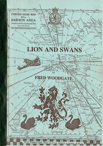
Booklet, Lion and Swan
The bombing of Darwin during World War 2 and the defense by the 54 Fighter Squadron, Royal Air Force. Historical notes on the Squadron between 1943 and 1945.Detailed information of 54th Fighter Squadron in Darwin between 1943-1945Lion and Swan by Fred Woodgate Fighter Guide Map No 1A - Darwin area - 50th Anniversary 13th August 1992Front Cover - see picturespitfire, darwin, 54 fighter squadron, lion and swans, fred woodgate, royal air force, spitfire association, ww2, world war two, 1943, 1945, 50th anniversary -
 Lara RSL Sub Branch
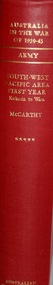
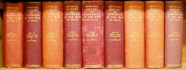
Book, Australia in the War of 1939 - 1945 ARMY South-West Pacific Area First Year - Kokoda to Wau. Author Dudley McCarthy, First Published in 1959
WWII Kokoda to Way Australia at War 1939-1945 List of events ARMY Historical Record of Kokoda to Way.Australia in the War of 1939-1945 - South-West Pacific Area First Year - Kokoda to War Maps, Illustrations and PhotographsAustralian War Memorialkokoda, milne bay, kanga force, ioribaiwa, eora creek, buna, gona, sanananda track, wau, blamey, general mac arthur, minister forde, owen stanley's, ower's corner, native carriers fuzzy wuzzies -
 Lara RSL Sub Branch
Book, Australia in the War of 1939-1945 - Air Power Over Europe 1944-1945 Volume 4. AIR. Author John Herington, First Published 1963
A continuation and conclusion of the story of Australian airmen who served in or beside the RAAF in the struggle against Germany and Italy. In general it covers a period when both in the Mediterranean and in Northern Europe Air superiority, the vital pre-requisite of successful air assault, had already been gained over the enemy. The emphasis is largely engagements or in the strategic bombing campaigns to the total achievement of allied air power in land and sea campaigns.Historical record of the Air power over Europe 1944-1945Australia in the War of 1939-1945 - Air Power Over Europe 1944-1945. AIR Maps, Illustrations, charts, photographsAustralian War Memorialinvasion of italy, long range missiles, oil, normandy, coastal command, ardennes offensive, battle of the bulge, evaders, prisoners, rhine, air force 1944-1945, wwii, 453 squadron, 646 squadron, spitfire, ground crew, no.3 squadron, 461 squadron, 466 squadron, 455 squadron -
 Lara RSL Sub Branch
Book, Official History of Australia in the War of 1914-18 - Volume VIII - Australian Flying Corps Author F.M.Cutlack. 6th edition, 1938
Historical record of the Australian Flying Corps from diaries of airmen and the Australian War Museum. No. 1 Squadron - private diaries of Lt. Colonel R. Williams. No, 2,3,and 4 Squadrons.Record of Australian Air Corps using personal diaries.Official History of Australia in the War of 1914-18 - Volume VIII - Australian Flying Corps. Maps and Illustrations Sixth editionmesopotamia, world war one, squadrons 1,2,3 and 4, private diaries, german offensive, air warfare, turkish retreat, gaza, mezzines ridge, somme, types of fighting aircraft -
Federation University Historical Collection
Map, Central Ballarat Retail and Business Guide, 2003, 07/2003
Map of Central Ballarat Streets, Central Square, Bridge Mall Shopping Centre and Creswick Plaza, with a legend of businesses and locations. scarsdale, grenville, krause, browns and scarsdale, mopianimum, watershed, yarrowee, woady yalloak, timber reserve, department of mines, plans, cgt, crown lands, ferdinand krause -
 Bendigo Military Museum
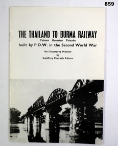
Book, Geoffrey Pharoah Adams, The Thailand to Burma Railway
Soft cover paper book, black print on white paper. Black & white photos, illustrated, maps, 16 pages.Thailand Hellfire Pass Ex POW Project J W Toon VX30397 Ex POW D Force Thailand 1943 Stamp: Fund Sec John W Toon 11 Lloyd Ave, Narre Warren 3805 7046866books, military, history, forced labour -
4th/19th Prince of Wales's Light Horse Regiment Unit History Room
Magazine Publication, Army Directorate of Public Relations, Salamaua Siege, 1943
Brochure Number 4 - "The Australian Army at War". An account of the Salamau campaign of World War 2 in the Pacific. With photos and mapsAn Official Publication