Showing 10846 items
matching maps
-
 Flagstaff Hill Maritime Museum and Village
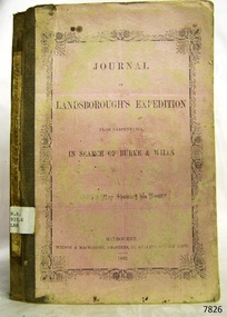
Book, Journal of Landsboroughs Expedition
WARRNAMBOOL MECHANICS’ INSTITUTE Warrnambool's Mechanics' Institute (or Institution as it was sometimes called) was one of the earliest in Victoria. On 17th October 1853 a meeting was held where it was resolved to request the Lieutenant Governor of the Colony to grant land for the erection of a Mechanics' Institutes building. A committee was formed at the meeting and Richard Osburne chaired the first meeting of this committee. The land on the North West corner of Banyan and Merri Streets was granted but there were no funds to erect the building. The Formal Rights of the Warrnambool Mechanics' Institute's encompassed its aims and these were officially adopted in1859; "This Institution has for its object the diffusion of literary, scientific, and other useful knowledge amongst its members, excluding all controversial subjects, religious or political. These objects are sought to be obtained by means of a circulating library, a reading room, the establishment of classes, debates, and the occasional delivery of lectures on natural and experimental philosophy, mechanics, astronomy, chemistry, natural history, literature, and the useful and ornamental arts, particularly those which have a more immediate reference to the colony." The Warrnambool Mechanics' Institute opened its first reading room in November1884 in the National School building at the corner of Banyan and Timor Streets. The Institute was funded by member subscription, payable on a quarterly, half yearly or yearly basis. Samuel Hannaford, the Manager of the Warrnambool Bank of Australasia, was the first Honorary Secretary of the Mechanics' Institutes, and an early President and Vice-President. He also gave several of the early lectures in the Reading Room. Another early Secretary, Librarian and lecturer was Marmaduke Fisher, the teacher at the National School. Lecture topics included The Poets and Poetry of Ireland', 'The Birth and Development of the Earth', 'The Vertebrae - with Remarks on the pleasures resulting from the study of Natural History' and 'Architecture'. In 1856 the Reading Room was moved to James Hider's shop in Timor Street, and by 1864 it was located in the bookshop of Davies and Read. In the 1860's the Mechanics' Institute struggled as membership waned but in 1866, after a series of fund raising efforts, the committee was able to purchase land in Liebig Street, on a site then called Market Square, between the weighbridge and the fire station. A Mechanics' Institute building was opened at this site in August 1871. The following year four more rooms were added to the main Reading Room and in 1873 the Artisan School of Design was incorporated into the Institute. The same year Joseph Archibald established a Museum; however it deteriorated when he was transferred to Bendigo in 1877. In 1880, with Archibald's return to Warrnambool, the Museum was re-established, and in 1885 a new building was built at the back of the Institute to accommodate the re-created School of Design, the Art Gallery and the Museum. In 1887 the Museum section was moved to the former court house in Timor Street (for some time the walls of the building formed part of the TAFE cafeteria but all is now demolished)). In 1911 the Museum was transferred back to the original building and the management of the Mechanics' Institute was handed over to the Warrnambool City Council. The Museum and Art Gallery became one and housed many fine works of art, and the Library continued to grow. The building was well patronised, with records showing that at the beginning of the 20th century there were between 500 and 800 visitors. During World War One the monthly figures were in the thousands, with 3,400 people visiting in January 1915. The Museum was a much loved Institution in Warrnambool until the contents of the Museum and Art Gallery were removed to make room for the Warrnambool City Council Engineers' Department. The contents were stored but many of the items were scattered or lost. When the original building was demolished the site became occupied by the Civic Centre, which included the new City Library. (The library was temporarily located in the old Palais building in Koroit Street.) In the process of reorganisation the Collection was distributed amongst the community groups: -The new City Library took some of the historic books and some important documents, historic photographs and newspapers. -The Art Gallery kept the 19th Century art collection and some of the artefacts from the museum. -The Historic Society has some items -The State Museum has some items -Some items were destroyed -Flagstaff Hill Maritime Village has old newspapers, Government Gazettes, most of the Mechanics' Institute Library, ledgers and documents connected to the Mechanics' Institute Library, some framed and unframed art works and some photographs. The Warrnambool Mechanics' Institute Library book collection is deemed to be of great importance because it is one of the few collections in an almost intact state, and many of the books are now very rare and of great value. Journal of Landsboroughs Expedition From Carpentaria in search of Burke and Wills (maps missing) Publisher: Wilson & Mackinnon Date: 1862Label on spine cover with typed text RA 919.4 LAN Pastedown front endpaper has sticker from Warrnambool Mechanics Institute and Free Librarywarrnambool, shipwrecked-coast, flagstaff-hill, flagstaff-hill-maritime-museum, maritime-museum, shipwreck-coast, flagstaff-hill-maritime-village, shipwrecked-artefact, great ocean road, book, warrnambool library, warrnambool mechanics’ institute, mechanics’ institute library, victorian library board, warrnambool books and records, warrnambool children’s library, warrnambool public library, journal of landsboroughs expedition, carpentaria, wilson & mackinnon -
 Mission to Seafarers Victoria
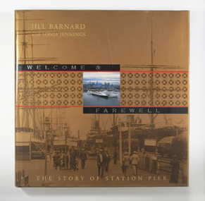
Book, Jill Barnard et al, Welcome and Farewell: The Story of Station Pier, 2004
In the mid-nineteenth century, Victoria’s primitive maritime infrastructure was not coping with the volume of passenger and cargo traffic arriving in and departing from the burgeoning gold-fevered colony. However, the opening of Railway Pier at Port Melbourne in 1854 greatly improved the situation. Railway Pier serviced the steamships, which plied Port Phillip Bay and the Victorian coastal waters beyond, and also offered berths for vessels on the regular runs to other Australian colonies and to overseas destinations. However, as the larger and more powerful steamships of the early twentieth century found berthing increasingly difficult at Railway Pier, the need for a more modern pier became apparent. By 1930, the new Station Pier had replaced its predecessor. Itself extended and upgraded several times including during the past decade, Station pier still offers every contemporary convenience to shipping services using its busy facilities, just as did its predecessor Railway Pier, 150 years ago. The Victorian Government commissioned Welcome & Farewell to celebrate the 150 years since the opening of the Railway Pier. In doing so, it was mindful that the story of the site is not limited to its contribution to national and state economies, or to its physical development. The Government wanted a history that would also speak to ordinary Victorians, and other Australians, of their own experiences of this significant place. For indeed the Station Pier site has played its part in almost every milestone or phase in our history: at moments of celebration and commemoration, during economic booms and depressions, during times of war and peace. It has also won a place in the hearts of ordinary individuals affected by the welcomes and farewells they have experienced there: those for visiting royalty and celebrities, for servicemen and medical personnel off to war or returning home, for migrants from distant countries and refugees from war zones, for friends and family travelling for personal, professional or cultural reasons. Welcome & Farewell thoughtfully examines Station Pier’s significance and offers a splendid visual panorama of the experiences lived out there between 1854 and 2004.Illustrated large-format book with 224 pages [36] p. of plates. : ill., maps, ports.Bibliography: p. 199-201non-fictionIn the mid-nineteenth century, Victoria’s primitive maritime infrastructure was not coping with the volume of passenger and cargo traffic arriving in and departing from the burgeoning gold-fevered colony. However, the opening of Railway Pier at Port Melbourne in 1854 greatly improved the situation. Railway Pier serviced the steamships, which plied Port Phillip Bay and the Victorian coastal waters beyond, and also offered berths for vessels on the regular runs to other Australian colonies and to overseas destinations. However, as the larger and more powerful steamships of the early twentieth century found berthing increasingly difficult at Railway Pier, the need for a more modern pier became apparent. By 1930, the new Station Pier had replaced its predecessor. Itself extended and upgraded several times including during the past decade, Station pier still offers every contemporary convenience to shipping services using its busy facilities, just as did its predecessor Railway Pier, 150 years ago. The Victorian Government commissioned Welcome & Farewell to celebrate the 150 years since the opening of the Railway Pier. In doing so, it was mindful that the story of the site is not limited to its contribution to national and state economies, or to its physical development. The Government wanted a history that would also speak to ordinary Victorians, and other Australians, of their own experiences of this significant place. For indeed the Station Pier site has played its part in almost every milestone or phase in our history: at moments of celebration and commemoration, during economic booms and depressions, during times of war and peace. It has also won a place in the hearts of ordinary individuals affected by the welcomes and farewells they have experienced there: those for visiting royalty and celebrities, for servicemen and medical personnel off to war or returning home, for migrants from distant countries and refugees from war zones, for friends and family travelling for personal, professional or cultural reasons. Welcome & Farewell thoughtfully examines Station Pier’s significance and offers a splendid visual panorama of the experiences lived out there between 1854 and 2004.port melbourne, station pier -
 Greensborough Historical Society
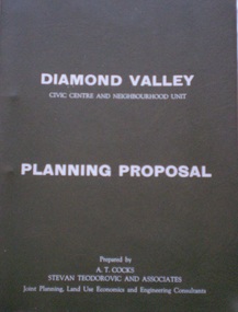
Planning Document, Diamond Valley Civic Centre and Neighbourhood Unit: Planning Proposal, 1960s
This document proposes the change of land use from farming and quarrying to residential. This also includes the proposal for a Civic Centre in the (then) Shire of Diamond Valley. The plans listed in the 'Schedule of Plans' on last page are missing.Includes proposal for the Aqueduct to be converted to an underground system. Includes statistics relating to population increase. Dark brown plastic folder. 23 foolscap-size pages. Maps, Application for Permits to subdivide land in the Greensborough area.partington family, mitchell family, whittingham family, albion reid, diamond valley civic centre, shire of diamond valley -
 Greensborough Historical Society
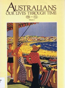
Book, Australians: Our lives through time. Volume 2, 1988_
An Australian history text that details a social history of Australia from 1938 to 1988. Published to celebrate the bi-centenary in 1988Shows the development of the Australian culture over 200 years. Soft cover, 255 pages. Black and white illus and maps. Cover has Percy Trompf's painting "Bondi Beach"australia history, australia social conditions, libby tudball -
 Greensborough Historical Society
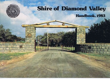
Book, Shire of Diamond Valley Handbook 1983, 1983_
Guide to services provided by Shire of Diamond Valley. The Shire of Diamond Valley was a Local Government Area located about 20 kilometres northeast of Melbourne. The shire covered an area of 74.38 square kilometres and existed from 1964 until 1994.Annual guide to services in Shire of Diamond Valley32 pages, col illus., maps. Cover illustration of the bluestone gateway, main entrance to Yarrambat Park, opened 1982.shire of diamond valley, greensborough, handbooks -
 Greensborough Historical Society
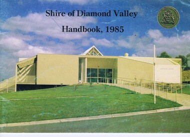
Book, Shire of Diamond Valley Handbook 1985, 1985_
Guide to services provided by Shire of Diamond Valley. The Shire of Diamond Valley was a Local Government Area located about 20 kilometres northeast of Melbourne. The shire covered an area of 74.38 square kilometres and existed from 1964 until 1994.Annual guide to services in Shire of Diamond Valley32 pages, col illus., maps. Cover illustration of Library/Arts facility at Civic Centre Greensborough, opened 1985.shire of diamond valley, greensborough, handbooks -
 Greensborough Historical Society
Business card; and photographs, songs & shoes, 2018_
Songs & Shoes is a ladies' shoe shop in Greensborough, situated at 2/33 Nell Street Business card printed in dark blue and black (front); multicoloured map on back; with 1 p. pf colour photographsshoe shops, nell street greensborough -
 Glenelg Shire Council Cultural Collection
Book, THE CAMBRIDGE HISTORICAL READERS, c. 1914
Hard back, olive black print and outline of tower spires. 'British History text, black and white photographs and maps -
Glenelg Shire Council Cultural Collection
Pamphlet, Portland, Town for all Seasons, 1970s
Pamphlet, produced for Tourist Information Centre, Portland 'Portland, Town for all Seasons'. Trifold, coloured photos, map, information.tourism, advertising, portland -
 Eltham District Historical Society Inc
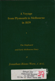
Book, A voyage from Plymouth to Melbourne in 1839 : the shipboard and early Melbourne diary of Jonathan Binns Were, 1964
J B Were was associated with Henry Dendy. Were Street, Montmorency possibly named for Were. "Were's were importers, exporters, and agents for shipping, land, cattle, sheep and wool. In 1851 they became brokers and buyers of gold, and in 1853 began to deal in shares." - ADB Hardback, no dust jacket; xv, 309 p. : ill., facsim., geneal. tables (folded), maps, ports. ; 20 cm.ISBN 0646002287ship voyage, early settlers, plymouth england, melbourne -
 Eltham District Historical Society Inc
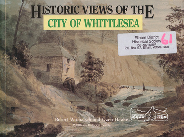
Book, Robert Wuchatsch 1950- et al, Historic views of the City of Whittlesea / Robert Wuchatsch and Gwen Hawke, 1988
Paperback; ix, 119 p. : chiefly ill. (some col.), 1 map, ports. ; 19 x 25 cm.ISBN 0958866333 [written on title page] To Eltham Historical Society, with our compliments and best regards - Whittlesea Historical Society - [signed] Robert Wuchatsch, G. Hawke. 13/12/89.whittlesea shire -
 Eltham District Historical Society Inc
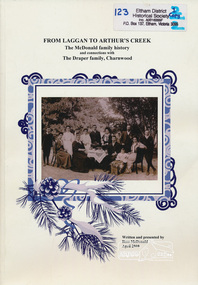
Book, From Laggan to Arthur's Creek : the McDonald family history and connections with the Draper family, Charnwood / written and presented by Ross McDonald, 2010
Paperback; 102 p. : ill. (some col.), maps, ports., facsims., geneal. table ; 30 cm. Two copiesmcdonald family, draper family, charnwood, arthur's creek -
 Orbost & District Historical Society
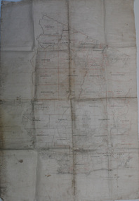
map, early 20th century
This is a useful research tool.A large cloth map with black and red print. Regions are labelled in black capital letters. There are some hand-written notes.on back - J. Leathamcartography map-tambo-shire -
 Ringwood and District Historical Society
Flyer, Land Sale Advertisement - Roebury Estate, Ringwood, Victoria - circa 1938
Advertisement for sale of residential allotments with map showing location and layout of subdivision, terms of sale, and summary of local features and services.Subdivision includes Dublin Road, Alexander Road, and Ferntree Gully Road (later Bedford Road). Agent - J.B. McAlpin, Opposite Railway Station, Ringwood. -
Federation University Historical Collection
Book, City of Ballaarat Planning Scheme Review: Planning Policies Identification Summary Report, 1980, 02/1980
Brown soft covered book outlining the City of Ballarat Planning Scheme Review . Includes black and white images and a map.city of ballaarat, city of ballarat planning, planning scheme review, map -
 Ringwood and District Historical Society
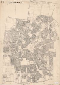
Map, City of Ringwood - Rateable Properties Layout - c.1966
A0-size (approx) map of named streets, lot-numbered properties and locality features within City of Ringwood boundary. Scale: 8 chains to 1 inch. City Engineer's signature in bottom right corner - Alan Robertson (City Engineer 1958-1987) -
 City of Moorabbin Historical Society (Operating the Box Cottage Museum)
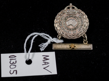
WW2 Medal for Women relatives of serving soldiers, 1942
Female Relative Badges were issued to the nearest female relative (usually wives or mothers) of those who engaged in active service overseas during the First and Second World Wars. For active service abroad during the Second World War, a single badge was issued to the nearest female relative of members of the RAN, the Australian Imperial Force (including members of the Australian Army Nursing Service), and the Royal Australian Air Force. Stars displayed on a bar suspended below the badge represented the number of relatives involved in the war effort. Authority for the issue of the badge was given under AIF Order 200,14 February 1941. This medal was given to Veronica ( White ) Roper in 1942 because her husband Alfred William Roper was a member of the Australian Army Signals Corp serving in New Guinea. Emma Olymphia Roper of Balaclava/ Ripponlea would also have received a medal like this with 4 four stars because her 4 sons were serving in the Australian Army 1939-45 This Military Medal was given to the wives and mothers of Australian Soldiers serving during World War 2 1939-1945Silver medal, engraved wreath of leaves, crown and map of Australia and pin clasp on back . A bar with one star is suspendedAround medal : For the Women of Australia Back : Issued by the / C'wealth Govt. / A 135699 / Angus & Coote / 1942 Bar : star/ asteriskworld war 1939-1945, military medals, roper alfred william , roper veronica, moore joan catherine, roper arthur leopold, roper emma olymphia, war memorials, bentleigh, city of moorabbin, totally and permanently invalid, returned service league, victoria barracks, department of defence australia, -
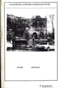 Bendigo Historical Society Inc.
Book - STRAUCH COLLECTION: EAGLEHAWK & BENDIGO HERITAGE STUDY
Eaglehawk & Bendigo Heritage Study, study extract & steering committee response to the study, contains maps and black & white photographs.bendigo, planning, heritage -
Bendigo Historical Society Inc.
Map - BENDIGO GOLDFIELD, 1873
Bendigo Goldfieds mining Lease blocks. April 1873 Topographic map. Surveyed and completed by R Brough April 1873Dept of manufacturing and Industry Development.bendigo, gold mining, mining lease blocks -
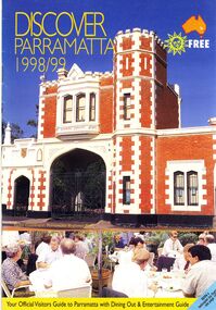 Bendigo Historical Society Inc.
Book - STRAUCH COLLECTION: DISCOVER PARRAMATTA
Discover Parramatta 1998/99 your official visitors guide to Parramatta with dining out & entertainment guide with photographs and a map.australia, history, parramatta, australia - history - nsw - parramatta -
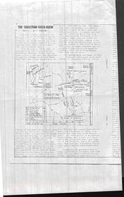 Bendigo Historical Society Inc.
Document - PHOTOCOPIED ARTICLE OF 'THE SEBASTIAN GOLD-RUSH PART 1 & 2 . BY F. ROBBINS'
Photocopied articles of 'The Sebastian Gold-Rush parts 1 & 2 . By F. Robbins' .First page shows a map of the goldfield.F. Robbins'document, gold, the sebastian gold-rush -
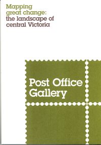 Bendigo Historical Society Inc.
Book - POST OFFICE GALLERY MAPPING GREAT CHANGE, 2013
Post Office Gallery exhibition catalogue, Mapping great change the landscape of central Victoria, 27 pages with maps and illustrations.books, catalogues, post office gallery -
 Bendigo Historical Society Inc.
Book - BENDIGO LANDSCAPE ASSESSMENT
Bendigo Landscape Assessment Big Hill & Mandurang Valley Drat Report 23 June 2012 contains maps and photographs.surveying, terrestial, mandurang valley -
 Bendigo Historical Society Inc.
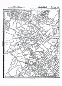
Map - LONG GULLY HISTORY GROUP COLLECTION: MAP OF LONG GULLY
Copy of a street map showing Jobs Gully, California Gully, Long Gully, St Just's Point and Iron Bark.bendigo, history, long gully history group, the long gully history group - map of long gully, jobs gully, california gully, long gully, st just's point, iron bark -
 Bendigo Historical Society Inc.
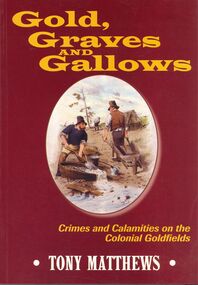
Book - GOLD GRAVES AND GALLOWS
Soft covered Gold,Graves and Gallows crimes and calamities on the Colonial Goldfields 215 pages with black and white photographs & maps.Tony Matthewsbooks, collections, crimes -
 Bendigo Historical Society Inc.
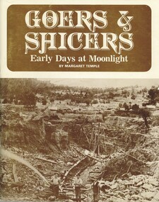
Book - GOERS AND SHICERS EARLY DAYS AT MOONLIGHT
Goers and Shicers - Early Days at Moonlight Story of Lewis family on Castlemaine goldfields. 66 pages, with photographs, illustrations, maps.Margaret Templecastlemaine, gold, lewis family, isbn 0959453008 -
 Bendigo Historical Society Inc.
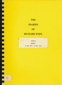
Book - THE DIARIES OF RICHARD POPE, 1879 - 1884
The Diaries of Richard Pope Volume V, Bendigo, 11 Feb. 1879 - 25 Dec 1884' 20 pages with maps.Richard Popebendigo, history, diary richard pope, bendigo, history, mining, pope family, goldfields -
Bendigo Historical Society Inc.
Map - PLAN SHEEPWASH CREEK
Two laminated maps, one in colour the other black and white, showing German Gully, sheepwash creek, milkmaid flat. -
 Bendigo Historical Society Inc.
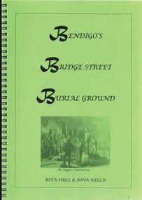
Book - BENDIGOS BRIDGE STREET BURIAL GROUND, 2010
Bendigo's Bridge Street Burial Ground. 53 pages in a spring bound folder containing black and white photographs and maps.Rita Hull & John Kellybendigo, history, cemetery, bendigo-history-cemetery -
 Bendigo Historical Society Inc.
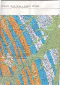
Map - STRUGNELL COLLECTION: GEOLOGICAL SURVEY OF VICTORIA, BENDIGO GOLD FIELD - GOLDEN SQUARE, 1992
Map, Geological Survey of Victoria, Bendigo Gold Field - Golden Square, Campaspe 10 000/2.2. Victoria 10,000.Dept. 0f Manufacturinf & Industry Development.map, bendigo, golden square gold field