Showing 570 items
matching boundary road
-
 Ringwood and District Historical Society
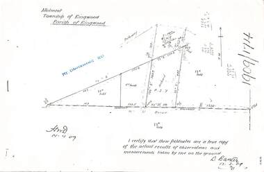
Document - Copy of Lands Department Field Notes - Parish of Ringwood, Victoria, Field Notes 1909/174 - Part of O.P. R72D surveyed 12.3.1909
Foolscap size photocopy of survey map with handwritten notations. References include Mount Dandenong Road, pathway, 2 room house, scillion, shed, WC, 17C sold, Cr lands, orchard, 17E sold, Township boundary, I certify that these field notes are a true copy of the actual results of observations and measurements taken by me on the ground (signed) D. Barker 12.3.09. -
 Phillip Island and District Historical Society Inc.
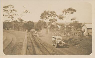
Photograph - Post Card, Cowes School Back to 1926 Chapel Street, March 1926
Donated by Stan McFee from the Keith McIlwraith CollectionSepia postcard of four cars , decorated with streamers, driving along Chapel Street going west on unmade road. Land on left was owned by Methodist Church, corner of Chapel and Bass Ave., where large tree denotes the boundary. Finley? Forrest's house on right. Coming to Back to Cowes School Celebration March 1926On back: "Back to Cowes March 1926"celebrations - back to cowes school phillip island, decorated cars, phillip island, stan mcfee, keith mcilwraith collection -
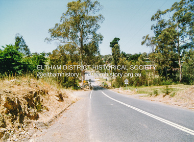
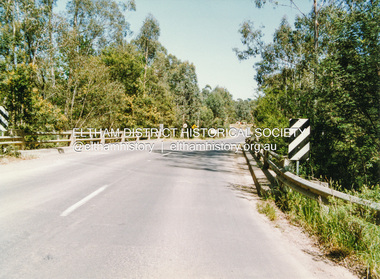
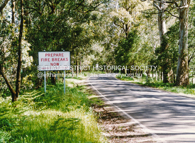
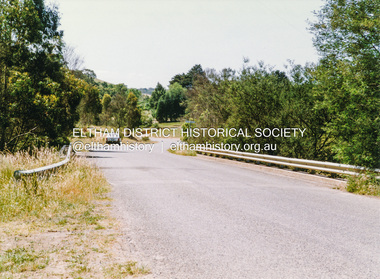
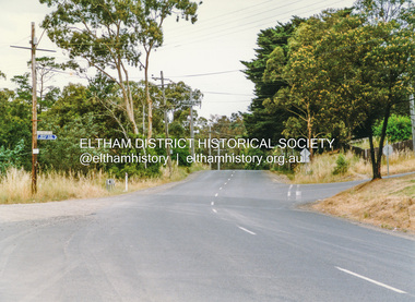
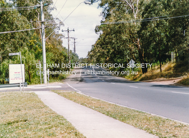
 Eltham District Historical Society Inc
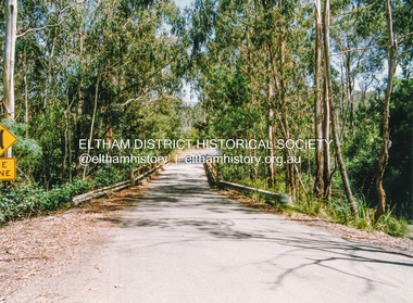
Photograph, Doug Orford, Oxley Bridge crossing Watsons Creek, Henley Road, Kangaroo Ground, 1991
From a collection of 35 photos taken by Doug Orford at 35 specific locations along the exact boundary of the then Shire of Eltham.Colour photographwatsons creek, kangaroo ground, oxley bridge, henley road -
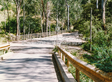
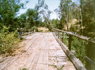
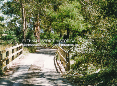
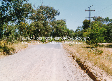
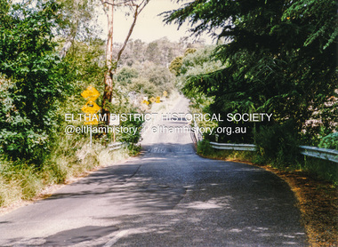
 Eltham District Historical Society Inc
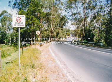
Photograph, Doug Orford, Bridge across Diamond Creek, Wattletree Road, Eltham North, 1991
From a collection of 35 photos taken by Doug Orford at 35 specific locations along the exact boundary of the then Shire of Eltham.Colour photographbridges, diamond creek, wattletree road, eltham north -
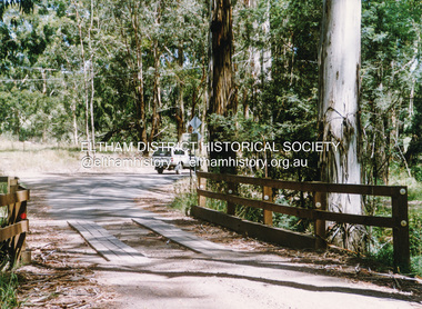
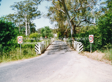
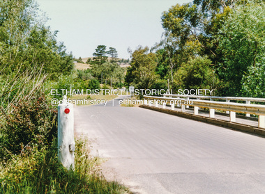
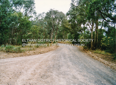
 Eltham District Historical Society Inc
Photograph, Doug Orford, Bridge across Diamond Creek, Allendale Road, Eltham North, 1991
From a collection of 35 photos taken by Doug Orford at 35 specific locations along the exact boundary of the then Shire of Eltham.Colour photographbridges, diamond creek, eltham north, allendale road -
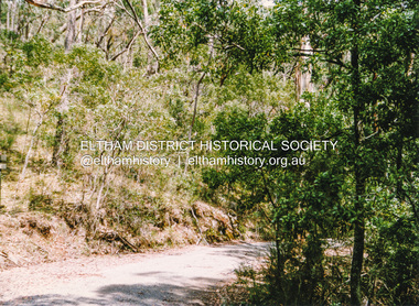
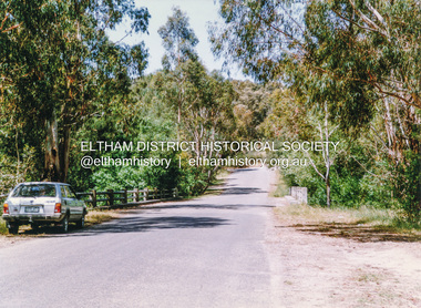
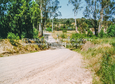
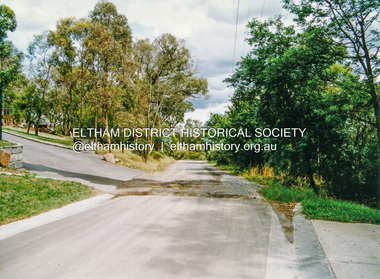
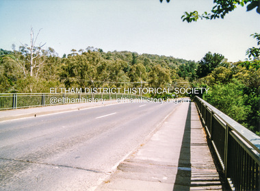 Eltham District Historical Society Inc
Photograph, Doug Orford, Bridge across Yarra River, Kangaroo Ground - Warrandyte Road, Warrandyte, 1991
From a collection of 35 photos taken by Doug Orford at 35 specific locations along the exact boundary of the then Shire of Eltham.Colour photographbridges, yarra river, warrandyte -
 Eltham District Historical Society Inc
Photograph, Doug Orford, Calwell Road crossing Watsons Creek, Kangaroo Ground, 1991
From a collection of 35 photos taken by Doug Orford at 35 specific locations along the exact boundary of the then Shire of Eltham.Colour photographwatsons creek, calwell road, kangaroo ground -
 Eltham District Historical Society Inc
Photograph, Doug Orford, Bridge across Watsons Creek, One Tree Hill Road, Christmas Hills, 1991
From a collection of 35 photos taken by Doug Orford at 35 specific locations along the exact boundary of the then Shire of Eltham.Colour photographwatsons creek, christmas hills, bridges, one tree hill road -
 Eltham District Historical Society Inc
Photograph, Doug Orford, Bridge across Watsons Creek, Eltham - Yarra Glen Road, Watsons Creek, 1991
From a collection of 35 photos taken by Doug Orford at 35 specific locations along the exact boundary of the then Shire of Eltham.Colour photographwatsons creek, bridges, eltham - yarra glen road -
 Eltham District Historical Society Inc
Photograph, Doug Orford, Bridge across Watsons Creek, Clintons Road, Christmas Hills, 1991
From a collection of 35 photos taken by Doug Orford at 35 specific locations along the exact boundary of the then Shire of Eltham.Colour photographwatsons creek, christmas hills, bridges -
 Eltham District Historical Society Inc
Photograph, Doug Orford, Bridge, Chads Creek Road, Strathewen, 1991
From a collection of 35 photos taken by Doug Orford at 35 specific locations along the exact boundary of the then Shire of Eltham.Colour photographbridges, chads creek road, strathewen -
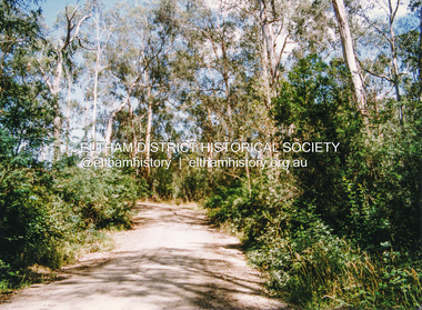
 Eltham District Historical Society Inc
Photograph, Doug Orford, Old Kinglake Road, Steels Creek, 1991
From a collection of 35 photos taken by Doug Orford at 35 specific locations along the exact boundary of the then Shire of Eltham.Colour photographold kinglake road, steels creek -
 Eltham District Historical Society Inc
Photograph, Doug Orford, Heidelberg - Kinglake Road near Kinglake, 1991
From a collection of 35 photos taken by Doug Orford at 35 specific locations along the exact boundary of the then Shire of Eltham.Colour photographheidelberg-kinglake road, kinglake -
 Eltham District Historical Society Inc
Photograph, Doug Orford, The old Burkes Bridge across Arthurs Creek, Hurstbridge - Arthurs Creek Road, Hurstbridge, 1991
From a collection of 35 photos taken by Doug Orford at 35 specific locations along the exact boundary of the then Shire of Eltham.Colour photographbridges, hurstbridge - arthurs creek road, hurstbridge, burkes bridge, arthurs creek -
 Eltham District Historical Society Inc
Photograph, Doug Orford, Monash Bridge across Diamond Creek, Hurstbridge - Arthurs Creek Road, Hurstbridge, 1991
From a collection of 35 photos taken by Doug Orford at 35 specific locations along the exact boundary of the then Shire of Eltham.Colour photographbridges, diamond creek, hurstbridge - arthurs creek road, hurstbridge, monash bridge -
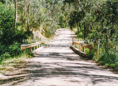
 Eltham District Historical Society Inc
Photograph, Doug Orford, Lintons Bridge across Arthurs Creek, Doctors Gully Road, Nutfield, 1991
From a collection of 35 photos taken by Doug Orford at 35 specific locations along the exact boundary of the then Shire of Eltham.Colour photographbridges, arthurs creek, lintons bridge, nutfield, doctors gully road -
 Eltham District Historical Society Inc
Photograph, Doug Orford, Burkes Bridge across Arthurs Creek, Hurstbridge - Arthurs Creek Road, Hurstbridge, 1991
From a collection of 35 photos taken by Doug Orford at 35 specific locations along the exact boundary of the then Shire of Eltham.Colour photographbridges, hurstbridge - arthurs creek road, hurstbridge, burkes bridge, arthurs creek -
 Eltham District Historical Society Inc
Photograph, Doug Orford, Bridge across Arthurs Creek, Eagles Nest Road, Arthurs Creek, 1991
From a collection of 35 photos taken by Doug Orford at 35 specific locations along the exact boundary of the then Shire of Eltham.Colour photographbridges, arthurs creek, eagles nest road -
 Eltham District Historical Society Inc
Photograph, Doug Orford, Bridge across Arthurs Creek, Arthurs Creek Road, Arthurs Creek, 1991
From a collection of 35 photos taken by Doug Orford at 35 specific locations along the exact boundary of the then Shire of Eltham.Colour photographbridges, arthurs creek, arthurs creek road -
 Eltham District Historical Society Inc
Photograph, Doug Orford, Bridge across Diamond Creek, Wilson Road, Wattle Glen, 1991
From a collection of 35 photos taken by Doug Orford at 35 specific locations along the exact boundary of the then Shire of Eltham.Colour photographwattle glen, bridges, diamond creek, wilson road -
 Eltham District Historical Society Inc
Photograph, Doug Orford, Kangaroo Ground - Wattle Glen Road, Wattle Glen, near Reynolds Road, 1991
From a collection of 35 photos taken by Doug Orford at 35 specific locations along the exact boundary of the then Shire of Eltham.Colour photographkangaroo ground - wattle glen road, wattle glen -
 Eltham District Historical Society Inc
Photograph, Doug Orford, Ingrams Road, Research, near Allendale Road, 1991
From a collection of 35 photos taken by Doug Orford at 35 specific locations along the exact boundary of the then Shire of Eltham.Colour photographingrams road, research (vic.) -
 Eltham District Historical Society Inc
Photograph, Doug Orford, Lorimer Road, Research, near Reynolds Road, 1991
From a collection of 35 photos taken by Doug Orford at 35 specific locations along the exact boundary of the then Shire of Eltham.Colour photographresearch (vic.), lorimer road -
 Eltham District Historical Society Inc
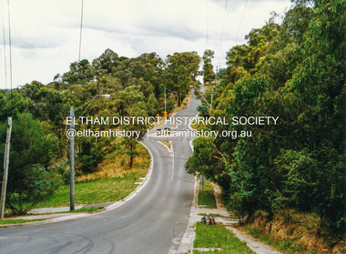
Photograph, Doug Orford, Warringah Crescent, Eltham, near Ramptons Road, 1991
From a collection of 35 photos taken by Doug Orford at 35 specific locations along the exact boundary of the then Shire of Eltham.Colour photographeltham, warringah crescent -
 Eltham District Historical Society Inc
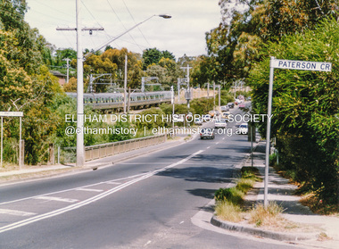
Photograph, Doug Orford, Ryans Road, Eltham, near Kerrie Crescent, 1991
From a collection of 35 photos taken by Doug Orford at 35 specific locations along the exact boundary of the then Shire of Eltham.Colour photographeltham, ryans road -
 Eltham District Historical Society Inc
Photograph, Doug Orford, Bridge across Plenty River, Para Road, Briar Hill, 1991
From a collection of 35 photos taken by Doug Orford at 35 specific locations along the exact boundary of the then Shire of Eltham.Colour photographbridges, plenty river, para road, briar hill -
 Eltham District Historical Society Inc
Photograph, Doug Orford, Bridge across Plenty River, Main Road, Lower Plenty, 1991
From a collection of 35 photos taken by Doug Orford at 35 specific locations along the exact boundary of the then Shire of Eltham.Colour photographbridges, lower plenty, main road, plenty river -
 Eltham District Historical Society Inc
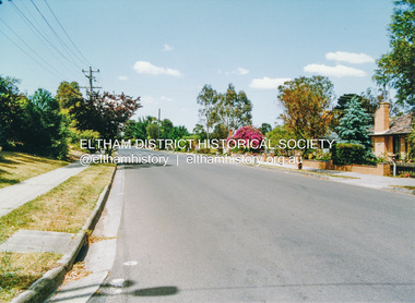
Photograph, Doug Orford, Mountain View Road, Briar Hill, near River Street, 1991
From a collection of 35 photos taken by Doug Orford at 35 specific locations along the exact boundary of the then Shire of Eltham.Colour photographbriar hill, mountain view road -
 Eltham District Historical Society Inc
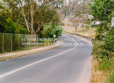
Photograph, Doug Orford, Karingal Drive, Eltham, near Ramptons Road, 1991
From a collection of 35 photos taken by Doug Orford at 35 specific locations along the exact boundary of the then Shire of Eltham.Colour photographkaringal drive, eltham -
 Eltham District Historical Society Inc
Photograph, Doug Orford, Bridge, Henty Road, Lower Plenty, 1991
From a collection of 35 photos taken by Doug Orford at 35 specific locations along the exact boundary of the then Shire of Eltham.Colour photographbridges, henty road, lower plenty