Showing 6813 items
matching 1956-01
-
 Ballarat Heritage Services
Photograph - Colour, Earth Banks, Old Sarum, England, 01 November 2016
William the Conqueror inherited Old Sarum from the last Saxon king of England. It was an ideal site for a royal castle. It was here in 1070 that William paid off his army after a long and bitter campaign in northern England. It was here in 1086 that he called together all the major landholders in England so they could swear allegiance to him. It was a crucial moment. The Domesday Book was being written, a threatened Viking invasion had only just been averted and William's eldest son was in armed rebellion. Old Sarum was an important place where this Norman king of England held power. In 1794 the Ordnance Survey set out to check the accuracy of the first mapping of Southern England, which had begun ten years earlier. From a point just below Old Sarum Lieutenant William Mudge laid out a base-line 36,574 feet (11,253 metres) long. From each end of the line the positions of distant places were plotted using a huge theodolite made in 1791 by Jesse Ramsden. The accuracy of the process, which was repeated all over England, depended on Jesse Ramsden's craftsmanship and on William Mudge's surveying skill in setting out this first base-line from Old Sarum. The nearer end of Mudge's line is marked by an inscribed stone beside the modern A345 at Old Sarum. ordnance survey, william mudge, jesse ramsden, william the conqueror, old sarum, saxon, 1086, england -
 Ballarat Heritage Services
Photograph - Colour, Dorothy Wickham, Earth Banks, Old Sarum, England, 2016, 01 November 2016
William the Conqueror inherited Old Sarum from the last Saxon king of England. It was an ideal site for a royal castle. It was here in 1070 that William paid off his army after a long and bitter campaign in northern England. It was here in 1086 that he called together all the major landholders in England so they could swear allegiance to him. It was a crucial moment. The Domesday Book was being written, a threatened Viking invasion had only just been averted and William's eldest son was in armed rebellion. Old Sarum was an important place where this Norman king of England held power. In 1794 the Ordnance Survey set out to check the accuracy of the first mapping of Southern England, which had begun ten years earlier. From a point just below Old Sarum Lieutenant William Mudge laid out a base-line 36,574 feet (11,253 metres) long. From each end of the line the positions of distant places were plotted using a huge theodolite made in 1791 by Jesse Ramsden. The accuracy of the process, which was repeated all over England, depended on Jesse Ramsden's craftsmanship and on William Mudge's surveying skill in setting out this first base-line from Old Sarum. The nearer end of Mudge's line is marked by an inscribed stone beside the modern A345 at Old Sarum. King William devised the Domesday Book, considered to be the first listing of land owners in England. Among the names is that of D'Arques, from Normandy, France. Descendants of this family later emigrated from England and settled in Victoria, Australia under the surname 'Dark'. ordnance survey, william mudge, jesse ramsden, william the conqueror, old sarum, saxon, 1086, england -
 Ballarat Heritage Services
Photograph - Colour, Earth Banks, Old Sarum, England, 2016, 01 November 2016
William the Conqueror inherited Old Sarum from the last Saxon king of England. It was an ideal site for a royal castle. It was here in 1070 that William paid off his army after a long and bitter campaign in northern England. It was here in 1086 that he called together all the major landholders in England so they could swear allegiance to him. It was a crucial moment. The Domesday Book was being written, a threatened Viking invasion had only just been averted and William's eldest son was in armed rebellion. Old Sarum was an important place where this Norman king of England held power. In 1794 the Ordnance Survey set out to check the accuracy of the first mapping of Southern England, which had begun ten years earlier. From a point just below Old Sarum Lieutenant William Mudge laid out a base-line 36,574 feet (11,253 metres) long. From each end of the line the positions of distant places were plotted using a huge theodolite made in 1791 by Jesse Ramsden. The accuracy of the process, which was repeated all over England, depended on Jesse Ramsden's craftsmanship and on William Mudge's surveying skill in setting out this first base-line from Old Sarum. The nearer end of Mudge's line is marked by an inscribed stone beside the modern A345 at Old Sarum. ordnance survey, william mudge, jesse ramsden, william the conqueror, old sarum, saxon, 1086, england -
 Ballarat Heritage Services
Photograph - Photograph - Colour, Castle toilets, Old Sarum, England, 2016, 01/11/2016
William the Conqueror inherited Old Sarum from the last Saxon king of England. It was an ideal site for a royal castle. It was here in 1070 that William paid off his army after a long and bitter campaign in northern England. It was here in 1086 that he called together all the major landholders in England so they could swear allegiance to him. It was a crucial moment. The Domesday Book was being written, a threatened Viking invasion had only just been averted and William's eldest son was in armed rebellion. Old Sarum was an important place where this Norman king of England held power. In 1794 the Ordnance Survey set out to check the accuracy of the first mapping of Southern England, which had begun ten years earlier. From a point just below Old Sarum Lieutenant William Mudge laid out a base-line 36,574 feet (11,253 metres) long. From each end of the line the positions of distant places were plotted using a huge theodolite made in 1791 by Jesse Ramsden. The accuracy of the process, which was repeated all over England, depended on Jesse Ramsden's craftsmanship and on William Mudge's surveying skill in setting out this first base-line from Old Sarum. The nearer end of Mudge's line is marked by an inscribed stone beside the modern A345 at Old Sarum. Colour photographs of Castle toilets at Old Sarum, England. The toilets are constructed of stone. ordnance survey, william mudge, jesse ramsden, william the conqueror, old sarum, saxon, 1086, england, subjects, toilets -
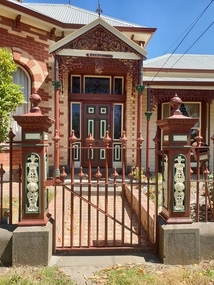
 Ballarat Heritage Services
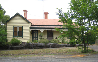
Image - Colour, 5 Sebastopol Street, Ballarat, 2004, 22/01/2008
Colour image of a house in Sebastopol Street, Ballarat.architecture, sebastopol street -
 Ballarat Heritage Services
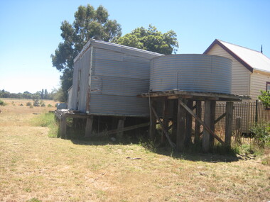
Photograph - Photograph - Colour, Clare Gervasoni, Shedding and tanks near Bungaree Hall, 2009, 26/01/2009
Photographs of a shed and tank near Bungaree Hall. architecture, bungaree, tank, shed, farm -
 Ballarat Heritage Services
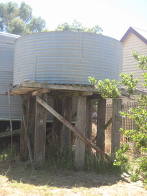
Photograph - Photograph - Colour, Tank near Bungaree Halll, 2009, 26/01/2009
Photographs of a tank near Bungaree Hall. architecture, bungaree, tank, shed, farm, water tank, agriculture -
 Ballarat Heritage Services
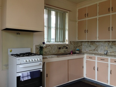
Photograph - Colour, Webb Avenue, Black Hill, Ballarat, 07/01/2017
Colour photographs of the interior of a house in Webb Avenue, Ballarat East, and its garden shed. The houses in Webb Avenue were built for the Housing Commission in 1959. The interior fit out was likely to be similar in the other houses and each property appears to have had an identical garden shed. webb avenue, black hill, ballarat, housing commission, architecture -
 Ballarat Heritage Services
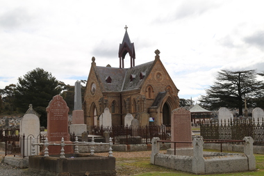
Photograph - Photograph - Colour, Chapel in the Bendigo Cemetery, 2018, 01/09/2018
Colour photograph of the chapel in the Bendigo Cemetery.bendigo cemetery, graves, chapel -
 Ballarat Heritage Services
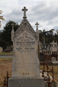
Photograph - Colour, Wiegard Headstone in the Bendigo Cemetery, 2018, 01/09/2018
Colour photograph of the Wiegard headstone in the Bendigo Cemetery.bendigo cemetery, peter hoey finn, headston, wilhelm wiegard, mary wiegard -
 Ballarat Heritage Services
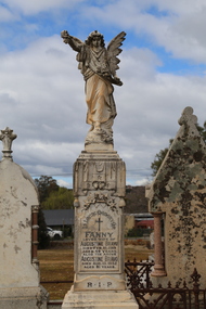
Photograph - Colour, Bravo Headstone in the Bendigo Cemetery, 2018, 01/09/2018
Colour photograph of the Bravo headstone in the Bendigo Cemetery.bendigo cemetery, peter hoey finn, headstone, fanny bravo, augustime bravo -
 Ballarat Heritage Services
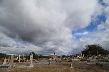
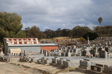
Photograph - Colour, Bendigo Cemetery, 2018, 01/09/2018
Colour photograph of the chapel and headstones in the Bendigo Cemetery.bendigo cemetery, graves, chapel -
 Ballarat Heritage Services
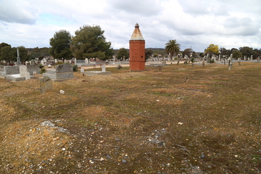
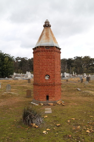
Photograph - Colour, Bendigo Cemetery, 2018, 01/09/2018
Colour photograph of headstones in the Bendigo Cemetery.bendigo cemetery, graves, headstones -
 Ballarat Heritage Services
Photograph - Photograph - Colour, Clare Gervasoni, Chinese Section in the Bendigo Cemetery, 2018, 01/09/2018
Colour photograph of the Chinese section in the Bendigo Cemetery.bendigo cemetery, graves, headstones, chinese, lee kie -
 Ballarat Heritage Services
Photograph - Photograph - Colour, Clare Gervasoni, Chinese Section in the Bendigo Cemetery, 2018, 01/09/2018
Colour photograph of the Chinese section in the Bendigo Cemetery.A plaque states: This Pomelo Tree (known to the Chinese as the tree of life) was planted on 9 October 1996 in recognition and to the memory of the many Chinese buried at or in close proximity to this site during the 19th and 20th centuries. bendigo cemetery, graves, headstones, chinese, oven -
 Ballarat Heritage Services
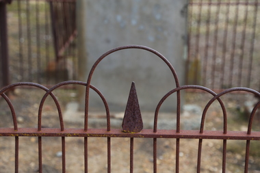
Photograph - Headstone, Hampton Headstone in the Bendigo Cemetery, 2018, 01/09/2018
Colour photograph of the Creswick headstone in the Bendigo Cemetery. It it surrounded by a beautiful hand forged fence. Erected to the memory of Charles P.R. Creswick eldest and beloved son of Josiah and Catherine Hampton who died at Redan Hill January 21st, 1867, aged twelve years and six months." "In youth our lives are not secure in childhood years we die."bendigo cemetery, headstone, forged fence, charles p.r. creswick hampton, charles philip richard creswick hampton, josiah hampton, catherine hampton -
 Ballarat Heritage Services
Photograph - Photograph - Colour, 'Vaugher' 406 Armstrong Street South, Ballarat, 19/01/2019
Coour photographs of a brick Victorian house in Ballarat, with exceptional cast iron detail and fence. iron lace, cast iron, ballarat, armstrong street south, victorian house, brick -
 Ballarat Heritage Services
Report, Analysis of the Value of Heritage to the City of Ballarat, 2007, 31/01/2007
102 page report outlining the ecomomic benefit of heritage to Ballarat. It is still in it's draft form as it was never formally accepted by City of Ballarat Council.heritage, economics, ballarat, skm report, planning -
 Ballarat Heritage Services
Photograph, Clare Gervasoni, Brookside, 21/01/2021
The farm known as Brookside.brookside, farm -
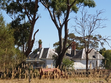 Ballarat Heritage Services
Photograph, Clare Gervasoni, Brookside Homestead, 21/01/2021
The Brookside Private Reformatory for Protestant Girls was established on 29 December 1887 by Mrs W. T. Rowe. It was initially established at Glenfine, and soon moved to more extensive premises in the town of Cape Clear, near Scarsdale. The establishement of private reformatories had been made possible by The Juvenile Offenders' Act 1887 , which was assented to only weeks before the opening of Brookside. The Mintaro Reformatory Home for Girls at Monegeetta, Lancefield was established in 1903 by the Methodist Home Mission Department to take the girls from the Brookside Reformatory at Cape Clear when it closed in 1903. Brookside Homestead taken from the public roadway.brookside, farm, homestead -
Ballarat Heritage Services
Photograph, Clare Gervasoni, Brookside Farm Looking Towards the Creek, 21/01/2021
A video of Brookside Homestead looking towards the Creek, taken from the public roadway.brookside, farm, homestead -
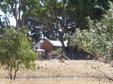 Ballarat Heritage Services
Photograph, Clare Gervasoni, Stable Complex at Brookside, 21/01/2021
Brookside Homestead taken from the public roadway.brookside, farm, stable -
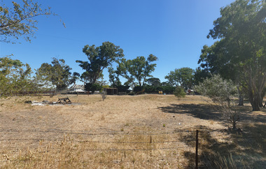
 Ballarat Heritage Services
Photograph, Clare Gervasoni, Gates into Brookside Farm, 21/01/2021
A photograph and two videos showing the gates into Brookside Homestead taken from the public roadway.brookside, farm, stable -
 Ballarat Heritage Services
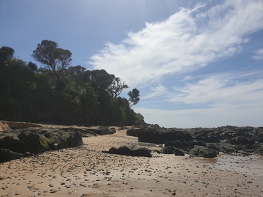
Photograph, Clare Gervasoni, Rocks Near Wild Dog Creek, Apollo Bay, 24/01/2022
Colour photograph of rocks on the beach at Apollo Bay at a rocky outcrop known as Match Point.apollo bay, match point, beach, coast, rocks -
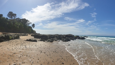 Ballarat Heritage Services
Photograph, Clare Gervasoni, Rocks Near Wild Dog Creek, Apollo Bay, 24/01/2022
Colour photograph of rocks on the beach at Apollo Bay at a rocky outcrop known as Match Point.apollo bay, match point, beach, coast, rocks -
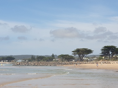 Ballarat Heritage Services
Photograph, Clare Gervasoni, Apollo Bay, Victoria, 24/01/2022
In 2021, the Department of Environment, Land, Water and Planning (DELWP) constructed two new groynes and a section of rock seawall at Apollo Bay to help manage the impacts of coastal erosion. The new 70-meter-long rock groynes run perpendicular to the shoreline and be located just south of the Milford St revetment and to the south of Milford Creek. Sections of rock seawall will be constructed between the two Groynes with an aim to protect the dune, walking path, cypress trees and road from erosion. Colour photograph of a coastal scene at Apollo Bay, featuring new rock groynes to protect the Great Ocean Road from erosion. apollo bay, beach, coast, groyne, rockwall