Showing 10847 items
matching maps
-
 Glen Eira Historical Society
Map - Orienteering
This file contains one item. A map/plan of the Bentleigh East Running Roulette for the Monday series on 21/03/2011.bayside kangaroos orienteering, bentleigh east, sedunary vic, leicester paul, sheahan jenny, clubs, sheahan john, tamblyn greg, centre road bentleigh, tucker road bentleigh, south road moorabbin, associations, nepean highway, bentleigh rsl club, orienteering, sports, recreations -
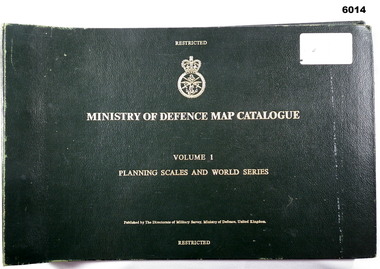 Bendigo Military Museum
Manual - Ministry of Defence Map Catalogue, Volume 1 Planning Scales and World Series
Map Catalogue, Ministry of Defence, Planning Scales and World Series, The Directorate of Military Survey, Ministry of Defence United KingdomLarge Book, dark green, hard cover, gold text, metal binding, elastic strap keeper, text, diagrams.royal australian survey corps, rasvy, fortuna, army survey regiment, army svy regt, asr -
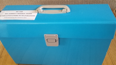 Peterborough History Group
Document - Ken Clements Research Folder, 2014
A comprehensive collection of documents, maps, book extracts and newspaper articles pertaining to the history of Peterborough. Researched and arranged by Ken Clements.An extensively researched collection of information in various forms indexed and arranged chronologically, portraying the timeline of Peterborough from Pre white settlement to 2014.Indexed expanding document folder containing individually researched information collated and indexed by Ken Clements.peterborough 3270 -
 Rutherglen Historical Society
Book, Kath Bentley et al, River of Islands: Charts of the River Murray Yarrawonga Weir to Hume Dam, November 1983
Book contains information and sketch maps to aid in the navigation of the Murray River, with advice on hazards to look for as these will change over time.74 page A4 book with a drawing of a boat on the Murray River on the coverAutographed on the title page by the authors: "9-1-84 Leon Bentley | Kath Bentley"murray river, boating, river navigation, boating safety -
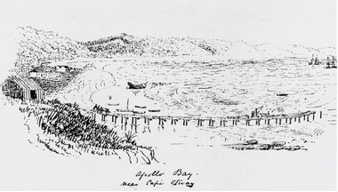
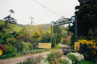 Apollo Bay Museum
Film - Audio Slideshow of memories and photos with Nelly O'Meara, Apollo Bay
Nelly O'Meara's memories of Apollo Bay and running the Paradise Tearooms. Created as part of the Heart Maps project with Amy Tsilemanis -
 Apollo Bay Museum
Film - Olive and Gordon Currie with photo album
Audio slideshow with Olive and Gordon Currie with a family photo album. Created as part of the Heart Maps project with Amy Tsilemanisapollo bay, oral history, farming -
 Apollo Bay Museum
Film - John Verey on the Apollo Bay Golf Course
Audio Slideshow with John Verey on the Apollo Bay Golf Course. Created as part of the Heart Maps project with Amy Tsilemanisapollo bay, golf course, oral history -
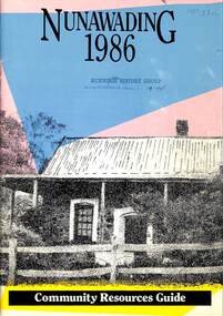 Whitehorse Historical Society Inc.
Pamphlet - Community Resources Guide, City of Nunawading, Nunawading 1986, 1986
An A4 publication of 45 pages of a Community Resources Guide distributed by the City of Nunawading.An A4 publication of 45 pages of a Community Resources Guide distributed by the City of Nunawading.An A4 publication of 45 pages of a Community Resources Guide distributed by the City of Nunawading.city of nunawading, community services -
Bendigo Historical Society Inc.
Map - ELMORE : COUNTY OF BENDIGO, 4-7-18
Map. Elmore, County of Bendigo, Diggorrra, Burnewang, Runnymede, Nolan, Egerton. Township of Elmore. Campaspe River. Northern Railway Line. Photo-Lithographed at the Department of Lands and Survey, Melbourne by W.J. Butson, 4-7-18.Price 1/-. By authority A.J. Mullett, Govt. Printer. (number 36 in map cupboard 1)A.J. Mullett, Govt. Printer.map, bendigo, elmore -
Bendigo Historical Society Inc.
Map - CAMPASPE : COUNTY OF BENDIGO, 1964
Map. Campaspe, County of Bendigo, County of Rodney, Runnymede, Nolan, Muskerry, Toolleen, Colbinabbin, Campaspe River, Goornong, Mount Pleasant Creek. By authority A.C. Brooks, Government Printer, Melbourne. Drawn and reproduced at the Department of Lands and Survey, Melbourne. 1964. Price 10/- per sheet. (number 112 in map cupboard 1)A.C. Brooks, Government Printer, Melbourne.map, bendigo, campaspe -
Port Melbourne Historical & Preservation Society
Map, City of Port Melbourne. Parishes of melbourne South. Doutta Galla, c. 1930
City of Port Melbourne. Parishes of Melbourne South. Doutta Galla Copy of map circa 1930, showing Port Melbourne, Station and Town piers. Map is black on white paper with numbered red dots on most residential blocks. 1876 written in ballpoint on bottom - possibly date of first edition, before later additions.built environment, engineering department - city of port melbourne -
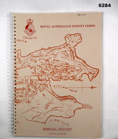 Bendigo Military Museum
Booklet - Royal Australian Survey Corps - Annual Report 1 Jul 87 - 30 Jun 88, Director of Military Survey -Army, 01.09.1988
Royal Australian Survey Corps Annual Report detailing Surveying and mapping activities 1 July 87 - 30 Jun 88. The first part of the report details the highlights during the period followed by Annexes A to J detailing Australian Map and Chart production. Annex A: 45 pages, Annex B: 1 page Aust Doppler Satelite Stations, Annex C: 1 page, Aust airborne Profile Recording, Annex D: 1 page Aust Aerial photography, Annex E: 1 page Aust Analytical Aerotriangulation, Annex F: 1 page Inertial Positioning System Network Traverses Fils Svy, Annex G: 1 page Global Positioning System Station/networks TI4100 Svy, Annex H: 1 page, Defence Cooperation Programme, Annex I 3 Pages RASvy Officer Manning, Annex J: 1 page RASvy ARES Manning Levels.Buff coloured light cardboard covers. Old map of Sydney Cove area printed in red/brown on front cover and Survey Corps Badge in red top left corner. "Map of the town of Sydney 1836" printed on back cover. A4 sized paper pages, 17 numbered pages plus, Annex A: 45 x pages, Annex B: 1 x page Aust Doppler Satellite Stations, Annex C: 1 x page, Aust Airborne Profile Recording, Annex D: 1 x page Aust Aerial photography, Annex E: 1 x page Aust Analytical Aerotriangulation, Annex F: 1 x page Inertial Positioning System Network Traverses Fils Svy, Annex G: 1 x page Global Positioning System Station/Networks TI4100 Svy, Annex H: 1 x page, Defence Cooperation Programme, Annex I 3 x pages RASvy Officer Manning, Annex J: 1 x page RASvy ARES Manning Levels.royal australian survey corps, rasvy, fortuna, army survey regiment, army svy regt, asr -
Creswick Campus Historical Collection - University of Melbourne
Still Image, 1968
Subject: Creswick 1968 Project . 1 x annotated map in envelope marked Run 3 No's 30 - 38 with runs marked up from aerial phtographs flown 1956 - 1968 on drafted plan of Creswick Plantations. 1 x topographical map marked Creswick with annotation "Mapsheet key diagram". 1 x topographical map marked Ballarat annotated with a grid of numbers. 13 brown envelopes marked Run 1 -3 No. 21 - 38 (missing sequences) of c.44 prints total. Mix of black and white and colour. Range of dates. Stored in a brown cardboard file box marked Creswick 1968 Project.Aerial Photographs -
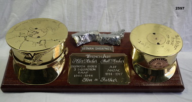 Bendigo Military Museum
Souvenir - TRENCH ART WW1, WW2, Post 1945 (estimated); Made in WWI and WWII and assembled upon return
William John ARCHER (Bill) No 321 enlisted in B Coy 21st Batt AIF on 18.1.15. Embarked for Eygpt 8.5.15. Hospital 9.9.15 with Influenza. Hospital 24.11.15 with Gastric Enteritis. Hospital 2.1.16 with Otitis Media. Transfers to the 57th Batt and embarks for France. Hospital with Trench Fever 4.10.16. Promoted to Cpl 28.4.17. Hospital 19.3.18 with Scabies. WIA 18.4.18 GSW's to chest and leg severe. Discharged from the AIF medically unfit 9.1.19. Alexander William ARCHER No 40637 enlisted in the RAAF on 16.5.41 age 18 years 8 months. He wanted to be a Mess Steward and was taken in as he had worked in similar work line. He then has 5 postings before embarking for Egypt on 2.4.1942 and was posted to No 3 SQD RAAF on 20.5.1942. Re mustered as a Motor Cyclist he became a Dispatch Rider on 8.9.1942 between the RAAF and the Army. Alex served in the Middle East and Italy with 3 SQD. He embarked from Egypt diagnosed with Kyphosis and Scoliosis on 5.2.1944. In Australia he was re mustered as Office Orderly on 6.7.1944 and then discharged from the RAAF on 2.10.1944 Medically Unfit. Wooden base with brass shells either end resembling Officers caps,one being WWI, the other WWII, both inscribed. Centre plaque inscribed Alex Archer and Bill Archer, father and son. Above the centre plaque is a piece of German shrapnel chrome plated Map - "North Africa, 1940", on left hand side, "18-Pounder, 1917, Bill Archer-Anzac, 1914-1919", on right hand side, "German shrapnel"handcrafts - trench art, metal craft- brassware, arms - ammunition, military history - souvenirs -
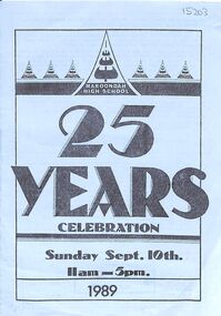 Ringwood and District Historical Society
Pamphlet, 8-page on 25-year celebration of Maroondah High School (formerly Croydon West HS), now Melba College
Celebrated in 1989 on Sunday 10th September.John Hutchinson, Chairman of 25th Birthday Committee. A Douglas, first principal, F Russell, second, and H Fletcher, third. Contains map of celebrations and school song. -
Glen Eira Historical Society
Map - Kooyong Road, Caulfield North
A sepia photograph of Kooyong Road (61 x 87mm) undated and unattributed. Accompanied by an undated, unattributed handrawn map of road (42mm x 87mm) and explanatory handwritten notes detailing what is depicted in the photograph: looking towards a field and church at the intersection of Kooyong and Glen Eira Roads. Map and handwritten explanatory notes have been photocopied from the back of one sepia photograph.kooyong road, glen eira road, derby parade, brighton road, caulfield north -
 Bendigo Historical Society Inc.
Map - GUIDE MAP OF BENDIGO & EAGLEHAWK, Late 1920's
Map. Guide map of Bendigo & Eaglehawk. Folded map of Bendigo & Eaglehawk with blue outer cover booklet. Map is compiled by E E Parker, Eaglehawk. Map shows tramways, bus routes and cost one shilling. Map shows Agricultural Showgrounds located between Park Street, Water Street, Barnard Street and Bridge Lane. Also shows Acclimitization Reserve located behind the Botanical Gardens at White Hills. Shows the location of Sailors Gully, Peg-Leg Gully, Jobs Gully, California Gully, Long Gully, Ironbark Gully, Golden Gully, Poverty Gully, Sheepshead Gully, Charcoal Gully, Eaglehawk Creek, Bendigo Creek and Back Creek.Contains interesting facts about Bendigo:- Area - 7,900 acres, Population - 26,000, First Council elected - 1855, Proclaimed a City - 1871. Gold Rush broke out - 1851. For first 10 years gold yield averaged 8,600 ozs. Per week. Total gold yield to 1923 - 572 tons valued at 82,000,000 pounds. Deepest mines - Victoria Quartz 4,614 ft., New Chum Railway 4,318 ft., 13 mines over 3,000ft. deep, 53 mines over 2,000 ft. deep. Sewering of City commenced 1922. All principal buildings now sewered. Map printed by Arnall & Jackson, General Printers, Stationers & Engravers, 476 Collins Street. Outer map blue cover printed in red and blue ink by J B Young, Lithographer. Map displays advertisement for Bendigo Timber Co. Outer blue cover displays advertisement for Campbell Connelly & Co. Pty. Ltd, Ironmongers, Timware Manufacturers, Plumbers, Sewerage Contractors, High and Forest Sts, Bendigo 9outside back cover) and for Hartleys ( J L Shoosmith) Bendigo, displaying Indian Motor Cycles (inside back cover).map, bendigo, township, guide map of bendigo & eaglehawk -
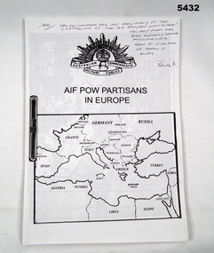 Bendigo Military Museum
Literary work - AIF POW'S IN EUROPE, Post WW2
Item in the collection relating to John Eric Wiles VX16067, refer Cat No 5410P for his service details.Literary work all paper copy joined by a metal clip, all print in black, front has Rising Sun & map of Europe, 27 pages, contains lists of POW’s, casualties, some maps, story is based around the Greece, Crete campaign. On front a hand written note to say this version has been superseded.pow’s, greece crete, wiles -
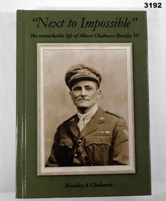 Bendigo Military Museum
Book - BOOK, AUTOBIOGRAPHY, Bradley A Chalmers, Next to Impossible, 2015
Biography. Next To Impossible - The remarkable life of Albert Chalmers Borella VC. Bushman, farm hand, artist, metropolitan fireman, decorated soldier, soldier settler, POW Commandant. At ease in the company of the King or the common man, Albert Chalmers Borella VC did it all. This is his remarkable story. Hard cardboard cover, black print over mid green background on front, spine & back. Sepia portrait photo on front. Colour portrait photo & colour photo of service medals on back. End pages illustrated in black & white battle maps. 510 pages, cut plain paper, illustrated with black & white photos & maps. books - biography/military, vc -
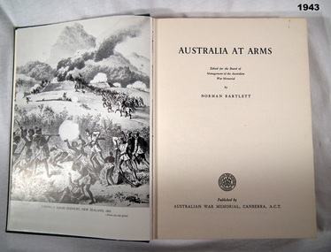 Bendigo Military Museum
Book, Norman Bartlett for the Board of Management of the Australian War Memorial, Australia at Arms, First published 1955, reprinted 1962
Hard cardboard cover, dark green buckram with gold print on front cover & spine. 265 pages, cut plain light beige paper, illustrated with black & white photos, maps & illustrations. Front & back end papers & fly leaves illustrated in dark green & cream, 2 soldiers in uniform with map in back ground.books, military history -
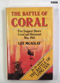 Bendigo Military Museum
Book, The Battle of Coral, 1988
"The Battle of Coral" is the exciting and dramatic story of the biggest unit level battle involving Australian soldiers in the Vietnam War. Donated by Andrew John BALSILLIE MBE. Refer Cat No 118.5 for his service details, RSL, Council history.Hard cover, red colour buckram. white colour print on spine. Dust cover with plastic cover, black and red colour print on front, back and spine. Illustrated yellow colour background, silhouette of helicopter/jungle on front. 361 pages cut plain. Illustrated black and white photographs and maps. End paper - illustrated maps.Title page - hand written in black ink "Donated by / 2-1-2000" - owners stamp in black ink "Major A.J. BALSILLE, .M.B.E.,J.P.books, military -
Frankston RSL Sub Branch
Magnifier, Map Reading
A small pocket size folding magnifier used for enlarging detail when reading maps or examining aerial photographs complete with a leather storage pouch. Manufactured of brass by Casartelli of Manchester, England. When unfolded this forms a "U" shape with the glass lens positioned conveniently for map viewing and the base can be used to measure scaled distances.This item is stamped "CASARTELLI, MANCHESTER" and has 1/4, 1/2 and 1 inch markings. -
Bendigo Historical Society Inc.
Map - HEATHCOTE : COUNTY OF BENDIGO, 11-4-35
Map. Heathcote, County of Bendigo, County of Dalhousie,Township of Heathcote, McIvor Creek, Argyle Station Ground, Wallan and Bendigo Railway, C.R.B. Main Road. By authority H.J. Green, Govt. Printer. Photo-Lithographed at the Department of Lands and Survey, Melbourne. 11-4-35. Price 2/-. (number 88 in map cupboard 1)H.J. Green, Govt.Printermap, bendigo, heathcote -
Bendigo Historical Society Inc.
Map - PANNOOBAMAWM : COUNTY OF BENDIGO, 1957
Map. Pannoobamawm, County of Bendigo, Turrumberry, Terrick Terrick East, Wanurp, Pannoomilloo, Bamawm, Elmore to Cohuna Railway, McColl Station Ground, Lockington Station Ground. By authority W.M. Houston, Government Printer, Melbourne. Drawn and reproduced at the Department of Lands and Survey, Melbourne 1957. Price 2/-. (number 80 in map cupboard 1)W.M. Houston, Government Printer, Melbourne.map, bendigo, pannoobamawm -
Bendigo Historical Society Inc.
Map - MARONG : COUNTY OF BENDIGO, 25-6-25
Map. Marong, County of Bendigo, Nerring, Sandhurst, Lockwood, Shelbourne, Woodstock, Leichardt, Kangaroo Flat Rifle Range, Crusoe Aqueduct. By authority H.J. Green, Government Printer, Melbourne. Photo-Lithographed at the Department of Lands and Survey, Melbourne by W.J. Butson 25-6-25.Price 1/-. (number 75 in map cupboard 1)H.J. Green, Government Printer, Melbourne.map, bendigo, marong -
Bendigo Historical Society Inc.
Map - CAMPBELL COLLECTION: BENDIGO AND DISTRICT MAPS
Map. Ascot, Parishes of Huntly, Sandhurst and Wellsford. Scale 20 chains to 1 inch. Total area 2818 acres. To Bendigo 4 1/2 miles, to Epsom 3/4 mile, Huntly 3/4 mile. Prepared in W.P.B. from Assessment Plans and Parish Plans. (number 380 in map cupboard 1)map, bendigo, agricultural lands -
Bendigo Historical Society Inc.
Map - FRED COWIE COLLECTION: AERIAL MAPS OF HEATHCOTE/EPPALOCK, 28-9-60
Map, Heathcote C3, Aerial Survey of Victoria, Photo-map prepared by Department of Crown Lands and Survey from photographs taken in 1960.Copied photographically at the Central Plan Office. Date 28-9 60, C.P.O.Neg. No.21588.Campaspe River, Coliban River. Flower Hill. Fred Cowie,46 McIvor Rd.Bendigo (Not located 29.9.2022)Central Plan Office.map -
Bendigo Historical Society Inc.
Map - CAMPBELL COLLECTION: BENDIGO AND DISTRICT MAPS, 1962
Map. Mandurang, County of Bendigo. Scale 40 chains to 1 inch. Sandhurst, Strathfieldsaye, Sedgwick, Sutton Grange, Ravenswood, Lockwood, Township of Kangaroo Flat, Township of Mandurang. By Authority A.C. Brooks, Government Printer, Melbourne. Drawn and Reproduced at the Department of Lands and Survey, Melbourne,1962, Price 2/-. (number 401 in map cupboard 1)A.C. Brooks, Government Printer.map, bendigo, allotments -
Bendigo Historical Society Inc.
Map - GOORNONG : COUNTY OF BENDIGO, 27-10-25
Map. Goornong, County of Bendigo, Egerton, Nolan, Ellesmere, Bagshot. Town of Goornong, Northern Railway. Campaspe, Muskerry, Campaspe River. Photo-Lithographed at the Department of Lands and Survey, Melbourne by W.J. Butson, 27-10-25,Price 1/-. By authority: H.J. Green, Government Printer, Melbourne. (number 43 in map cupboard 1)H.J. Green,Govt.Printer, Melbourne.map, bendigo, goornong -
Bendigo Historical Society Inc.
Map - SALISBURY WEST : COUNTY OF BENDIGO, 24-6-24
Map. Salisbury, County of Bendigo, County of Gladstone, Powlett, Yarrayne, Bridgewater, Inglewood, Glenalbyn, Kurting, River Loddon, Bulabul Creek. By authority A.J. Mullett, Government Printer, Melbourne. Photo-Lithographed at the Department of Lands and Survey, Melbourne by W.J. Butson, 24-6-24. Price 1/-. (number 116 in map cupboard 1)A.J. Mullett, Government Printer, Melbourne.map, bendigo, salisbury west