Showing 19906 items
matching orbost-show
-
 Lakes Entrance Regional Historical Society (operating as Lakes Entrance History Centre & Museum)
Photograph, 1997
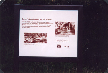
Date made 18 January 1997Colour photograph of the sign at Comer's Landing, North Arm. It shows an anodised metal plaque set on a metal support, depicting the history of the Tea Rooms, run by Mrs Comer during the 1930's. Lakes Entrance Victoriatransport, boats and boating, public works -
 Lakes Entrance Regional Historical Society (operating as Lakes Entrance History Centre & Museum)
Postcard, 1905c
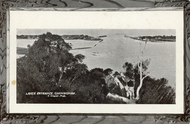
Message on back of card, to 'Misses M & A Henderson, Swan Reach, Just a line to wish ......, Yours sincerely, R J Gilsenan.'Black and white postcard of the man made entrance. It shows the works building and cottages on each side of the entrance, timber cribs and rock groynes at Bullock Island, natural vegetation of Jemmys Point in foreground. Lakes Entrance VictoriaLakes Entrance, Cunninghamboats and boating, public works, topography, waterways -
 Lakes Entrance Regional Historical Society (operating as Lakes Entrance History Centre & Museum)
Postcard, 1935c
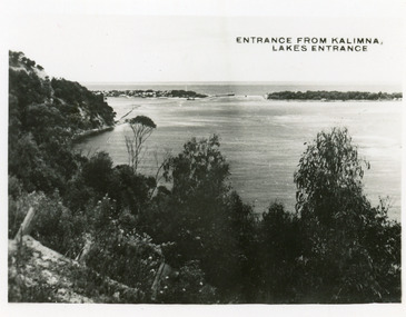
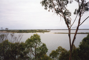
Also 2 identical small format postcardsBlack and white small format postcard taken from the cliff top at Kalimna. It shows the man made entrance through the hummocks, rock groynes, Jemmys Point cliff and natural vegetation in foreground. Lakes Entrance VictoriaEntrance from Kalimna, Lakes Entrancehouses, waterways, topography -
 Lakes Entrance Regional Historical Society (operating as Lakes Entrance History Centre & Museum)
Postcard, Bulmer H D, 1940c
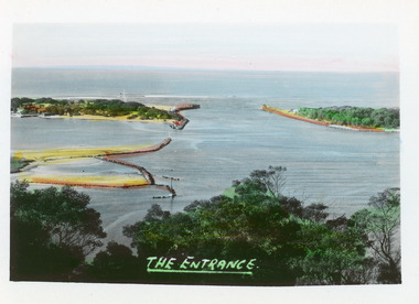
Hand tinted small format postcard of the entrance to the Gippsland Lakes, taken from Jemmys Point. It shows the rock groynes at Bullock Island with dredged sand filling the basin between island and groyne. Lakes Entrance VictoriaThe Entranceislands, waterways, topography -
 Lakes Entrance Regional Historical Society (operating as Lakes Entrance History Centre & Museum)
Photograph, 1920c
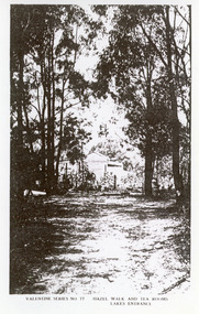
Black and white photograph of Hazel Walk and Tea Rooms at Kalimna. It shows bush track through natural vegetation leading to rustic weather board with canvas awning on the veranda side of tea rooms. Lakes Entrance VictoriaHazel Walk and Tearooms, Lakes Entranceislands, public works, waterways, topography -
 Lakes Entrance Regional Historical Society (operating as Lakes Entrance History Centre & Museum)
Photograph, Fraser Nancy, 1980c
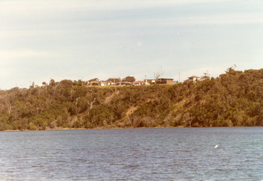
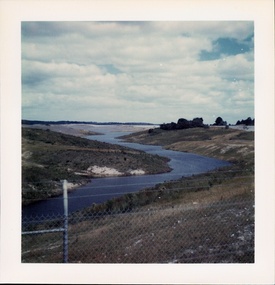
Colour photograph of private residences on the Kalimna escarpment. It shows houses above a timbered cliff at the northern shore of the North Arm of the lake, bare areas on cliff side indicating recent land slide. Lakes Entrance VictoriaHouses Seaview Parade Kalimna North Arm Lakes Entrance (on back)islands, topography, waterways, public works -
 Lakes Entrance Regional Historical Society (operating as Lakes Entrance History Centre & Museum)
Photograph, Fish Marie, 1995
Black and white photograph of the site of Peck's fish processing factory on Bullock Island. It shows a heavy machine in background, broken concrete and rubbish skip in foreground, site cleared for TAFE education complex. Lakes Entrance Victoriaislands, waterways, dredging, topography -
 Lakes Entrance Regional Historical Society (operating as Lakes Entrance History Centre & Museum)
Photograph, Holding M, 2000c
Colour photograph of Fraser Island, Gippsland Lakes, taken from Nyerimilang. It shows Flannagan Island mid centre, residence on Fraser Island, scrub covered dunes of southern shore of lake system. Lakes Entrance Victoriarestaurant, waterways, topography, boats and boating -
 Lakes Entrance Regional Historical Society (operating as Lakes Entrance History Centre & Museum)
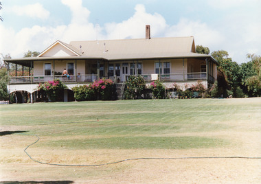
Photograph, 1995c
This house, named Kawar, was owned by John Herbert Syme, in first half of the 20th Century.Colour photograph of the accommodation house on Fraser Island, Gippsland Lakes. It shows a large weatherboard house with gable roof and veranda on three sides. Steps leading up to a raised veranda in centre front. Lakes Entrance Victoriawaterways, islands -
 Lakes Entrance Regional Historical Society (operating as Lakes Entrance History Centre & Museum)
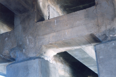
Photograph, 1999
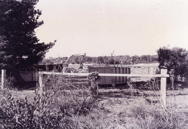
Bridge was built 1917Colour photograph taken underneath the concrete North Arm bridge, shows the original four concrete piers and two piers added to widen bridge. Construction of abutments for new bridge seen in background. Lakes Entrance Victoriabridges, waterways -
 Lakes Entrance Regional Historical Society (operating as Lakes Entrance History Centre & Museum)
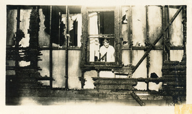
Photograph, 1925c
Black and white photograph of fire damage to Venga Guest House. It shows the destroyed eastern wall of the guest house, charred timber framework and wall lining, woman inside window looking out. Lakes Entrance Victoria.guesthouses, disasters -
 Lakes Entrance Regional Historical Society (operating as Lakes Entrance History Centre & Museum)
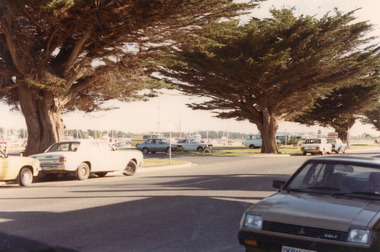
Photograph, Soderlund, Glenice, 1985
Date April 1985Colour photograph of the boat harbour carpark on Esplanade. It shows boat in background, cars parked in designated area and beside highway, three large cypress trees, part of the Great War Memorial Avenue. Lakes Entrance Victoriaworld war 1914-1918, waterfront, township, transport -
 Lakes Entrance Regional Historical Society (operating as Lakes Entrance History Centre & Museum)
Photograph, Lakes Post Newspaper, 1991
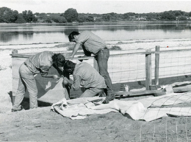
Date made June 1991Black and white photograph of work in progress during the development of the recreational area beside Cunninghame Arm. It shows three men building a shelter fence, to protect proposed plantings of native trees and shrubs. Lakes Entrance Victoriaoccupation, vegetation, waterfront -
 Lakes Entrance Regional Historical Society (operating as Lakes Entrance History Centre & Museum)
Postcard, 1935c
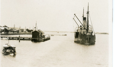
Also a 10x15cm sepia coloured copy, and a 16.5x25cm black and white enlargementBlack and white small format postcard of the Western wharf also known as Post Office Jetty, or Freemans Jetty. It shows some of the buildings on Esplanade, Rubeena, in foreground, SS Wyralla passing wharf. Lakes Entrance Victoriajetties, boats and boating, waterfront -
 South Gippsland Shire Council
Photograph, Framed, Fishing on the Tarwin River, 2003
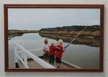
Framed and laminated colour photograph featuring a small group fishing from a timber pier on the Tarwin River. Shows a man and two blonde haired boys fishing holding rods. Laminated surface and brown timber frame. -
 Southern Sherbrooke Historical Society Inc.
Photograph - Glen Park homestead, Menzies Creek
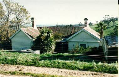
Colour photograph of Glen Park homestead at Menzies Creek prior to its demolition in the early 2000's. Photo shows house's north wall with two gables and a verandah between. Photo from Victorian heritage study. -
 Southern Sherbrooke Historical Society Inc.
Photograph - Cardinia Reservoir filling, post 1973, Narre Warren East area
A set of five colour photos showing Cardinia Dam beginning to fill after its completion in 1973. One photo shows smoke or possibly dust rising on a distant hillside. The set was donated to the society by David Howe. -
 Ballarat Tramway Museum
Document - Roster, Wayne Kell, "Rotating Shift Roster", 2021
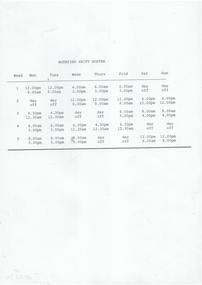
Yields information about the duties of the SEC Ballarat depot pitman and their roster.Roster - single A4 sheet - titled "Rotating Shift Roster" for the depot pitman and servicing staff. Shows the working hours for each weekday and the week number. Prepared by Wayne Kell, former SEC Ballarat depot pitman.trams, tramways, sec, depot, workshops, employees, rosters -
 Ballarat Tramway Museum
Photograph - Digital image, Warren Doubleday, Former SEC owned hall known as Electra Hall in Camp St Ballarat, Mar. 2016
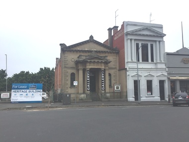
Digital Image of the former SEC owned hall known as Electra Hall in Camp St Ballarat March 2016. Shows the building for Lease and being used for a Gallery space. See Reg Item 6548 for a c1971 image.trams, tramways, secv, electra hall -
 Ballarat Tramway Museum
Photograph - Black & White Photograph/s, Charles Craig, 1971
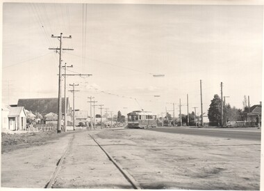
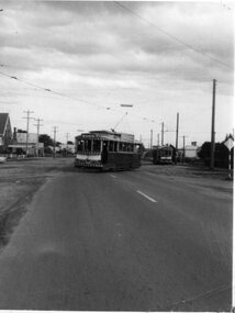
Yields information about the appearance of Albert St where the tram crossed at Ophir St, Sebastopol. Black and White photograph of a single trucker tram, with a Twin Lakes sign crossing Albert St, near Ophir St en route to Sebastopol. Shows the street scene at the time. Photo by Charles Craig - during 1971. trams, tramways, albert st, sebastopol, ophir st -
 Ballarat Tramway Museum
Photograph - Black & White Photograph/s, c1971
Yields information about the nature of the crossing of Albert St Sebastopol and special workings towards the end of the tramway.Black and white photograph of a single truck tram followed by a bogie tram crossing Albert St Sebastopol during a special working. Shows the nature of the roadway at this time. Probably taken shortly before closure. Photographer unknown.tramways, trams, albert st, sebastopol -
 Ballarat Tramway Museum
Photograph - Black & White Photograph/s, c1971
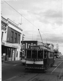
Yields information about the SEC operations towards the ends, tram in Mair St, with people in the back cab.Black and white photograph of the No. 21 southbound in Lydiard St North, about to cross Mair St. Taken from a north bound tramcar. Tram has destination of Sebastopol. Shows people in the back cab. Photographer unknown.tramways, trams, lydiard st nth, mair st, tram 21 -
 Bendigo Historical Society Inc.
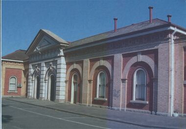
Photograph - BENDIGO RAILWAY STATION PLATFORM NO 2 BUILDING
Colour image, laminated, shows brick building, arched windows, double doorway, pediment on top of entry. On back of photo : Platform Number 2, what the original platform number 1 was like before the fire of 1965.railways, bendigo to melbourne, platform number 2 -
 Bendigo Historical Society Inc.
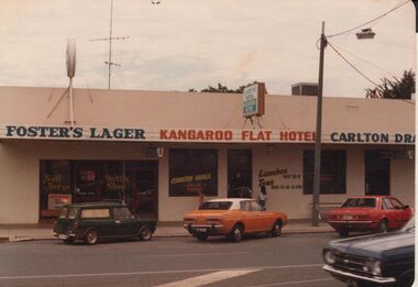
Photograph - BENDIGO HOTEL COLLECTION: KANGAROO FLAT HOTEL, HIGH STREET, KANGAROO FLAT
Colour photograph. Image shows single storey building, flat roof construction, cantilever verandah. Cars parked out front. Written on front of verandah façade 'Fosters Lager, Kangaroo Flat Hotel, Carlton Draught'.bendigo, hotel, kangaroo flat hotel -
 Bendigo Historical Society Inc.
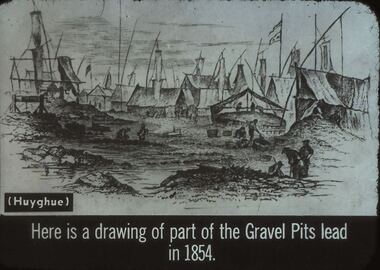
Slide - DIGGERS & MINING. GETTING THE GOLD, c1854
Diggers & Mining. Getting the Gold. Slide: (Huyghue) Here is a drawing of part of the Gravel Pits lead in 1854. Show many of the shafts with their awnings over them. Markings: 37 994.LIF:4. Used as a teaching aid.hanimounteducation, tertiary, goldfields -
 Bendigo Historical Society Inc.
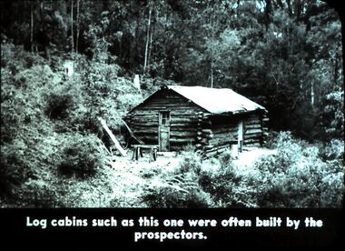
Slide - DIGGERS & MINING. DIGGERS AND MINERS, c1800s
Diggers & Mining. Diggers and miners. Walhalla - Gold Town. Log cabins such as this one were often built by the prospectors. Photo shows log cabin in bush surroundings. Markings: 10 995 WAL. Used as a teaching aid.hanimounteducation, tertiary, goldfields -
 Bendigo Historical Society Inc.
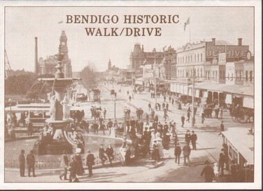
Flyer - Bendigo Historic Walk / Drive
1988 Bendigo Historic Walk / Drive pamphlet. A3 quarter folded to show map of Bendigo and walking tour options to visit local buildings. Dual print in two colours (orange and brown) includes several images.walking tour, driving tour -
 Bendigo Historical Society Inc.
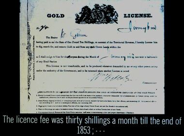
Slide - DIGGERS & MINING. THE GOLD LICENCE, c1850
Diggers & Mining. The gold licence. The Government Camp.. The licence fee was thirty shillings a month till the end of 1853; Slide shows a copy of a Gold Licence. Markings:3 994.LIF:4. Used as a teaching aid.hanimounteducation, tertiary, goldfields -
 Bendigo Historical Society Inc.
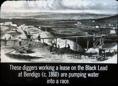
Slide - DIGGERS & MINING. GETTING THE GOLD, c1860
Diggers & Mining. Getting the Gold. Slide: These diggers working a lease on the Black Lead at Bendigo (c1860) are pumping water into a race. Picture on slide shows race. Markings: 68 994.LIF:4. Used as a teaching aid.hanimounteducation, tertiary, goldfields -
 Bendigo Historical Society Inc.
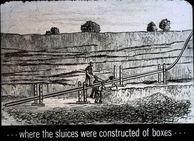
Slide - DIGGERS & MINING. GETTING THE GOLD, c1850
Diggers & Mining. Getting the Gold. Slide: . . . Where the sluices were constructed of boxes . . . (picture shows miners getting a channel ready for the water needed for sluicing. Markings: 60 994.LIF:4. Used as a teaching aid.haniomunteducation, tertiary, goldfields