Showing 1921 items matching " bridge rd"
-
 Eltham District Historical Society Inc
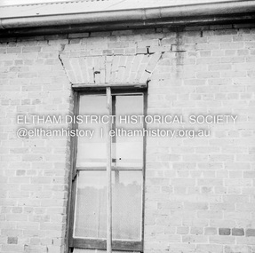
Negative - Photograph, J.A. McDonald, Old house, Susan Street, Eltham, c. 1962
Williams house, Susan StreetRecord of various Shire of Eltham infrastructure works undertaken during the period of 1952-1962 involving bridge and road reconstruction projects, sometimes with Eltham Shire Council Project Reference numbers quoted. It was during this period that a number of significant improvements were made to roads and new bridges constructed within the shire that remain in place as of present day (2022). In many situations, the photos provide a tangible visible record of infrastructure that existed throughout the early days of the Shire. The album was put together by or under the direction of the Shire Engineer, J.A. McDonald.eltham, houses, susan street, williams house -
 Eltham District Historical Society Inc
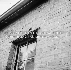
Negative - Photograph, J.A. McDonald, Old house, Susan Street, Eltham, c. 1962
Williams house, Susan StreetRecord of various Shire of Eltham infrastructure works undertaken during the period of 1952-1962 involving bridge and road reconstruction projects, sometimes with Eltham Shire Council Project Reference numbers quoted. It was during this period that a number of significant improvements were made to roads and new bridges constructed within the shire that remain in place as of present day (2022). In many situations, the photos provide a tangible visible record of infrastructure that existed throughout the early days of the Shire. The album was put together by or under the direction of the Shire Engineer, J.A. McDonald.eltham, houses, susan street, williams house -
 Eltham District Historical Society Inc
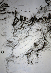
Slide - Photograph, Old map of Diamond Creek catchment, c.Sep. 1989
Part of a slide show presentation "Bridges & Waterways of the Shire" by Russell Yeoman to the 13 September 1989 Society meeting. The presentation included slides of historic photos from the Shire of Eltham Pioneers collections as well as several recent views.35mm colour positive transparency (1 of 33) Mount - Agfa CS System grey 8 dotsProcess Date Sep 1989diamond creek catchment, map -
 Eltham District Historical Society Inc
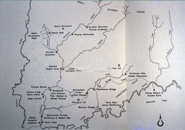
Slide - Photograph, Pastoral Runs, Diamond Creek Catchment, c.Sep. 1989
Part of a slide show presentation "Bridges & Waterways of the Shire" by Russell Yeoman to the 13 September 1989 Society meeting. The presentation included slides of historic photos from the Shire of Eltham Pioneers collections as well as several recent views.35mm colour positive transparency (1 of 33) Mount - Agfa CS System grey 8 dotsProcess Date Sep 1989diamond creek catchment, map, pastoral runs -
 Eltham District Historical Society Inc
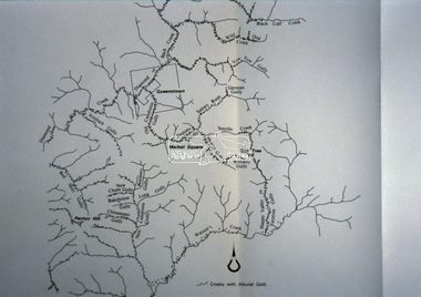
Slide - Photograph, Creeks with Alluvial gold, St Andrews, c.Sep. 1989
Part of a slide show presentation "Bridges & Waterways of the Shire" by Russell Yeoman to the 13 September 1989 Society meeting. The presentation included slides of historic photos from the Shire of Eltham Pioneers collections as well as several recent views.35mm colour positive transparency (1 of 33) Mount - Agfa CS System grey 8 dotsProcess Date Sep 1989map, creeks, alluvial gold, st andrews -
 Eltham District Historical Society Inc
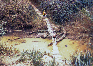
Slide - Photograph, Old footbridge, Gum Glade, Eltham, c.Sep. 1989
Part of a slide show presentation "Bridges & Waterways of the Shire" by Russell Yeoman to the 13 September 1989 Society meeting. The presentation included slides of historic photos from the Shire of Eltham Pioneers collections as well as several recent views.35mm colour positive transparency (1 of 33) Mount - Agfa CS System grey 8 dotsProcess Date Sep 1989old footbridge, gum glade, eltham, diamond creek (creek) -
 Eltham District Historical Society Inc
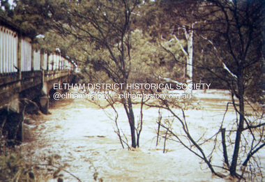
Slide - Photograph, 1934 flood, Eltham South, c.Sep. 1989
Part of a slide show presentation "Bridges & Waterways of the Shire" by Russell Yeoman to the 13 September 1989 Society meeting. The presentation included slides of historic photos from the Shire of Eltham Pioneers collections as well as several recent views.35mm colour positive transparency (1 of 33) Mount - Agfa CS System grey 8 dotsProcess Date Sep 1989eltham, diamond creek (creek), 1934 flood, eltham south, main road bridge -
 Eltham District Historical Society Inc
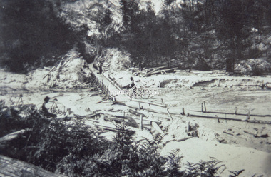
Slide - Photograph, Sluicing Race, St Andrews, c.Sep. 1989
Part of a slide show presentation "Bridges & Waterways of the Shire" by Russell Yeoman to the 13 September 1989 Society meeting. The presentation included slides of historic photos from the Shire of Eltham Pioneers collections as well as several recent views.35mm colour positive transparency (1 of 33) Mount - Agfa CS System grey 8 dotsProcess Date Sep 1989sluicing race, st andrews -
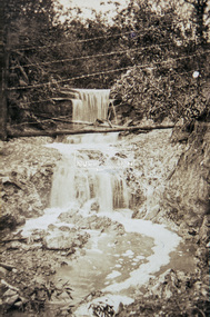 Eltham District Historical Society Inc
Slide - Photograph, Waterfall, c.Sep. 1989
Part of a slide show presentation "Bridges & Waterways of the Shire" by Russell Yeoman to the 13 September 1989 Society meeting. The presentation included slides of historic photos from the Shire of Eltham Pioneers collections as well as several recent views.35mm colour positive transparency (1 of 33) Mount - Agfa CS System grey 8 dotsProcess Date Sep 1989waterfall -
 Eltham District Historical Society Inc
Slide - Photograph, Near the old Lower Plenty Bridge (present day Edward Willis Court), c.Aug. 1990
Part of a presentation, "Roads and Byways of the Shire of Eltham", by Russell Yeoman to the 12 September 1990 Society meeting. Slides shown included copies of old photos and recent images ranging from the suburban streets of Eltham and Montmorency to the mountain roads of Kinglake. In the byways category are views of some iof the Shire's bicycle paths including then recently completed sections of the Main Yarra Trail at Lower Plenty.35mm colour positive transparency (1 of 37) Mount - Agfachrome Agfa CS System black 8 dotsinfrastructure, roads, edward willis court, lower plenty, lower plenty bridge -
 Eltham District Historical Society Inc
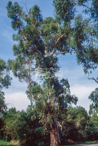
Slide - Photograph, Manna Gum, Main Road, Eltham South, c.Apr. 1993
Estimated to date from 1870-180, this large Manna Gum (now deceased 2022) on the northern side of Main Road just south of the Main Road Bridge over the Diamond Creek, Eltham South, c.1993. Diamond Creek Trail can be see on opposite side of the road. 35mm colour positive transparency (1 of 22) Mount - Kodak EktachromeProcess Date "Apr M"eltham south, main road, significant tree, main road bridge, manna gum -
 Eltham District Historical Society Inc
Photograph - Colour Print, Alistair Knox Park, Eltham, Victoria, Australia, c.1990
alistair knox park, bridge street, bridge street bridge, eltham -
 Eltham District Historical Society Inc
Photograph - Colour Print, Eltham Shire Council, Unidentified road, Eltham district, c.Oct. 1987
Date based on other similar display panels visible in images of the Shire of Eltham display at the Eltham Community Festival, 7 November 1987. 20 x 25 cm Shire of Eltham Engineering Department Providing the resources to undertake • Survey, design, consultation • Road construction and maintenance • Bridge construction and maintenance • Street sweeping • Drain and pit cleaning • Traffic engineering installation and maintenance • Garbage collection • Tip management, land reclamation and beautification • Maintenance of community buildings • Provision of community and recreation facilitiesunidentified, display panel, eltham festival, footpaths and gutters, infrastructure, residential, roads, shire of eltham, streets, 1987 -
 Eltham District Historical Society Inc
Photograph - Colour Print, Warrandyte Bridge over Yarra River, c.1987
Boundary for the Shire of Eltham and now Shire of Nillumbikwarrandyte bridge, yarra river -
 Eltham District Historical Society Inc
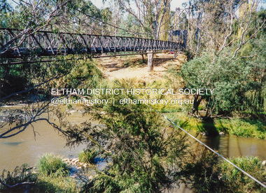
Photograph - Colour Print, Pedestrian suspension bridge over the Yarra River at Lower Plenty, c.1987
blessed sacrament fathers, bonds road, bridge, footbridge, lower plenty, odyssey house, seminary, yarra river -
 Eltham District Historical Society Inc
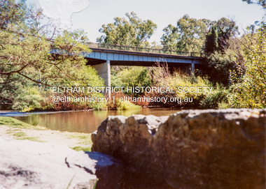
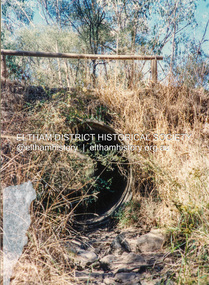
Photograph - Colour Print, Unidentified bridge over creek, c.1987
... Eltham District Historical Society Inc 728 Main Rd Eltham ...bridge, creek, unidentified -
 Eltham District Historical Society Inc
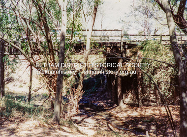
Photograph - Colour Print, Brougham Street Bridge, Eltham, c.1987
brougham street bridge, eltham, diamond creek (creek) -
 Eltham District Historical Society Inc
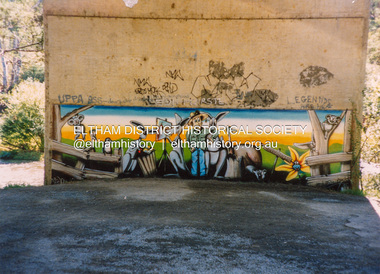
Photograph - Colour Print, Mural on Bridge Street Bridge pylon, Eltham, c.1987
Australian mural scene with reference to Warrandyte. Fortunately not spoilt by the usual addition of graffiti with questionable spelling. One tag "NMW" is dated 29-5-87.eltham, diamond creek (creek), bridge street bridge, graffiti, murals -
 Eltham District Historical Society Inc
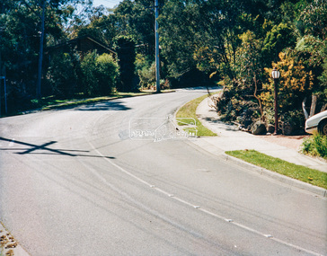
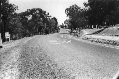
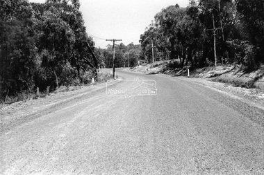
Photograph - Black and White Print, Unidentified road, Eltham district, c. Sep. 1966
On the left is an advertising sign for a housing development lots for auction sale, 20 acre lotsBlack and white photographic printOriginally located in a Filmpro King Size Prints processing envelope $3.01 Shire of Eltham 9/9/66 and noted as Calrossie Ave area and crossed out Eltham-Yarra Glen Road, Bridge Street to Elsa Court existing conditions mid 1967auction sale, housing estate, infrastructure, real estate agent, roads, sign, unidentified -
 Eltham District Historical Society Inc
Photograph - Black and White Print, Unidentified road, Eltham district, c. Sep. 1966
Black and white photographic printOriginally located in a Filmpro King Size Prints processing envelope $3.01 Shire of Eltham 9/9/66 and noted as Calrossie Ave area and crossed out Eltham-Yarra Glen Road, Bridge Street to Elsa Court existing conditions mid 1967infrastructure, roads, unidentified -
 Eltham District Historical Society Inc
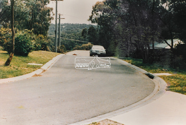
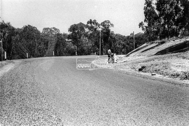
Photograph - Black and White Print, Unidentified road, Eltham district, c. Sep. 1966
A postal employee (Postie) of the Post Master General (PMG) is delivering mail by bicycleBlack and white photographic printOriginally located in a Filmpro King Size Prints processing envelope $3.01 Shire of Eltham 9/9/66 and noted as Calrossie Ave area and crossed out Eltham-Yarra Glen Road, Bridge Street to Elsa Court existing conditions mid 1967infrastructure, roads, unidentified, australia post, post master general, postie, bicycle -
 Eltham District Historical Society Inc
Photograph - Black and White Print, Unidentified road, Eltham district, possibly Montmorency, c. Sep. 1966
Black and white photographic printOriginally located in a Filmpro King Size Prints processing envelope $3.01 Shire of Eltham 9/9/66 and noted as Calrossie Ave area and crossed out Eltham-Yarra Glen Road, Bridge Street to Elsa Court existing conditions mid 1967infrastructure, roads, unidentified -
 Eltham District Historical Society Inc
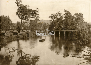
Photograph - Sepia Print, Albert Jones, Possibly Henley Bridge over the Yarra River, c.1915
... Eltham District Historical Society Inc 728 Main Rd Eltham ...Sepi print mounted on cardStamped on reverse: A.J. Spark Collection Photos 1900-1930 Photography Late Albert Jones Diamond Valley Tel: 83 - 3561henley bridge, yarra river, row boat, uniden, unidentified -
 Eltham District Historical Society Inc
Photograph - Aerial Photograph, Intersection of Main Road and Bridge Street, c.1995
View of Main Road from Henry Street to Brougham Street across to the Diamond Creek showing the Eltham Shire Offices (demolished 1996), the Eltham Library (opened 1994)aerial photo, alistair knox park, bridge street, brougham street, central park, diamond creek (creek), eltham, eltham community centre, eltham courthouse, eltham justice precinct, eltham living and learning, franklin street, henry street, local history centre, main road -
 Eltham District Historical Society Inc
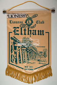
Banner, Lioness Club Eltham, M.D. 201 Victoria
banners, lioness club eltham, trestle bridge -
 Eltham District Historical Society Inc
Slide - Photograph, Eltham Shire Council, Proposed extension of Railway Road, Briar Hill, 1969
35mm colour positive transparency blue Agfacolour Service plastic mountA4, Railway Road intersection, 4 August 1969infrastructure, map, planning, subdivison lots, railway road, carter street bridge, para road, para road bridge, briar hill -
 Eltham District Historical Society Inc
Slide - Photograph, View looking down Luck Street towards Main Road, Eltham, c.Dec. 1987
The former Franklins and McEwans building is on the left. It then became Bunnings before they built a new store in Bridge Street and is presently a Dan Murphy and Aldi store and other smaller stores. The focus for Eltham Shire Council officers in this image is the significant littering concern.35mm colour positive transparency (1 of 7) Mount - Kodak Kodachrome CardProcess Date JUN 86Mroads, infrastructure, litter, luck street, mcewans, franklins, franklins supermarket