Showing 2312 items
matching infrastructure
-
 Eltham District Historical Society Inc
Negative - Photograph, J.A. McDonald, General; Shire Offices, 1959
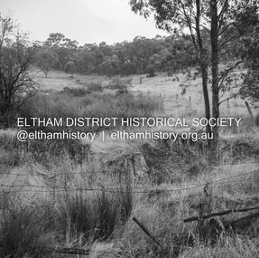
Shire of Lilydale, 15 Anderson Street, LilydaleRecord of various Shire of Eltham infrastructure works undertaken during the period of 1952-1962 involving bridge and road reconstruction projects, sometimes with Eltham Shire Council Project Reference numbers quoted. It was during this period that a number of significant improvements were made to roads and new bridges constructed within the shire that remain in place as of present day (2022). In many situations, the photos provide a tangible visible record of infrastructure that existed throughout the early days of the Shire. The album was put together by or under the direction of the Shire Engineer, J.A. McDonald.infrastructure, 1959, buttermans track, crosby property, creeks -
 Eltham District Historical Society Inc
Negative - Photograph, J.A. McDonald, General; Shire Offices, 1959
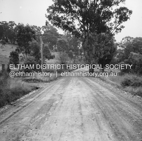
Shire of Lilydale, 15 Anderson Street, LilydaleRecord of various Shire of Eltham infrastructure works undertaken during the period of 1952-1962 involving bridge and road reconstruction projects, sometimes with Eltham Shire Council Project Reference numbers quoted. It was during this period that a number of significant improvements were made to roads and new bridges constructed within the shire that remain in place as of present day (2022). In many situations, the photos provide a tangible visible record of infrastructure that existed throughout the early days of the Shire. The album was put together by or under the direction of the Shire Engineer, J.A. McDonald.infrastructure, 1959, buttermans track, crosby property, creeks -
 Eltham District Historical Society Inc
Slide - Photograph, Near the old Lower Plenty Bridge (present day Edward Willis Court), c.Aug. 1990
Part of a presentation, "Roads and Byways of the Shire of Eltham", by Russell Yeoman to the 12 September 1990 Society meeting. Slides shown included copies of old photos and recent images ranging from the suburban streets of Eltham and Montmorency to the mountain roads of Kinglake. In the byways category are views of some iof the Shire's bicycle paths including then recently completed sections of the Main Yarra Trail at Lower Plenty.35mm colour positive transparency (1 of 37) Mount - Agfachrome Agfa CS System black 8 dotsinfrastructure, roads, edward willis court, lower plenty, lower plenty bridge -
 Eltham District Historical Society Inc
Slide - Photograph, Unidentified location, Eltham district, c.1992
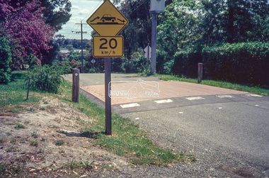
35mm colour positive transparency Mount - Black and Whiteunidentified, infrastructure, speedhumps, streets, roads -
 Eltham District Historical Society Inc
Slide - Photograph, Unidentified location, Eltham district, c.1992
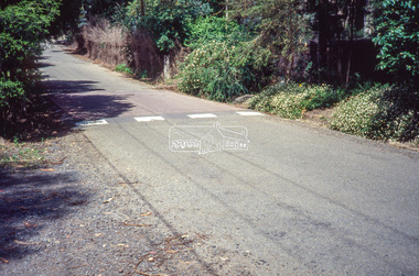
35mm colour positive transparency Mount - Black and Whiteunidentified, infrastructure, speedhumps, streets, roads -
 Eltham District Historical Society Inc
Slide - Photograph, Unidentified location, Eltham district, 1993
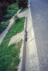
35mm colour positive transparency Mount - Black and Whiteunidentified, infrastructure, streets, roads, footpaths and gutters -
 Eltham District Historical Society Inc
Slide - Photograph, Unidentified location, Eltham district, 1993
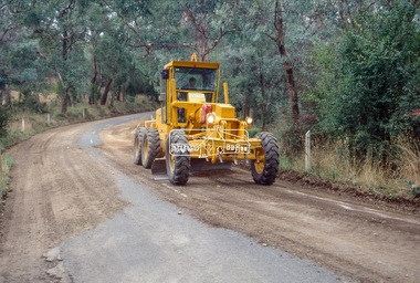
35mm colour positive transparency Mount - Black and Whiteunidentified, infrastructure, streets, roads, graders -
 Eltham District Historical Society Inc
Slide - Photograph, Unidentified location, Smiths Gully, 1993
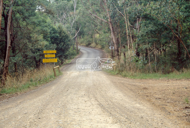
35mm colour positive transparency Mount - Black and Whiteunidentified, infrastructure, streets, roads, smiths gully -
 Eltham District Historical Society Inc
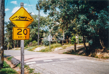
Slide - Photograph, Heidelberg-Kinglake Road, St Andrews, 1993
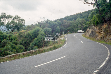
35mm colour positive transparency Mount - Black and Whiteinfrastructure, streets, roads, heidelberg-kinglake road, st andrews -
 Eltham District Historical Society Inc
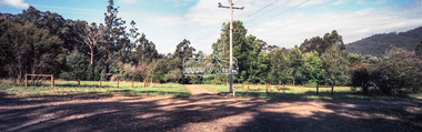
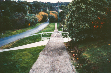
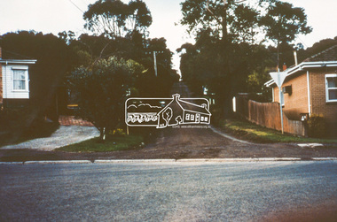
Slide - Photograph, Unidentified location, Eltham district, c.1990
35mm colour positive transparency Mount - Blank Cardhouses, infrastructure, residential, roads, streets -
 Eltham District Historical Society Inc
Slide - Photograph, Unidentified location, Eltham district, c.1990
35mm colour positive transparency Mount - Blank Cardhouses, infrastructure, residential, roads, streets -
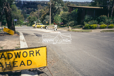
 Eltham District Historical Society Inc
Photograph - Colour Print, Eltham Shire Council, Unidentified, Eltham district, c.1990
infrastructure, roads, shire of eltham, unidentified, speedhumps -
 Eltham District Historical Society Inc
Negative - Photograph, Unidentified rural property, Eltham district, c.1985
Roll of 35mm colour negative film, 1 strip, 3 framesKodak CL200 5093driveway, infrastructure, residential, rural property, unsealed road -
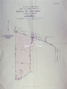 Eltham District Historical Society Inc
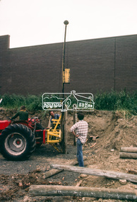
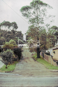
Slide - Photograph, Eltham Shire Council, Plan of Subdivision, Part of Crown Portion 3, Parish of Nillumbik, County of Bourke, 1969
35mm colour positive transparency blue Agfacolour Service plastic mountB3 Robinson prelim subdivision, View Road, 4 August 1969infrastructure, map, planning, subdivison lots, rattray road -
 Eltham District Historical Society Inc
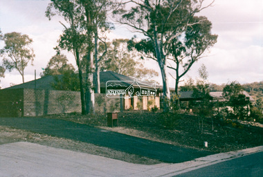
Slide - Photograph, Unidentified residential scene, c.Jun. 1985
35mm colour positive transparency (1 of 15) Mount - Kodak Kodachrome CardLen Big Topinfrastructure, residential, road drainage, roads, unidentified -
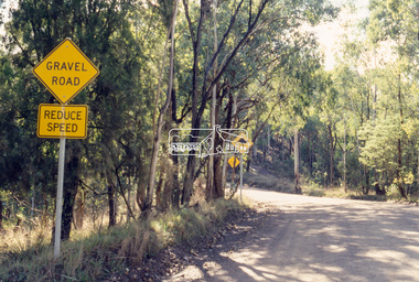 Eltham District Historical Society Inc
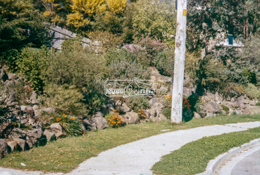
Slide - Photograph, Unidentified rural road within the Shire of Eltham, c.May 1988
Located bewteen Watson's Creek Antiques, Eltham-Yarra Glen Road and Panton Hill Memorial Park35mm colour positive transparency (1 of 25) Mount - Kodak EktachromeProcess Date MAY 88Minfrastructure, roads, shire of eltham, unidentified, rural road -
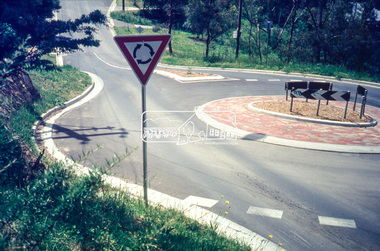 Eltham District Historical Society Inc
Slide - Photograph, Ryans Road, Eltham, c.1989
Ryans Road was reconstructed and sealed to the north of Kerrie Crescent in 1983. Roundabout and southern reconstruction added later. This photo is probably shortly after construction of roundabout.35mm colour positive transparency Mount - Black and Whiteeltham, infrastructure, kerrie crescent, roundabout, ryans roads -
 Eltham District Historical Society Inc
Slide - Photograph, Ryans Road, Eltham, c.1989
Ryans Road was reconstructed and sealed to the north of Kerrie Crescent in 1983. Roundabout and southern reconstruction added later. This photo is probably shortly after construction of roundabout.35mm colour positive transparency Mount - Black and Whiteeltham, infrastructure, ryans roads, burd street, meruka drive -
 Eltham District Historical Society Inc
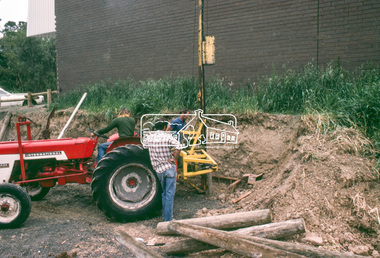
Slide - Photograph, Construction of Public Toilet, Research, c.Dec. 1980
Pile driving treated pine poles, Research Comfort Station, c.Dec. 198035mm colour positive transparency Mount - Kodak Kodachrome Cardinfrastructure, public toilets, research (vic.), research comfort station, construction -
 Eltham District Historical Society Inc
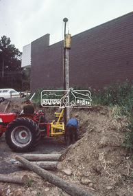
Slide - Photograph, Construction of Public Toilet, Research, c.Dec. 1980
35mm colour positive transparency Mount - Kodak Kodachrome Cardinfrastructure, public toilets, research (vic.), research comfort station, construction -
 Eltham District Historical Society Inc
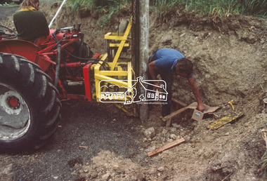
Slide - Photograph, Construction of Public Toilet, Research, c.Dec. 1980
Pile driving treated pine poles, Research Comfort Station, c.Dec. 198035mm colour positive transparency Mount - Kodak Kodachrome Cardinfrastructure, public toilets, research (vic.), research comfort station, construction -
 Eltham District Historical Society Inc
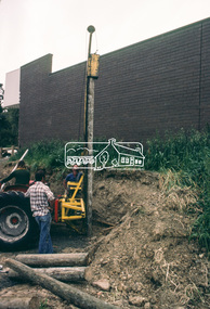
Slide - Photograph, Construction of Public Toilet, Research, c.Dec. 1980
Pile driving treated pine poles, Research Comfort Station, c.Dec. 198035mm colour positive transparency Mount - Kodak Kodachrome Cardinfrastructure, public toilets, research (vic.), research comfort station, construction -
 Eltham District Historical Society Inc
Slide - Photograph, John Street, Eltham, c.Jun. 1986
35mm colour positive transparency (1 of 7) Mount - Kodak Kodachrome CardProcess Date JUN 86Mbible street, eltham, john street, roads, infrastructure -
 Eltham District Historical Society Inc
Slide - Photograph, Brougham Street, Eltham, c.Aug. 1978
35mm colour positive transparency Mount - Grey and Whitebrougham steet, brougham steet bridge, eltham, infrastructure, roads -
 Eltham District Historical Society Inc
Slide - Photograph, John Street, Eltham, c.Aug. 1978
35mm colour positive transparency Mount - Grey and Whiteinfrastructure, roads, bible street, eltham, john street -
 Eltham District Historical Society Inc
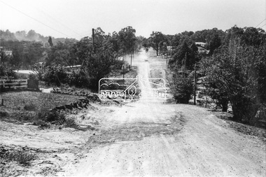
Photograph, Brougham Street, Eltham, c. Sep. 1966
Taken from alongside the Justice Precinct looking east. In the distance on the right hand verge there is a large Eucalyptus tree with a branch growing out over the road. That tree still stands today and is outside No. 102. The two houses on the right are possibly numbers 94 and 96.Black and white photographic printOriginally located in a Filmpro King Size Prints processing envelope $3.01 Shire of Eltham 9/9/66 and noted as Calrossie Ave area and crossed out Eltham-Yarra Glen Road, Bridge Street to Elsa Court existing conditions mid 1967brougham street, eltham, infrastructure, road construction, roads -
 Eltham District Historical Society Inc
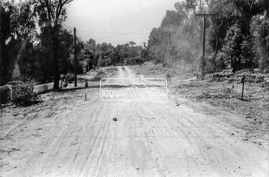
Photograph, Brougham Street, Eltham, c. Sep. 1966
Looking east No. 117. Large tree on left near electric pole still standing today in front of No. 121.Black and white photographic printOriginally located in a Filmpro King Size Prints processing envelope $3.01 Shire of Eltham 9/9/66 and noted as Calrossie Ave area and crossed out Eltham-Yarra Glen Road, Bridge Street to Elsa Court existing conditions mid 1967brougham street, eltham, infrastructure, road construction, roads -
 Eltham District Historical Society Inc
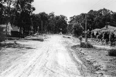
Photograph, Bridge Street, Eltham, c. Sep. 1966
Last house on right is No. 122. The three houses on right remain relatively original in present time, the two visible houses on left have been substantially altered or replaced. Bridge Street ended at this point but has since been further extended eastBlack and white photographic printOriginally located in a Filmpro King Size Prints processing envelope $3.01 Shire of Eltham 9/9/66 and noted as Calrossie Ave area and crossed out Eltham-Yarra Glen Road, Bridge Street to Elsa Court existing conditions mid 1967eltham, infrastructure, road construction, roads, bridge street -
 Eltham District Historical Society Inc
Slide, Price Avene, Montmorency, Oct. 1980
35mm colour positive transparency (1 of 24) Mount - Kodak Kodachrome Cardinfrastructure, lilicur road, montmorency, price avenue, roads