Showing 10944 items matching " plan"
-
 Federation University Historical Collection
Plan, Ballarat School of Mines M.B John Building, c1984, c1984
This building, known as the M.B. John Building, was refurbished to house Ballarat Tech in 2018.Two plans for the new Ballarat School of Mines Trades building named the M.B. John Building. The building fronts Albert Street, Ballarat.ewan jones, ewan jones and associates, architects, m.b. john building, ballarat tech school, architectural plan, ballarat school of mines, buildings -
Vision Australia
Plan - Text, Allom Lovell and Associates, RVIB Conservation Management plan, 2002
Commissioned by the RVIB, this Conservation Management plan provides an assessment of the cultural significance of the buildings and develop conservation policies around future management of the site.1 CD with 1 Word fileroyal victorian institute for the blind, buildings -
 Ringwood and District Historical Society
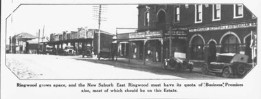
Photograph, 1925 - Ringwood East Railway Station Estate. Photo taken from subdivisional plan land sale
Catalogue card reads, "1925 - Ringwood East Railway Station Estate. Photo taken from subdivisional plan land sale." -
Kew Historical Society Inc
Archive (Sub-series) - Subject File, Foster Parents Plan (Kew), 1980
Various partiesReference, Research, InformationSecondary Values (KHS Imposed Order)Single item subject file, with a newspaper article/clipping stating that the organisation Foster Parents Plan of Australia (PLAN) was located on the corner of Cotham and Highbury Grove. The organisation was located in what had been the Kew Presbyterian Church.kew (vic) - history, social welfare - kew (vic), child services - kew (vic)kew (vic) - history, social welfare - kew (vic), child services - kew (vic) -
 Rutherglen Historical Society
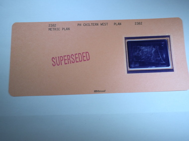
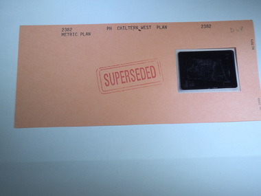
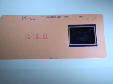
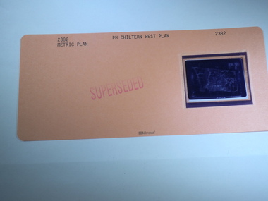
Aperture Card microfilm, Victorian Land Tiltes Office, Parish Plan Chiltern West (Superseded)
Parish Schedule of Chiltern Westcard with a single microfilm insertplan, lots, roads, boundary -
 Rutherglen Historical Society
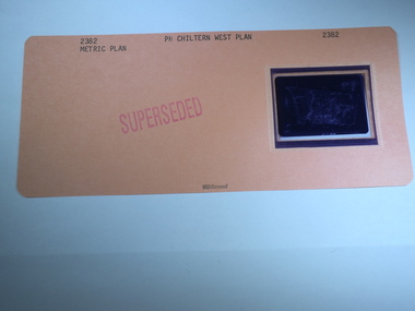
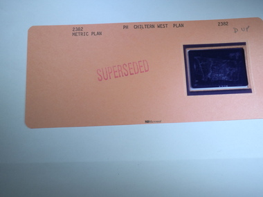
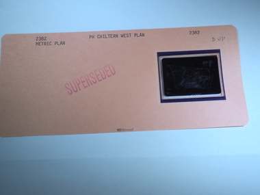
Aperture Card microfilm, Victorian Land Tiltes Office, Parish Plan Chiltern West (Superseded)
Parish Schedule of Chiltern Westcard with a single microfilm insertplan, lots, roads, boundary -
 Rutherglen Historical Society
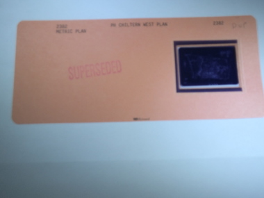
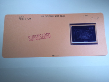
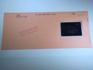
Aperture Card microfilm, Victorian Land Tiltes Office, Parish Plan Chiltern West (Superseded)
Parish Schedule of Chiltern Westcard with a single microfilm insertplan, lots, roads, boundary -
 Rutherglen Historical Society
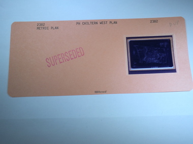
Aperture Card microfilm, Victorian Land Tiltes Office, Parish Plan Chiltern West (Superseded)
Parish Schedule of Chiltern Westcard with a single microfilm insertplan, lots, roads, boundary -
 Rutherglen Historical Society
Aperture Card microfilm, Victorian Land Tiltes Office, Parish Plan Chiltern West (Superseded)
Parish Schedule of Chiltern Westcard with a single microfilm insertplan, lots, roads, boundary -
 Rutherglen Historical Society
Aperture Card microfilm, Victorian Land Tiltes Office, Parish Plan Chiltern West (Superseded)
Parish Schedule of Chiltern Westcard with a single microfilm insertplan, lots, roads, boundary -
 Rutherglen Historical Society
Aperture Card microfilm, Victorian Land Tiltes Office, Parish Plan Chiltern West (Superseded)
Parish Schedule of Chiltern Westcard with a single microfilm insertplan, lots, roads, boundary -
 Rutherglen Historical Society
Aperture Card microfilm, Victorian Land Tiltes Office, Parish Plan Chiltern West (Superseded)
Parish Schedule of Chiltern Westcard with a single microfilm insertplan, lots, roads, boundary -
 Rutherglen Historical Society
Aperture Card microfilm, Victorian Land Tiltes Office, Parish Plan Chiltern West (Superseded)
Parish Schedule of Chiltern Westcard with a single microfilm insertplan, lots, roads, boundary -
 Rutherglen Historical Society
Aperture Card microfilm, Victorian Land Tiltes Office, Parish Plan Chiltern West (Superseded)
Parish Schedule of Chiltern Westcard with a single microfilm insertplan, lots, roads, boundary -
 Rutherglen Historical Society
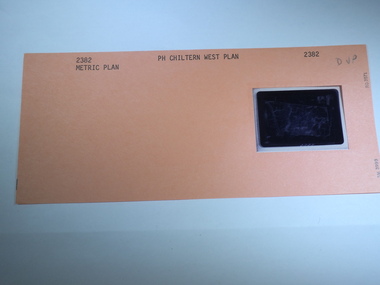
Aperture Card microfilm, Victorian Land Tiltes Office, Parish Plan Chiltern West
Parish Schedule of Chiltern Westcard with a single microfilm insertplan, lots, roads, boundary -
 Rutherglen Historical Society
Aperture Card microfilm, Victorian Land Tiltes Office, Parish Plan Chiltern West (Superseded)
Parish Schedule of Chiltern Westcard with a single microfilm insertplan, lots, roads, boundary -
 Rutherglen Historical Society
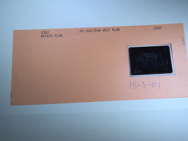
Aperture Card microfilm, Victorian Land Tiltes Office, Parish Plan Chiltern West, 15/03/2001
Parish Schedule of Chiltern Westcard with a single microfilm insertplan, lots, roads, boundary -
 Federation University Historical Collection
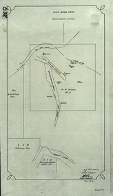
Plan, King River Mine, 1932, 12/1932
Copy of a plan of King River Mine.mount lyell, king river, mining, tasmania, king river mine, k.m. white, h. turner, k.j. finnacane, blake -
 Federation University Historical Collection
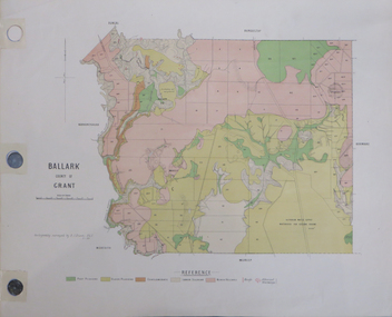
Plan, Ballark: County of Grant, 05/01/1889
A geological plan of Ballark in the County of Grant.moreep, mount wallace, ballark -
Stawell Historical Society Inc
Map, Stawell Gold Mine, Provisional Plan Wonga Area, c1980
c1980 Preliminary Provisional Reconnaissance Plan Showing Workings Above and Below water LevelWonga Area 1:1000 Base Geological Sheet mining, gold, map -
Whitehorse Historical Society Inc.
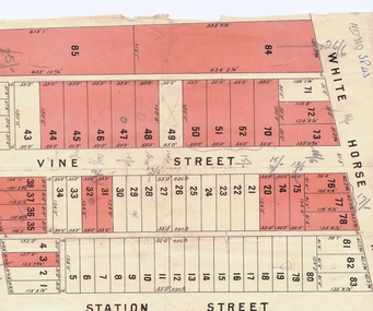
Map, Plan, 1939
Plan of subdivision, part of crown portion 83A and 83, Parish of Nunawading, County of BourkePlan of subdivision, part of crown portion 83A and 83, Parish of Nunawading, County of BourkePlan of subdivision, part of crown portion 83A and 83, Parish of Nunawading, County of Bourkestreet names, parish of nunawading, station street, blackburn, railway road, blackburn, vine street, blackburn, south parade, blackburn, laburnum street, blackburn, main street, blackburn, gardenia street, blackburn, the avenue, blackburn, fuschia street, blackburn, linum street, blackburn -
Whitehorse Historical Society Inc.
Article, Knox Opposes Plan to Rezone Freeway Reserve, 11/08/1992 12:00:00 AM
Nunawading's plan to rezone part of the Healesville Freeway Reservation is opposed by Knox City Council.Nunawading's plan to rezone part of the Healesville Freeway Reservation is opposed by Knox City Council.Nunawading's plan to rezone part of the Healesville Freeway Reservation is opposed by Knox City Council.freeways, city of nunawading, city of knox, atkins, adrian -
 Whitehorse Historical Society Inc.
Document, Plan of Blackburn
Copy of plan of Blackburn areaCopy of plan of Blackburn area bounded by Whitehorse Road, Station Street and Railway ParadeCopy of plan of Blackburn arealand subdivision, blackburn, whitehorse road, station street, railway road, vine street -
Whitehorse Historical Society Inc.
Article, Lake residents reject big plan, 2014
160 residents have objected to plans for a $70,000,000 retirement village near Blackburn Lake.160 residents have objected to plans for a $70,000,000 retirement village near Blackburn Lake.160 residents have objected to plans for a $70,000,000 retirement village near Blackburn Lake.seventh day adventist church, blackburn lake sanctuary, central road blackburn -
Whitehorse Historical Society Inc.
Article, Farm Plan Under Way, 1992?
Nunawading Council has appointed consultants to develop a management plan for the historic Matheson orchard.Nunawading Council has appointed consultants to develop a management plan for the historic Matheson orchard.Nunawading Council has appointed consultants to develop a management plan for the historic Matheson orchard.matheson orchard, city of nunawading, matheson family, strathdon homestead -
University of Melbourne, Burnley Campus Archives
Plan, Grace Park Feature Plan, 1901-1983
(1) City of Hawthorn plan dated August 1983. Drawing No P12/24 Sheet 1 of 1. Surveyed: L.B. & H.K. Traced H.K. Scale 1:500. (2) Photocopy of map of area, Grace Park coloured in. 1901 handwritten on page.hawthorn, grace park -
University of Melbourne, Burnley Campus Archives
Plan, Plan of Richmond Park, 1872
Plan of Richmond Park L4461. Shows Horticultural Society's Garden without extra land used for Field Station (see 11.0363, but earlier). Surveyed and drawn by A.L. Martin, Authorized Surveyor. Photo-lithographed at the Department of Lands and Survey, 6th Sept. 1872.Handwritten notes on reverse and another railway line marked in pencil.railway lines, swan street, yarra river, richmond park, horticultural society, orchard -
University of Melbourne, Burnley Campus Archives
Plan - Photocopy, Royal Park Landscape Development Plan, 1985
Photocopies of plans prepared for the City of Melbourne, November 1985 by Laceworks Landscape Collaborative Maunsell and Partners. (1) P & G DRG No 3/11 1 Longterm Parking Zoo. (2) P & G DRG No 3/12 0 Existing Conditionsroyal park, landscape, city of melbourne, zoological gardens, laceworks landscape collaborative maunsell and partners -
 Melbourne Tram Museum
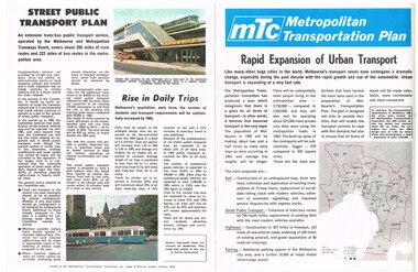
Pamphlet, The Metropolitan Transportation Committee, "Metropolitan Transportation Plan - Rapid Expansion of Urban Transport", c1968-69
Pamphlet full colour, four pages, printed on off white paper titled "Metropolitan Transportation Plan - Rapid Expansion of Urban Transport", issued by the Metropolitan Transportation Committee, c1968 - 69, explaining the planning of the Committee for Melbourne's transport in 1985. Looks at the future of Melbourne's rail, bus, tram and road network. Includes the survey and implementation. See Reg Item 623 for part of the final plan.trams, tramways, melbourne, road transport, tramways, railways, public transport, transportation plan -
 Ringwood and District Historical Society
Pamphlet, Land Sale Brochure Titled Eureka Plan Book - Seven Delightful & Valuable Ringwood Estates - circa 1925
Twenty page land sale brochure including photographs, subdivision features and local facilities. Additional flyer with conditions of sale and prices for estate blocks.Seven delightful and valuable Ringwood Estates called Bestpart, Paradise, Hill Top, Greenwood, Creek, Station, and School Estates. These nestle amidst the hills and valleys of beautiful Ringwood district. Also Goodluck Estate at Clarinda. Pamphlet marked as being From Mr. Farmer, No. 5 Flinders Court, Melbourne. Phone 988, 989 Central, or 55 Ringwood after 7 p.m. Plan of Ringwood School Estate includes William Street (later Kendall Street), Greenwood Avenue, Alton Street and Locke Street. Plan of Bestpart Estate, Ringwood, includes Bedford Road, Wilana Street, Greenwood Avenue, Caroline Street, Henry Street and Haig Street. Plan of Ringwood Station Estate includes Pitt Street, Bedford Road, Greenwood Avenue, Station Street, William Street (later Kendall Street, James Street, Wantirna Road, Caroline Street, Henry Street, Ellison Street and Haig Street. Plan of Geenwood Estate, Ringwood, includes Prussian Road (later Geenwood Avenue). Plan of Paradise Estate, Ringwood, includes Canterbury Road, Dandenong Road (Wantirna Road), Luck Street and Paradise Road. Plan of Creek Estate, Ringwood, includes Dandenong Creek, Wantirna Road and Gordon Crescent. Plan of Hill Top Estate, Ringwood (later Heathmont area), includes Heathmont Railway Station, Heathmont Road, Balfour Avenue, Lilian Street, Edith Street, Edna Street and Great Ryrie Street. Plan of Goodluck Estate, Clarinda, includes Talbot Avenue, Good Street, Luck Street, and Centre Road in locality plan between Oakleigh and Clayton Railway Stations.