Showing 38899 items matching "2016-10-13"
-
 Eltham District Historical Society Inc
Photograph, Liz Pidgeon, Heritage Excursion; Maroondah Aqueduct, 3 September 2016, 3 September 2016
Newsletter No., 229, August 2016 Heritage Excursion - Maroondah Aqueduct Walk - Saturday 3rd September The Maroondah Aqueduct was once a major link in Melbourne’s water supply system. It was built between 1886 and 1891 to transfer water from the Watts River near Healesville to the Preston Reservoir. It was 66 km in length, made up of 41 km of open channel, 10 km of tunnel through hills and 15 km of pipeline across stream valleys known as inverted siphons. The section of the aqueduct through the Eltham area has been abandoned since the 1980s but the open channel has largely been retained. A recreational path follows the aqueduct reserve. For our excursion on 3rd September we intend to walk along the section of the aqueduct adjacent to Allendale Road. This is a section not visited on previous excursions and includes the transition from open channel to the inverted siphon across the Diamond Creek valley. Apart from the aqueduct itself the main feature of the walk is the extensive views across Eltham North and Diamond Creek. Along the way we will talk about the history of the aqueduct and the area. This easy walk is about 3 km return and will take 2 to 2.5 hours. It will start at 2pm at the junction of Allendale Road with Godber Road and Zig Zag Road North, officially Diamond Creek, but on the northern boundary of Eltham. (Melway ref.12 B10). Born Digitalmaroondah aqueduct, eltham north, activities, eltham district historical society, heritage excursion, aqueduct trail, open channel, pipe -
 Eltham District Historical Society Inc
Photograph, Liz Pidgeon, Heritage Excursion; Maroondah Aqueduct, 3 September 2016, 3 September 2016
Newsletter No., 229, August 2016 Heritage Excursion - Maroondah Aqueduct Walk - Saturday 3rd September The Maroondah Aqueduct was once a major link in Melbourne’s water supply system. It was built between 1886 and 1891 to transfer water from the Watts River near Healesville to the Preston Reservoir. It was 66 km in length, made up of 41 km of open channel, 10 km of tunnel through hills and 15 km of pipeline across stream valleys known as inverted siphons. The section of the aqueduct through the Eltham area has been abandoned since the 1980s but the open channel has largely been retained. A recreational path follows the aqueduct reserve. For our excursion on 3rd September we intend to walk along the section of the aqueduct adjacent to Allendale Road. This is a section not visited on previous excursions and includes the transition from open channel to the inverted siphon across the Diamond Creek valley. Apart from the aqueduct itself the main feature of the walk is the extensive views across Eltham North and Diamond Creek. Along the way we will talk about the history of the aqueduct and the area. This easy walk is about 3 km return and will take 2 to 2.5 hours. It will start at 2pm at the junction of Allendale Road with Godber Road and Zig Zag Road North, officially Diamond Creek, but on the northern boundary of Eltham. (Melway ref.12 B10). Born Digitalmaroondah aqueduct, eltham north, activities, eltham district historical society, heritage excursion, aqueduct trail -
 Eltham District Historical Society Inc
Photograph, Liz Pidgeon, Heritage Excursion; Maroondah Aqueduct, 3 September 2016, 3 September 2016
Newsletter No., 229, August 2016 Heritage Excursion - Maroondah Aqueduct Walk - Saturday 3rd September The Maroondah Aqueduct was once a major link in Melbourne’s water supply system. It was built between 1886 and 1891 to transfer water from the Watts River near Healesville to the Preston Reservoir. It was 66 km in length, made up of 41 km of open channel, 10 km of tunnel through hills and 15 km of pipeline across stream valleys known as inverted siphons. The section of the aqueduct through the Eltham area has been abandoned since the 1980s but the open channel has largely been retained. A recreational path follows the aqueduct reserve. For our excursion on 3rd September we intend to walk along the section of the aqueduct adjacent to Allendale Road. This is a section not visited on previous excursions and includes the transition from open channel to the inverted siphon across the Diamond Creek valley. Apart from the aqueduct itself the main feature of the walk is the extensive views across Eltham North and Diamond Creek. Along the way we will talk about the history of the aqueduct and the area. This easy walk is about 3 km return and will take 2 to 2.5 hours. It will start at 2pm at the junction of Allendale Road with Godber Road and Zig Zag Road North, officially Diamond Creek, but on the northern boundary of Eltham. (Melway ref.12 B10). Born Digitalmaroondah aqueduct, eltham north, activities, eltham district historical society, heritage excursion, aqueduct trail, russell yeoman -
 Eltham District Historical Society Inc
Photograph, Liz Pidgeon, Heritage Excursion; Maroondah Aqueduct, 3 September 2016, 3 September 2016
Newsletter No., 229, August 2016 Heritage Excursion - Maroondah Aqueduct Walk - Saturday 3rd September The Maroondah Aqueduct was once a major link in Melbourne’s water supply system. It was built between 1886 and 1891 to transfer water from the Watts River near Healesville to the Preston Reservoir. It was 66 km in length, made up of 41 km of open channel, 10 km of tunnel through hills and 15 km of pipeline across stream valleys known as inverted siphons. The section of the aqueduct through the Eltham area has been abandoned since the 1980s but the open channel has largely been retained. A recreational path follows the aqueduct reserve. For our excursion on 3rd September we intend to walk along the section of the aqueduct adjacent to Allendale Road. This is a section not visited on previous excursions and includes the transition from open channel to the inverted siphon across the Diamond Creek valley. Apart from the aqueduct itself the main feature of the walk is the extensive views across Eltham North and Diamond Creek. Along the way we will talk about the history of the aqueduct and the area. This easy walk is about 3 km return and will take 2 to 2.5 hours. It will start at 2pm at the junction of Allendale Road with Godber Road and Zig Zag Road North, officially Diamond Creek, but on the northern boundary of Eltham. (Melway ref.12 B10). Born Digitalmaroondah aqueduct, eltham north, activities, eltham district historical society, heritage excursion, aqueduct trail -
 Eltham District Historical Society Inc
Photograph, Liz Pidgeon, Heritage Excursion; Maroondah Aqueduct, 3 September 2016, 3 September 2016
Newsletter No., 229, August 2016 Heritage Excursion - Maroondah Aqueduct Walk - Saturday 3rd September The Maroondah Aqueduct was once a major link in Melbourne’s water supply system. It was built between 1886 and 1891 to transfer water from the Watts River near Healesville to the Preston Reservoir. It was 66 km in length, made up of 41 km of open channel, 10 km of tunnel through hills and 15 km of pipeline across stream valleys known as inverted siphons. The section of the aqueduct through the Eltham area has been abandoned since the 1980s but the open channel has largely been retained. A recreational path follows the aqueduct reserve. For our excursion on 3rd September we intend to walk along the section of the aqueduct adjacent to Allendale Road. This is a section not visited on previous excursions and includes the transition from open channel to the inverted siphon across the Diamond Creek valley. Apart from the aqueduct itself the main feature of the walk is the extensive views across Eltham North and Diamond Creek. Along the way we will talk about the history of the aqueduct and the area. This easy walk is about 3 km return and will take 2 to 2.5 hours. It will start at 2pm at the junction of Allendale Road with Godber Road and Zig Zag Road North, officially Diamond Creek, but on the northern boundary of Eltham. (Melway ref.12 B10). Born Digitalmaroondah aqueduct, eltham north, activities, eltham district historical society, heritage excursion, aqueduct trail, open channel -
 Eltham District Historical Society Inc
Photograph, Liz Pidgeon, Heritage Excursion; Maroondah Aqueduct, 3 September 2016, 3 September 2016
Newsletter No., 229, August 2016 Heritage Excursion - Maroondah Aqueduct Walk - Saturday 3rd September The Maroondah Aqueduct was once a major link in Melbourne’s water supply system. It was built between 1886 and 1891 to transfer water from the Watts River near Healesville to the Preston Reservoir. It was 66 km in length, made up of 41 km of open channel, 10 km of tunnel through hills and 15 km of pipeline across stream valleys known as inverted siphons. The section of the aqueduct through the Eltham area has been abandoned since the 1980s but the open channel has largely been retained. A recreational path follows the aqueduct reserve. For our excursion on 3rd September we intend to walk along the section of the aqueduct adjacent to Allendale Road. This is a section not visited on previous excursions and includes the transition from open channel to the inverted siphon across the Diamond Creek valley. Apart from the aqueduct itself the main feature of the walk is the extensive views across Eltham North and Diamond Creek. Along the way we will talk about the history of the aqueduct and the area. This easy walk is about 3 km return and will take 2 to 2.5 hours. It will start at 2pm at the junction of Allendale Road with Godber Road and Zig Zag Road North, officially Diamond Creek, but on the northern boundary of Eltham. (Melway ref.12 B10). Born Digitalmaroondah aqueduct, eltham north, activities, eltham district historical society, heritage excursion -
 Eltham District Historical Society Inc
Photograph, Liz Pidgeon, Heritage Excursion; Maroondah Aqueduct, 3 September 2016, 3 September 2016
Newsletter No., 229, August 2016 Heritage Excursion - Maroondah Aqueduct Walk - Saturday 3rd September The Maroondah Aqueduct was once a major link in Melbourne’s water supply system. It was built between 1886 and 1891 to transfer water from the Watts River near Healesville to the Preston Reservoir. It was 66 km in length, made up of 41 km of open channel, 10 km of tunnel through hills and 15 km of pipeline across stream valleys known as inverted siphons. The section of the aqueduct through the Eltham area has been abandoned since the 1980s but the open channel has largely been retained. A recreational path follows the aqueduct reserve. For our excursion on 3rd September we intend to walk along the section of the aqueduct adjacent to Allendale Road. This is a section not visited on previous excursions and includes the transition from open channel to the inverted siphon across the Diamond Creek valley. Apart from the aqueduct itself the main feature of the walk is the extensive views across Eltham North and Diamond Creek. Along the way we will talk about the history of the aqueduct and the area. This easy walk is about 3 km return and will take 2 to 2.5 hours. It will start at 2pm at the junction of Allendale Road with Godber Road and Zig Zag Road North, officially Diamond Creek, but on the northern boundary of Eltham. (Melway ref.12 B10). Born Digitalmaroondah aqueduct, eltham north, activities, eltham district historical society, heritage excursion, aqueduct trail -
 Eltham District Historical Society Inc
Photograph, Liz Pidgeon, Heritage Excursion; Maroondah Aqueduct, 3 September 2016, 3 September 2016
Newsletter No., 229, August 2016 Heritage Excursion - Maroondah Aqueduct Walk - Saturday 3rd September The Maroondah Aqueduct was once a major link in Melbourne’s water supply system. It was built between 1886 and 1891 to transfer water from the Watts River near Healesville to the Preston Reservoir. It was 66 km in length, made up of 41 km of open channel, 10 km of tunnel through hills and 15 km of pipeline across stream valleys known as inverted siphons. The section of the aqueduct through the Eltham area has been abandoned since the 1980s but the open channel has largely been retained. A recreational path follows the aqueduct reserve. For our excursion on 3rd September we intend to walk along the section of the aqueduct adjacent to Allendale Road. This is a section not visited on previous excursions and includes the transition from open channel to the inverted siphon across the Diamond Creek valley. Apart from the aqueduct itself the main feature of the walk is the extensive views across Eltham North and Diamond Creek. Along the way we will talk about the history of the aqueduct and the area. This easy walk is about 3 km return and will take 2 to 2.5 hours. It will start at 2pm at the junction of Allendale Road with Godber Road and Zig Zag Road North, officially Diamond Creek, but on the northern boundary of Eltham. (Melway ref.12 B10). Born Digitalmaroondah aqueduct, eltham north, activities, eltham district historical society, heritage excursion, aqueduct trail -
 Eltham District Historical Society Inc
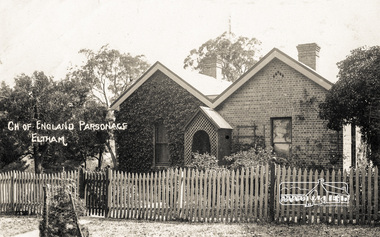
Photograph postcard, St Margaret's Rectory, Eltham; postcard stamped and dated Eltham 10 July 1909
Digital file only Postcards scanned from the collection of Michael Aitken on loan to EDHS, 13 Feb 2018michael aitken collection, postcards, eltham, pitt street, st margaret's anglican church, dendy house -
 Greensborough Historical Society
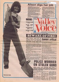
Newspaper, The Valley Voice, The Valley Voice, No. 28, 10 January 1979, 10/01/1979
Complete copy of The Valley Voice, 10 January 1979. Contains local news in the Shire of Diamond Valley.16 p. black & white & colour. shire of diamond valley -
 Tatura Irrigation & Wartime Camps Museum
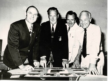
Photograph, POW 13 Reunion 1974, 1947
Left to Right - Cpl K. Stratewski, Sgt G. R. Campbell (guard), Pte Heinz Pexa (organiser), Lt. Commander Heinrich Messerschmidt, looking at photos on a table. Black and white photograph of POW 13 reunion in Hampton Victoria 1974. 4 men looking over a display of photographs. 2 on left, dark blazers 2 on right white jacket and white shirt.g campbell, k stratewski, heinz pexa, heinrich messerschmidt -
 Tatura Irrigation & Wartime Camps Museum
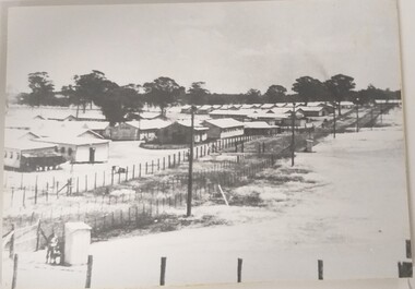
Photograph, Camp 13, 1989 copy
Copy of black and white photograph of early stage of Camp 13.Copy of black and white photograph of pre fabricated huts in fenced off area. Sentry box and guard near gate in foreground, trees in background.camp 13, murchison victoria, internment camps, internment camp buildings -
 Tatura Irrigation & Wartime Camps Museum
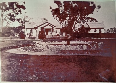
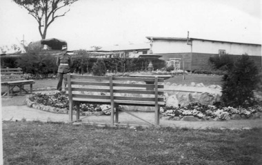
Photograph, Camp 13 Garden
Shows the gardens in front of some of the administration buildings at camp 13.Black and white photograph of large circular pond with fountain in centre. 2 buildings, much different from the normal. Gum tree between them and of to the left.camp gardens, camp 13 gardens, camp 13 admin -
 Tatura Irrigation & Wartime Camps Museum
Photograph, Camp 13 Reunion
Camp 13 Murchison Reunion of ex guards and pow's in 1974 1 Black and white photograph of Gerhard Kruger, wearing a tartan tie check shirt, pen in right hand. gerhard kruger, murchison, camp 13 murchison, camp reunions -
 Stawell Historical Society Inc
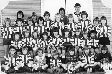
Photograph, North U/13 Football Team Runners-up 1978 -- Named
North U/13 Football Team Runners-up 1978stawell sport -
 Stawell Historical Society Inc
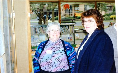
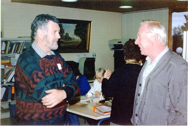
Photograph, Biarri 10 Year Certificate Presentation
7126-1: Lelie Bennett, Mayoress Anne gardiner. 7126-1A: Betty rouch, Jen Coote. 7126-1B: John & Mrs Grey. 7126-1C: Sandra Horne, Jeane Skurrie. 7126-1D: June Radford, Jeanne Skurrie. 7126-1E: Shane Wegener, COral Eagles, Tracy Wegener, 7126-1F: Rae Smith,. 7126-1G: Sandra Horne & Daughter, Jen Radford (Back). 7126-1H: Shane wegener, Gail Wood (Libraian) 7126-1I: Don Gardiner, Elenor Musumeci. 7126-1J Beryle Cox, Rae Smith looking at the Slorach Family Tree. 7126-1K: Beryl Cox, Doug Hately (President), Rae Smith.43 Colour Photographs. Showing various peole at the 10 year celebrations.biarri -
 Stawell Historical Society Inc
Photograph, Biarri 10 Year Certificate Presentation
7126-2: Ian Howell, Darol Walstaff. 7126-2A: Ellenor Musumeci, Don Gardiner, June Radford. 7126-2B: Janine Skurrie, Darol Walstaff, Ian Howell, Jill Riddler, Terry Howell. 7126-2C: Beryl Cox, Sandra Horne, Jeanie Skurrie, June Radford (Back). 7126-2D: Don Gardiner, Doug Hately. 7126-2E: Doug Hately, Sandra Horne & Daughter. June Radford (Back). 7126-2F: Don Gariner, Coral Eagles, June Radford, doug Hately. 7126-2G: Beryl Cox with her boo "Slorach's From Scotland.43 Colour Photographs Showing various people at the 10 year celebrations. -
 Stawell Historical Society Inc
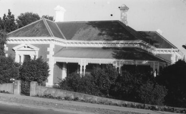
Photograph, Hobbs Family House at 10 Seaby Street Stawell 1997
Built by Mary Ellen Hobbs of Seaby Street widow of William Hobbs.B/W photograph of substantial brick home at 10 Seaby Street. stawell -
 National Vietnam Veterans Museum (NVVM)
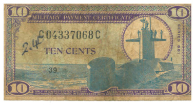
Currency, State Bank of Vietnam, Military Payment Certificate, 10 Cents, 1962-1978
Military Payment Certificate, 10 Cents, purple & green, #C04337068C-39currency, military payment certificates, julian peter mcnamara, mcnamara, australian army, 3794332, trooper, royal australian armoured corps, national service, b squadron, a squadron, 1st armoured regiment -
 National Vietnam Veterans Museum (NVVM)
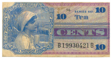
Currency, State Bank of Vietnam USA, Military Payment Certificate, 10 Cents, 1962-1978
Military Payment Certificate, 10 Cents, blue & purple, #B19930421B-56currency, military payment certificates, julian peter mcnamara, mcnamara, australian army, 3794332, trooper, royal australian armoured corps, national service, b squadron, a squadron, 1st armoured regiment -
 Stawell Historical Society Inc
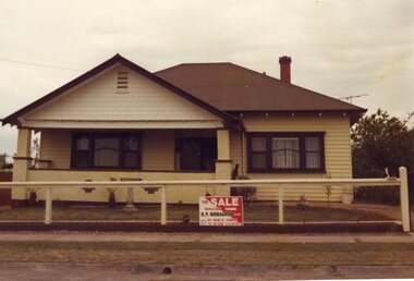
Photograph, 13 Campbell Street
Colour Photpgraph: White House with Brown Iron Roof, with hald length Veandah with brick wall. Wood & Wire fence in foreground, a For sile sign on fenceSign reads: For Sale Inspection ??? R P Monaghan Ltd ( 2 Phone Numbers) On Reverse: 1985/86 13 Campbell Streetcampbell street -
 Melbourne Tram Museum
Document - List, Melbourne & Metropolitan Tramways Board (MMTB), "Trams due for Overhaul as at 1-10-66", 1/10/1966 12:00:00 AM
List or report - four foolscap sheets, photocopied, possibly on heat sensitive paper titled "Trams due for Overhaul as at 1-10-66", listing all trams in numerical order, giving dotes for last 01 and 02.Has in ink "Mr Hall" in top right hand cornertrams, tramways, overhauls, preston workshops, tramcars -
 Stawell Historical Society Inc
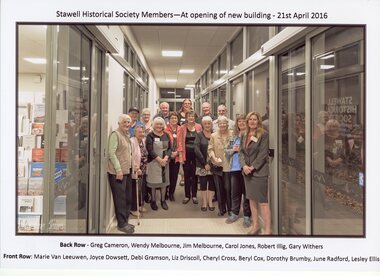
Photograph, Historical Society Members at the opening of Stawell Historical Societies "Stewart Bradley Research Centre" 2016
Historical Soc Members on opening of Stawell Historical Societies Stewart Bradley Research Centre. 2016stawell -
 Melbourne Tram Museum
Pamphlet, Public Transport Victoria (PTV), "The night network is arriving on 1 January 2016", late 2015
Pamphlet - 3 fold DL titled "The night network is arriving on 1 January 2016", giving details of the night services on trains, trams, buses and coaches. Has a diagrammatic map of services. Provides contact details, language phone numbers. Published late 2015, Two copies held.trams, tramways, night trams, public transport, ptv, buses, railways, all night services -
 Tatura Irrigation & Wartime Camps Museum
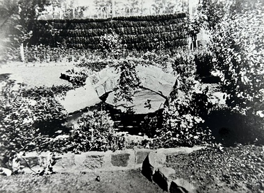
Photograph, Camp 13 Garden
The gardens at Camp 13 were attended to by the POW's and were magnificent to see.Black and white photograph of attractive gardens made by POW's. Featuring a stone edge around a garden and wall in the background.camp 13, camp compounds, camp gardens -
Tatura Irrigation & Wartime Camps Museum
Photographs - Copy, Italian POWs held in Camp 13
Photos borrowed for copying Copies of photos of Italian POW's in Camp 13.Photos copied. -
 Tatura Irrigation & Wartime Camps Museum
Photograph, Camp 13 Garrison Gardens
Camp 13 Garrison Gardens. Transport Line behind Recreation Areaphotograph, people -
4th/19th Prince of Wales's Light Horse Regiment Unit History Room
CD, Hand over parade 13 Dec 2011
CD Containing 27 still photos of parade of hand over of Commanding Officers of 4th/19th Prince of Wales's Light Horse Regiment on 13 Dec 2011 - LTCOL Ed Luisetto to LTCOL Mike Kalmscd, parade