Showing 24072 items
matching matthew-creek
-
 Stawell Historical Society Inc
Photograph, Pleasant Creek Special School, Gilmartin's Shoes, Interior Nov 1975, Nov 1975
Photographs taken by teacher at Pleasant Creek Training Centre to help train students in living skills and becoming familiar with what shops sold. Part of socializing students for leaving the training centre.Main Street Stawell. Showing shops and businesses in Main Street. education, shops, main street -
 Stawell Historical Society Inc
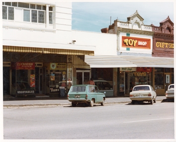
Photograph, Pleasant Creek Special School, Wimmera Cafe (Poon Ming), Dress Shop (Lois Redman), Toy Shop (Mrs John Boyd), Gift Shop (Rosemary Illig) Nov 1975, Nov 1975
Photographs taken by teacher at Pleasant Creek Training Centre to help train students in living skills and becoming familiar with what shops sold. Part of socializing students for leaving the training centre.Main Street Stawell. Showing shops and businesses in Main Street. education, shops, main street, streetscape -
 Stawell Historical Society Inc
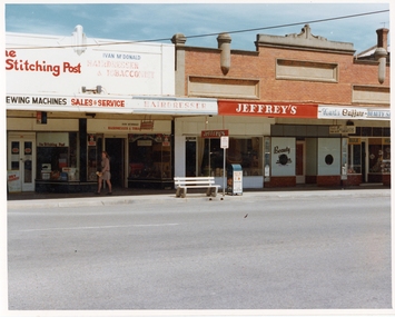
Photograph, Pleasant Creek Special School, Stitching Post - Maurie Kennedy, Ivan McDonald Men's Hairdresser, Jeffrey's Electrical, Kurts Coiffure Ladies Hairdresser, Health Food Shop - Ruthven Nov 1975, Nov 1975
Photographs taken by teacher at Pleasant Creek Training Centre to help train students in living skills and becoming familiar with what shops sold. Part of socializing students for leaving the training centre.Main Street Stawell. Showing shops and businesses in Main Street. education, shops, main street, streetscape -
 Stawell Historical Society Inc
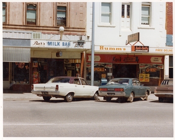
Photograph, Pleasant Creek Special School, Unknown, Brian Bartholomew's Milk Bar, Humm's Supermarket Nov 1975, Nov 1975
Photographs taken by teacher at Pleasant Creek Training Centre to help train students in living skills and becoming familiar with what shops sold. Part of socializing students for leaving the training centre.Main Street Stawell. Showing shops and businesses in Main Street. education, shops, main street, streetscape -
 Stawell Historical Society Inc
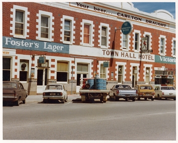
Photograph, Pleasant Creek Special School, Town Hall Hotel, Fish & Chip Shop Nov 1975, Nov 1975
Photographs taken by teacher at Pleasant Creek Training Centre to help train students in living skills and becoming familiar with what shops sold. Part of socializing students for leaving the training centre.Main Street Stawell. Showing shops and businesses in Main Street. education, shops, main street, streetscape -
 Stawell Historical Society Inc
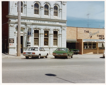
Photograph, Pleasant Creek Special School, Stawell Estate Agent - Jim Rathgeber, Stawell Times News Nov 1975, Nov 1975
Photographs taken by teacher at Pleasant Creek Training Centre to help train students in living skills and becoming familiar with what shops sold. Part of socializing students for leaving the training centre.Main Street Stawell. Showing shops and businesses in Main Street. education, shops, main street, streetscape -
 Stawell Historical Society Inc
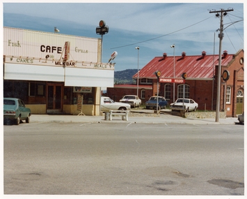
Photograph, Pleasant Creek Special School, Sheffield's Café & Milk Bar, McCracken's Holden Used Car Yard, Salvation Army Citadel Nov 1975, Nov 1975
Photographs taken by teacher at Pleasant Creek Training Centre to help train students in living skills and becoming familiar with what shops sold. Part of socializing students for leaving the training centre.Main Street Stawell. Showing shops and businesses in Main Street. education, shops, main street, streetscape -
 Stawell Historical Society Inc
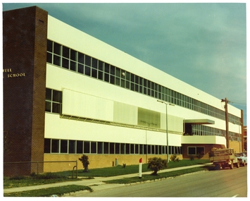
Photograph, Pleasant Creek Special School, Stawell Technical School Patrick Street Nov 1975, Nov 1975
Photographs taken by teacher at Pleasant Creek Training Centre to help train students in living skills and becoming familiar with what shops sold. Part of socializing students for leaving the training centre.Patrick Street Building education, streetscape -
 Stawell Historical Society Inc
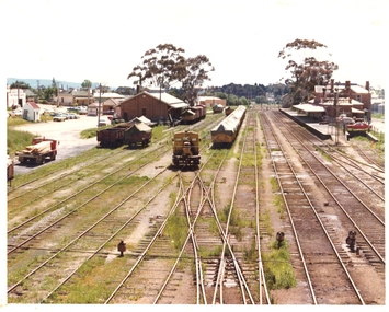
Photograph, Pleasant Creek Special School, Stawell Railway Station, Goods Shed and Railway Station Nov 1975, Nov 1975
Photographs taken by teacher at Pleasant Creek Training Centre to help train students in living skills and becoming familiar with what shops sold. Part of socializing students for leaving the training centre.Napier Street Stawell education, railways, transport, streetscape -
 Stawell Historical Society Inc
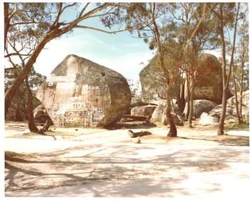
Photograph, Pleasant Creek Special School, Sister Rocks, Western Highway Stawell Nov 1975, Nov 1975
Photographs taken by teacher at Pleasant Creek Training Centre to help train students in living skills and becoming familiar with what shops sold. Part of socializing students for leaving the training centre.Western Highway education, tourism -
 Stawell Historical Society Inc
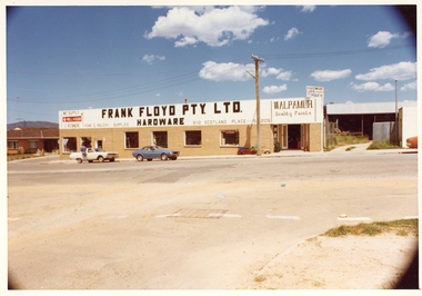
Photograph, Pleasant Creek Special School, Frank Floyd Pty Ltd. Hardware Store, Wimmera Street Stawell Nov 1975, Nov 1975
Photographs taken by teacher at Pleasant Creek Training Centre to help train students in living skills and becoming familiar with what shops sold. Part of socializing students for leaving the training centre.Wimmera Street Stawell education, streetscape -
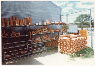
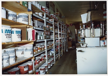
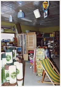
 Stawell Historical Society Inc
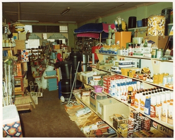
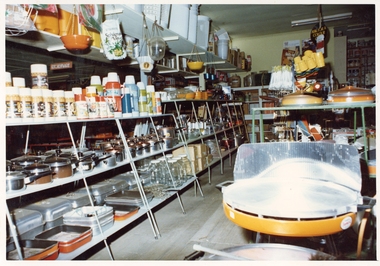
Photograph, Pleasant Creek Special School, Frank Floyd Pty Ltd. Hardware Store interior Wimmera Street Stawell Nov 1975, Nov 1975
Photographs taken by teacher at Pleasant Creek Training Centre to help train students in living skills and becoming familiar with what shops sold. Part of socializing students for leaving the training centre.Business in Wimmera Street Stawell selling hardware education -
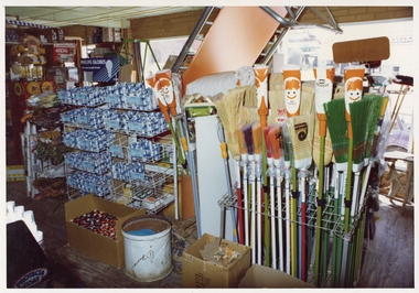
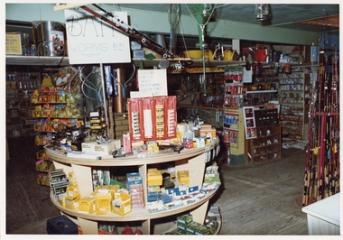
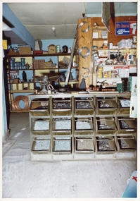
 Stawell Historical Society Inc
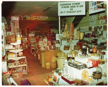
Photograph, Pleasant Creek Special School, Frank Floyd Pty Ltd. Hardware Store interior Wimmera Street Stawell Nov 1975, Nov 1975
Photographs taken by teacher at Pleasant Creek Training Centre to help train students in living skills and becoming familiar with what shops sold. Part of socializing students for leaving the training centre.Business in Wimmera Street Stawell selling hardware education -
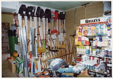
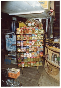
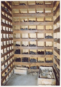
 Stawell Historical Society Inc
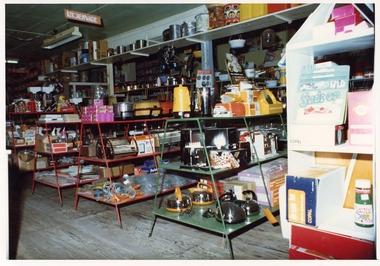
Photograph, Pleasant Creek Special School, Frank Floyd Pty Ltd. Hardware Store interior Wimmera Street Stawell Nov 1975, Nov 1975
Photographs taken by teacher at Pleasant Creek Training Centre to help train students in living skills and becoming familiar with what shops sold. Part of socializing students for leaving the training centre.Business in Wimmera Street Stawell selling hardware education -
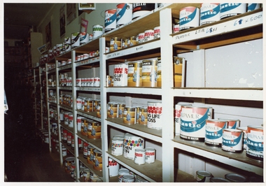
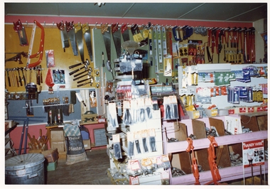
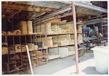
 Stawell Historical Society Inc
Photograph, Pleasant Creek Special School, Frank Floyd Pty Ltd. Hardware Store interior Wimmera Street Stawell Nov 1975, Nov 1975
Photographs taken by teacher at Pleasant Creek Training Centre to help train students in living skills and becoming familiar with what shops sold. Part of socializing students for leaving the training centre.Business in Wimmera Street Stawell selling hardware education -
 Stawell Historical Society Inc
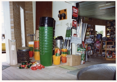
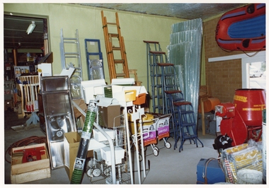
Photograph, Pleasant Creek Special School, Frank Floyd Pty Ltd. Hardware Store interior Wimmera Street Stawell Nov 1975, Nov 1975
Photographs taken by teacher at Pleasant Creek Training Centre to help train students in living skills and becoming familiar with what shops sold. Part of socializing students for leaving the training centre.Business in Wimmera Street Stawell selling hardware education