Showing 2304 items matching "parishes"
-
 Bendigo Historical Society Inc.
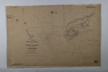
Map - KOOYOORA, July 23rd 1857
Map: The Township of Kooyoora and suburban allotments in the Parish of Kingower. This plan has been applied to a newer backingmap, township, kooyoora, allotments, parish of kingower -
 Bendigo Historical Society Inc.
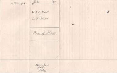
Legal record - BLOSSETT Rupert Stanley - Deed of Charge, Watson, James & Rogers, Rogers Collection, 1920
In the early 1980s the firm of Watson, James & Rogers merged with the partnership of Every & Every and became the iconic “Rogers & Every” as known today. The firm is still located on Bull Street. https://rogersevery.com.au/about/Deed of Charge concerning the purchase of land in the Parish of Mandurang, County of Bendigo. Dated 13 November 1920.Signatureswatson james & rogers, bendigo, legal documents -
 Stawell Historical Society Inc
Map, R.O. Robson - Authorised Surveyor, Road from Glenorchy to near Geary's Selection Callawaddy 1880, 29.04.1880
Survey for Road CreationCloth Backed Map. Plan of Road.Parishes of Richella & Callawadda. County of Borong. Plan of Road. R.O. Robson Authorised Surveyor Stawell 29.04.80 -
Glen Eira Historical Society
Book - St Peter's Catholic Church, Bentleigh East
The Growing Harvest Is A Book That Continues The History Of St Peter's Parish, Bentleigh East During 1974 – 1983, Written By Bernie O’Brien. It Includes The Opening Of The New Church, The Foundations Of The Parish, Parish Developments, St Peter's School Church Community Related Aids & Groups Including All Previous Parish Priests.st peter's catholic church, guiney john, bentleigh east, bentleigh parish, heriot maurice fr, centre road, st paul's, o’brian bernie, bignell road, parish of st peter's, mannix daniel dr, connie street, the living harvest, whitehouse ray fr, new church, kennedy james joseph, cooper julie, stanhope wayne fr, bennett maureen, o’connor gerald fr, kathleen sr, chambers greg fr, murphy brendan, bourke colin fr, o’sullivan tim fr, maloney des fr, crawford fr, mckenna fred fr, bowd mr & mrs, livingstone stan, reed john, smith patricia sr, doolan fr, de marzi led fr, nolan m fr, handley dennis fr, boyer peter, hogan chris, reynolds mark fr, reynolds greg fr, dillon kevin fr, hayes brendan rev., shannon sue sr., family planning, emergency home help, moorabbin hospital, lay ministers, school bus, bingo, catholic family welfare bureau, liturgy, scout hall, bottle drive, moongala drop-in centre, the lighthouse, sacrificial offering, mayor of moorabbin, ecumenical civil service, rite of christian initiation for adults, big brother little brother, st peter's school, ash wednesday bushfires, lightning premiership, safety house program, salesian society, cappuchin fathers, jesuits, diocesan seminary, order of our lady of the sacret heart, sisters of our lady of the sacret heart, kennedy margaret sr., laidler terry fr, noreen sr., cochrane james, leach martin fr, reynolds greg, kooy van fr, lazzaro maria sr., coakley fr, maloney desmond fr, crawford malcolm fr, browne joseph fr, lilley con, corpus christi, cabrini sisters, mission cross, the rite of dedication, statue of st peter, the tree of life, the relic of st olivier, plunkett, holy name society, st vincent de paul, the children of mary, the legion of mary, parish finance committee, the anchor club -
Bendigo Historical Society Inc.
Map - CAMPBELL COLLECTION: BENDIGO AND DISTRICT MAPS, 18-6 29
Map. Longlea, Parishes of Axedale and Eppalock, scale 20 chains to 1 inch, total area 2372 acres. Prepared from Assessment Plan and Parish Plan by H.A. Darby18-6-29., Wondong, Heathcote and Sandhurst line (Railway). (number 386 in map cupboard 1)H.A.Darbymap, bendigo, agricultural lands -
 Bacchus Marsh & District Historical Society
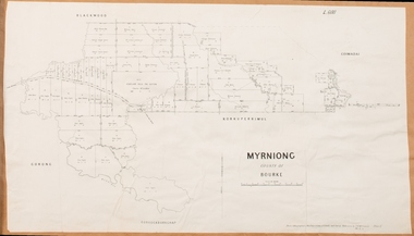
Map, Myrniong Parish Map 1904
A single page paper map showing the map for the Parish of Myrniong in the County of Bourke. A cadastral map showing parish boundaries and land ownership. The map is pasted into a bound volume containing 76 maps or plans in total. High resolution digital image stored on BMDHS computer network. myrniong parish plan, myrniong parish maps, bacchus marsh region parish plans -
 Bacchus Marsh & District Historical Society
Map, Parwan Parish Map, County of Grant, 1909
A single page paper map showing the map for the Parish of Parwan in the County of Grant. A cadastral map showing parish boundaries and land ownership. The map is pasted into a bound volume containing 76 maps or plans in total. High resolution digital image stored on BMDHS computer network. Photo-lithographed at the Department of Lands and Survey, Melbourne by T.F. McGauran, 7.7.09. bacchus marsh region parish plans, parwan parish maps, parwan parish plan -
 Bacchus Marsh & District Historical Society
Map, Blackwood Parish Map, County of Bourke, 1892
A single page paper map showing the map for the Parish of Blackwood in the County of Bourke. A cadastral map showing parish boundaries and land ownership. The map is pasted into a bound volume containing 76 maps or plans in total. High resolution digital image stored on BMDHS computer network. Photo-lithographed at the Department of Lands and Survey, Melbourne by T.F. McGauran 14.7.92bacchus marsh region parish plans, blackwood parish plan, blackwood parish maps -
 Bacchus Marsh & District Historical Society
Map, Blackwood Parish Map, County of Bourke, 1905
A single page paper map showing the map for the Parish of Blackwood in the County of Bourke. A cadastral map showing parish boundaries and land ownership. The map is pasted into a bound volume containing 76 maps or plans in total. High resolution digital image stored on BMDHS computer network. Photo-lithographed at the Department of Lands and Survey, Melbourne by T.F. McGauran 21.7.05bacchus marsh region parish plans, blackwood parish plan, blackwood parish maps -
 Bacchus Marsh & District Historical Society
Map, Myrniong Parish Map, County of Bourke, 1882
A single page paper map showing the map for the Parish of Myrniong in the County of Bourke. A cadastral map showing parish boundaries and land ownership. The map is pasted into a bound volume containing 76 maps or plans in total. High resolution digital image stored on BMDHS computer network. Photo-lithographed at the Department of Lands and Survey, Melbourne by J. Noone, 17.7.82myrniong parish plan, myrniong parish maps, bacchus marsh region parish plans -
 Greensborough Historical Society
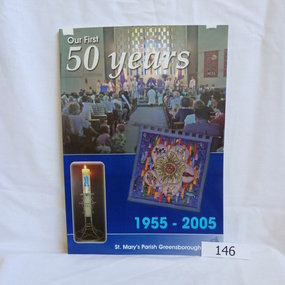
Book, Para Printing Pty Ltd, Our first 50 years: 1955-2005. St Mary's Parish Greensborough, 1955-2005
A history of St Mary's Parish Greensborough compiled to celebrate the 50th anniversary of the founding of the Parish 1955-2005.History of this Parish and those who have contributed to its development.74 pages, colour illustrations, maps. Soft cover with photograph of interior of church.Inside cover in pencil 'Bonnie Dickson', a contributor to the publication.st marys catholic church, greensborough, churches -
 Eltham District Historical Society Inc
Photograph, Dendy House, Pitt Street Eltham
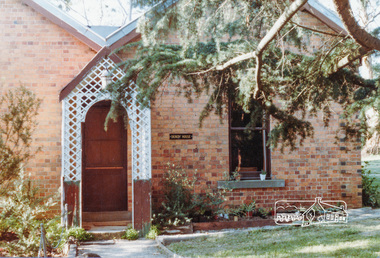
Colour photograph of Dendy House, original St. Margaret's vicarage now Parish Centre, Pitt Street, Eltham.dendy house, st margarets church, pitt street, eltham, churches -
Bendigo Historical Society Inc.
Map - KANGAROO FLAT SUBDIVISION, 26/11/1900
Map: Plan of Subdivision at Kangaroo flat, Parish of Sandhurst, County of Bendigo ( number 149 in Map Cupboard 1)map, bendigo, parish plan, kangaroo flat, parish of sandhurst, county of bendigo -
Bendigo Historical Society Inc.
Map - EAGLEHAWK (PART), 22/01/1882
Map: Parish plan showing area Eastward from Lightning Hill ( number 205 in Map Cupboard 1)map, bendigo, parish plan, eaglehawk, lightning hill -
Bendigo Historical Society Inc.
Map - NERRING. SHEET ?, Circa 1894
Map: Nerring, Part ( number unreadable), County of Bendigo. Parish plan ( number 190 in Map Cupboard 1)map, bendigo, parish plan, nerring -
Bendigo Historical Society Inc.
Map - RAVENSWOOD, April 6th 1872
Map: Township of Ravenswood. Parish plan, has a 1913 calendar as a backing (number 266 in map cupboard 1)map, bendigo, township, ravenswood -
Bendigo Historical Society Inc.
Map - PORTION OF SANDHURST, 27/01/1877
Map: Hand draughted parish plan, showing a portion of the City of Sandhurst ( number 225 in Map Cupboard 1)map, bendigo, parish plan, sandhurst -
Bendigo Historical Society Inc.
Map - SANDHURST (PART), Circa 1880's
Map: Parish plan sowing an area along Specimen Hill Rd. ( number 211 in Map Cupboard 1)map, bendigo, parish plan, specimen hill rd. sandhurst , bendigo -
Bendigo Historical Society Inc.
Map - TARNAGULLA SHEET 1, Examined 25/08/1926
Map: Tarnagulla Sheet 1, Counties of Gladstone and Bendigo. Parish plan (number 304 in map cupboard 1)map, gladstone, parish plan, tarnagulla -
 Whitehorse Historical Society Inc.
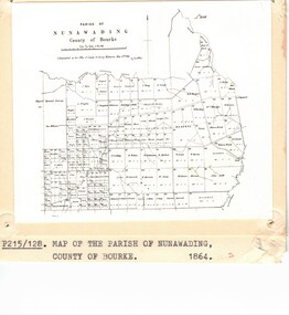
Map - Nunawading scaled Map, Nunawading, 1864
Parish plan of Nunawading, Lands Department, 1864, showing names of first purchasers of land. Copy also at NP215.parish of nunawading, land settlement, maps -
 Whitehorse Historical Society Inc.
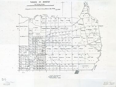
Photograph - Parish Map, Parish of Nunawading
Black and white photo of map of the Parish of Nunawading, County of Bourke, 1864. Copy also at ND880, Map Drawer.parish of nunawading, county of bourke, maps -
Bendigo Historical Society Inc.
Map - BENDIGO PARISH PLAN
BHS CollectionBendigo Parish Plan Central Bendigo. Canvas with Canvas typed edges. Taken from George Black's maps -
 Ringwood and District Historical Society
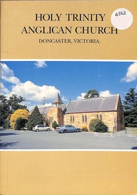
Book, Holy Trinity Anglican Church Doncaster, 1997
The History of the Parish of Holy Trinity Anglican Church Doncaster and includes many of the early Ringwood families Published 1997 -
Tatura Irrigation & Wartime Camps Museum
Booklet, History of Sacred Heart Parish of Tatura, 1989
Written to commemorate Centenary of Sacred Heart Parish, including photographs of church buildings, Clergy, Nuns, Parish groups.Cream coloured booklet, photograph of Sacred Heart Church on cover. Foreword by Father Collins. PP.religion in tatura, sacred heart parish tatura, church clergy, church nuns, church parish groups -
Bendigo Historical Society Inc.
Map - CAMPBELL COLLECTION: BENDIGO AND DISTRICT MAPS
Map. Whirrakee, Parish of Whirrakee. Total area of map 4419 acres. Scale 20 chains to 1 inch. 23 allotments are sold, Eucalypt oil distillery on lower portion of map. Prepared in W.P.B. from Assessor's plan and Parish Plan. (number 350 in map cupboard 1)map, bendigo, allotments -
 Bacchus Marsh & District Historical Society
Map, Trentham Parish Map 1905 Copy 1
A single page paper map showing the map for the Parish of Trentham in the Counties of Dalhousie and Bourke. A cadastral map showing parish boundaries and land ownership. The map is pasted into a bound volume containing 76 maps or plans in total. High resolution digital image stored on BMDHS computer network. Photo-lithographed at the Department of Lands and Survey, Melbourne by T.F. McGauran 22.3.05 trentham parish maps, trentham parish plan, bacchus marsh region parish plans -
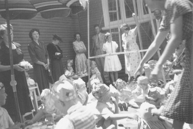 Ringwood and District Historical Society
Photograph, 1950 - Parish Hall Xmas Party, Church of England, Ringwood Street, Ringwood. Attendees included Mrs. J. Mason, Mrs. Gray, Mrs. McCrae Snr., Mr. and Mrs. G. Williams
Typed below photograph, "1950 - Parish Hall Xmas Party. Linda Evans, Mrs. Caughey, Mrs. Gray" -
Tatura Irrigation & Wartime Camps Museum
Book, Damien Finlayson, Time to Reflect. The centenary of Sacred Heart Church : Tatura 1912 - 2012
The centenary of Sacred Heart Church Tatura: 1912 - 2012Cover of book shows the alter and stained glass windows of the Church. There is a copy of the Last Supper on the back cover. Includes photographs of past priests and scenes of the church. 33 pages.The Forward : written by the Parish priest Fr Michael Morley 18/10/2012. A page of "Acknowledgements" is also included.catholic church history -
 Linton and District Historical Society Inc
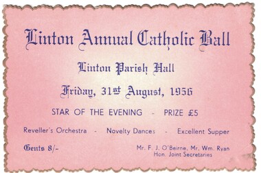
Ticket, Linton Annual Catholic Ball, 1956, 1956
Pink card, gold edge, blue printing. Ticket for Linton Annual Catholic Ball, held 31st August 1956.Text: " Linton Annual Catholic Ball / Linton Parish Hall / Friday, 31st August, 1956 / STAR OF THE EVENING. "linton catholic church, events, balls, f. j. o'beirne, william ryan -
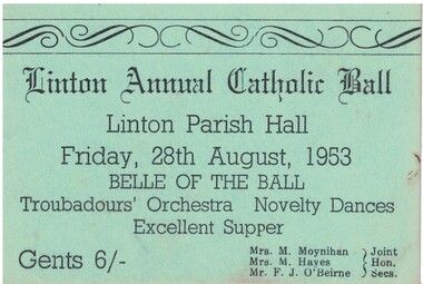 Linton and District Historical Society Inc
Ticket, Linton Annual Catholic Ball, 1953, 1953
Green card, black printing. Ticket for Linton Annual Catholic Ball, held 28th August 1953.Text: " Linton Annual Catholic Ball / Linton Parish Hall / Friday, 28th August, 1953 / BELLE OF THE BALL. "linton catholic church, events, balls, mrs m. moynihan, mrs m. hayes, f. j. o'beirne