Showing 16995 items
matching plenty-river
-
 Kiewa Valley Historical Society
Black and white photograph of Surveyor's Camp, 1938, Kiewa River and surveyor's Camp 25/8/38, 25/08/1938
Surveying under the prevailing conditions at this time was an arduous and demanding task. There were no roads beyond Tawonga and access was by bridle tracks, on foot or horseback. This camp was to provide accommodation to those men who were surveying the road from South Tawonga to the Bogong High Plains which was commenced in April, 1938. The actual work was undertaken by the Country Roads Board, on behalf of the State Electricity Commission, using three Caterpillar diesel crawler tractors equipped with Kay Bruneriei (Brunner) lhydraulically operated trailbuilders (angle dozers)This photograph shows the primitive living conditions that were endured by those carrying out the initial field investigations and surveys for the Kiewa Hydro Electric Scheme. It is possibly one of the few photographs in existence of this camp and of the very rustic timber foot bridge across the West Kiewa river. It has been taken from approx. 100m up Simmonds Creek Road. A black and white photograph showing a small, timber foot bridge across the West Kiewa River. There is a man standing on the bridge and two small huts on the far side of the river, against a backdrop of Mt. Beauty and Mt. Bogong.At the top of the photograph, handwritten in black ink is the inscription "Kiewa River and Surveyor's Camp 25/8/38". The number 4 is stamped towards the right upper corner. On the back, in a circle, about 1.3cm in diameter, are the words "Kodak Print". The word "Velox" is faintly discernible on the back as well.surveyor, tawonga, west kiewa river, bridge, camp, secv -
 Greensborough Historical Society
Map, Melbourne and Metropolitan Board of Works. Survey Division, MMBW, Yarra 2500 / 13.24. Plenty, Memorial Drive, 1979_03
Melbourne and Metropolitan Board of Works. Yarra 2500 [base map] 13-24. Plenty, Memorial Drive. Parish of Morang 3183. Municipalities of Diamond Valley 257 and Whittlesea 239. Prominent streets include: Oatland Road, River Avenue and Memorial Drive. Includes Plenty River and SEC Transmission easement.MMBW Map in 1:2500 [scale] series. Cream parchment with green tape reinforcing on edges and punched holes on left edge.mmbw, melbourne and metropolitan board of works, shire of diamond valley, plenty - maps -
 Greensborough Historical Society
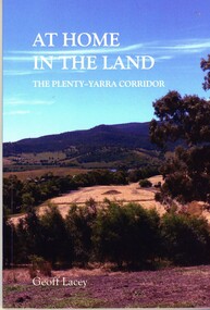
Book, Geoff Lacey, At home in the land: the Plenty-Yarra corridor, 2021
111 p., paperback, col. photographs, mapsnon-fictionindigenous plants, indigenous fauna, plenty river, yarra river -
 Marysville & District Historical Society
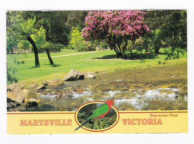
Postcard (item) - Colour postcard, Neil Cutts, Marysville Victoria-Steavenson River, Pre 2009
A postcard in a series produced by the Rose Stereograph Company in Victoria, Australia as a souvenir of Marysville.A colour photograph of the Steavenson River which flows through Marysville in Victoria. The Rose Series postcard No. 3527.POST CARD The "Rose" Series/ De Luxe Proudly Printed in/ Australia Since 1880 AFFIX/ STAMP/ HERE/ Rose Series/ Post Card No./ 3527 ADDRESS/ POSTCODE Steavenson River/ MARYSVILLE, VICTORIA, AUSTRALIA/ Photo Neil Cutts Copyright Rose Stereograph Co., Glen Waverley, Victoria (03) 9560 7772marysville, victoria, steavenson river, postcard, souvenir, rose stereograph co, 3527 -
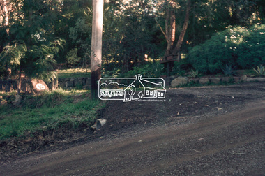
 Eltham District Historical Society Inc
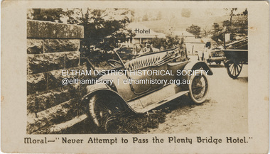
Photograph - Business Card, C. Aarons, Moral - "Never Attempt to Pass the Plenty Bridge Hotel.", c.1920
Circa 1920 Business Card: Plenty Bridge Hotel, Lower Plenty via Heidelberg C. Aarons, Licensee Humorous business card warning motorists of the dire consequences attempting to negotiate the Plenty River Bridge should they decide to pass by the hotel with stopping.marg ball collection, c. aarons, car crash, golf club hotel, lower plenty bridge hotel, plenty bridge hotel, lower plenty bridge -
 Orbost & District Historical Society
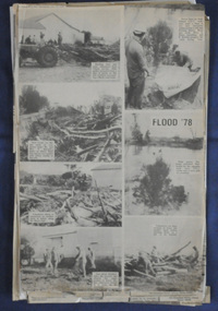
newspaper clippings, June 1978
Orbost has been subject to major floods throughout its history, such as those which left the town isolated in 1934, 1952, 1971 and 1978. It is recorded that the Snowy River broke its banks and flooded the flats 104 times between 1884 and 1978. Extensive flooding in Eastern Victoria during June 1978, caused widespread damage to roads, road closures and hazards to traffic, particularly over the Queen's Birthday holiday weekend. These newspaper articles are contemporary records of a significant event in Orbost history.A collection of black/white newspaper clippings relating to the 1978 flood in Orbost. Some are original articles. others are photo-copies. They appear to be from the Snowy River Mail newspaper.floods-orbost-1978 newspaper-articles -
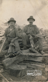 Eltham District Historical Society Inc
Photograph, Arthur Frederick Castledine (right) sitting on a wood pile towards the rear of their property, Araluen (southern end), Old Eltham Road, Lower Plenty, c.1930, 1930c
Shows the men with rifles sitting on a wood pile out hunting for rabbits around the time of the Great DepressionDigital image of original held in private collection of Joan Castledine, daughter of Sid and Polly (nee Arrowsmith) Castledine, granddaughter of Arthur Frederick Castledine.araluen, arthur frederick castledine, lower plenty, old eltham road, rabbits -
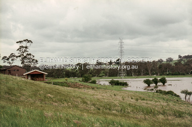
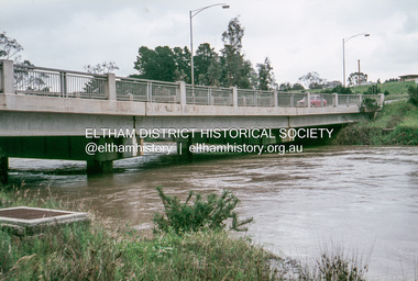 Eltham District Historical Society Inc
Slide, Floodwater, Lower Plenty Bridge, November 1971, 1971
35 mm colour positive transparency Mount - Agfacolor Service (Blue)floods, lower plenty bridge -
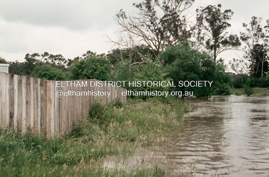 Eltham District Historical Society Inc
Slide, Floodwater, Towyn Close, Lower Plenty, November 1971, 1971
35 mm colour positive transparency Mount - Agfacolor Service (Blue)floods, lower plenty, towyn close -
 Eltham District Historical Society Inc
Slide, Floodwater, Towyn Close, Lower Plenty, November 1971, 1971
35 mm colour positive transparency Mount - Agfacolor Service (Blue)floods, lower plenty, towyn close -
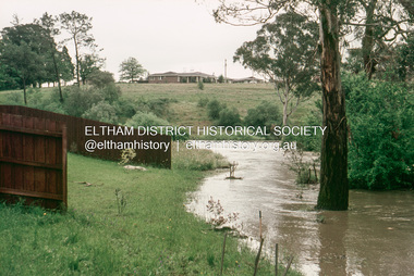
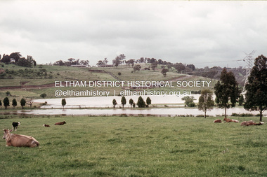
 Eltham District Historical Society Inc
Slide, Floodwater, looking southeast from Montpelier Drive, Lower Plenty, November 1971, 1971
35 mm colour positive transparency Mount - Agfacolor Service (Blue)floods, lower plenty, montpelier drive -
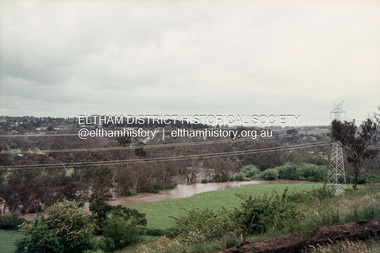
 Eltham District Historical Society Inc
Slide, Floodwater, looking north to Montpelier Drive, Lower Plenty, November 1971, 1971
35 mm colour positive transparency Mount - Agfacolor Service (Blue)floods, lower plenty, montpelier drive -
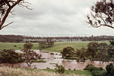
 Eltham District Historical Society Inc
Slide, Floodwater, looking east from Monastery, Lower Plenty, November 1971, 1971
35 mm colour positive transparency Mount - Agfacolor Service (Blue)floods, lower plenty, monastery -
 Eltham District Historical Society Inc
Slide, Floodwater, looking north from Monastery, Lower Plenty, November 1971, 1971
35 mm colour positive transparency Mount - Agfacolor Service (Blue)floods, lower plenty, monastery -
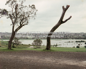 Eltham District Historical Society Inc
Slide, Floodwater, southwest from entrance of Rosanna Golf Club, Lower Plenty, November 1971, 1971
35 mm colour positive transparency Mount - Agfacolor Service (Blue)floods, lower plenty, rosanna golf club -
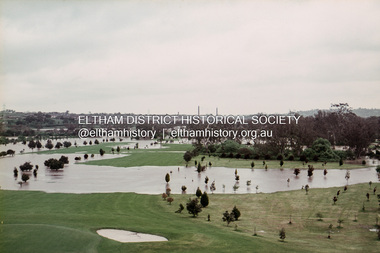 Eltham District Historical Society Inc
Slide, Floodwater, southwest from Clubhouse of Rosanna Golf Club, Lower Plenty, November 1971, 1971
35 mm colour positive transparency Mount - Agfacolor Service (Blue)floods, lower plenty, rosanna golf club -
 Eltham District Historical Society Inc
Slide, Possibly looking east along Rosehill Road, Lower Plenty towards Bolton Street intersection, 18 July 1972, 1972
Reconstruction works by Eltham Shire Council, Bolton Street, Eltham, 18 July 197235 mm colour positive transparency Mount - Agfacolor Service (Blue)bolton steet, eltham, eltham shire council, infrastructure, lower plenty, road construction, rosehill road -
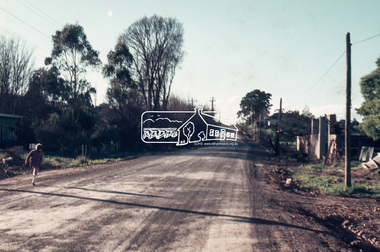
 Eltham District Historical Society Inc
Slide, Looking south along Bolton Street towards intersection with Rosehill Road, Lower Plenty, 18 July 1972, 1972
Reconstruction works by Eltham Shire Council, Bolton Street, Eltham, 18 July 197235 mm colour positive transparency Mount - Agfacolor Service (Blue)bolton steet, eltham, eltham shire council, infrastructure, lower plenty, road construction, rosehill road -
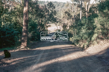
 Eltham District Historical Society Inc
Slide, Drainage under driveway near No. 10 Bolton Street, Lower Plenty, 18 July 1972, 1972
Reconstruction works by Eltham Shire Council, Bolton Street, Eltham, 18 July 197235 mm colour positive transparency Mount - Agfacolor Service (Blue)bolton steet, eltham, eltham shire council, infrastructure, lower plenty, road construction, rosehill road -
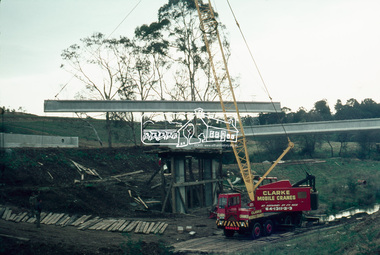
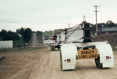
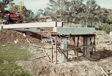
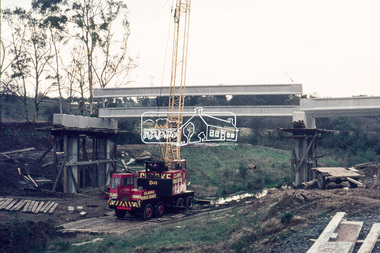
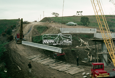 Eltham District Historical Society Inc
Photograph, Construction of Lower Plenty Bridge, c.August 1966, 1966
35mm Colour positive transparency Mount - Agfacolor Service (Blue stepped)Originally contained in Agfacolor Box stamped received 14 Sep 1966 and posted 16 Sep 1966bridge construction, lower plenty bridge -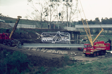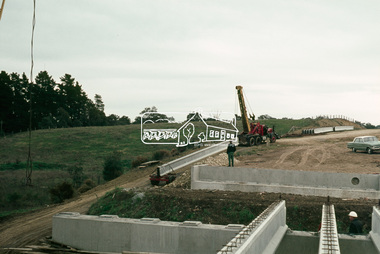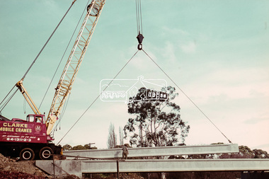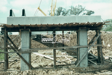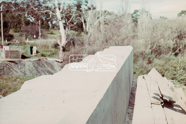
 Eltham District Historical Society Inc
Photograph, Construction of Lower Plenty Bridge, c.August 1966, 1966
35mm Colour positive transparency Mount - Agfacolor Service (Blue stepped)Originally contained in Agfacolor Box stamped received 14 Sep 1966 and posted 16 Sep 1966bridge construction, lower plenty bridge