Showing 636 items matching "river view"
-
 University of Melbourne, Burnley Campus Archives
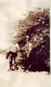
Album - Black and white and sepia prints, Mrs Dorothy Jessep, Mrs. Jessep's Photograph Album, 1923 - 1941
Mrs. Jessep, wife of Alexander William Jessep, Principal 1926 -1941.124 Sepia and b/w photographs pasted onto pages in photograph album. Photographs labelled up to 91. String holding pages together has become detached.{Photographs labelledmrs. jessep, alexander william jessep, principal, a.w. jessep, students, staff, garden views, russ, stewie, seniors, juniors, c. broadhurst, yarra river, bill richmond, long border, orchard border, pavilion, s cohn, b jackson, miss pater, principal's residence, banksia rose, joan hornabrook, mollie shannon, luffmann ponds, lily ponds, jacaranda, sequoia sempervirens, entrance, pinus, g crivelli, c baker, v sanderson, n white, rose bed, elm, old nursery, nancy dewey, andy, barney, frank, vic, student group 1925-1928, g hudson, cows, friesan cows, recreation, h kirkhope, orchard, tuppence, student group 1927, australian border, students working outside, crack willow, espalier pears, oak lawn, potting shed, m rawlins, whitting, miss courtney, miss horton, e murray, h carnegie, j mackie, g campbell, m suiter, pruning, bees, outside classes, delphiniums, christmas party, lawnmower -
 Lakes Entrance Historical Society
Photograph - Foreshore Lakes Entrance, Bulmer H D, 1923c
Second copyBlack and white photograph showing aerial view of the entrance to the Gippsland Lakes, shows Cunninghame Arm, North Arm, Reeves River and Hopetoun Channel, Rigby Island and Snake Island, the barrier on right foreground. Lakes Entrance Victoriawaterways, islands, aerial photograph, fishing industry, coast -
 Linton and District Historical Society Inc
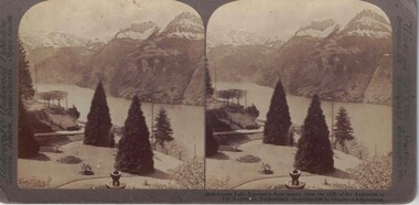
Stereograph, Underwood & Underwood, Publishers, Across Lake Lucerne's Deep Waters, Copyright 1902
One of two sets of stereographs donated by the O'Beirne family along with a stereoscope for viewing (Stereoscope is Registration no. 2014-51).Stereograph of two black and white images. Images are of a landscape. Trees, stairs, people in foreground. River through centre of image with snowcapped hill tops in background.1868 - Across Lake Lucerne's deep waters. from the cliffs of the Axenstein to / Uri Rothstock, Switzerland.stereographs -
 Lakes Entrance Historical Society
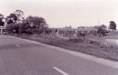
Photograph - Bridges, Fish Marie, 1995
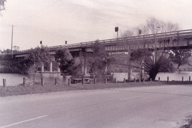
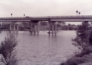
Black and white photograph showing view of the Swan Reach bridge over the Tambo River. Traffic lights on bridge to control traffic and reduce weight. Swan Reach Victoriabridges, waterways, roads and streets -
 Lakes Entrance Historical Society
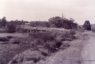
Photograph - Bridges, Fish Marie, 1995
Black and white photograph showing view of the Swan Reach bridge over the Tambo River. Traffic lights on bridge to control traffic and reduce weight. Swan Reach Victoriabridges, waterways, roads and streets -
 Lakes Entrance Historical Society
Photograph - Bridges, Fish Marie, 1995
Black and white photograph showing view of the Swan Reach bridge over the Tambo River. Traffic lights on bridge to control traffic and reduce weight. Swan Reach Victoriabridges, waterways -
 Lakes Entrance Historical Society
Photograph - Bridges, Fish Marie, 1995
Black and white photograph showing view of the Swan Reach bridge over the Tambo River. Traffic lights on bridge to control traffic and reduce weight. Swan Reach Victoriabridges, waterways -
 Lakes Entrance Historical Society
Photograph - Bridges, 1990
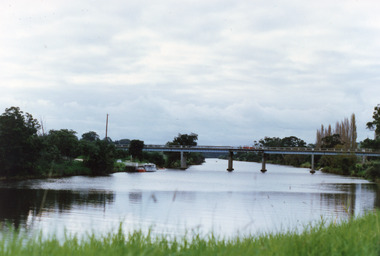
... Colour photograph showing view of the Tambo River at Swan...Bridges Waterways Colour photograph showing view ...Colour photograph showing view of the Tambo River at Swan Reach looking upstream. Boats at jetty on left, vegetation on each bank, poplar trees on right. Swan Reach Victoriabridges, waterways -
 Linton and District Historical Society Inc
Stereograph, The Rose Stereographs, Melbourne, Sydney, Wellington and London, 16,300 Bird's-Eye View of Paris, France, Copyright 1912
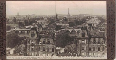
One of two sets of stereographs donated by the O'Beirne family along with a stereoscope for viewing (Stereoscope is Registration no. 2014-51).Stereograph of two black and white images. Images show bridges over the River Seine. Eiffel Tower in background.16,300. BIRD'S-EYE VIEW OF PARIS, FRANCE, and Seven Bridges Over the Seine from Spire / of St. Gervais Church. Eiffel Tower in Distance.stereographs -
 Lakes Entrance Historical Society
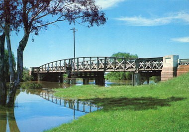
Photograph - Bridges, Murray Views Gympie, 1980
Photo printed on Jumbo card by Murray Views, Gympie QLDColour photograph showing swing bridge on Latrobe River, shows north facing side of bridge, willows on opposite bank on site of Latrobe River wharf, river running very high, two red gum trees in water on left. Longford Victoriabridges, waterways -
 Warrnambool and District Historical Society Inc.
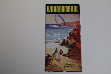
Pamphlet - Tourist Map and Guide, Victorian Railway Commissioners, Warrnambool Victoria Australia, c. 1950
Warrnambool Tourist Map and Guide.1 This is a single sheet of paper folded twice to make a pamphlet. It has a multi-coloured map (predominantly yellow), an illustration, several black and white photographs, printed text and coloured headings. .2 This is a single sheet of paper inserted into item 1. It is folded twice and contains black and white photographs.non-fictionWarrnambool Tourist Map and Guidetourism in warrnambool, warrnambool rail, warrnambool tourist guides -
 Kew Historical Society Inc
Work on paper - Sepia Wash & Ink, G B Richardson, Creek and Old Watering Stage, on the Yarra, East Collingwood, 1854, 1854
Blind Creek was located between the Abbotsford Convent and what is now the Collins Bridge in Studley Park. In an 1858 map of East Collingwood by Clement Hodgkinson, in the State Library of Victoria, one can see how the creek was originally a significant landmark in Collingwood; remaining vacant land until a barrel drain enclosed it. The area was later filled in, surveyed and developed. The position where Blind Creek entered the Yarra was in the immediate vicinity of Hodgson’s Punt, which had linked Kew to the other side of the Yarra from 1839. The Punt was purchased by the Colonial Government in 1852 and was in use until the opening of the Studley Park Road (Johnston Street) Bridge in 1858 made its continued use redundantThe point of view selected by the artist for the watercolour is from the banks of Blind Creek in East Collingwood, looking across the Yarra to the Kew side of the river.Inscribed verso 'Creek and Old Watering stage, on the Yarra East Collingwood 1854 / Trees, stage, &c have long since disappeared / [Artist Signature] / FT 110 / Creek itself now being filled in 1903.gb richardson, blind creek - abbotsford, yarra river - abbotsford (vic) - kew (vic), colonial artists, australian art - 19th century, george bouchier richardson -
 Kew Historical Society Inc
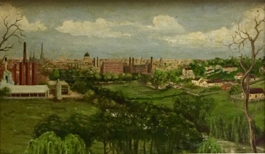
Painting - Panoramic View of Kew and Abbotsford from the garden of Rockingham, V Maloney, 1952
... . The painting of the view across the river to Abbotsford may have been.... The painting of the view across the river to Abbotsford may have been ...The extensive formal landscaped gardens of Rockingham had been created in the 1860s, and by the 1950s remained bordered to the south by the Barkers Road cutting, and to the north by Blytheswood, the neighbouring Syme family property, By 1940, the Syme family were no longer the occupiers of Rockingham. John Herbert Syme had died in October 1939, and by August the following year, his wife had made the house and garden available, rent free to the Red Cross as a convalescent home for Australian soldiers injured in the Second World War. At the time, the house was described as containing twenty rooms, including a ballroom and a billiards room, with a garden of eight acres overlooking the Yarra. The task of renovating the house to conform to its new function as a convalescent home took a year, finally opening in August 1941. Community support for Rockingham was widespread and included the decision by the National Gallery of Victoria to loan pictures from its collection to decorate the walls. Calls were made for women around Victoria to donate fruit and vegetables from their gardens, which the railways agreed to freight for free. Other local support included the work by a team of boys to establish a three-acre vegetable garden within the formal terraced gardens. From the beginning, occupational therapy formed a key component of the rehabilitation of psychologically injured soldiers. This is confirmed by contemporary newspaper accounts of weaving, ironwork, leatherwork, basketry and gardening by patients. Numerous photographs, held by the Australian War Memorial (AWM) and the State Library of Victoria (SLV), record the importance of these rehabilitation activities. The painting of the view across the river to Abbotsford may have been painted in one of these occupational therapy sessions. For many decades it hung in the occupational therapy room. It must have been on view following the sale of Rockingham by the Syme family to the Red Cross in 1955, and subsequently, until the house was demolished and its grounds finally subdivided in 1977.View of Abbotsford from the garden of Rockingham (1952) was created by V Maloney. The vantage point of the artist was the garden of Rockingham, one of two mansions overlooking the Yarra owned by the Syme family. The artwork depicts a number of sites - especially factories - that have since been demolished.Signed by the artist, lower right "V Maloney"rockingham red cross convalescent home, hospitals - kew (vic), rosemary lade, art therapy -
 Melbourne Tram Museum
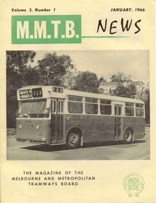
Magazine, Melbourne & Metropolitan Tramways Board (MMTB), "MMTB News", 1966
Eight issues of "MMTB News" - The Magazine of the Melbourne and Metropolitan Tramways Board. Two copies of each issue held. All issues printed with an cream colour paper cover with the rest of the magazine white glass paper. 1723.1 - Vol. 3, No. 1 - 16 pages, January 1966, with a photo of the Mark VI bus No. 702 on the front cover, notes on Traffic Congestion, motor cars and supermarkets, depot masters, engineering, bus maintenance, sports and social club news. On rear cover includes a photo of a Christmas function with past senior employees - left to right - H. R. Steains (architect), H. S. McComb (Chief Surveyor), Mr. Aird, Mr. P. M. Ireland (Rolling stock engineer), J Fisher (Civil Engineer) and H. A. Warner (Secretary) 1723.2 - Vol. 3, No. 2 - 16 pages, February 1966, with a photo of counting decimal coins, Tribute to the W2 class tram written by Norm Cross, (with photo), Hawthorn Clothing Depot, retirement of Harry Munroe, introduction of decimal currency, donation of 1B bogies to SPER, tramways band, death of Neil Olsen, sports and social club news. See btm2720i9.jpg for image of the Norm Cross photograph. 1723.3 - Vol. 3, No. 3 - 12 pages, March - April 1966, with a photo of Tramways Bowl Tournament presentation on the front cover, Recent developments in public transport in North America, Vera Cruz Mexico, cable cars at Rushworth, sports and social club news and photo of the Melbourne bogies under Sydney tram. 1723.4 - Vol. 3, No. 4 - 16 pages, May 1966, with a photo of W2 321being overhauled at Preston Workshops, change over to decimal currency for accounting machines, "Tram Driver Salutes the L class tram" - written by A. Bailey, Melbourne's New Trams, retirement of Gordon Wilson, sports and social club news. 1723.5 - Vol. 3, No. 5 - 16 pages, June 1966, with a photo of the track relaying in Camberwell Rd with Camberwell fire station in background, Melbourne cable tram routes, opening and closing dates, retirement of G. H. Box, visit of SPER members to Melbourne, memories of Malvern Depot, sports and social club news. Death of A L Robertson, rostering, sports, Sydney trams, Safety and excuses for accidents. Full pdf copy added 28/8/2019 1723.6 - Vol. 3, No. 6 - 16 pages, July - August 1966 with a photo of the view from the St Kilda Junction signal box, more trams for Russia, retirements of 31 Employees, a contest to win an old W2, St Kilda Road Junction box - and how it works - signalling and interlocking, closure of Port Melbourne bus depot, sports and social club news. 1723.7 - Vol. 3, No. 7 - 16 pages, September - October 1966 with a photo of 610 on the Maribyrnong River Bridge, during the SPER tour, "Public Transport in Big Cities" - R. Risson - with photo - see image i10, MMTB Ambulance division, new trams, trams or buses, death of Harry Hood, Chas Samuels, retirement of Jack Ferguson, Reg Maxwell, manufacture of trackwork, cable tram working, sports and social club news. 1723.8 - Vol. 3, No. 8 - 16 pages, November - December 1966 with a photo of a wedding party on a tram (Richards / Fuller), apprenticeship training, Christmas message from the Chairman, tramway canteens, art of rostering by R. Drummond, Wattle Park Chalet, clock and instrument shop at North Fitzroy, tramways band, sports and social club news.trams, tramways, mmtb, carlton control, buses, pcc 980, ballarat, new trams, are, tmsv -
 Melbourne Tram Museum
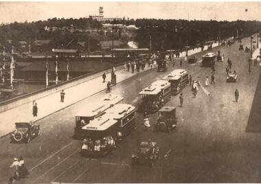
Photograph - Photograph Card, Kelly Collection, View Productions, Princes Bridge / Batman Ave tram terminus, Photo c1920
Photograph Card - folded card, blank inside of Cable Trams, motor cars, pedestrians crossing Princes Bridge over the Yarra River with the Princes Bridge / Batman Ave tram terminus with a shelter in the background. Shows five cable tram sets. Has railway signals and Government House in the view. Produced by View Productions GPO Box 1858 Sydney, from the Kelly Collection, titled "On the Princes Bridge, circa 1920, Melbourne, Victoria, Australia". Has the Publishers logo on the rear.trams, tramways, princes bridge, batman ave, swanston st, cable trams, shelters -
 Melbourne Tram Museum
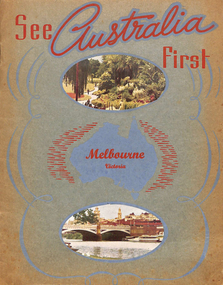
Book, Murray Views, "See Australia First - Melbourne Victoria", c1950
Book - 16 pages, including grey card covers, titled "See Australia First - Melbourne Victoria" featuring 12 pages of postcard photographs of Melbourne. Inside rear cover has a details of Melbourne's history, the city and its features. Produced by Murray Views of Gympie Qld, printed by Samuel Lee and Co. Images post second world war - late 1940's to early 1950's. Features images of: Alexandra Gardens River Yarra and Princes Bridge Flinders St Station St Kilda Road - tram track work being undertaken Flinders St and the Forum theatre The Exhibition Buildings Collins St Parliament House Bourke St - with cable tram tracks and the Metropole Hotel, Myer, Foys Aerial view of Melbourne Captains Cook's Cottage St Kilda Road with W2 287 Burns Memorial St Kilda Road St Paul's and Princes Bridge Town Hall Royal Melbourne Hospital Collins St with W2 turning Queen Victoria Gardenstrams, tramways, melbourne, flinders st station, collins st, town hall, princes bridge, st kilda rd -
 Melbourne Tram Museum
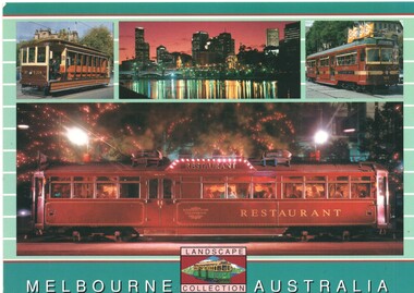
Postcard, Scancolor, Four images of Melbourne trams, mid 1970's
... , view across the Yarra River, Circle car 909 and one... Trams tramways Postcards V class Restaurant Tram Yarra River ...Colour postcard divided back - Scancolor - part of their Landscape collection featuring four photographs on one card - V214, view across the Yarra River, Circle car 909 and one of the Restaurant trams. Back has space for name and address, stamp and a message and details of the postcard. Produced by Scan colour, possibly early 2000's. Two copies held. See Reg Item 5446 for a larger photo of the Restaurant tramtrams, tramways, postcards, v class, restaurant tram, yarra river, melbourne, city circle, tram v214, tram 909 -
 Melbourne Tram Museum
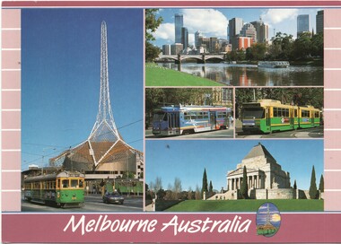
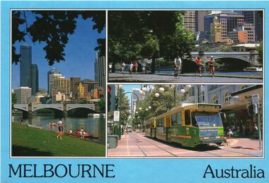
Postcard, Scancolor, Five Melbourne tram photos, early 2000's
... with the Arts Centre spire in the background, the view across the Yarra..., the view across the Yarra River, a Z3 advertising tram, B2 2013 ...Colour postcard divided back - Scancolor - titled Melbourne Australia, featuring five photographs on one card -1010 with the Arts Centre spire in the background, the view across the Yarra River, a Z3 advertising tram, B2 2013 and the Shrine of Remembrance. Back has space for name and address, stamp and a message and details of the postcard. Produced by Scan colour, possibly early 2000's.trams, tramways, postcards, w7 class, b class, z3 class, melbourne, yarra river, tram 1010, tram 2013 -
 Melbourne Tram Museum
Postcard, Biscay Greetings, Set of five photos of Melbourne trams, mid 1980's
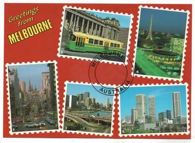
Colour postcard divided back - Biscay Greetings, series of 5 photographs of Melbourne, with the words "Greetings from Melbourne" in the top right hand corner. Features Z3 223 class tram outside Parliament, the Arts Centre, a view looking east along Bourke St, the Yarra River overlooking the King St bridge and the city and a general city photo. For the photo of Z3 223, see Reg item 2642. Back has space for name and address, stamp and a message and details of the postcard. Produced by Biscay Greetings, possibly mid 1980's. Card No. BG 178.trams, tramways, postcards, yarra river, z class, melbourne, tram 223 -
 Melbourne Tram Museum
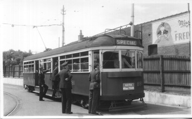
Photograph - Set of 5 Black & White - First AETA tour, 15-2-1947
Set of five photographs of the first Australian Electric Traction Association (AETA) tram tour of Melbourne on 15/2/1947. See page 8 of the March 1947 issue of "Tram Tracks" for details of the tour and the MMTB Crew. 1 - SW6 881 about to leave Glen Huntly Depot 2 - Crossing Balaclava Junction 3 - Crossing the Kooyong railway level crossing in Glenferrie Road - has the railway signal box and gates in view. 4 - Turning into Riversdale Road from Glenferrie Road with the Stotts Business College building in the background. 5 - Just to the east of Yarra River Bridge in Swan Street with the Burnley Gardens on the right.Yields information about the first AETA tram tour in 1947Set of 5 Black and white photograph on paper. Two copies of each held.Each one of the set has a photographers file stamp on the rear, but no details filled in.trams, tramways, aeta, tram tours, tram 881, sw6 class, glen huntly, kooyong level crossing, glenferrie road, riversdale road, burnley, hawthorn, balaclava junction, glen huntly depot, hawthorn road, swan st -
 Melbourne Tram Museum
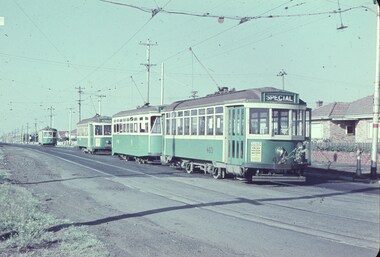
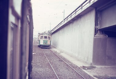
Slide - Set of 7, Keith Caldwell, 11/03/1962 12:00:00 AM
Set of 7 Agfa Colour slides, cardboard mounts, by Keith Caldwell dated 11.3.1962 of the transfer of cars from Footscray to the "Main System" the day after the system was closed. See Keith Kings history of Footscray notes. All trams running trolley wheels. .1 - Footscray depot cars X1 463, X2 678, X1 460 and X1 466 in Gordon St, about to turn into River Street. .2 - X2 678 turning from Nicholson St into Irving St. Footscray with the Rockmans Store in the background. This store was later demolished for the Ring Road. Also is J. Boltons Chemist shop advertising Kodak film and another shop advertising Darrell Lea Chocolates, Peters Icecream and ? Lopes fruit shop. .3 - X1 460 at same location. .4 - X2 678 crossing Maribyrnong River Bridge - note the person crouching down on the south side of the bridge behind the tram. .5 - X1 460 in Rosamond Road, just before the curve onto Williamson Rd. This site became the Bunnings site. The tram has a modified 21E truck. .6 - X2 468 as above with part of the curve in the view. Has an advertisement for Bon Stores of Hopkins St Footscray. .7 - X2 678 at ditto..1 - in ink - "Farewell Footscray" Sun 11.3.1962 - Footscray Depot cars departing areas en route to Main system." .2 - .7 all have "Footscray Sun 11.3.62"trams, tramways, footscray, closure, maribyrnong, gordon st, river st, irving st, maribyrnong river, bridges, x1 class, x2 class, rosamond rd, 21e trucks, tram 463, tram 678, tram 460, tram 466 -
 Melbourne Tram Museum
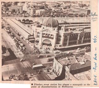
Document - Illustration/s, Royal Automobile club of Victoria (RACv), Jun. 1957
Illustration from the RACV Royal Auto magazine of June 1957 of an aerial view of Flinders St Station and buildings on the south side of the Yarra River, showing motor cars, trams and one bus. Also possibly shows the curve from Swanston St into Flinders St. Caption: "Flinders street station has almost a monopoly as the point of disembarkation in Melbourne"In ink on the side" "RACV - Royal Auto - 6/57 Before 1955"trams, tramways, flinders st station, swanston st -
 Melbourne Tram Museum
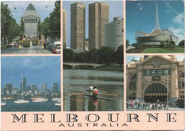
Postcard, Steve Parish Paddington Qld, Five views of Melbourne with trams, 1990
Postcard - full colour, Divided back type of six views of five views of Melbourne of St Kilda Road with trams, Rowing on the Yarra River with the city skyline in the background, The Arts Centre, Flinders St station and a view from Williamstown back to the CBD. Has title "Melbourne Australia" on the underside of the photos. Steve Parish production, 1990, produced in Paddington Qld. Has logo, position for stamp and address on the rear and number PC 308.trams, tramways, melbourne, shrine of remembrance, flinders st station, arts centre -
 Melbourne Tram Museum
Slide, Keith Caldwell, Mar. 1968
Agfa colour slide, blue / white plastic mount, photo by Keith Caldwell of a view from a tram southbound in Kingsway section where the road bridge starts to rise to cross over the tram track and then the Yarra river. Tram 802, West Coburg - via William St, route 55 is in the view. Tram has adverts for Tolley's Brandy and ? in Essendon. 3/1968In ink "St K jct 3/68"trams, tramways, kingsway, bridges, route 55, west coburg, tram 802 -
 Melbourne Tram Museum
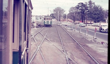
Slide - Set of 3, Keith Caldwell, March 1967?
Set of three Agfa colour blue white plastic mount slides, photo by Keith Caldwell of : .1 - W2 651 outbound on route 15 to St Kilda beach negotiating trackwork at the St Kilda Junction. .2 - view from Upton Road overpass looking east at the Queensway road and tram track construction .3 - ditto, looking west shows the St Kilda Road bridge section being constructed c early, possibly March 1967.1 - "BXBU" and on .3, .1 also has "MBR River" in ink.trams, tramways, st kilda rd, st kilda junction, w2 class, route 15, trackwork, queensway, tram 651 -
 Melbourne Tram Museum
Postcard, Bartel Postcards, three photos of Melbourne scenes, early 1990's
Colour postcard 3 photo panels, blue border, divided back - Bartel Postcards: 1 - View of Melbourne over the Yarra River 2 - Princes Bridge 3 - B2 2013 in Bourke St, East Brunswick, Route 96 Back has space for name and address, stamp and a message and details of the postcard. Produced by Bartel Postcards possibly early 1990's Card No. BG318 Has "Melbourne Australia" along the bottom edge. Two copies held.trams, tramways, bourke st, mall, b class, tram 2013 -
 Melbourne Tram Museum
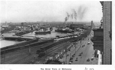
Photograph - Illustration, c1916
Illustration from a photograph reproduced in a magazine of the river Yarra, Flinders St railway yard, the viaduct, the swing basin, the wharves and Queens Bridge. Has a number of cable cars and trains in the view. Taken prior to the construction of the second or duplicate viaduct which was completed during 1915. Construction of the second viaduct on the south side of the original can be seen.in ink in bottom right hand comer "By 1916"trams, tramways, flinders st, railways, shipping, cable trams -
 Melbourne Tram Museum
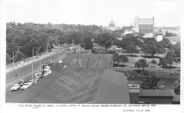
Postcard, Rose Stereograph Co, Flinders St station clock tower looking south towards the Shrine, 1956
Postcard - Rose Series black and white of the view from the Flinders St station clock tower looking south towards the Shrine. Shows St Kilda Road, Prince Henry's Hospital, the Yarra River and the gardens on the south side of the river. Has two trams in the view. On the lower edge of the card "The Rose Series P13602 Looking over St Kilda Road from Flinders St Station Melb. Vic" and "Olympic Year 1956". On the rear is a note written to Keith from Ken of Barkly St Mornington on 14/1/58 mainly about a Pat Lyton? now a tram conductor at Hanna St and a meeting with Brian. Has some personal notes about Pat.trams, tramways, flinders st, postcards, st kilda road -
 Melbourne Tram Museum
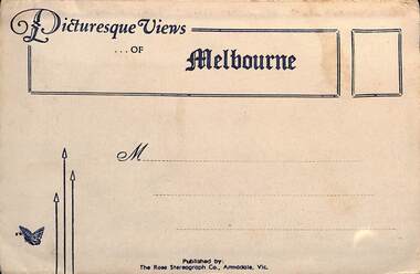
Postcard - Folder, Rose Stereograph Co, "Picturesque Views of Melbourne", mid 1930s
Comprises 12 photos of Melbourne, mid to late 1930s. Produced by Rose Stereograph of Armadale. 1 - Botanical Gardens and Government House Melbourne. - 2 - The MacRobertson Fountain Melbourne - Both the Fountain and the Shrine of Remembrance were completed in 1934. Government House tower features in the background. Also note the absence of any mature trees. See reference - completed 1934. 3 - Flinders Street Railway Station with a "W" class tram in Flinders Street and "Y" class tram in Swanston Street in the view 4 - St Kilda Road Melbourne - Looking south with the Queen Victoria Gardens in the left of the photo. 5 - Collins Street Melbourne - Showing the Regent Theatre, Manchester Unity Building and the Town Hall. 6 - Princes Bridge and city Skyline Melbourne - Shows; Princes Bridge, Yarra River, Excursion Ferry, Princes Walk, Flinders Street Railway Station, the Nicholas and Manchester Unity Buildings in Swanston Street and the Sargood Gardner building in Flinders Street. 7 - The Conservatory, Fitzroy Gardens Melbourne - 8 - The Cathedral Corner Melbourne - shows; Young & Jacksons Hotel, St Paul's Cathedral, The Gas & Fuel building, Ball & Walsh Department store and The State Theatre plus several "w" class trams in Swanston Street. 9 - St Kilda Road Melbourne - Looking south from Nolan Street. Note trees still present at the entrance area to the Shrine of Remembrance. 10 - Looking across Princes Bridge to St Kilda Road Melbourne - Looking south from the roof of the Nicolas Building showing; Princes Bridge, St. Kilda Road, The Shrine of Remembrance and the Victoria Barracks in the distance. 11 - Parliament House Melbourne - in Spring Street 12 - Captain Cook's Cottage, Fitzroy Gardens Melbourne - Erected in the gardens in 1934. Yields information about Melbourne city views and new attractions mid 1930s. Paper envelope folder with 6 photos on each side of a foldout section titled "Picturesque Views of Melbourne" melbourne, photo folders, postcards -
 Melbourne Tram Museum
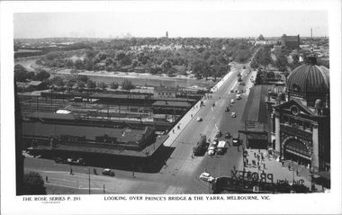
Postcard, Rose Stereograph Co, "Looking over Princes Bridge & The Yarra, Melbourne", c1941
Rose Series postcard No. P 201, titled "Looking over Princes Bridge & The Yarra, Melbourne" with a view including Princes Bridge Railway Station, Batman Ave. tram terminus with two trams, The Yarra River, the bridge, and the entrance to Flinders St station. The south west curve track from Swanston Street into Flinders Street is visible along with various Safety Zones at the tram stop.Yields information about St Kilda Road, Princes Bridge c1941Postcard - printed real photograph with Rose Stereograph Co. name on the rear. Two copies held.tramways, flinders st station, st kilda road, princes bridge station, princes bridge, yarra river, flinders st, trams