Showing 2496 items
matching gardens and parks
-
 Tennis Australia
Lawn tennis set, Circa 1876
A chest (.1), housing a lawn tennis and badminton set. Black and green lithographic print features couples playing mixed doubles tennis and badminton in Cassiobury Park, with Cassiobury House in the background. Inscription: THE CASSIOBURY GAMES OF/BADMINTON AND GARDEN TENNIS/.../LONDON/DEAN & SON 160 FLEET STREET. The hourglass court used in Wingfield's version of lawn tennis is depicted in this lithograph. Contents include: racquets (.2 -.3); tennis balls (.4 - .5); shuttlecock (.6); badminton net (.7); guy ropes (.8 - .9); ornate pegs (.10 - .11); mallet (.12); and net posts (.13 - .14, 2 parts each). Materials: Wood, Metal, Ink, Glue, Paint, Paper, Lacquer, Gut, Rope, String, Velvet, Bird feather, Felt, Rubbertennis -
 Kew Historical Society Inc
Photograph - 'Fernhurst', 13 Fernhurst Grove, 1978
George Wharton arrived in Melbourne in 1844. An architect and surveyor, he was appointed to lay out the 'Village of Kew' by N.A. Fenwick following the land sales of 1851. A protagonist for Kew's separation from the Boroondara District Road Board, he was elected chairman when Kew achieved municipal status in December 1860. His home, 'Fernhurst', was built in 1866 on eight acres in Studley Park, with a four-storey tower and pyramidal roof. The Italianate home was a prominent Kew landmark. It was demolished in 1979 and replaced by St Paul's College in 1980.Rare colour photograph of what was once a significant mansion in Kew.Original colour positive photograph (Kodak print) of 'Fernhurst' in 1978. Photographed by Stewart West in May 1978, one year before it was demolished, the photograph gives little idea of the large landholding once surrounding the house. Originally accessed from near the corner of Princess Street and Studley Park Road, its gardens had been subdivided in the 1900s and its footprint restricted to 13 Fernhurst Grove. Like many other grand houses, by the 1970s it had been converted into apartments. From the photograph, one can see that the house had retained many of its original features such as the distinctive tower and the wide bow-fronted verandah. The slates on the roof (apart from those on the tower) had been replaced by tiles and the cement render of the exterior painted white. Annotated reverse: "View of Fernhurst Home Taken from Street / 10"fernhurst, 13 fernhurst grove -- kew (vic.), george wharton, italianate architecture, vila maria society, st paul's school for the blind -
 Kew Historical Society Inc
Photograph - 'Fernhurst', 13 Fernhurst Grove, 1978
George Wharton arrived in Melbourne in 1844. An architect and surveyor, he was appointed to lay out the 'Village of Kew' by N.A. Fenwick following the land sales of 1851. A protagonist for Kew's separation from the Boroondara District Road Board, he was elected chairman when Kew achieved municipal status in December 1860. His home, 'Fernhurst', was built in 1866 on eight acres in Studley Park, with a four-storey tower and pyramidal roof. The Italianate home was a prominent Kew landmark. It was demolished in 1979 and replaced by St Paul's College in 1980.Rare colour photograph of what was once a significant mansion in Kew.Original colour positive photograph (Kodak print) of 'Fernhurst' in 1978. Photographed by Stewart West in May 1978, one year before it was demolished, the photograph gives little idea of the large landholding once surrounding the house. Originally accessed from near the corner of Princess Street and Studley Park Road, its gardens had been subdivided in the 1900s and its footprint restricted to 13 Fernhurst Grove. Like many other grand houses, by the 1970s it had been converted into apartments. From the photograph, one can see that the house had retained many of its original features such as the distinctive tower and the wide bow-fronted verandah. The slates on the roof (apart from those on the tower) had been replaced by tiles and the cement render of the exterior painted white. Annotated reverse: "Fernhurst from higher ground level side shot / 7"fernhurst, 13 fernhurst grove -- kew (vic.), george wharton, italianate architecture, vila maria society, st paul's school for the blind -
 Kew Historical Society Inc
Photograph - 'Fernhurst', 13 Fernhurst Grove, 1978
George Wharton arrived in Melbourne in 1844. An architect and surveyor, he was appointed to lay out the 'Village of Kew' by N.A. Fenwick following the land sales of 1851. A protagonist for Kew's separation from the Boroondara District Road Board, he was elected chairman when Kew achieved municipal status in December 1860. His home, 'Fernhurst', was built in 1866 on eight acres in Studley Park, with a four-storey tower and pyramidal roof. The Italianate home was a prominent Kew landmark. It was demolished in 1979 and replaced by St Paul's College in 1980.Rare colour photograph of what was once a significant mansion in Kew.Original colour positive photograph (Kodak print) of 'Fernhurst' in 1978. Photographed by Stewart West in May 1978, one year before it was demolished, the photograph gives little idea of the large landholding once surrounding the house. Originally accessed from near the corner of Princess Street and Studley Park Road, its gardens had been subdivided in the 1900s and its footprint restricted to 13 Fernhurst Grove. Like many other grand houses, by the 1970s it had been converted into apartments. From the photograph, one can see that the house had retained many of its original features such as the distinctive tower and the wide bow-fronted verandah. The slates on the roof (apart from those on the tower) had been replaced by tiles and the cement render of the exterior painted white. Annotated reverse: "Back view of Fernhurst / 8"fernhurst, 13 fernhurst grove -- kew (vic.), george wharton, italianate architecture, vila maria society, st paul's school for the blind -
 Kew Historical Society Inc
Photograph - 'Fernhurst', 13 Fernhurst Grove, 1978
George Wharton arrived in Melbourne in 1844. An architect and surveyor, he was appointed to lay out the 'Village of Kew' by N.A. Fenwick following the land sales of 1851. A protagonist for Kew's separation from the Boroondara District Road Board, he was elected chairman when Kew achieved municipal status in December 1860. His home, 'Fernhurst', was built in 1866 on eight acres in Studley Park, with a four-storey tower and pyramidal roof. The Italianate home was a prominent Kew landmark. It was demolished in 1979 and replaced by St Paul's College in 1980.Rare colour photograph of what was once a significant mansion in Kew.Original colour positive photograph (Kodak print) of 'Fernhurst' in 1978. Photographed by Stewart West in May 1978, one year before it was demolished, the photograph gives little idea of the large landholding once surrounding the house. Originally accessed from near the corner of Princess Street and Studley Park Road, its gardens had been subdivided in the 1900s and its footprint restricted to 13 Fernhurst Grove. Like many other grand houses, by the 1970s it had been converted into apartments. From the photograph, one can see that the house had retained many of its original features such as the distinctive tower and the wide bow-fronted verandah. The slates on the roof (apart from those on the tower) had been replaced by tiles and the cement render of the exterior painted white. Annotated reverse: "Fernhurst front view taken from across Fernhurst Grove / 6"fernhurst, 13 fernhurst grove -- kew (vic.), george wharton, italianate architecture, vila maria society, st paul's school for the blind -
 Kew Historical Society Inc
Photograph - 'Fernhurst', 13 Fernhurst Grove, 1978
George Wharton arrived in Melbourne in 1844. An architect and surveyor, he was appointed to lay out the 'Village of Kew' by N.A. Fenwick following the land sales of 1851. A protagonist for Kew's separation from the Boroondara District Road Board, he was elected chairman when Kew achieved municipal status in December 1860. His home, 'Fernhurst', was built in 1866 on eight acres in Studley Park, with a four-storey tower and pyramidal roof. The Italianate home was a prominent Kew landmark. It was demolished in 1979 and replaced by St Paul's College in 1980.Rare colour photograph of what was once a significant mansion in Kew.Original colour positive photograph (Kodak print) of 'Fernhurst' in 1978. Photographed by Stewart West in May 1978, one year before it was demolished, the photograph gives little idea of the large landholding once surrounding the house. Originally accessed from near the corner of Princess Street and Studley Park Road, its gardens had been subdivided in the 1900s and its footprint restricted to 13 Fernhurst Grove. Like many other grand houses, by the 1970s it had been converted into apartments. From the photograph, one can see that the house had retained many of its original features such as the distinctive tower and the wide bow-fronted verandah. The slates on the roof (apart from those on the tower) had been replaced by tiles and the cement render of the exterior painted white. Annotated reverse: "Front view of Fernhurst showing tower to advantage / 9"fernhurst, 13 fernhurst grove -- kew (vic.), george wharton, italianate architecture, vila maria society, st paul's school for the blind -
 Kew Historical Society Inc
Photograph - 'Fernhurst', 13 Fernhurst Grove, 1978
George Wharton arrived in Melbourne in 1844. An architect and surveyor, he was appointed to lay out the 'Village of Kew' by N.A. Fenwick following the land sales of 1851. A protagonist for Kew's separation from the Boroondara District Road Board, he was elected chairman when Kew achieved municipal status in December 1860. His home, 'Fernhurst', was built in 1866 on eight acres in Studley Park, with a four-storey tower and pyramidal roof. The Italianate home was a prominent Kew landmark. It was demolished in 1979 and replaced by St Paul's College in 1980.Rare colour photograph of what was once a significant mansion in Kew.Original colour positive photograph (Kodak print) of 'Fernhurst' in 1978. Photographed by Stewart West in May 1978, one year before it was demolished, the photograph gives little idea of the large landholding once surrounding the house. Originally accessed from near the corner of Princess Street and Studley Park Road, its gardens had been subdivided in the 1900s and its footprint restricted to 13 Fernhurst Grove. Like many other grand houses, by the 1970s it had been converted into apartments. From the photograph, one can see that the house had retained many of its original features such as the distinctive tower and the wide bow-fronted verandah. The slates on the roof (apart from those on the tower) had been replaced by tiles and the cement render of the exterior painted white. Annotated reverse: "Fernhurst corner shot through trees / 12-22"fernhurst, 13 fernhurst grove -- kew (vic.), george wharton, italianate architecture, vila maria society, st paul's school for the blind -
 Melbourne Tram Museum
Slide, Keith Caldwell, 12/03/1960 12:00:00 AM
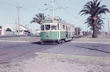
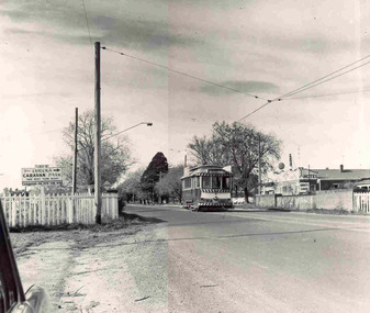
Agfa Colour slide, cardboard mount, by Keith Caldwell dated 12 March 1960, of W5 818 running in Mount Alexander Road, North Essendon, crossing the street access for Marco Polo Street. The tram showing route 59, Essendon Aerodrome, has trolley wheels and has a second person in the cab, possibly a trainer. Unusually the tram number is placed above the headlight, In the background are the palm trees in the centre median plantation. The house with the red guttering is one that dates back to the gold mining era. See http://www.esshissoc.org.au/1070%20Mount%20Alexander%20Road.pdf It was relocated to Woodland Park during 2017? Note the Centre poles, overhead construction and street light. Also in the background is a Mobil Service station that later became a garden centre. Now a block of apartments.hand stamped "12 Mar '60"trams, tramways, mount alexander rd, north essendon, essendon airport, essendon aerodrome, route 59, w5 class, tram 818 -
 Melbourne Tram Museum
Photograph - Set of 3 Black & White Photograph/s, c1920
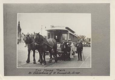
Set of three black and white photographs of the Melbourne Zoo Horse tram. .1 - view of tram with horses, a conductor, and a well dressed family in front of the tram. Photo taken at the Sydney road terminus. Has the note under the photo "Zoo Horse Tram Mr Richardson of W. Brunswick, driver." .2 - Side of view of the horse tram - No. 42 with "Royal Park" on the side. .3 - View of the zoo terminus, from the rear of the tram with "Zoological Gardens" on the rear dash panel of the tram. The conductor appears to be applying the hand brake. Note the signage on the right side of the photo. Photos c1900 to 1910. 2nd copy of .2 and .3 added from the Keith Kings collection - 14-8-2021 - see also Reg Item 5993 for another copy.On the rear of .3 -"M. G. R? collection" On rear of 2nd copy of .2 is the MMTB Stamp.trams, tramways, horse trams, royal park, zoo tram, tram 42 -
 Federation University Historical Collection
Booklet, N.L. Harvey Photographers, All that Glitters ... :The Growth of Ballarat Victoria, c1966
Red, blue and gold soft covered booklet. Images include the Ballarat Town Hall, The Eureka Monument, Begonia house, Ballarat Botanic Gardens,M.B. John, Sebastopol Technical School, reservoirs, Ballarat Base Hospital, Calembeen Park, Ballarat Industrial Estate, Lal Lal Falls, Buninyong Golf Course, Mayne Nickless, Firth Cleveland Plant, Bendix Mintex, Bunge, (Aust.) Pty Ltd, Martin's Stoneware, Sunshine biscuits, Timken, M.B. John and Hattersley Limited, Ballarat Gas Company, Ballarat Paper Mills, Ballarat Woollen and Worsted Mills, Eclipse Motors, E. Lucas and Co, Milk Processors Pty Ltd, Eureka Valves, Paddle Bros., George Farmer Pty Ltd, Sebastopol technical School, Burrumbeet and Windermere Co-Operative Society Ltd .greater ballarat association, develop victoria council, ballarat, begonia queens, yvonne arstall, carol penrose, wendy longmore, lal lal falls, ballarat town hall, the eureka monument, begonia house, ballarat botanic gardens, m.b. john, sebastopol technical school, reservoirs, ballarat base hospital, calembeen park, ballarat industrial estate, buninyong golf course, mayne nickless, firth cleveland plant, bendix mintex, bunge, martin's stoneware, sunshine biscuits, timken, m.b. john and hattersley limited, ballarat gas company, ballarat paper mills, ballarat woollen and worsted mills, eclipse motors, e. lucas and co, milk processors pty ltd, eureka valves, paddle bros., george farmer pty ltd, yvonne arsrtall, wendouree, shire of wendouree, guncotton factory, regina glass fibre -
 Ballarat Heritage Services
Photograph - Photograph - Colour, Burke and Wills Memorial at Bendigo Cemetery, 2018, 02/09/2018
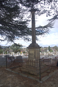
Robert O'Hara Burke and Thomas Pope Besnard were childhood friends. As sexton of the local Back Creek Cemetery Thomas Besnard organised a subscription to raise the money for a monument to Burke, Wills and Gray. A subscription of one shilling, no more and not less, was asked so all subscribers were equal. The Bendigo monument was designed by Adam Duncan and features a Corinthian column mounted on a foundation stone, topped with a Grecian urn draped with the Union Jack. The stone for the monument was quarried from New Chum Mine. The site in the Bendigo Cemetery was selected by Besnard so the monument was on a grass knoll well clear of any other graves. The design included landscaping with a path and garden beds that provided dignified access. The Burke and Wills Monument in Bendigo has been entered on the Register of the National Estate as being important for its association with historical events and developments associated with exploration in the early days of Colony of Victoria. Two conifers remain from the original group sent by Mueller of the Melbourne Botanical Gardens to develop the garden layout on the knoll. These two trees are listed as Significant Trees by City of Greater Bendigo. The foundation block was laid on 20 August 1862 by Chairman of the Bendigo Municipality, Charles Burrows – exactly two years after the Expedition left Melbourne. A half day holiday was declared by Bendigo Council, and a procession left the Bendigo Town Hall and marched to the cemetery where 8000 people were gathered and another 4000 lined the route. John King was unable to attend due to ill health. Chairman of the Municipality of Bendigo, Charles Burrows, gave a long address, and diaries of members of the expedition, the Sandhurst Almanac, the Bendigo Advertiser, the Bendigo Independent Evening News, photographs of the deceased, photographs of Public Buildings in Bendigo, a Sydney half sovereign and all the silver coins of the Realm were wrapped in a Union Jack and placed in a niche in the foundation stone. Fifteen months later a column was erected on the foundation stone after Besnard openly criticised the Memorial Committee for their lack of action. The Bendigo Advertiser was disappointed at the location of the monument preferring a more central location and in 1893 an attempt was made to move the monument to Rosalind Park. On 19 May 1893, Mr Minto, the City Surveyor of the Bendigo MunicIpality reported it would cost £25, and no other action occurred. In 1940 the land around the memorial was sold off as grave sites and the paths and garden beds disappeared with graves now surrounding the base of the monument. The Burke and Wills Monument in Bendigo Cemetery was entered on the Register of the National Estate for its association with historical events and developments associated with exploration in the early days of Colony of Victoria. Two conifers remain from the original group sent by Mueller of the Melbourne Botanical Gardens to develop the garden layout on the knoll. These two trees are listed as Significant Trees by City of Greater Bendigo.Burke and Wills Memorial at Bendigo Cemetery, 2018Erected by the people of Bendigo in honor of the Victorian Explorers, Burke, Wills, Gray and King who first crossed the continent of Australia. King alone surviving the privation and suffering under which his three brave ill-fated companions sank. A.D. 1862. Robert O'Hara Burke, leader of the Victorian Expedition, left Melbounre 24th August 1860. Reached Carpentaria 12th Feby 1861. Died on his return at Coopers Creek, 30th June 1861. Charles Gray, died also on his return at Polygorum Swamp. 17th April 1861. William John Wills, second in command, died also near Coopers Creek, 29th June 1861. bendigo cemetery, burke and wills, burke and wills memorial, william john wills, john o'hara burke, charles gray, polygonum swamp, coopers creek, victorian expedition, carpentaria, bendigo public cemetery, bendigo remembrance park, thomas pope besnard -
 Glen Eira Historical Society
Letter - Halley Park
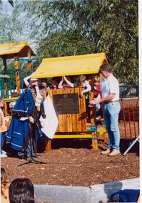
... Parks ...This file contains three items. A letter to Ms Wendy A. Ross from Hazel Ford, secretary of the Glen Eira Historical Society, dated 31/05/2002. A letter to Felicitie Camplbell from Wendy A. Ross dated 07/05/2002, along with three photographs which were enclosed with the letter, including two of Mayor of Moorabbin, Cr. R. J. Bob Flavell, opening the playground at Halley Park, and one of a plaque. Three photographs including two of Halley Park Opening Ceremony where the Mayor of Moorabbin opened the playground at Halley Park which was the winner of the COMMUNITY PROJECT OF THE YEAR 1994 award, and one of the plaque commemorating the organisations that developed the park, photographs taken on 01/05/1994.ross wendy a., campbell felicitie, moorabbin, bentleigh, marquis road bentleigh, halley park, glen eira historical society, ford hazel, flavell r. j. cr., flavell bob cr., jasper road bentleigh, mortimore street bentleigh, playgrounds, parks, reserves, friends of halley park inc., community project of the year, apex club, playground equipment, children’s playgrounds, gardens, recreations establishments, healthy hearts local government state awards 1994, plaques -
 Ballarat Tramway Museum
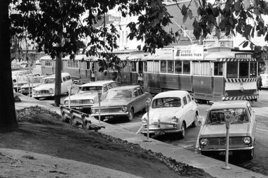
Photograph - Digital image Set of 8, George Coop, 1968 - 1970
Yields information about the City Loop area and its operation. Eight (8) Digital images taken by George Coop during the period 1968 - 1970, of trams at the City Loop. .1 - 33, 17 and two other single truckers parked in the loop with motor vehicles and parking meters. No. 33 has an Eureka Roofing Tile Advert. .2 - 28? passing two track workers cleaning the west end points with a bogie car and three single truckers in the loop. In the background are Patersons and Dickins Food Store. .3 - No. 12 parked at the east end of the loop, hard up against the tram in front. Shows the Section Insulator. .4 - As for .1, front on photo with the destination of City and a "Pay as You Enter". The Dickins sign can be seen. .5 - as for .2, No. 35 leads the queue. Has the Woolworths Big W store in the background. .6 - view from the rear (12, 30, 17) with No. 33 being driven out of the loop. .7 - View from the rear, 33 has moved out of view. Has the T&G (Temperance and General) building in the view. .8 - No. 31 moves over the points at the west end of the loop. The tram has the Destination of Gardens via Drummond North, a Twin Lakes advert and a SEC Electric Cooking Advert.trams, tramways, city loop, sturt st, trackwork, overhead, tram 33, tram 17, tram 26, tram 12, tram 35, tram 31 -
 Eltham District Historical Society Inc
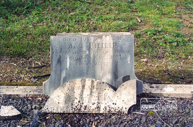
Negative - Photograph, Harry Gilham, Grave of Sarah and Phillip Shillinglaw, Eltham Cemetery, Victoria, Sep 2009
Philip Shillinglaw and his wife Sarah came to Eltham in 1882. Their property "Wattle Brae" originally encompassed present-day Eltham Central Park and part of Eltham Library, extending north to include Andrew Park and the site of the railway station. An early photo shows that much of it was planted for crops. They also had cows; in 1913 Philip wrote to the local paper complaining about an earlier report that one of them had been killed on the railway line. "I give an emphatic denial to the report. It is not true." Their house Shillinglaw Cottage (built by George Stebbings) still exists, though it was moved with funding from local residents in 1963-64 when faced with demolition to make room for new Council Offices. Philip was actively involved with the Methodist Church as preacher, Church Steward and Sunday School teacher. A Sunday School picnic and a sports carnival were held on his paddock. Eight of his children attended Eltham Primary School. In 1908 he ploughed part of the schoolyard (possibly for use as a garden) free of charge. When Philip died in 1914, his funeral was described as one of the largest ever seen in Eltham. He and Sarah are buried in Eltham Cemetery. In Loving Memory of Sarah Ann Shillinglaw Died 10th Dec. 1891 Also Phillip Loved husband of above Died 18th Aug. 1914 Sweet BestRoll of 35mm colour negative film, 6 stripsKodak GC 400-9eltham cemetery, gravestones, phillip shillinglaw, sarah ann shillinglaw -
 Eltham District Historical Society Inc
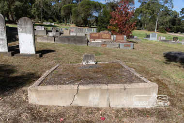
Photograph, Peter Pidgeon, Grave of Sarah and Phillip Shillinglaw, Eltham Cemetery, Victoria, 5 April 2021
Philip Shillinglaw and his wife Sarah came to Eltham in 1882. Their property "Wattle Brae" originally encompassed present-day Eltham Central Park and part of Eltham Library, extending north to include Andrew Park and the site of the railway station. An early photo shows that much of it was planted for crops. They also had cows; in 1913 Philip wrote to the local paper complaining about an earlier report that one of them had been killed on the railway line. "I give an emphatic denial to the report. It is not true." Their house Shillinglaw Cottage (built by George Stebbings) still exists, though it was moved with funding from local residents in 1963-64 when faced with demolition to make room for new Council Offices. Philip was actively involved with the Methodist Church as preacher, Church Steward and Sunday School teacher. A Sunday School picnic and a sports carnival were held on his paddock. Eight of his children attended Eltham Primary School. In 1908 he ploughed part of the schoolyard (possibly for use as a garden) free of charge. When Philip died in 1914, his funeral was described as one of the largest ever seen in Eltham. He and Sarah are buried in Eltham Cemetery. In Loving Memory of Sarah Ann Shillinglaw Died 10th Dec. 1891 Also Phillip Loved husband of above Died 18th Aug. 1914 Sweet BestBorn Digitaleltham cemetery, gravestones, phillip shillinglaw, sara ann shillinglaw -
 Melbourne Tram Museum
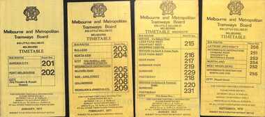
Ephemera - Timetables - MMTB Buses - set of 9, Melbourne & Metropolitan Tramways Board (MMTB), 1976 to 1978
Timetables - provide information on ticketing, fares, timing points, with a description of the route and a map. Not all services had been allocated a route number at the time. 1 - Garden City - Port Melbourne - City - routes 201 and 202 - Jan. 1977 2 - Bulleen - North Kew City - Routes 203, 204, 205, 206, 208 and 209 - Feb. 1977 3 - Deer Park West - Sunshine - Footscray - City - routes 215, 216, 217, 219. 218, 220, 231 with a Saturdays and Sundays timetable sheet printed on green paper - Aug. 1977 4 - La Trobe University - Northland - West Heidelberg - City - routes 256, 251, 253, 254, 252, 255 - Sept. 1978 5- Warrandyte - Park Orchards - Ringwood - routes 273, 274, 275 - June 1976 6 - Warrandyte - Donvale - Templestowe - Shoppingtown - City - routes 276, 277, 278, 294, 278, 280, 299, 268 - July 1976 7 - Box Hill - Mitcham, East Doncaster, Ringwood - routes 287, 286, 288, 282, 283, 272 - June 1976 8 - Box Hill - North Blackburn - route 290 - June 1976 9 - Box Hill - Heidelberg, East Doncaster, Shopping town - routes 291, 297, 296, 293, 271 and 269 - Sept. 1976Yields information about MMTB Bus services during the mid 1970s. Set of nine MMTB Bus timetables - multifolded printed on yellow paper, unless noted otherwise. timetable, mmtb, buses, port melbourne, garden city, deer park, fisherman's bend, west heidelberg, box hill, doncaster, shoppingtown, mitcham, ringwood, blackburn, templestowe, lower templestowe -
 Ballarat Heritage Services
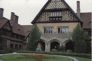
Photograph - digital photographs, Potsdam, Cecilienhof Palace, 10/2007
It was at the “Schloss Cecilienhof” (Cecilienhof Palace) that Churchill, Truman and Stalin met from June 17 to August 2, 1945, for the Potsdam Conference. Cecilienhof Palace in the New Garden was the last Hohenzollern palace, built for the crown prince during the years 1913-1917. The end of monarchy in 1918 was another hard blow for the town, which so far was shaped by the Royal Court, garrison and administration. During the night of April 14, 1945, a British air raid destroyed large parts of the inner city of Potsdam. Battles against Soviet military units during the last days of April 1945 caused still more and heavy damages. The parks and their palaces remained almost unscathed. After the war ended, from the end of July until the beginning of August 1945, the Potsdam Agreement was negotiated and signed between Churchill, Truman and Stalin in Cecilienhof Palace. http://www.historicgermany.travel/historic-cities/potsdam/history Colour photograph of, Cecilienhof Palace, Potsdampotsdam -
 Ringwood and District Historical Society
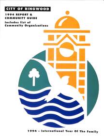
Book, City of Ringwood, City of Ringwood 1994 Report & Community Guide, 1994
The City of Ringwood and the City of Croydon merged in December 1994 and became the City of Maroondah.Community information book issued by City of Ringwood for 1994 - covering the facilities and activities of the Ringwood Council and other local organisations and associations. Includes Ringwood Public Golf Course discount vouchers and two Ringwood Aquatic Centre bonus entry vouchers.CONTENTS: (page no.) Contents A Message from the Mayor - Cr. Margaret Cheevers 3 Your Council 4 Local State and Federal MPs 5 Council Meetings and Elections 6 History of Ringwood 7 City Manager's Report 8 Organisational structure 9 Human Services 10-19 Environmental Health 20-21 Ringwood Library 22 Parks and Gardens 23 Ringwood's Parks and Reserves 24 Building 25 Engineering Planning Services 26-28 Waste Management 29 Town Planning 30 Traffic and Local Laws 31-33 Roads, Drainage and Major Works 38-39 Halls and Facilities 40-41 Aquatic Centre 42 Convention Centre/Karralika Theatre 43 Golf Course 44 Free Swim & Golf Discount Vouchers 45 Community Organisations 46-64 Finance 65-66 Administration 67 Community Liaison 68 Information Systems 69 Personnel 70-71 Risk Management 71 Rates and Valuations 72 rinx -
 Bendigo Historical Society Inc.
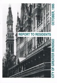
Book - BOOKLET: ''REPORT TO RESIDENTS CITY OF GREATER BENDIGO, OCTOBER 1995''
Front cover is a photo of The Shamrock Hotel. 52 paged booklet - ''Report to Residents - City of Greater Bendigo, October 1995''. Table of Contents; Commissioners; Chief Executive Officer; Council meetings; Office location and hours; ''One Telephone Number''; Committees; Ward boundaries; Elections; Customer services; Rural services; Economic development; Bendigo Tourism Board; Bendigo Trust; Events Bendigo; Capital works 1995/96; Major projects; Discovery; Bendigo Regional Arts Centre; local laws; Fire prevention; Aged and disability services; Children and family services; Environmental health; Recreation and leisure; Parks and gardens; Planning and building; Waste management; Library services; Bendigo Leisureland; Rates; Budget for 1995/96; Index. Contains some photographs and map of proposed 7 internal Wards for the City of Greater Bendigo.Richard Cambridge Printers Bendigo.bendigo, council, report, maxine crouch, maurie sharkey, perer ross-edwards, peter seamer, hadley sides, richard morriss, bernard smith, annie galvin child care centre, bendigo regional art centre, rosalind park, budget 1995/96. bendigo health care services. -
City of Kingston
Photograph - Colour, 6 March 1993
Edithvale is a suburb in the City of Kingston. It is located between Aspendale and Chelsea on the Port Phillip Bay and built within remnant areas of the Carrum Carrum swamp. The foreshore precinct comprises a wide sandy beach, with low sand dunes and numerous historic boat sheds. The suburb consists of older style dwellings and former holiday houses, combined with mid-century housing and newer homes. The large blocks are increasingly subdivided and the existing dwellings demolished to accommodate units and townhouses, thus changing the landscape of the area and reducing the tree canopy.The beachside suburb of Edithvale was previously part of the extensive Carrum Carrum Swamp. The area was once a source of fish and eels for the Mayone-Bulluk clan of the Bunurong people. Over time the area was drained and predominantly devoted to dairy farming and holiday houses. The farms were gradually sold and subdivided with a large number of homes built after World War II and in the 1960s. Edithvale is mainly residential with a shopping strip along Nepean Highway but little significant industry was ever established in the area apart from a plaster works and confectionary factory, both now closed.Laminated aerial colour photograph of Edithvale as viewed from Alexandra Avenue in the north to Ella Grove Chelsea/Edithvale in the south. regents Park Aspendale can be seen in the top left. The area is built-up with residential housing and facilities including Edithvale Primary School, numerous churches and the Edithvale Railway station. Large sections depict the remnant Carrum Carrum swamp. Edithvale Common and the former "Duck Inn" (Melbourne Water/Friends of Edithvale Seaford Wetlands) can be seen. Edithvale Recreational reserve, the valodrome and Edithvale Public Golf Course are prominent. The image shows vacant land in the area now known as Aspendale Gardens and the newer residential section of Chelsea Heights is not developed. A bike path has been established to cover the secondary drain. The Golf Links Court residential development located off Hughes Avenue is a large vacant block.Black type on white adhesive label: 6-3-93 Black type on white adhesive label: 25/9211, 6/3/93, 11.20 am Black type on white adhesive label: 9211 Yellow circular adhesive sticker Black pencil: 9211 6-3-93 arrow pointing Nedthvale, carrum carrum swamp, aspendale, chelsea -
 Surrey Hills Historical Society Collection
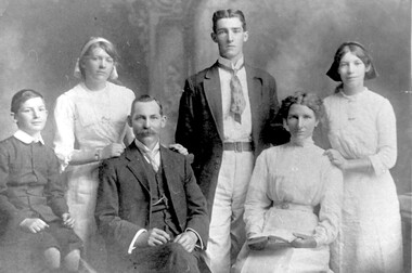
Photograph, Formal photo of the Kleinert family of 34 Union Road, Surrey Hills
William was a coach-builder, wheelwright and blacksmith. He moved from Prahran (13 Regent Street) to Surrey Hills to property owned by the family. The house at 34 Union Road was built in 1905 for William and his wife Emily. Their son Ernest worked with him as a coach painter and also worked as a painter undertaking intricate hand painting on early cars. Their other son Martin played for the Surrey Hills Football Club. In return for the support given to the club by Mrs Emily Kleinert, it built a rotunda in South Surrey Park as a memorial to her. Alan Holt research: Lot 6 was sold to Martin Kleinert by Karl Richter in 1860 together with a portion of another adjacent lot. From 1860-1885 Martin worked it as a market garden leasing some land for grazing when it was not required for gardening. He died in 1898. In a formal document, William declared he was the son of Martin "who purchased land in 1860, died in 1898 and the land has been continually occupied by father and family since. It has been cultivated as a market garden; when not being used for gardening it was let for cultivation and grazing." William died in 1939 and the property passed to his sons Martin and Ernest. The Kleinert land extended from Union Road to Essex Road. They ran horses, ducks and fowls and Emily Kleinert grew flowers. The Kleinert property later became the South Surrey Park. The family sold the land to the Camberwell Council in the 1950s. Ernest and Ida Kleinert lived on the corner of Scotsdale and Warrigal Roads. The donor of the photo Nada Harris, nee Kleinert, was Ernest and Ida's daughter. Ida lived to a good age (> 93 years) and in later life lived in Burwood. Many of the family are buried in Box Hill Cemetery. Friedrich Johann Wilhelm (William) Kleinert (1870-1949) married (1872-1937) in 1893. Their children were: Ernest Henry John (1892-1971) married Ida Grace Vassie. Ivy Louise (1898-1952) Martin William (1903-1964) Henriette Rose (Hetta Rose) 1896-1958.Black and white photo of William and Emily Kleinert and family. The children are L to R: Martin, Rose, Ernest and Ivy.surrey hills football club, blacksmiths, wheelwrights, coachbuilders, south surrey park, rotunda, friedrich johann wilhelm kleinert, william kleinert, emily florence radford, emily florence kleinert, ernest henry john kleinert, ida grace vassie, ida grace kleinert, ivy louise kleinert, martin william kleinert, henriette rose kleinert, hetta rose kleinert, rose kleinert, nada harris, nada kleinert -
 Stawell Historical Society Inc
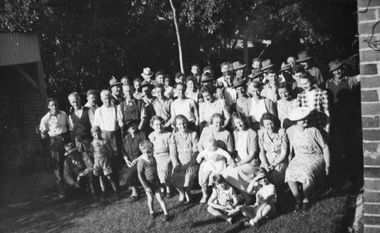
Photograph, North Park Volunteers instrumental in making North Park at the home of Mr G LaGerche 1948, 1948
Group of North Park Volunteers 1948 instrumental in making North Park. Taken in backyard of Mr G LaGerche's home Cnr Houston and Lamont Streets. This snapshot was donated by miss Glenda Hurst - Stawell - to the Society - Black and White Photograph of a large group of persons - Background of trees.On rear: North Park Volunteers 1948. Taken in the back garden of Mr G LaGerche (morning Tea). Men L to R Roy Hurst, Alan Willoughby, Fred Crouch, Arthur Parsons, Cyril Cashin, Glynn Cashin. Ladies Second Row L to R: Mrs Edna(Geoff) LaGerche, Mrs Pretty, ?, Mrs Darling, Ladies in front Row: ?, ?, Mrs Ted Mills, Mrs Harold Dunn, Miss Dorothy Kingston, Mrs Bess (bill) Wilson, ?, . Farmers brought in their Not Horse drawn graders, etc to form the two (2) ovals at "The Pug" Photo property R.W. Hurst. 29 Houston Street Stawellstawell, north park -
 Melbourne Tram Museum
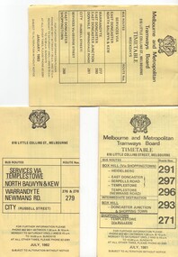
Ephemera - Timetable/s, Melbourne & Metropolitan Tramways Board (MMTB), "MMTB Bus Timetables", 1981 - 1984
Timetables for specific routes, day of week giving information on tram times at specific time points, route map, sections and fares and organisation address - 616 Little Collins St. Melbourne. All printed on yellow paper. .1 - Timetable for Box Hill via Shoppingtown and Templestowe, Doncaster bus services, dated July 1981 - routes 291, 297, 296, 293 and 271. .2 - Services via Templestowe, North Balwyn and Kew, Warrandyte and Newmans Rd - routes 276, 278 and 279 - July 1982 .3 - Services via East Doncaster, North Balwyn, Kew, Warrandyte, City, Shoppingtown - routes 277, 280, 281 and 268 - dated Jan. 1983 .4 - ditto as above, including Park Orchards and Donvale - routes 265, 262, 261, 260, 266 and 264 - dated Feb. 1983 .5 - North Altona - City Route 232 - April 1984 - issued by Metropolitan Transit with their logo. 6 - Garden City, Port Melbourne - City - Sept 1982 - routes 201, 202 7 - Sunshine - Footscray - City - Routes 230 and 231 - Jan. 1982 8 - North Altona - City - MMTB logo, route 232 - Nov. 1982 9 - East Kew, Box Hill, Doncaster - Express bus - Box Hill to City - routes 284, 270, 300 - April 1982 10 - Ringwood - Warrandyte, Park Orchards, Mitcham - routes 313, 31, 315 and 316 - Jan. 1983Yields information about MMTB Bus services early 1980s and 1 The Met badged item.Set of 9 MMTB and 1 MTA Bus timetables, folded sheets, 8 sections.trams, tramways, mmtb, timetables, melbourne, fares, east kew, box hill, doncaster, north altona, route 232, route 201, route 202, route 220, route 231, route 284, route 270, route 300, route 313, route 314, route 315, route 316 -
 Old Colonists' Association of Ballarat Inc.
Photograph - Photograph - Colour, Ballarat Old Colonists' Association Homes, Charles Anderson Grove, Ballarat
HISTORY OF THE BALLARAT OLD COLONISTS' ASSOCIATION HOMES AT CHARLES ANDERSON GROVE, LAKE GARDENS One of the original objectives of the Association was “to provide the shelter of a house for those Pioneers of the Goldfields whom the reverses of fortune have deprived of the means of procuring the comforts of life in their declining years.” While the first home at Charles Anderson Grove was built in 1925 the Association had previously provided relief for needy pioneers from the time it was formed in 1883. Relief included monthly monetary payments, loads of firewood, medical assistance and distribution of Christmas boxes of groceries to deserving pensioners and in some cases payment of burial costs. Records indicate that in September 1922 three of the pensioners being assisted by the Association were accepted as residents in the newly erected Hassell Homes in Gillies Street (now demolished-opposite the High School). The first site for an Asylum for Indigent Members of the Old Colonists' Association was temporarily reserved from sale in October 1891. The site was approximately 28 acres in area in Mt Clear nearly opposite Midvale Shopping Centre in Main Road. The site was heavily timbered and when cleared over 260 tons of wood was sold to the Woah Hawp Gold Mining Company. A set of gates were erected but no homes built, although a plan for this reserve was drawn which showed twenty buildings ranging from one to four unit per building. The reserve was revoked in November 1909. The second site temporarily reserved in November 1909 as an Asylum was in Alfredton and consisted of some 7 acres and was adjacent to land reserved for an Abattoirs for the Ballarat Council. The reserve was revoked in February 1912 as it was deemed more appropriate to be added to the Abattoir site. Council suggested four (4) other sites in exchange for this land and they were inspected by the President, Vice President and Secretary on 22 December 1912. The first site inspected was land on the west side of Creswick Road opposite the brick kilns (now occupied by the showgrounds and oval). The land was described as being good quality, well fenced, no trees, good drainage and ample acreage but some distance from trams. The second site was Perry Park which was described as being good land, well fenced, having frontage to Gillies Street, good drainage and about 26 acres (but subsequently reduced to 10 acres). It was closely planted with Pinus Insignias and Wattle and had easy access from the Botanic Gardens tram. The third site was the North West portion of Victoria Park (corner of Sturt and Gillies Street) and was described as good land, well fenced and drained and well located. The fourth site was the South West corner of Victoria Park and known as Pound Paddock (corner of Winter Street and Gillies Street). It was considered to be low lying and too close to the Abattoir, and was also a considerable distance from trams. While the third site was recommended as the most suitable for the erection of homes it was considered unwise from the point of view as citizens to reduce the acreage of the park and therefore it was recommended that the Perry Park site be asked for as the most acceptable to the Association for the building of homes. The site was eventually temporarily reserved for an Asylum for Indigent Members of the Association in April 1914 with the gates from Mt Clear having been removed to the site a year earlier and eventually erected in 1917 for £12.10.0. In the same year the first 290 pine trees were advertised for removal in July and sold for £16. A sign indicating that the site was reserved for the erection of cottages was erected in September 1917. Stripping of the wattle bark (for tanning) and the cutting of the wood occurred in November 1918 with the land then being leased until it was required for the construction of the first homes in 1924. While the site was the third to be reserved it was the only one which was used for its intended purpose. It was named as Charles Anderson Grove in honour of Charles Anderson who joined the Association in 1918 and was President of the Association from 1942 to 1944. A number of cottages in the Ballarat Old Colonists' Association Retirement Village of Gillies Street, Ballarat.charles anderson grove, old colonists' club, ballarat, old colonists' association, old colonists' homes, retirement village -
 Bendigo Military Museum
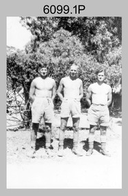
photograph - Fortuna - 1st Year of Army Occupation in Bendigo, 1942
This is a set of 17 photographs taken during the first year of Army occupation at Fortuna, Bendigo in 1942. The photos provide an insight into the preparatory work performed on the Fortuna Villa and surrounding buildings, by the Working Party 5th Army Troop and Ordnance Training Depot, before its occupation by personnel from LHQ Cartographic Company, Royal Australian Survey Corps. The annotation on the back of Photos .9P and .10P is misspelt. The correct spelling is ‘Nell Gwynne’. The poppet head of the Central Nell Gwynne mine is still an iconic landmark in Bendigo, lying just down the road from the poppet head lookout at Victoria Hill. The Central Nell Gwynne was the premier mine of Bendigo's 1930s mining revival and is of high historical value, due to the extensive and relatively intact features which remain at the site. The annotation on the back of Photo .17P is incorrect. The location of HQ 5th Army Troop was ‘Reynard St, Coburg.’ By late 1941 as Japan extended its control throughout Indo-China, resolving the accommodation problem of AHQ Cartographic Company located in Melbourne became more urgent. The steady Japanese advance made the bombing of Melbourne no longer a remote possibility, and in accordance with a general policy of dispersion, the Deputy Chief of the General Staff, Major General Sidney Rowell instructed Major William Sarll, in the interests of security of plant and to provide against possible damage of air attack, to investigate suitable safer inland accommodation for AHQ Cartographic Company. Major Sarll inspected many properties before finding one that would meet the requirements of the Cartographic Company. In late 1941, he came to inspect Fortuna, a rambling old mansion with about fifteen acres of ground in central Bendigo. Initially there was no intention to occupy the site beyond the end of the war, although Major Sarll's report to the Director of Survey noted many advantages in moving the Company to Bendigo. Major General Rowell quickly approved the selection of Fortuna before other authorities, which were investigating the evacuation of school children, could get in ahead of the Cartographic Company. On 23 March 1942, the Commonwealth of Australia, under the provisions of the National Security Act of 1939, took possession of the house, the old battery buildings and the fifteen acres of grounds. Under Warrant Officer J. Trist’s direction, over fifty Parks and Works tradesmen completed building works necessary to accommodate the Survey Corps’ military, map making and printing requirements. The building program was still under way when the first officer, Lieutenant Ralph Westgarth, arrived in May 1942 with the advance party which received and positioned all equipment as it came up from Melbourne in semi-trailers. Once the equipment was installed the rest of the Cartographic Company completed its shift to Bendigo by 11th June 1942. The first year of the Survey Corps’ occupation of Fortuna is covered in more detail with additional historic photographs, in pages 17-22 of Valerie Lovejoy’s book 'Mapmakers of Fortuna – A history of the Army Survey Regiment’ ISBN: 0-646-42120-4.This is a set of 17 photographs taken during the first year of Army Occupation at Fortuna, Bendigo in 1942. The black and white photographs were printed on photographic paper and are part of the Army Survey Regiment’s Collection. The photographs were scanned at 300 dpi. .1) - Photo, black & white, 1942. Bendigo Parks and Works tradesmen at Fortuna. L to R: Cliff Day, Ernie Arnold, Norm? .2) - Photo, black & white, 1942. “Don” - possibly SGT Don Sutcliffe. Fortuna, Bendigo. .3) - Photo, black & white, 1942. Parks and Works tradesmen in garden at Fortuna, Bendigo. L to R: Fred & Ernie. .4) - Photo, black & white, 1942. Benny Jack Williams at Fortuna, Bendigo. Accommodation tents were erected above the lake, which later became the parade ground. .5) - Photo, black & white, 1942. Working dress - Giggle suits. Parks and Works tradesmen at Fortuna, Bendigo. L to R: Cliff and Harry on big roof. .6) - Photo, black & white, 1942. Parks and Works tradesmen at Fortuna, Bendigo. Ted on big roof. .7) - Photo, black & white, 1942. Gold crusher battery just behind Fortuna. .8) - Photo, black & white, 1942. Scene of Bendigo from Fortuna. .9) - Photo, black & white, 1942. Nell Gwynne Mine from mullock heap at Victoria Hill near Fortuna, Bendigo. .10) - Photo, black & white, 1942. Nell Gwynne Mine and crusher near Fortuna, Bendigo. .11) - Photo, black & white, 1942. Sluicing for gold at Eaglehawk. .12) - Photo, black & white, 1942. Fortuna, Bendigo taken from the far side of tennis courts. .13) - Photo, black & white, 1942. Fortuna, Bendigo & its reflection from across the lake. .14) - Photo, black & white, 1942. Fortuna, Bendigo from the fishpond. .15) - Photo, black & white, 1942. Fortuna, Bendigo. .16) - Photo, black & white, 1942. First Fortuna Football Team at unknown location. L to R: 5th Bob Wright, 11th SGT Don Sutcliffe. .17) - Photo, black & white, 1942. Working Party from 5th Army Troop and Ordnance Training Depot at Fortuna, Bendigo.Some personnel are identified. Annotated with date within photos. .1) – Annotated on back ‘Cliff, Ernie, Norm, Dec ‘42. Cliff Day - dairy farmer, plasterers’ labourer. Ernie Arnold – hard plasterer. Norm? - QM Store for tools etc. QM Store was the Stables.’ .2) - Annotated on back ‘Don. Fortuna 1942’ .3) - Annotated on back ‘Fred & Ernie. Dec 1942. Carpenters. Note the state of the gardens.’ .4) - Annotated on back ‘Benny Jack Williams Fortuna Bendigo. Tents were erected where present day parade ground is above the lake.’ .5) - Annotated on back ‘Working dress - Giggle suits. June 42. Cliff and Harry on big roof. This photo was taken as the ventilating ridge was being installed on the building housing the printing machines. The machines were installed later by civilian labour when building was complete.’ .6) - Annotated on back ‘Ted on big roof Fortuna Bendigo.’ .7) - Annotated on back ‘Gold crusher battery – Bendigo for slay heap – 1942. 12 stamp battery. Just behind Fortuna. Was working at night when the “Army” came to Bendigo. Later removed to “Coolgardie - WA. Present site of Southern Cross TV.’ .8) - Annotated on back ‘Scene of Bendigo from Fortuna. June 1942.’ .9) - Annotated on back ‘Nell Gwyne Mine from mullock heap (Victoria Hill) Sept 1942.’ .10) - Annotated on back ‘Nell Gwyne Mine and crusher September 1942.’ .11) - Annotated on back ‘Sluicing for gold at Eaglehawk. August 1942.’ .12) - Annotated on back ‘Fortuna Bendigo 1942. Taken from far side of tennis courts.’ .13) - Annotated on back ‘ “Fortuna” across the lake & reflection.’ .14) - Annotated on back ‘Fortuna from fishpond June 1942.’ .15) - Annotated on back ‘Fortuna Dec 1942.’ .16) - Annotated on front ‘X’ x2. Annotated on back First Fortuna Football Team 1942‘Bob Wright’, ‘SGT Don Sutcliffe’. .17) - Annotated ‘Working Party at Fortuna before one of the drafts’, Working Party 5th Army Troop and Ordnance Training Depot Showgrounds, now the Sportsground Bendigo’, ‘HQ of 5th Army Troop was Reynards Rd, Coburg.’royal australian survey corps, rasvy, army survey regiment, army svy regt, fortuna, asr -
 Bendigo Military Museum
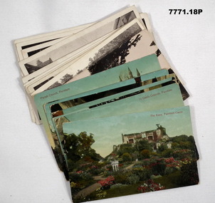
Postcard - POSTCARD, FARNHAM, U.K, Valentine's Series, cWW1
1. Florrie is a relative living in Farnham. 2. R.H. Baron married Elsie Keast in 1921. All cards relate to R.H. Baron's visits to Farnham whilst on leave to see Florrie. Part of the 'Robert H. Baron', no.3596 and Cooper Collection. See Catalogue No. 1981P for details of Baron's service.1. Coloured scene of a ruined castle and surrounding gardens. 2. Coloured scene of a garden with building and ruins in background. 3. Coloured photograph of a red brick building with battlement. 4. Coloured street scene with buildings, horse drawn transport and pedestrians. 5. Coloured photograph of the nave of a church looking towards the alter. 6. Coloured street scene with buildings and horse drawn transport. 7. Coloured view across a street to a white walled building with horse drawn transport. 8. Coloured photograph of a church, graveyard in foreground. 9. Black and white photograph of a castle surrounded by trees. 10. Black and white photograph of a forest scene with people standing on a bridge. 11. Black and white photograph of a street scene with buildings, horse drawn transport and people. 12. Black and white photograph of the tower of a church. Graveyard in the foreground. 13. Black and white photograph of a street scene with buildings, horse drawn transport and pedestrians. Castle on the hill in background. 14. Black and white photograph of a street scene with buildings, motor cars and pedestrians. 15. Black and white photograph of a street scene with buildings, motor cars, horse drawn transport and pedestrians. 16. Black and white photograph of a wooded valley. Houses on a hill in the background. 17. Black and white photograph of an avenue of trees. 18. Black and white photograph taken in a park. Three people standing on a bridge over a stream.1. The Keep, Farnham Castle. Handwritten in black ink on back: 'This is one of the pretty places around Farnham. I was all once here with Florrie. Bob' 2. In Castle grounds, Farnham. Handwritten in black ink on back: 'Dear Elsie, these are some places that visit... when I was down at Flories place. Bob xxxxxx' 3. Farnham Castle. 4. West Street, Farnham. 5. Parish Church, Farnham. 6. Castle Street, Farnham. 7. The Church House, Farnham. 8. Parish Church, Farnham. 9. Farnham Castle. 10. Red Hill Hanger, Farnham. Handwritten in black ink on back: 'Letter to R.H. Baron's sister - no date.' 11. South Street, Farnham. Handwritten in black ink on back: 'this part of the place I spent my leave at this is where Florrie is.' 12. Farnham Parish Church. Handwritten in black ink on back: 'Letter to R.H. Baron's mother - dated 24 July 1918.' 13. Castle Street, Farnham. Handwritten in black ink on back. 'I think you will know where this is as I have told you quite a lot about Farnham, it is where Florrie is. I spent my leave here. This is Castle Street and the castle is right on the top of the hill.' 14. Borough, Farnham. Handwritten in black ink on back. ' This is the place where Florrie lives. I spent my last leave their (sic), Bob.' 15. West Street, Farnham. Handwritten in pencil on back. 'Pte R.H. Baron, 57 Battalion, Australian Imperial Forces Abroad.' 16. Lower Bourne Valley, Farnham. Handwritten in black ink on back: 'Partial letter from R.H. Baron to his sweetheart.' 17. The Avenue, Farnham. Handwritten in black ink on back: 'Partial letter from R.H. Baron to his mother.' 18. Recreation Ground, Farnham. Handwritten in black ink on back: 'Letter to Doris from R.H. Baron - no date.' robert h. baron, cooper collection, postcards, farnham uk -
 Bendigo Military Museum
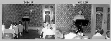
Photograph - Army Survey Regiment Open Day - Briefings and Tours, Fortuna, Bendigo, 1990
These 27 photographs were taken at an Army Survey Regiment Open Day at Fortuna Villa, Bendigo on the 24th of February 1990. This occasion was one of several events held to commemorate the 75th anniversary of the formation of the Royal Australian Survey Corps. Although historical tours of Fortuna occurred on a regular basis, this was the first technical open day since 1972. The Royal Australian Survey Corps recognised that an Open Day was the best way for the local community in Bendigo to gain an insight into the unit’s important role as Defence’s map production agency, its technical equipment, and its economic importance to Bendigo. It also gave them an opportunity to tour through historic Fortuna Villa. This occasion is covered in more detail in page 143 of Valerie Lovejoy’s book 'Mapmakers of Fortuna – A history of the Army Survey Regiment’ ISBN: 0-646-42120-4. Refer to items 6435.35P and 6436.18P for more photos of the Open Day taken in the Map Production areas of Air Survey and Cartographic Squadron, and production areas of Lithographic Squadron. Photo prints of some of these photos were scanned and catalogued in items 6247.30P and 6291.6P.These 27 photographs were taken at an Army Survey Regiment Open Day held at Fortuna, Bendigo on the 24th of February 1990. The 35mm colour and black & white negatives photographs were scanned at 96 dpi and are part of the Army Survey Regiment’s Collection. .1) & .2) - Photo, black & white, 1990. Ballroom - Visitor briefings by CO LTCOL Renee van den Tol. .3) - Photo, colour, 1990. Ballroom - Visitor briefings by MAJ Ray Redman. .4) - Photo, colour, 1990. Ballroom - Visitor briefings by unidentified UK Exchange officer. .5) - Photo, black & white, 1990. Music Room - Visitor briefings by MAJ Bob Williams. .6) - Photo, black & white, 1990. Orderly Room - ADJT CAPT Peter Parkes. .7) - Photo, colour, 1990. Music Room - ADJT CAPT Peter Parkes with civilian visitors. .8) - Photo, colour, 1990. Music Room - Visitor briefings by CPL Le-Anne (Smallshaw) Shirley. .9) - Photo, colour, 1990. Entrance Foyer - Visitor briefings. .10) - Photo, colour, 1990. CO’s Office - Visitor briefings by CPL Raelene (Munting) Brodie. .11) - Photo, colour, 1990. Mr Pat Thwaites outlining utilisation of satellite imagery to civilian visitors. .12) - Photo, black & white, 1990. Mr Pat Thwaites outlining utilisation of satellite imagery to civilian visitors. .13) - Photo, colour, 1990. Staircase leading up to the top floor - Visitor briefings by CPL Ian Nelson. .14) - Photo, colour, 1990. Building 16 - Visitor briefings by RSM WO1 Neville Stone. .15) - Photo, colour, 1990. Civilian visitors enjoying views of the garden from Fortuna Villa’s rooftop. .16) - Photo, black & white, 1990. Visitor briefings at Fortuna’s rear steps. .17) - Photo, black & white, 1990. Outside Building 16 - Visitor briefings by WO1 Gary Warnest. .18) - Photo, colour, 1990. Outside Building 16 - Visitor briefings by WO2 Adrian ‘Charlie’ Creedy. .19) - Photo, colour, 1990. Outside Building 16 - L to R: SPR Sue (Foote) Bourne, LCPL Sandy Winn, WO2 Adrian ‘Charlie’ Creedy. .20) - Photo, colour, 1990. Outside Building 16 - SGT Greg Byers. .21) - Photo, colour, 1990. Visitors enjoying Devonshire Tea in the gardens next to the Tavern. .22) - Photo, colour, 1990. RSM WO1 Neville Stone and family enjoying Devonshire Tea in the gardens next to the Tavern. .23) - Photo, colour, 1990. Visitors relaxing in the garden next to Fortuna’s lake. .24) - Photo, black & white, 1990. CPL Trevor Poll and others serve up BBQ lunch next to the tennis courts. .25) to .27) - Photo, colour, 1990. Parking at a premium inside the Army Survey Regiment and Chum Street..1P to .27P – no annotationsroyal australian survey corps, rasvy, army survey regiment, army svy regt, fortuna, asr -
 Ballarat Tramway Museum
Photograph - Black and White photograph/s - mounted set of 2', John Phillips, late 1960's or early 1970's
Yields information about the vicinity of the Victoria St terminus and the bridge over the Buninyong Railway line.Black and White photograph mounted on heavy cardboard backing. Photo of Ballarat No. 31, just after leaving Victoria St. terminus, late 1960's or early 1970s crossing over the Eureka siding railway bridge. Taken by John Phillips. Tram has destination of Gardens via Sturt St. West, Twin Lakes advertisement on the front. In the background is Meagher's Hotel with Abbots Lager and Victoria Bitter sign. On the bridge is graffiti "Smash US Imperialism". On the Ballarat side of the bridge is a sign directing travellers to the "Eureka Caravan Park". Has 6 Velcro dots on rear and marks where mounting devices have been removed on the rear. Note image scanned in two runs through a scanner, resulting in the shading in the image file. .1 - Second copy with 4 black Velcro squares and 4 dots on rear - wider view on the right hand side with an additional pole - not scanned.trams, tramways, victoria st, eureka, twin lakes, tram 31 -
 Kew Historical Society Inc
Photograph - 'Clutha', Studley Park Road, 1860-1890
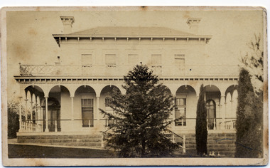
Clutha was the home of John Carson, the second mayor of Kew. Leonard Terry designed the house for him in 1856. Terry was the architect of the Melbourne Club (1858), the former London Chartered Bank (1861), Lothian Terrace in Carlton (1865), and the ES&A Bank in Hawthorn (1873). The commission for Clutha was won three years after Terry’s arrival in Victoria.An extremely rare photograph of a major residential architectural commission of Leonard Terry. The photograph of the house has statewide significance as the home of the Victorian pioneer and businessman, John Carson. A rare, nineteenth century photograph of ‘Clutha’ in Studley Park Road, Kew. The sepia-toned photograph is of the front of the house, with its bluestone foundations and its second storey balcony. A real estate advertisement in 1875 described the house as: 'First-class family mansion, and about 8½ acres of pleasure grounds and fruit garden. The house, erected under the plans and supervision of Mr. Leonard Terry, is most substantially built of brick, stuccoed, on solid bluestone pediment, forming a noble basement story, large entrance hall, and lobby, with conservatory on the left. *** A wide verandah and balcony, erected on cast-iron columns, runs round the house, the views from which are perhaps unequalled in extent and beauty in the neighbourhood of the city, commanding the bay, shipping, Mount Macedon, and Dandenong Ranges. Th e whole forming a most complete gentleman's residence, no expense having been spared in its erection and comfortable finish.'"Clutha West Side Studley Park Road Kew / Clutha West Side"clutha, john carson, leonard terry -
 City of Moorabbin Historical Society (Operating the Box Cottage Museum)
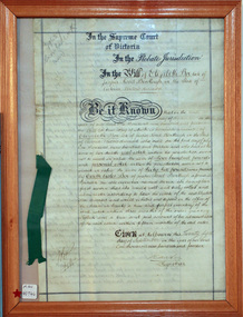
Document - Will of Elizabeth Avis-Box 1914, 1914
Elizabeth Avis- Box 1835-1913 was born in Sussex, married William Box in 1854 and arrived in Melbourne in 1855. William’s parents George and Mary Box and his siblings sailed with them. William & Mary at first leased land in the area of the ‘Dendy Special Survey Brighton 1841’ and then purchased the property with the pioneer cottage 1868 & 1869. William & Elizabeth established a market garden and raised 13 children. 1888 they built a larger 2nd house in front of the original cottage. William died in 1902 and Mary sold 9 acres in 1908 to W. .Snowden Anderson – it later became Joyce Park where the reconstructed Box Cottage Museum now stands. After Elizabeth died her daughters Ada and Violet lived on the 1 acre property until 1917 when August Reitman, a potter and monumental mason, leased the house and land. He established his pottery business and purchased the property in 1935. The business moved in 1953 but continued to use the cottage as a workshop/ storeroom until it was sold to Lewis Timber P/L in 1970. Elizabeth & William Box settled in the pioneer Cottage in Jasper Road East Brighton 1868 and established a market garden whilst raising their 13 children. This Cottage was reconstructed in Joyce Park, Ormond 1984 and is the home of City of Moorabbin Historical Society. In 1960 many local residents responded to a call for the donation of historical artefacts and the Box Cottage Museum now preserves this eclectic collection for the community.The original Last Will & Testament of Elizabeth Avis Box September 1914In the Supreme Court / of Victoria / In the Probate Jurisdiction / In the Will of Elizabeth Box late of / Jasper Road Bentleigh in the State of / Victoria Widow deceased. Be it known ............. Given at Melbourne this ( 21st September 1914) Signed A Carter / Registrar top left corner 79637 / Snowball ( X232) Bottom left corner 10/9/...box elizabeth, box william, moorabbin, bentleigh, brighton, ormond, pioneers, market gardeners, box george, box mary cripps, reitman august, anderson w. snowden, joyce park ormond, box cottage museum dendy’s special survey brighton 1841,