Showing 740 items
matching historic buildings victoria
-
 Queen Victoria Women's Centre
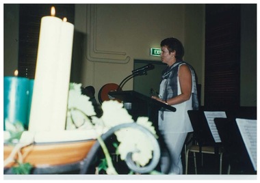
Photograph, c. early 1997
Colour photograph. Shilling Fund launch. Janet England, Chair of Trust, addressing the audience. Level four Victoria room QVWC building. Candles in foreground.fundraising events, official events, historic buildings, charitable organisations -
 Queen Victoria Women's Centre
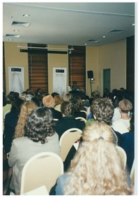
Photograph, c.1997-1998
Colour photograph. Example of an event in Victoria room level four of the QVWC building. Taken from the north o the room looking towards an unidentified speaker. 'FES' on two banners at the front of the room.official events, historic buildings, cultural structures and establishments -
 Queen Victoria Women's Centre
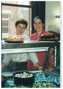
Photograph, c.1997
Colour photograph. Two women behind od display cabinet in the cafe. Possibly the owner/manager on the right and the owner/chef on the left. Both looking at the camera. cafe, historic buildings, cultural structures and establishments -
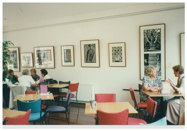
 Queen Victoria Women's Centre
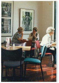
Photograph, C.1997
Colour photograph. In the dining area in the annex on the ground level of the QVWC building. Three unidentified women in frame sitting down. Taken facing south east. Black and white artwork on the wall. cafe, historic buildings, art exhibitions -
 Queen Victoria Women's Centre
Photograph, c.1997
Colour photograph. Taken in the dinning area of the cafe, annex ground floor of the QVWC building. Groups of unidentified women in frame. Black and white artwork hang from the wall. Taken facing north east. cafe, historic buildings, art exhibitions, cultural structures and establishments -
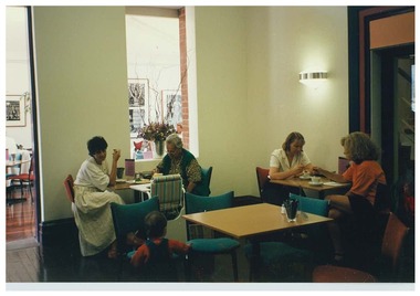 Queen Victoria Women's Centre
Photograph, c.1997
Colour photograph. Ind the dining area of the cafe ground floor of the QVWC building. Groups of unidentified women in frame. Black and white artwork on the wall. Taken from the building looking east into the annex. art exhibitions, cafe, historic buildings -
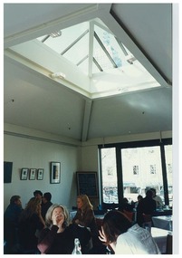 Queen Victoria Women's Centre
Photograph, c.1997
Colour photograph. In the annex on ground floor in the dining area of the cafe. Groups of unidentified women in frame. Facing south east towards Lonsdale street towards Lonsdale street. Photographic artwork on wall. Sky light in frame. cafe, historic buildings, art exhibitions -
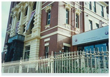 Queen Victoria Women's Centre
Photograph, 10 July 1998
Colour photograph. Exterior view of QVWC building. Taken from Lonsdale street on the south east corner of QVWC facing towards the building. Depicts the cafe signage and fencing around the buildingcafe, historic buildings, cultural structures and establishments, architectural features, fences, entrances -
 Queen Victoria Women's Centre
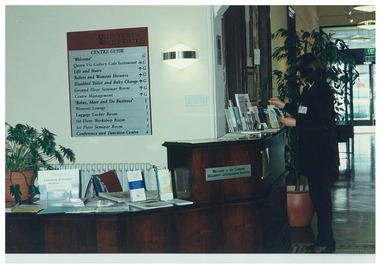
Photograph, 10 July 1998
Colour photograph. Reception area on ground floor southern entrance. Desk has an assortment of flyers and brochures. Behind reception area is a building guide. Unidentified woman appears to the right o frame in front of the reception desk. Taken from the entrance facing northentrances, historic buildings, cultural structures and establishments -
 Queen Victoria Women's Centre
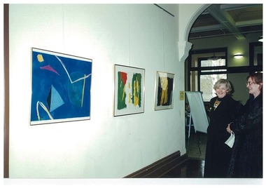
Photograph, 10 July 1998
Colour photograph. Gallery space on ground floor corridor. Art is coloured abstract paintings from an unidentified artist. Two women appear right of frame. Taken from the corridor towards the south of the QVWC building towards the entrance and Lonsdale street.art exhibitions, historic buildings, cultural structures and establishments -
 Queen Victoria Women's Centre
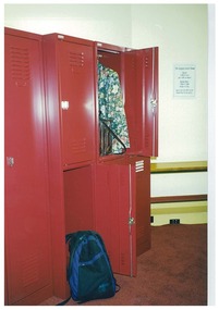
Photograph, c.1998
Colour photograph. In QVWC building in level one locker room. Red metal locker taking up most of the rame. A sign on the wall in the background. This is a styled photo and was probably for Qmag newsletter.historic buildings -
 Queen Victoria Women's Centre
Photograph, c.1997
Colour photograph. Interior of level 5 atrium after renovations works have been competed. Taken facing south west. There is a room divider in the foreground, left of frame. Stained glass window seen in background. historic buildings, cultural structures and establishments, christmas, official events -
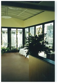
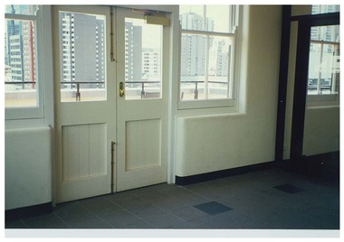 Queen Victoria Women's Centre
Photograph, c.1998
Colour photograph. Interior of level five foyer. Facing east. White painted double doors lead to exterior rooftop garden. Taken after restoration works have been completedhistoric buildings, cultural structures and establishments -
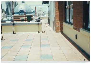 Queen Victoria Women's Centre
Photograph, c.1997
Colour photograph. Roof top exterior, taken on the eastern side towards the south of the building. South eastern turret in frame. Taken after restoration works had been completedhistoric buildings, cultural structures and establishments -
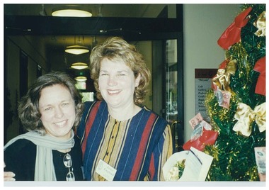 Queen Victoria Women's Centre
Photograph, December 1997
Colour photograph. Shilling Fund Christmas function. Two women stand beside Christmas tree adorned with dollar notes in Northern foyer on ground floor. Left to right: General Manager Glenys Sharma and Trust Chair Janet England. official events, fundraising events, historic buildings -
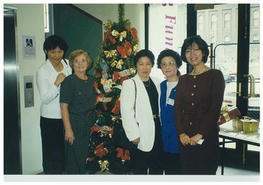 Queen Victoria Women's Centre
Photograph, December 1997
Colour photograph. Shilling fund Christmas function. Ground floor northern foyer. Five women stadning in front of Christmas tree adorned wit various dollar amount notes. Vi Tennahill, second from left. Marion Lau, Trust member is second from right. Wife of Benjamin Liang, head of the Tiwanese Business Economic and Cultural Centre on Collins Street Shiri Liang. Lucille Chin in the middle of the group.fundraising events, official events, historic buildings, christmas -
 Queen Victoria Women's Centre
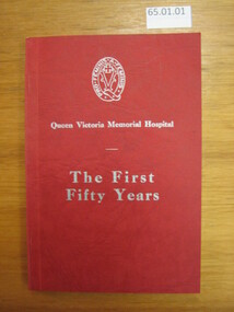
Book, N.S Ecersley Pty. Ltd, A History: The First Fifty Years, 1951
Book written about the first 50 years of the Queen Victoria Memorial Hospital 59 pages. Red cover with silver text. Internal, white paper with black ink, black and white images throughout. The Queen Victoria Memorial Hospital crest on the front cover. hospitals, books, historic buildings, women health professionals -
 Queen Victoria Women's Centre
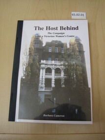
Book, Barbara Cameron, The Host Behind: The Campaign for a Victorian Women's Centre, 2005
Written for the 10 years since the QVWC centre opened. This book details the campaign and restoration of the Queen Victoria Memorial Hospital to create a women's centre in the spirit of the Hospital's founders "for women, by women". 138 pages. Plastic cover. Cardboard inner cover with colour image of the QVWC building. White paper and black ink throughout. women social services, historic buildings, cultural structures and establishments, woman professionals, books -
 Queen Victoria Women's Centre
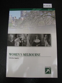
Book, National Trust, Women's Melbourne, 2010
Written to provide a 'walking tour guide' of Melbourne Women's History. Project supported by the City of Melbourne writing about Melbourne Arts Grant Program. Project supported by Heritage Victoria Heritage Grants project and Helen McPherson Smith Trust. 96 pages. Cardboard cover with colour and black and white images. Accent of green throughout. Inside pages are paper with black ink, green accents and colour images throughout. women historic sites, historic sites, historic buildings, cultural structures and establishments -
 Queen Victoria Women's Centre
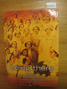
Book, Susan Sherson, Being There: Nursing at "The Melbourne" Victoria's First Hospital, 2005
It follows the intertwined history of nursing and the Royal Melbourne Hospital. Significant events, people and places. 572 pages. Orange toned cover of nurses c.1934 with handwriting overlay. White pages with black and white images throughout. Added Index booklet 32 pages attached. inside the cover handwritten inscription from the author in blue ink reads "For the Queen Vic Women's Centre, Warmest good wishes, Susan Sherson 7/2/2008"women health professionals, historic buildings, hospitals -
 Queen Victoria Women's Centre
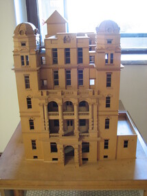
Architectural Model, c.1995
Made by architectural student - Wendy Hastrich in 1993. Barbara Cameron, "The model – taken around rural Victoria via project officer QVWC Inc. Elizabeth Vanaveld for demonstrations."Believed to be a to scale model of the QVWC by Wendy Hastrich. Possibly to 1:500 scale. Perspex covering the model. architectural models, historic buildings -
 Queen Victoria Women's Centre
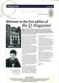
Newletter, Q Magazine: Welcome to the first edition of the Q Magazine!, June 1996
First edition of the Q MagazinePrinter paper. 8 pages. Navy and taupe on white. Grey scaled images throughout of women who are employed by the Trust or are sitting on the trust. Middle pages include original planned layout for the QVWC building. newsletters, historic buildings, cultural structures and establishments -
 Queen Victoria Women's Centre
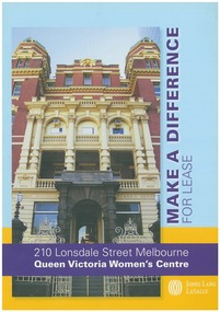
Flyer, Make a Difference
A4 multi coloured flyer. Facade image on front and internal images of building on the back of flyer.pamphlet, leases, cultural structures and establishments, historic site, charitable organisations -
 Queen Victoria Women's Centre
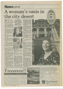
Newspaper Excerpt, A woman's oasis in the city desert, 17 February 1997
News paper article. News extra. Melbourne Yarra Leader page 8. Three black and white photographs of women on page. QVWC original logo on top right of page. official events, openings (events), historic buildings -
 Queen Victoria Women's Centre
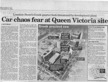
Newspaper excerpt, The Sunday Age, Car Chaos fear at Queen Victoria Site: Lonsdale Street's Greek quarter feels threatened by development plans, 29 October 2000
Newspaper excerpt from The Sunday Age. Page 5 and a smaller introduction probably from the front page. Smaller excerpt colour photo of blue-stone and cast-iron wall which was to be demolished. Larger excerpt, a black and white aerial view of QVWC and the block where it is situated. building construction, building permits, historic building -
 Queen Victoria Women's Centre
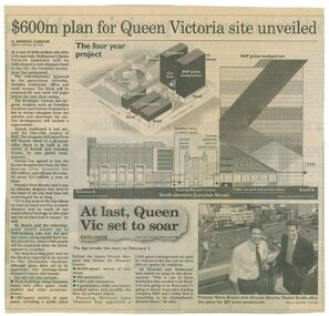
Newspaper clipping, Wayne Taylor, $600m plan for Queen Victoria site unveiled, 21 February 2001
Unveiling of the QV plans by Groconnewspaper clipping from The Age. Graphic representing the works to be done on the QV block between Swanston street and Russell street. Black and white photo at the bottom of page of Premier Steve Bracks with director of Grocon, Daniel Grollo after the plans for QV were announced. building construction, historic building, civic centres, town planning -
 Queen Victoria Women's Centre
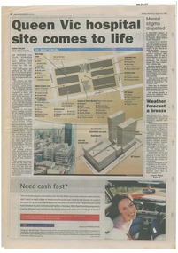
Newspaper excerpt, Queen Vic hospital site comes to life, 24 August 2003
newspaper articles Sunday Herald Sun page 28. colour photograph of the construction works bottom left of article's images. Graphic images of the the construction works and what would be included in the centre.town planning, historic building, retail trade, restaurants, construction and demolition workers -
 Queen Victoria Women's Centre
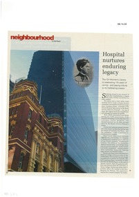
Magazine excerpt, Hospital nurtures enduing legacy, 13-19 September 2006
Inside - Neighbourhood page 30, 32 and 33. Page 30: Colour photograph of QVWC building facade. Black and white portrait of Dr Constance Stone. Page 32: Two coloured portraits one of Kay Setches and the other, Cheryl Teng CEO. Page 33: Black and white photograph of the Queen Victoria Hospital. historic buildings, women's history, official events -
 Queen Victoria Women's Centre
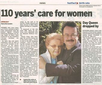
Newspaper excerpt, 110 years' care for women and Day Queen dropped by, 4 October 2006
Newspaper article Melbourne Yarra Leader page 4. Colour photograph portrait of two people looking towards the camera, Kathleen Atkins and Russell Atkins. official event, charitable organisation, hosptial, historic buildings, women's history -
 Queen Victoria Women's Centre
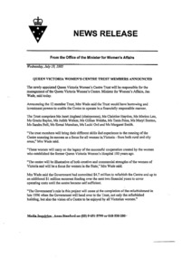
News release, Queen Victoria Women's Centre Trust members announced, 19 July 1995
First trust of the QVWC: Janet England (Chair), Christine Haydon, Marion Lau, Gracia Baylor, Judith Walker, Gillian Welshe, Tania Price, Meryl Sexton, Sandra Bell, Esmai Manahan, Lecki Ord, Margaret Smith.One A4 white paper describing the announcement from the Office of the Minister for Women's Affairs of the first twelve women appointed to the QVWC Trust. committees of management, women professionals, historic buildings, building construction