Showing 6427 items matching "housing"
-
 Port Melbourne Historical & Preservation Society
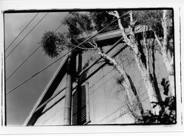
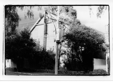
Photograph - Paperbark tree in Station Street, Excelsior Hall, Port Melbourne, Gary Spivak, 2000
Taken by Gary Spivak, an officer of the City of Port Phillip involved with the reconstruction of heritage buildings to create low cost housing. this project was under his direction.B&W photos of Excelsior Hall 2003, prior to redevelopment into units 08 - Paperbark tree in Station Stbuilt environment - civic, town planning, heritage, excelsior hall, rsl, returned services league -
 Port Melbourne Historical & Preservation Society
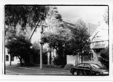
Photograph - Station Street exterior, Excelsior Hall, Port Melbourne, Gary Spivak, 2000
Taken by Gary Spivak, an officer of the City of Port Phillip involved with the reconstruction of heritage buildings to create low cost housing. this project was under his direction.B&W photos of Excelsior Hall 2003, prior to redevelopment into units 11 - Station St view from southbuilt environment - civic, town planning, heritage, excelsior hall, rsl, returned services league -
 Port Melbourne Historical & Preservation Society
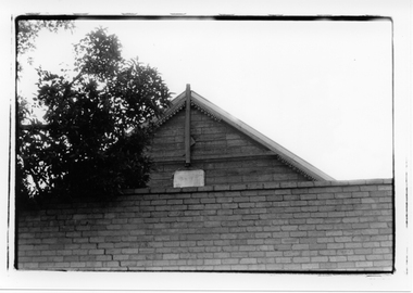
Photograph - Roof valance, Excelsior Hall, Port Melbourne, Gary Spivak, 2000
Taken by Gary Spivak, an officer of the City of Port Phillip involved with the reconstruction of heritage buildings to create low cost housing. this project was under his direction.B&W photos of Excelsior Hall 2003, prior to redevelopment into units 12 - Roof valancebuilt environment - civic, town planning, heritage, excelsior hall, rsl, returned services league -
 Port Melbourne Historical & Preservation Society
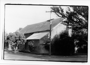
Photograph - View from north, Excelsior Hall, Port Melbourne, Gary Spivak, 2000
Taken by Gary Spivak, an officer of the City of Port Phillip involved with the reconstruction of heritage buildings to create low cost housing. this project was under his direction.B&W photos of Excelsior Hall 2003, prior to redevelopment into units 13 - view of hall from Northbuilt environment - civic, town planning, heritage, excelsior hall, rsl, returned services league -
 Port Melbourne Historical & Preservation Society
Photograph - View from west, Excelsior Hall, Port Melbourne, Gary Spivak, 2000
Taken by Gary Spivak, an officer of the City of Port Phillip involved with the reconstruction of heritage buildings to create low cost housing. this project was under his direction.B&W photos of Excelsior Hall 2003, prior to redevelopment into units 14 - view of Hall from Westbuilt environment - civic, town planning, heritage, excelsior hall, rsl, returned services league -
 Robin Boyd Foundation
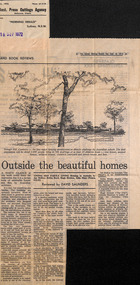
Newspaper - Clipping, David Saunders, Outside the Beautiful Homes, 16.09.1972
Book review by David Saunders of Living and Partly Living: Housing in Australia by Ian McKay, Robin Boyd, Hugh Stretton, John Mant (Melson $10.95)living and partly living. book review, ian mckay, robin boyd, hugh stretton, john mant , walsh st library -
 Hume City Civic Collection
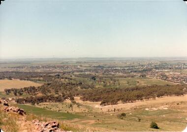
Photograph, early 1980s
The Headland Estate housing development began in the early 1980s. It was situated west of Sunbury and was bounded by Elizabeth Drive, Reservoir Road, Phillip Drive and Stewart's Lane.A coloured landscape photograph with rounded corners of a view of Sunbury overlooking the Headland Estate before its development. There is a rocky outcrop on the LHS of the photograph and a lightly timbered area in the middle distance. Sunbury can be seen in the distance.headland estate, mt. holden, sunbury township, george evans collection -
 Ringwood and District Historical Society
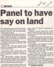
Newspaper, Scrapbook Clipping, Library Collection, Ringwood, Victoria
Newspaper Clipping from "The Mail", 3-10-95. P23. By Andrew Meath. Panel to have Say on LandAn independent panel will decide whether a housing subdivision in an environmentally sensitive part of North Ringwood should proceed. The Ministry of Planning and Development will appoint the panel to consider a request from developers of Barnsdale Forest to divide one acre (0.4 hectares) parcels of land into 7 lots -
 Eltham District Historical Society Inc
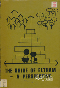
Book, Shire of Eltham, The Shire of Eltham - A Perspective, July 1981
This report was produced by the Shire of Eltham (Planning Department) following a population study of the Shire. It also includes other areas of general interest. The Document contents includes Present and Future - Population - Housing - Residential Lands - Social Characteristics - Development and History. Includes maps, tables and diagrams. Part 1: The Existing situation - introduction, the Shire of Eltham, physical characteristics, historical development, population growth. Characteristics of the population - size and distribution, age / sex, natural increase, migration. Socio-Economic Factors: socio-economic status, employment/workforce, education, other social factors. Housing/ building statistics: characteristics of Housing stock, current residential trends, other types of building activity. Residential Land: existing vacant lots, estimated additional lots. Part 2: The Future. Land availability, the future population.The Shire of Eltham Council resolved on publication of this report "to commend it to the ratepayers as a most valuable resource document". It provides a comprehensive statistical review of the Shire of Eltham, Victoria in 1981 with some population and development predictions for the future.Spiral bound, soft cover, includes indexBarcode and identification markings including stamped "WITHDRAWN" from Heidelberg Regional Library Serviceshire of eltham, planning, population -
 Eltham District Historical Society Inc
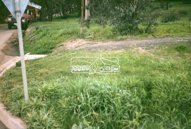
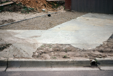
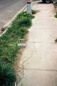
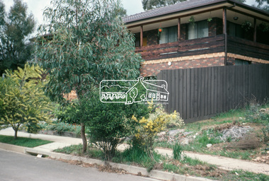
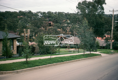
Photograph, Kerb and channeling works, Beard Street and Main Road, Eltham, 3 Sep 1981
Roll of film taken by Eltham Shire Council officers of roads and houses in the Eltham East area, 3 September 1981 prior to construction of new water main; including views of existing damage to footpaths and gutters and general views of Beard Street. These images provide a perspective of housing estate developments and changes in housing styles and road development which began sweeping in from the mid 1970s with increasing urbanisation of what was once more outlying suburbs and regions.35mm colour positive transparency (1 of 28) Mount - Kodak Kodachrome Cardbeard street, eltham, footpaths and gutters, infrastructure, roads, main road -
 Eltham District Historical Society Inc
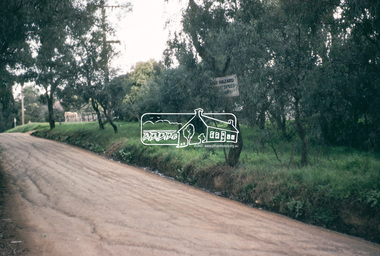
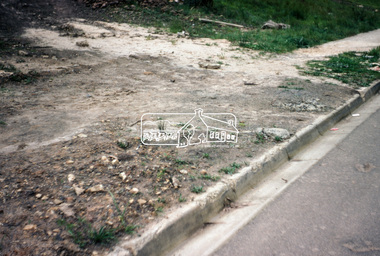
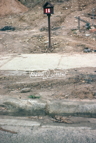
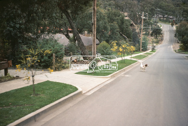
Photograph, Beard Street, Eltham, 3 Sep 1981
Roll of film taken by Eltham Shire Council officers of roads and houses in the Eltham East area, 3 September 1981 prior to construction of new water main; including views of existing damage to footpaths and gutters and general views of Beard Street. These images provide a perspective of housing estate developments and changes in housing styles and road development which began sweeping in from the mid 1970s with increasing urbanisation of what was once more outlying suburbs and regions.35mm colour positive transparency (1 of 28) Mount - Kodak Kodachrome Cardbeard street, eltham, infrastructure, roads, horse, park road -
 Eltham District Historical Society Inc
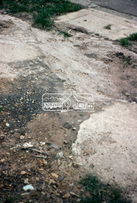
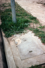
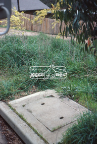
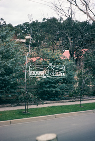
Photograph, Foothpath and kerb damage, Bainbridge Drive, Eltham, 3 Sep 1981
Roll of film taken by Eltham Shire Council officers of roads and houses in the Eltham East area, 3 September 1981 prior to construction of new water main; including views of existing damage to footpaths and gutters and general views of Beard Street. These images provide a perspective of housing estate developments and changes in housing styles and road development which began sweeping in from the mid 1970s with increasing urbanisation of what was once more outlying suburbs and regions.35mm colour positive transparency (1 of 28) Mount - Kodak Kodachrome Cardeltham, infrastructure, roads, bainbridge drive, footpaths and gutters -
 Eltham District Historical Society Inc
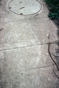
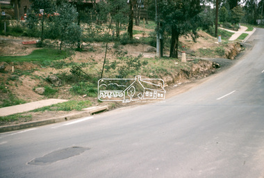
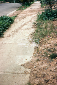
Photograph, Foothpath and kerb damage, Madine Way, Eltham, 3 Sep 1981
Roll of film taken by Eltham Shire Council officers of roads and houses in the Eltham East area, 3 September 1981 prior to construction of new water main; including views of existing damage to footpaths and gutters and general views of Beard Street. These images provide a perspective of housing estate developments and changes in housing styles and road development which began sweeping in from the mid 1970s with increasing urbanisation of what was once more outlying suburbs and regions.35mm colour positive transparency (1 of 28) Mount - Kodak Kodachrome Cardeltham, infrastructure, roads, footpaths and gutters, madine way -
 Eltham District Historical Society Inc
Photograph, Madine Way, Eltham, 3 Sep 1981
Roll of film taken by Eltham Shire Council officers of roads and houses in the Eltham East area, 3 September 1981 prior to construction of new water main; including views of existing damage to footpaths and gutters and general views of Beard Street. These images provide a perspective of housing estate developments and changes in housing styles and road development which began sweeping in from the mid 1970s with increasing urbanisation of what was once more outlying suburbs and regions.35mm colour positive transparency (1 of 28) Mount - Kodak Kodachrome Cardeltham, infrastructure, roads, madine way, tadema park -
 Eltham District Historical Society Inc
Photograph, Beard Street, Eltham, 3 Sep 1981
Roll of film taken by Eltham Shire Council officers of roads and houses in the Eltham East area, 3 September 1981 prior to construction of new water main; including views of existing damage to footpaths and gutters and general views of Beard Street. These images provide a perspective of housing estate developments and changes in housing styles and road development which began sweeping in from the mid 1970s with increasing urbanisation of what was once more outlying suburbs and regions.35mm colour positive transparency (1 of 28) Mount - Kodak Kodachrome Cardeltham, infrastructure, roads, beard street, frank street, shalbury avenue -
 Eltham District Historical Society Inc
Photograph, Beard Street, Eltham, 3 Sep 1981
Roll of film taken by Eltham Shire Council officers of roads and houses in the Eltham East area, 3 September 1981 prior to construction of new water main; including views of existing damage to footpaths and gutters and general views of Beard Street. These images provide a perspective of housing estate developments and changes in housing styles and road development which began sweeping in from the mid 1970s with increasing urbanisation of what was once more outlying suburbs and regions.35mm colour positive transparency (1 of 28) Mount - Kodak Kodachrome Cardeltham, infrastructure, roads, beard street -
 Eltham District Historical Society Inc
Photograph, Beard Street, Eltham, 3 Sep 1981
Roll of film taken by Eltham Shire Council officers of roads and houses in the Eltham East area, 3 September 1981 prior to construction of new water main; including views of existing damage to footpaths and gutters and general views of Beard Street. These images provide a perspective of housing estate developments and changes in housing styles and road development which began sweeping in from the mid 1970s with increasing urbanisation of what was once more outlying suburbs and regions.35mm colour positive transparency (1 of 28) Mount - Kodak Kodachrome Cardeltham, infrastructure, roads, beard street, frank street -
 Eltham District Historical Society Inc
Photograph, Beard Street, Eltham, 3 Sep 1981
Roll of film taken by Eltham Shire Council officers of roads and houses in the Eltham East area, 3 September 1981 prior to construction of new water main; including views of existing damage to footpaths and gutters and general views of Beard Street. These images provide a perspective of housing estate developments and changes in housing styles and road development which began sweeping in from the mid 1970s with increasing urbanisation of what was once more outlying suburbs and regions.35mm colour positive transparency (1 of 28) Mount - Kodak Kodachrome Cardeltham, infrastructure, roads, beard street, grove street, valonia drive, wycliffe crescent, livingstone road -
 Eltham District Historical Society Inc
Photograph, Beard Street, Eltham, 3 Sep 1981
Roll of film taken by Eltham Shire Council officers of roads and houses in the Eltham East area, 3 September 1981 prior to construction of new water main; including views of existing damage to footpaths and gutters and general views of Beard Street. These images provide a perspective of housing estate developments and changes in housing styles and road development which began sweeping in from the mid 1970s with increasing urbanisation of what was once more outlying suburbs and regions.35mm colour positive transparency (1 of 28) Mount - Kodak Kodachrome Cardeltham, infrastructure, roads, beard street -
 Eltham District Historical Society Inc
Photograph, Beard Street, Eltham, 3 Sep 1981
Roll of film taken by Eltham Shire Council officers of roads and houses in the Eltham East area, 3 September 1981 prior to construction of new water main; including views of existing damage to footpaths and gutters and general views of Beard Street. These images provide a perspective of housing estate developments and changes in housing styles and road development which began sweeping in from the mid 1970s with increasing urbanisation of what was once more outlying suburbs and regions.35mm colour positive transparency (1 of 28) Mount - Kodak Kodachrome Cardeltham, infrastructure, roads, beard street -
 Eltham District Historical Society Inc
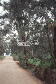
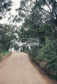
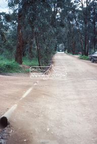
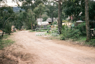
Photograph, Water Main Pipe Track (Madine Way-Bainbridge Drive), Eltham, 3 Sep 1981
Roll of film taken by Eltham Shire Council officers of roads and houses in the Eltham East area, 3 September 1981 prior to construction of new water main; including views of existing damage to footpaths and gutters and general views of Beard Street. These images provide a perspective of housing estate developments and changes in housing styles and road development which began sweeping in from the mid 1970s with increasing urbanisation of what was once more outlying suburbs and regions.35mm colour positive transparency (1 of 28) Mount - Kodak Kodachrome Cardeltham, infrastructure, roads, bainbridge drive linear reserve, madine way, water main pipe track -
 Eltham District Historical Society Inc
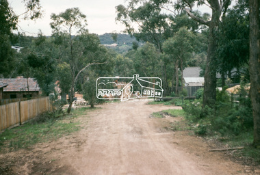
Photograph, Water Main Pipe Track (Madine Way-Bainbridge Drive), Eltham, 3 Sep 1981
Roll of film taken by Eltham Shire Council officers of roads and houses in the Eltham East area, 3 September 1981 prior to construction of new water main; including views of existing damage to footpaths and gutters and general views of Beard Street. These images provide a perspective of housing estate developments and changes in housing styles and road development which began sweeping in from the mid 1970s with increasing urbanisation of what was once more outlying suburbs and regions.35mm colour positive transparency (1 of 28) Mount - Kodak Kodachrome Cardeltham, infrastructure, roads, bainbridge drive linear reserve, madine way, water main pipe track