Showing 2473 items
matching map of victoria
-
 Warrnambool and District Historical Society Inc.
Booklet, Beyond the Point, 2007
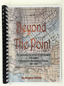
This book was written in 2007 by Margaret McOrist to mark the 150th anniversary of the arrival in the Warrnambool area of John Logan. It is a sequel to a 1991 book, ‘Clotted Cream and Mangels’ which told the story of John Logan and his wife Mary Gardner. They lived at Hopkins Point, Warrnambool and the book, ‘Beyond the Point’ tells the story of the Logan descendants. When the farm land was sub-divided and sold the nearby beach was named ‘Logans Beach’. This book is of considerable interest as it tells the story of the descendants of important early settlers, John Logan and Mary Gardner. The area where they first settled is now of major interest as Logans Beach (named for the Logan family) is the well-known whale watching area. Southern Right Whales return to this beach each year and the females calve and remain up to three months at this beach, making it an important ‘whale nursery’. This is a soft cover book with black plastic ring binding and clear plastic sheets covering the front and back paper covers. The front cover has a reproduction of an 1891 map of Warrnambool and district with the title of the book and other information superimposed on the map. The back cover is black. The book has 101 pages and contains information on the Logan families who lived at Tooram in Allansford and their descendants. There are many black and white and colour photographs, diagrams, maps and family trees. Front Cover: ‘Beyond the Point, 150 years since the arrival of Irish ancestor, John Logan, Hopkins Point, Warrnambool, Victoria, 1857-2007, by Margaret McOrist’. john logan and mary gardner, hopkins point, logans beach, tooram, history of warrnambool -
 Warrnambool and District Historical Society Inc.
Book, War Memorials of Victoria, 1994
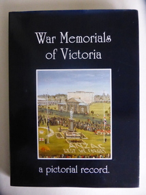
This book gives information on 1,100 War Memorials in Victoria. It was compiled by Bradley, Christey et al and produced for the Returned and Services League of Victoria. War Memorials were established in most settlements in Australia after World War One and added to after World War Two and succeeding conflicts. The number of War Memorials reflect the historical importance of Australia’s involvement in world wars and because of our distance from the battlefields they have become sacred places in Australia – de facto war cemeteries. The book includes information on the Warrnambool War Memorial and those in our area. This book is of interest as it gives details on War Memorials and includes all those in the Western District of Victoria. It will be useful to researchers of social and military history. This is a hard cover book with a blue cover and gold printing on the spine. The dust cover is dark blue with a colour sketch of the Portland War Memorial and white printing on the front cover and an outline of the map of Australia on the back cover. The book has 240 pages, black and white and colour illustrations, a Foreword, Dedication, Acknowledgements, Introduction, Contents, Bibliography and Index and information in alphabetical order of the War Memorials in Victoria. It also has reproductions of 20 oil paintings of Victorian War Memorials by Dacre Smyth.Spine: ‘War Memorials of Victoria’ R.S.L. Victorian Branch’ Front Cover: ‘War Memorials of Victoria, a Pictorial Record’ war memorials in victoria, warrnambool war memorial, history of warrnambool -
 Victoria Police Museum
Map (Thomas McIntyre), 1878 - 1880
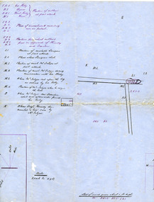
Created by Constable Thomas McIntyre, sole survivor of the police party murdered by the Kelly Gang at Stringybark Creek near Mansfield Victoria in 1878. Thomas McIntyre was the main witness in Ned Kelly's trial.Large hand drawn map of the Stringybark Creek ambush site on blue government paper.ned kelly, kelly gang, victoria police, thomas mcintyre, stringybark creek, thomas lonigan, michael kennedy, thomas scanlan -
 Warrnambool and District Historical Society Inc.
Book, Star Printing Terang Victoria. 978-0-9751360-1-0, Plants of the Great South West 2013 Second Edition, 2013
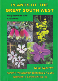
... to the indigenous plants of South West Victoria. South West Victoria: Nelson ...Second edition (revised a& expanded edition) First edition 2004. Guide to the indigenous plants of South West Victoria. South West Victoria: Nelson – Port Campbell. Zone A.B.C & D. Local maps BioregionsCard cover green) gloss white paper. End papers. Map 1&2. 6 pages credits, title, table of contents, forward, acknowledgements, disclaimer, websites. 348 pages. Colour maps & photographs. References & reading. Index plantsof western victoria, kevin sparrow, warrnambool -
 Warrnambool and District Historical Society Inc.
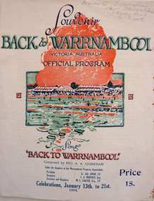
Programme - Back to Warrnambool Souvenir program, 1934
This program provides information for the week of festivities in 1934The Back to celebrations were an important event on the social calendar and this program gives an insight into the kinds of events which were prevalent during the early to mid 20th century. White cover printed in dark blue with red and green accents. Picture of Warrnambool main beach centre front. Back cover is in black and white, Black text at the top reads Warrnambool the Capital City of the West—The city Beautiful. Underneath is a large photo of the Hopkins Falls. The inside four pages contain a brief history of the city, the program for the week and words of the song Back to Warrnambool. A map is on the inside back cover.Particulars supplied by the W’bool Progress Association.warrnambool, back to warrnambool, 1934 official program, reg. a. a. stoneham., reginald alberto agrati stoneham, 1934, program, programme -
 Warrnambool and District Historical Society Inc.
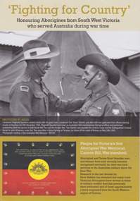
Booklet, 'Fighting for Country' Honouring Aborigines from South West Victoria who served Australia during war time, February 2014
This booklet was collated and printed for the 2014 Lake Bolac Eel Festival, ‘Return to Country’. The author, Peter Bakker, has spent several years researching the part played by south western Victorian aborigines and this booklet details the results of this research. Several of the soldiers came from the Warrnambool area.This is a booklet of ten pages with printed material and black and white and colour photographs and a map.Front Cover: ‘Fighting For Country – Honouring Aborigines from South West Victoria who served Australia during War Time’ (plus other printed material) Back Cover: Map and List of Service Men and Women of Aboriginal Descent with connections to South West Victoria aborigines from south west victoria, return to country, lake bolac eel festival, peter bakker, world war one, world war two, korean war, vietnam war -
 Warrnambool and District Historical Society Inc.
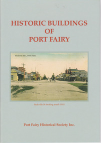
Booklet, Port Fairy Historical Society, Historic Buildings of Port Fairy, 2012
Port Fairy, a small town in Western Victoria established in 1836, has an exceptional collection of public buildings and dwellings dating from the 1840s. This booklet gives short descriptions of 58 of these historic buildings, many with accompanying photographs. These include many buildings in Gipps and Sackville Streets, the Powder Magazine, some hotels, the Drill Hall, Dublin House, the Port Fairy Cemetery and several schools and churches. This booklet is useful for those seeking quick information on the historic buildings in Port Fairy and for those wanting to undertake a walk around the town’s historic spots. TryBooking will show you the full breakdown on the Booking Payment Report and the Event Revenue Itemised Report so you can clearly see the ticket sales, credit card processing fee and the funds that are yours. Front cover: ‘Historic Buildings of Port Fairy, Port Fairy Historical Society Inc.’ Photograph on front cover: ‘Sackville Str. Port Fairy’, ‘Sackville St. looking south 1910’ Back cover map: ‘Port Fairy Historic Buildings’ warrnambool, port fairy, western victoria, historic buildings -
 Warrnambool and District Historical Society Inc.
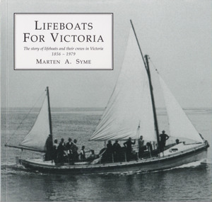
Book, Marten Syme, Lifeboats For Victoria, 2001
History of lifeboats and their crews in Victoria from 1856 to 1879This is a paper back book with a plasticized cover. It has 76 pages and an index. The cover is olive-green in colour with images of a life boat and a lifeboat service certificate. The book contains printed material, diagrams, maps, photographs and other illustrations.non-fictionHistory of lifeboats and their crews in Victoria from 1856 to 1879lifeboats, shipwrecks, port fairy lifeboats, warrnambool lifeboats, history of warrnambool -
 Orbost & District Historical Society
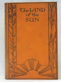
book, Butler & Tanner, The Land of the Sun, 1924
This is the author's account of life in Northern Queensland. Edwin James Brady was an Australian poet. He was born at Carcoar, New South Wales, and was educated both in the United States and Sydney. He worked as a wharf clerk, a farmer, and journalist, and edited both rural and city newspapers. Brady established a writers' and artists' colony at Mallacoota, in 1909, and he continued to live there until his death in 1952. E. J. Brady was a leading figure of Australian literature. He has an association with Mallacoota, a small town in the East Gippsland region of Victoria, Australia. A 303 pp book with a hard back cloth covered bright orange cover. It is titled in black print " The Land of the Sun" and has black print illustrations of crops and the sun. It contains black/white plates and a fold-out map of Queensland.brady-edwin-james book--the-land-of-the-sun queensland-northern -
 Ringwood and District Historical Society
Badges, Badges and Coins 1939-45: 50 years of Queen Victoria's Reign; ANZAC Pins, King George and Queen Elizabeth; City of Wangaratta; etc, 1939 - 1945
Many issues - ANZAC DayBadges and coins. Refer photograph. +Additional Keywords: Pratt, G / GibbonTop Row L_R:; Victoria - 50 Years of Reign. Diam 3cm.; RDFA/Time Keeper (2 badges); Plastic 7-pointed badge (2 badges): Palestine-Gallipoli, FRANCE, Egypt, Mesopotamia, North Sea, New Guinea. In Centre: Lest We Forget printed across a map of Australia.; Assorted ANZAC pins/badges (5 badges); Middle Row L-R:; Side 1: King George VI & Queen Elizabeth (5 badges); Side 2: City of Wangaratta. Wangaratta Proclaimed a City.; Bottom Row:; Royal Life Saving Society, Established 1891. Centre: Awarded to G. Gibbon 1945.; Awarded to G Pratt v 1945; Victorian Rifle Association (2 badges); Legacy Badges/Pins (2 badges); Map of Australia on metal pin; Badge: Side 1 Centenary of Victoria 1934. On undeveloped scene embossed)/ Side 2 Centenary of Victoria 1935. (On city skyline embossed) Diam 2.6 cm.; Pavilion Fund Bayswater 1947-1948 -
Ringwood and District Historical Society
Report Book, Education Department Victoria - Inspectors Report Book State School No 2997 Ringwood, May 1948 to April 1955, May 1948 - April 1955
Contains Inspector's Records and various maps and photographs relating to Ringwood School.Education Department Victoria - Inspectors Report Book State School No 2997 Ringwood, May 1948 to April 1955. -
 Ringwood and District Historical Society
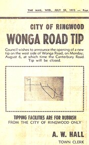
Newspaper - Newspaper Cutting, City of Ringwood, Victoria - opening of Wonga Road Tip by the council - 1973
Newspaper cutting from "The Mail" Wednesday July 25 1973 announcing the opening of Wonga Road Tip by the council. A.W. Hall, Town Clerk. (Accompanying map lacks readable navigation reference points/street names.) -
Australian Commando Association - Victoria
Equipment - Map board and case
-
Australian Commando Association - Victoria
Equipment - Map Case
-
 Orbost & District Historical Society
Book - front cover, The Corringle Creek to Sydenham Inlet Coastal Reserve A RESOURCES STUDY, 1977
This 1977 Resources Study was a joint project of the Shire of Orbost & the Dept. of Crown Lands & Survey with the purpose of collating information on natural resources, pattern of public use, and constraints on future use so that management can be formulated.This report gives and understanding of the resources and management directions of coastal land in East Gippsland in 1977. A buff coloured cover with black printing and blue tape binding. 71 pages + maps/charts. THE CORRINGLE CREEK TO SYDENHAM INLET COASTAL RESERVE. A resources study with comment on the implications for management by IAN R. BROWN Research officer and PETER B. LAVERY Land Management Oficer. Coastal management Committee Victoria 1977. Published under the authority of the Coastal Management Committee by the Department of Crown Lands and Survey, Victoria 1977. Printed by James Yeates Printing, Bairnsdale 3875.corringle creek, sydenham inlet, natural resources survey -
 Ringwood and District Historical Society
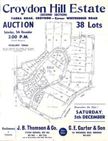
Flyer, Land Auction Sale Advertisement, Croydon Hill Estate, Croydon, Victoria - 1959
Single sided land auction sale advertisement for 38 residential allotments - Croydon Hill Estate (Second Section) Yarra Road, Croydon - corner Whitehorse Road. Auction Saturday, 5th December, and corresponding newspaper advertisement - Ringwood Mail, Thursday, November 26, 1959.Subdivision map includes Richardson Road, Yarra Road, Whitehorse Road, Alice Street, Hull Street (later Mulawa Stret). Auctioneers in Conjunction: J.B. Thomson & Co., Station Entrance, Box Hill, (Telephone) WX 1862, WX 7356, and at Nunawading, WU 1968, WU 3452, and C.E. Carter & Son, 126 Whitehorse Road, Ringwood. WU 6024. -
 Ringwood and District Historical Society
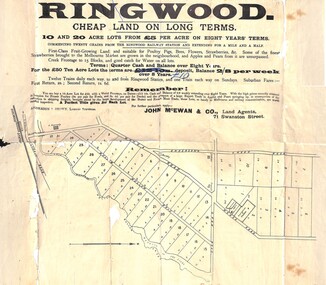
Flyer, Land Sale Advertisement, Ringwood, Victoria - 1894
Land sale advertisement for 10 and 20 acre lots from £5 per acre on eight years' terms in Ringwood, with description of local facilities and agricultural features.Subdivision map includes Mullum Mullum Road, Wonga Road, Oban Road and Anderson's Creek Road (later Warrandyte Road). Markings on reverse side indicate the sheet was sent by post from John McEwan & Co., Auctioneers, Land Agents & Business Brokers, 71 Swanston Street, Melbourne, to Mr Allan, Builder, Ringwood, postmarked in JE (June), 1894. -
 Ringwood and District Historical Society
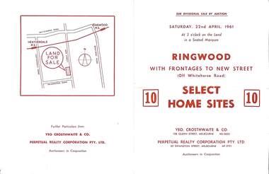
Flyer, Auction sale brochure advertising home sites with frontages to New Street, Ringwood, Victoria - 1961
Advertisement for Sub-divisional sale by auction on Saturday, 22nd April, 1961, with terms of sale of 10 home sites with frontages to New Street, Ringwood, Victoria.Location map showing land for sale on New Street, Ringwood, north of Palmerston Road. Auctioneers in conjunction - Yeo, Crosthwaite & Co., 108 Queen Street Melbourne (Telephone) MU 8605, and Perpetual Realty Corporation Pty. Ltd., 62 Swanston Street, Melbourne (Telephone) MF 3721. -
 Ringwood and District Historical Society
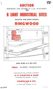
Flyer, Flyer advertising auction sale of light industrial sites in Ringwood, Victoria - 1969
Single page advertisement for auction sale of 6 light industrial sites in Charter Street and Bond Street in Ringwood on Wednesday 22nd October (1969).Advertisement includes terms of sale and location map. Auctioneers in Conjunction - C.E. Carter & Son, 126 Whitehorse Road Ringwood, (Telephone) 870 6024, and Carolan & Co. Pty. Ltd., 243 Collins Street, Melbourne, (Telephone) 63 7373. -
 Ringwood and District Historical Society
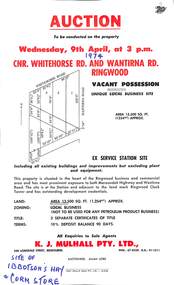
Flyer, Flyer advertising auction sale of ex service station site in Ringwood, Victoria - 1974
Single page advertisement for auction sale of restricted business site, corner of Whitehorse Road and Wantirna Road, Ringwood, Victoria, on Wednesday, 9th April (1974).Advertisement includes location map and terms of sale of 3 separate certificates of title on land zoned as Restricted Business (Not to be used for any petroleum product business). Sole Agents - K.J. Mulhall Pty. Ltd., 358 Lonsdale Street, Melbourne (Telephone) 67 8338, A.H. 91 1511. Auctioneer - Allan Lord. Handwritten notation describes this as originally the site of Ibbotson's Hay and Corn Store. -
 Ringwood and District Historical Society
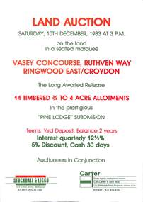
Flyer, Advertisement for land auction - Pine Lodge Subdivision, Ringwood East / Croydon, Victoria - 1983
Folded A3 double sided page advertising auction of 14 timbered allotments - 3/4 to 4 acres, on Saturday, 10th December, 1983, with terms of sale, location map, and summary of subdivision features.Subdivision includes Angus Avenue, Vasey Concourse and Ruthven Way, Ringwood East, and Cheong Street, Croydon, Victoria. A covenant has been placed on most titles specifying that only one dwelling house can be erected during the next ten years. Auctioneers in Conjunction - Stockdale & Leggo, 422 Collins Street, Melbourne, (Telephone) 67 6661, A.H. 20 2364, and C.E. Carter & Son, 122 Whitehorse Road, Ringwood, Victoria 3134, (Telephone) 870 6211, A.H. 876 4124. -
 Ringwood and District Historical Society
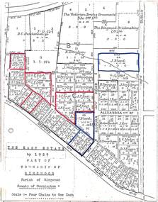
Map, The East Estate, Township of Ringwood, Victoria - 1927
... . The East Estate, Township of Ringwood, Victoria - 1927 Map ...Photocopied page - partial Parish map of Ringwood labeled The East Estate, showing street names and properties marked with names of individual owners or businesses.Page titled The East Estate by 1927 Part of Township of Ringwood, Parish of Ringwood, County of Mornington, Scale: Four Chains to One Inch. L.F. East blocks are marked by red outline. J. Blood blocks are marked by blue outline. Other names include B.C. Hutchinson & Co., The Victorian Brick & Ornamental Tile Coy., Ltd., The Ringwood Brickmaking Coy., Ltd., R. Davidson, J. Williamson, W.E. Bower, H. Jennings, G.J. Sims, J. Smallman, J. Horne, J. Lindsay, J. Kay, H. Unverhan, B.C. Hutchinson, M.A. Williamson, J.S. Woodworth, J. Price, C. Medew, S.W. Burchett, B.J. Hosking, D.J. Rogers, C. Wheeler, H. Frost, G.G. Miller, L. Winchcombe. Streets include Dublin Road, Illoura Road, Alexandra Road, and Bedford Road. -
 Ringwood and District Historical Society
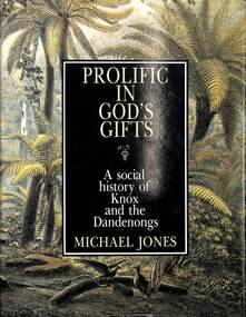
Book, Michael Anthony Jones, Prolific In God's Gifts - A Social History of Knox and The Dandenongs, 1983
Hardcover book by Michael Jones illustrated with photographs and maps. Full title: Prolific In God's Gifts - A Social History of Knox and The Dandenongs (Victoria, Australia). -
 Ringwood and District Historical Society
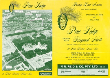
Flyer, Land Auction Sale Brochure, Pine Lodge, Ringwood North, Victoria - 1977
Refer also to Reg. No. 5172 for Pine Lodge Land Auction 3rd release, 1978.Yellow double-sided real estate auction notice with green print showing aerial photograph and map of subdivision layout and summary of local features and services for Pine Lodge, Kalinda Road, Ringwood North. Auction date, Saturday, 4th June, 1977, at 2:30pm.Subdivision plan includes Parkgate Drive, Wood-Church Close, and Pensby Court. (Agent) N.R. Reid & Co. Pty. Ltd., Safeway Centre, Boronia Road, Boronia (Phone) 762 1022, 450 Little Collins Street, Melbourne (Phone) 67 1746, and 207 Stud Road, Wantirna South (Phone) 231 2277. -
 Ringwood and District Historical Society
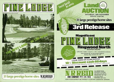
Flyer, Land Auction Sale Brochure, Pine Lodge, Ringwood North, Victoria - 3rd Release 1978
Refer also to Reg. No. 5171 for Pine Lodge Land Auction previous release, 1977.Green tri-fold advertisement for auction of home sites, with map of subdivision, photographs, and summary of local features and services for Pine Lodge, Kalinda Road, Ringwood North - 3rd release - Auction date, Saturday, 18th November, 1978, at 2:30pm.Subdivision plan includes Mundara Drive, Bidston Court, Parkgate Drive, Frodsham Road, and Bebington Close. (Agent) N.R. Reid & Co. Pty. Ltd., 10A Hewish Road, Croydon (Phone) 725 0999, 450 Little Collins Street, Melbourne (Phone) 67 1746, and 207 Stud Road, Wantirna South (Phone) 221 2222. -
 Ringwood and District Historical Society
Flyer, Land Auction Sale Brochure, Proclamation Estate, Ringwood, Victoria - circa 1963
Land sale auction advertisement - Proclamation Estate, Ringwood, with map of subdivision and summary of local features and services. Auction date, Saturday, March 2, (1963?), at 2pm.Subdivision plan includes Maidstone Street, Stanhope Court, Wrights Court, and Watirna Road. (Agents) Blackburn & Lockwood in conjunction with C.E. Carter & Son, 126 Whitehorse Road, Ringwood (Phone) 87 6024. -
 Ringwood and District Historical Society
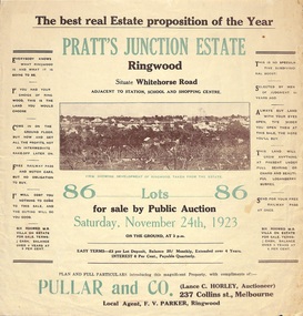
Flyer, Brochure for Land Sale By Public Auction, Pratt's Junction Estate, Ringwood, Victoria - 1923
Folded double-sided brochure advertising 86 residential lots for sale by Public Auction at 3pm, Saturday, November 24th, 1923, with town photographs, map of subdivision and summary of local features and services. Subdivision plan includes Whitehorse Road, Oliver Street, Georges Road, Junction Street, and six room weatherboard villa for sale. Local Agent - F.V. Parker, Ringwood. -
 Ringwood and District Historical Society
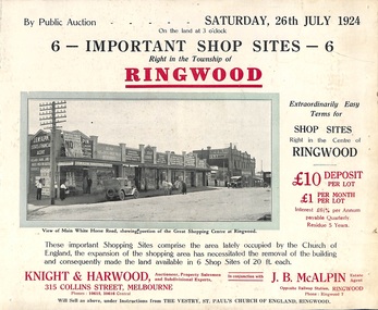
Flyer, Shop Sites Sale By Public Auction, Ringwood, Victoria - 1924
Folded double-sided brochure advertising six Ringwood shop sites for sale by Public Auction at 3pm, Saturday, July, 1924, with town photographs, location map, and summary of local features and services. Includes newspaper extract from the Real Estate and Property section from "Evening Sun", 6th June, 1924.Locality plan highlights shop sites for auction east of Pratt Street along Whitehorse Road. (Agents) Knight & Harwood, 315 Collins Street, Melbourne, Phones 10615, 10616 Central, in conjunction with J.B. McAlpin, Estate Agent, Opposite Railway Station, Ringwood, Phone Ringwood 7. -
 Ringwood and District Historical Society
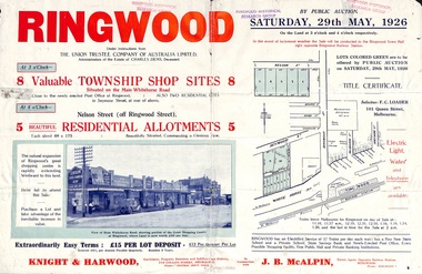
Flyer, Township Shop Sites and Residential Allotments Sale By Public Auction, Ringwood, Victoria - 1926
Advertisement for eight township shop sites and five residential allotments for sale by Public Auction on the land in Ringwood on Saturday, 29th May, 1926, with location map, and summary of local features and services. Locality plan highlights sites for auction in Nelson Street, Seymour Street and Whitehorse Road. (Agents) Knight & Harwood, 315 Collins Street, Melbourne, Phones 10615, 10616 Central, in conjunction with J.B. McAlpin, Estate Agent, Opposite Railway Station, Ringwood, Phone Ringwood 7. -
 Ringwood and District Historical Society
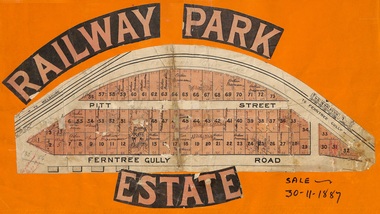
Flyer, Subdivision sale poster - Railway Park Estate, Ringwood, Victoria - 1887
Collage of clipped lettering and map pasted to orange coloured card depicting Railway Park Estate subdivision sale. Handwritten names associated with allotments and notation of sale date - 30 November, 1887. Subdivision plan with pink shading highlighting 73 allotments in Ferntree Gully Road (later Bedford Road) and Pitt Street, Ringwood. Handwritten names associated with allotments include Arthur Wiseman, T. Grant, J.J. Miller, M. Dickson, G.G. Miller, J. Frost, J.K. Turnbul, J.W. Davis, William Aldridge.